No products in the basket.
Return to shop
Taylor’s Plan of Hereford
By TAYLOR, Isaac, March 21, 1757.
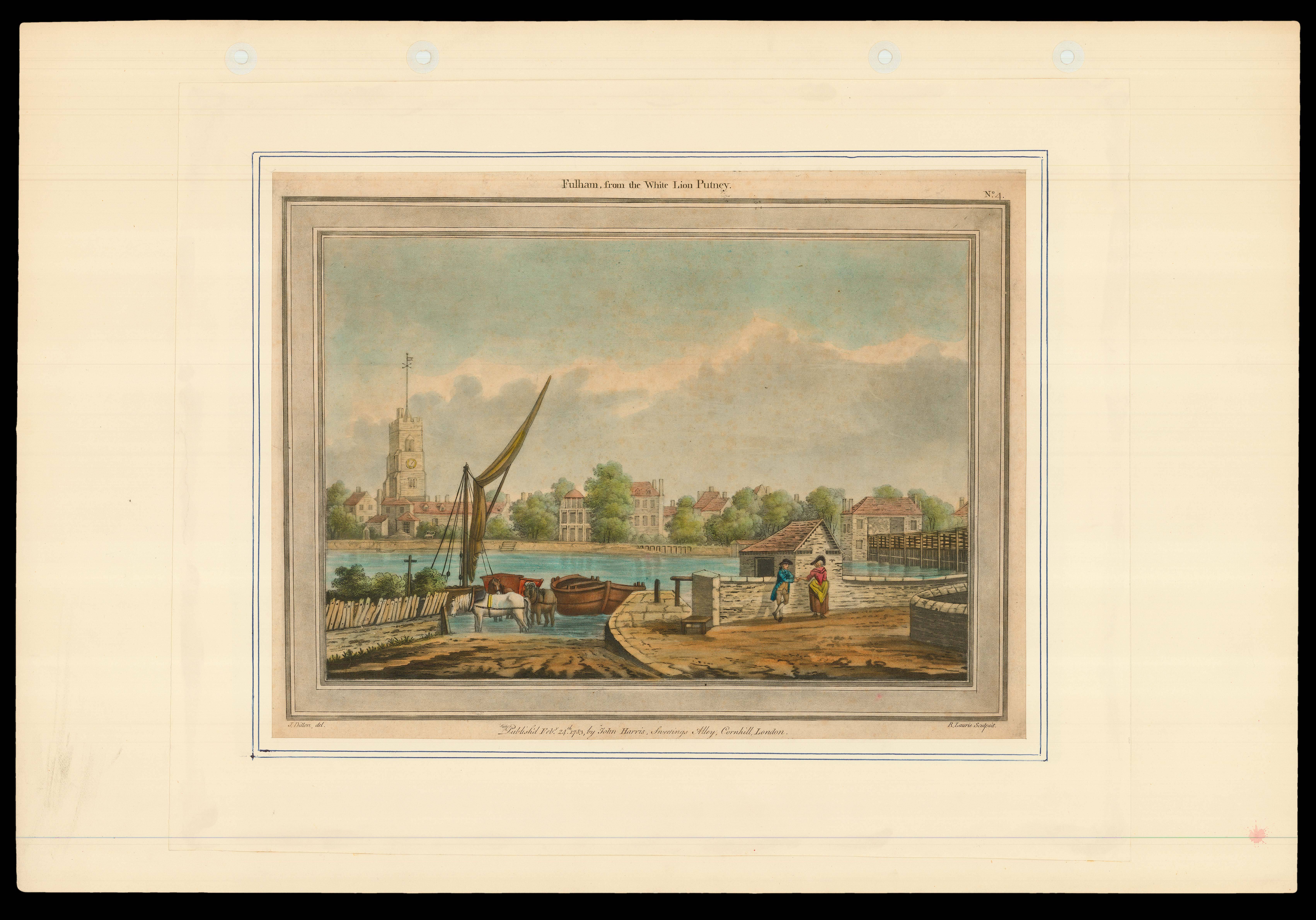
The White Lion
By LAURIE, Robert after DILLON, J., February 24th 1783.
Wales – Evans’ large-scale map of North Wales
By EVANS, John, 1795
Printed on the ice
By [ANONYMOUS], February 4,1814.
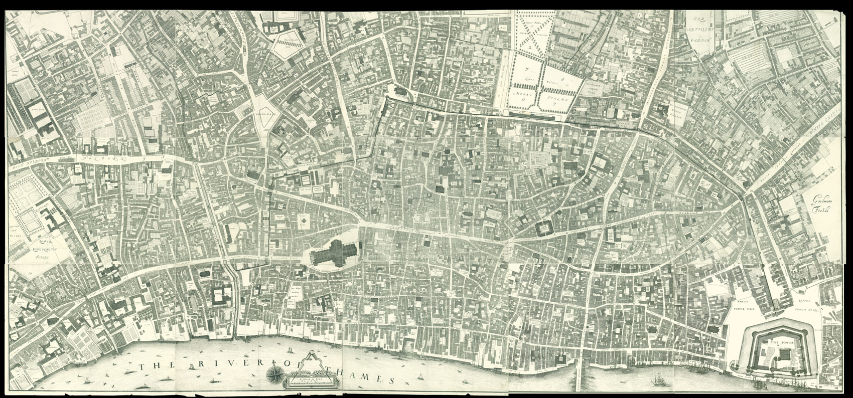
Early Victorian London
By CROSS, J[oseph], January 1st [c1843].
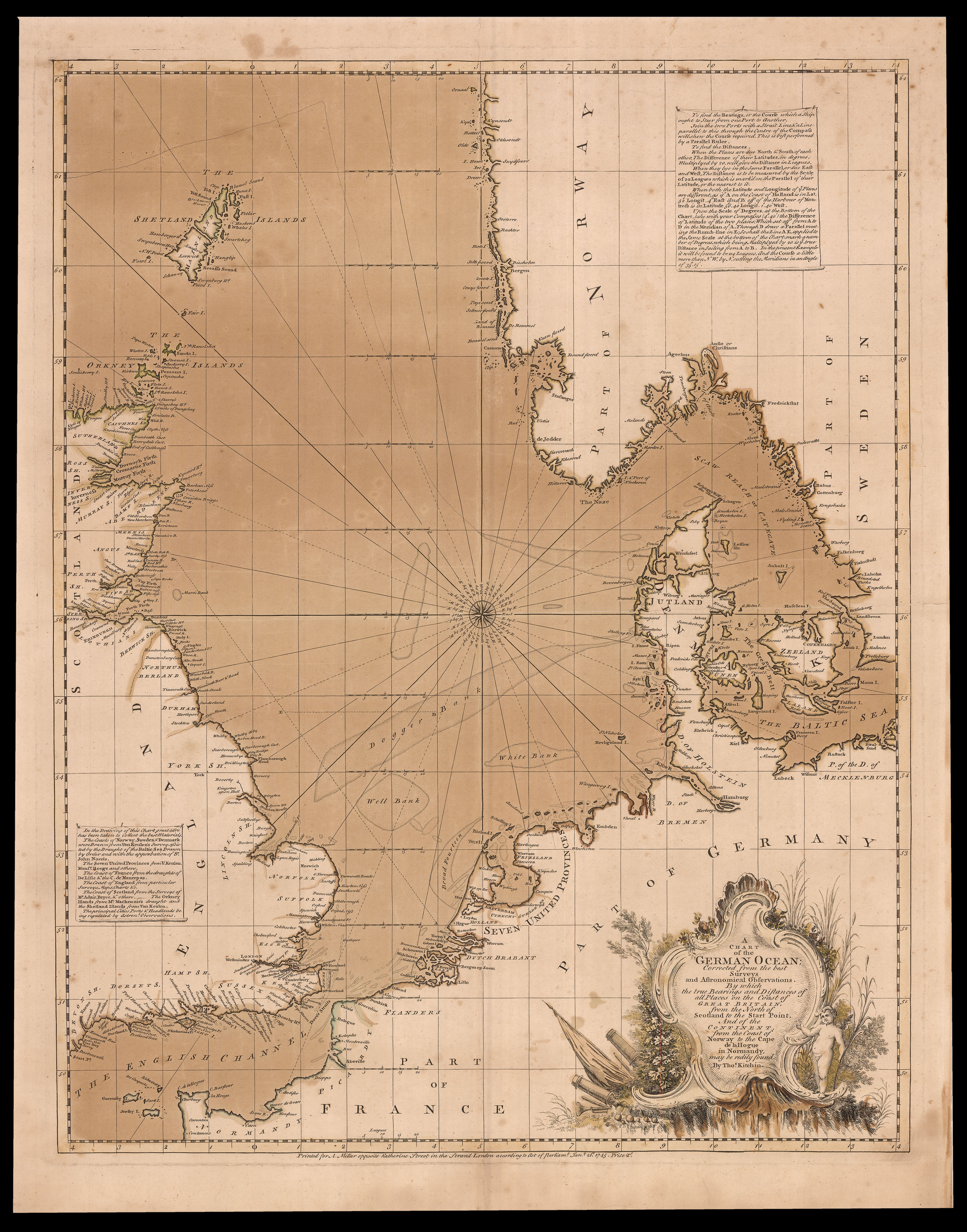
Kitchin’s separately issued chart of the North Sea
By KITCHIN, Thomas, Januray 1st, 1745
The final Frost Fair
By [CLENNELL, Luke], 1814].
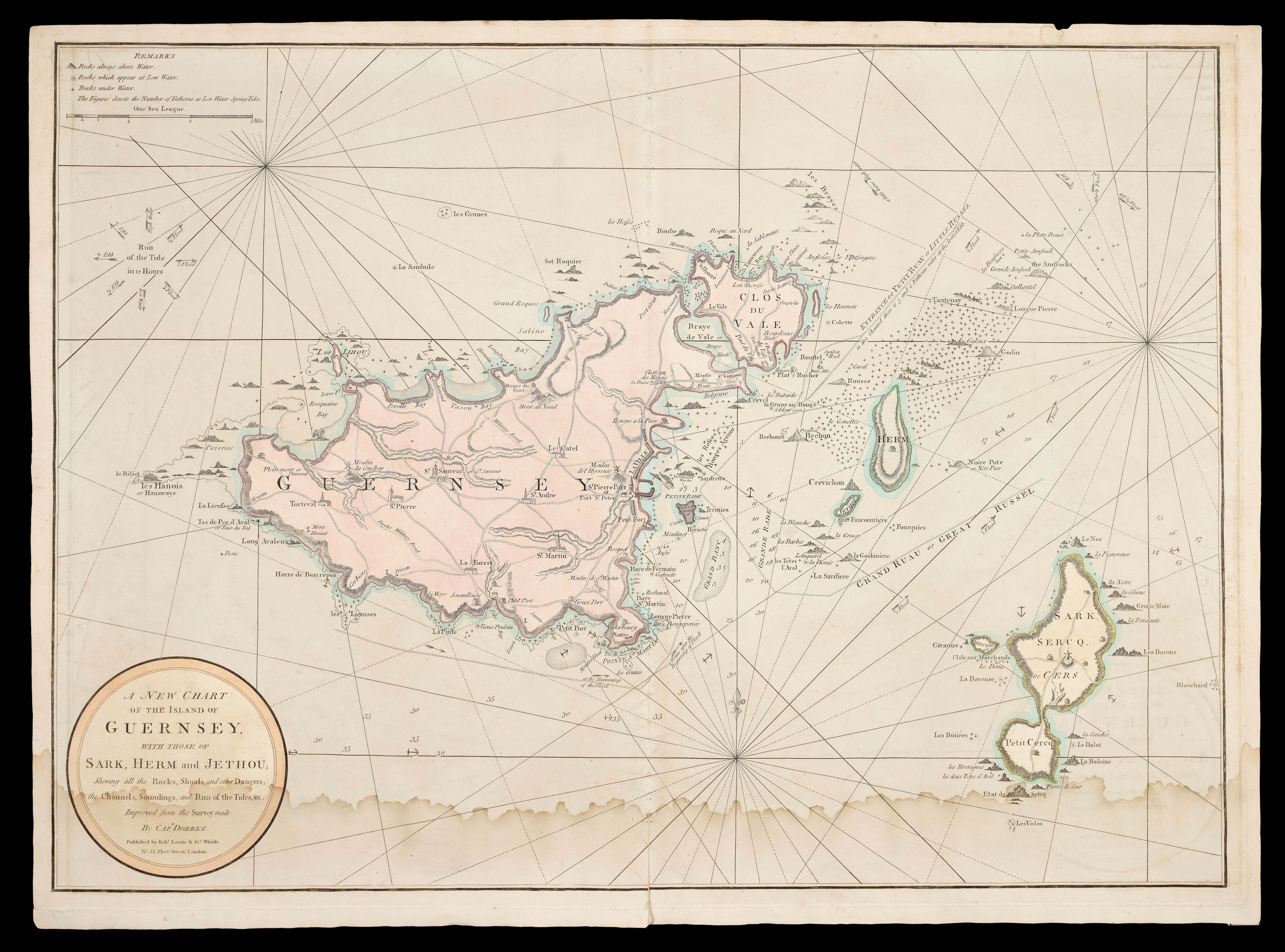
An unrecorded state of Dobree’s chart of Guernsey
By DOBREE, Nicholas, c1823].
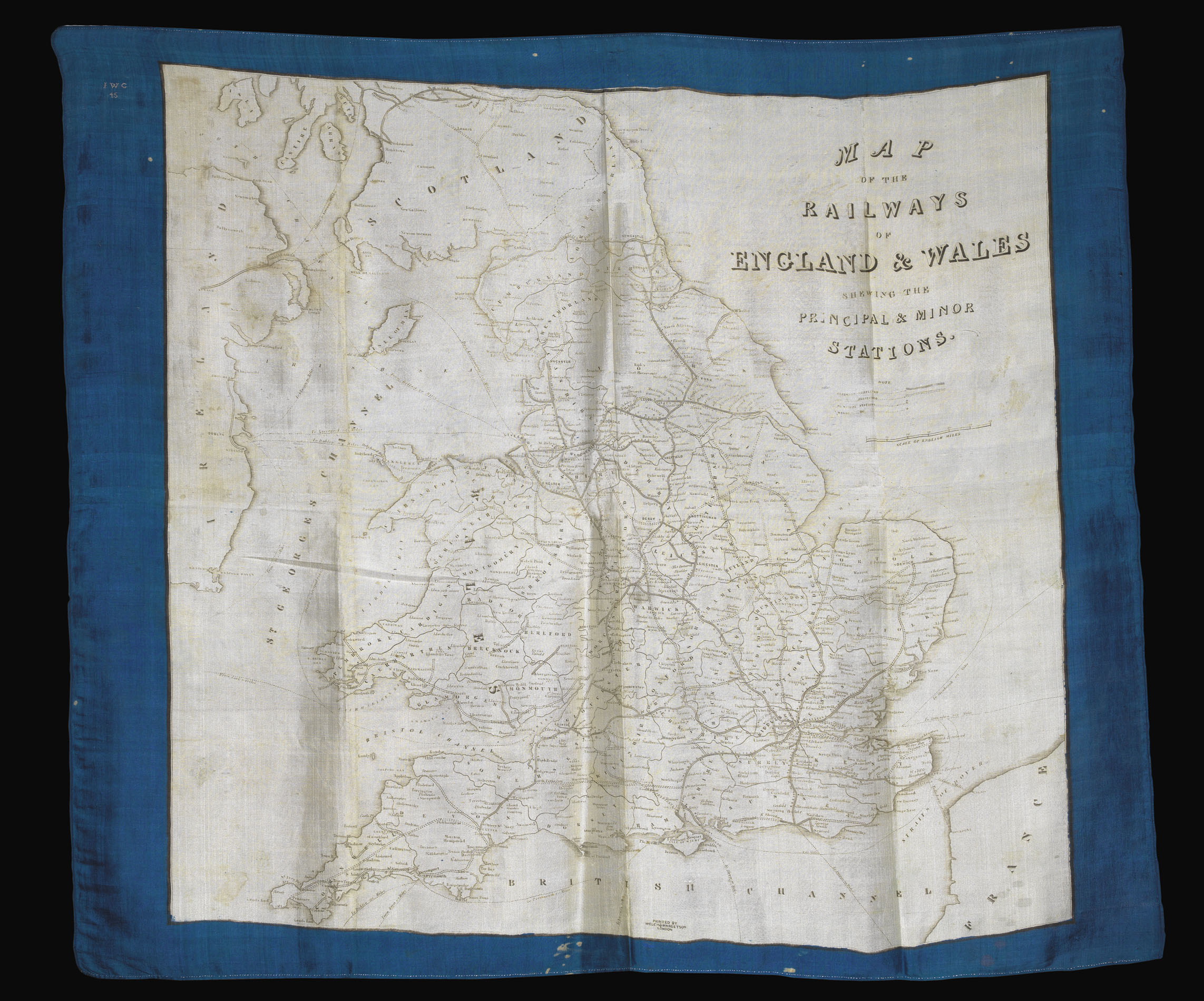
Rare railway map of England and Wales printed on silk
By WELCH, MARGETSON & CO, [c1845].
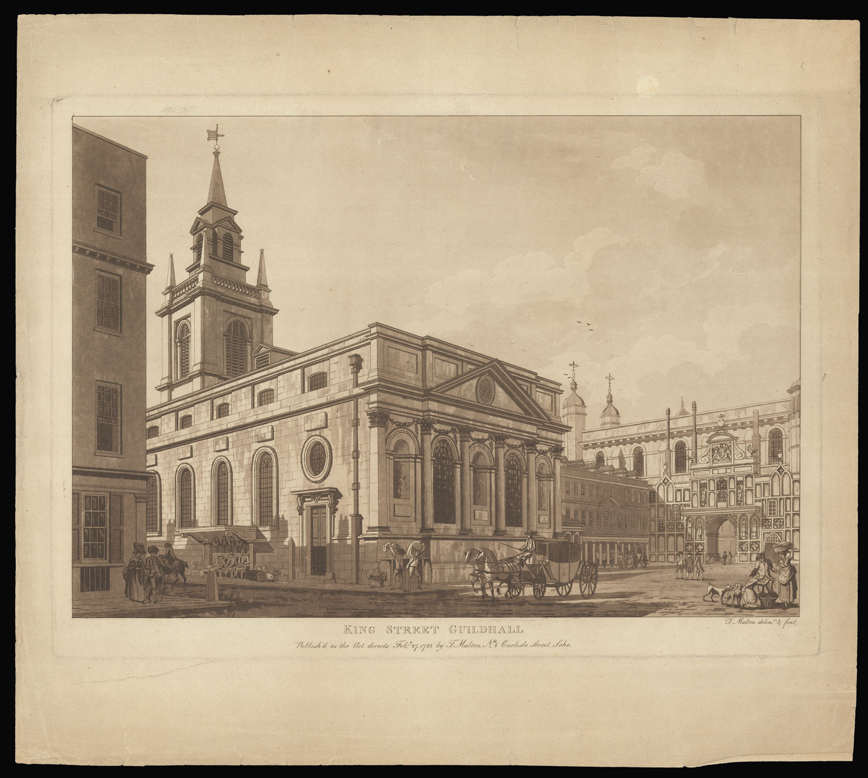
“My real Master”
By MALTON, Thomas, 1781-1783.
Rare map of London printed on cloth
By [ANONYMOUS], c1855].
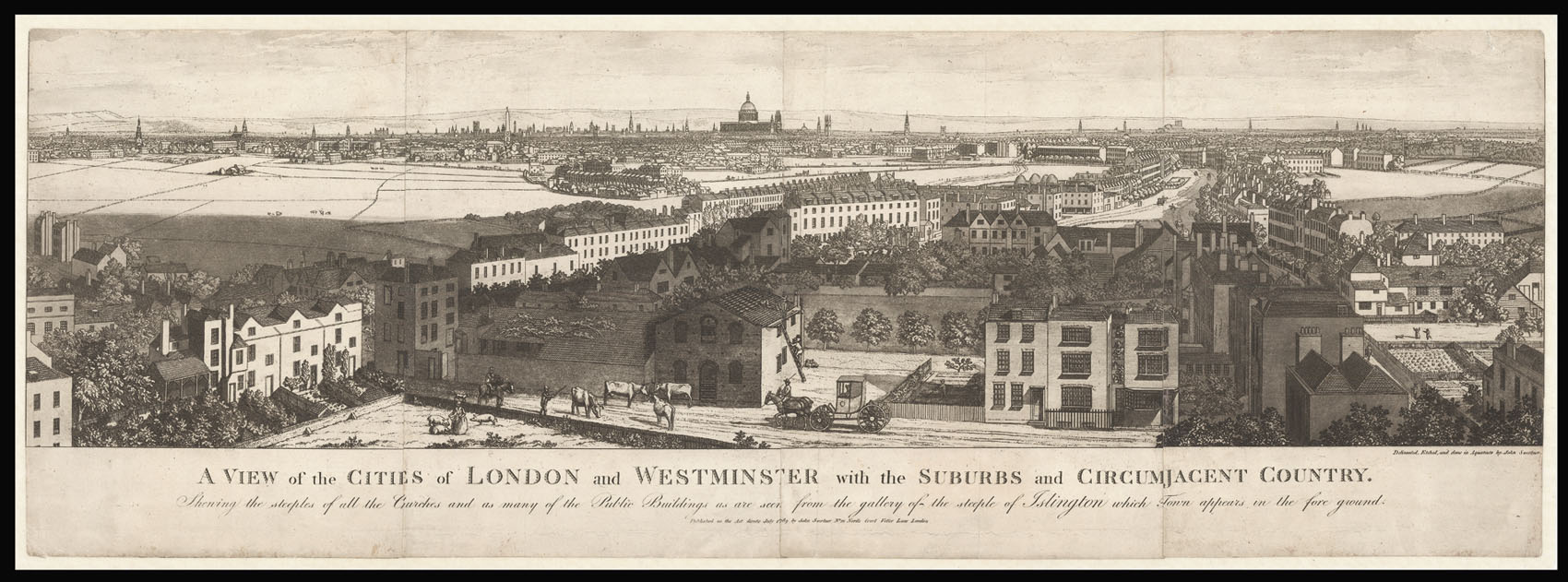
London from Islington
By SWERTNER, John, 1789
The Civil Wars in England and Prague
By HOLLAR, [Wenceslaus], [?c1659].
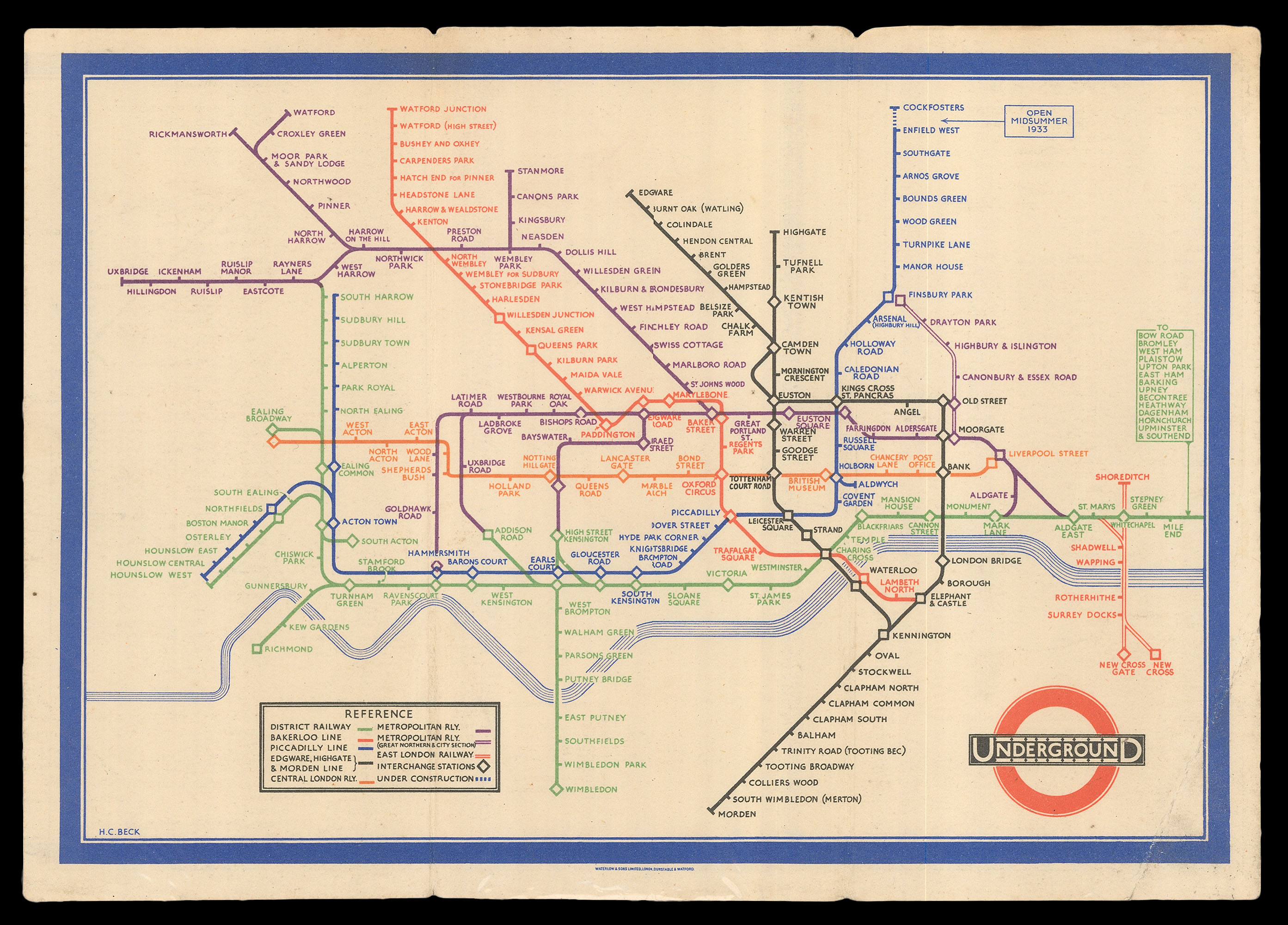
First state of Beck’s iconic tube map
By BECK, Harry, [January, 1933].
The Rhinebeck Panorama
By HAVELL Jnr., R[obert], 1831
The Blanket Fair of 1683-84
By [ANONYMOUS], 1684
Rare large-scale plan of Oxford
By HOGGAR, Robert Syer, 1850
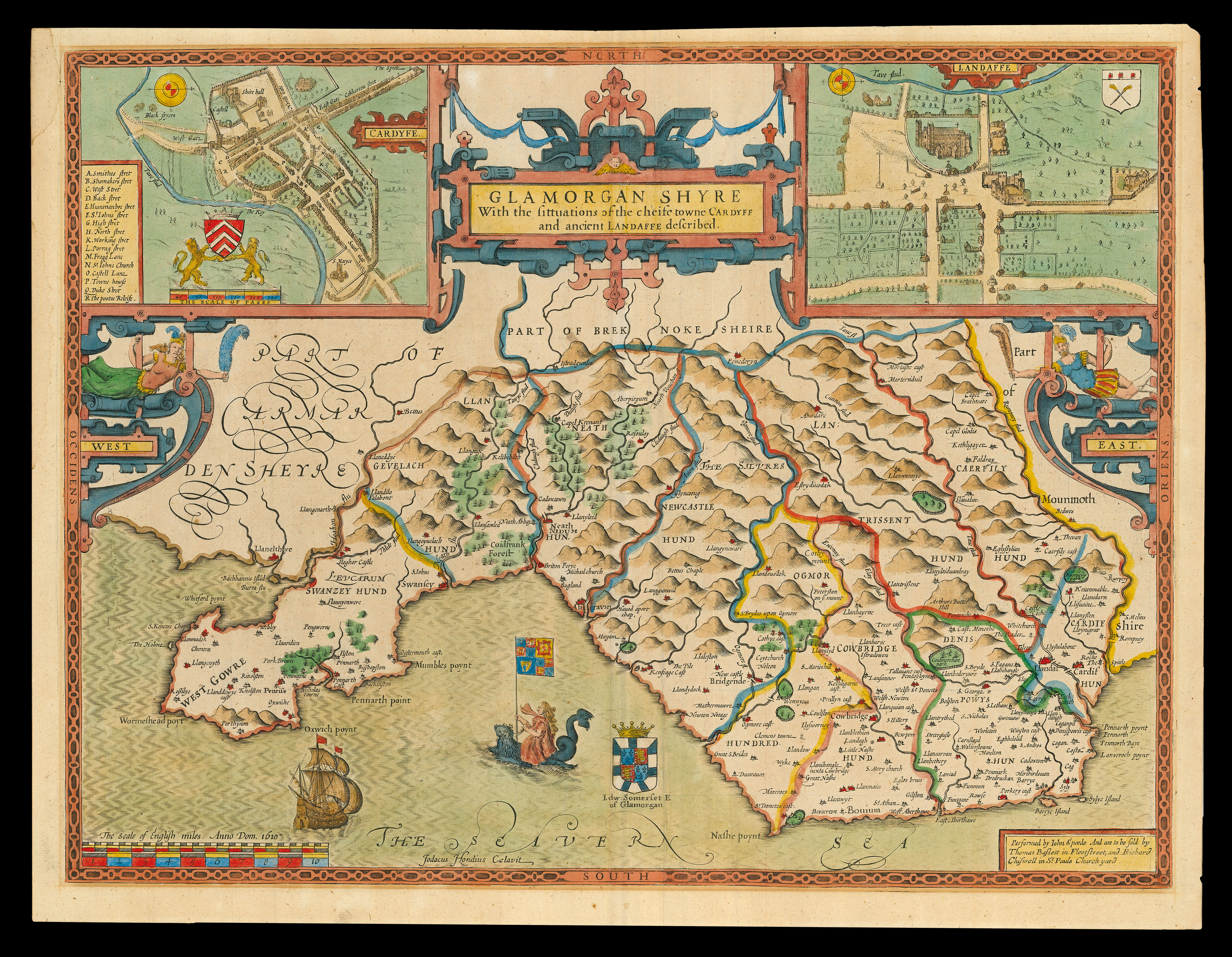
Speed’s map of Glamorganshire
By SPEED, John, [1676].
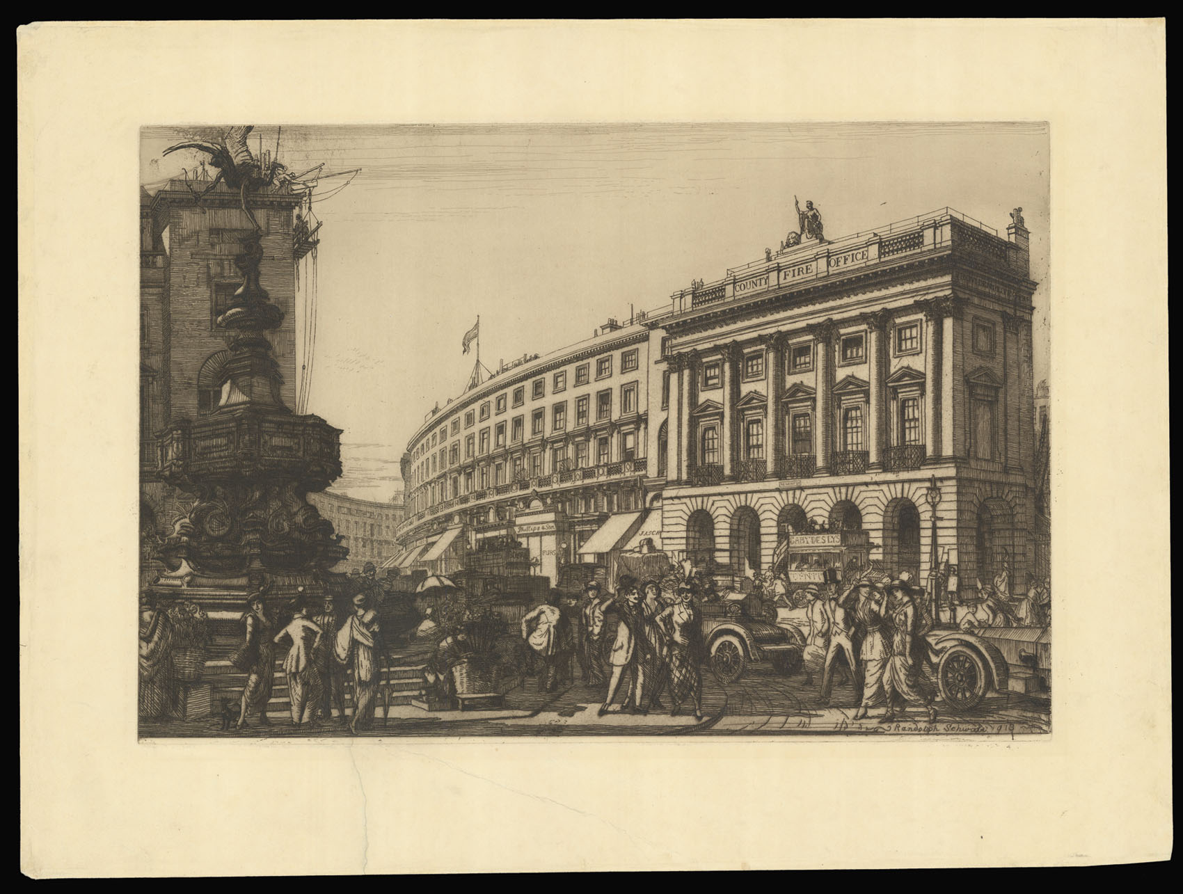
Piccadilly Circus
By SCHWABE, Randolph, 1918
“The first accurate and detailed map of London”
By OGILBY, John and MORGAN, William, 1676]
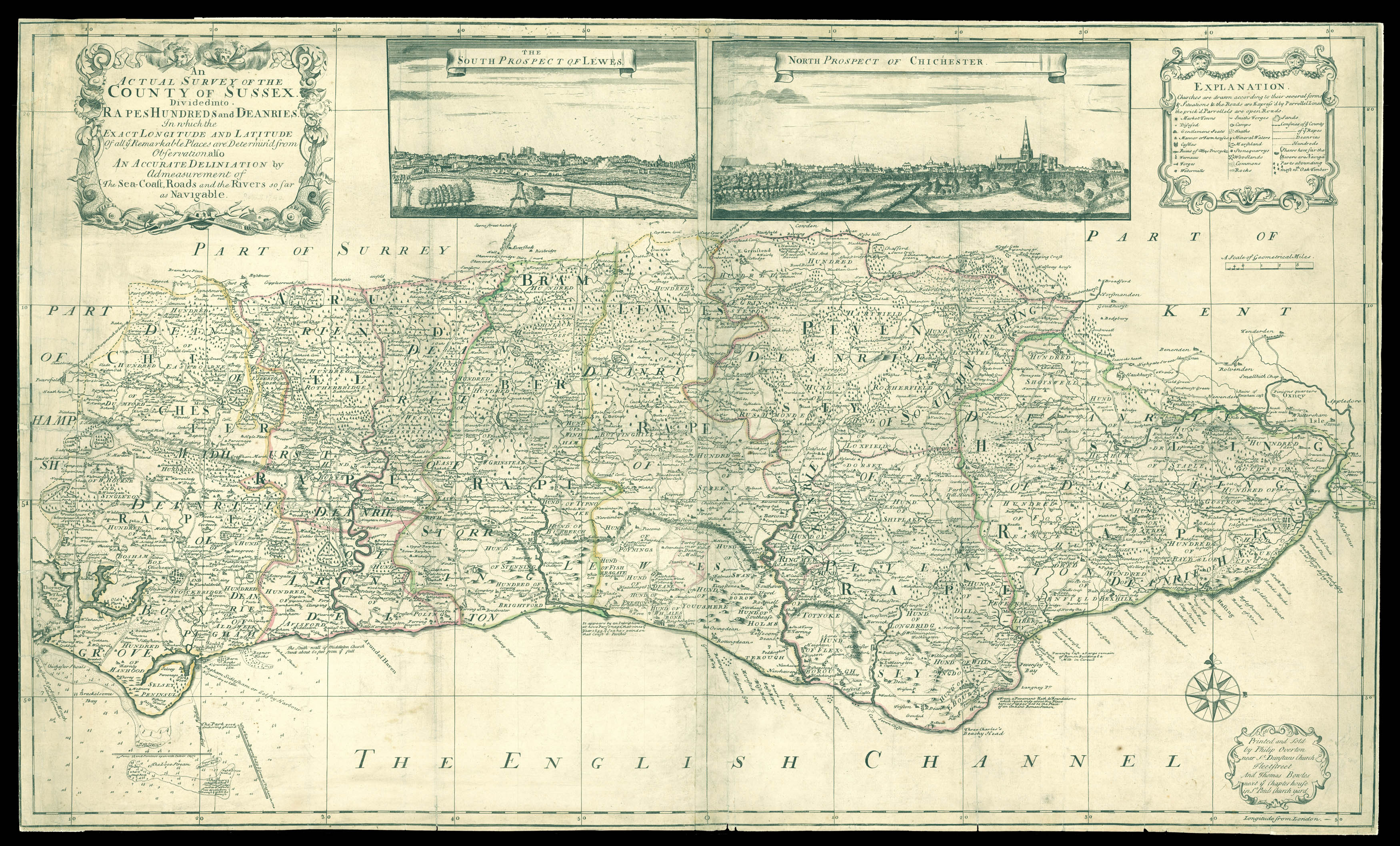
Sussex – Rare separately issued map of Sussex
By OVERTON, Phillip, [c1726].
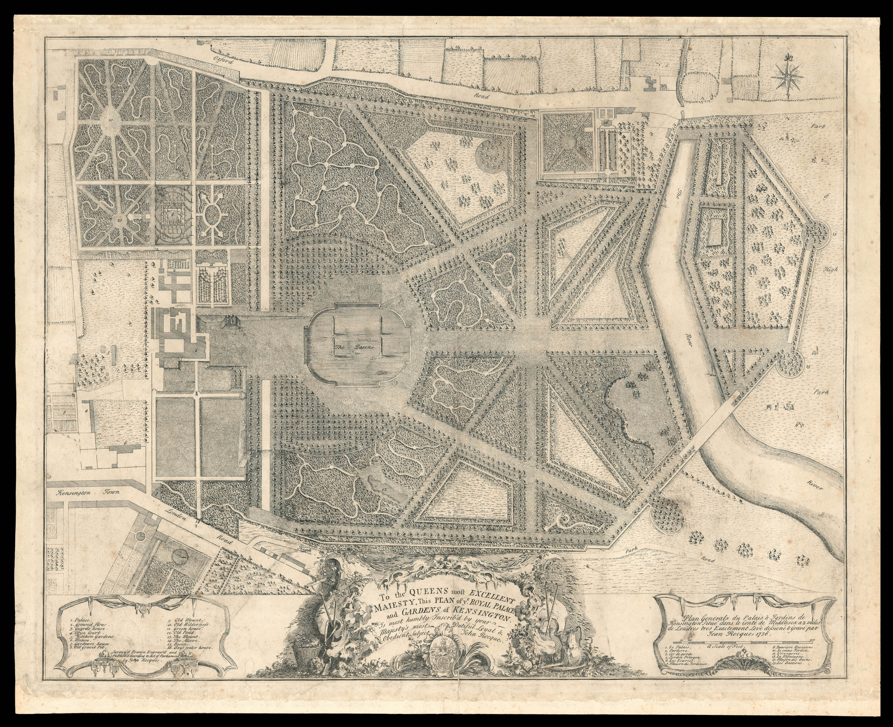
Kensington Gardens
By ROCQUE, John, 1736
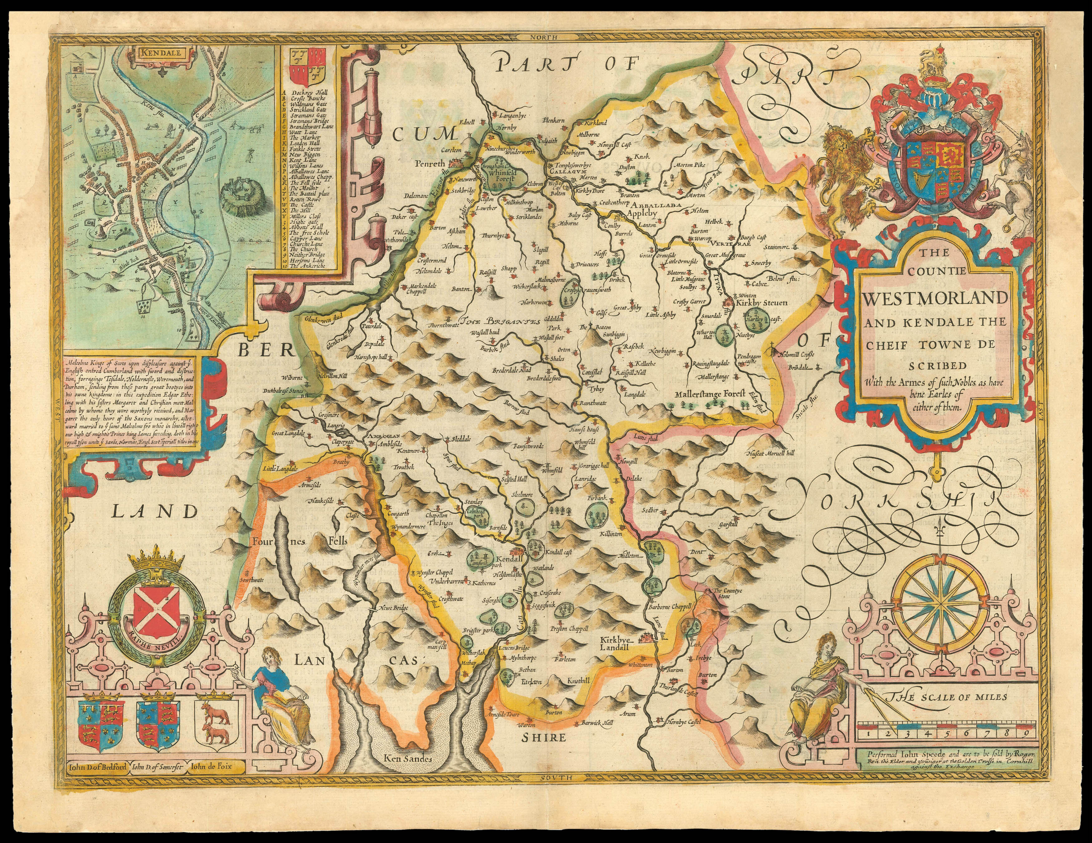
Rare Roger Rea edition of Speed’s map of Westmorland
By SPEED, John, 1665
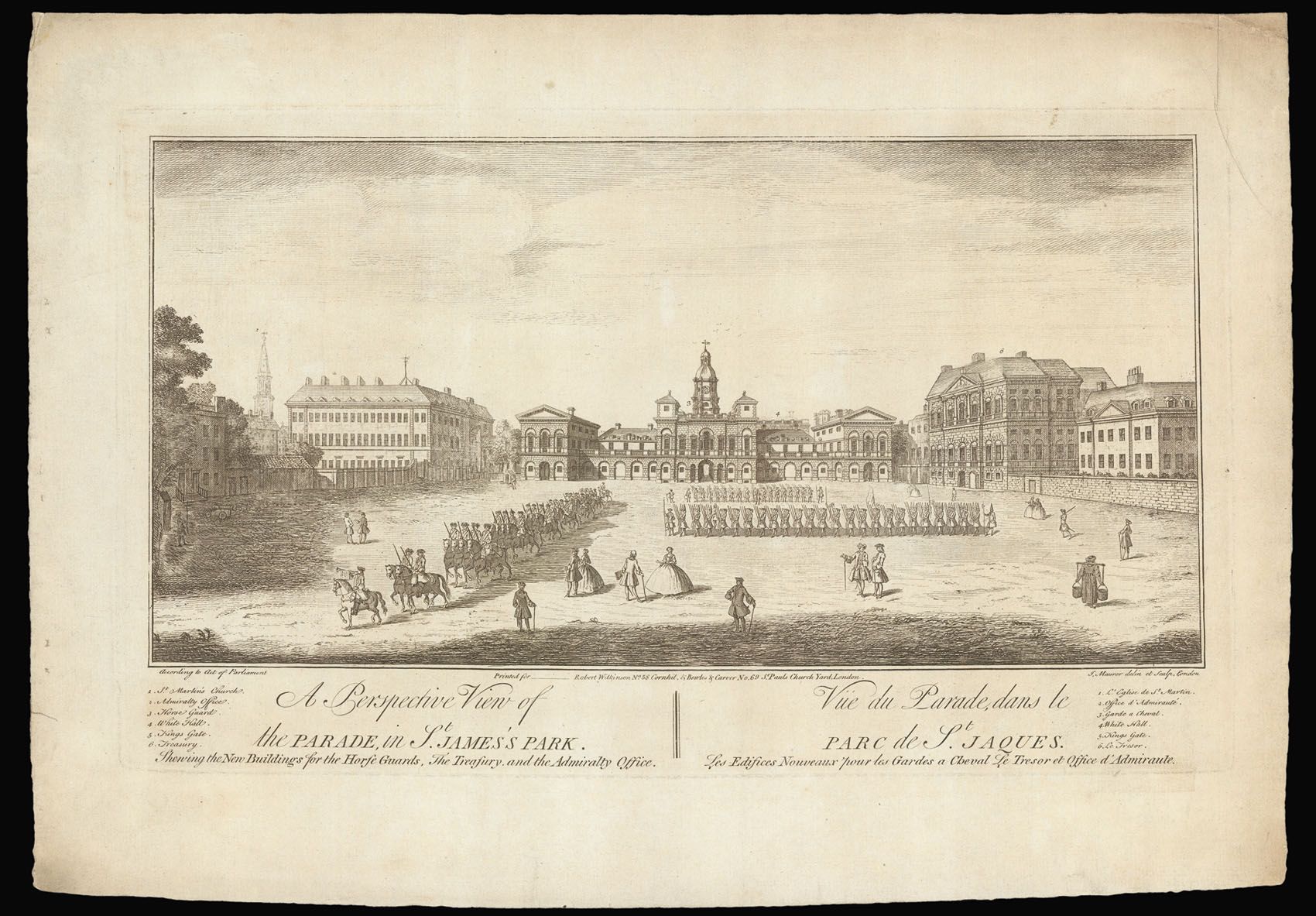
St James’s
By MAURER, John, 1740
Username or email address *Required
Password *Required
Remember me Log in
Lost your password?
Email address *Required
A link to set a new password will be sent to your email address.
Your personal data will be used to support your experience throughout this website, to manage access to your account, and for other purposes described in our privacy policy.
Register


![TAYLOR, Isaac [City of Hereford] To the right Hon[oura]ble ye Earl of Oxford High Steward of the City of Hereford...](https://omega.crouchrarebooks.com/wp-content/uploads/2025/03/21794_1H.jpg)
![EVANS, John [North Wales].](https://omega.crouchrarebooks.com/wp-content/uploads/2025/03/1367_1H.jpg)
![[ANONYMOUS] [Souvenir ticket from the Frost Fair of 1814].](https://omega.crouchrarebooks.com/wp-content/uploads/2025/03/18204_1H.jpg)
![CROSS, J[oseph] Cross's New Plan of London.](https://omega.crouchrarebooks.com/wp-content/uploads/2025/03/1928_1H.jpg)
![[CLENNELL, Luke] [Frost fair]](https://omega.crouchrarebooks.com/wp-content/uploads/2025/03/18154_1H.jpg)
![[ANONYMOUS] An Illustrated Map of London.](https://omega.crouchrarebooks.com/wp-content/uploads/2025/03/2366_1H.jpg)
![HOLLAR, [Wenceslaus] Sed nulla potentia longa est Quo non discordia Cives](https://omega.crouchrarebooks.com/wp-content/uploads/2025/03/18344_1H.jpg)
![HAVELL Jnr., R[obert] An Aeronautical View of London Drawn & Engraved by R. Havell.](https://omega.crouchrarebooks.com/wp-content/uploads/2025/03/12499_1H.jpg)
![[ANONYMOUS] View of the Fair held on the River Thames.](https://omega.crouchrarebooks.com/wp-content/uploads/2025/03/18171_1H.jpg)