|
× |
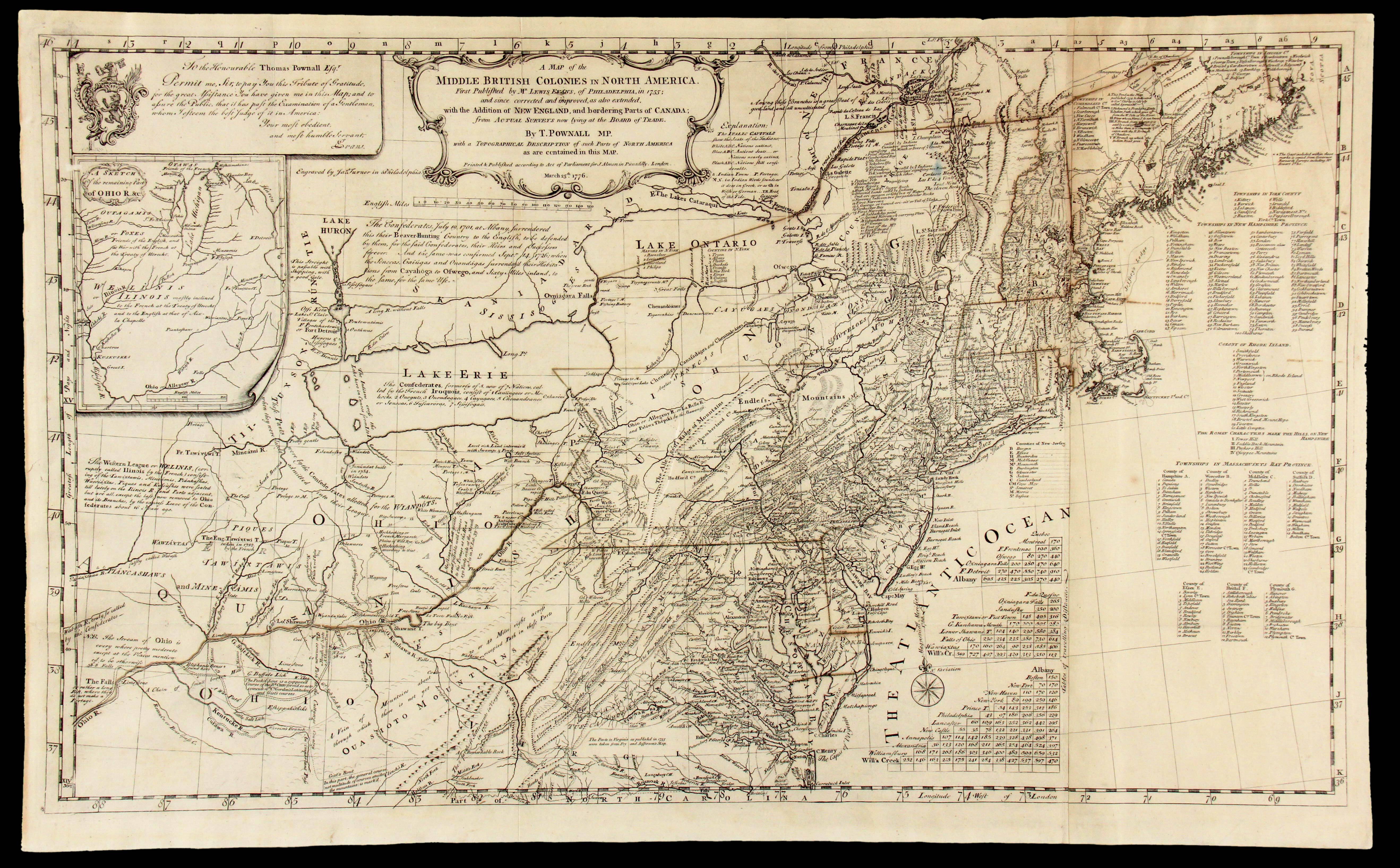 |
British Colonies in America
1 x
£12,000
|
£12,000 |
|
£12,000 |
|
× |
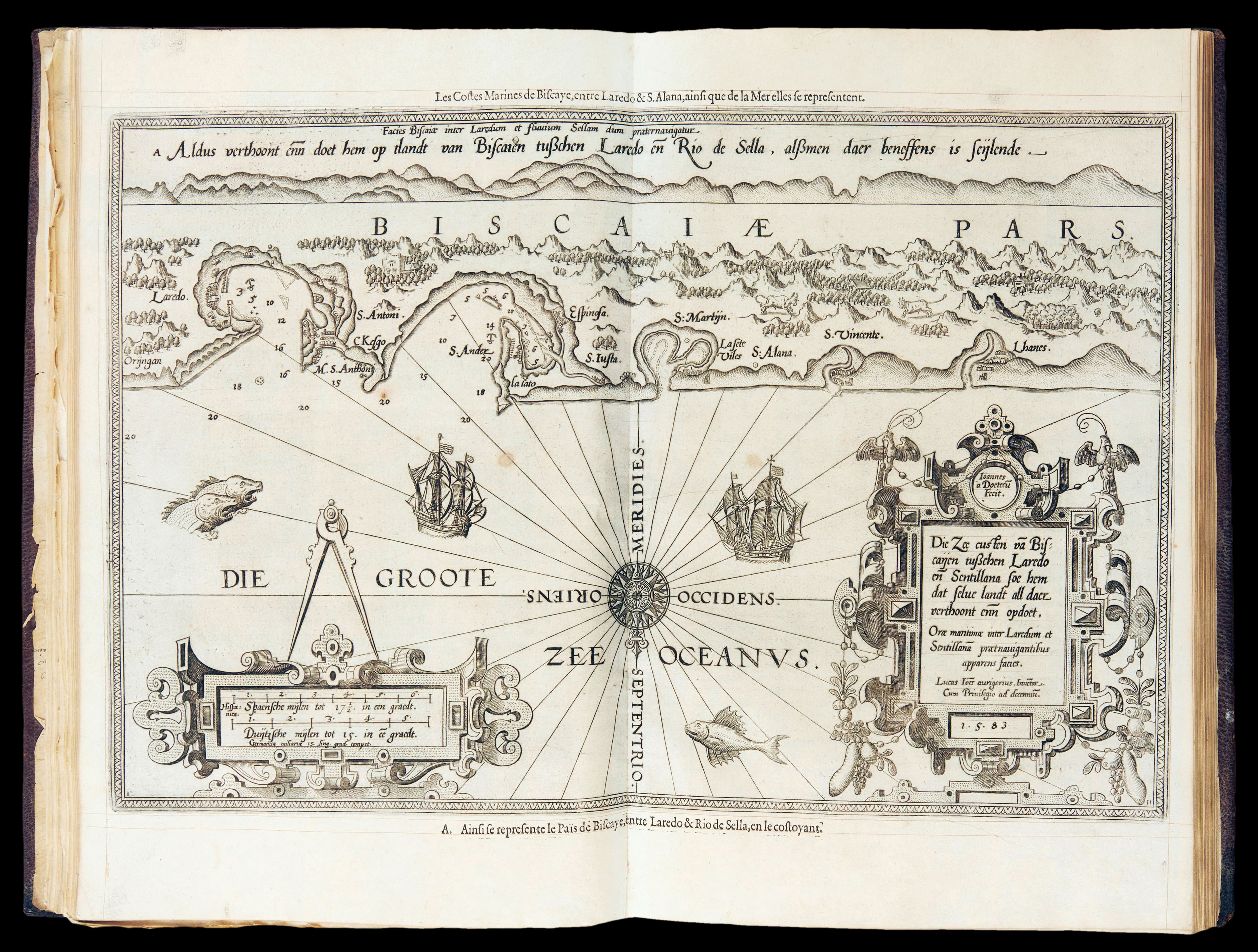 |
The French edition of Waghenaer's pilot
1 x
£110,000
|
£110,000 |
|
£110,000 |
|
× |
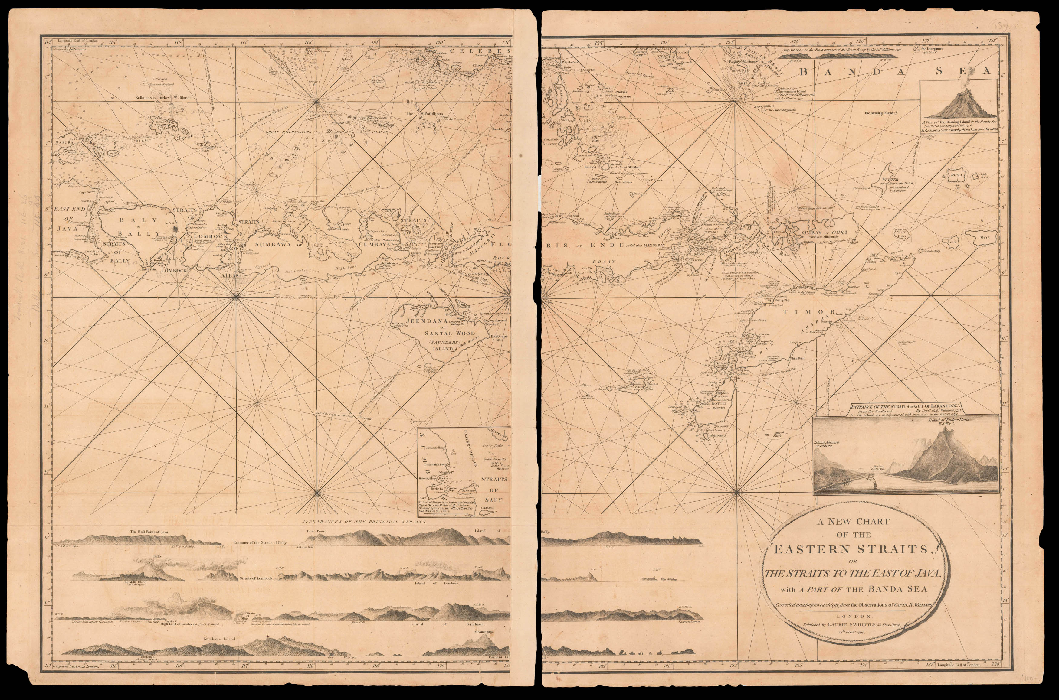 |
A dramatic vignette of the Gut of Larantooca
1 x
£750
|
£750 |
|
£750 |
|
× |
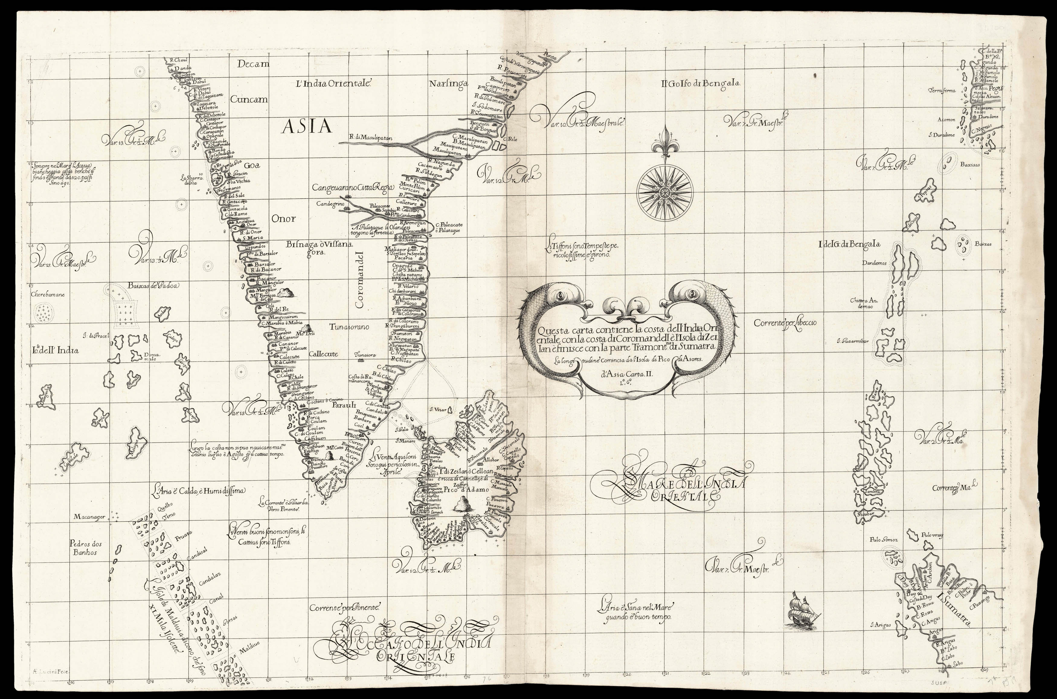 |
Dudley's chart of southern India
1 x
£8,000
|
£8,000 |
|
£8,000 |
|
× |
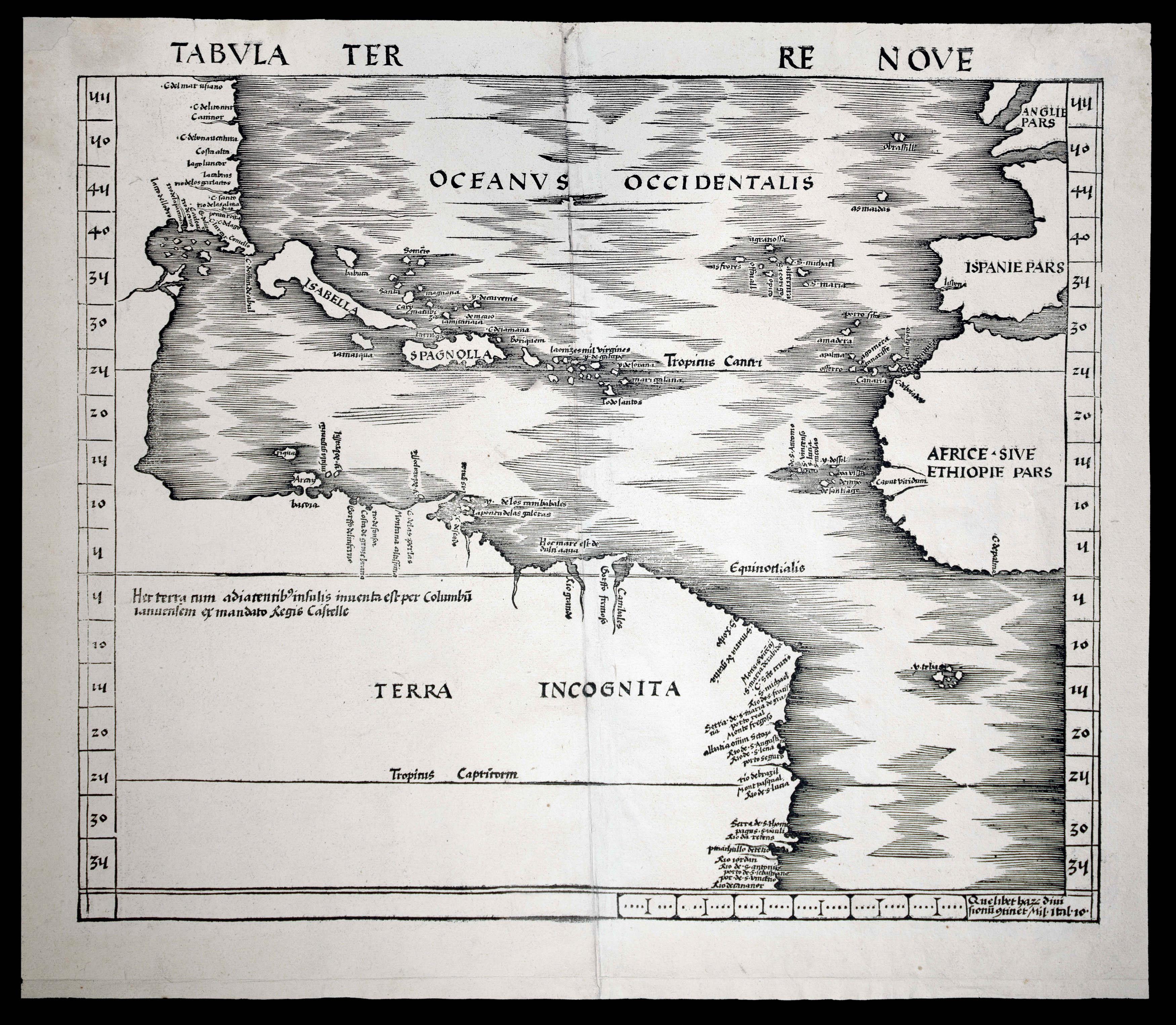 |
The first map devoted to America to appear in an atlas
1 x
£50,000
|
£50,000 |
|
£50,000 |
|
× |
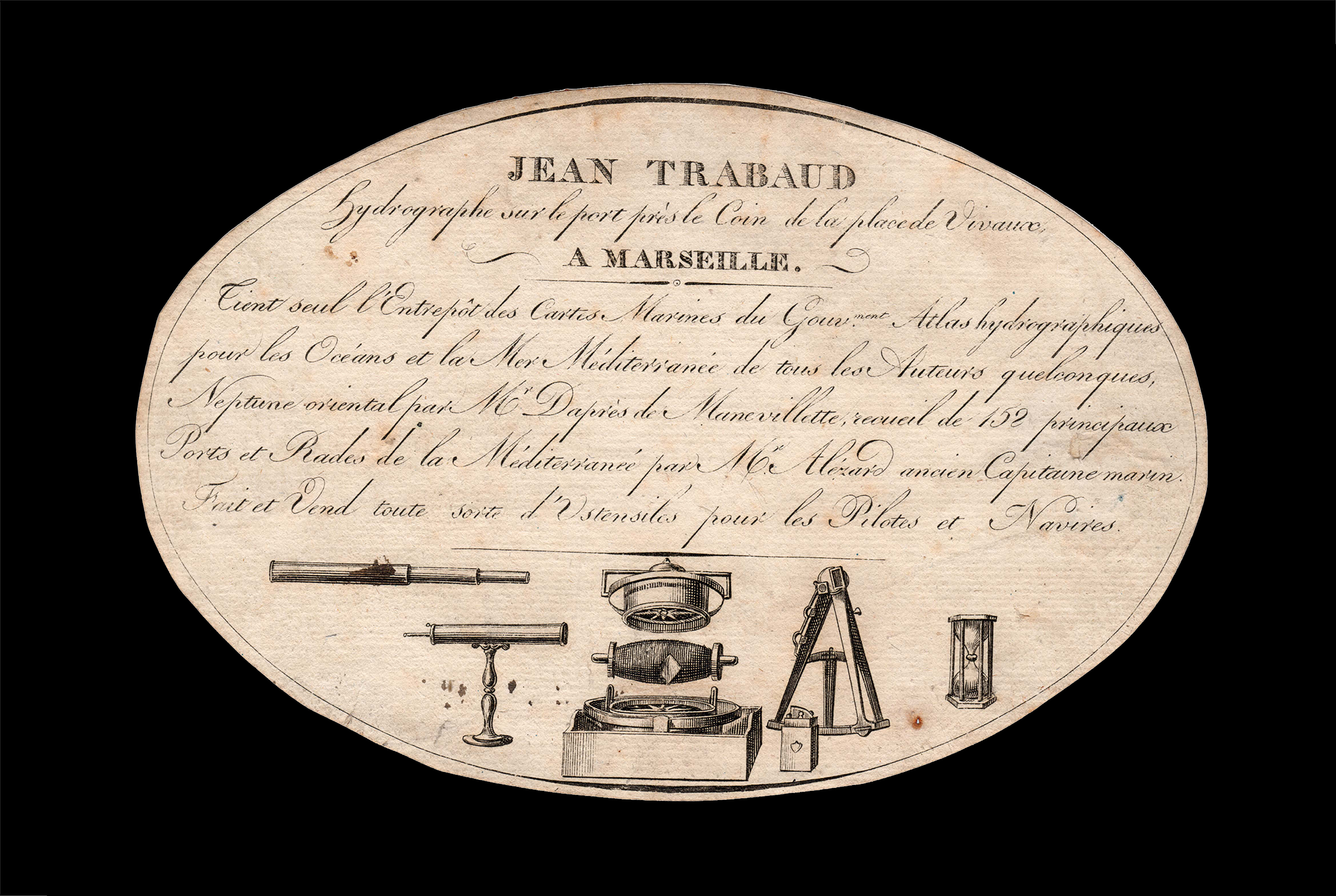 |
Charts of the Mediterranean for sale
1 x
£650
|
£650 |
|
£650 |
|
× |
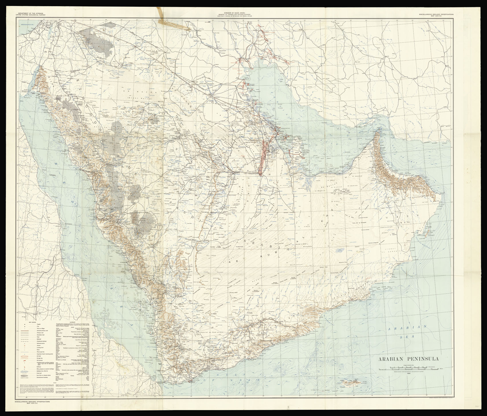 |
The search for black gold continues
1 x
£15,000
|
£15,000 |
|
£15,000 |
|
× |
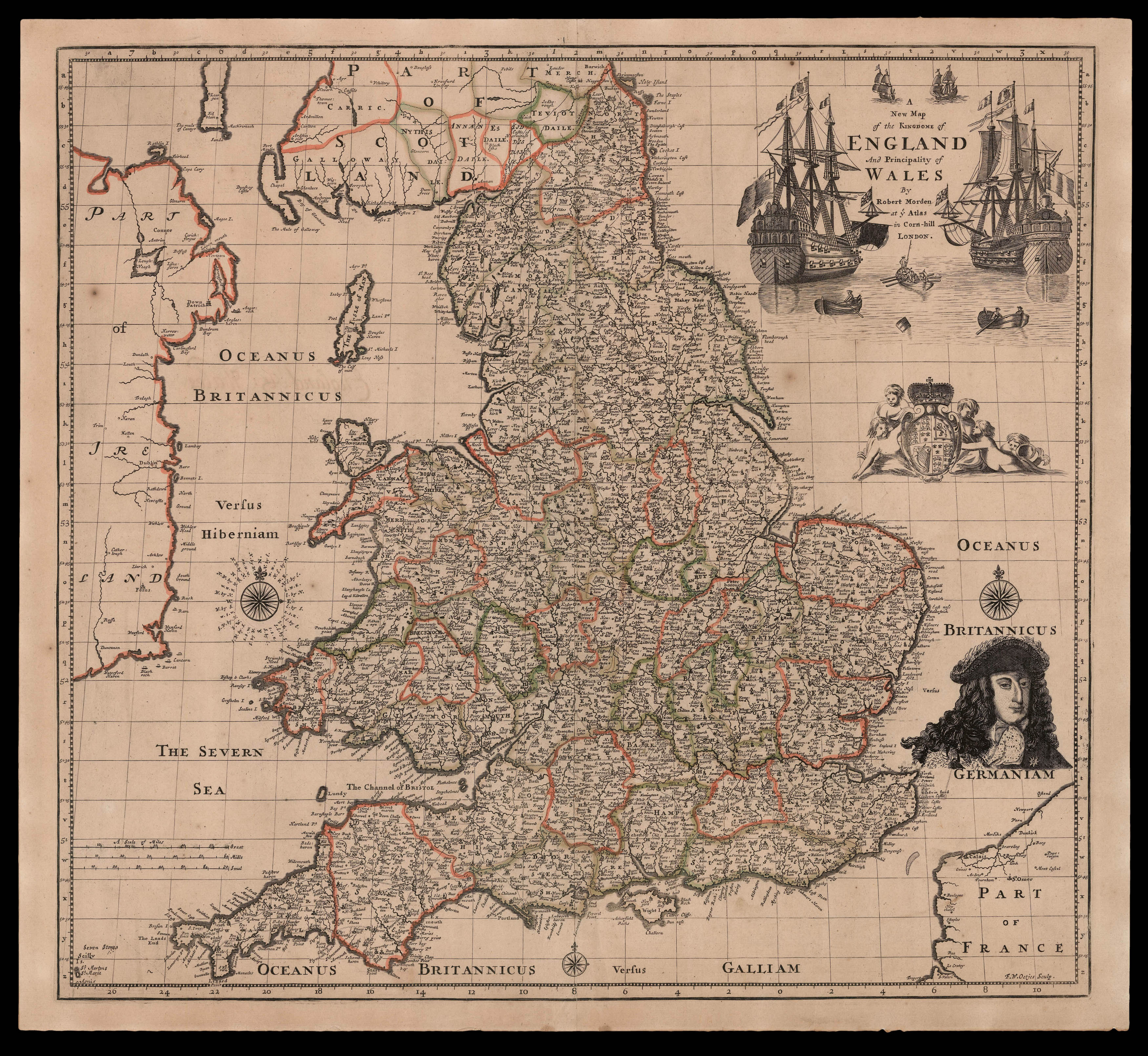 |
Rare separately issued map of England and Wales
1 x
£7,000
|
£7,000 |
|
£7,000 |
|
× |
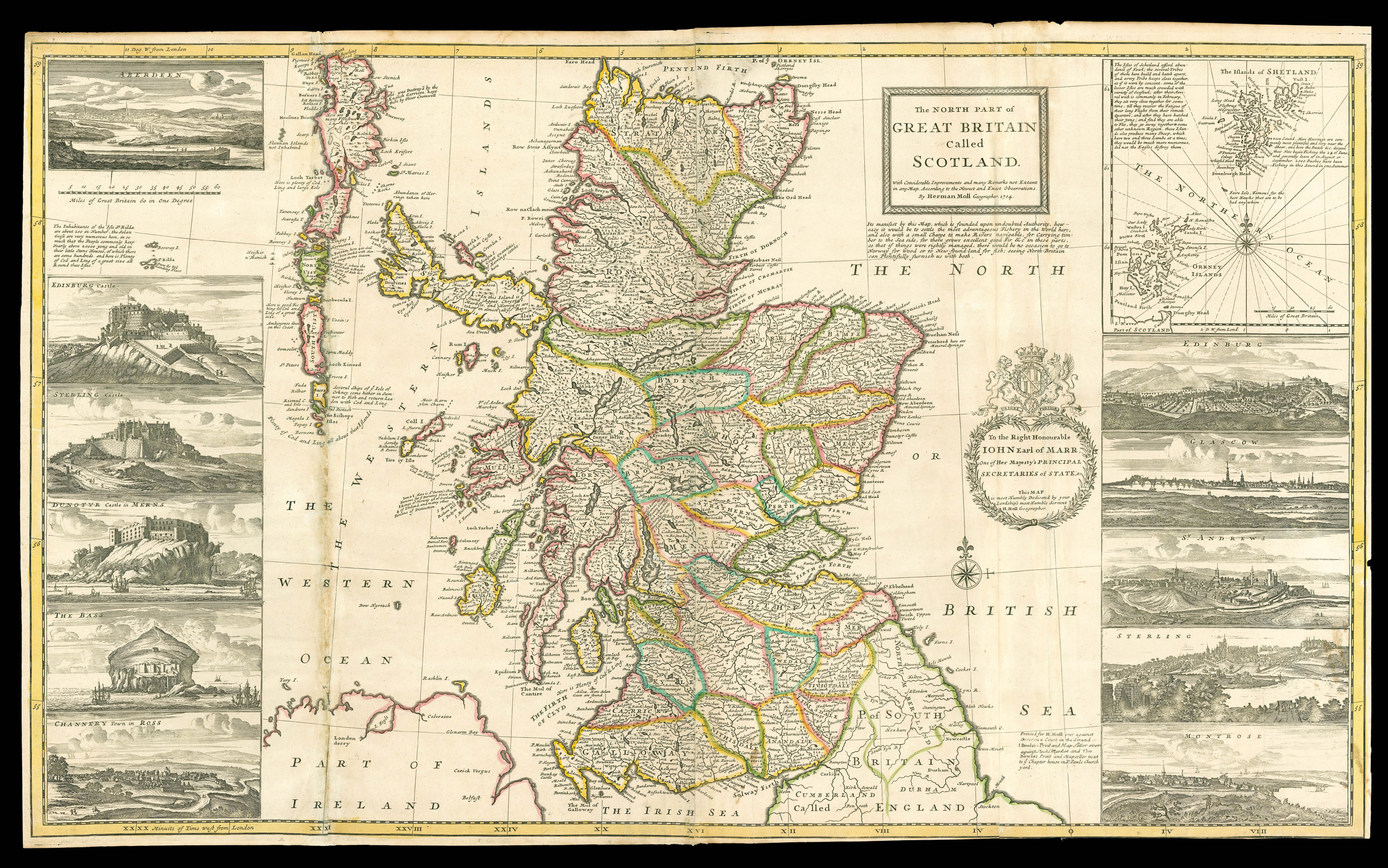 |
Moll's striking map of Scotland
1 x
£3,000
|
£3,000 |
|
£3,000 |
|
× |
![[MAPSELLER] [Porcelain figure of a mapseller]](https://omega.crouchrarebooks.com/wp-content/uploads/2025/03/17626_1H.jpg) |
The Meissen Mapseller
1 x
£2,000
|
£2,000 |
|
£2,000 |
|
× |
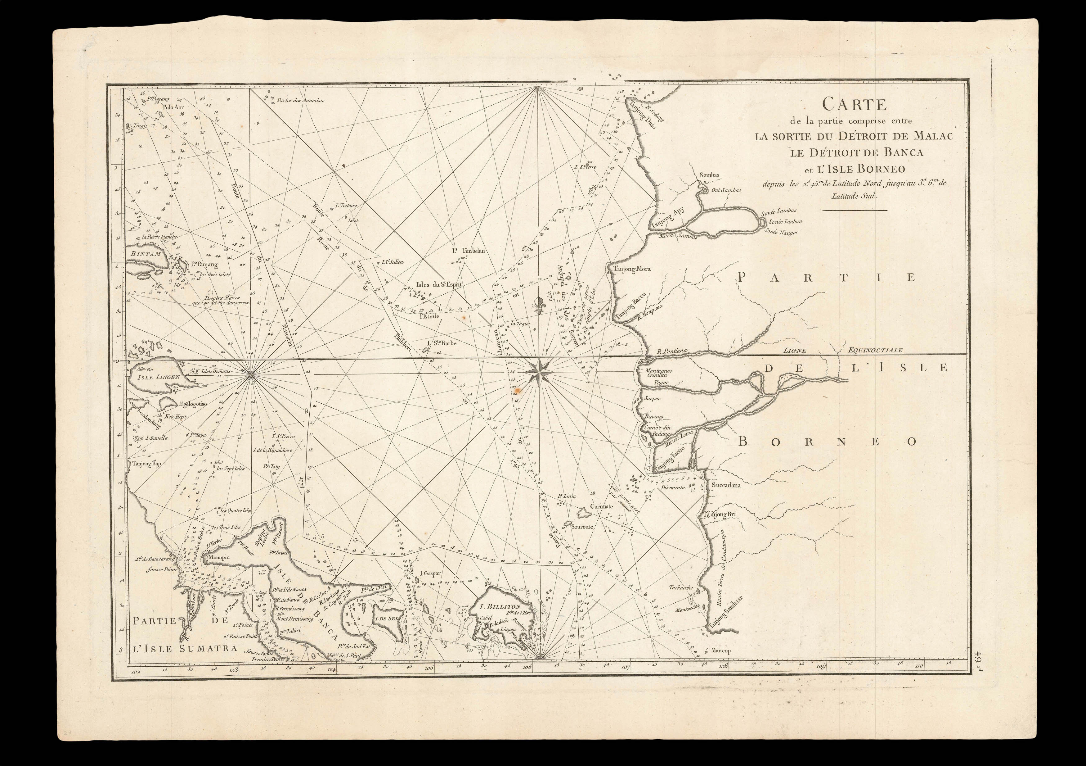 |
The sea between Sumatra and Borneo
1 x
£350
|
£350 |
|
£350 |
|
× |
![HOLLAR, W[enceslaus] [Etching of ships at sea]](https://omega.crouchrarebooks.com/wp-content/uploads/2025/03/18262_1H.jpg) |
The whale and the warships
1 x
£2,000
|
£2,000 |
|
£2,000 |
|
× |
![HAINES, Captain [Stafford Bettesworth]; Lieutenant CARLESS; and Lieutenant A. M. GRIEVE Chart of the Gulf of Aden on Mercator's Projection](https://omega.crouchrarebooks.com/wp-content/uploads/2025/03/16481_1H.jpg) |
Haines's deatiled chart of southern Arabia
1 x
£100
|
£100 |
|
£100 |
|
× |
![HUMBOLDT, Alexander von [and] Aime J.A. BONPLAND Essai Politique sur le Royaume de la Nouvelle-Espagne.](https://omega.crouchrarebooks.com/wp-content/uploads/2025/03/14600_1H.jpg) |
The first scientific analysis of the American Southwest
1 x
£45,000
|
£45,000 |
|
£45,000 |
|
× |
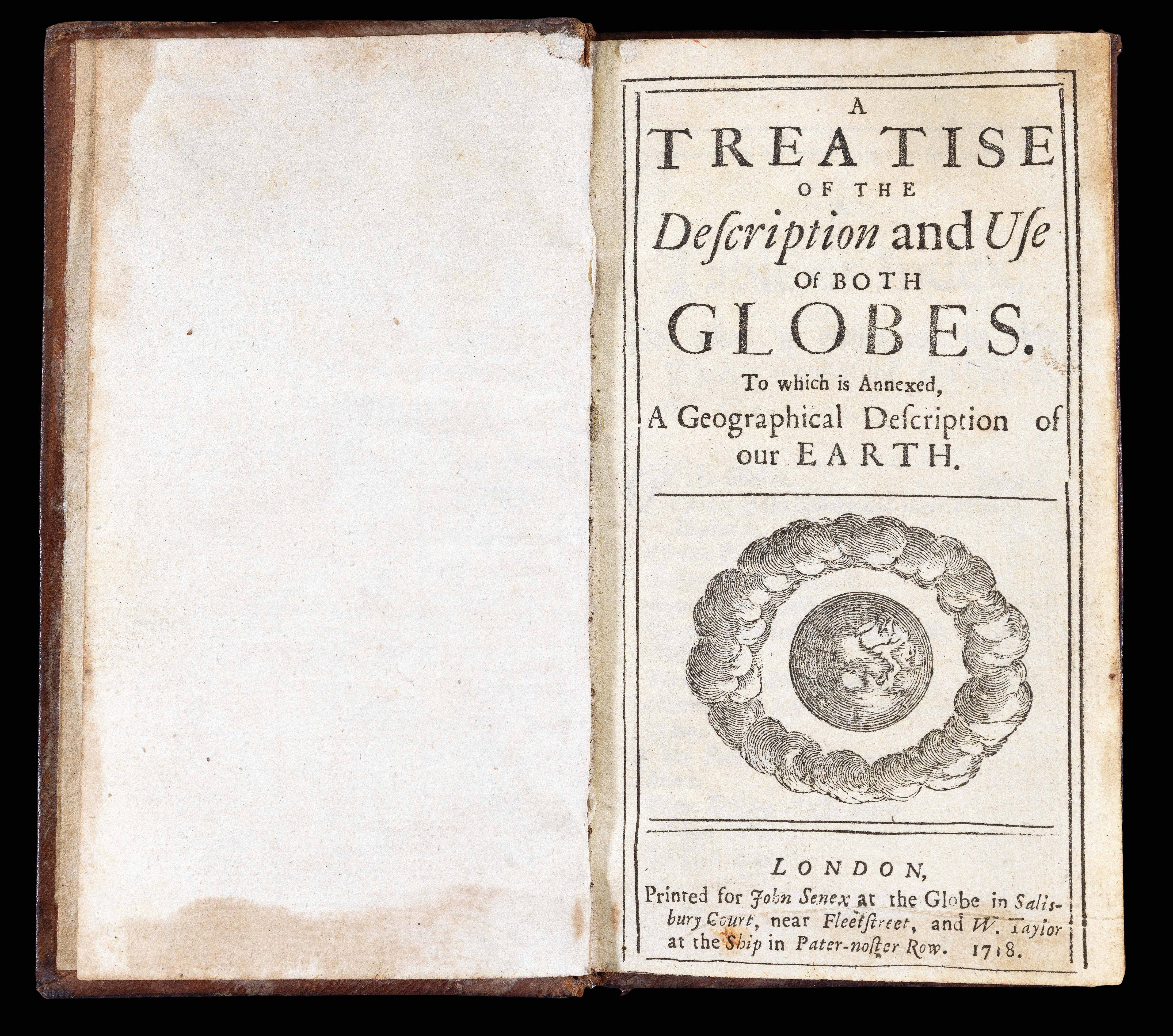 |
"a true and exact representation of the Earth and Heavens"
1 x
£1,200
|
£1,200 |
|
£1,200 |
|
× |
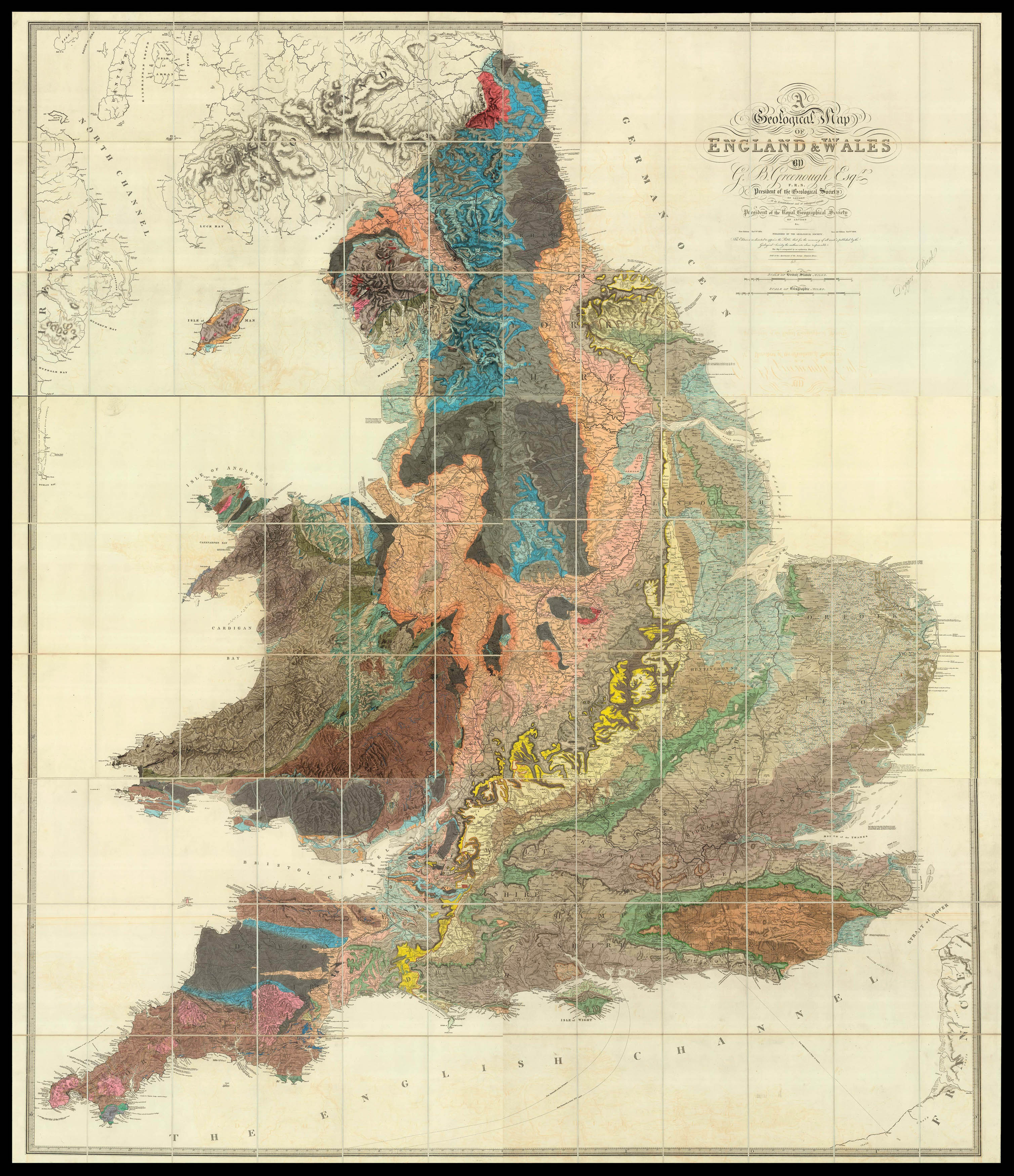 |
Greenough's riposte to Smith in the battle of the geological maps
1 x
£18,500
|
£18,500 |
|
£18,500 |
|
× |
![LE SAGE, P. Carte depuis la fin du Detroit de la Sonde jusqu'a la fin D'Etroit de Banca faitte en l'anne 1734 – [Singapore Strait] – [South China Sea].](https://omega.crouchrarebooks.com/wp-content/uploads/2025/03/17525_1H.jpg) |
Charting a voyage of nearly two thousand nautical miles from the Sunda Strait to Hong Kong
1 x
£87,000
|
£87,000 |
|
£87,000 |
|
× |
![[SANXING PRESS] [The latest edition of the map of Hong Kong in full detail;](https://omega.crouchrarebooks.com/wp-content/uploads/2025/03/14291_1H.jpg) |
Large plan of 1930s Hong Kong showing the cyclone scale
1 x
£5,000
|
£5,000 |
|
£5,000 |
|
× |
![RIVET, Claude [Panorama of Leiden] Lugdunum Batavorum Hollandia Celeberrimum et Academia Florentissma.](https://omega.crouchrarebooks.com/wp-content/uploads/2025/03/1914_1H.jpg) |
Leiden - home to Rembrandt, Lievens and, Dou
1 x
£20,000
|
£20,000 |
|
£20,000 |
|
× |
![[BRY, Theodor de] Wolfganus Lazius Historic Caesare](https://omega.crouchrarebooks.com/wp-content/uploads/2025/03/17791_1H.jpg) |
Wolfgang Lazius
1 x
£300
|
£300 |
|
£300 |
|
× |
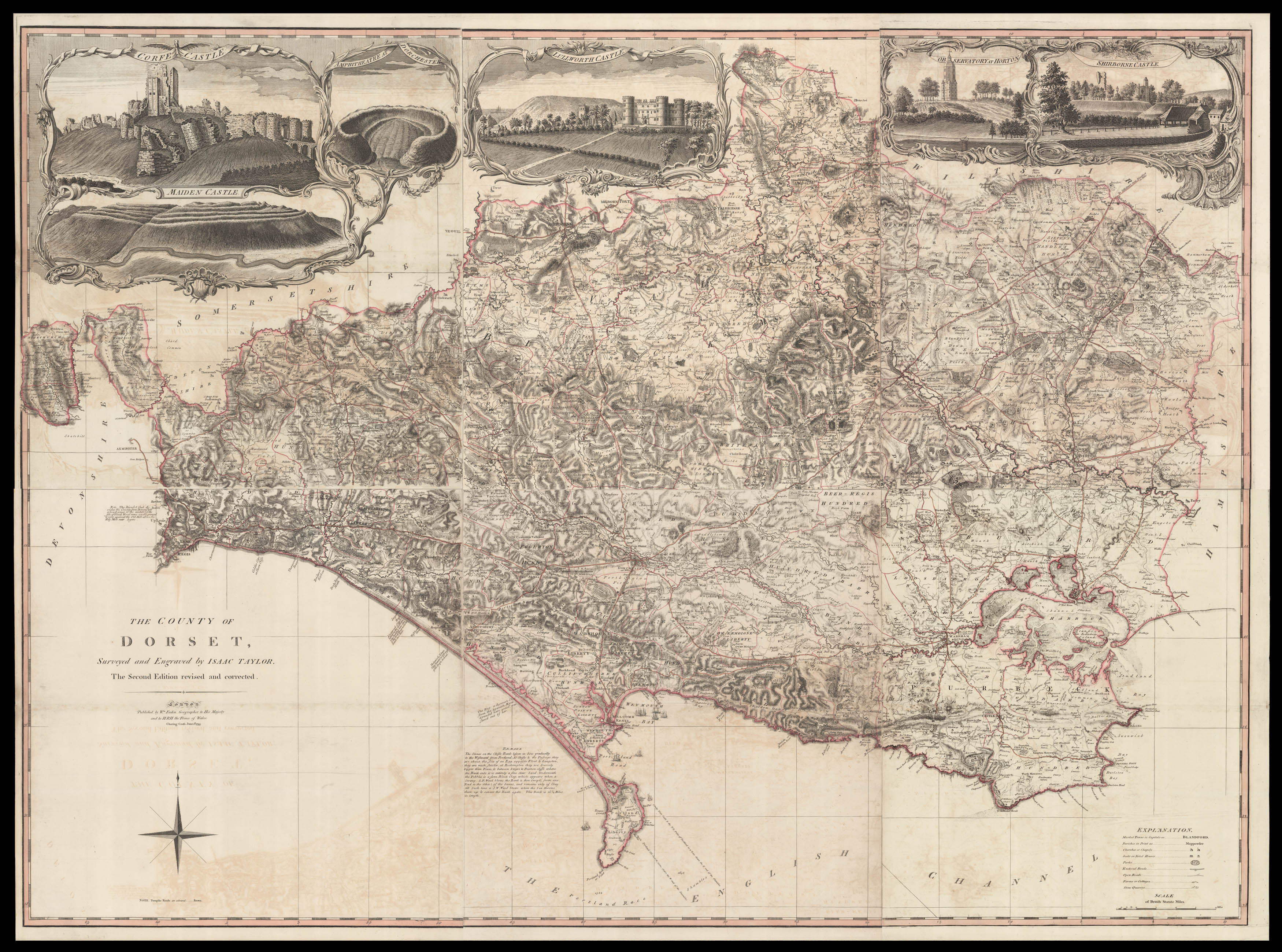 |
The rare second edition of the first large-scale survey of Dorset
1 x
£5,000
|
£5,000 |
|
£5,000 |
|
× |
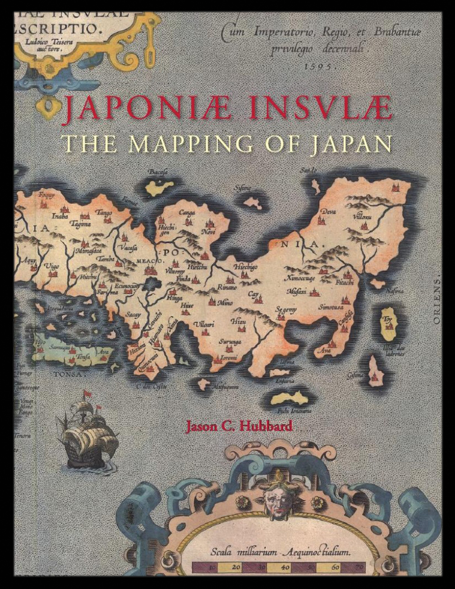 |
Hubbard's cartobibliography of Japan
1 x
£159
|
£159 |
|
£159 |
|
× |
 |
Southwark
1 x
£650
|
£650 |
|
£650 |
|
× |
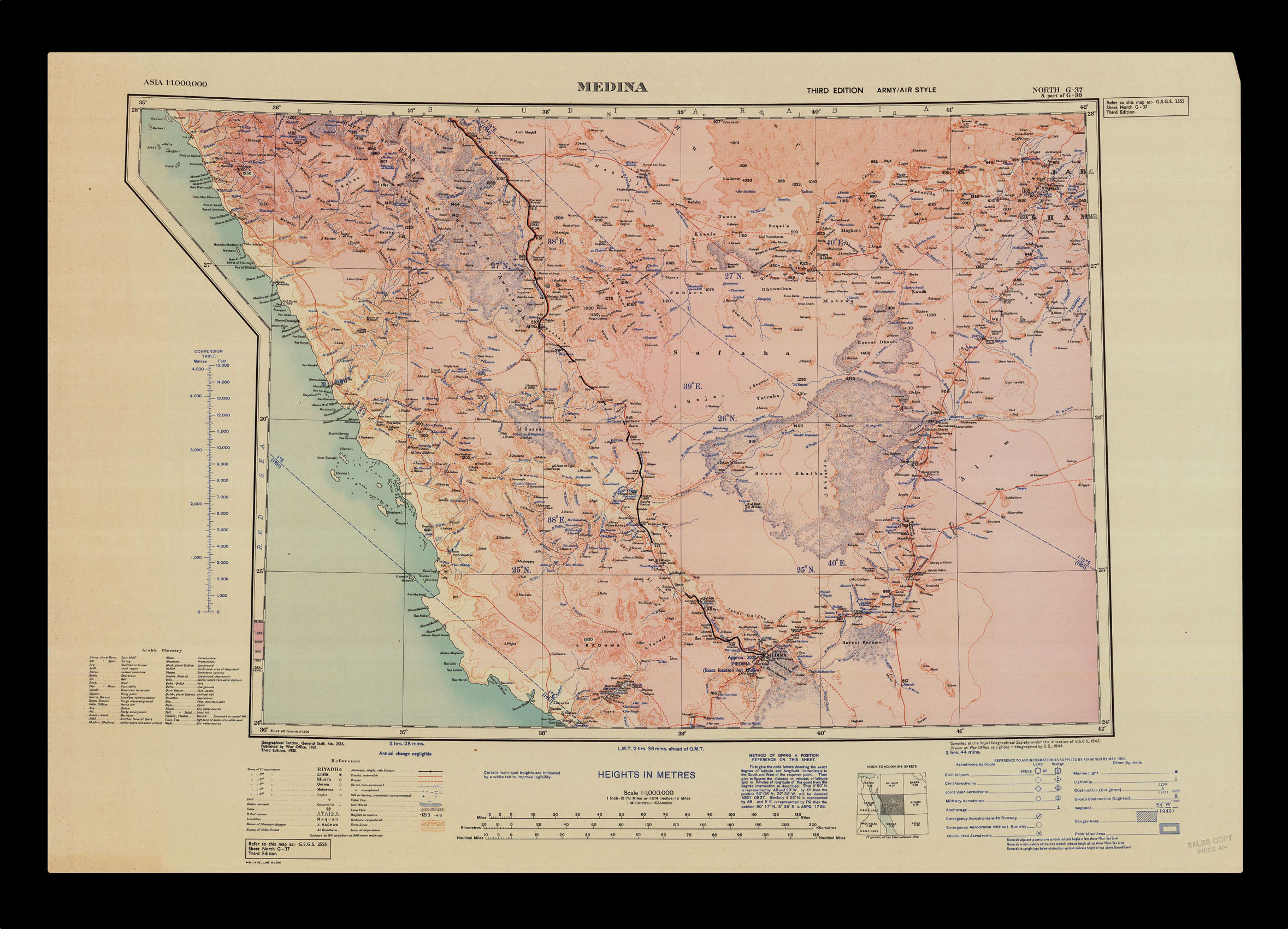 |
Medina
1 x
£250
|
£250 |
|
£250 |
|
× |
![PTOLEMAEUS, Claudius [translated by ANGELUS, Jacobus, edited by GERMANUS, Nicolaus] [Balkans] Nona Europe tabula.](https://omega.crouchrarebooks.com/wp-content/uploads/2025/03/18397_1H.jpg) |
A striking map of Balkans from the 1482 Ulm Ptolemy
1 x
£15,000
|
£15,000 |
|
£15,000 |
|
× |
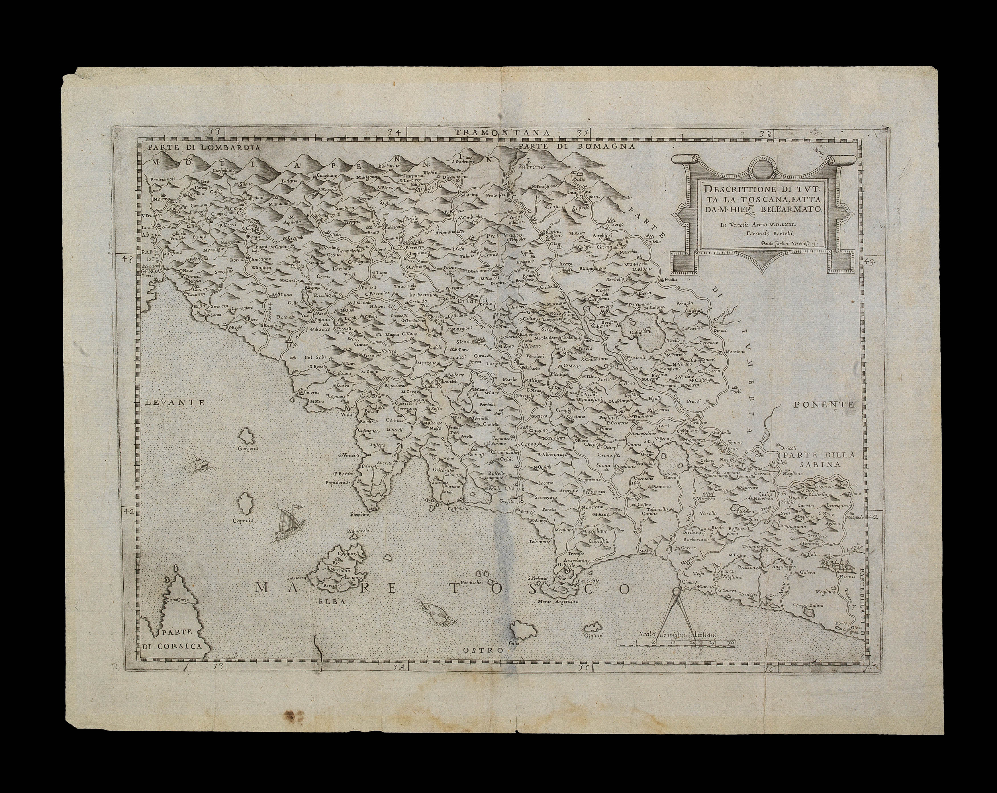 |
Bell'Armato's Tuscany
1 x
£3,000
|
£3,000 |
|
£3,000 |
|
× |
![CUNEGO, D[omenico] View of Part of Whitehall, Shewing the Admiralty Office, with the new Gateway designed & executed in the year 1760 & also a part of the Horse Guards, &c.](https://omega.crouchrarebooks.com/wp-content/uploads/2025/03/12344_1H.jpg) |
The Admiralty
1 x
£850
|
£850 |
|
£850 |
|
× |
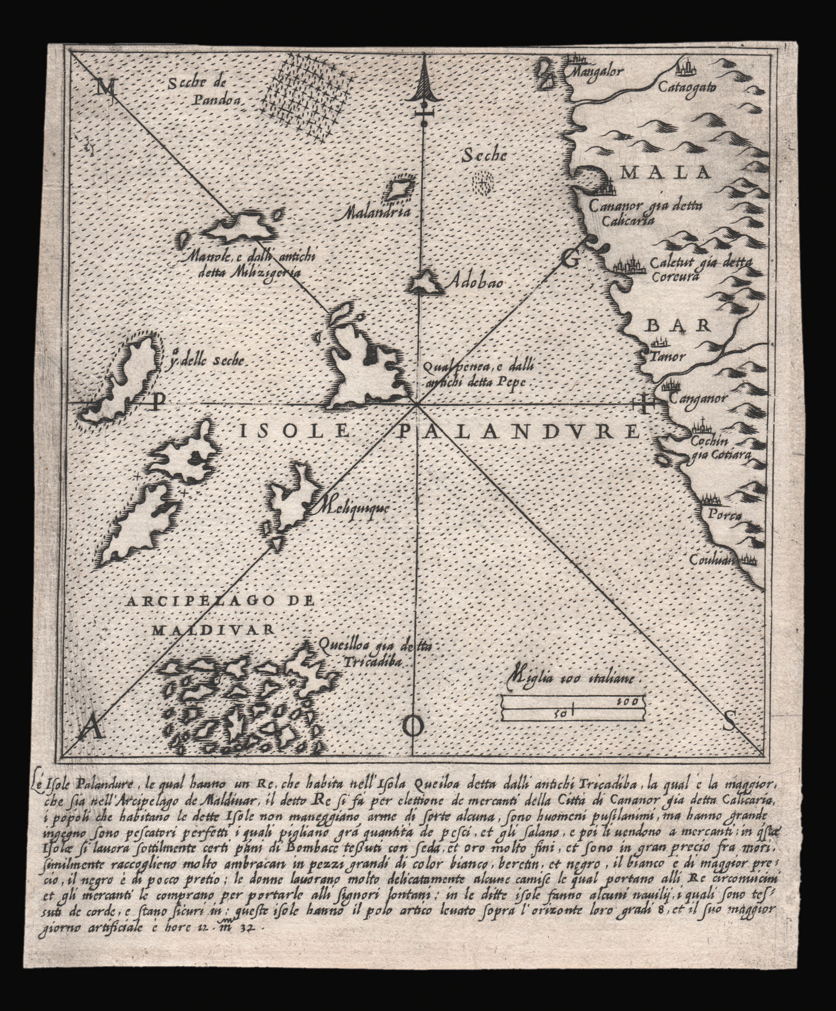 |
Only known example of this map of Isole Palandure
1 x
£3,200
|
£3,200 |
|
£3,200 |
|
× |
 |
Presentation copy of Jules Marcou's geological map of the United States to Auguste Trecul
1 x
£4,000
|
£4,000 |
|
£4,000 |
|
× |
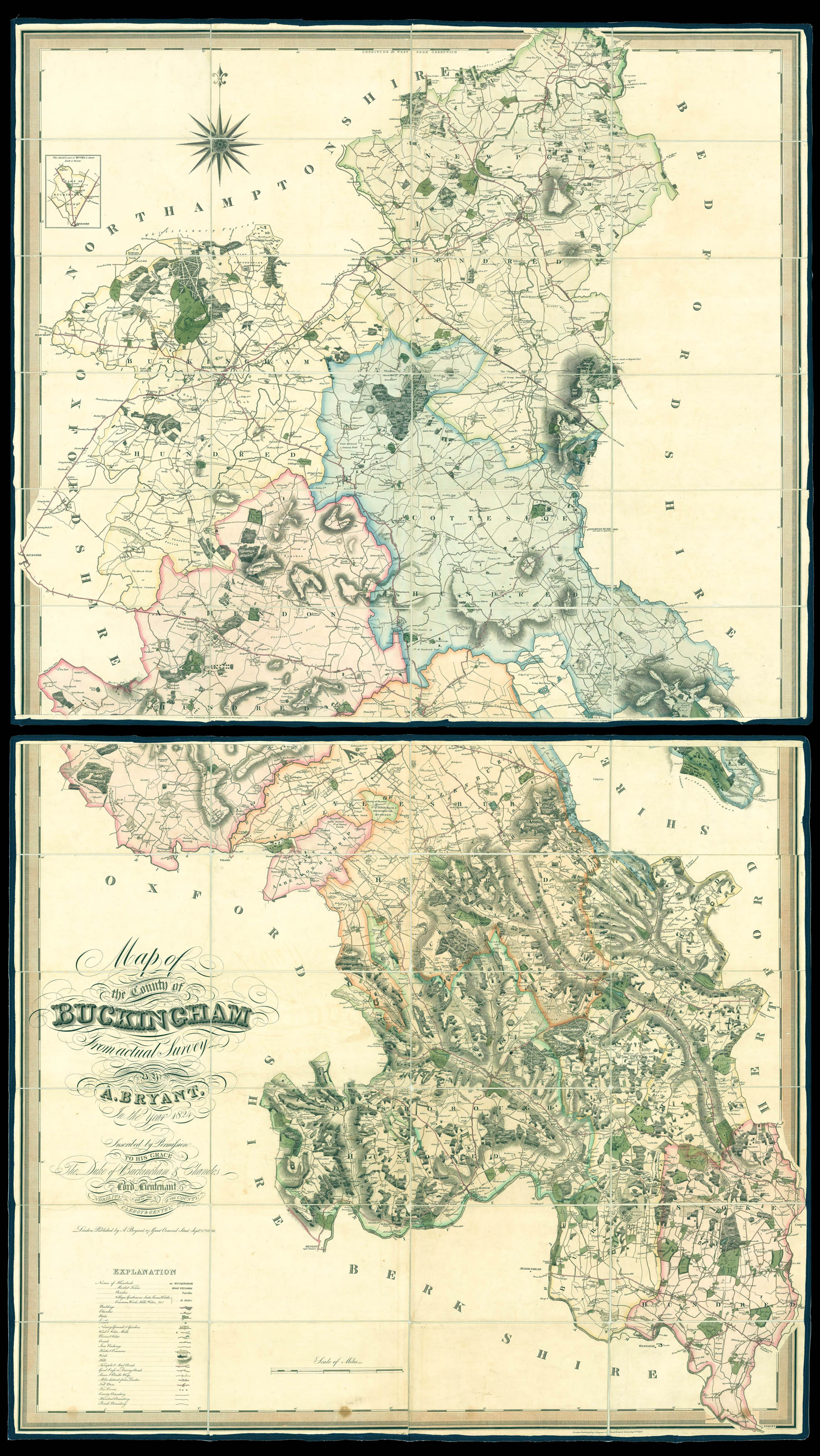 |
Buckinghamshire - Bryant's large-scale map of Buckinghamshire
1 x
£3,000
|
£3,000 |
|
£3,000 |
|
× |
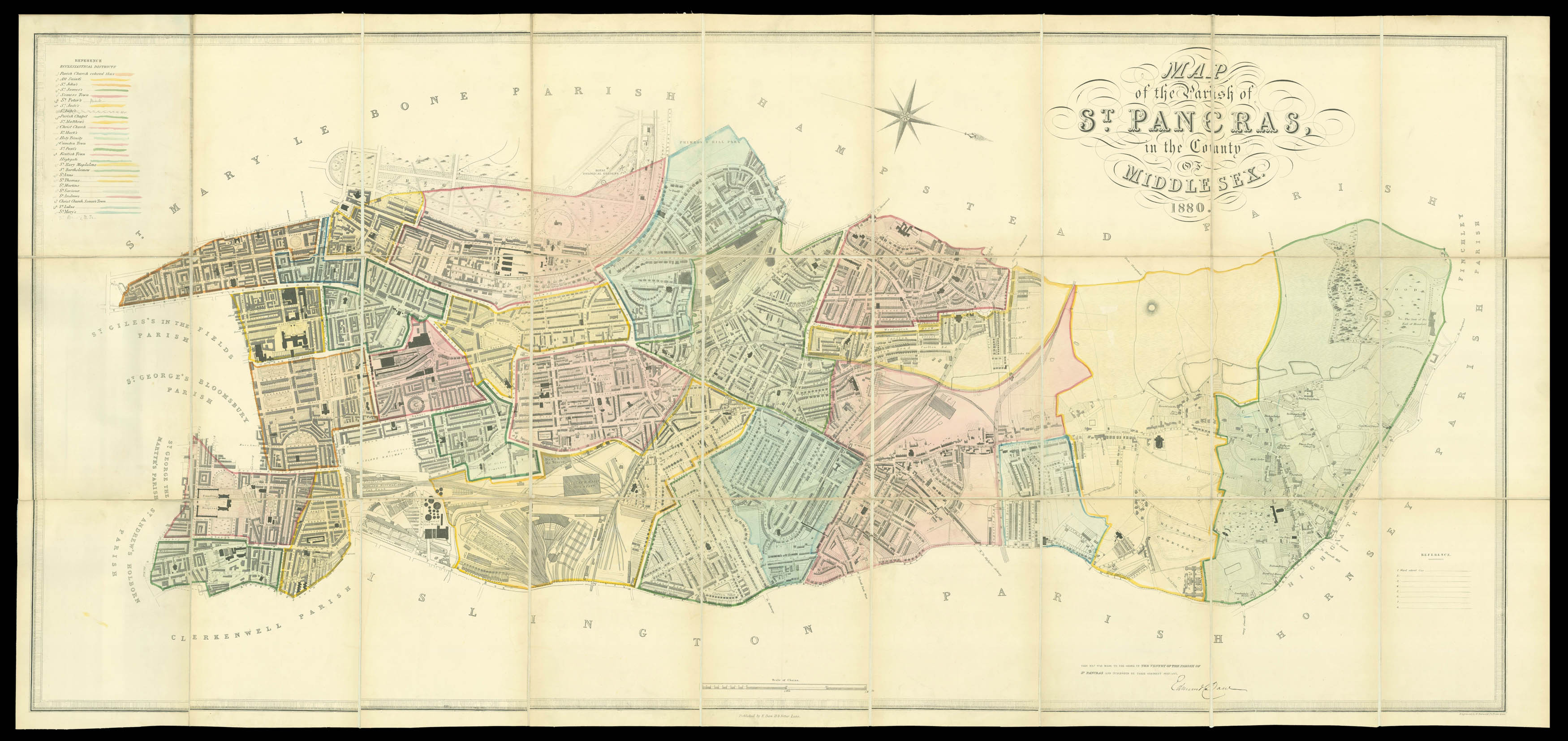 |
Daw's detailed plan of mid-Victorian St Pancras
1 x
£4,500
|
£4,500 |
|
£4,500 |
|
× |
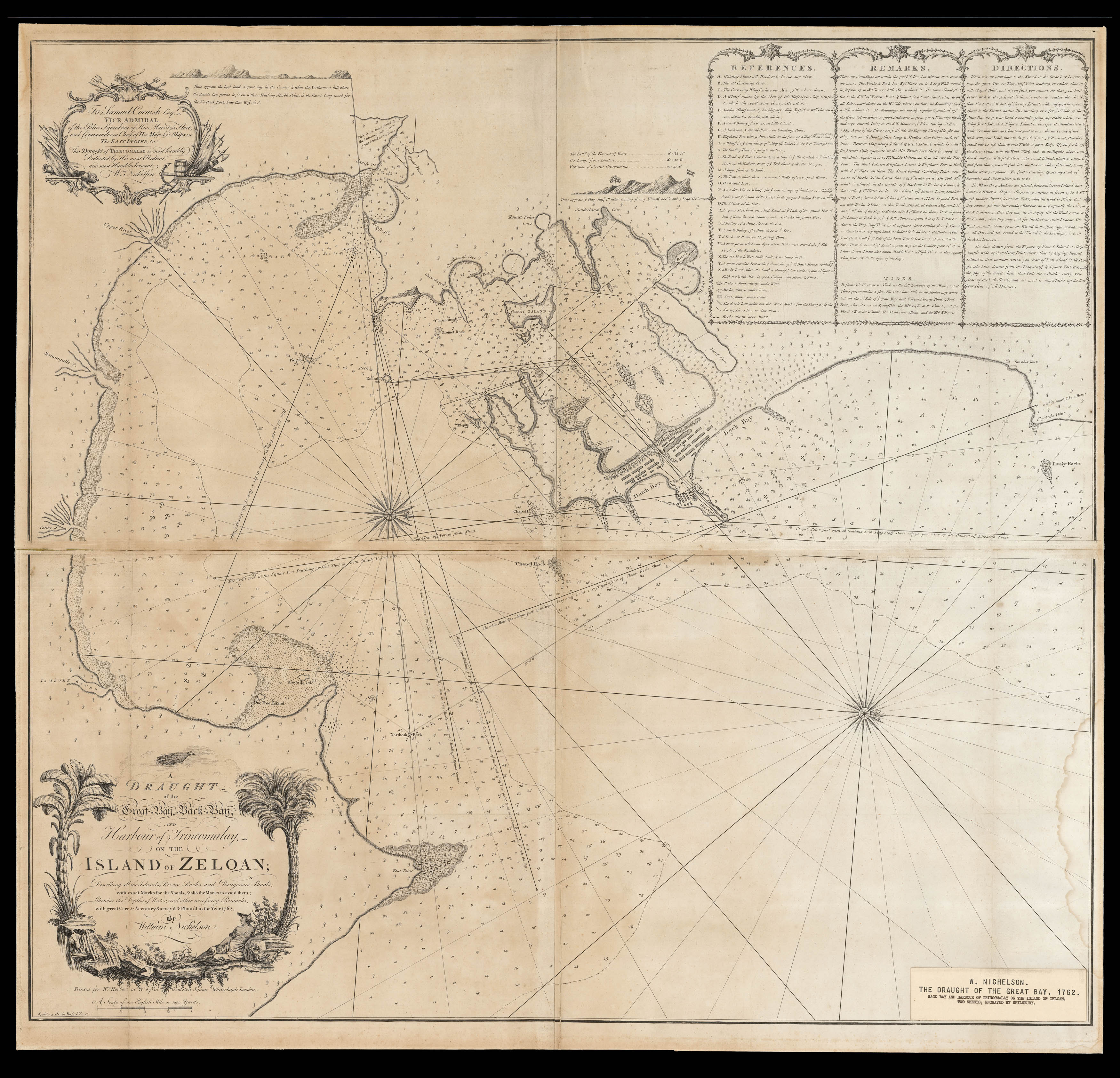 |
Rare eighteenth-century chart of Northeastern Sri Lanka
1 x
£2,500
|
£2,500 |
|
£2,500 |
|
× |
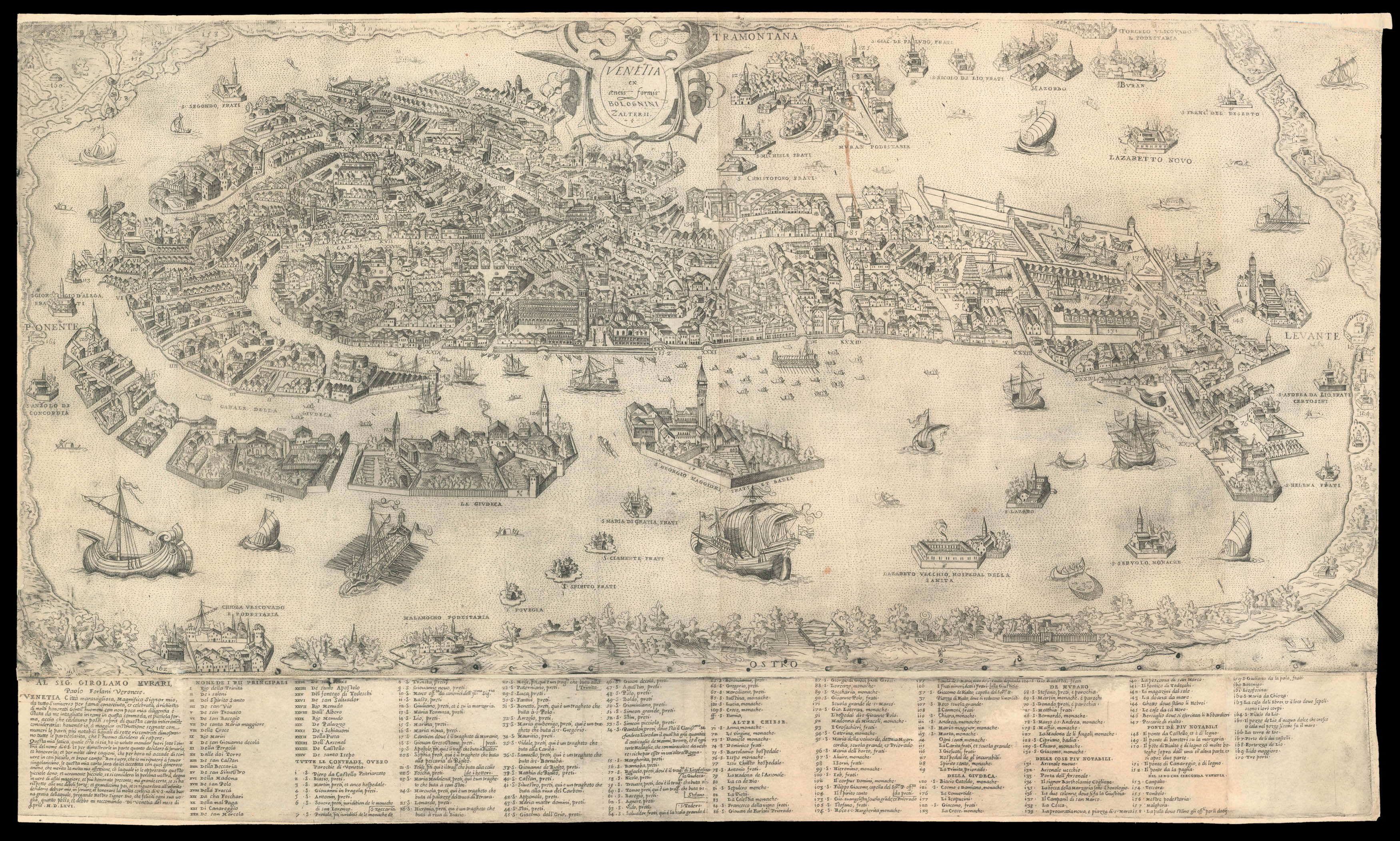 |
Forlani's magnificent plan of Venice
1 x
£30,000
|
£30,000 |
|
£30,000 |
|
× |
![BRYANT, A[ndrew] Map of the County of Norfolk,](https://omega.crouchrarebooks.com/wp-content/uploads/2025/03/10764_1H.jpg) |
The most important nineteenth century map of Norfolk
1 x
£3,500
|
£3,500 |
|
£3,500 |
|
|


