|
× |
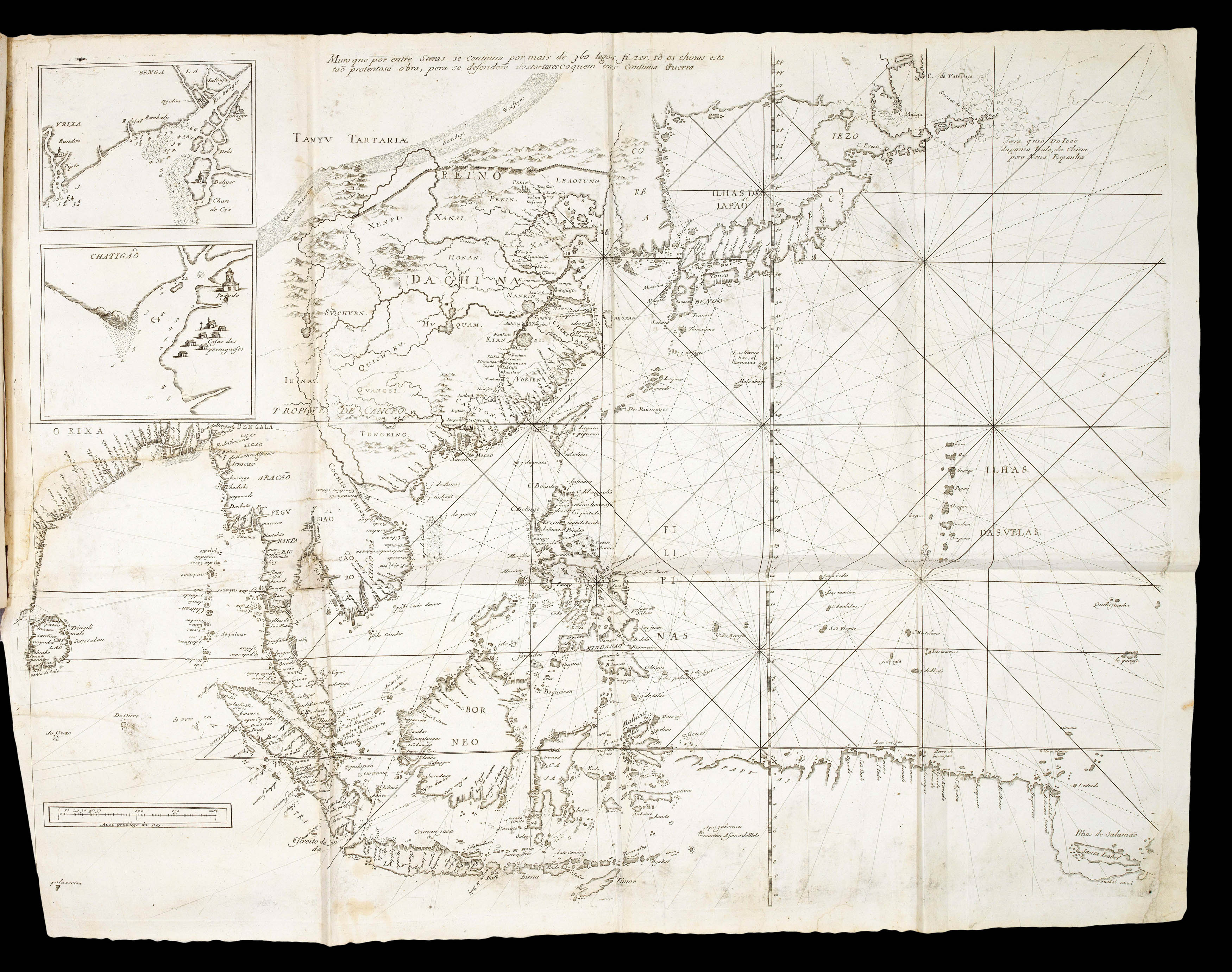 |
The most up-to-date practical knowledge on navigation and information on foreign countries
1 x
£35,000
|
£35,000 |
|
£35,000 |
|
× |
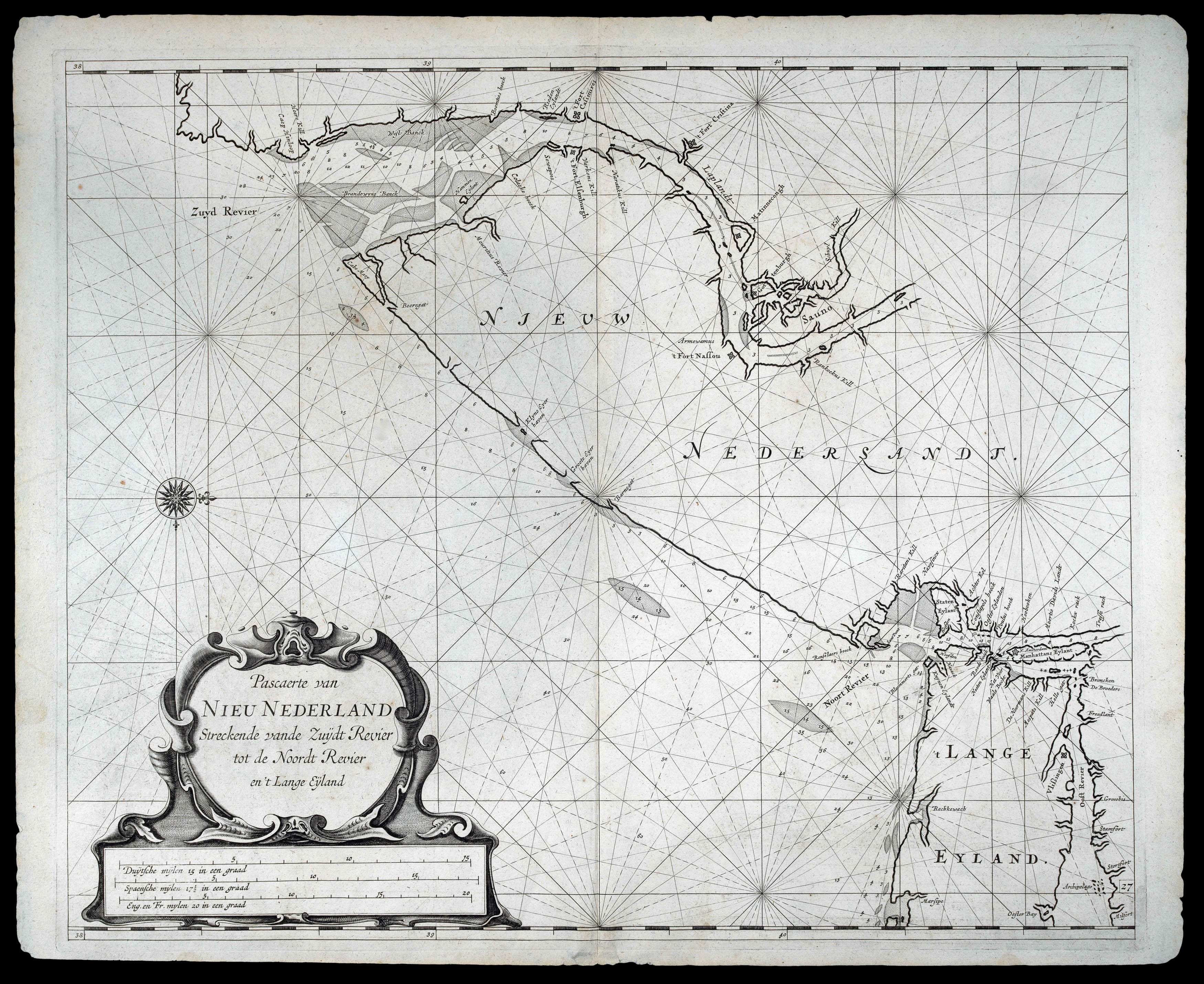 |
Rare chart of New Jersey published in "the first maritime atlas to be devoted to the Americas"
1 x
£35,000
|
£35,000 |
|
£35,000 |
|
× |
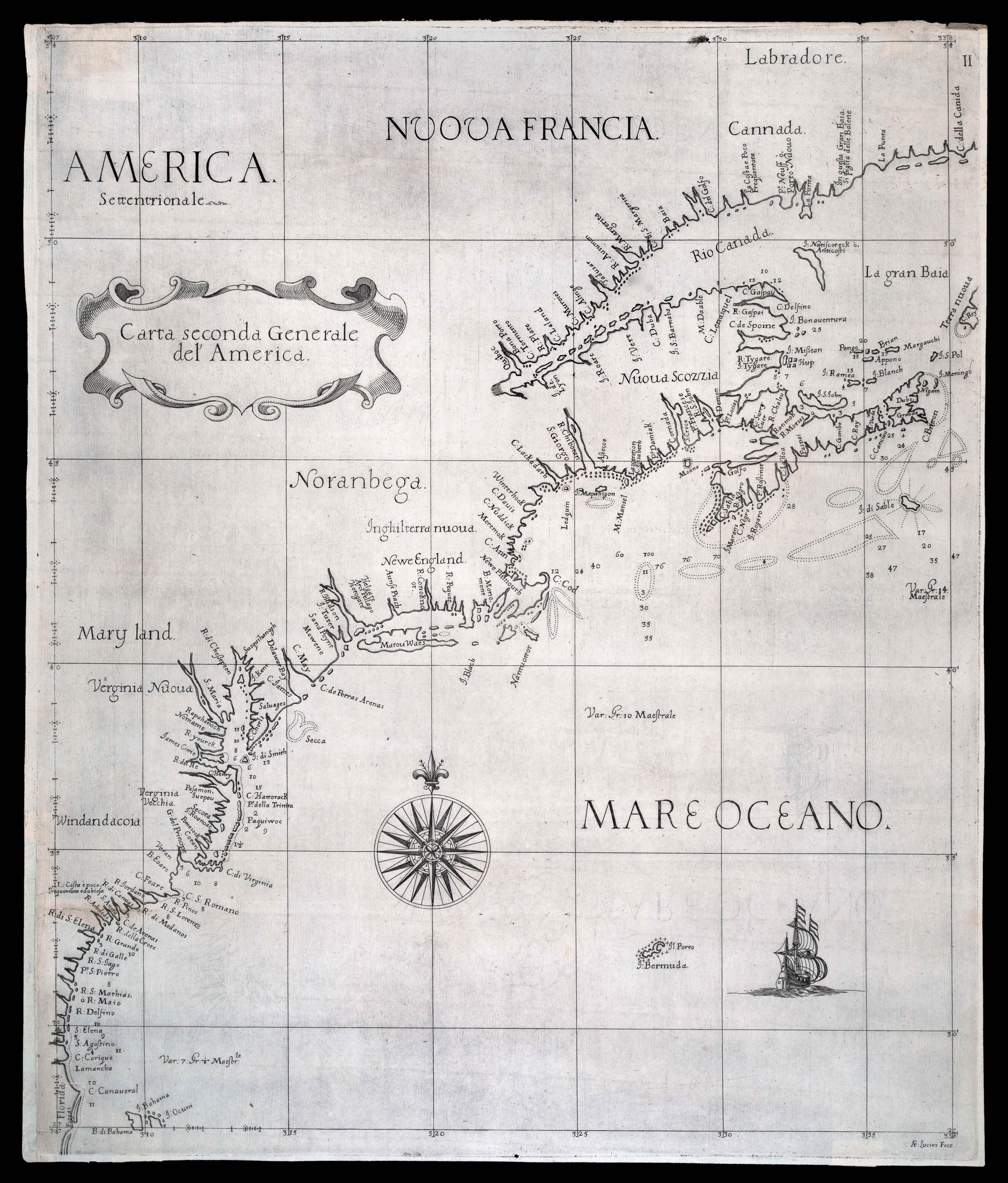 |
First printed sea chart of the northeastern seaboard by an Englishman, and the first with soundings
1 x
£25,000
|
£25,000 |
|
£25,000 |
|
× |
 |
with an early bird's-eye view of Venice
1 x
£80,000
|
£80,000 |
|
£80,000 |
|
× |
 |
"don't one of you fire until you see the white of their eyes"
1 x
£45,000
|
£45,000 |
|
£45,000 |
|
× |
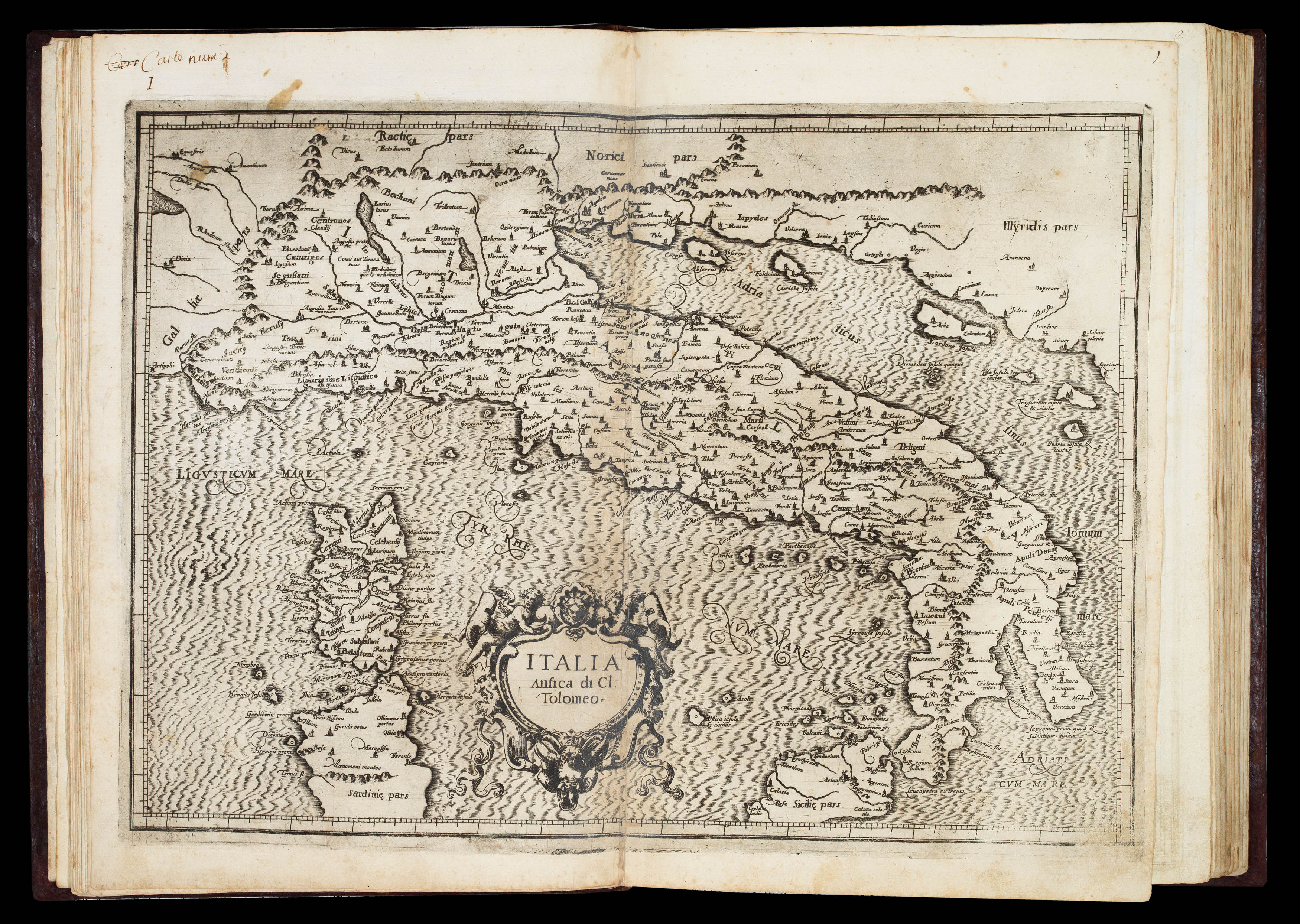 |
First edition of Magini's Italia
1 x
£40,000
|
£40,000 |
|
£40,000 |
|
× |
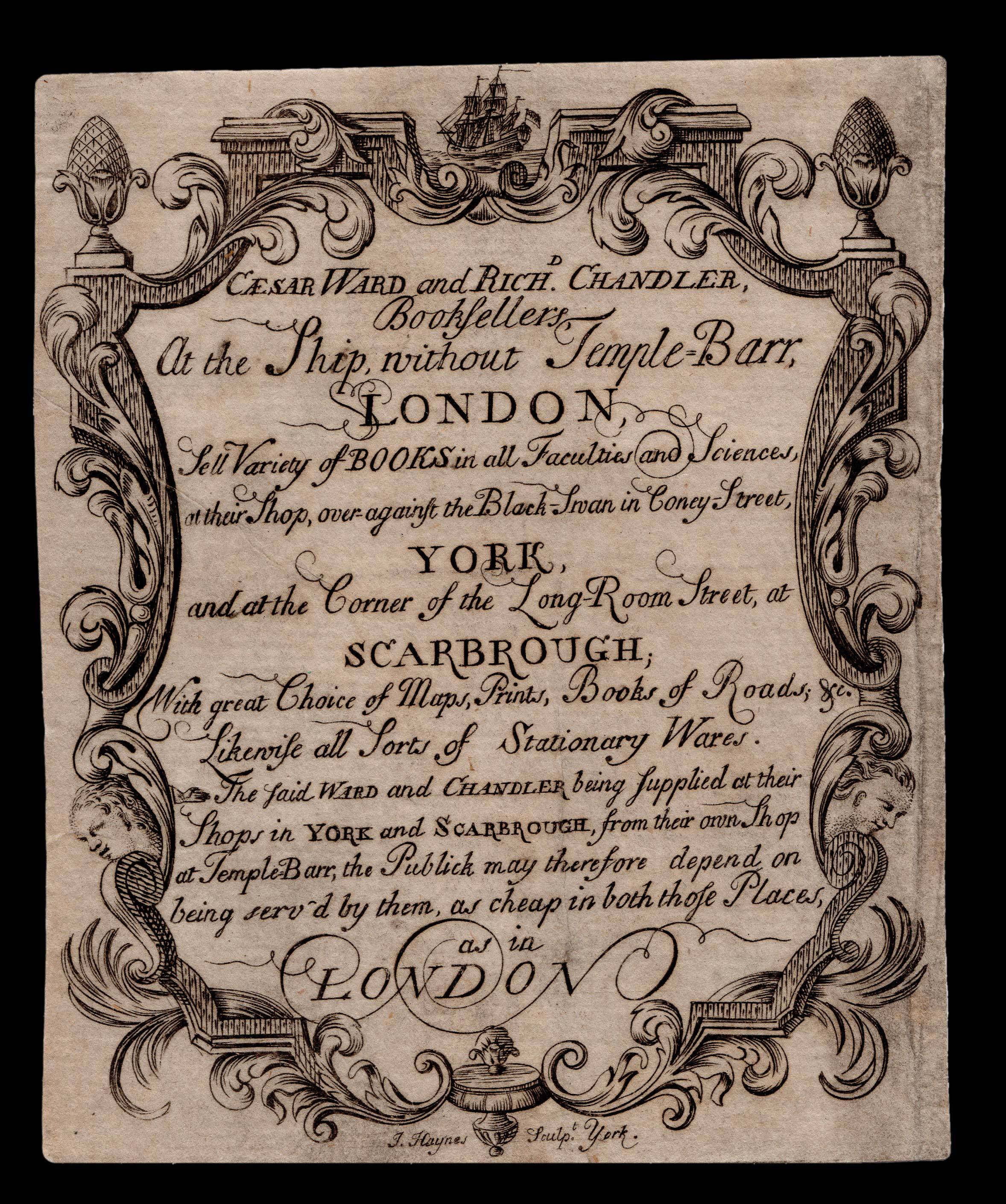 |
Booksellers of York and Scarborough
1 x
£750
|
£750 |
|
£750 |
|
× |
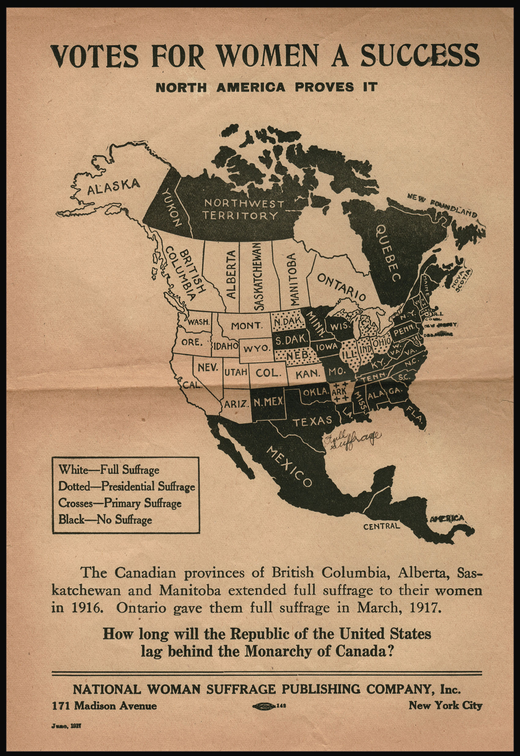 |
"How long will the Republic of the United States lag behind the Monarchy of Canada?"
1 x
£1,200
|
£1,200 |
|
£1,200 |
|
× |
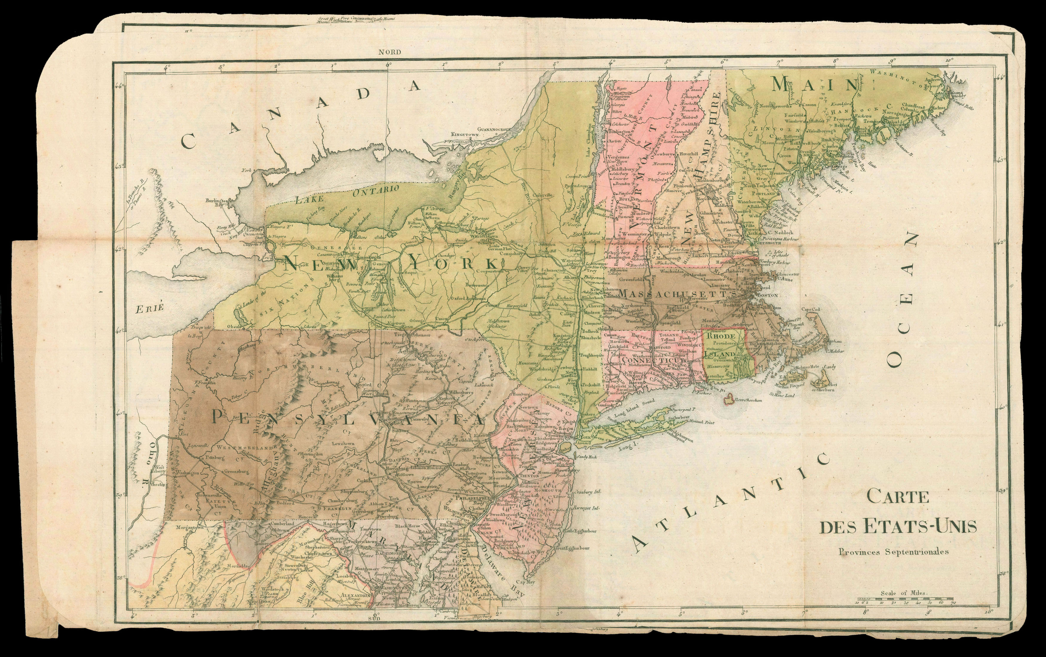 |
Rochambeau family maps of North America
1 x
£25,000
|
£25,000 |
|
£25,000 |
|
× |
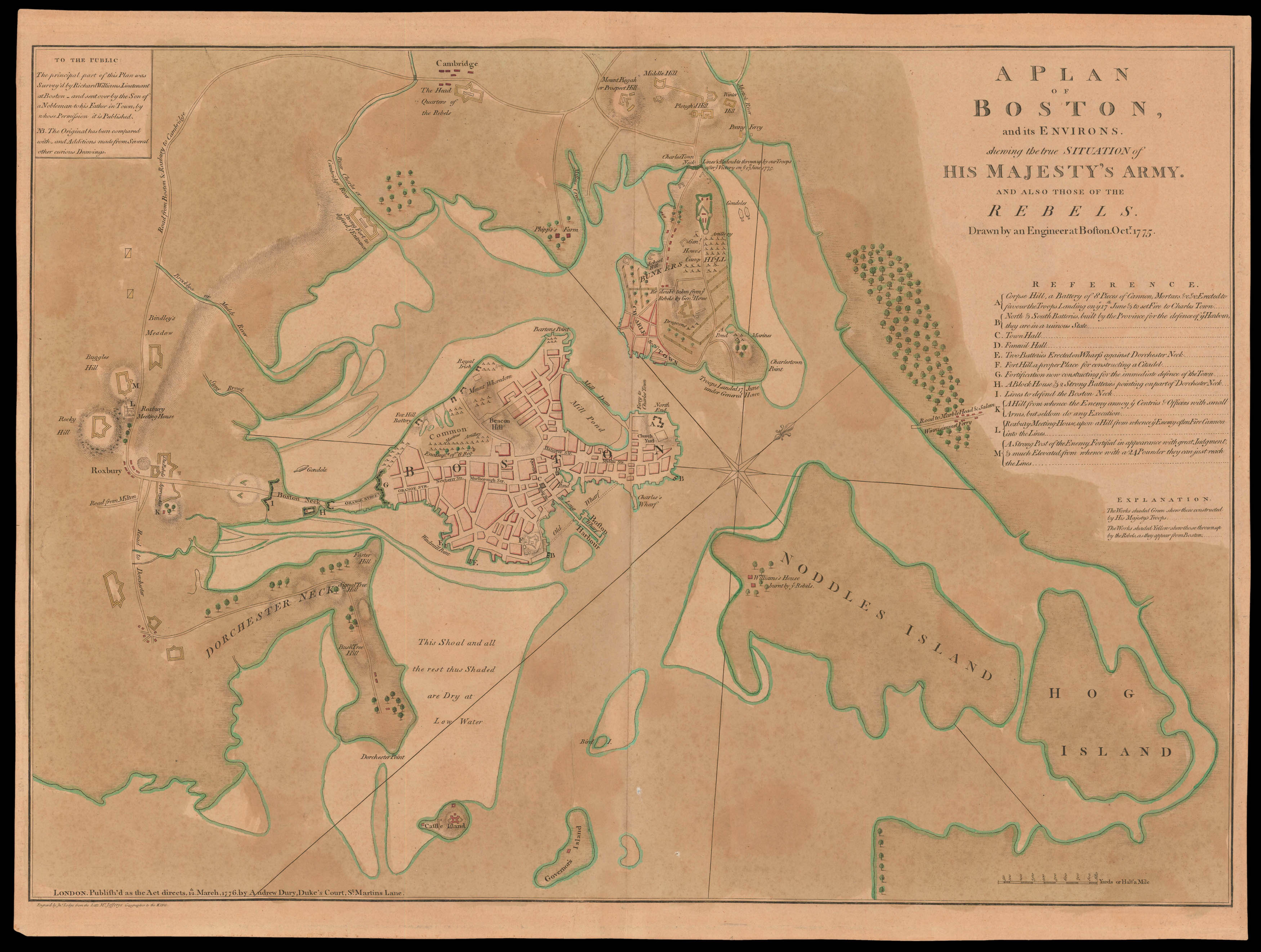
![DES BARRES, Joseph Frederick Wallet [Chart of the Harbour of Boston]/ Nautical Remarks and Observations for the Chart of the Harbour of Boston.](https://omega.crouchrarebooks.com/wp-content/uploads/2025/03/10833_1H.jpg) |
Des Barres' Rare Chart of Boston Harbour
1 x
£18,500
|
£18,500 |
|
£18,500 |
|
× |
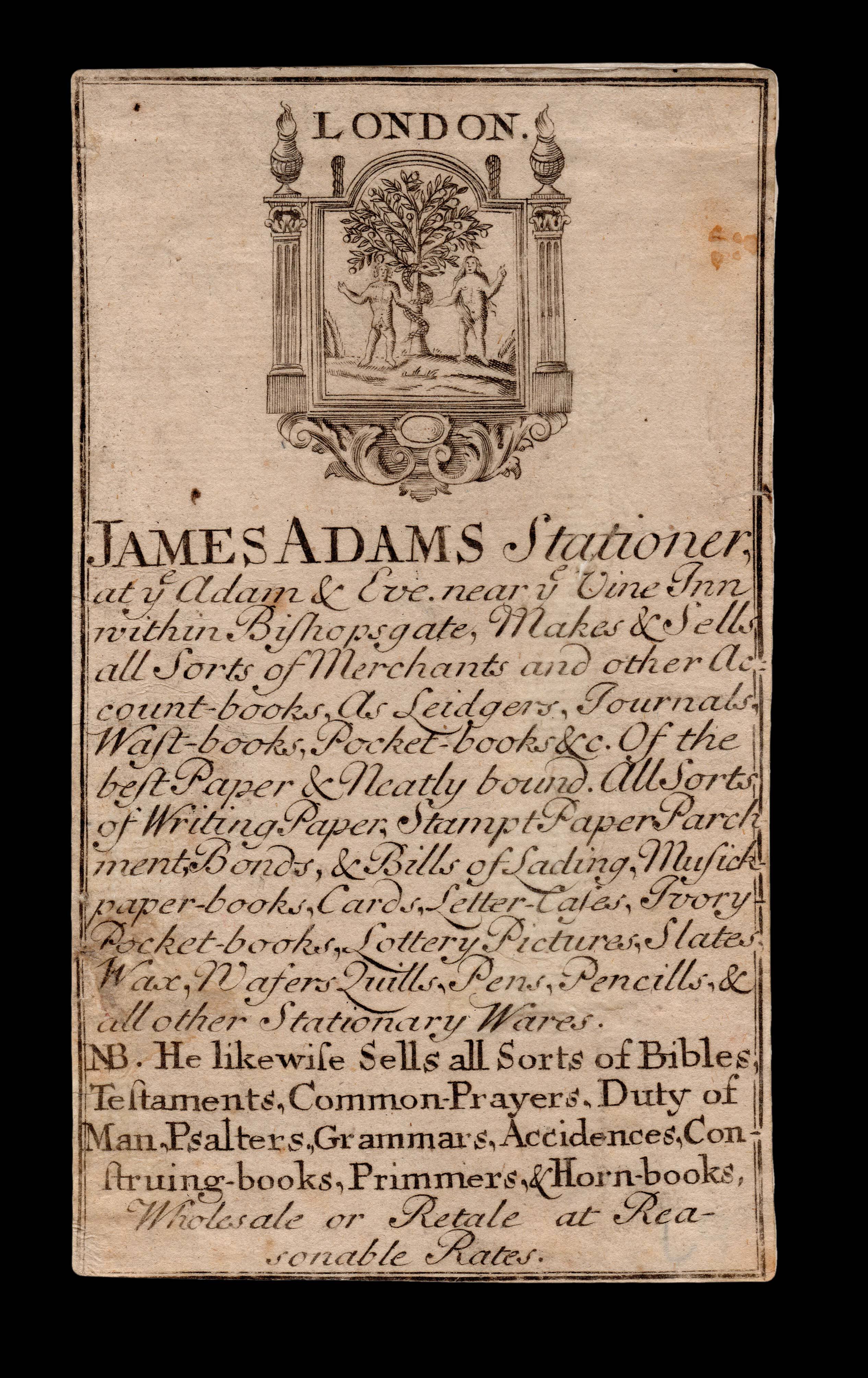 |
S is for Stationer
1 x
£1,500
|
£1,500 |
|
£1,500 |
|
× |
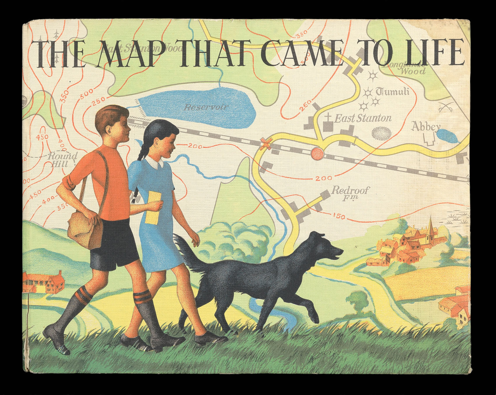 |
Five Go Mapping
1 x
£500
|
£500 |
|
£500 |
|
× |
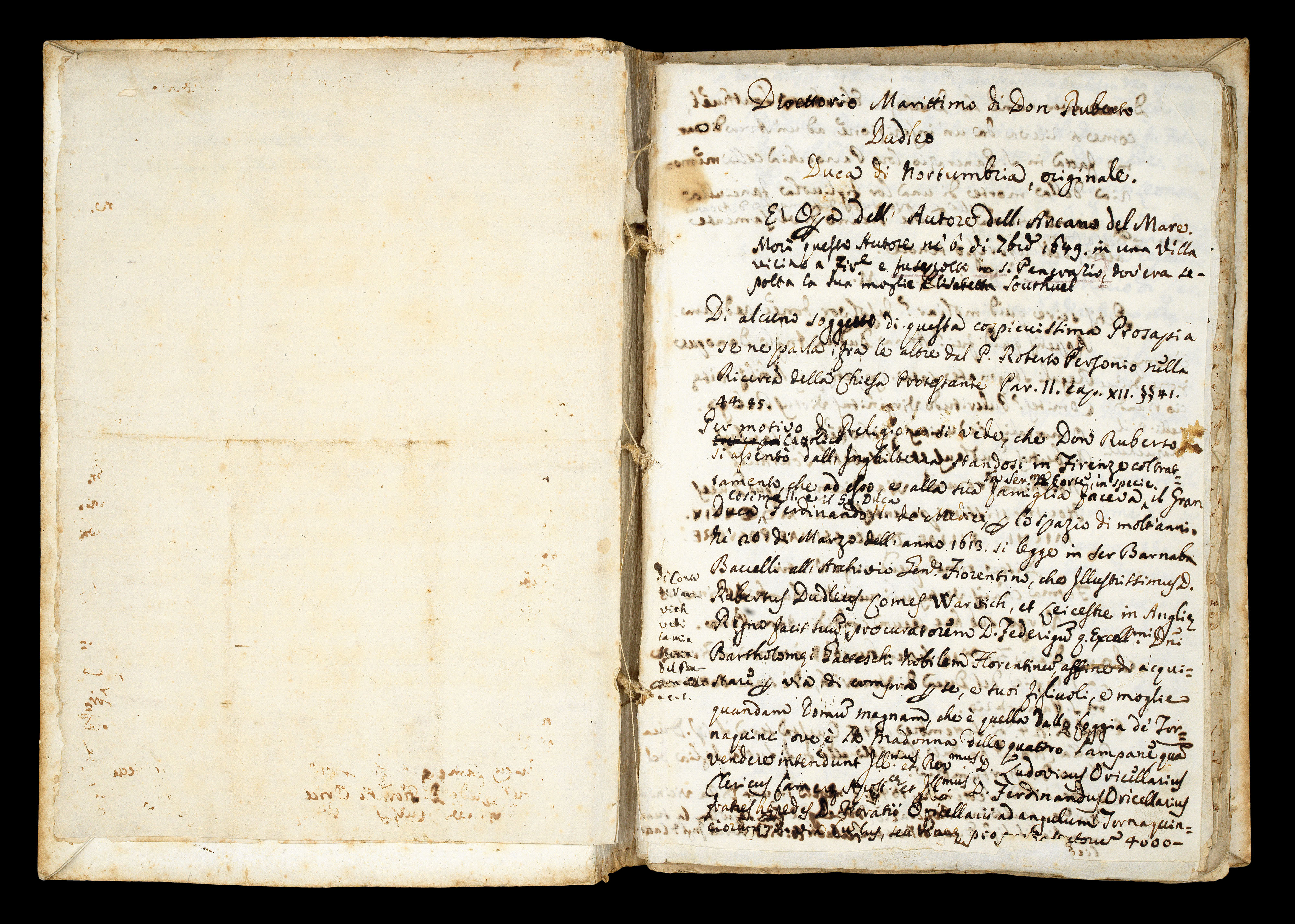 |
Dudley's original manuscript manual for the use and instruction of the officers of the Tuscan fleet
1 x
£500,000
|
£500,000 |
|
£500,000 |
|
× |
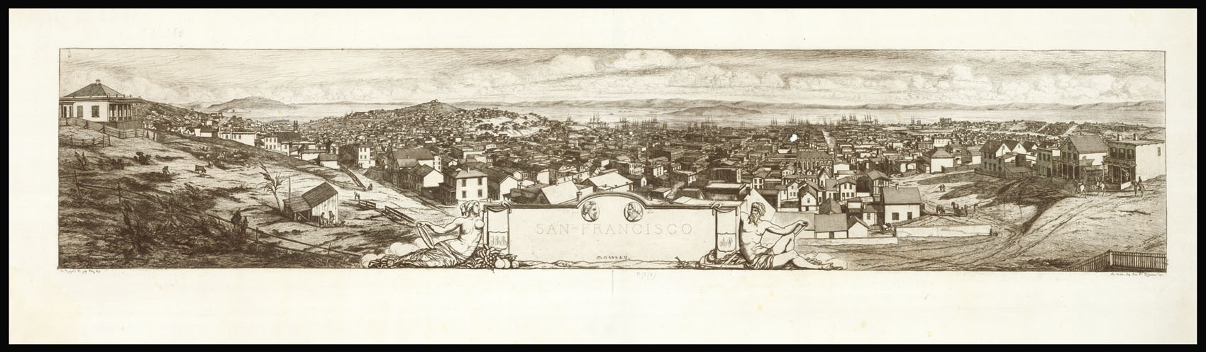 |
A Frenchman's view of San Francisco
1 x
£6,000
|
£6,000 |
|
£6,000 |
|
× |
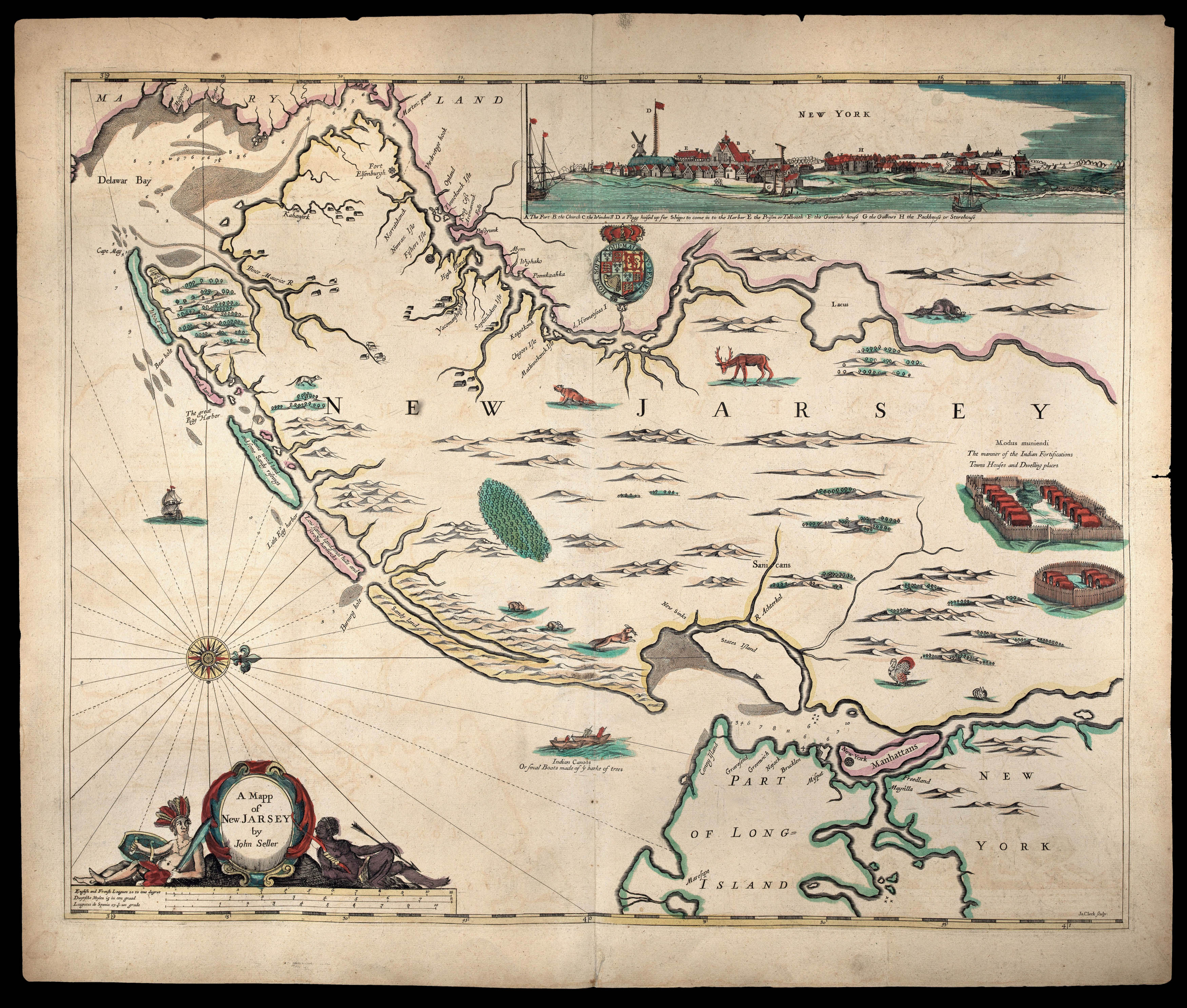 |
The first state of Seller's map of New Jersey
1 x
£72,500
|
£72,500 |
|
£72,500 |
|
× |
 |
The most influential view of Rome published in the sixteenth century
1 x
£16,000
|
£16,000 |
|
£16,000 |
|
× |
 |
Presentation copy of Jules Marcou's geological map of the United States to Auguste Trecul
1 x
£4,000
|
£4,000 |
|
£4,000 |
|
× |
![ORTELIUS, Abra[ham] [Autograph letter to his nephew].](https://omega.crouchrarebooks.com/wp-content/uploads/2025/03/15764_1H.jpg) |
Ortelius writes to his "most brilliant and dearest nephew"
1 x
£50,000
|
£50,000 |
|
£50,000 |
|
× |
![HORSBURGH, James and INGLIS Sir Hugh [Two autograph letters concerning the East India Company and the War of 1812].](https://omega.crouchrarebooks.com/wp-content/uploads/2025/03/18376_1H.jpg) |
"more knowledge of the Eastern Seas than perhaps any other man"
1 x
£3,000
|
£3,000 |
|
£3,000 |
|
× |
![PTOLEMAEUS, Claudius [translated by ANGELUS, Jacobus, edited by GERMANUS, Nicolaus] Tabula quinta Europa](https://omega.crouchrarebooks.com/wp-content/uploads/2025/03/16470_1H.jpg) |
Ptolemy's map of the countries of the Adriatic
1 x
£15,000
|
£15,000 |
|
£15,000 |
|
× |
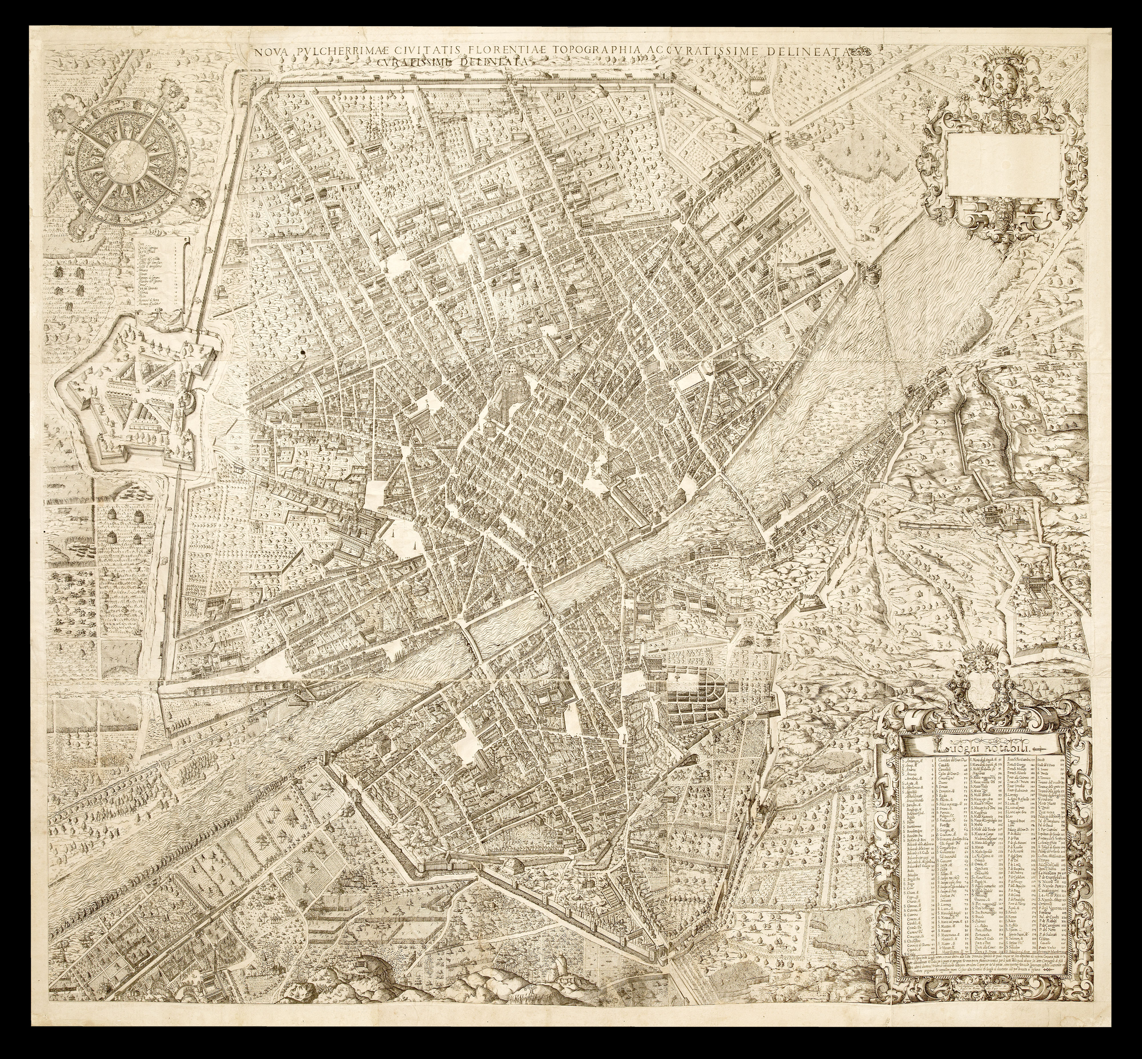 |
The only large scale plan of Florence produced in the Sixteenth Century
1 x
£250,000
|
£250,000 |
|
£250,000 |
|
|


