|
× |
![[Anonymous] Attaque de Landau commencé la nuit de 24 au 25 juin et compris le 19 Aout 1713 quil a capitulé](https://omega.crouchrarebooks.com/wp-content/uploads/2025/03/11380_1H.jpg) |
Manuscript map of Landau
1 x
£2,200
|
£2,200 |
|
£2,200 |
|
× |
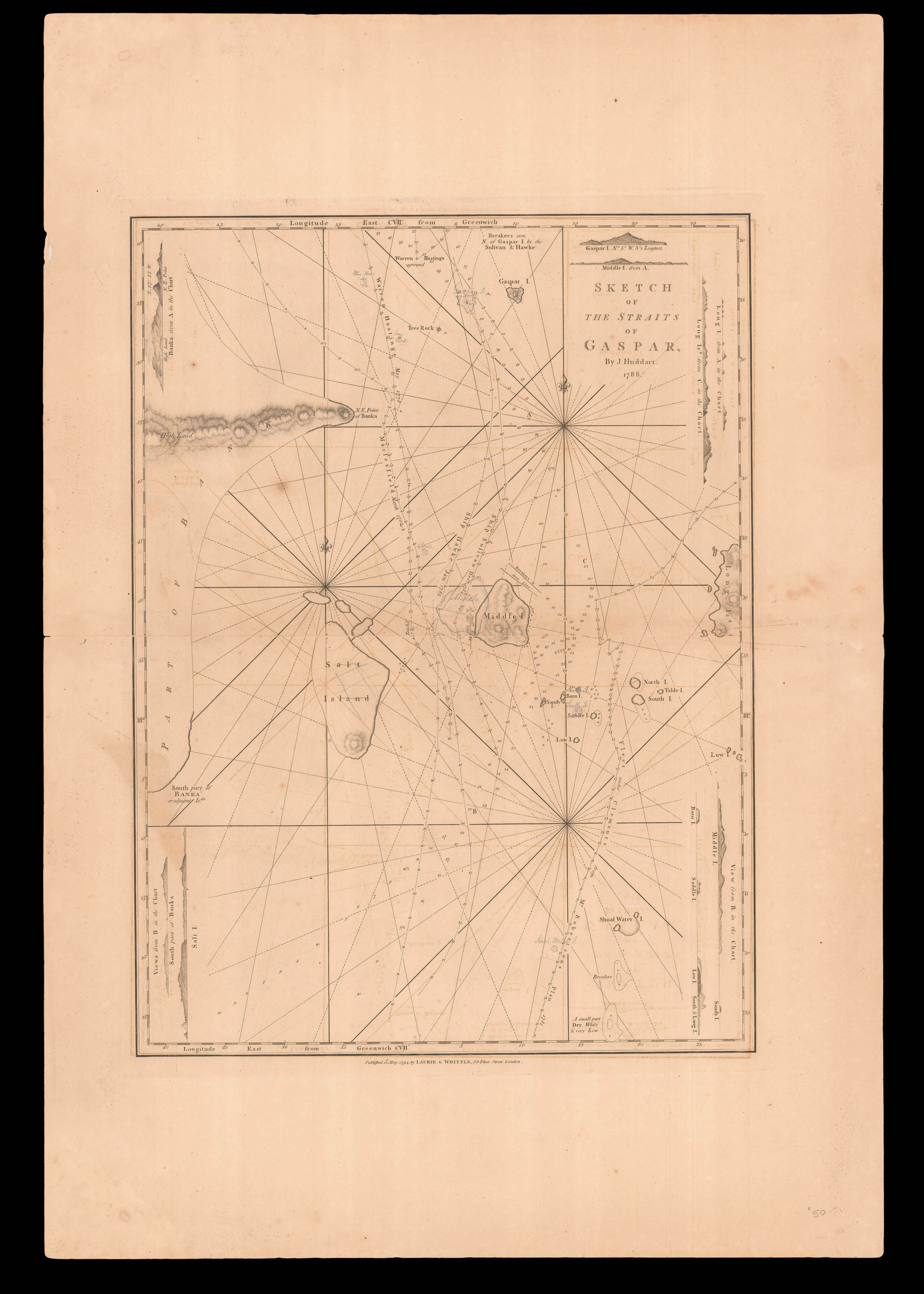 |
Gaspar Strait
1 x
£180
|
£180 |
|
£180 |
|
× |
![GOODALL, Cha[rle]s Goodall's Historic Playing Cards](https://omega.crouchrarebooks.com/wp-content/uploads/2025/03/20699_1H.jpg) |
English Monarchs
1 x
£400
|
£400 |
|
£400 |
|
× |
![DE AGUIRRE, Domingo; and others [Untitled catalogue of a Cartographical Library]](https://omega.crouchrarebooks.com/wp-content/uploads/2025/03/16388_1H.jpg) |
Manuscript inventory for an important Spanish cartographical library
1 x
£6,000
|
£6,000 |
|
£6,000 |
|
× |
![[ANONYMOUS] [British Legation Peking].](https://omega.crouchrarebooks.com/wp-content/uploads/2025/03/14776_1H.jpg) |
A collection of contemporary documents from the Boxer Rebellion
1 x
£1,500
|
£1,500 |
|
£1,500 |
|
× |
!["The first [map] published in an atlas to depict California as an island, and an accurate east coast of North America" (Burden)](https://omega.crouchrarebooks.com/wp-content/uploads/2025/04/21911_1H.jpg) |
"The first [map] published in an atlas to depict California as an island, and an accurate east coast of North America" (Burden)
1 x
£3,500
|
£3,500 |
|
£3,500 |
|
× |
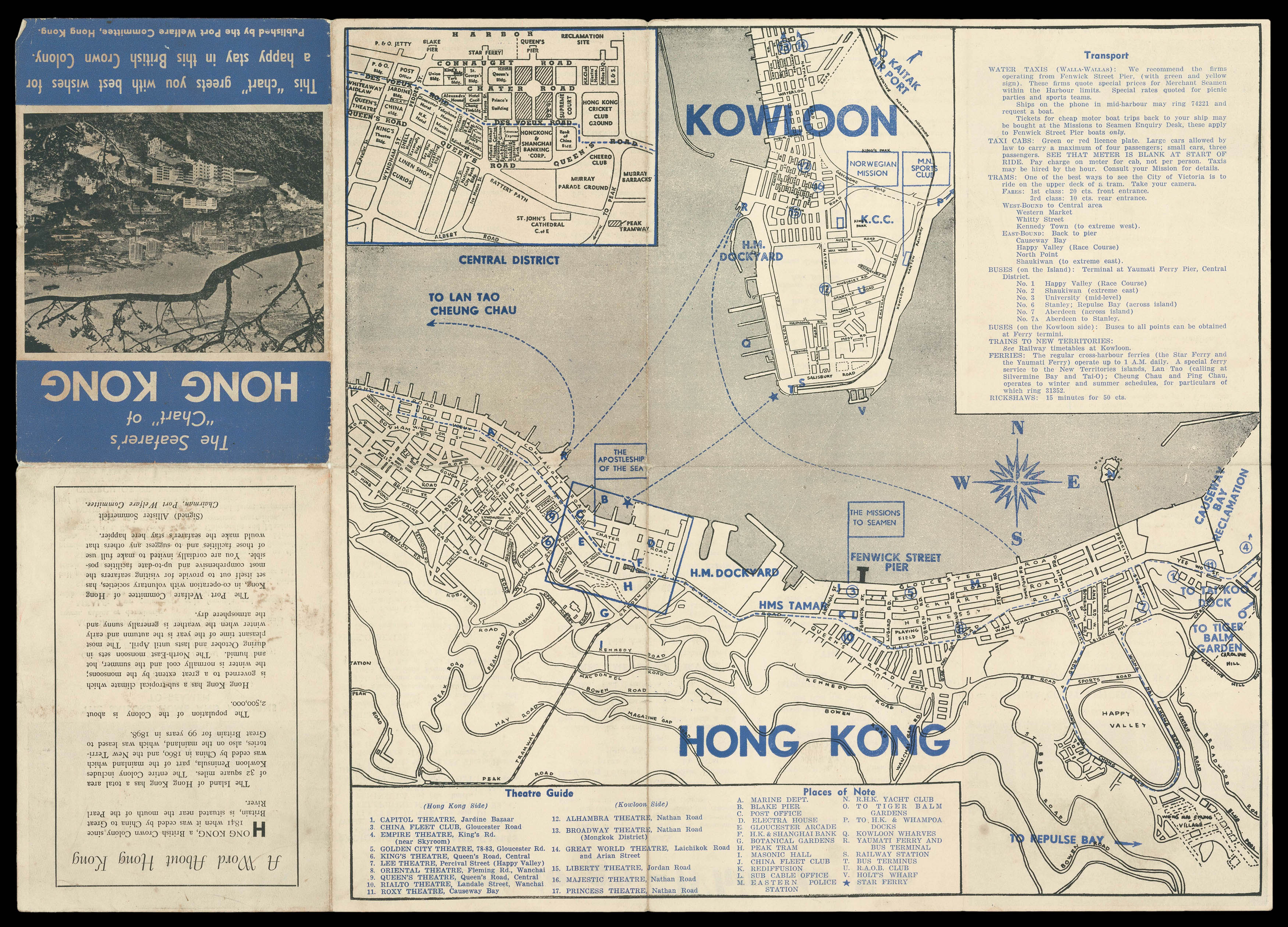 |
A tourist map of Hong Kong
1 x
£250
|
£250 |
|
£250 |
|
× |
![CARY, John [World and four continents]](https://omega.crouchrarebooks.com/wp-content/uploads/2025/03/1759_1H.jpg) |
Cary's rare wall maps of the world and four continents
1 x
£15,000
|
£15,000 |
|
£15,000 |
|
× |
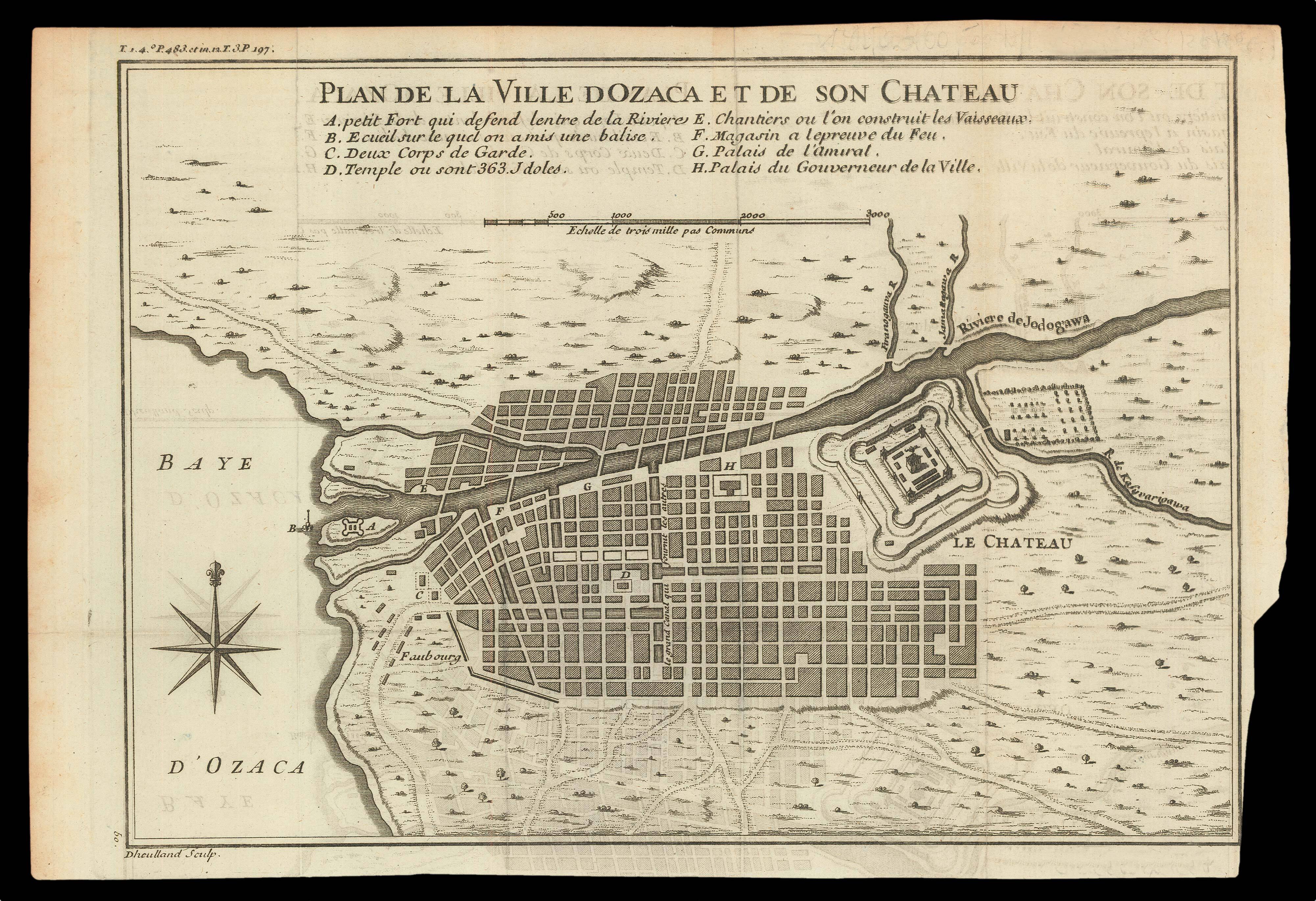 |
Plan of Osaka castle
1 x
£150
|
£150 |
|
£150 |
|
× |
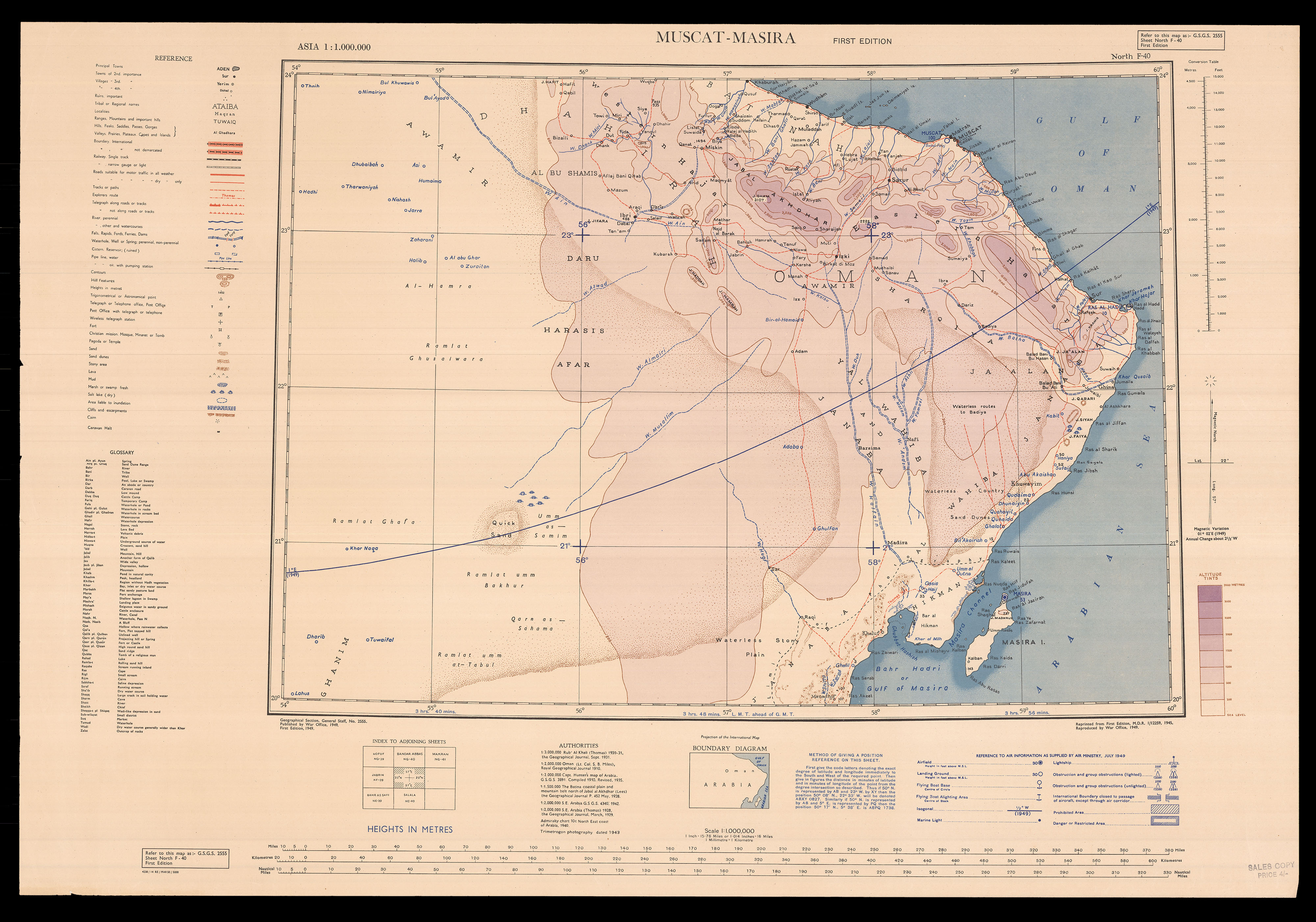 |
Oman
1 x
£250
|
£250 |
|
£250 |
|
× |
![[Anonymous] Londinum Londinum Urbs Praecipua Regni Angliae.](https://omega.crouchrarebooks.com/wp-content/uploads/2025/03/12426_1H.jpg) |
A Latin version of Aveline's view of London
1 x
£1,500
|
£1,500 |
|
£1,500 |
|
× |
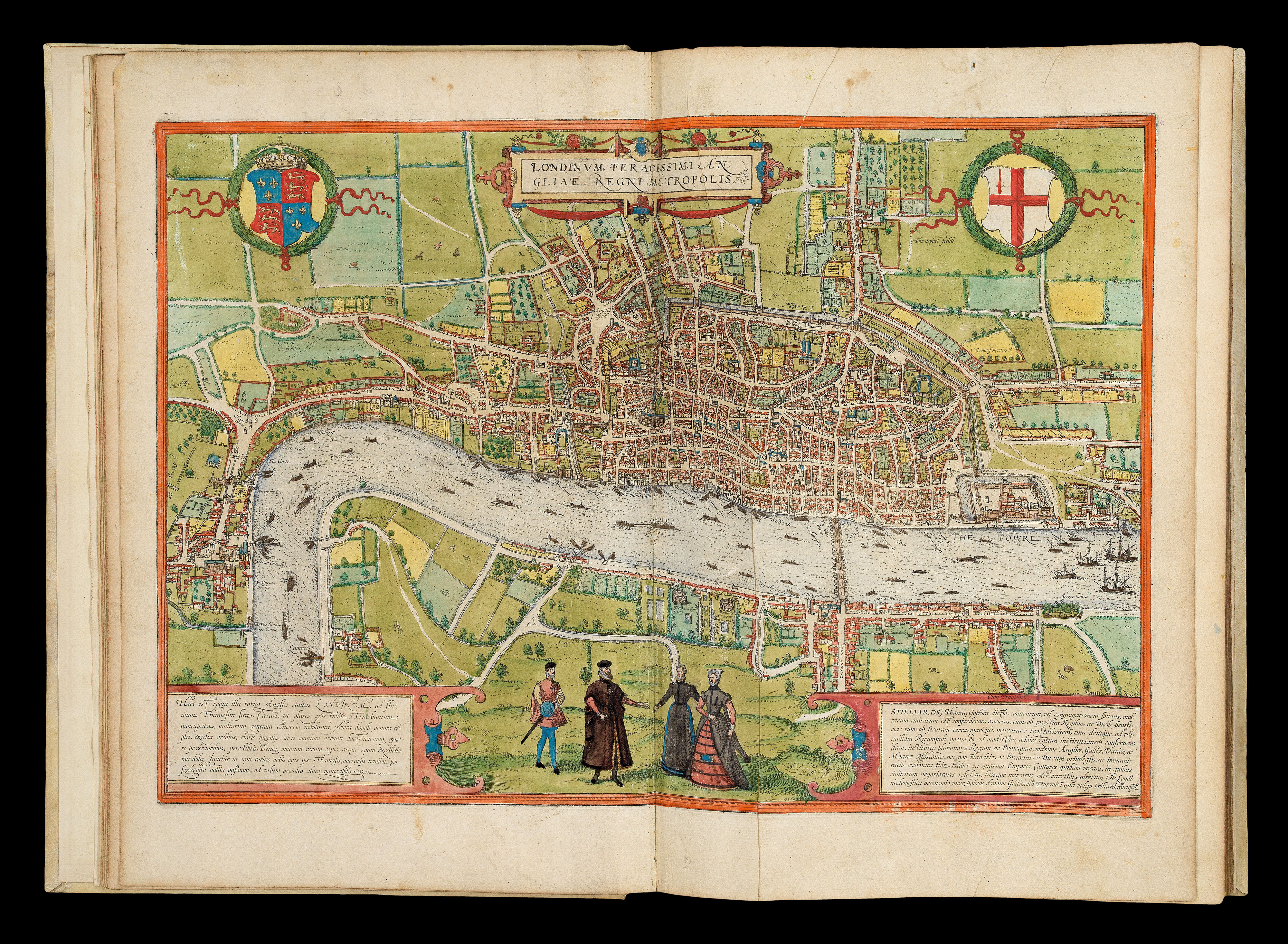 |
The earliest systematic city atlas
1 x
£300,000
|
£300,000 |
|
£300,000 |
|
× |
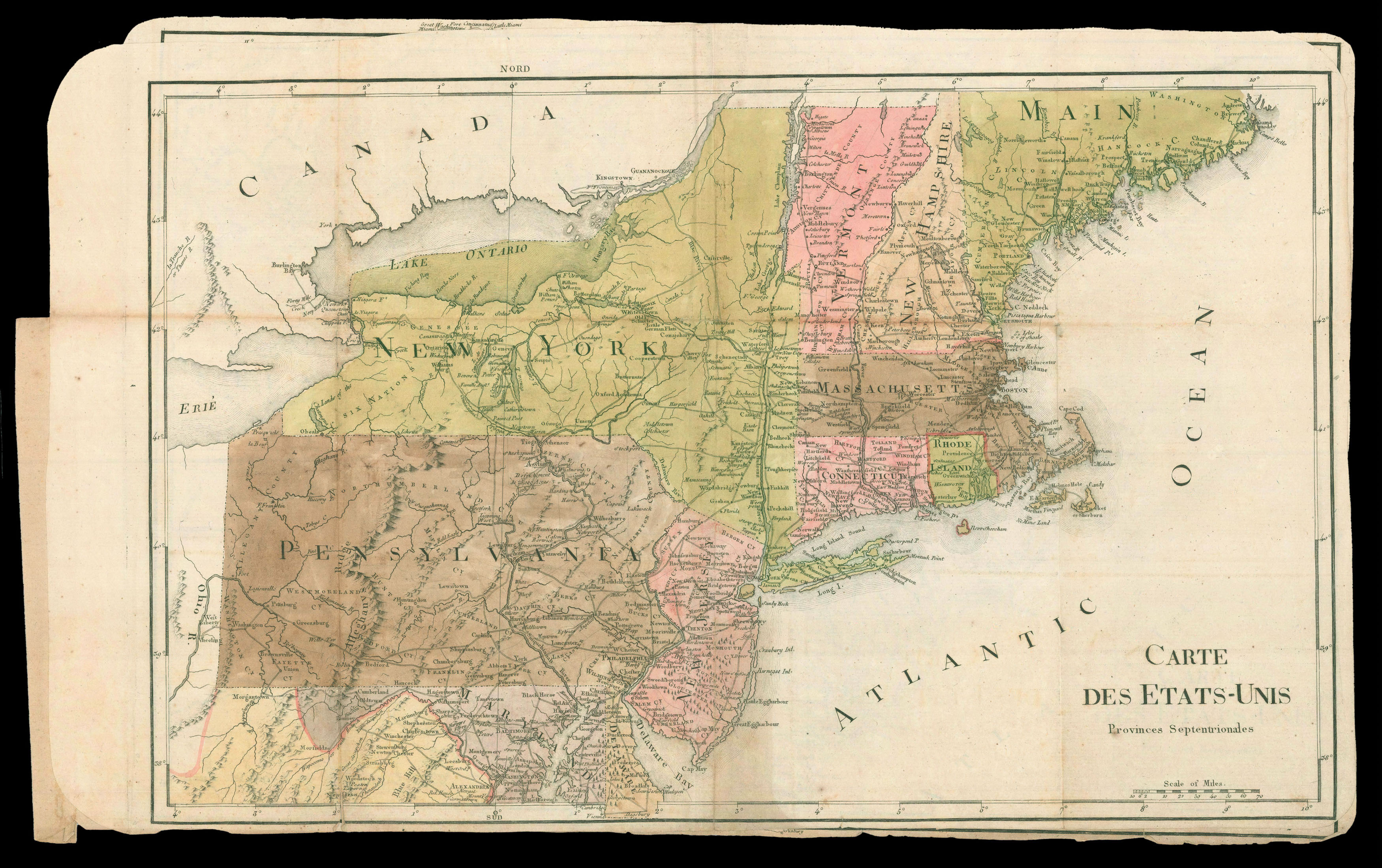 |
Rochambeau family maps of North America
1 x
£25,000
|
£25,000 |
|
£25,000 |
|
× |
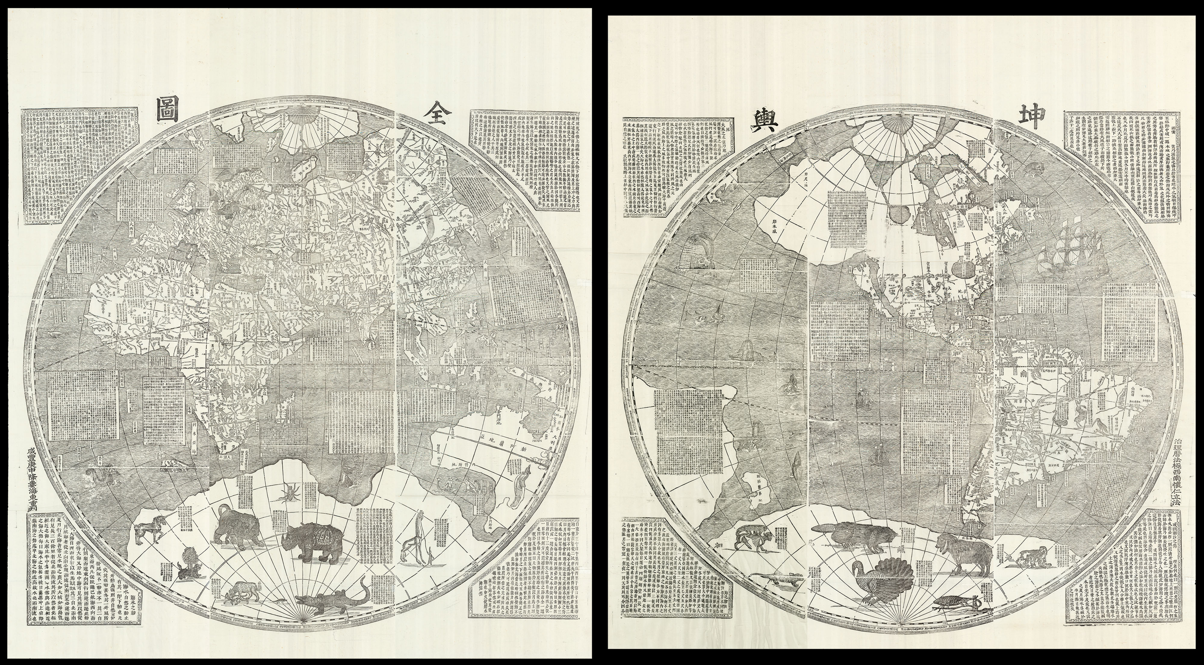 |
One of the largest world maps ever printed
1 x
£180,000
|
£180,000 |
|
£180,000 |
|
× |
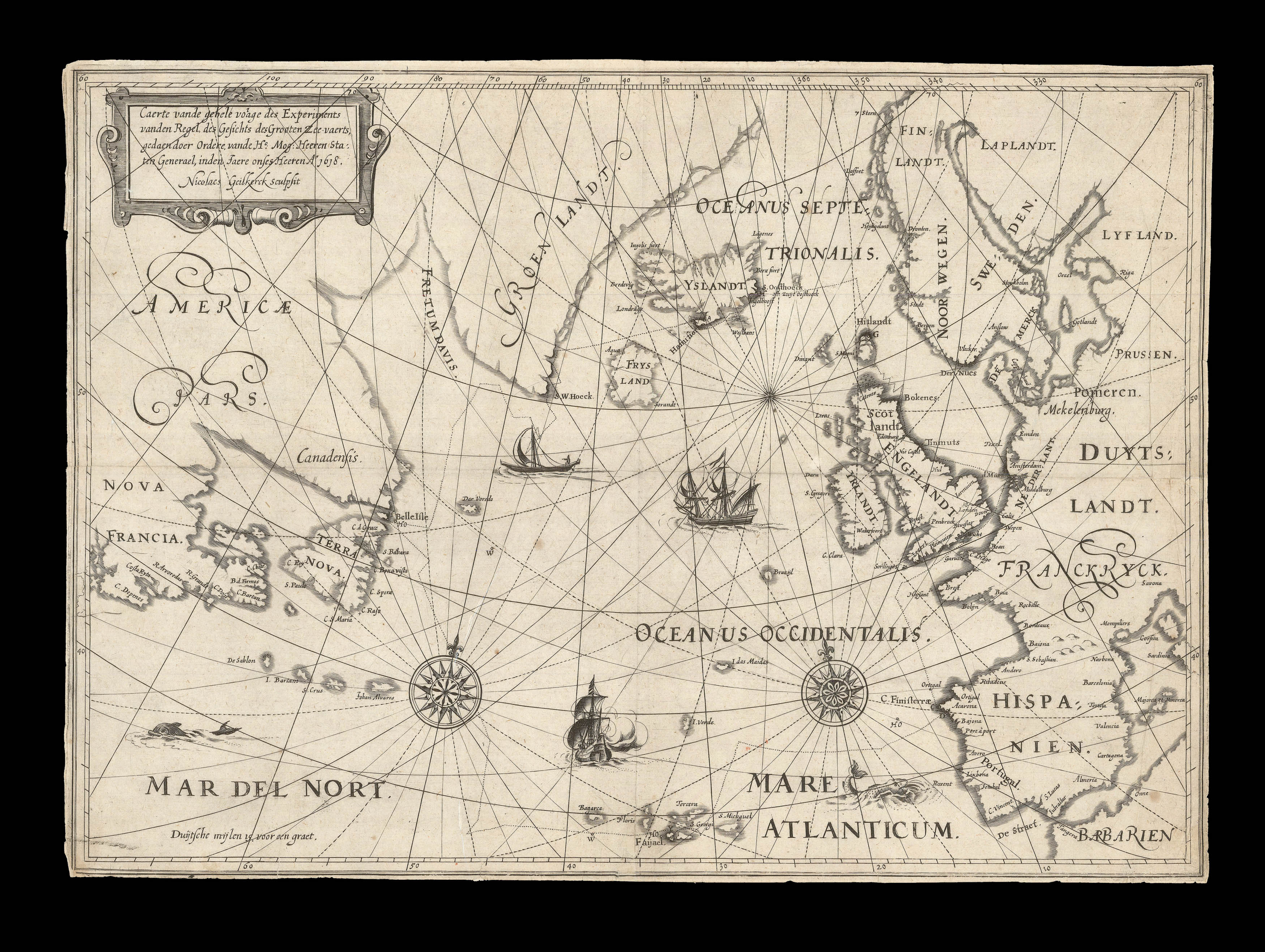 |
Jarichs' Solution to the Longitude Problem
1 x
£30,000
|
£30,000 |
|
£30,000 |
|
× |
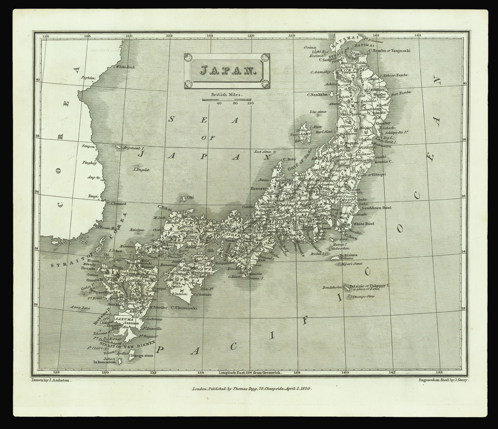 |
From the first edition of Thomas Tegg's 'A London Encyclopaedia'
1 x
£40
|
£40 |
|
£40 |
|
× |
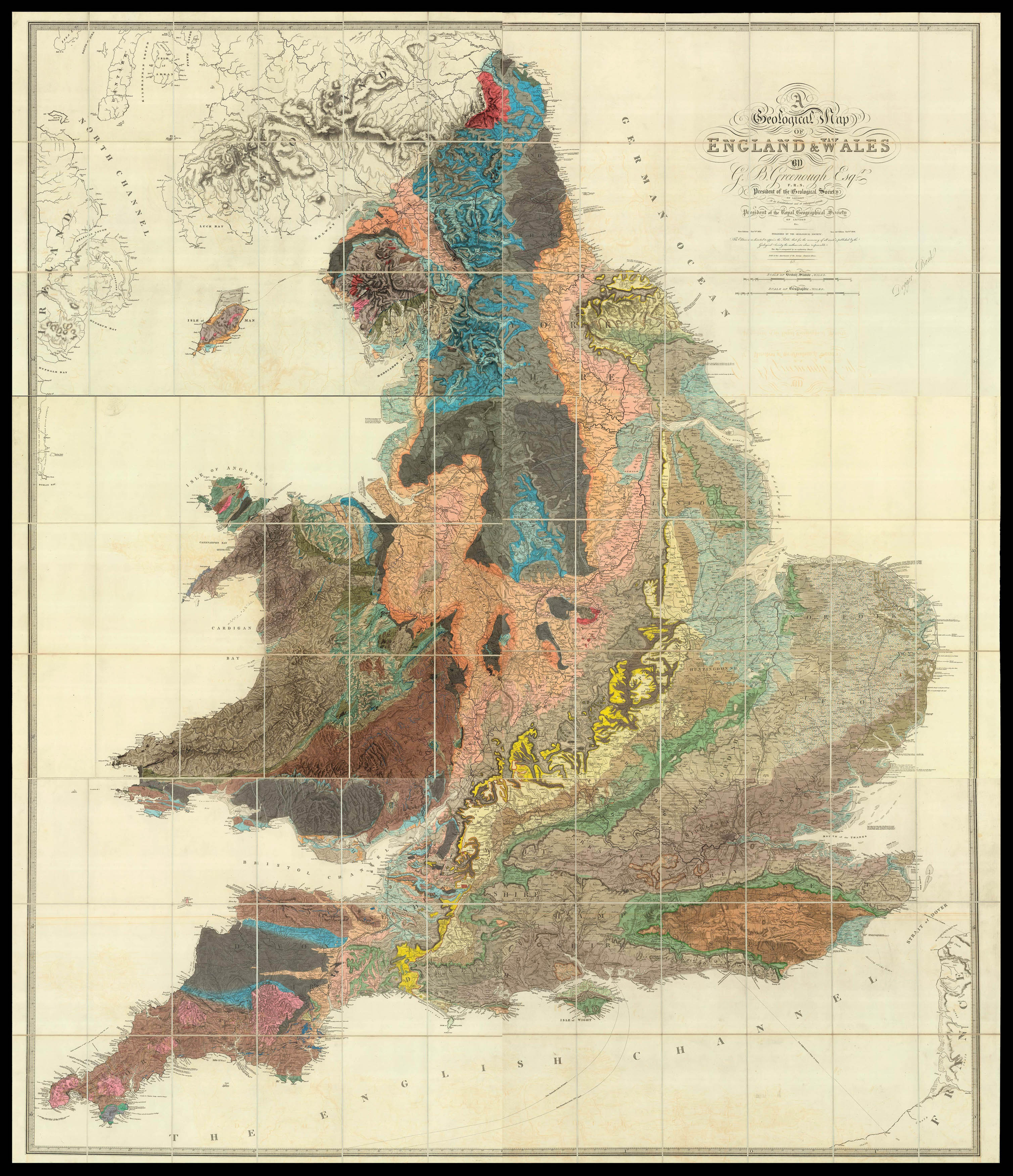 |
Greenough's riposte to Smith in the battle of the geological maps
1 x
£18,500
|
£18,500 |
|
£18,500 |
|
× |
![HOLLAR, W[enceslaus] The Abbey of Groenendael](https://omega.crouchrarebooks.com/wp-content/uploads/2025/03/18261_1H.jpg) |
Groenendael Abbey
1 x
£600
|
£600 |
|
£600 |
|
× |
![BRETEUIL, Louis Charles Auguste le Tonnelier, baron de Vüe de Rio de Janeiro [together with] Plan de la Baye de Rio Janeiro et de ses Deffense, 1757.](https://omega.crouchrarebooks.com/wp-content/uploads/2025/03/2402_1H.jpg) |
A plan of Rio de Janeiro by the Comte de Breteuil, the last prime minister of pre-revolutionary France, together with one of the earliest manuscript prospects of the city
1 x
£135,000
|
£135,000 |
|
£135,000 |
|
× |
 |
More graceful figures than those now seen' (Dickens)
1 x
£10,000
|
£10,000 |
|
£10,000 |
|
× |
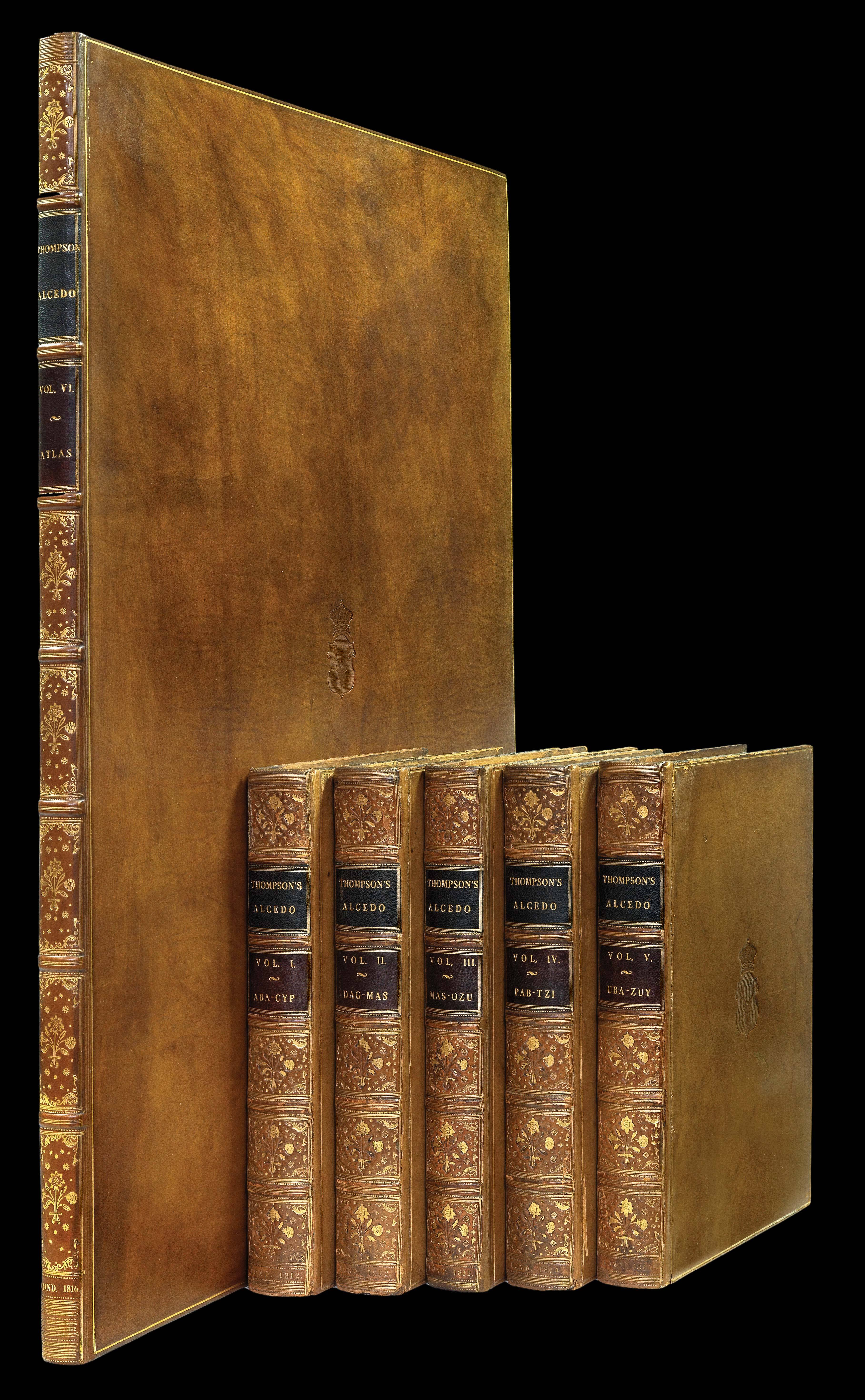 |
The Earl of Lonsdale's copy of Thompson's Alcedo
1 x
£65,000
|
£65,000 |
|
£65,000 |
|
× |
![SIMONAU, Gustave [Westminster Abbey].](https://omega.crouchrarebooks.com/wp-content/uploads/2025/03/12364_1H.jpg) |
Westminster Abbey
1 x
£350
|
£350 |
|
£350 |
|
× |
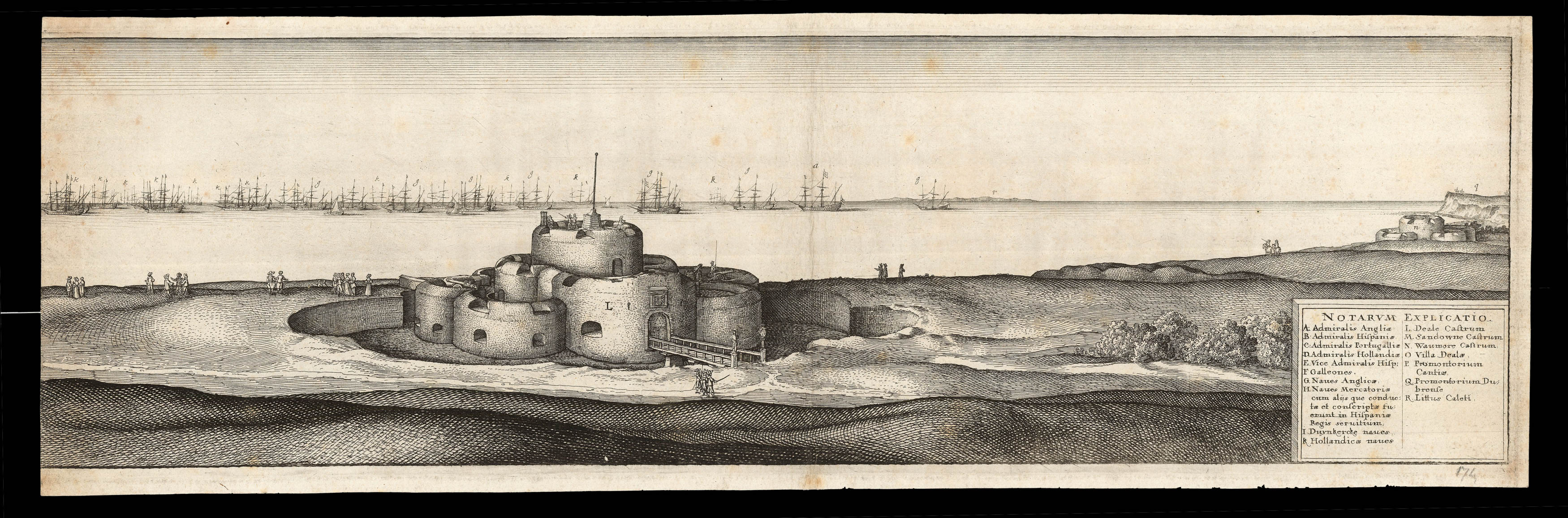 |
The Battle of the Downs
1 x
£2,000
|
£2,000 |
|
£2,000 |
|
× |
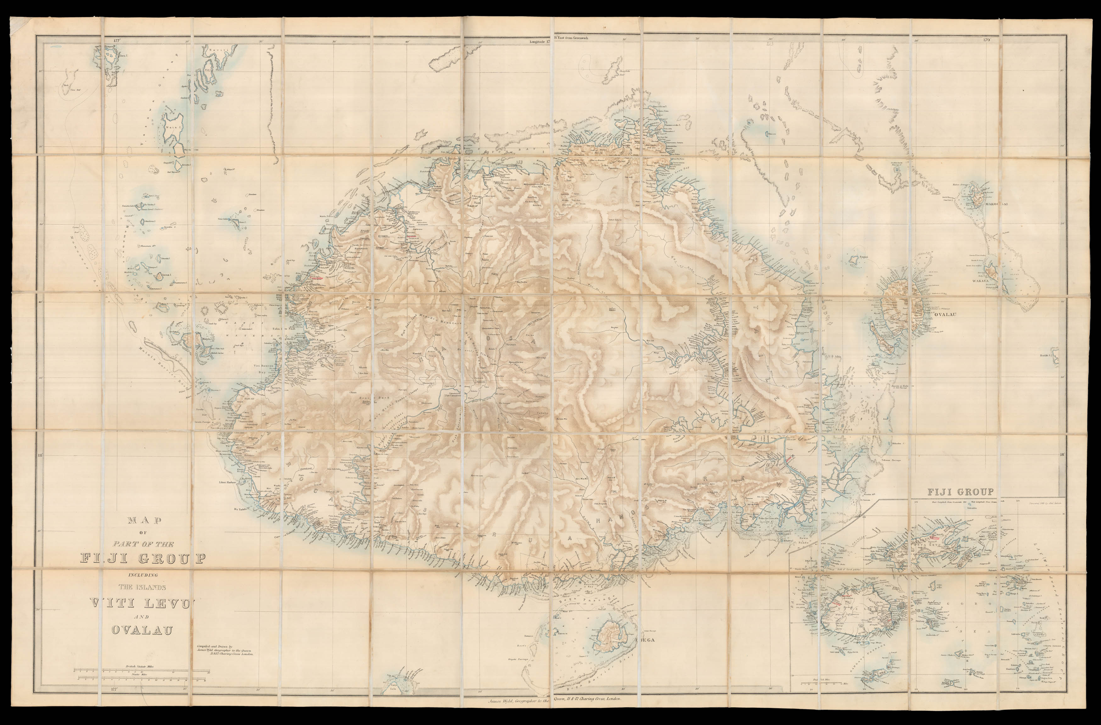 |
Fiji under the British
1 x
£1,600
|
£1,600 |
|
£1,600 |
|
|


