|
× |
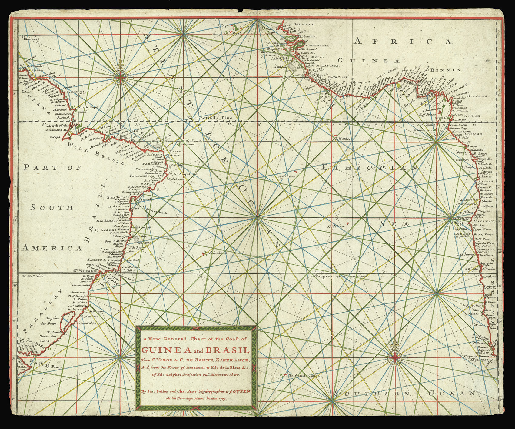 |
Seller and Price's extremely rare chart of the Southern Atlantic
1 x
£2,000
|
£2,000 |
|
£2,000 |
|
× |
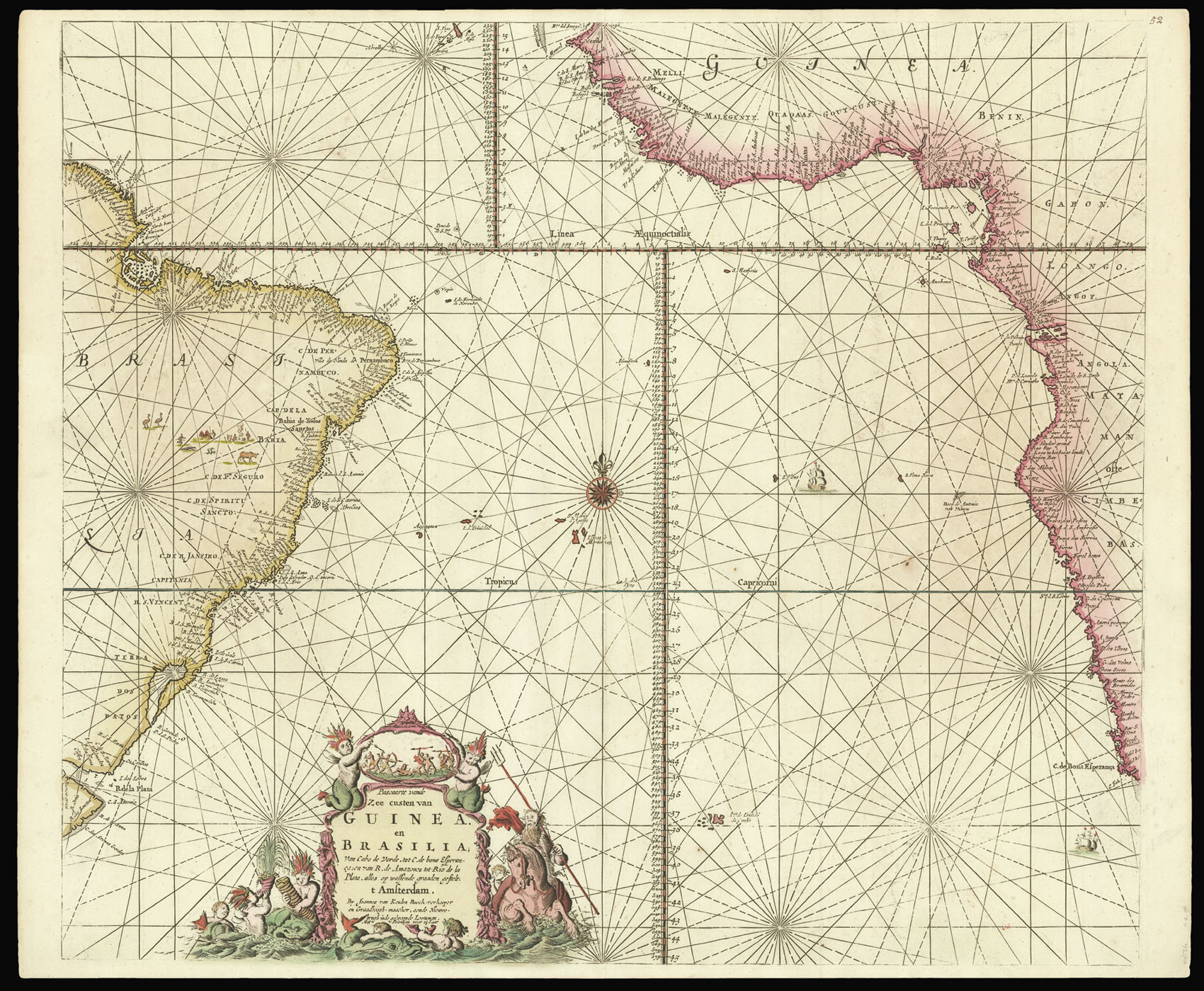 |
An early chart of the Southern Atlantic
1 x
£1,200
|
£1,200 |
|
£1,200 |
|
× |
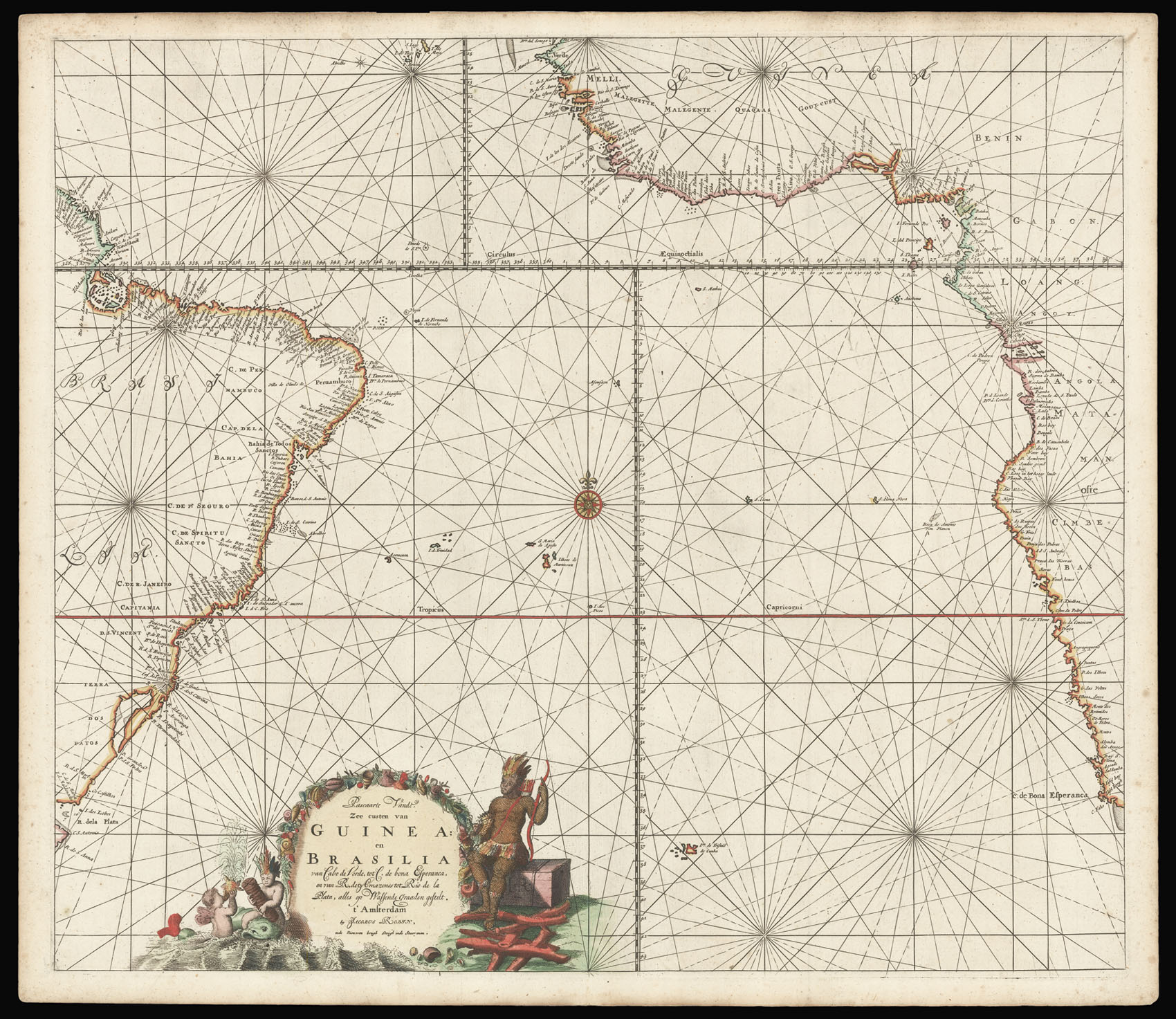 |
Known in only one other example
1 x
£3,600
|
£3,600 |
|
£3,600 |
|
× |
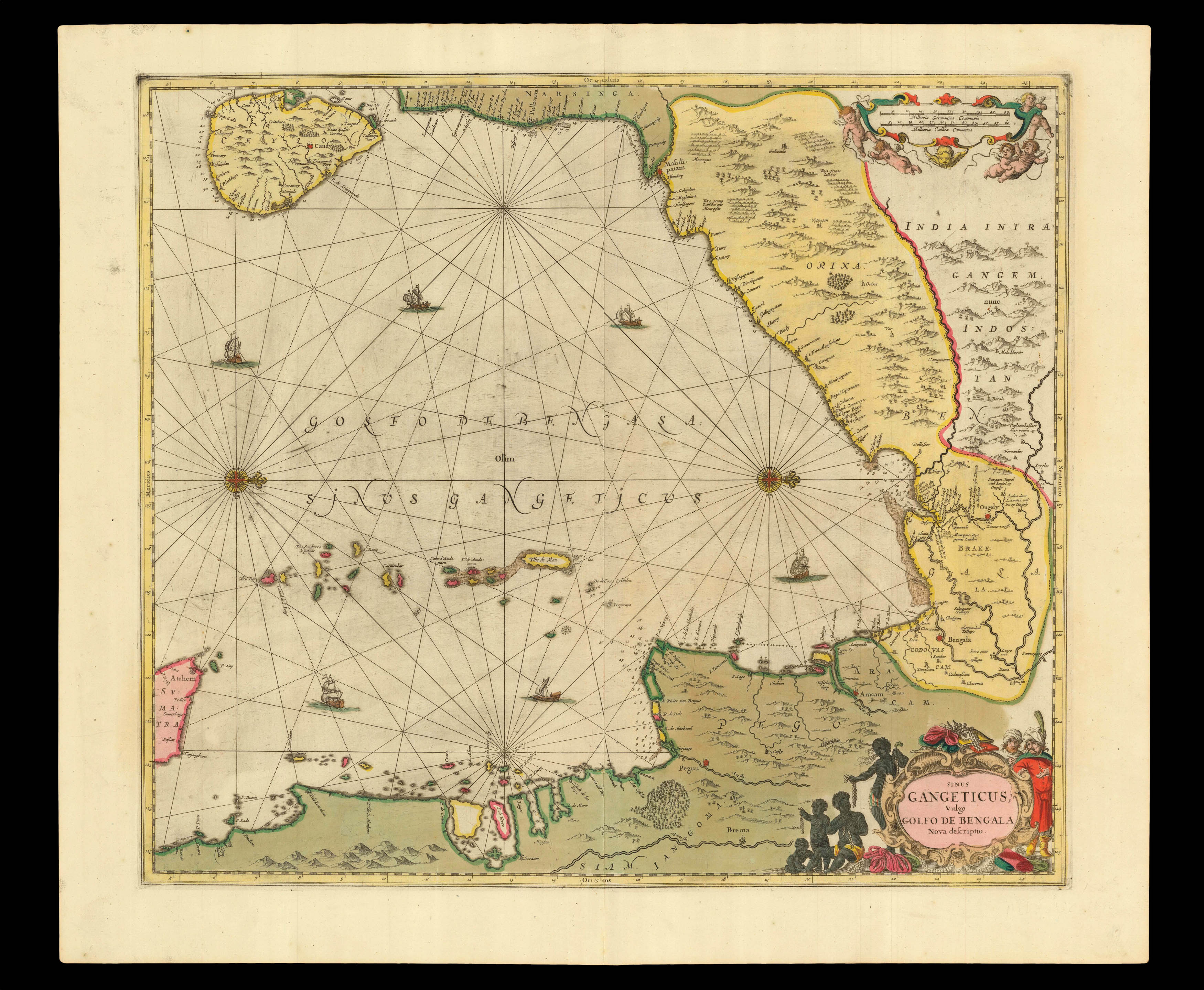 |
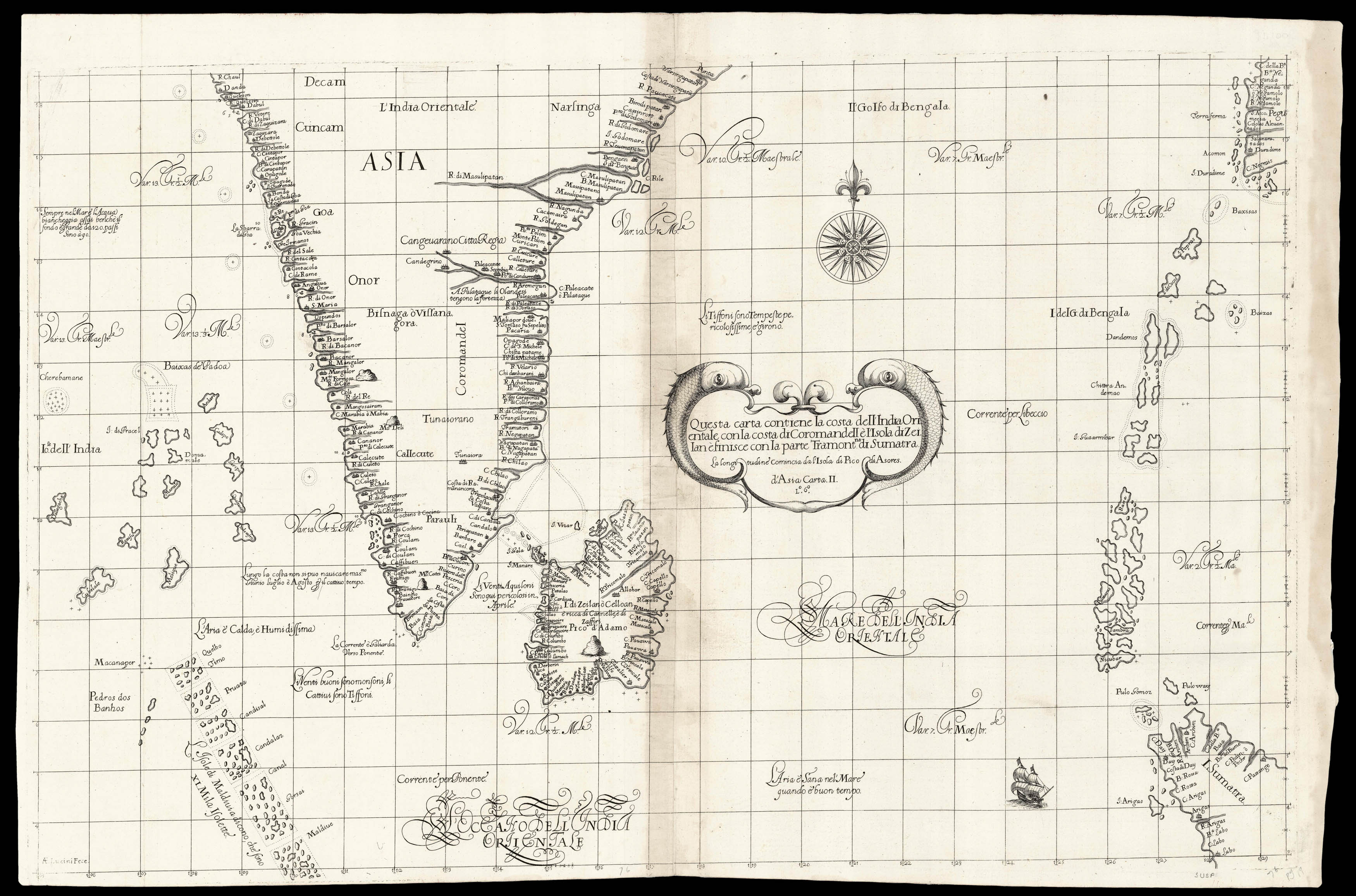
One of the earliest printed sea charts of the Bay of Bengal
1 x
£750
|
£750 |
|
£750 |
|
× |
![[?BOAZIO, Giovanni Battista] S. Iacob.](https://omega.crouchrarebooks.com/wp-content/uploads/2025/03/15989_1H.jpg) |
The first printed view of Santiago, Cape Verde
1 x
£12,000
|
£12,000 |
|
£12,000 |
|
× |
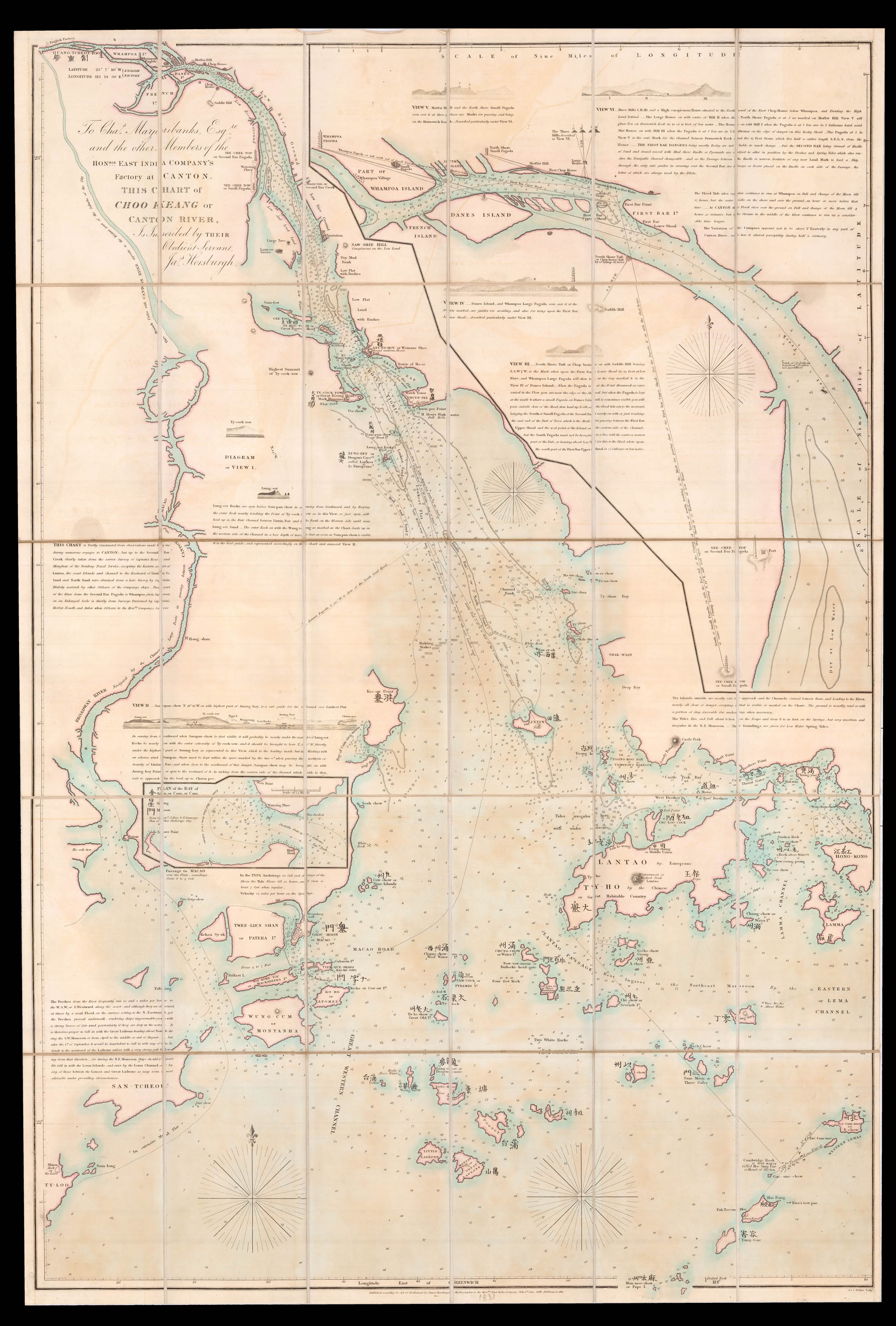 |
Horsburgh's chart of the Pearl River Delta
1 x
£20,000
|
£20,000 |
|
£20,000 |
|
× |
 |
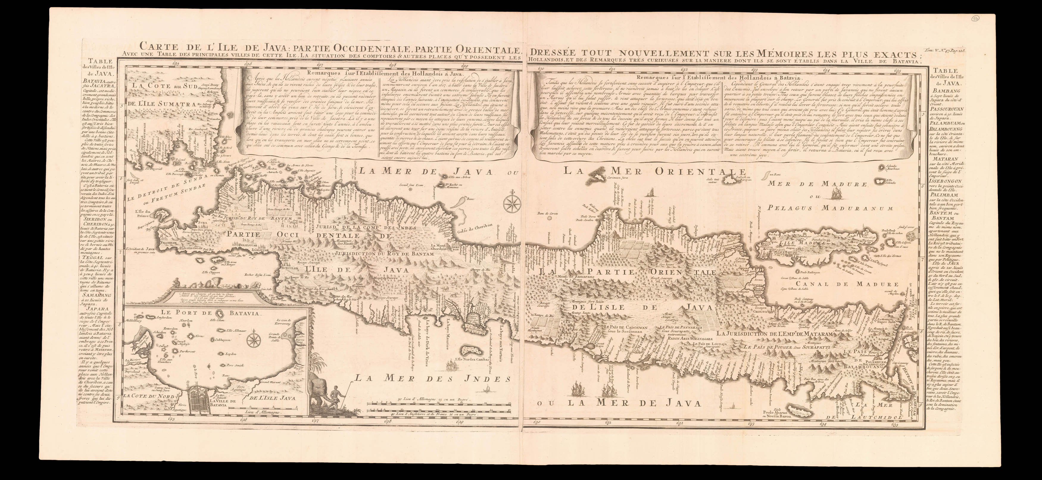
The heart of VOC territory in Southeast Asia
1 x
£750
|
£750 |
|
£750 |
|
× |
![[WAR OFFICE] Sketch Map of Arabia.](https://omega.crouchrarebooks.com/wp-content/uploads/2025/03/17633_1H.jpg) |
British map charting the progress of the Hejaz Railway
1 x
£6,000
|
£6,000 |
|
£6,000 |
|
× |
![ARROWSMITH, Aaron To The Hon[oura]ble the Court Directors of the East India Company This Improved Map of India](https://omega.crouchrarebooks.com/wp-content/uploads/2025/03/15255_1H.jpg) |
The largest map of India produced before the trigonometrical survey
1 x
£10,000
|
£10,000 |
|
£10,000 |
|
× |
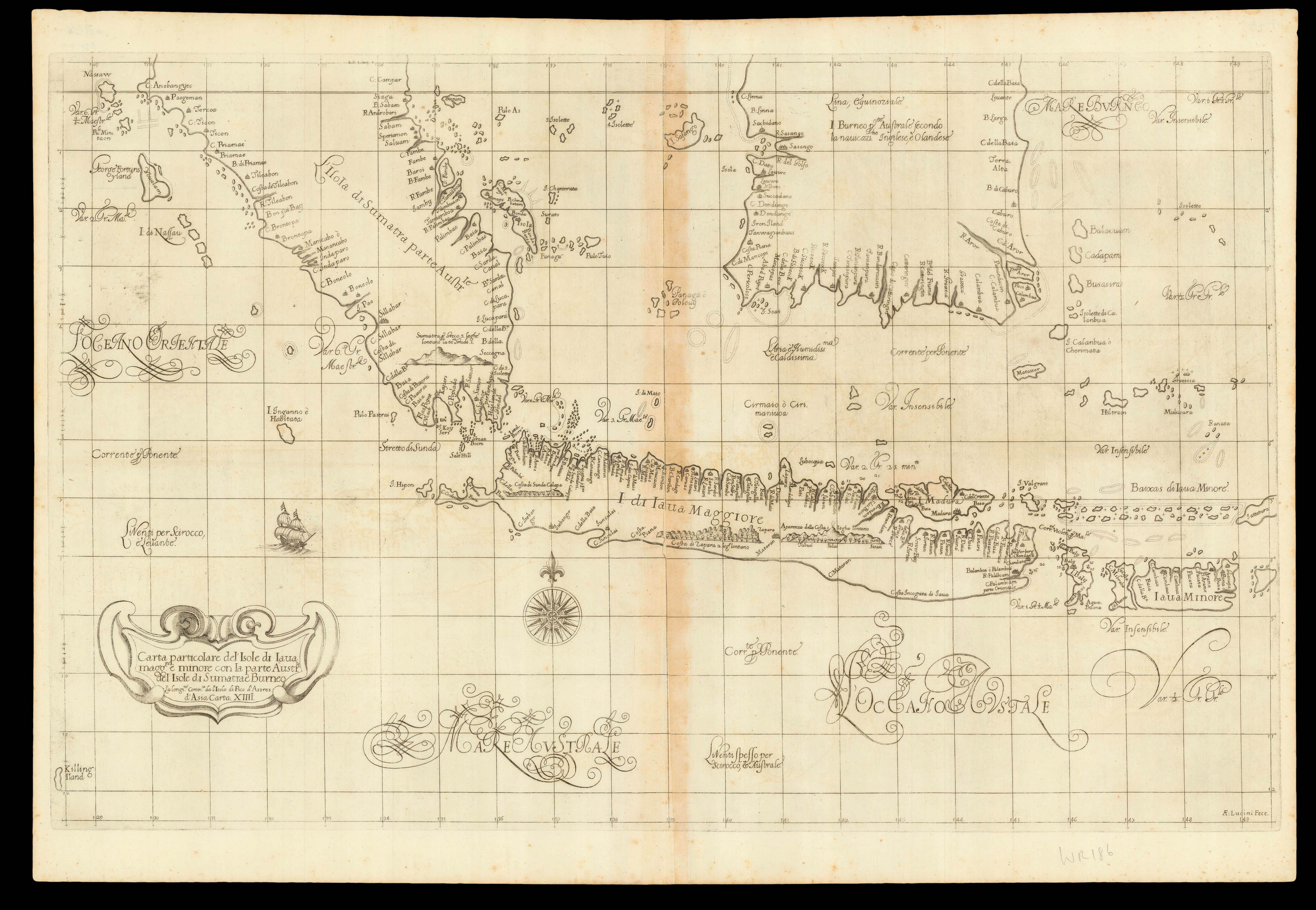 |
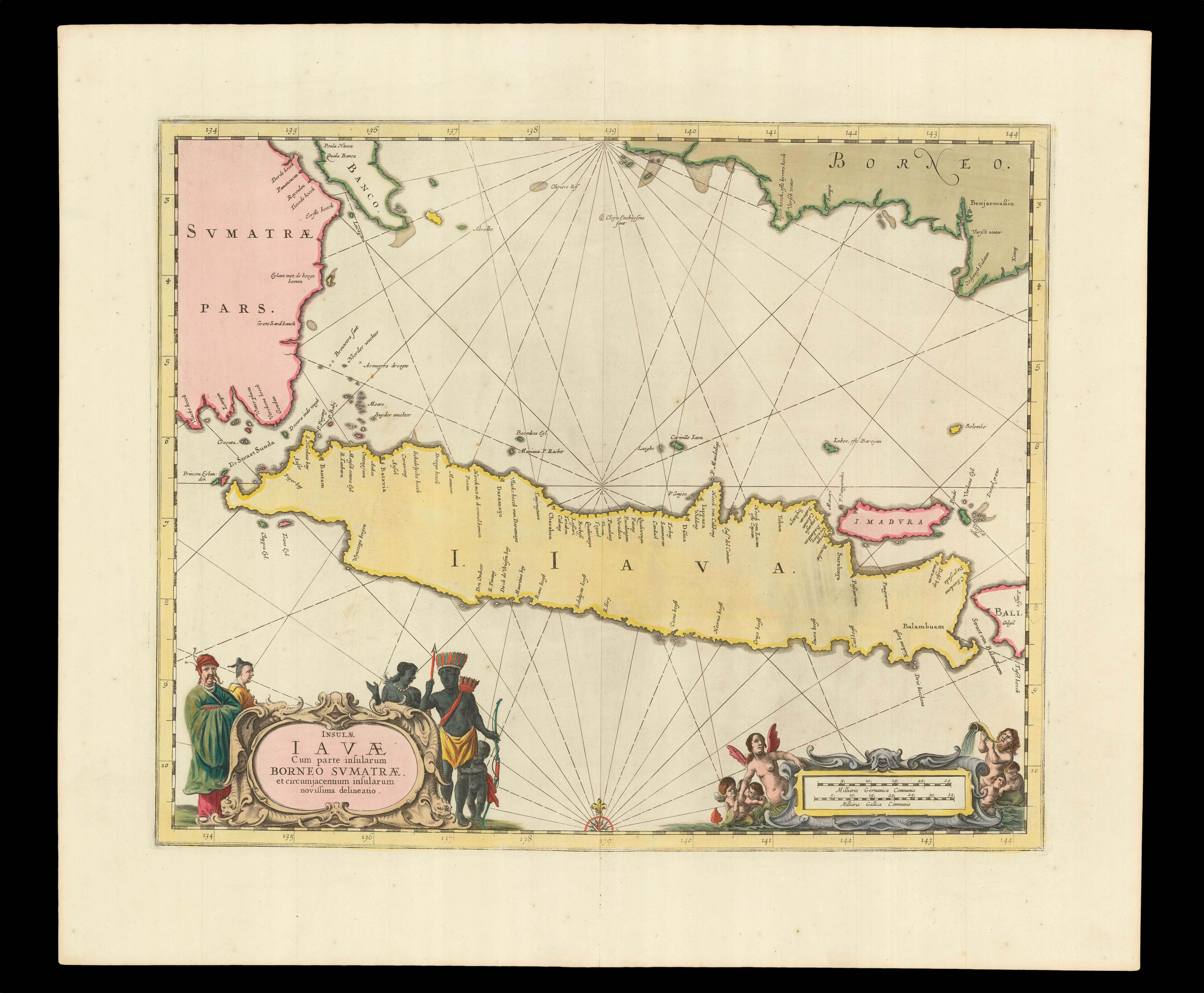
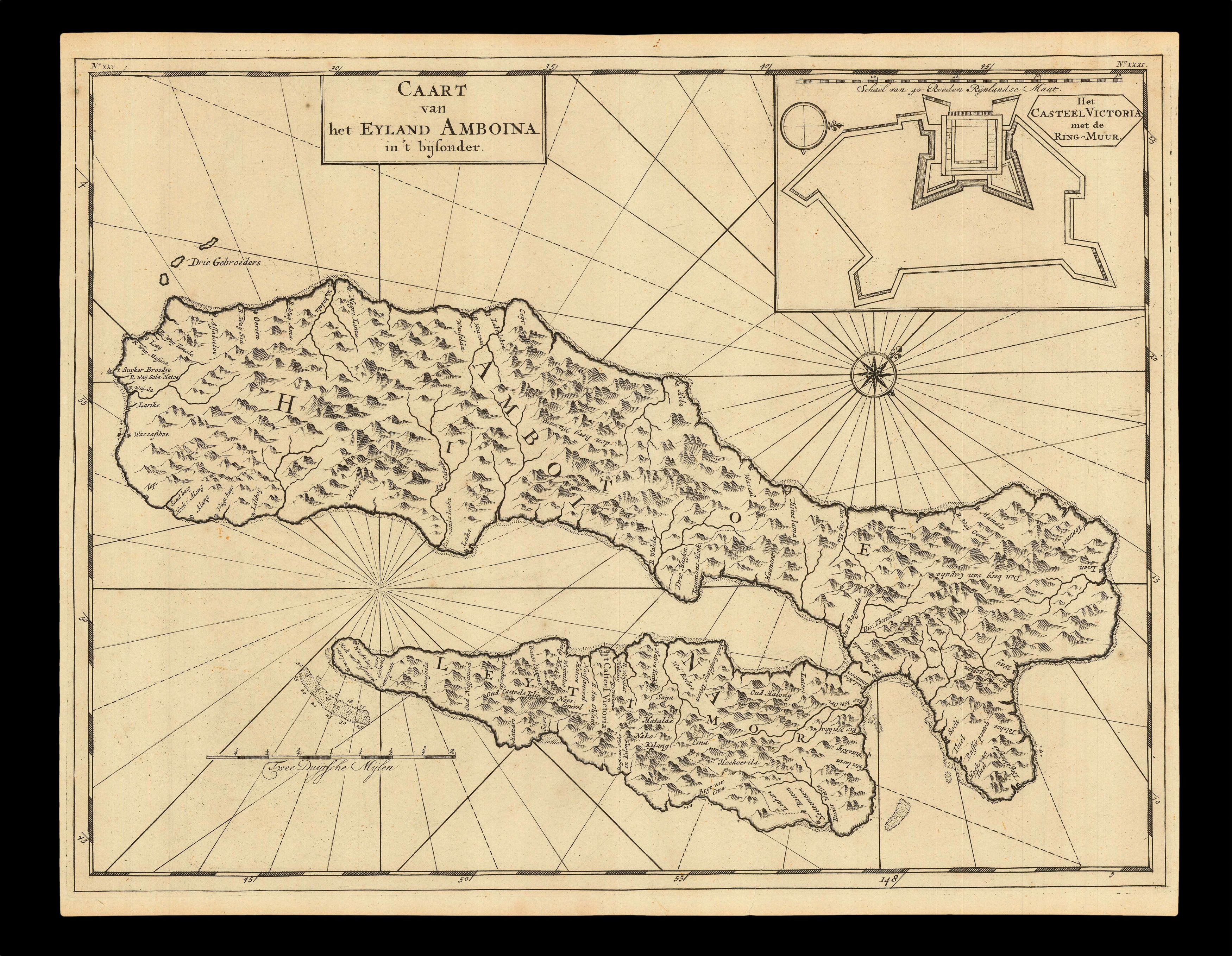
Chart of the islands at the heart of the VOC controlled Indonesian archipelago
1 x
£5,500
|
£5,500 |
|
£5,500 |
|
× |
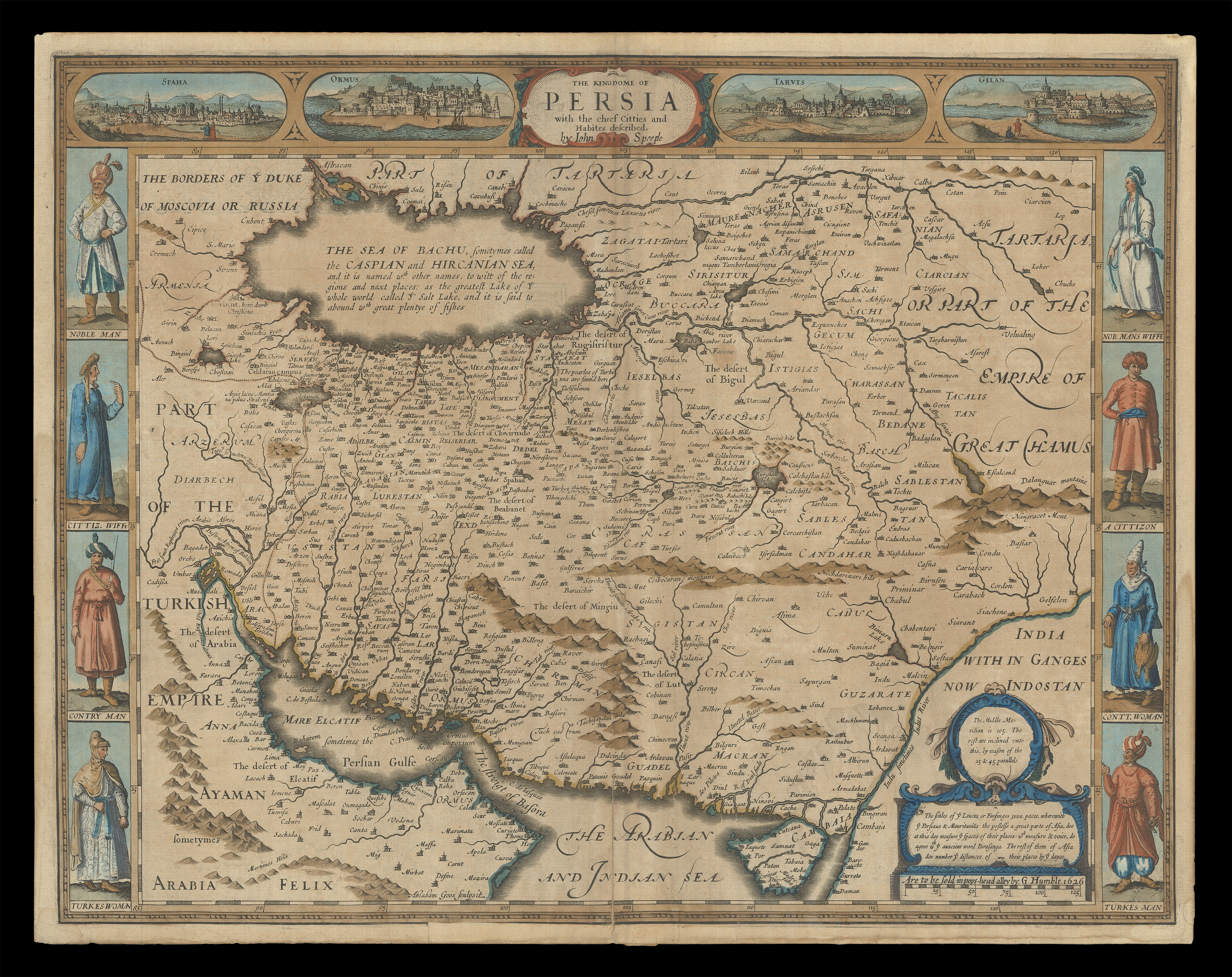 |
Speed's map of Persia
1 x
£1,800
|
£1,800 |
|
£1,800 |
|
× |
 |
Early headquarters of the VOC in Southeast Asia
1 x
£370
|
£370 |
|
£370 |
|
× |
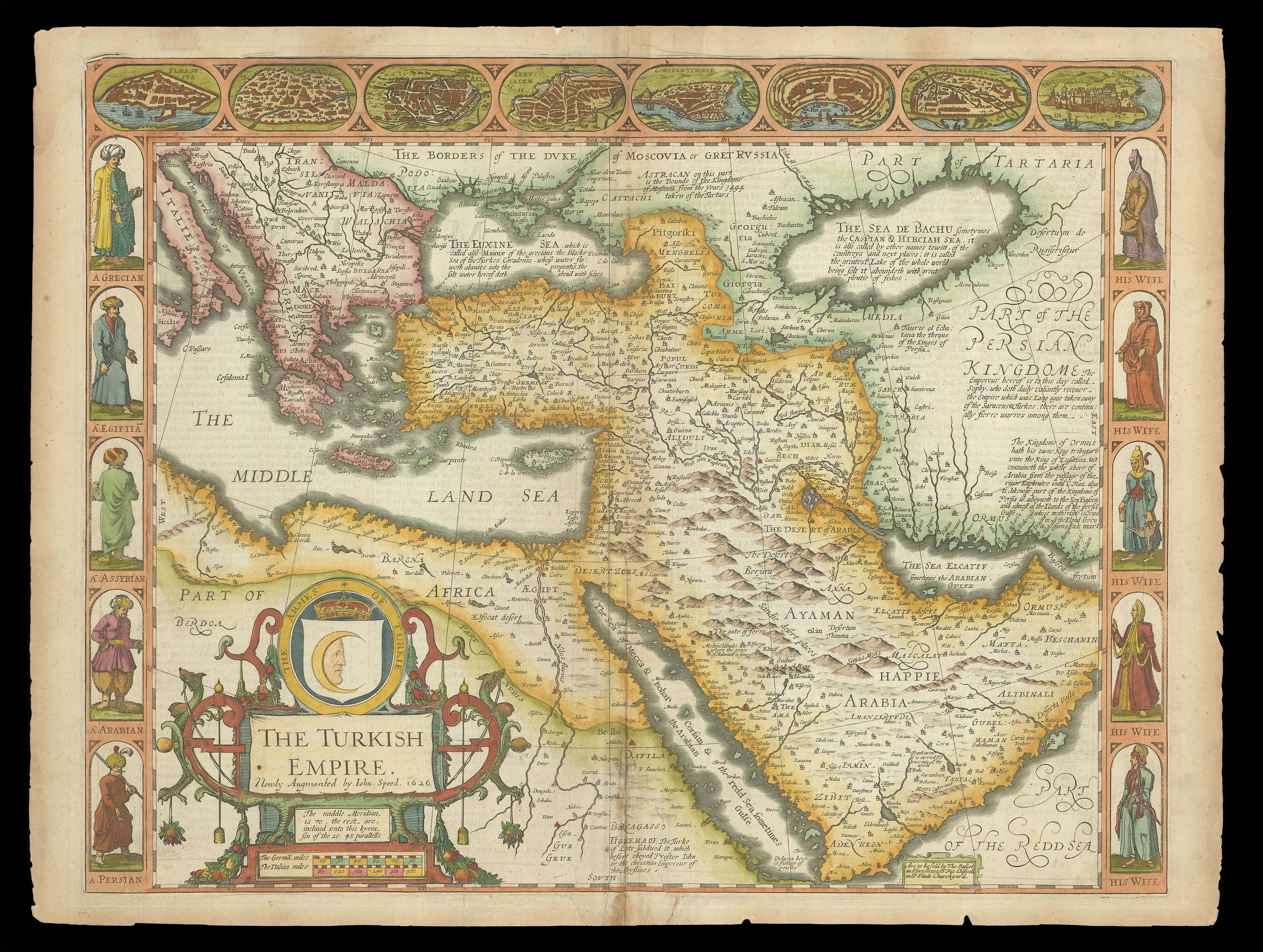 |
Speed's map of the Ottoman Empire
1 x
£2,000
|
£2,000 |
|
£2,000 |
|
× |
![Wallis, Edward [after] & Kollner, Augustus [litographer] & Sinclair, Thomas [printer], National Game of the Star Spangled Banner, Or Geographical & Historical Tourist through the United States & Canada](https://omega.crouchrarebooks.com/wp-content/uploads/2025/03/20541_1H.jpg) |
An early, striking and rare American cartographic game
1 x
£11,500
|
£11,500 |
|
£11,500 |
|
× |
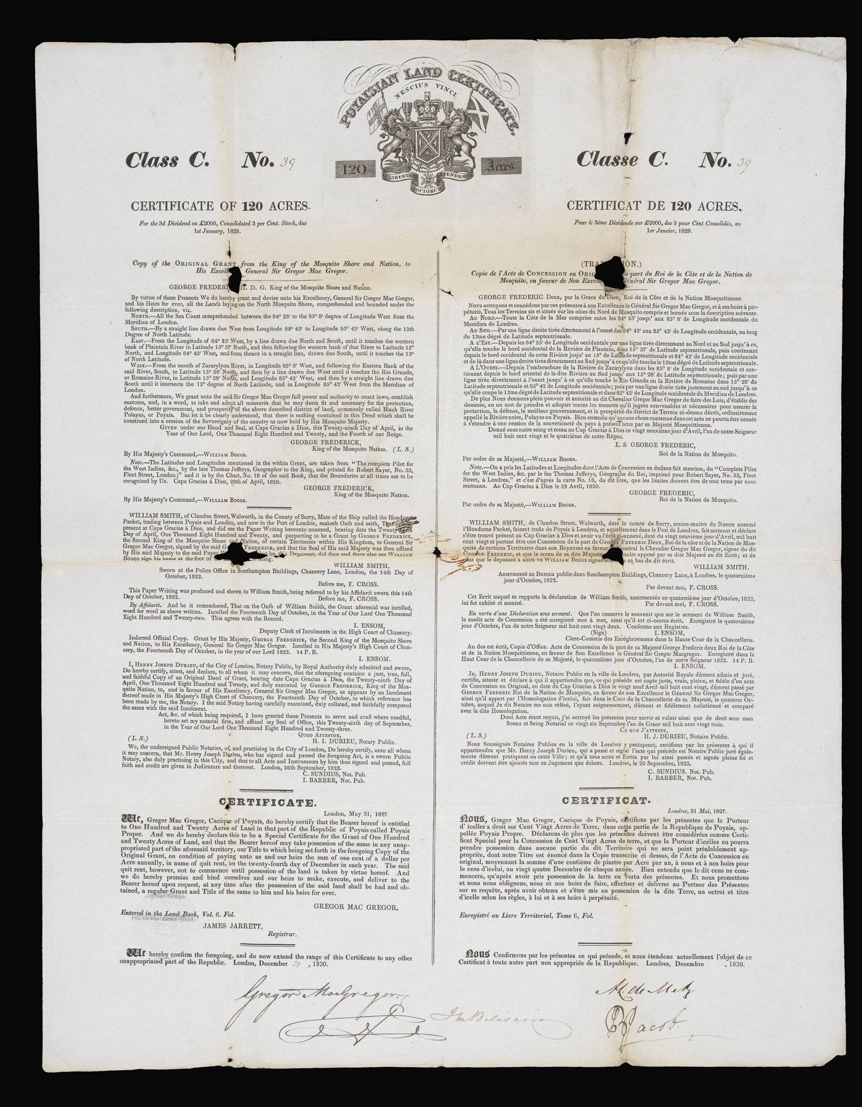 |
"The Fraud of the Prince of Poyais"
1 x
£800
|
£800 |
|
£800 |
|
× |
![HORSBURGH, James and INGLIS Sir Hugh [Two autograph letters concerning the East India Company and the War of 1812].](https://omega.crouchrarebooks.com/wp-content/uploads/2025/03/18376_1H.jpg) |
"more knowledge of the Eastern Seas than perhaps any other man"
1 x
£3,000
|
£3,000 |
|
£3,000 |
|
× |
![MINISTRY OF DEFENCE ONC-H-5 [and] ONC-H-6](https://omega.crouchrarebooks.com/wp-content/uploads/2025/03/17484_1H.jpg) |
Aeronautical charts of the Middle East during a period of waning British influence
1 x
£250
|
£250 |
|
£250 |
|
× |
![WYLD, James [Junior] [Manuscript map of the Arabian Peninsula].](https://omega.crouchrarebooks.com/wp-content/uploads/2025/03/15158_1H.jpg) |
Manuscript map of the Arabian Peninsula
1 x
£30,000
|
£30,000 |
|
£30,000 |
|
× |
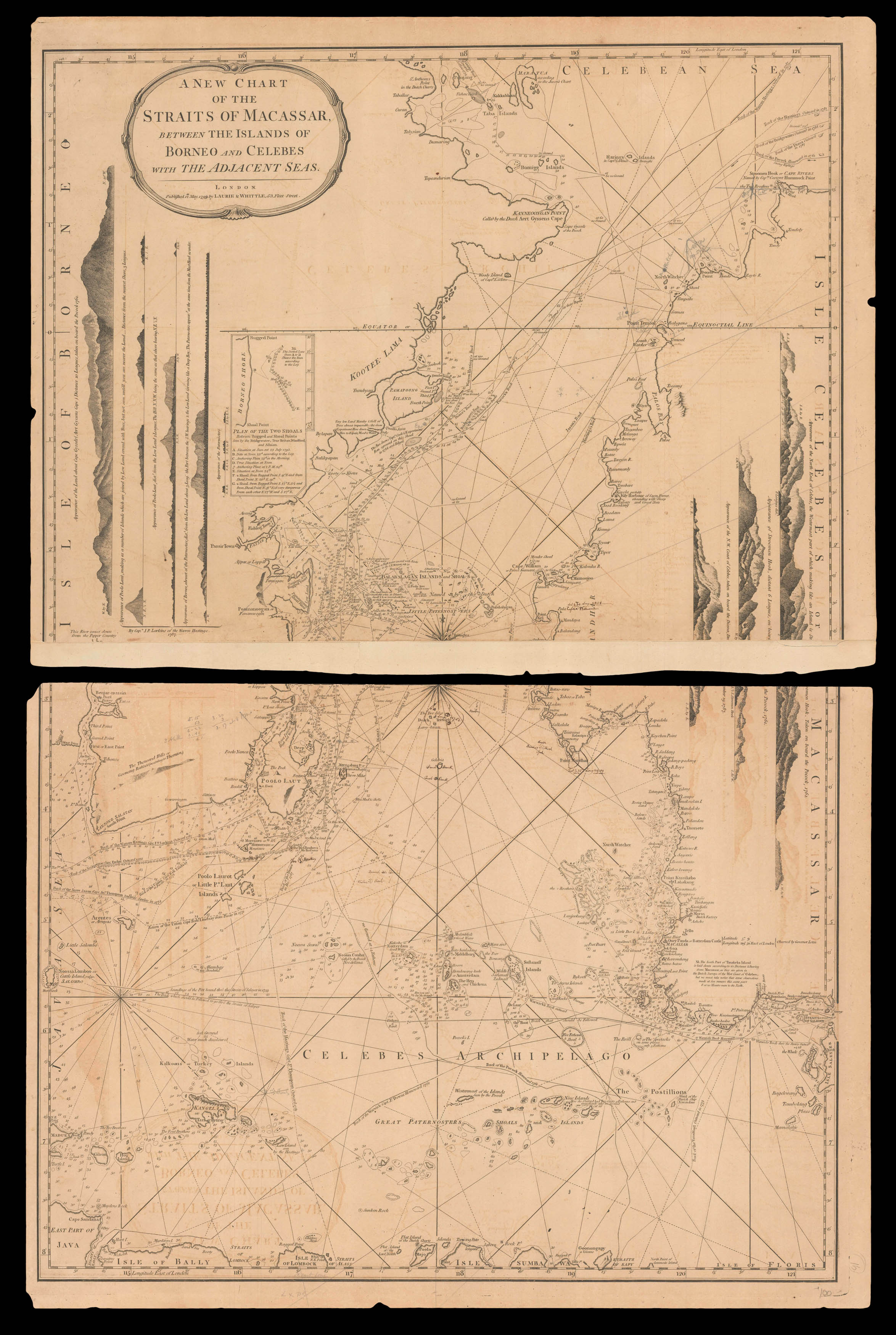 |
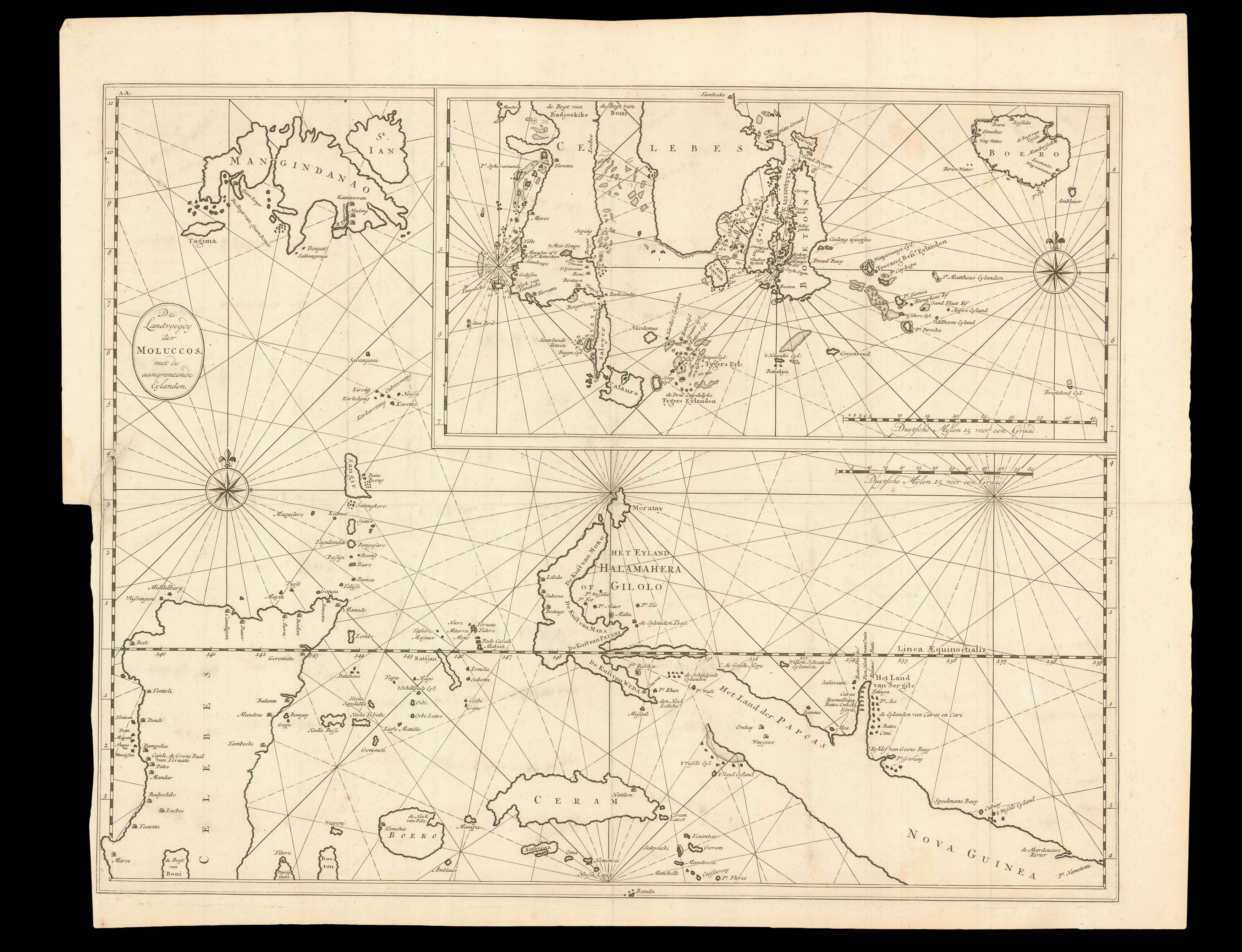
The many islands of the Celebes archipelago
1 x
£750
|
£750 |
|
£750 |
|
× |
 |
Dudley's chart of southern India
1 x
£8,000
|
£8,000 |
|
£8,000 |
|
× |
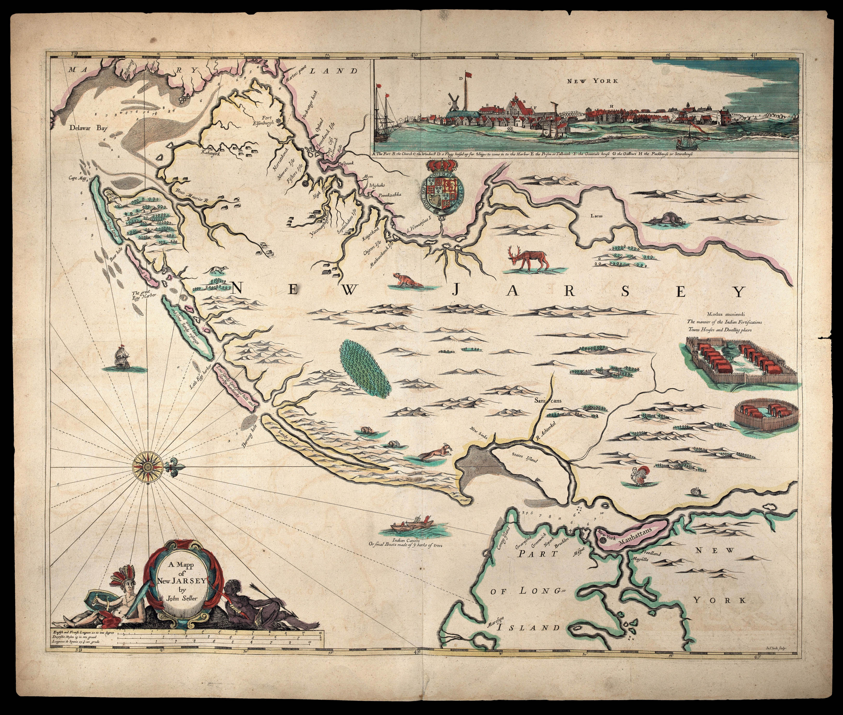 |
The first state of Seller's map of New Jersey
1 x
£72,500
|
£72,500 |
|
£72,500 |
|
× |
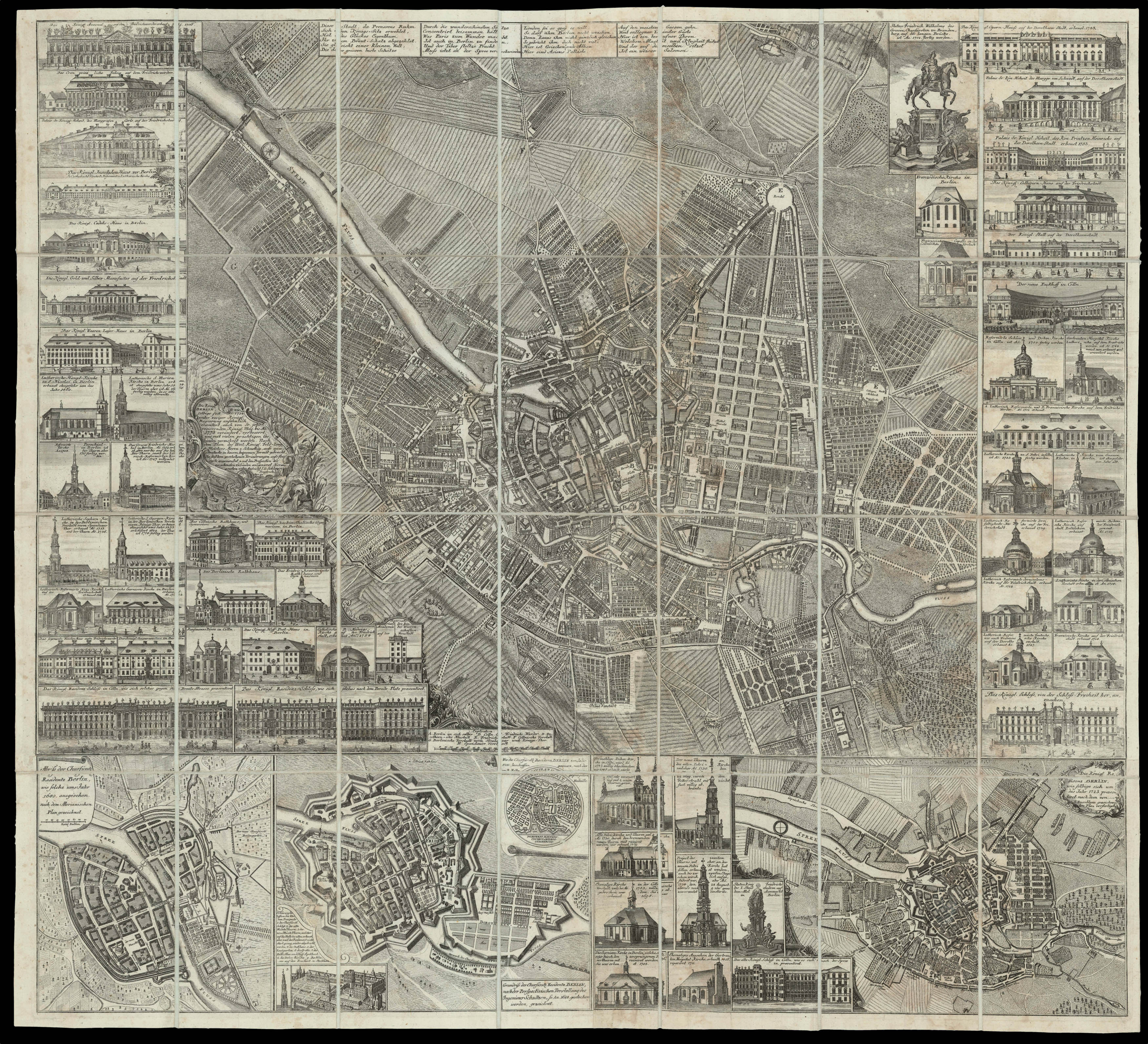 |
The Capital of Prussia
1 x
£15,000
|
£15,000 |
|
£15,000 |
|
× |
![[ANONYMOUS] Partie De L'Isle De Java - Suite De L'Isle De Iava.](https://omega.crouchrarebooks.com/wp-content/uploads/2025/03/17524_1H.jpg) |
French manuscript chart of Java - the heart of the Dutch empire
1 x
£32,500
|
£32,500 |
|
£32,500 |
|
× |
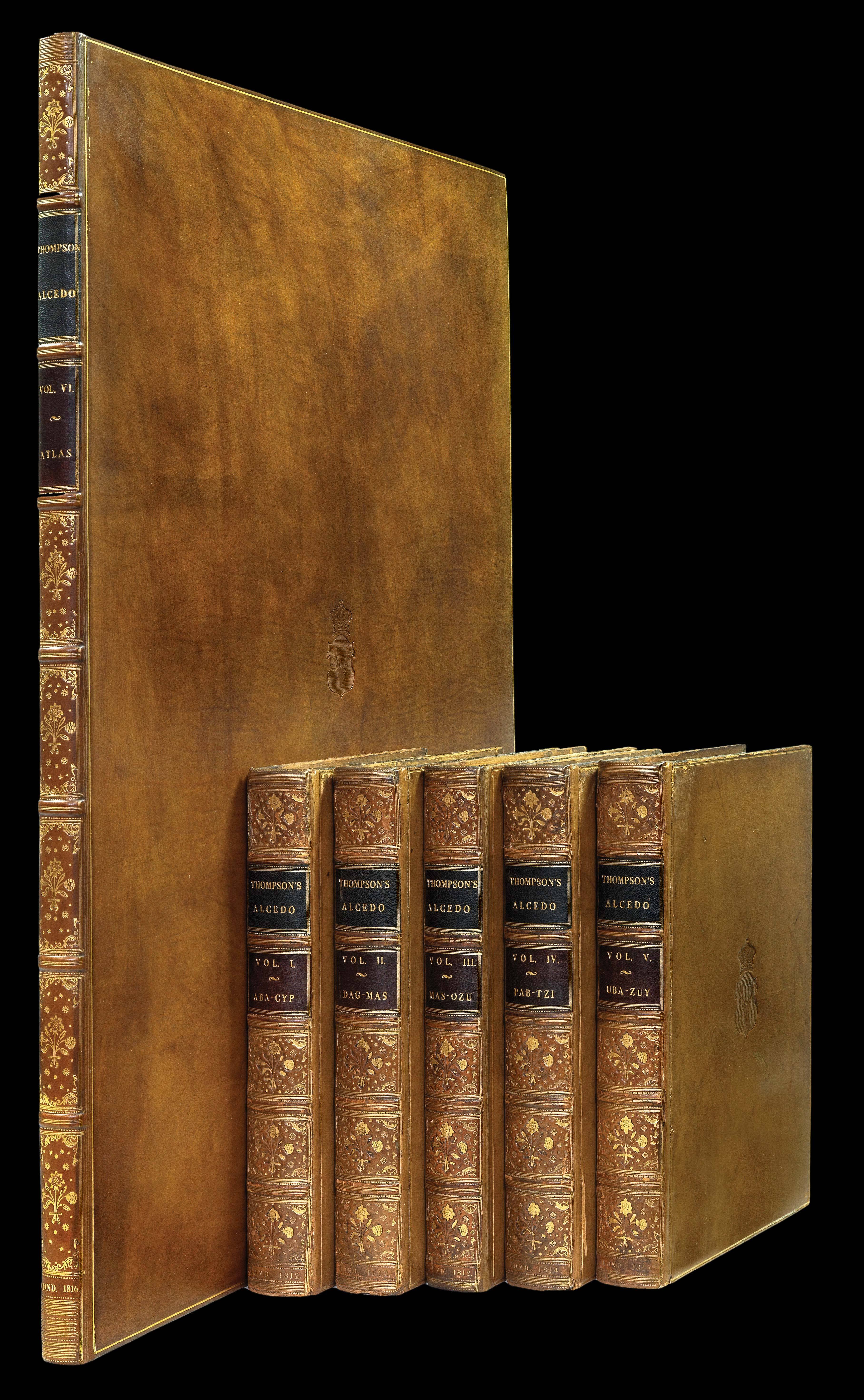 |
The Earl of Lonsdale's copy of Thompson's Alcedo
1 x
£65,000
|
£65,000 |
|
£65,000 |
|
× |
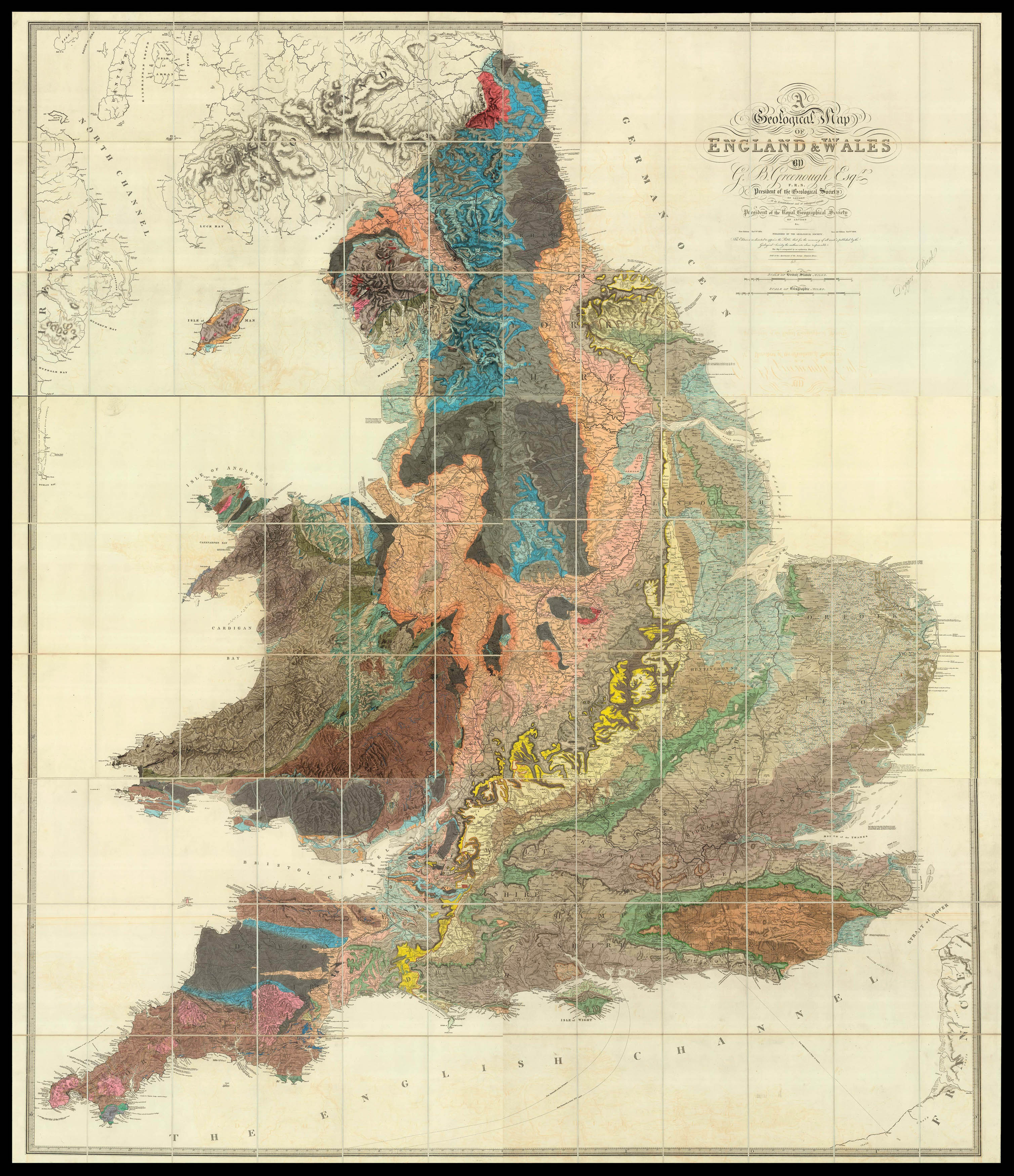 |
Greenough's riposte to Smith in the battle of the geological maps
1 x
£18,500
|
£18,500 |
|
£18,500 |
|
× |
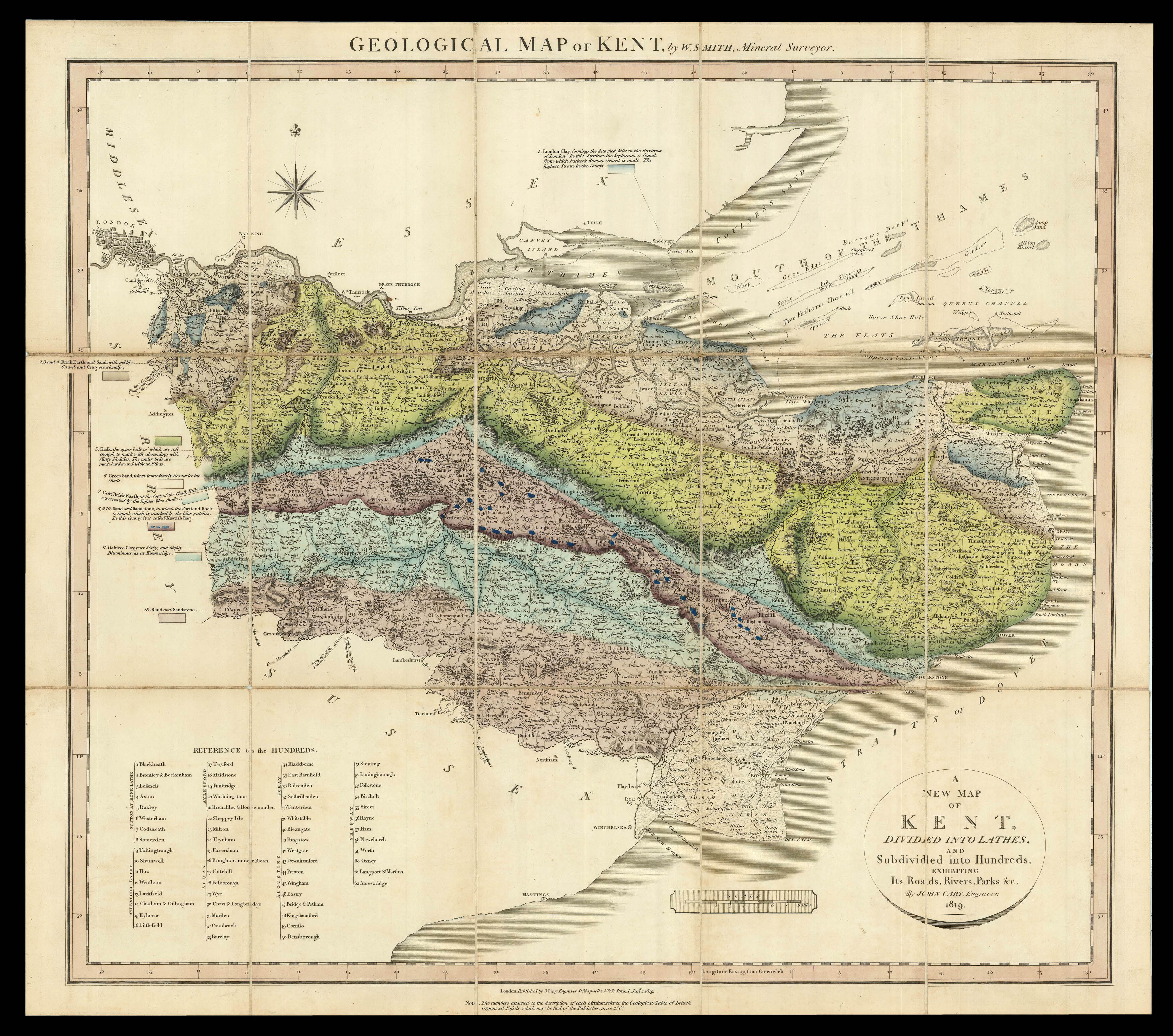 |
Smith's rare geological survey of Kent
1 x
£13,000
|
£13,000 |
|
£13,000 |
|
× |
 |
Black Gold
1 x
£15,000
|
£15,000 |
|
£15,000 |
|
× |
![[ANONYMOUS] Plan of Shanghai 1928](https://omega.crouchrarebooks.com/wp-content/uploads/2025/03/15011_1H-3-scaled.jpg) |
Plan of Shanghai, 1928
1 x
£15,000
|
£15,000 |
|
£15,000 |
|
× |
 |
The search for black gold continues
1 x
£15,000
|
£15,000 |
|
£15,000 |
|
× |
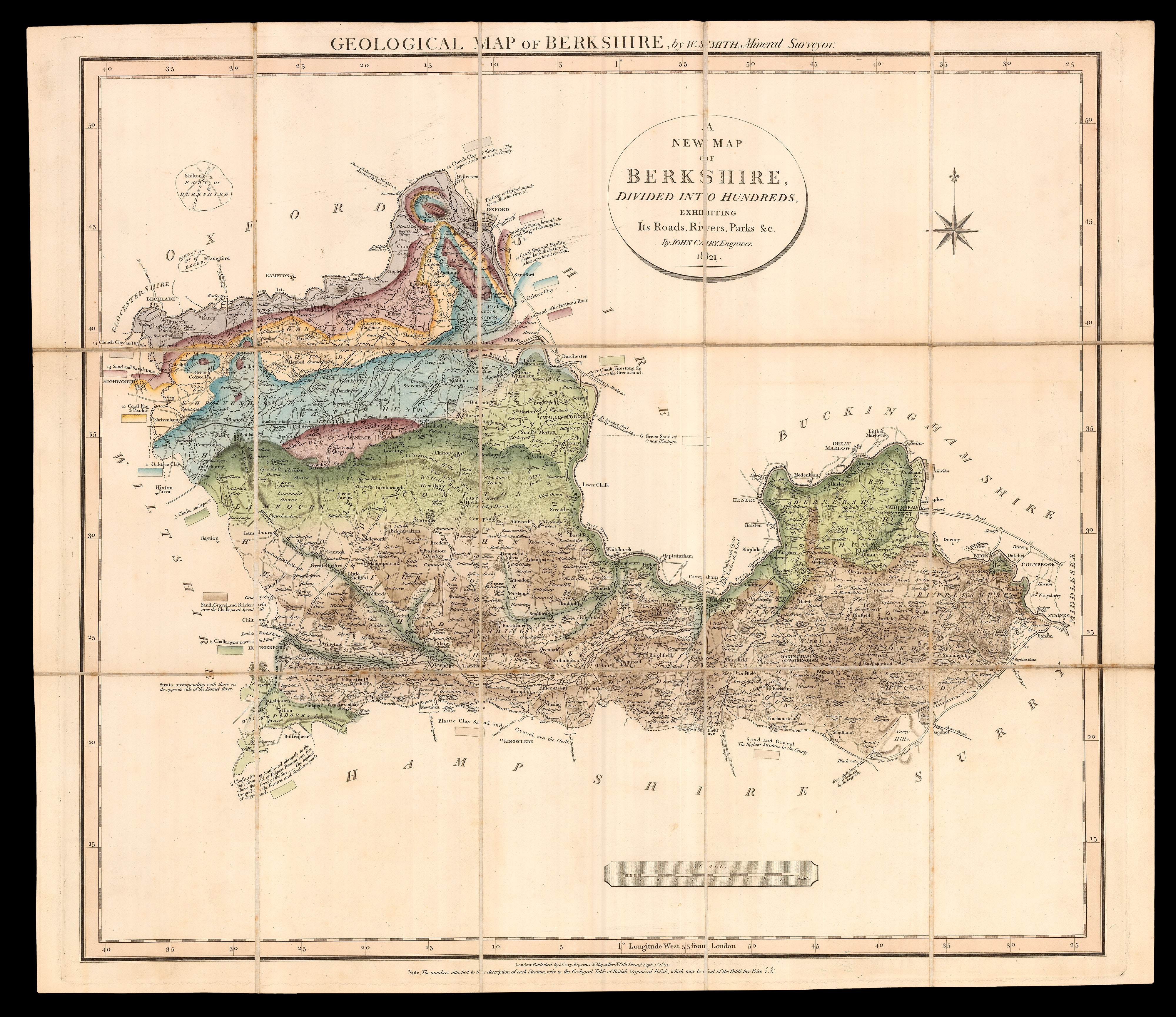 |
Smith's rare geological survey of Berkshire
1 x
£7,500
|
£7,500 |
|
£7,500 |
|
× |
 |
Superb facsimile of the Vatican's Ptolemy Cosmographia of 1472
1 x
£6,000
|
£6,000 |
|
£6,000 |
|
× |
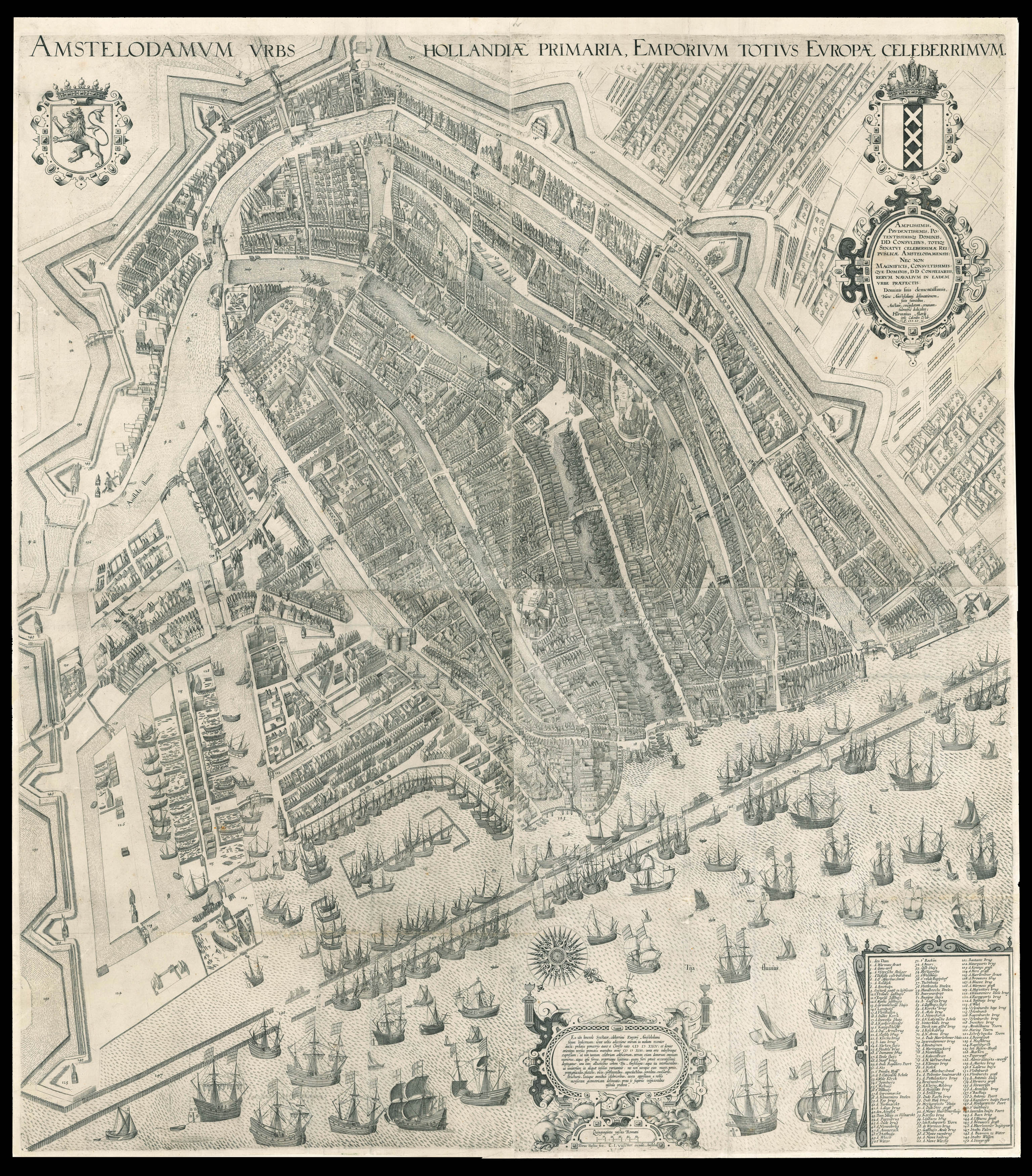 |
One of the most influential maps of Amsterdam
1 x
£60,000
|
£60,000 |
|
£60,000 |
|
× |
 |
The Poly-olbion
1 x
£15,000
|
£15,000 |
|
£15,000 |
|
× |
 |
The British Empire reaches for the stars
1 x
£32,000
|
£32,000 |
|
£32,000 |
|
× |
![[ANONYMOUS] Plan of Shanghai](https://omega.crouchrarebooks.com/wp-content/uploads/2025/03/22065_1H.jpg) |
Shanghai Sewers
1 x
£15,000
|
£15,000 |
|
£15,000 |
|
× |
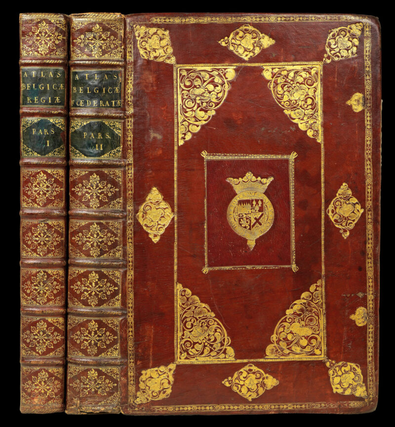 |
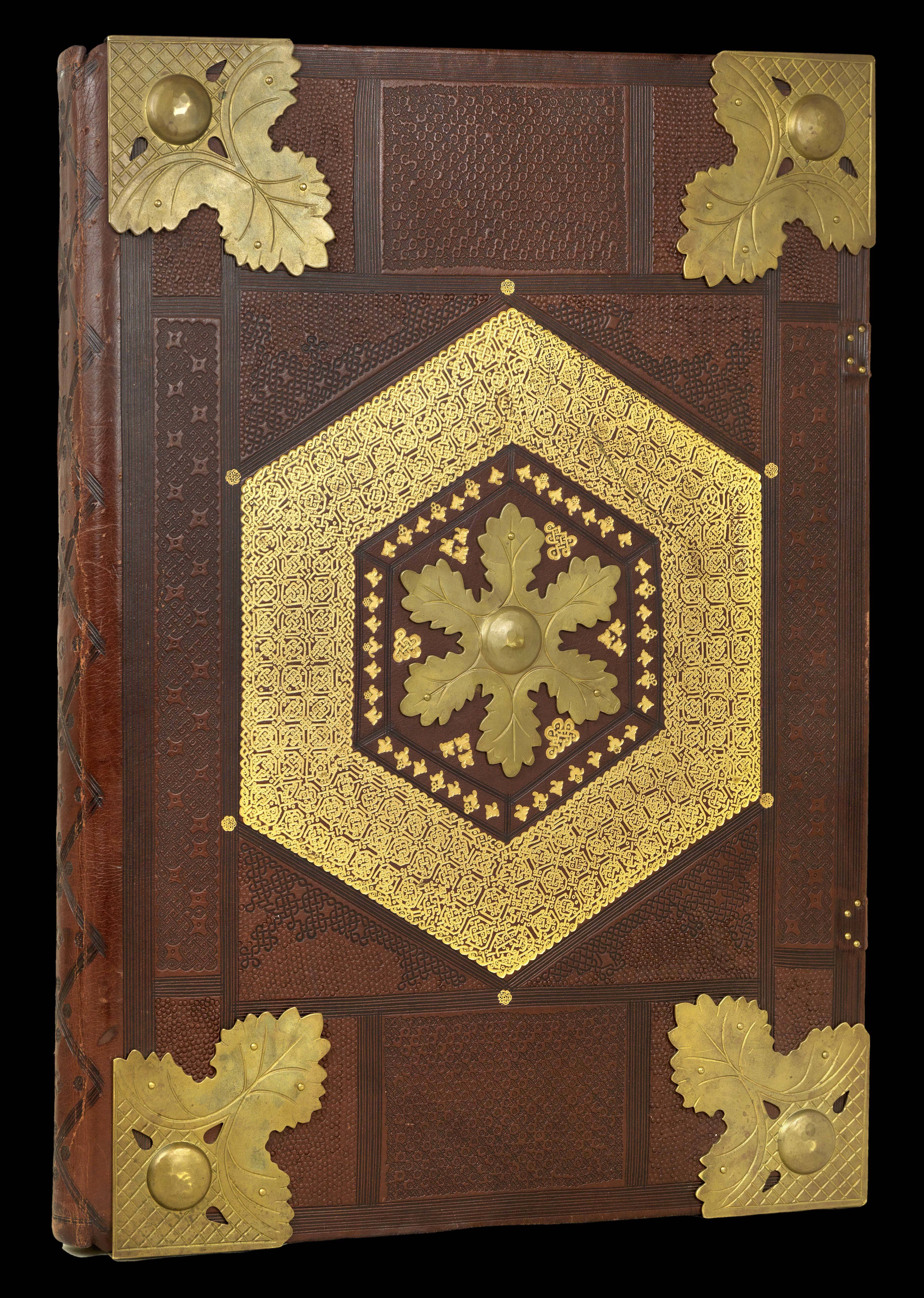
An exceptionally fine example of Blaeu's great work on the towns of the Netherlands bound in full red morocco with the coats-of-arms of James Butler, 1st Duke of Ormond
1 x
£300,000
|
£300,000 |
|
£300,000 |
|
× |
 |
One of the earliest printed detailed charts of Java
1 x
£1,850
|
£1,850 |
|
£1,850 |
|
× |
 |
The Moluccas
1 x
£370
|
£370 |
|
£370 |
|
× |
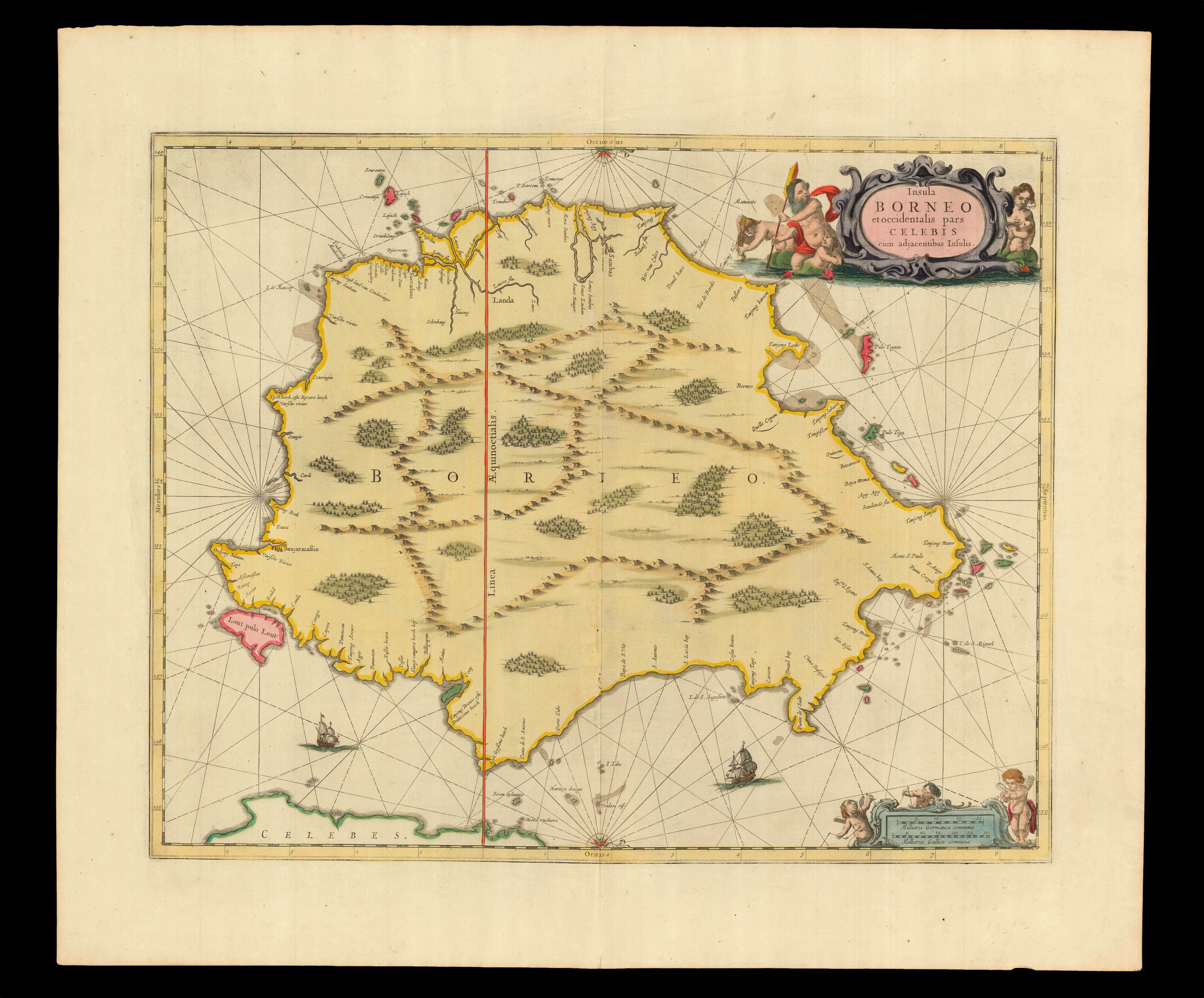 |
Early printed map showing the east coast of Borneo
1 x
£750
|
£750 |
|
£750 |
|
× |
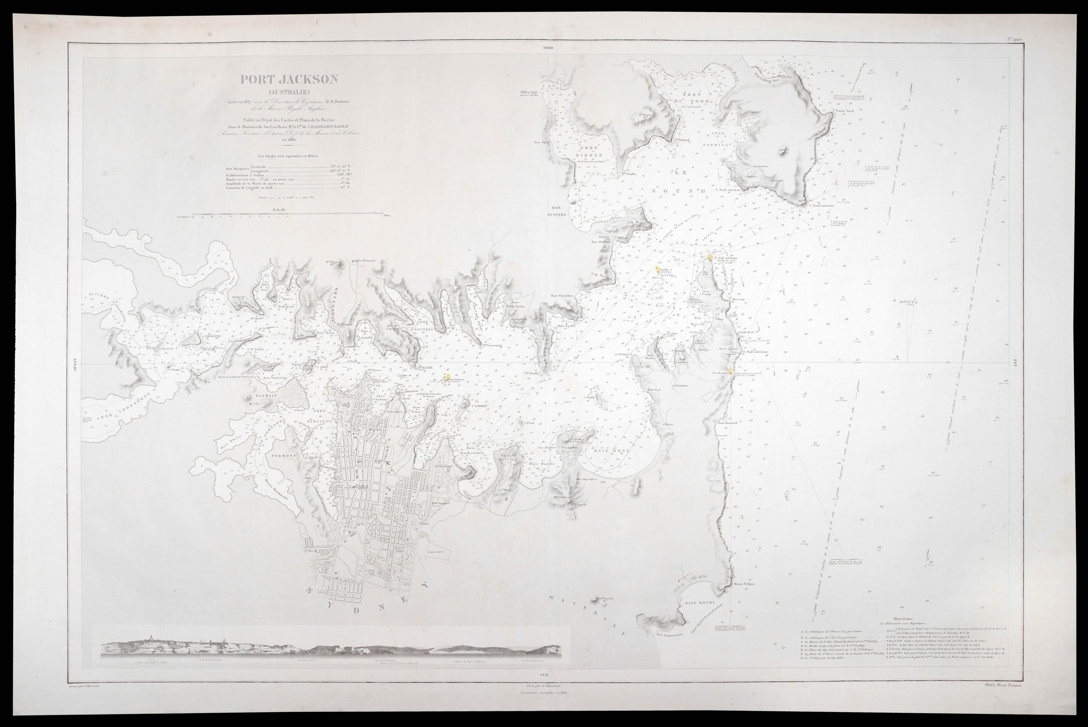 |
Sydney Harbour during the Gold Rush
1 x
£7,000
|
£7,000 |
|
£7,000 |
|
× |
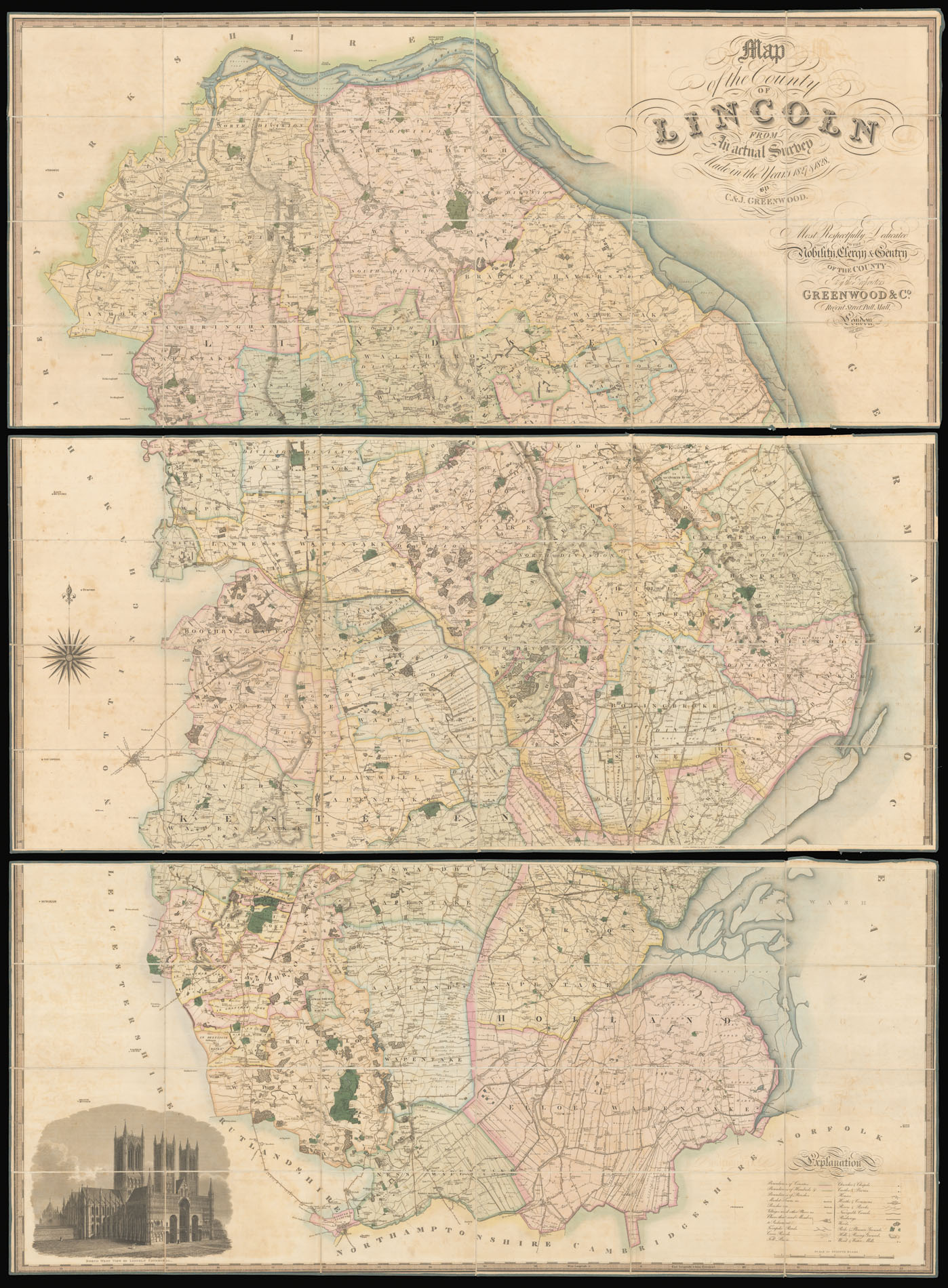 |
Greenwood's large-scale map of Lincolnshire
1 x
£1,500
|
£1,500 |
|
£1,500 |
|
× |
![PHILLIPS, J[ohn] & HUTCHINGS, W. F. A Map of the County of Stafford](https://omega.crouchrarebooks.com/wp-content/uploads/2025/03/11427_1H.jpg) |
Staffordshire - Hutchings' large-scale map of Staffordshire
1 x
£1,000
|
£1,000 |
|
£1,000 |
|
× |
 |
From the inventory of the Van Keulen family of cartographers
1 x
£60,000
|
£60,000 |
|
£60,000 |
|
× |
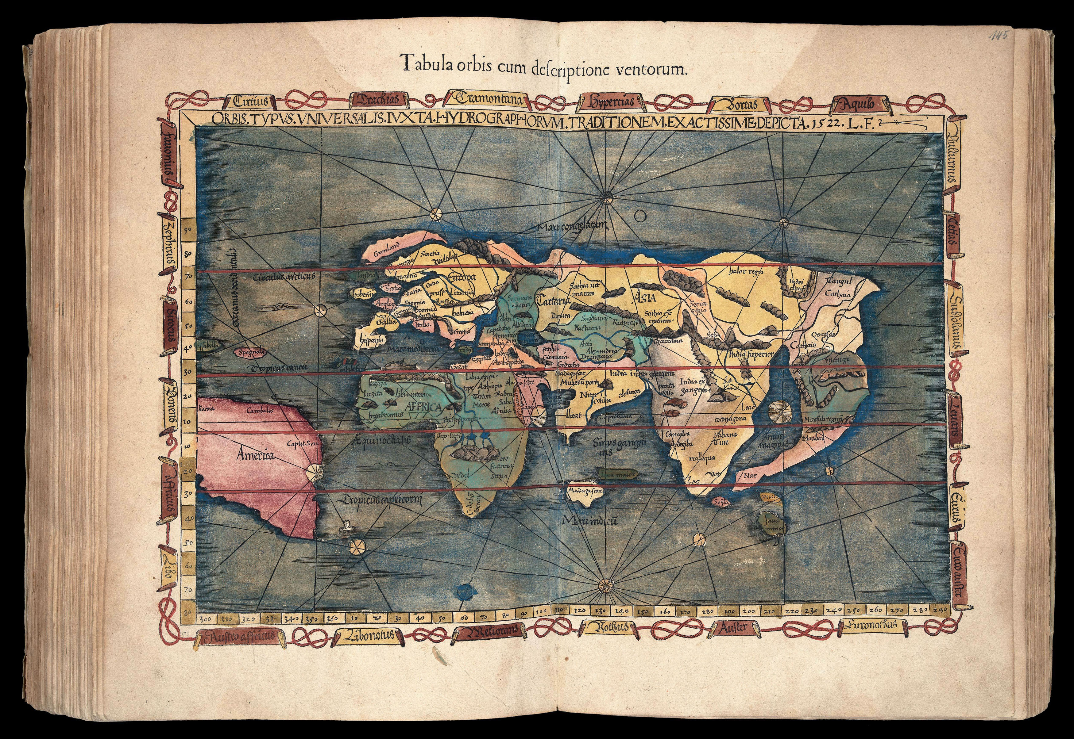 |
The first map in an atlas to name America, and Ptolemy's third projection
1 x
£200,000
|
£200,000 |
|
£200,000 |
|
× |
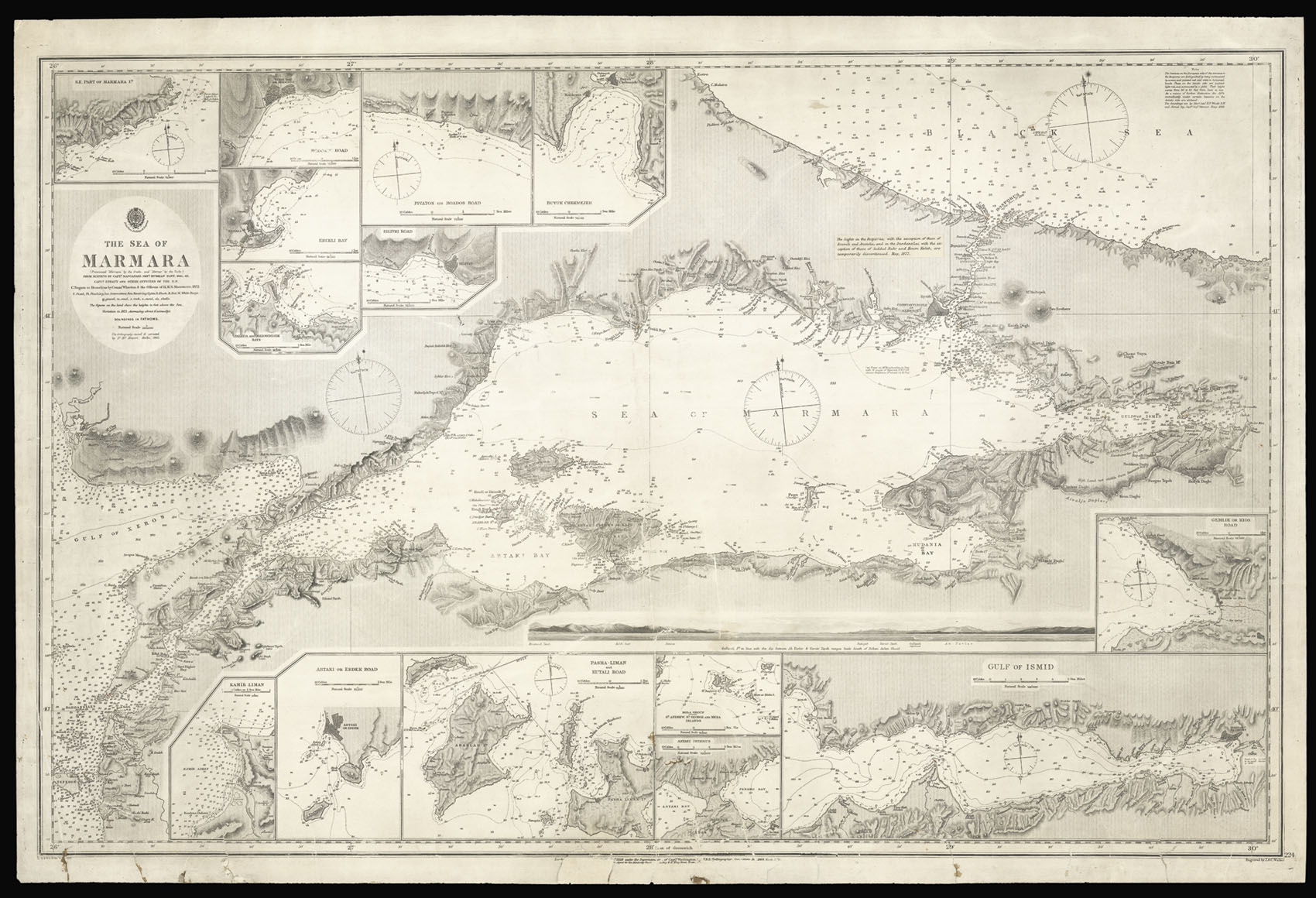 |
The Sea of Marmara with Istanbul and the Bosphorus
1 x
£1,500
|
£1,500 |
|
£1,500 |
|
|


