-
×
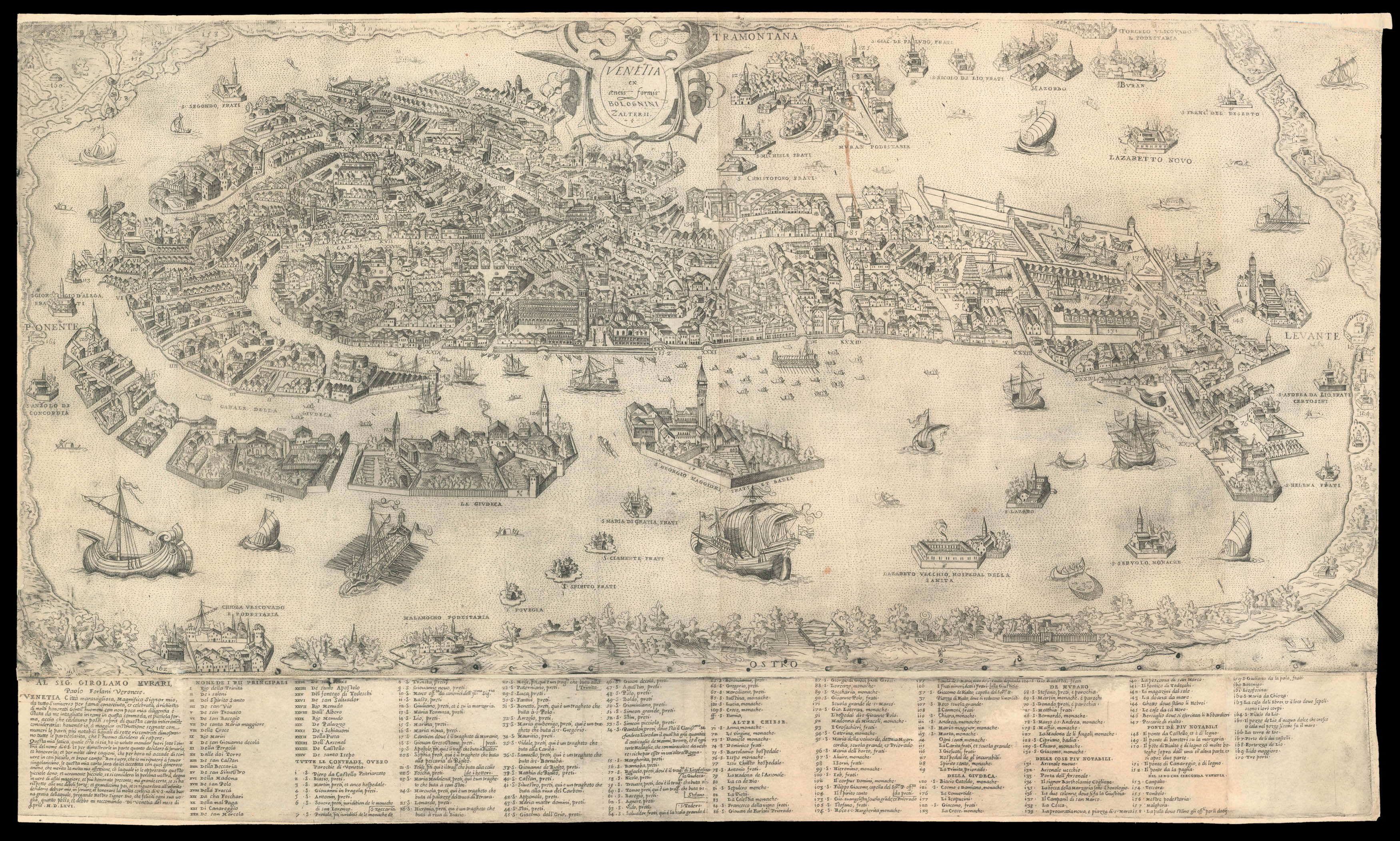 Forlani's magnificent plan of Venice
1 × £30,000
Forlani's magnificent plan of Venice
1 × £30,000 -
×
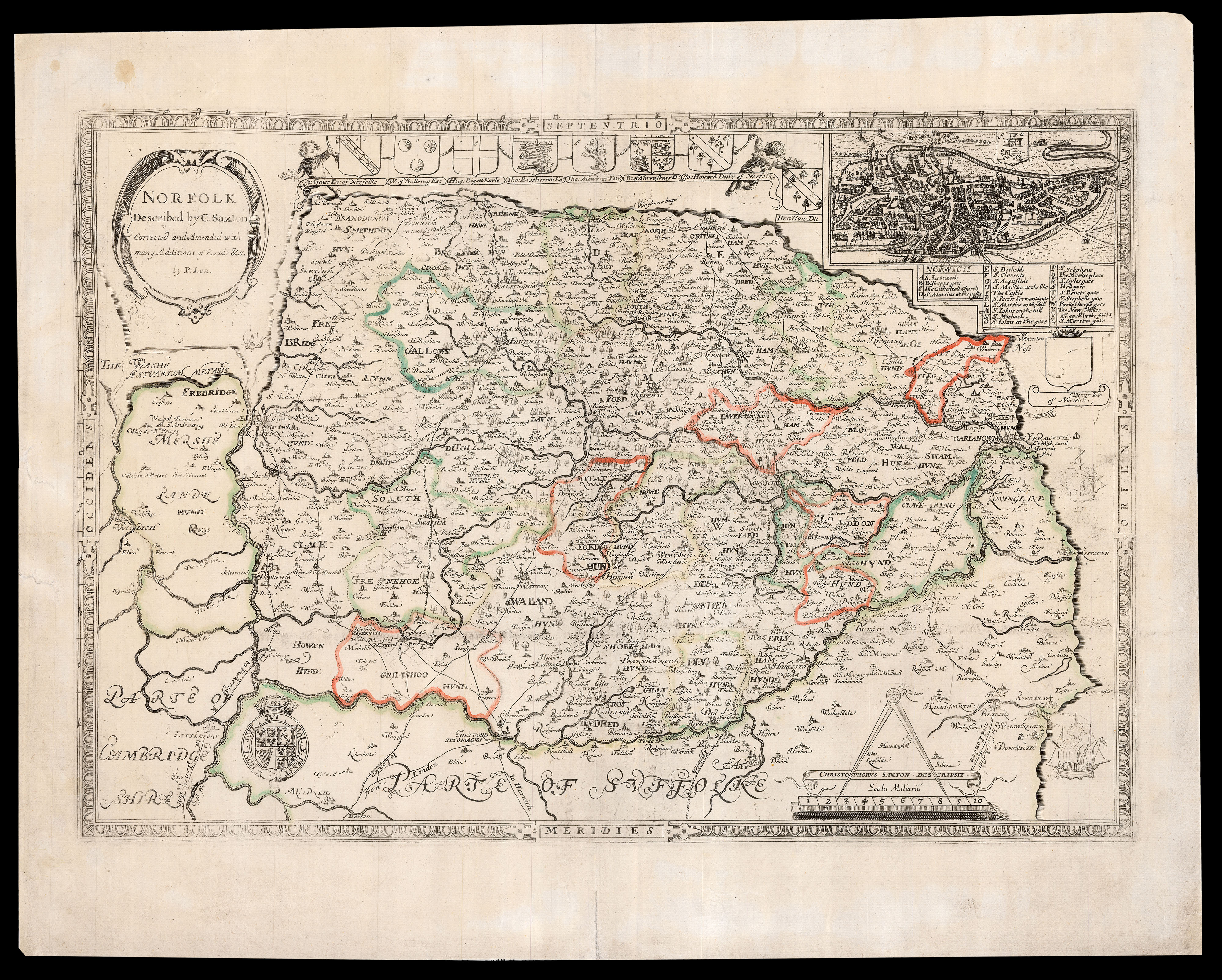 Lea's edition of Saxton's map of Norfolk
1 × £1,200
Lea's edition of Saxton's map of Norfolk
1 × £1,200 -
×
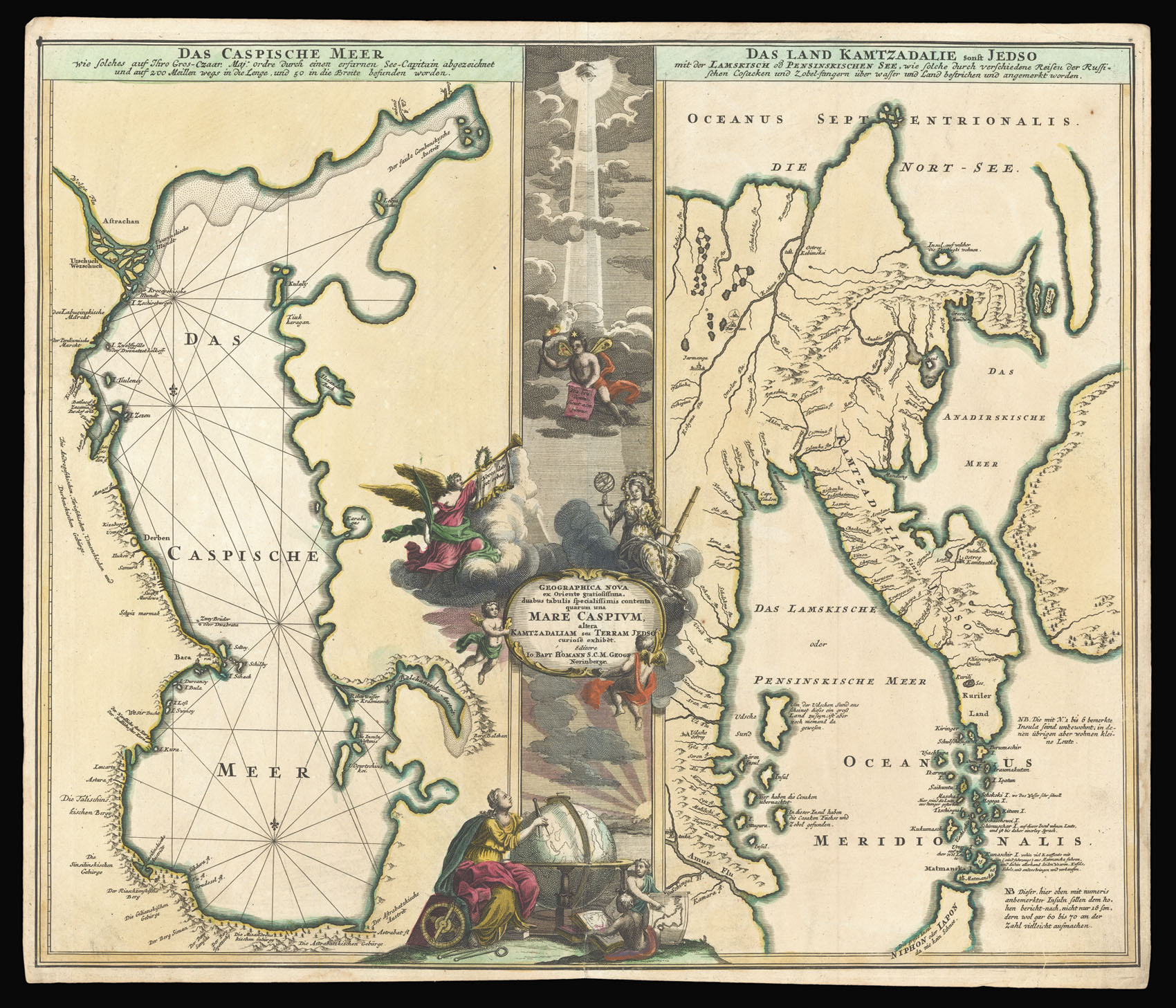 Homann's map of the Caspian Sea
1 × £500
Homann's map of the Caspian Sea
1 × £500 -
×
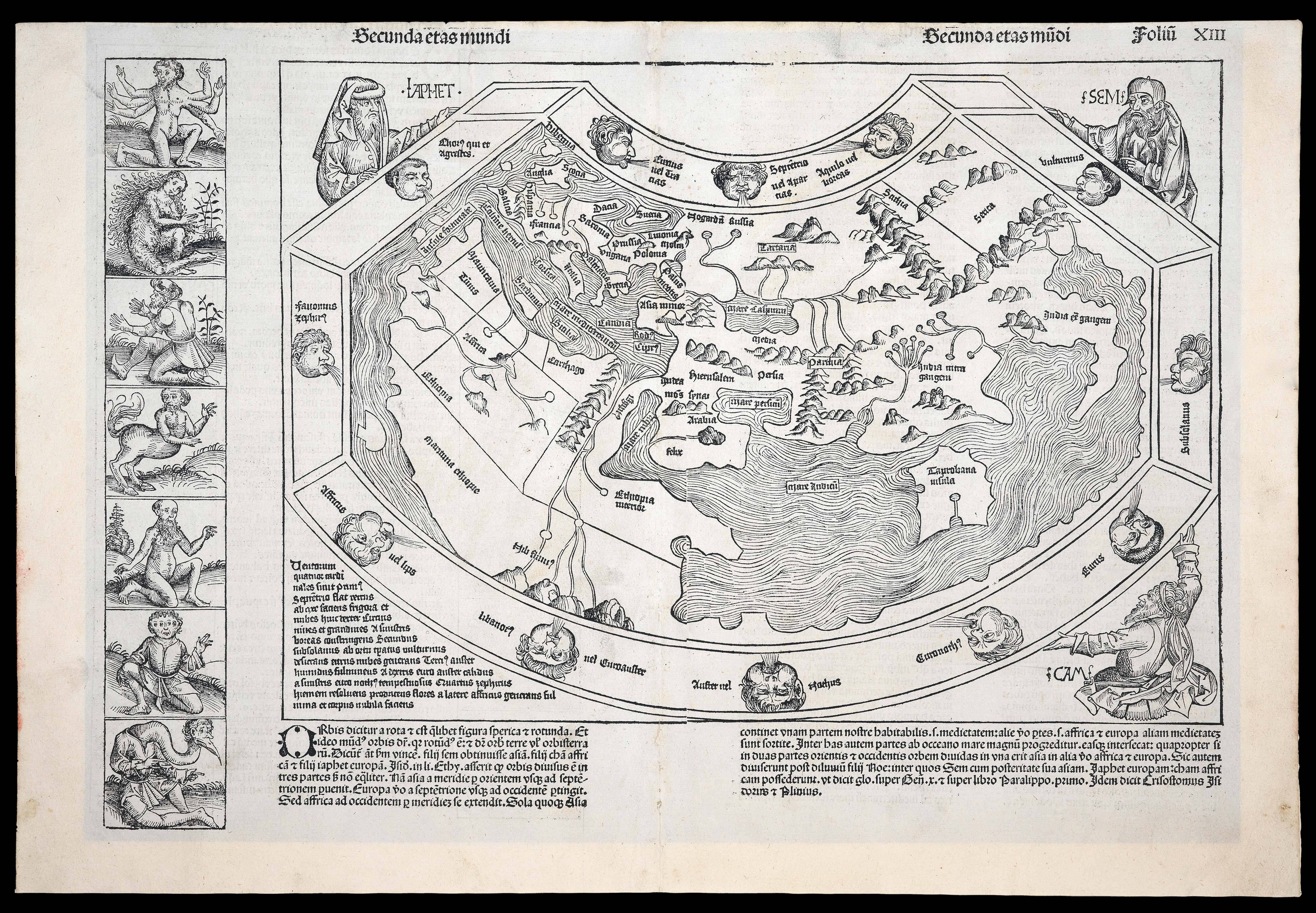 "Outlandish creatures and beings that were thought to inhabit the furthermost parts of the earth".
1 × £24,000
"Outlandish creatures and beings that were thought to inhabit the furthermost parts of the earth".
1 × £24,000 -
×
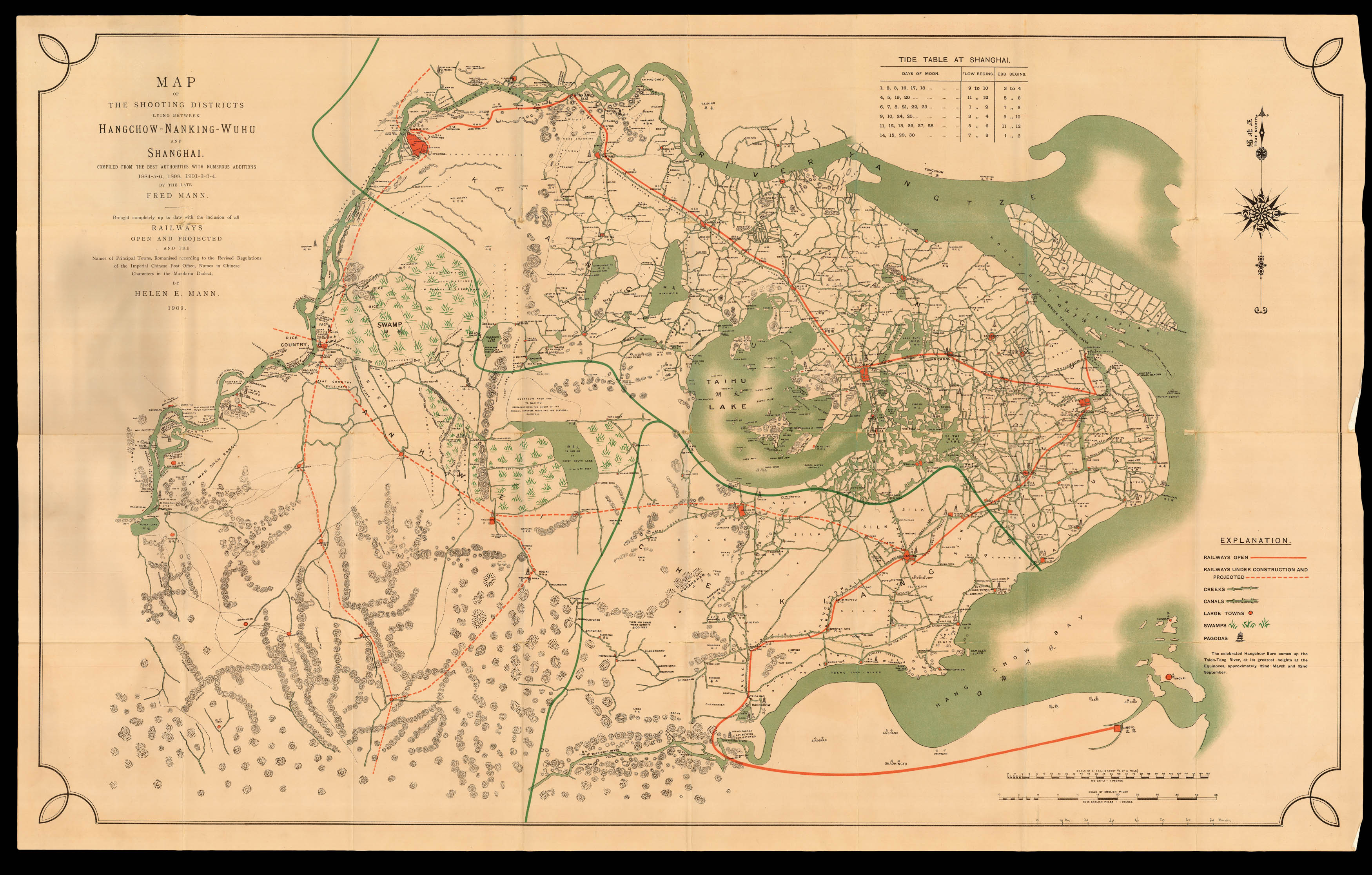 Mann's shooting map of Shanghai and her environs
1 × £5,500
Mann's shooting map of Shanghai and her environs
1 × £5,500 -
×
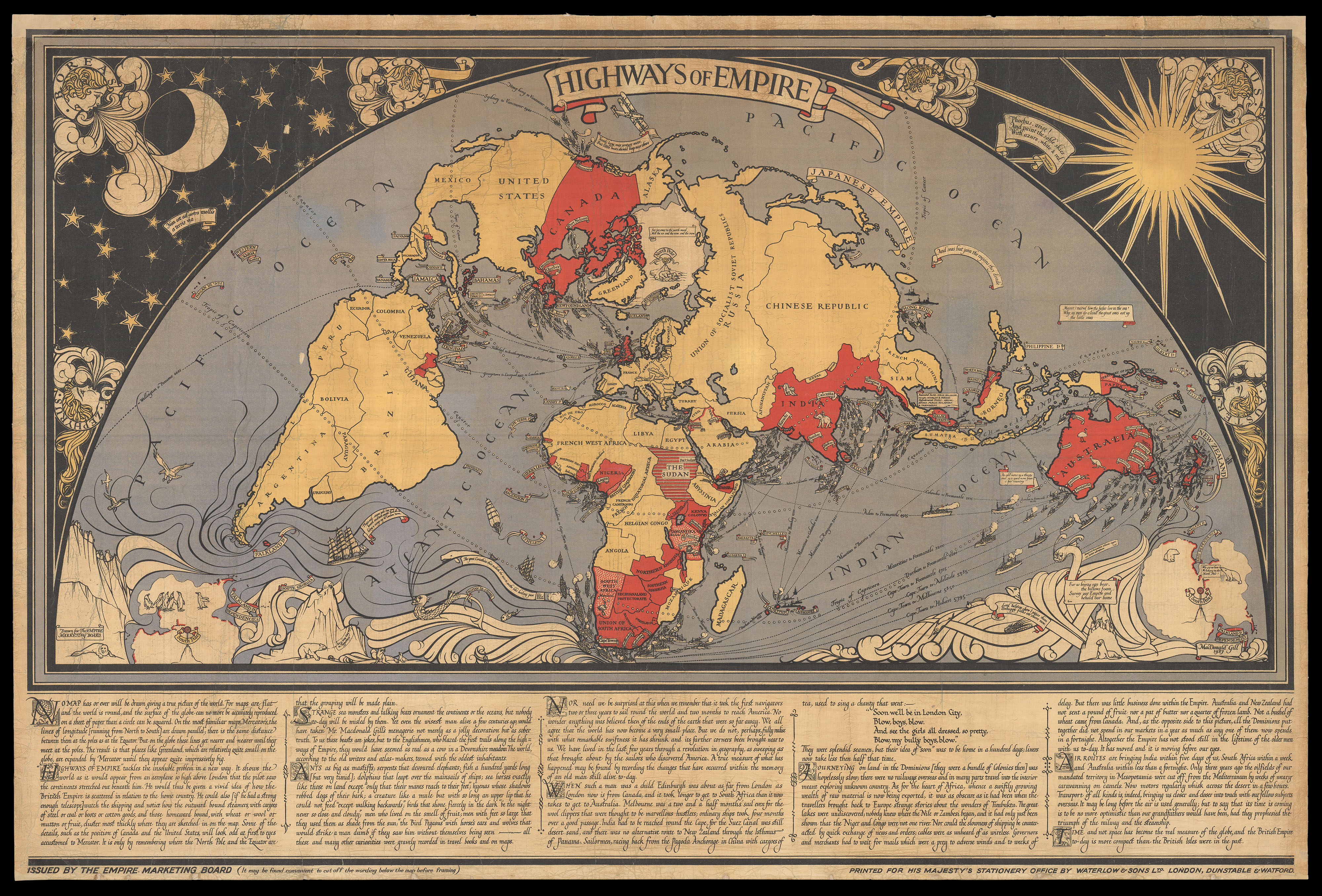 So striking "as to cause congestion of the highways of London"
1 × £10,000
So striking "as to cause congestion of the highways of London"
1 × £10,000 -
×
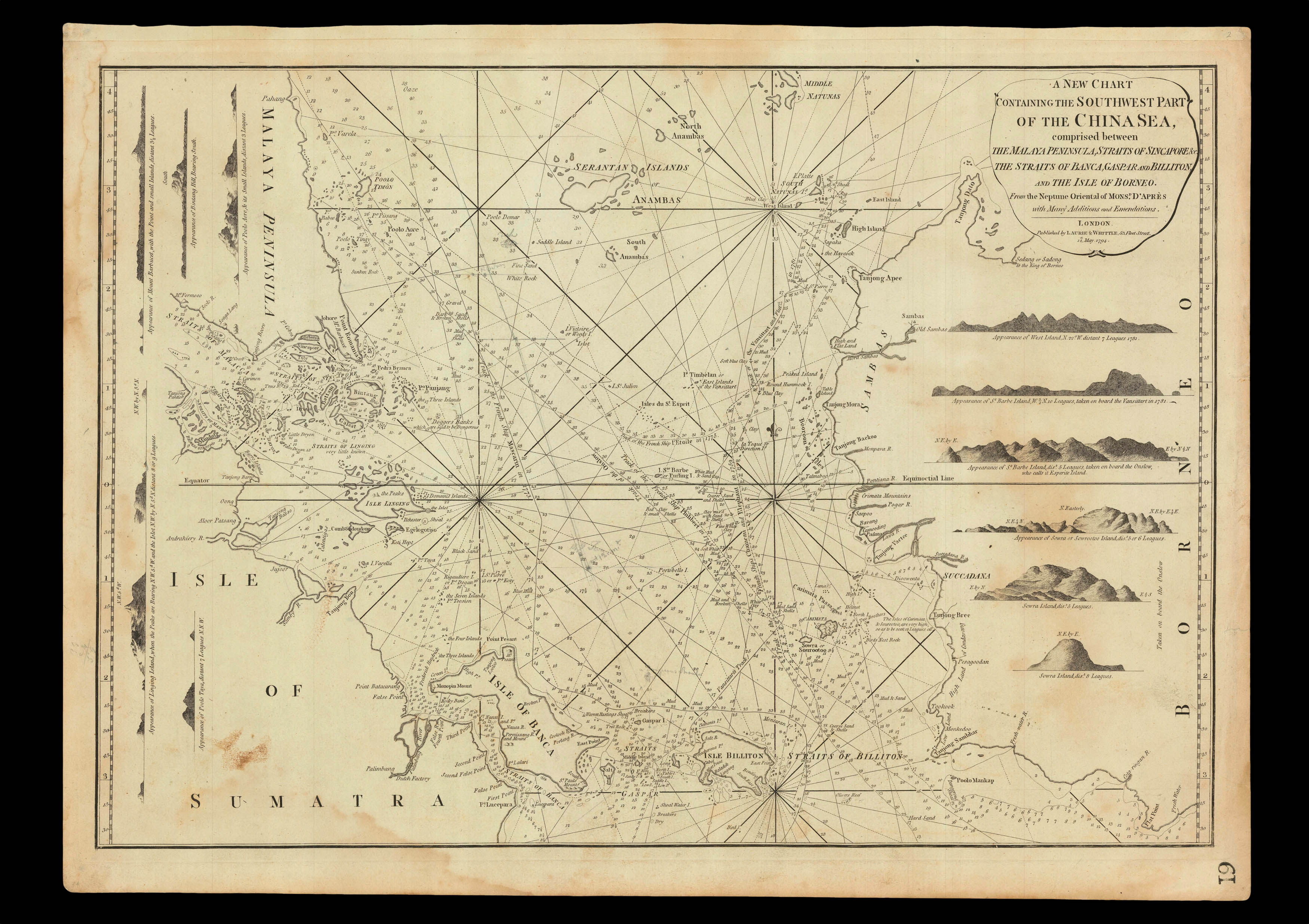 Detailed chart of the Singapore Strait
1 × £3,700
Detailed chart of the Singapore Strait
1 × £3,700 -
×
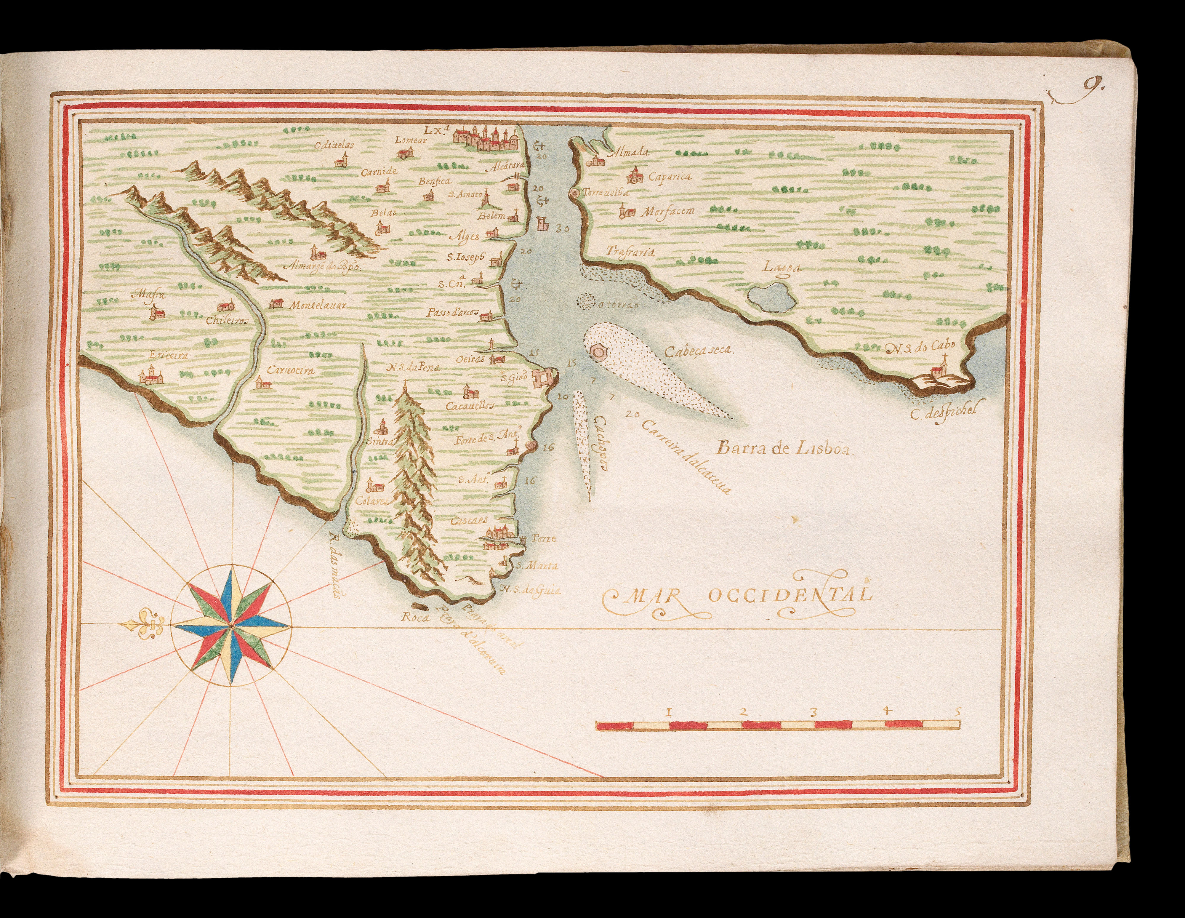 Beautiful Portolan of the Portuguese Coast
1 × £50,000
Beautiful Portolan of the Portuguese Coast
1 × £50,000 -
×
 The first European to enter Mecca and Medina
1 × £20,000
The first European to enter Mecca and Medina
1 × £20,000 -
×
![CAMPBELL, Lieutenant [Robert] A New and Correct Map of Scotland or North Britain.](https://omega.crouchrarebooks.com/wp-content/uploads/2025/03/16491_1H.jpg) Campbell's map of Scotland
1 × £2,500
Campbell's map of Scotland
1 × £2,500 -
×
![PTOLEMAEUS, Claudius [translated by ANGELUS, Jacobus, edited by GERMANUS, Nicolaus] [Southeast Asia] Undecima Asie tabula.](https://omega.crouchrarebooks.com/wp-content/uploads/2025/03/18410_1H.jpg) A striking map of Southeast Asia from the 1482 Ulm Ptolemy
1 × £37,500
A striking map of Southeast Asia from the 1482 Ulm Ptolemy
1 × £37,500 -
×
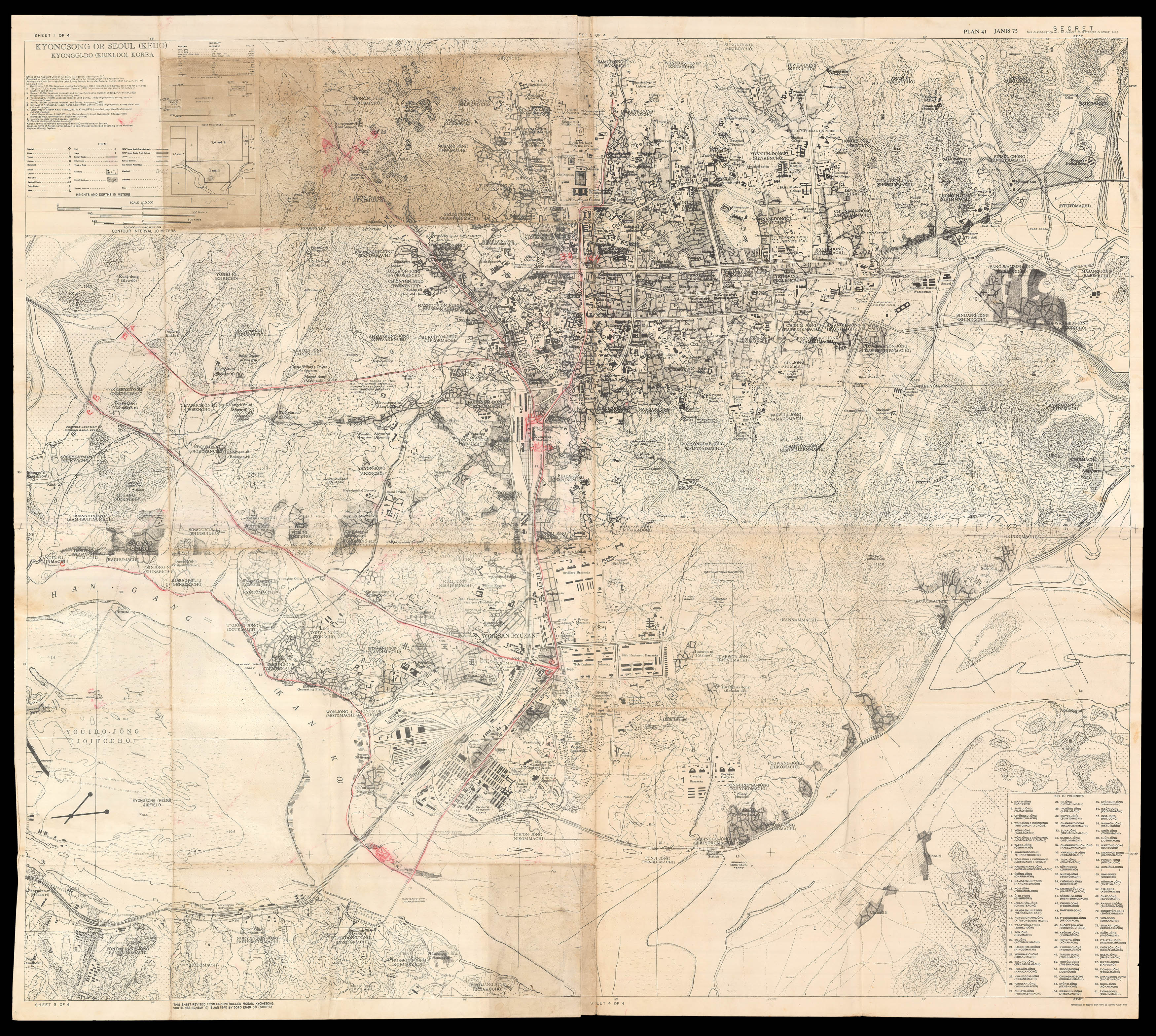 Seoul at the moment of the division of Korea
1 × £5,000
Seoul at the moment of the division of Korea
1 × £5,000 -
×
![PTOLEMAEUS, Claudius [translated by ANGELUS, Jacobus, edited by GERMANUS, Nicolaus] [Africa] Quarta et Ultima Affrice Tabula.](https://omega.crouchrarebooks.com/wp-content/uploads/2025/03/18402_1H.jpg) A striking map of Africa from the 1482 Ulm Ptolemy
1 × £30,000
A striking map of Africa from the 1482 Ulm Ptolemy
1 × £30,000 -
×
![KIP, Johannes A Prospect of the City of London [with] A Prospect of Westminster.](https://omega.crouchrarebooks.com/wp-content/uploads/2025/03/12591_1H.jpg) London's calling
1 × £12,000
London's calling
1 × £12,000 -
×
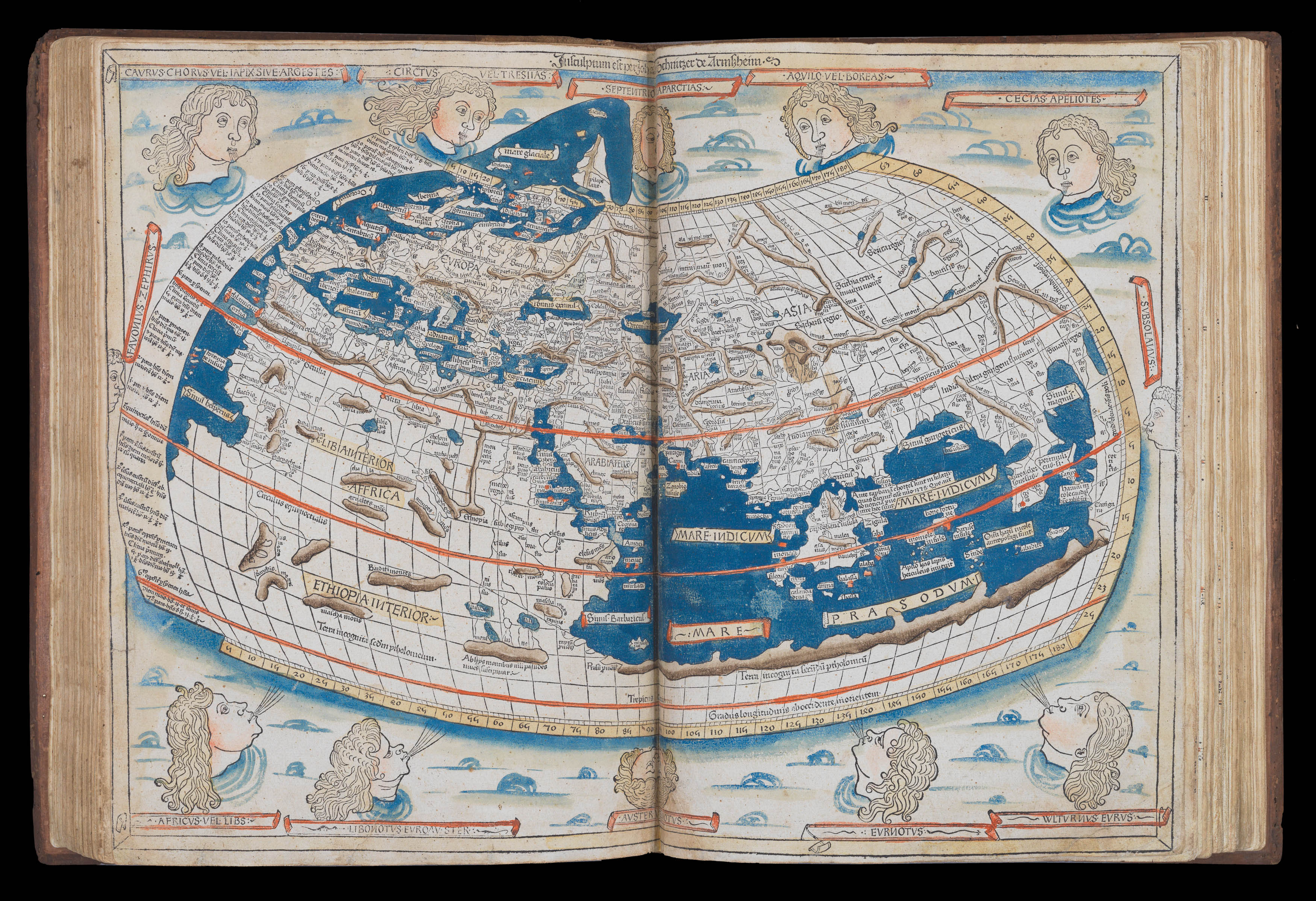 The world Columbus knew – Ptolemy's Second Projection, and the first map signed by its author
1 × £1,200,000
The world Columbus knew – Ptolemy's Second Projection, and the first map signed by its author
1 × £1,200,000 -
×
![PTOLEMAEUS, Claudius [translated by ANGELUS, Jacobus, edited by GERMANUS, Nicolaus] [Germany] Quarta Europe Tabula](https://omega.crouchrarebooks.com/wp-content/uploads/2025/03/18390_1H.jpg) A striking map of Germany from the 1482 Ulm Ptolemy
1 × £12,000
A striking map of Germany from the 1482 Ulm Ptolemy
1 × £12,000 -
×
![PTOLEMAEUS, Claudius [translated by ANGELUS, Jacobus, edited by GERMANUS, Nicolaus] [North Africa, Sardinia and Sicily] Secunda Affrice Tabula.](https://omega.crouchrarebooks.com/wp-content/uploads/2025/03/18400_1H.jpg) A striking map of North Africa, Sardinia and Sicily from the 1482 Ulm Ptolemy
1 × £7,500
A striking map of North Africa, Sardinia and Sicily from the 1482 Ulm Ptolemy
1 × £7,500 -
×
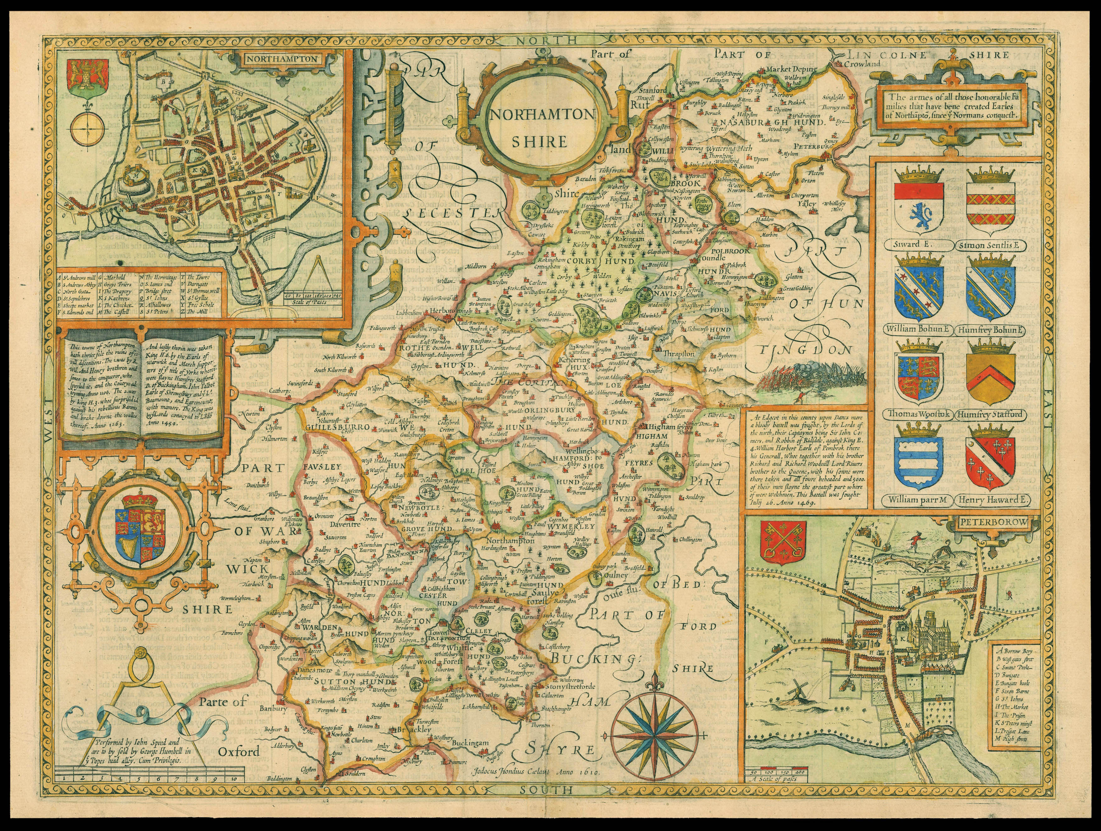 Speed's map of Northamptonshire
1 × £700
Speed's map of Northamptonshire
1 × £700 -
×
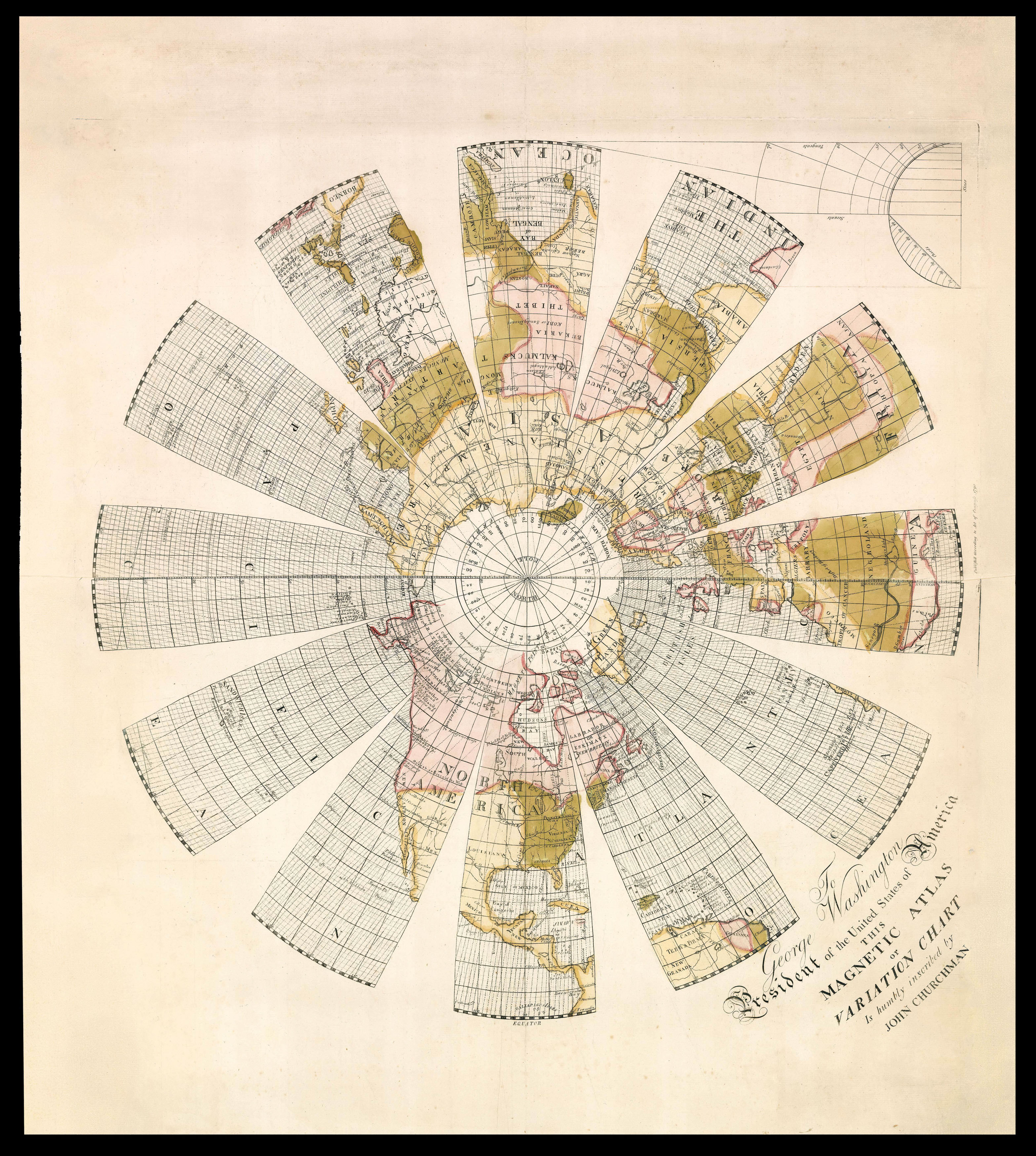 A presentation copy of the last gasp for Edmund Halley's theory for the determination of longitude by magnetic declination
1 × £50,000
A presentation copy of the last gasp for Edmund Halley's theory for the determination of longitude by magnetic declination
1 × £50,000 -
×
![PTOLEMAEUS, Claudius [translated by ANGELUS, Jacobus, edited by GERMANUS, Nicolaus] [Balkans] Nona Europe tabula.](https://omega.crouchrarebooks.com/wp-content/uploads/2025/03/18445_1H.jpg) A striking map of Balkans from the 1482 Ulm Ptolemy
1 × £12,000
A striking map of Balkans from the 1482 Ulm Ptolemy
1 × £12,000 -
×
![PTOLEMAEUS, Claudius [translated by ANGELUS, Jacobus, edited by GERMANUS, Nicolaus] [Himilayas and Central Asia] Octava Asie tabula.](https://omega.crouchrarebooks.com/wp-content/uploads/2025/03/18407_1H.jpg) A striking map of the Himilayas and Central Asia and China from the 1482 Ulm Ptolemy
1 × £9,000
A striking map of the Himilayas and Central Asia and China from the 1482 Ulm Ptolemy
1 × £9,000 -
×
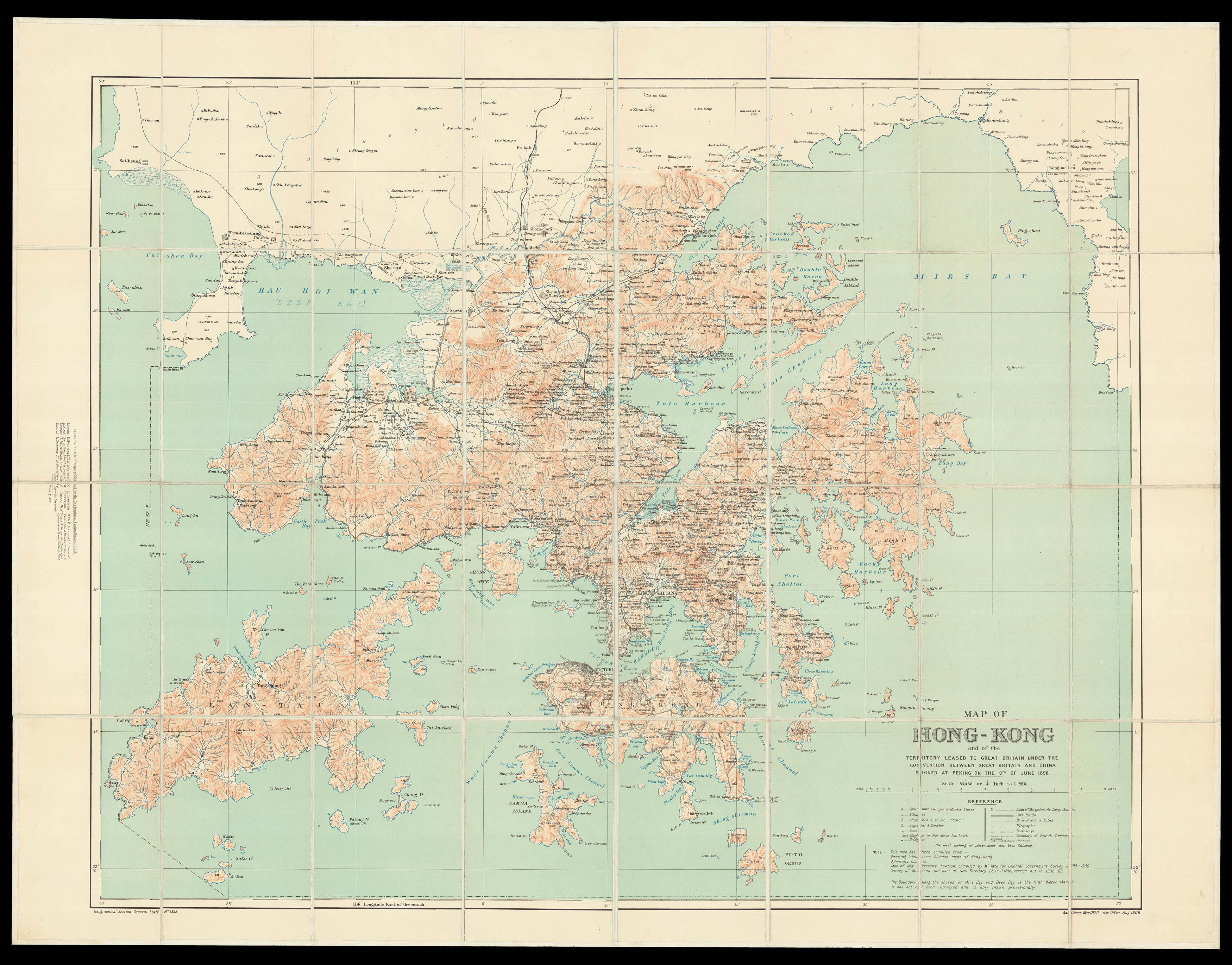 Hong Kong - the ailing Qing dynasty leased to Great Britain, 1898
1 × £7,000
Hong Kong - the ailing Qing dynasty leased to Great Britain, 1898
1 × £7,000 -
×
 Plan of London showing troop dispositions
1 × £1,500
Plan of London showing troop dispositions
1 × £1,500 -
×
![HORSBURGH, James and INGLIS Sir Hugh [Two autograph letters concerning the East India Company and the War of 1812].](https://omega.crouchrarebooks.com/wp-content/uploads/2025/03/18376_1H.jpg) "more knowledge of the Eastern Seas than perhaps any other man"
1 × £3,000
"more knowledge of the Eastern Seas than perhaps any other man"
1 × £3,000 -
×
 "...being the best for LEAKY VESSELS, during the strength of the S.W. Monsoon"
1 × £5,750 -
×
![VINKELES, Reinier; [after] BUYS, J[acobus] Casparus Barlaeus.](https://omega.crouchrarebooks.com/wp-content/uploads/2025/03/17746_1H.jpg) Caspar Barlaeus
1 × £250
Caspar Barlaeus
1 × £250 -
×
![HEUMANN, G[eorg]. D[aniel] [Eight views of London]](https://omega.crouchrarebooks.com/wp-content/uploads/2025/03/12404_1H.jpg) Eight views from a member of the Nuremberg Academy
1 × £3,200
Eight views from a member of the Nuremberg Academy
1 × £3,200 -
×
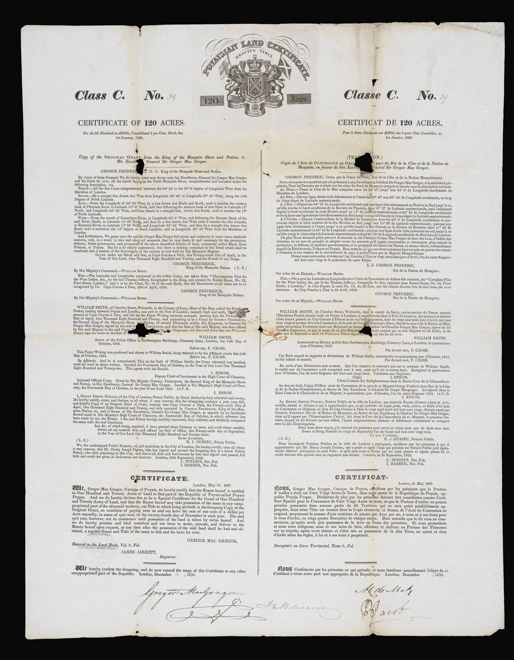 "The Fraud of the Prince of Poyais"
1 × £800
"The Fraud of the Prince of Poyais"
1 × £800 -
×
![DEAN, T.; [after] H.W. PICKERSGILL Aaron Arrowsmith Ætat. 72. Obiit. 1828.](https://omega.crouchrarebooks.com/wp-content/uploads/2025/03/17716_1H.jpg) Aaron Arrowsmith
1 × £500
Aaron Arrowsmith
1 × £500 -
×
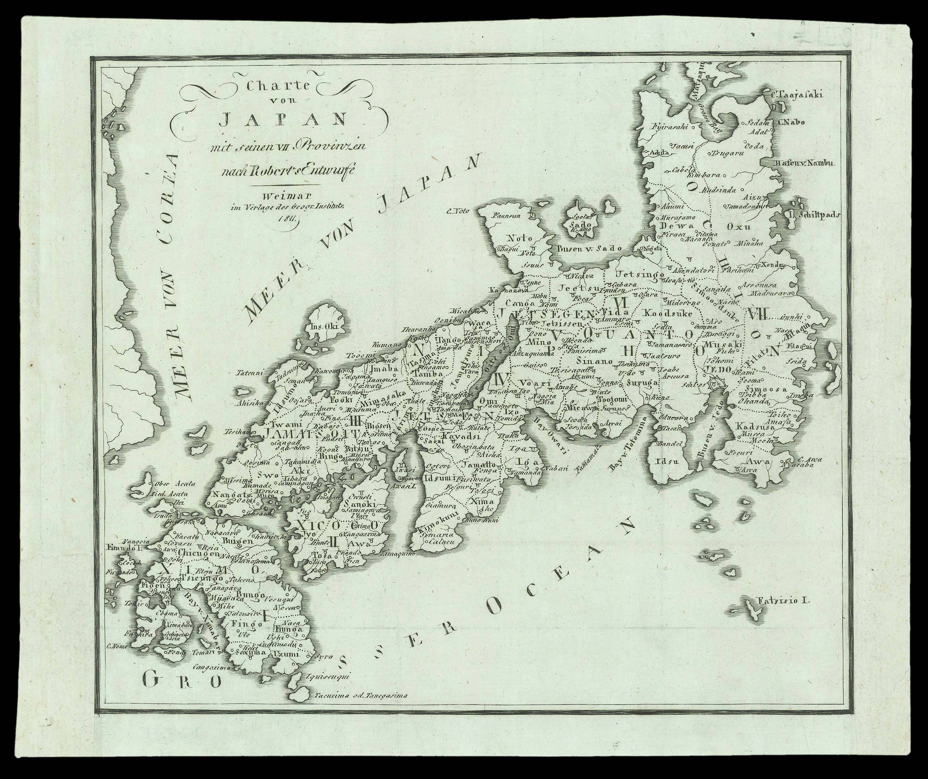
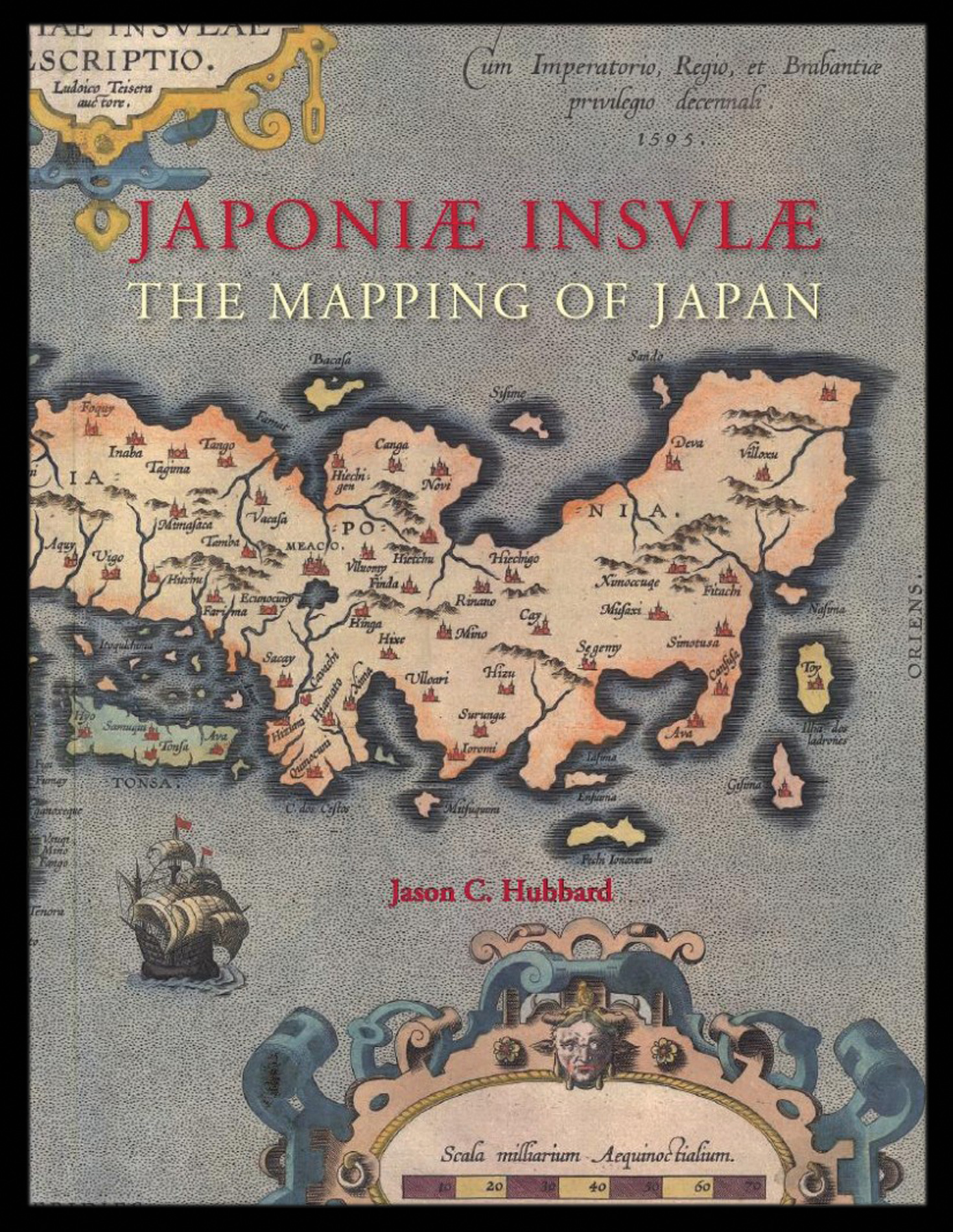 Hubbard's cartobibliography of Japan
1 × £159
Hubbard's cartobibliography of Japan
1 × £159 -
×
 A German reprint after Gilles Robert de Vaugondy
1 × £175
A German reprint after Gilles Robert de Vaugondy
1 × £175

Rare Maps

Rare Atlases

Rare Books

Rare Prints

![SAXTON, Christopher [Radnor, Breconshire, Cardiganshire and Carmarthenshire] Radnor Breknok Cardigan et Caermarden](https://omega.crouchrarebooks.com/wp-content/uploads/2025/03/15371_1H.jpg)
![EVANS, John [North Wales].](https://omega.crouchrarebooks.com/wp-content/uploads/2025/03/1367_1H.jpg)
![SAXTON, Christopher [Anglesey and Caernarfon] Mone Insulae modo Anglesey, et Caernaruan<br />](https://omega.crouchrarebooks.com/wp-content/uploads/2025/03/15373_1H.jpg)