-
×
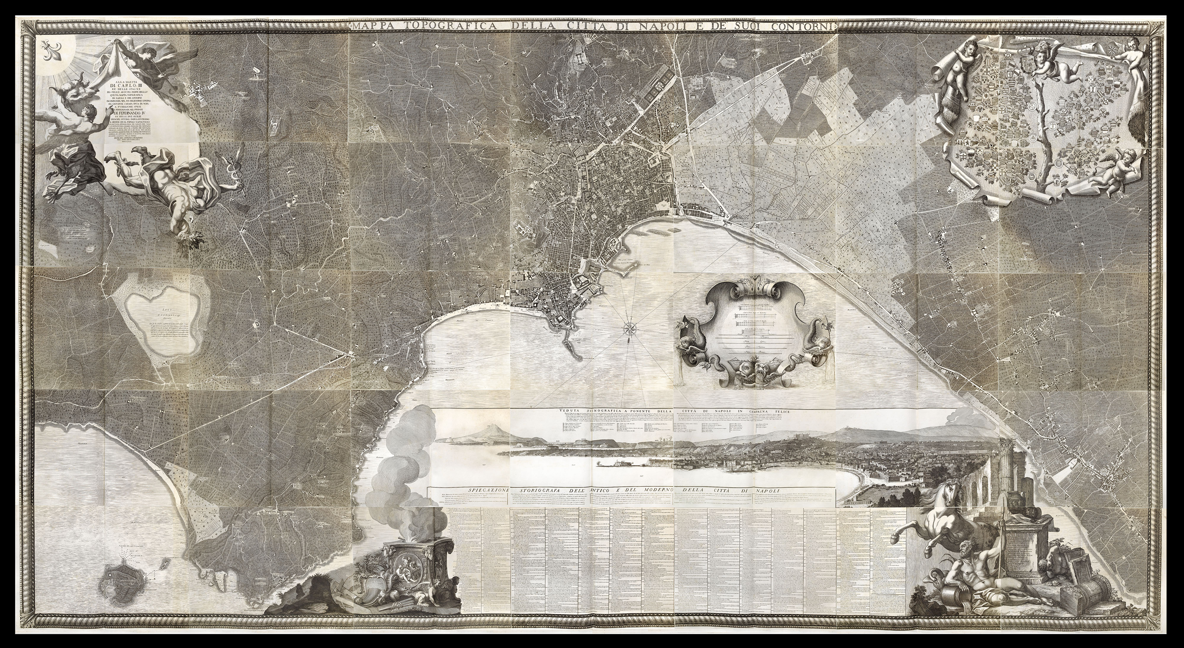 Carletti's magnificent plan of Naples
1 × £45,000
Carletti's magnificent plan of Naples
1 × £45,000

Rare Maps

Rare Atlases

Rare Books

Rare Prints

![[?BOAZIO, Giovanni Battista] S. Iacob.](https://omega.crouchrarebooks.com/wp-content/uploads/2025/03/15989_1H.jpg)

![[OUR HALF SHARE] READ, R. P. This Geographical Plan of The Island & Forts of Saint Helena](https://omega.crouchrarebooks.com/wp-content/uploads/2025/03/2535_1H.jpg)
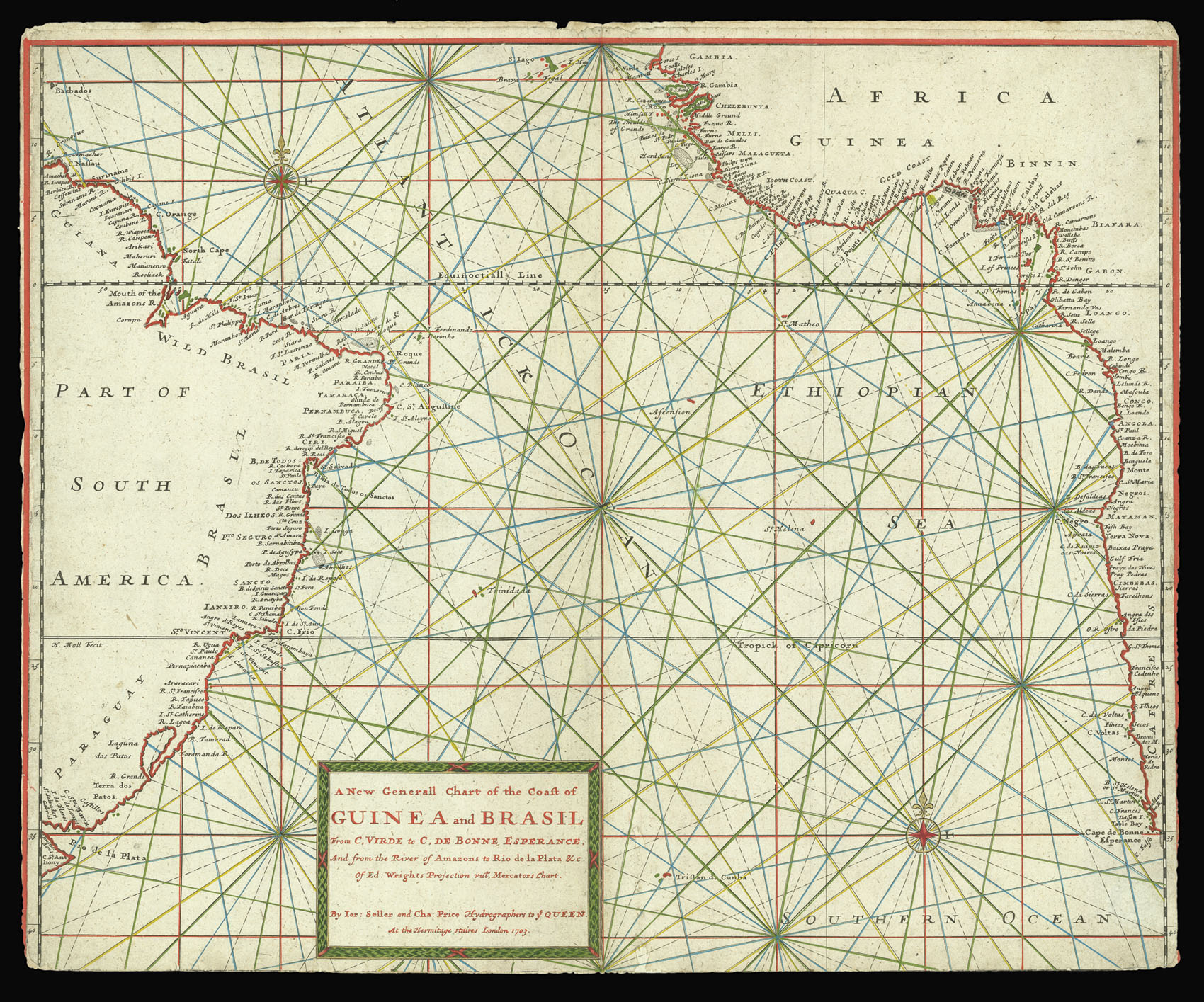
By SELLER, Jeremiah and PRICE, Charles, 1703
![LASH, J[oseph] A Draught of the River Senegal,](https://omega.crouchrarebooks.com/wp-content/uploads/2025/03/2394_1H.jpg)
![INTELLIGENCE DIVISION OF THE WAR OFFICE [Six Maps of Nigeria] Sokoto Sheet 50; Kano Sheet 51; Lake Chad Sheet 52; Nikki Sheet 61; Central Nigeria Sheet 62; Yola Sheet 63.](https://omega.crouchrarebooks.com/wp-content/uploads/2025/03/13946_1H.jpg)
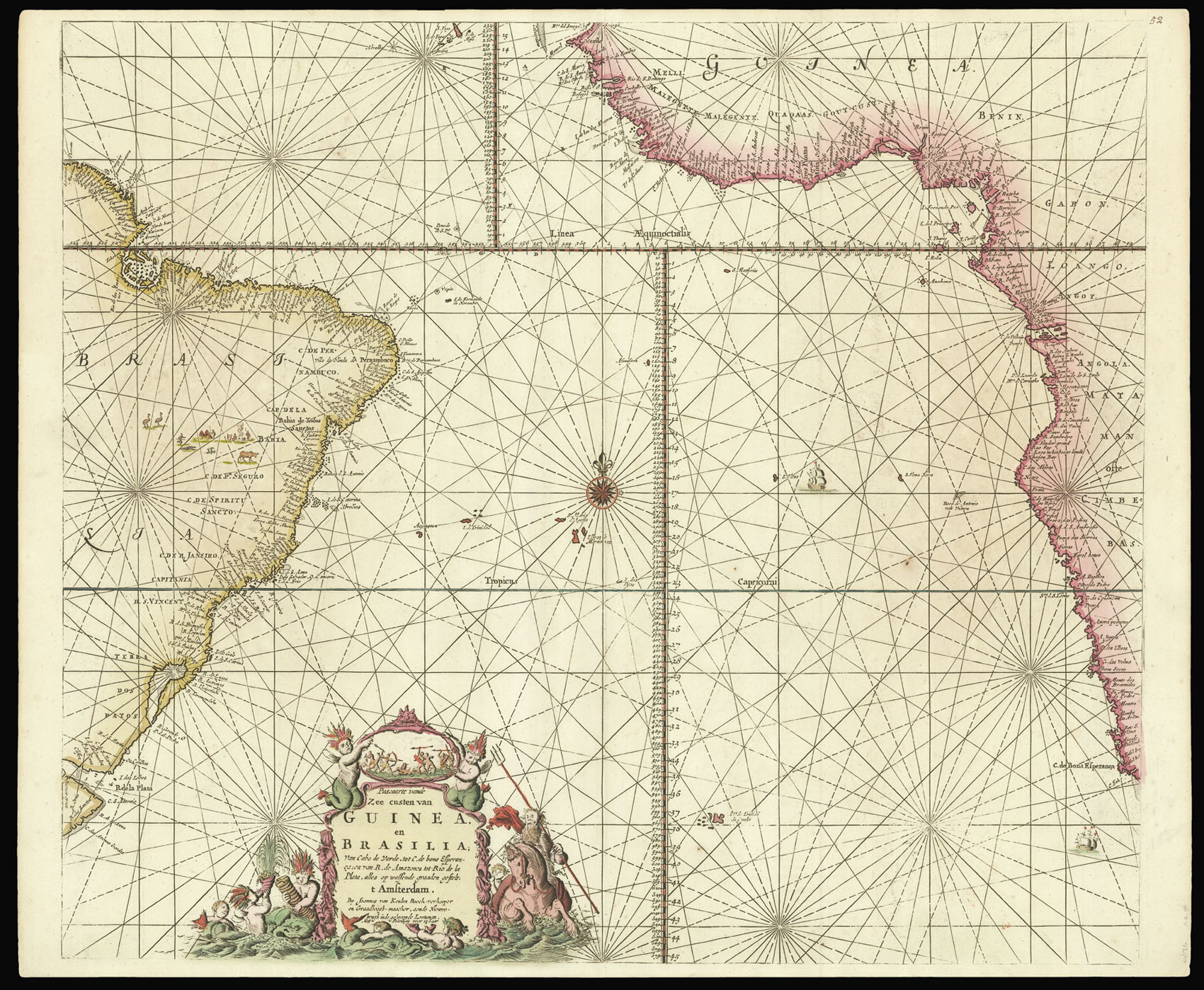
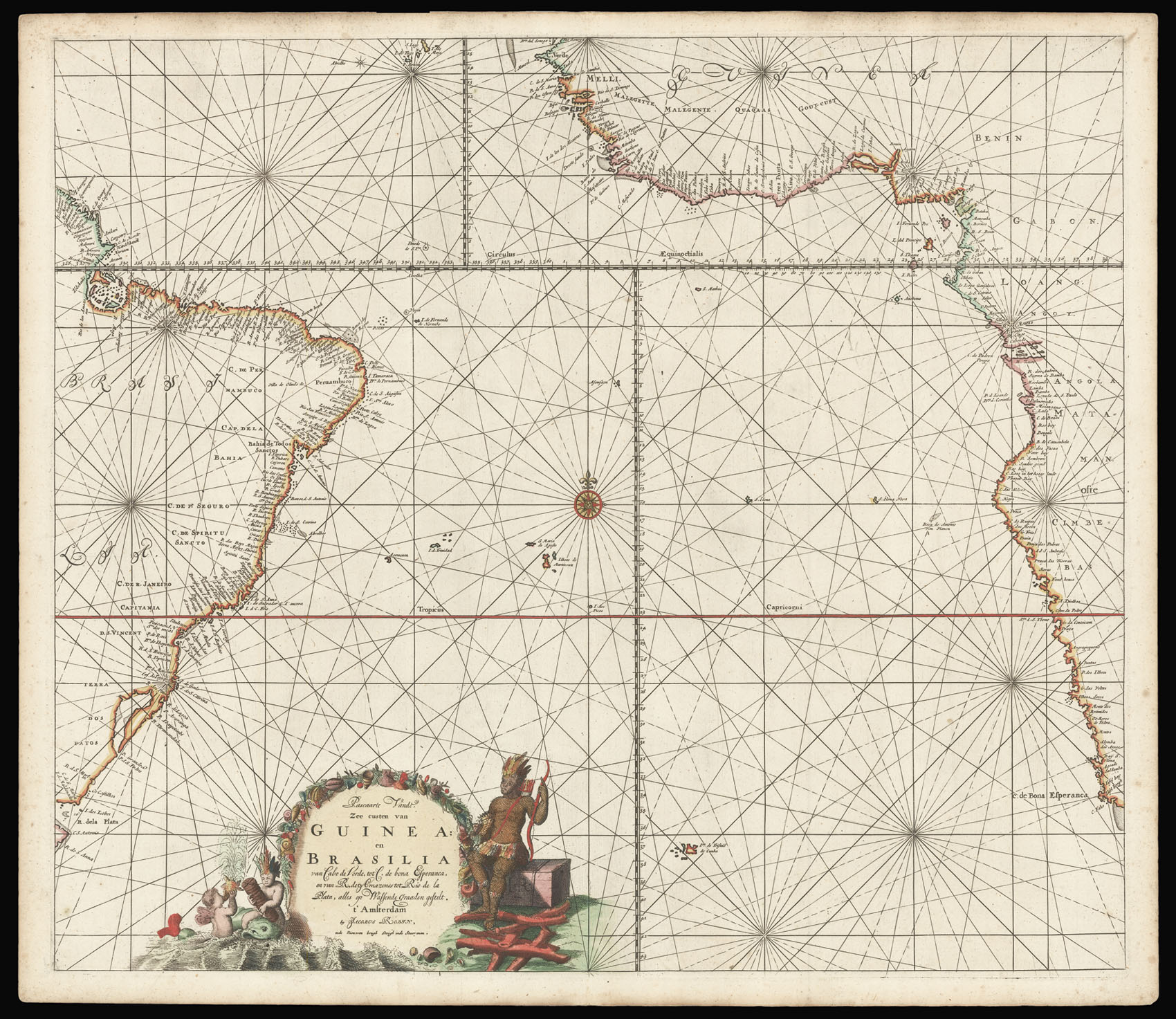
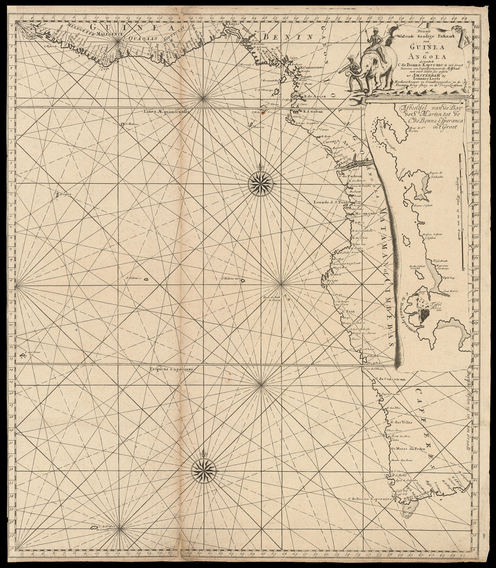
By KEULEN, Johannes II van and KEULEN, Gerard van, [c1728].