|
× |
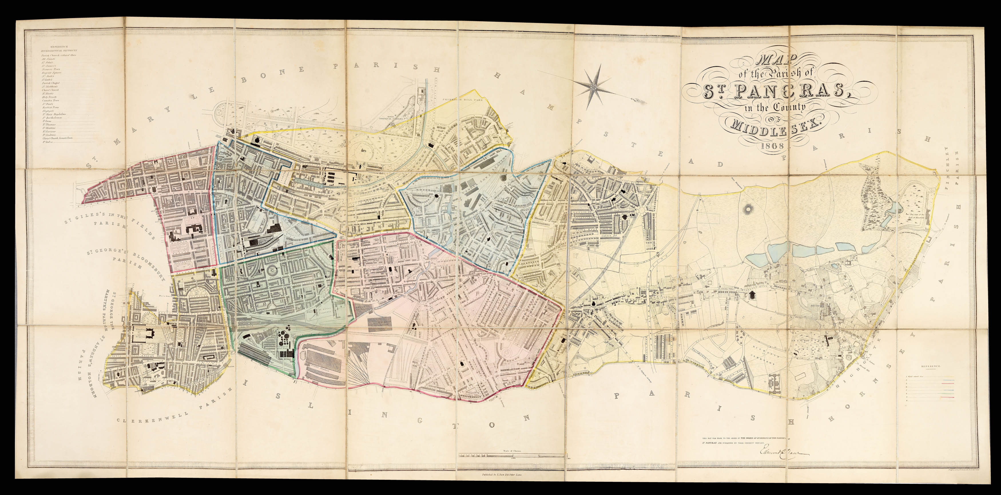 |
Daw's detailed plan of mid-Victorian St Pancras
1 x
£4,500
|
£4,500 |
|
£4,500 |
|
× |
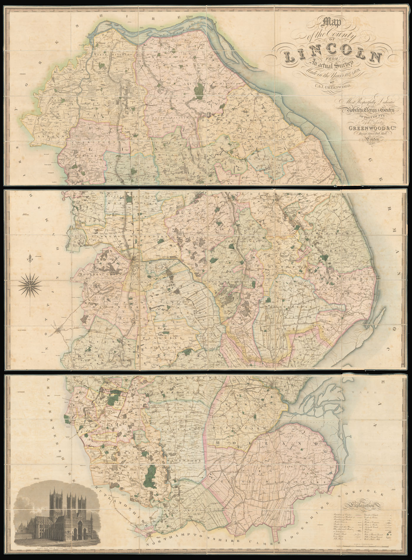 |
Greenwood's large-scale map of Lincolnshire
1 x
£1,500
|
£1,500 |
|
£1,500 |
|
× |
![HEYWOOD, Captain P[eter] The Typa and Harbour of Macao.](https://omega.crouchrarebooks.com/wp-content/uploads/2025/03/22648_1H.jpg) |
Captain Heywood's chart of Macau
1 x
£9,000
|
£9,000 |
|
£9,000 |
|
× |
![[Anonymous] Attaque de Landau commencé la nuit de 24 au 25 juin et compris le 19 Aout 1713 quil a capitulé](https://omega.crouchrarebooks.com/wp-content/uploads/2025/03/11380_1H.jpg) |
Manuscript map of Landau
1 x
£2,200
|
£2,200 |
|
£2,200 |
|
× |
![HUANG, Qianren [Complete Geographical Map of the Everlasting Unified Qing Empire].](https://omega.crouchrarebooks.com/wp-content/uploads/2025/03/20129_1H.jpg) |
The "Blue Map" of the World
1 x
£400,000
|
£400,000 |
|
£400,000 |
|
× |
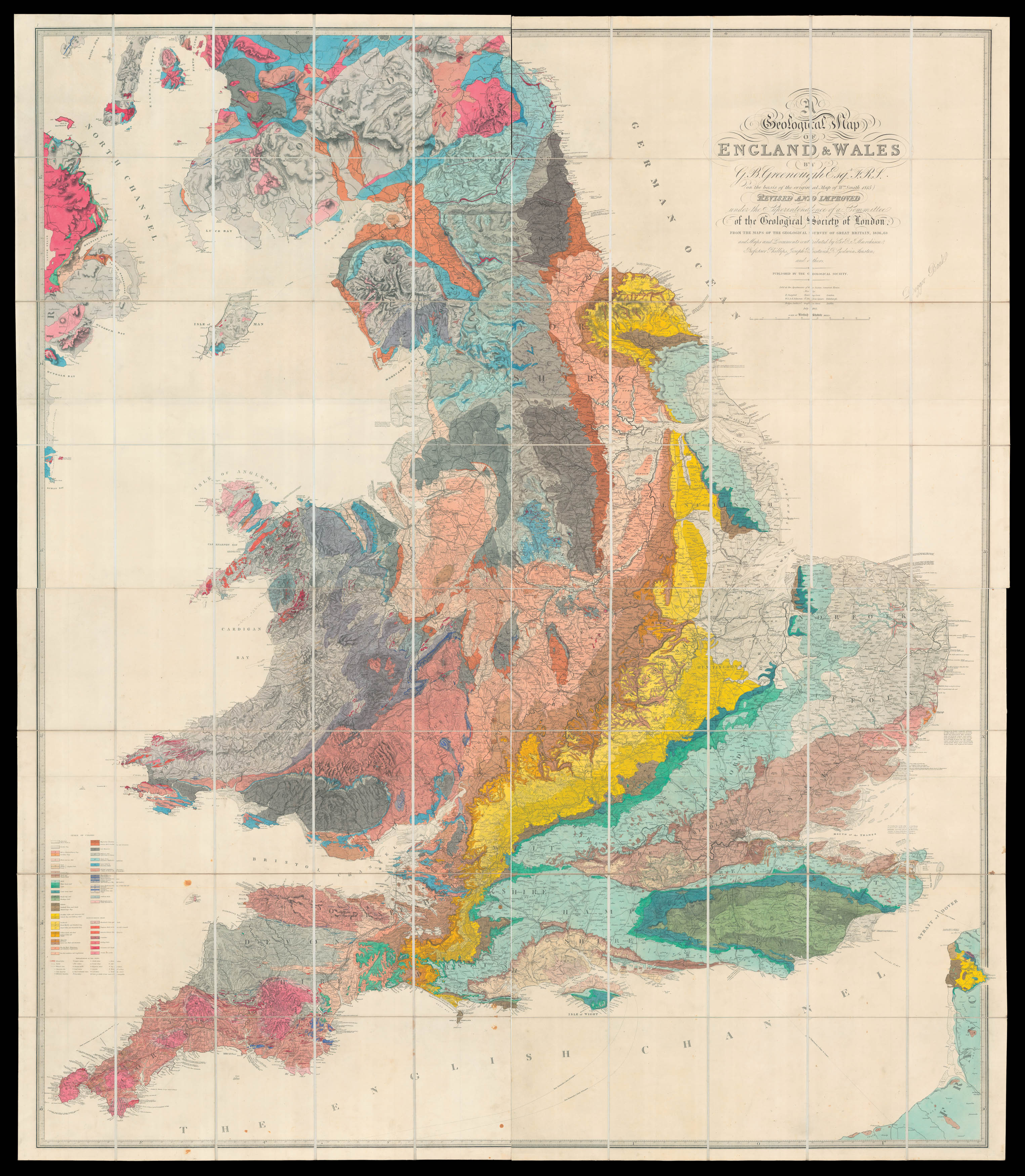 |
Greenough recognises his debt to William Smith
1 x
£18,500
|
£18,500 |
|
£18,500 |
|
× |
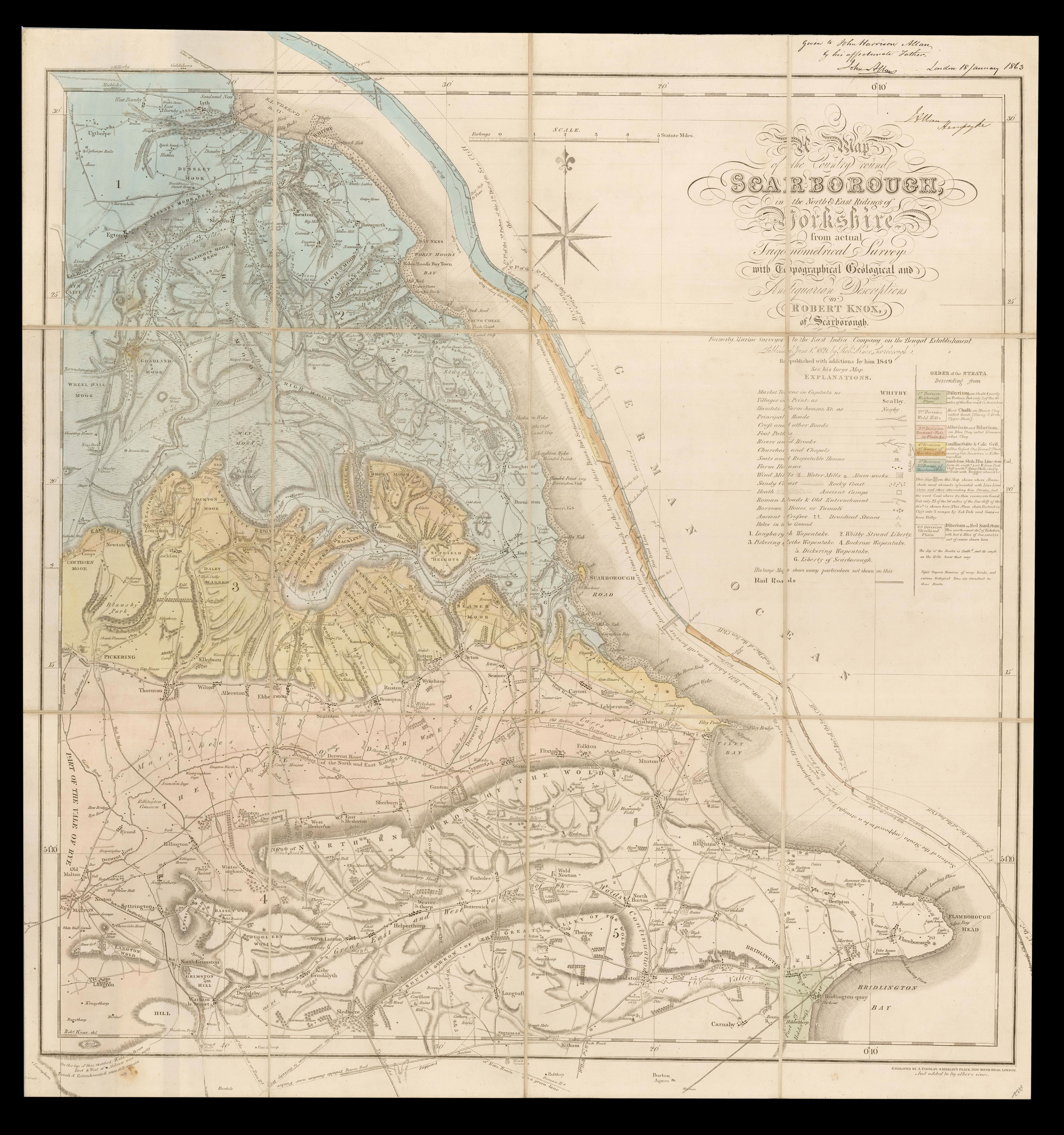 |
A delineation of the strata around Scarborough
1 x
£450
|
£450 |
|
£450 |
|
× |
![RIGAUD, [Jacques] Prospect of St James Park from Bukingham House](https://omega.crouchrarebooks.com/wp-content/uploads/2025/03/12360_1H.jpg) |
The view from Buckingham Palace
1 x
£2,500
|
£2,500 |
|
£2,500 |
|
× |
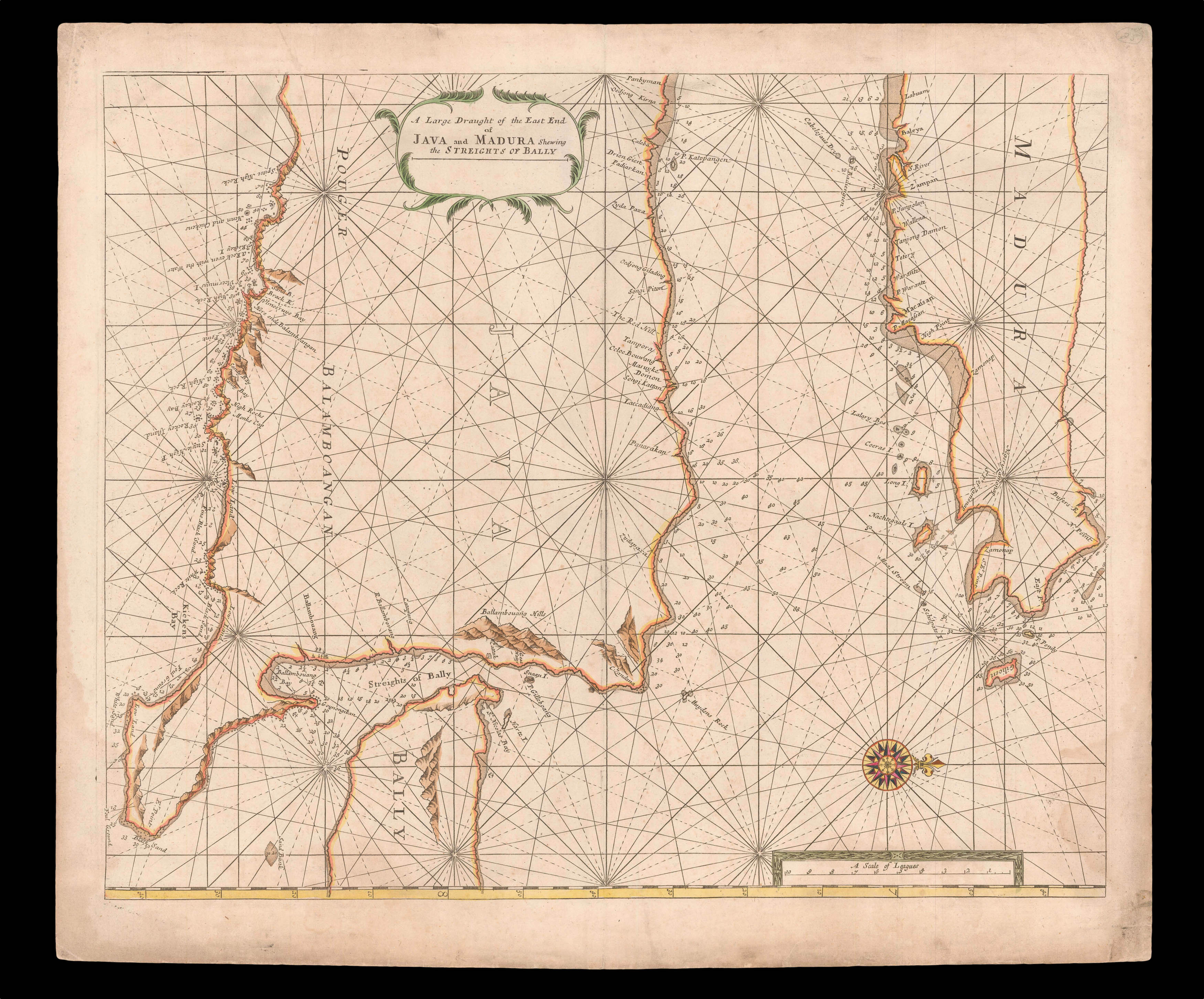 |
The Bali Strait
1 x
£750
|
£750 |
|
£750 |
|
× |
![HORSBURGH, James; and Captain Daniel ROSS China Sea - Sheet I [and] Sheet II](https://omega.crouchrarebooks.com/wp-content/uploads/2025/03/17533_1H.jpg) |
"The best route towards China for leaky crazy ships during the strength of the S.W. Monsoon"
1 x
£2,900
|
£2,900 |
|
£2,900 |
|
× |
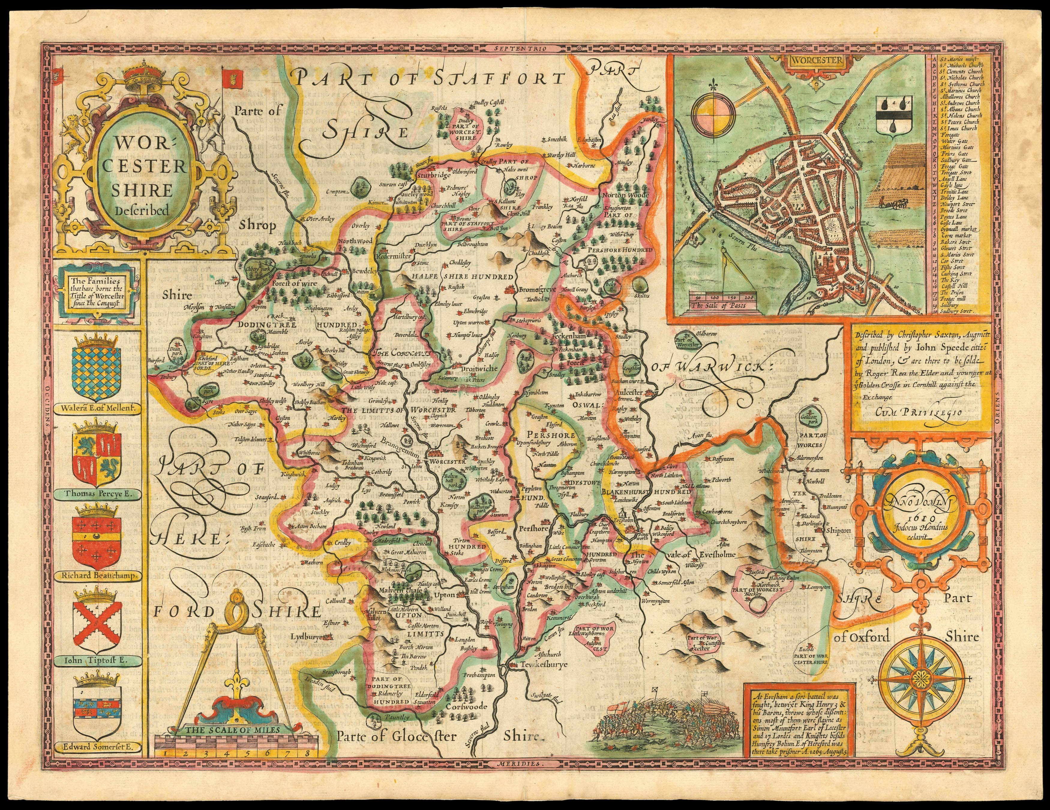 |
Rare Roger Rea edition of Speed's map of Worcestershire
1 x
£1,200
|
£1,200 |
|
£1,200 |
|
× |
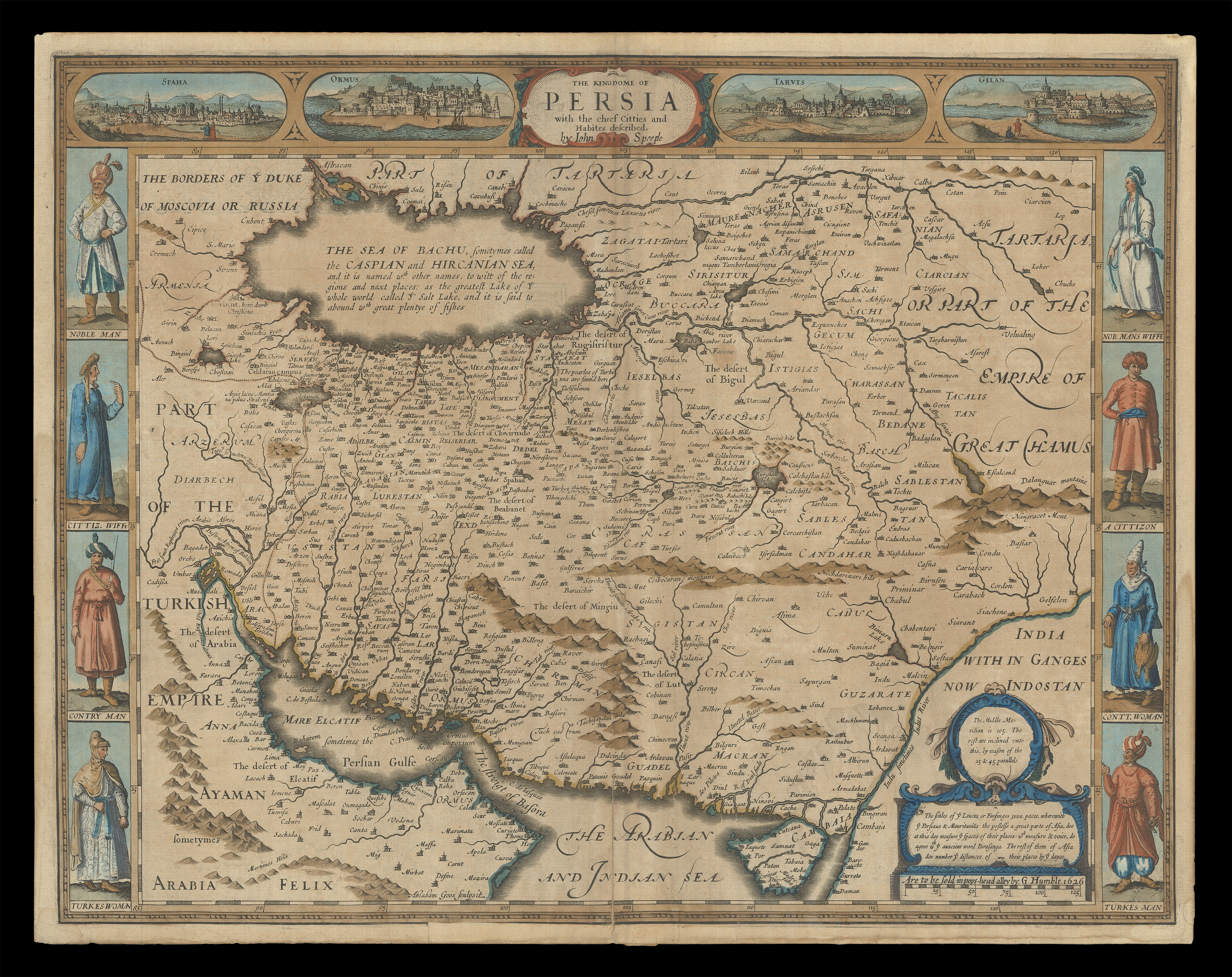 |
Speed's map of Persia
1 x
£1,800
|
£1,800 |
|
£1,800 |
|
× |
![JANSSONIUS, Johannes [Middlesex and Hertfordshire] Middelsexiae cum Hertfordiae comitatu Midlesex & Hertford Shire.](https://omega.crouchrarebooks.com/wp-content/uploads/2025/03/1857_1H.jpg) |
Middlesex and Hertfordshire
1 x
£1,200
|
£1,200 |
|
£1,200 |
|
× |
![PTOLEMAEUS, Claudius [translated by ANGELUS, Jacobus, edited by GERMANUS, Nicolaus] [Central Asia and China] Septima Asie tabula.](https://omega.crouchrarebooks.com/wp-content/uploads/2025/03/18406_1H.jpg) |
A striking map of Central Asia and China from the 1482 Ulm Ptolemy
1 x
£12,000
|
£12,000 |
|
£12,000 |
|
× |
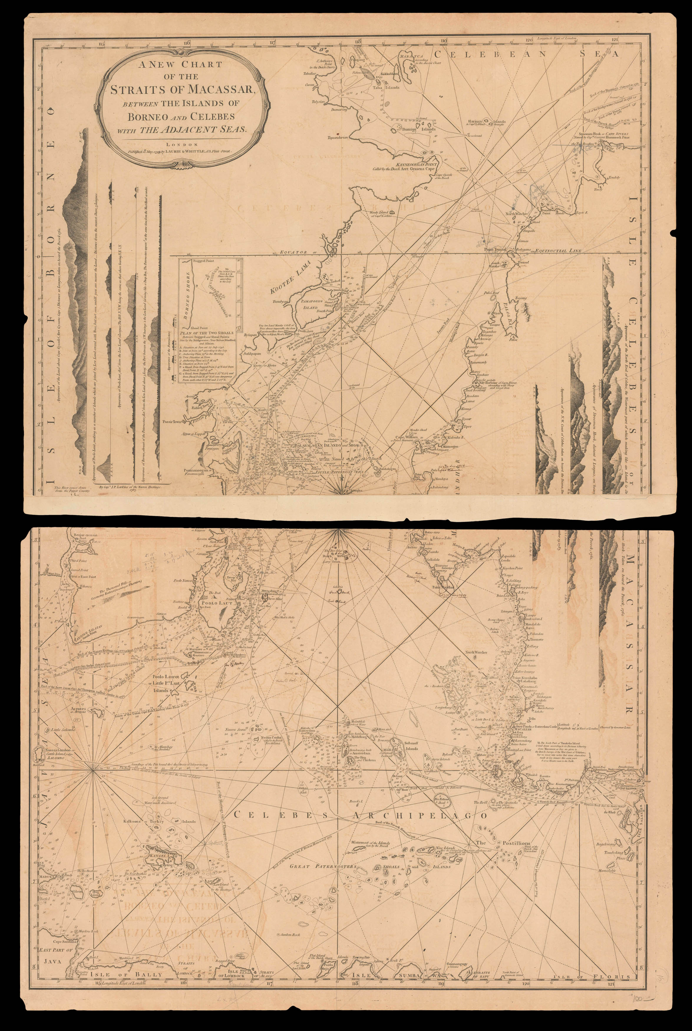 |
The many islands of the Celebes archipelago
1 x
£750
|
£750 |
|
£750 |
|
× |
![LE SAGE, P. Carte depuis la fin du Detroit de la Sonde jusqu'a la fin D'Etroit de Banca faitte en l'anne 1734 – [Singapore Strait] – [South China Sea].](https://omega.crouchrarebooks.com/wp-content/uploads/2025/03/17525_1H.jpg) |
Charting a voyage of nearly two thousand nautical miles from the Sunda Strait to Hong Kong
1 x
£87,000
|
£87,000 |
|
£87,000 |
|
× |
 |
Half a tent is better than none...
1 x
£5,000
|
£5,000 |
|
£5,000 |
|
× |
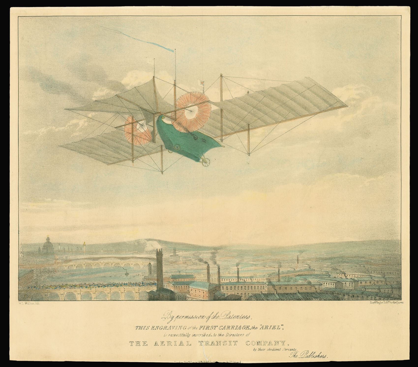 |
The first aeroplane?
1 x
£1,150
|
£1,150 |
|
£1,150 |
|
× |
 |
Superb facsimile of the Vatican's Ptolemy Cosmographia of 1472
1 x
£6,000
|
£6,000 |
|
£6,000 |
|
× |
 |
Rocque's Index to his monumental 24-sheet plan of London
1 x
£1,500
|
£1,500 |
|
£1,500 |
|
|


