Rare Maps

Rare Atlases

Rare Books

Rare Prints

![[FOSTER, G.] The Seat of War in the West Indies](https://omega.crouchrarebooks.com/wp-content/uploads/2025/03/11874_1H.jpg)
![CAMPBELL, Lieutenant [Robert] A New and Correct Map of Scotland or North Britain.](https://omega.crouchrarebooks.com/wp-content/uploads/2025/03/16491_1H.jpg)
![ROCQUE, John [Berkshire] A Topographical Survey of the County of Berks,](https://omega.crouchrarebooks.com/wp-content/uploads/2025/03/14994_1H.jpg)
![OLIVIER, F[rançois] Nouvelle Carte de la Mer Mediterranee](https://omega.crouchrarebooks.com/wp-content/uploads/2025/03/1303_1H.jpg)
By ROCQUE, John, [1747].


![BAUERKELLER, G[eorge] Bauerkeller's New Embossed Plan of London 1841](https://omega.crouchrarebooks.com/wp-content/uploads/2025/03/12163_1H.jpg)
By BAUERKELLER, G[eorge], 1841
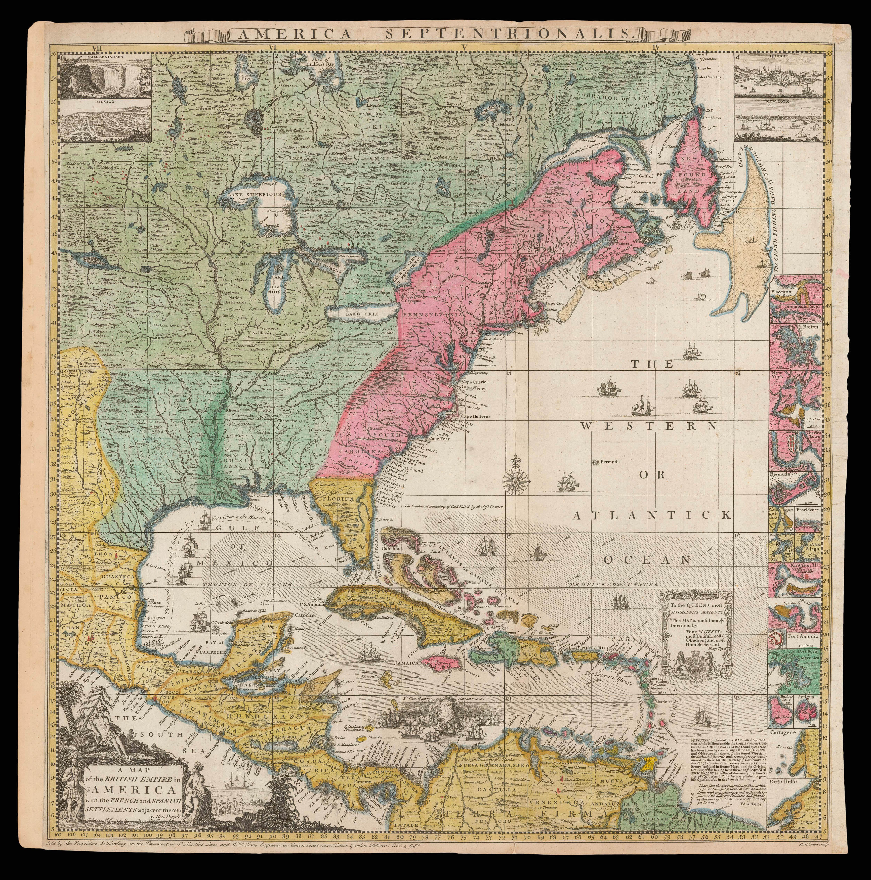
By POPPLE, Henry, [1741]