No products in the basket.
Return to shop
A fine set of Greenwood’s large-scale county maps
By GREENWOOD, Christopher, 1818-1831.
John Rocque’s large-scale map of Berkshire
By ROCQUE, John, 1761 [and] 1762.
The first printed map of Oxfordshire, Buckinghamshire and Berkshire
By SAXTON, Christopher, 1579
An eighteenth century manuscript plan of Queens Leaze, Bray, Berkshire
By RICHARDSON, Th[omas], 1790
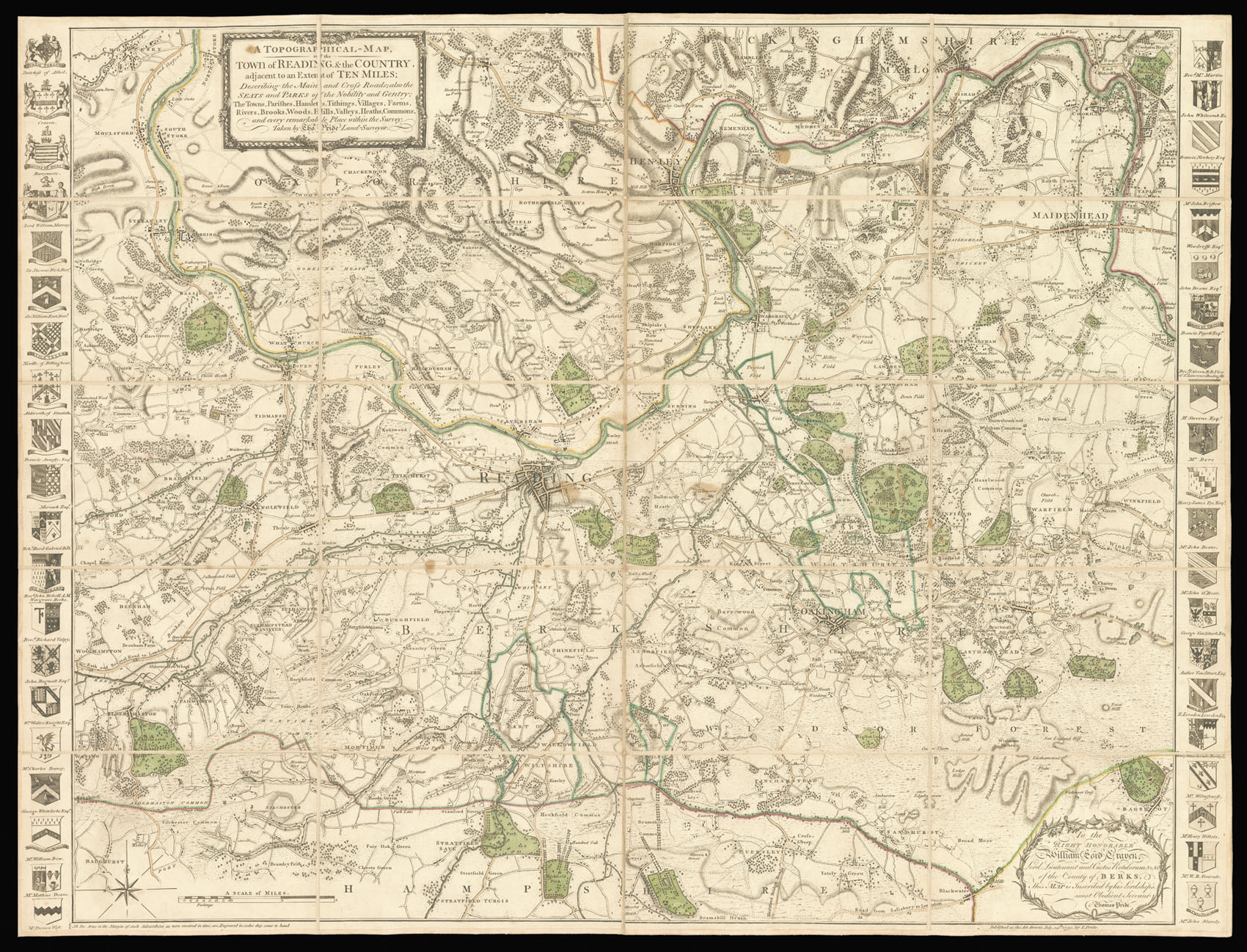
Reading and its environs
By PRIDE, Thomas, July, 24th, 1790.
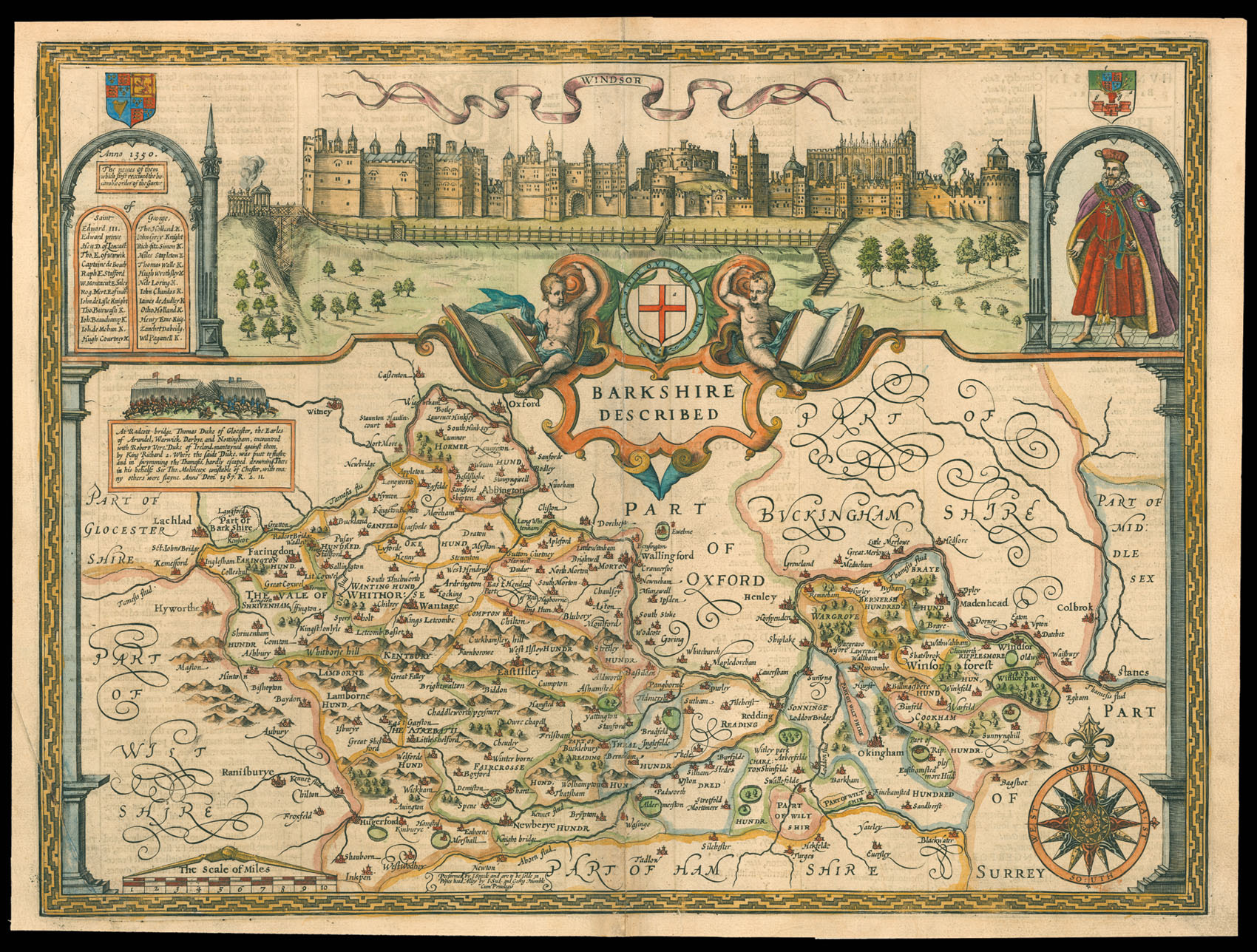
Speed’s map of Berkshire
By SPEED, John, [1627].
Reading and It’s Environs
Rare Roger Rea edition of Speed’s map of Berkshire
By SPEED, John, 1665.
Username or email address *Required
Password *Required
Remember me Log in
Lost your password?
Email address *Required
A link to set a new password will be sent to your email address.
Your personal data will be used to support your experience throughout this website, to manage access to your account, and for other purposes described in our privacy policy.
Register


![GREENWOOD, Christopher [Collection of Greenwood's Large Scale County Maps].](https://omega.crouchrarebooks.com/wp-content/uploads/2025/03/1160_1H.jpg)
![ROCQUE, John [Berkshire] A Topographical Survey of the County of Berks,](https://omega.crouchrarebooks.com/wp-content/uploads/2025/03/14994_1H.jpg)
![SAXTON, Christopher [Oxfordshire, Buckinghamshire and Berkshire] Oxonii buckinghamiae et berceriae Comitatum](https://omega.crouchrarebooks.com/wp-content/uploads/2025/03/17625_1H.jpg)
![SAXTON, Christopher [Oxfordshire, Buckinghamshire and Berkshire] Oxonii buckinghamiae et berceriae Comitatum](https://omega.crouchrarebooks.com/wp-content/uploads/2025/03/15345_1H.jpg)
![RICHARDSON, Th[omas] Plan of Queens Leaze situate in the Manor & Parish of Bray in the County of Berks held by lease from the Crown to Trustees, for the parish of Bray by Th. Richardson & Son Surveyors 1790.](https://omega.crouchrarebooks.com/wp-content/uploads/2025/03/15580_1H.jpg)