|
× |
 |
Half a tent is better than none...
1 x
£5,000
|
£5,000 |
|
£5,000 |
|
× |
![LA SALE, Antoine de La Salade, nouvelleme[n]t imprimee](https://omega.crouchrarebooks.com/wp-content/uploads/2025/03/21873_1H.jpg) |
Salad Days
1 x
£75,000
|
£75,000 |
|
£75,000 |
|
× |
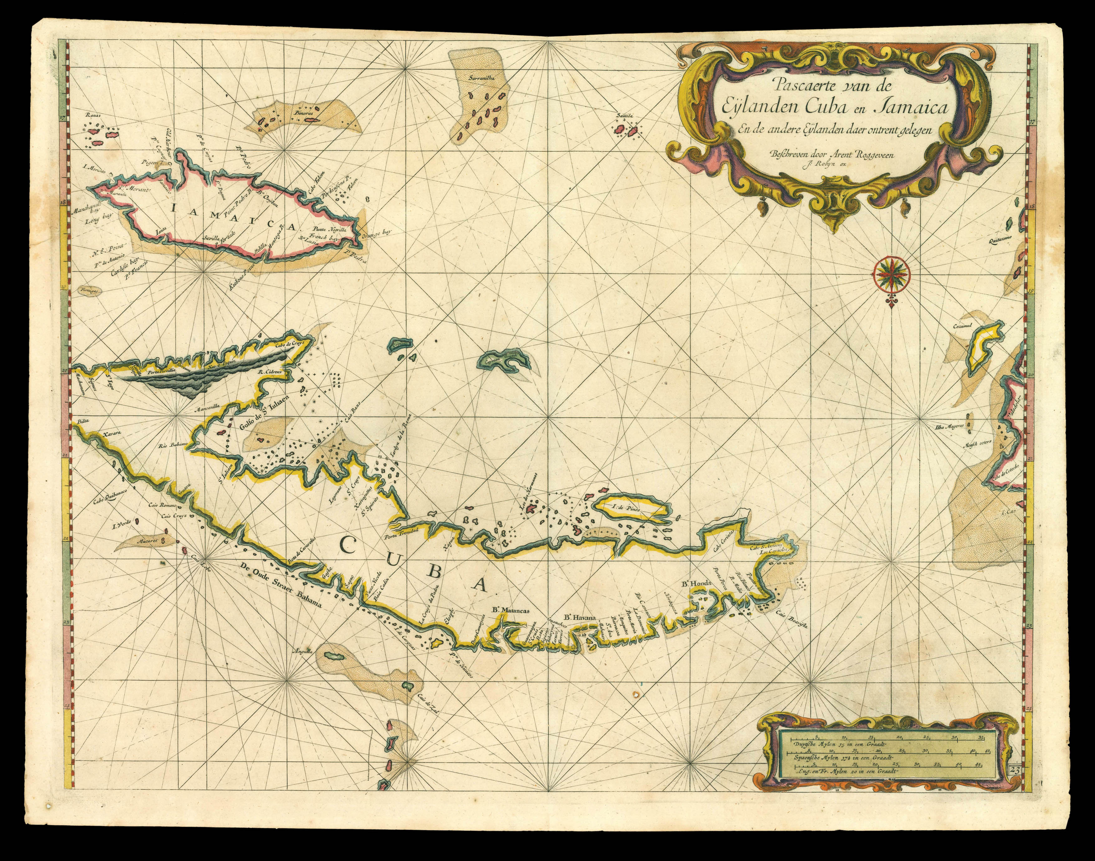 |
Cuba and Jamaica
1 x
£9,000
|
£9,000 |
|
£9,000 |
|
× |
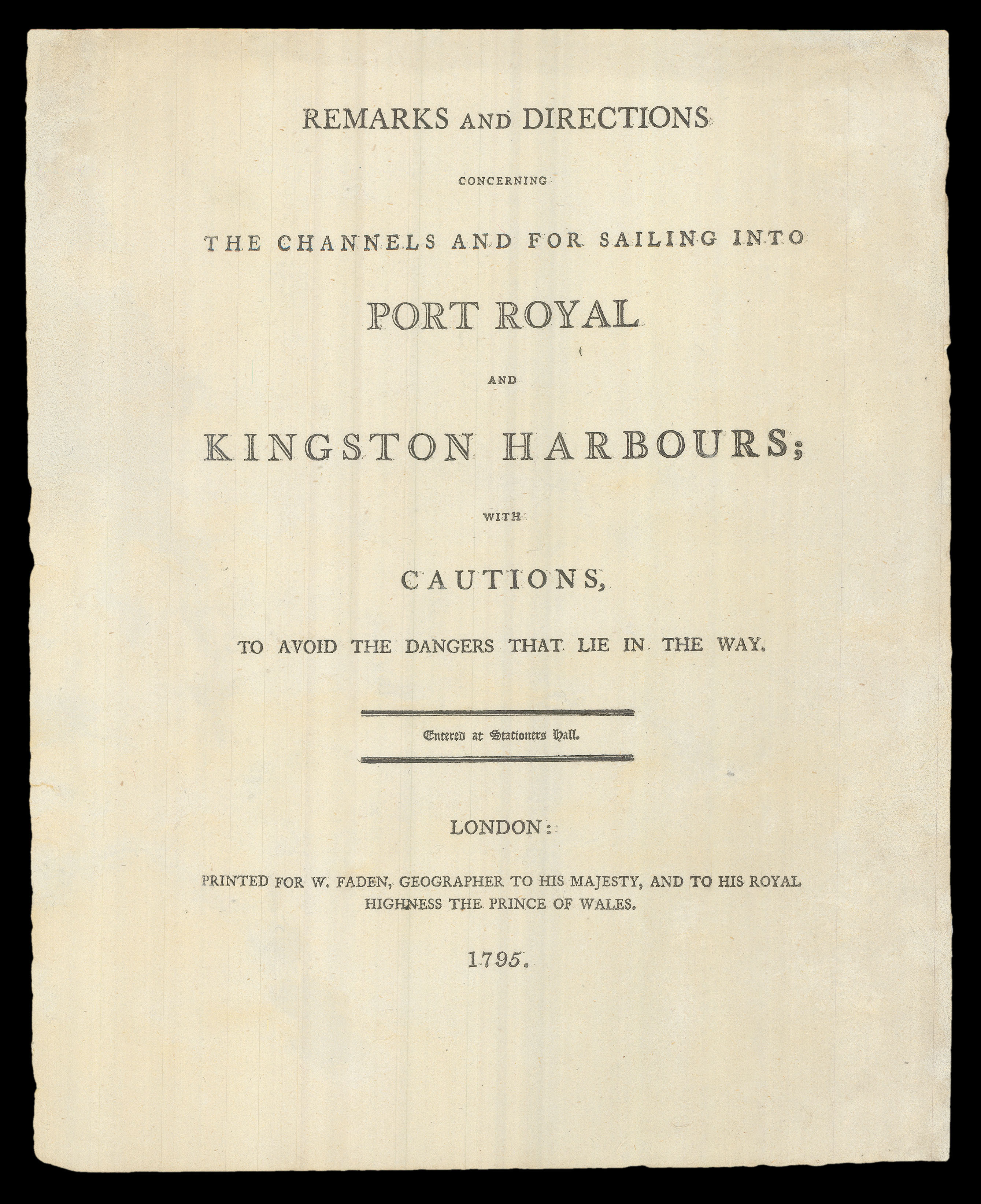 |
A guide to sailing to Jamaica
1 x
£6,000
|
£6,000 |
|
£6,000 |
|
× |
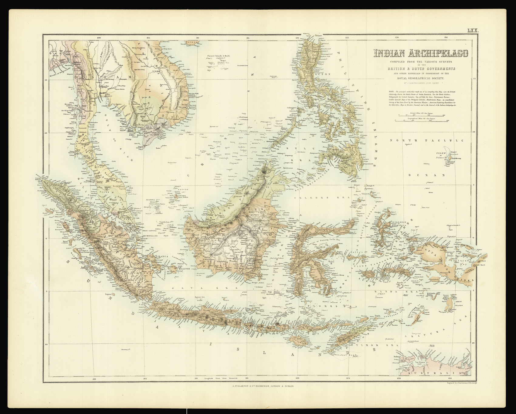 |
Bartholomew's Southeast Asia
1 x
£150
|
£150 |
|
£150 |
|
× |
![BAILLEUL, N[icolas, Le Jeune] L'Asie divisé suivant l'etendue des Empires et Royaumes qui la partagent](https://omega.crouchrarebooks.com/wp-content/uploads/2025/03/12876_1H.jpg) |
A rare map of Asia showing the Sea of Korea
1 x
£6,000
|
£6,000 |
|
£6,000 |
|
× |
![[Anonymous] Keysers hof te Iedo. Le Palais Imperial de Iedo.](https://omega.crouchrarebooks.com/wp-content/uploads/2025/03/15860_1H.jpg) |
Tokyo's Imperial Palace
1 x
£300
|
£300 |
|
£300 |
|
× |
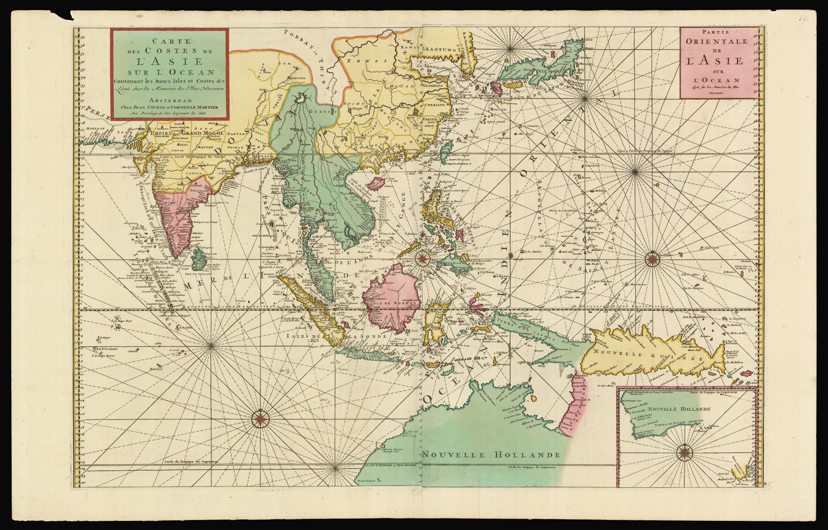 |
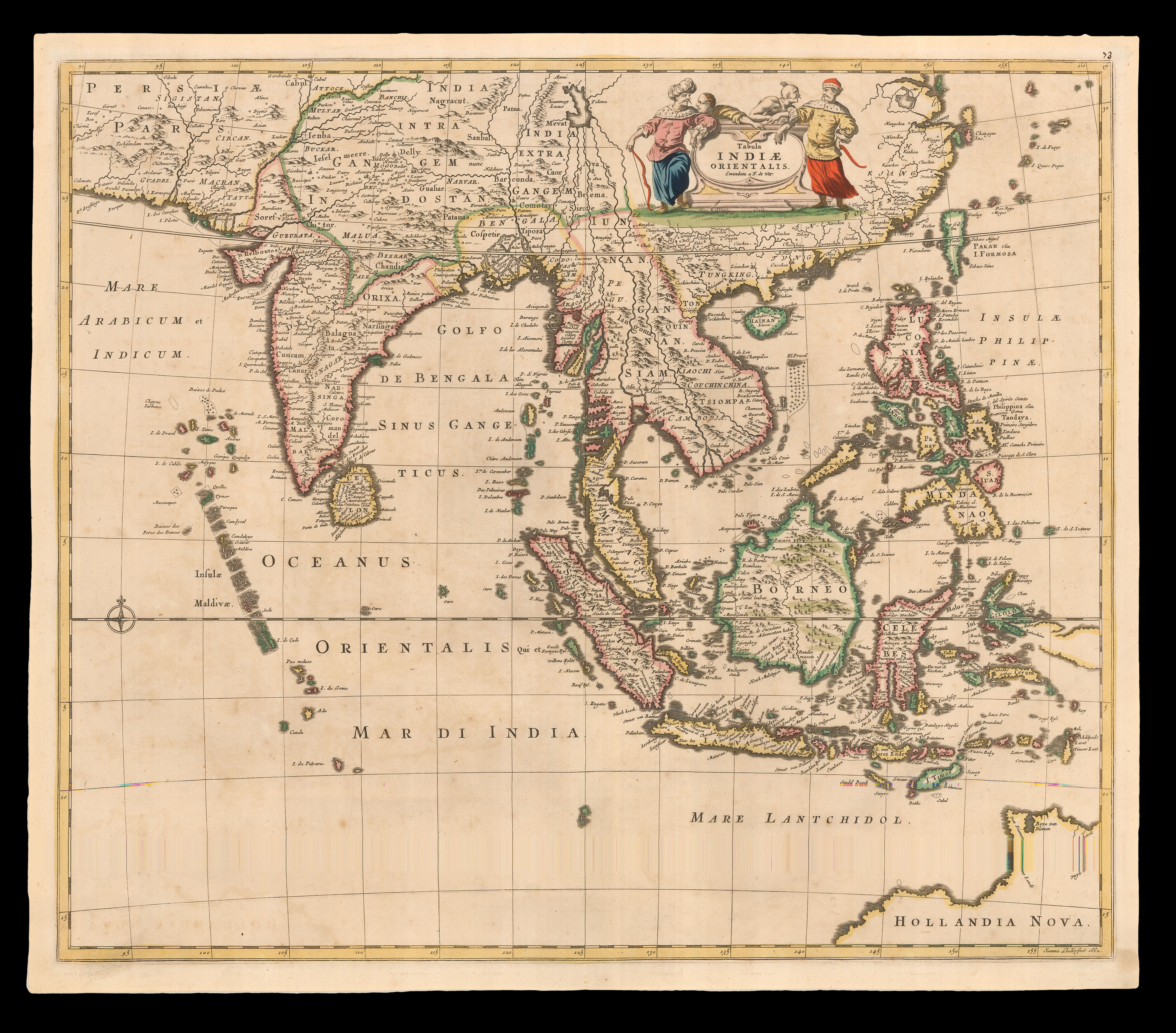
Covens and Mortier's Southeast Asia
1 x
£6,000
|
£6,000 |
|
£6,000 |
|
× |
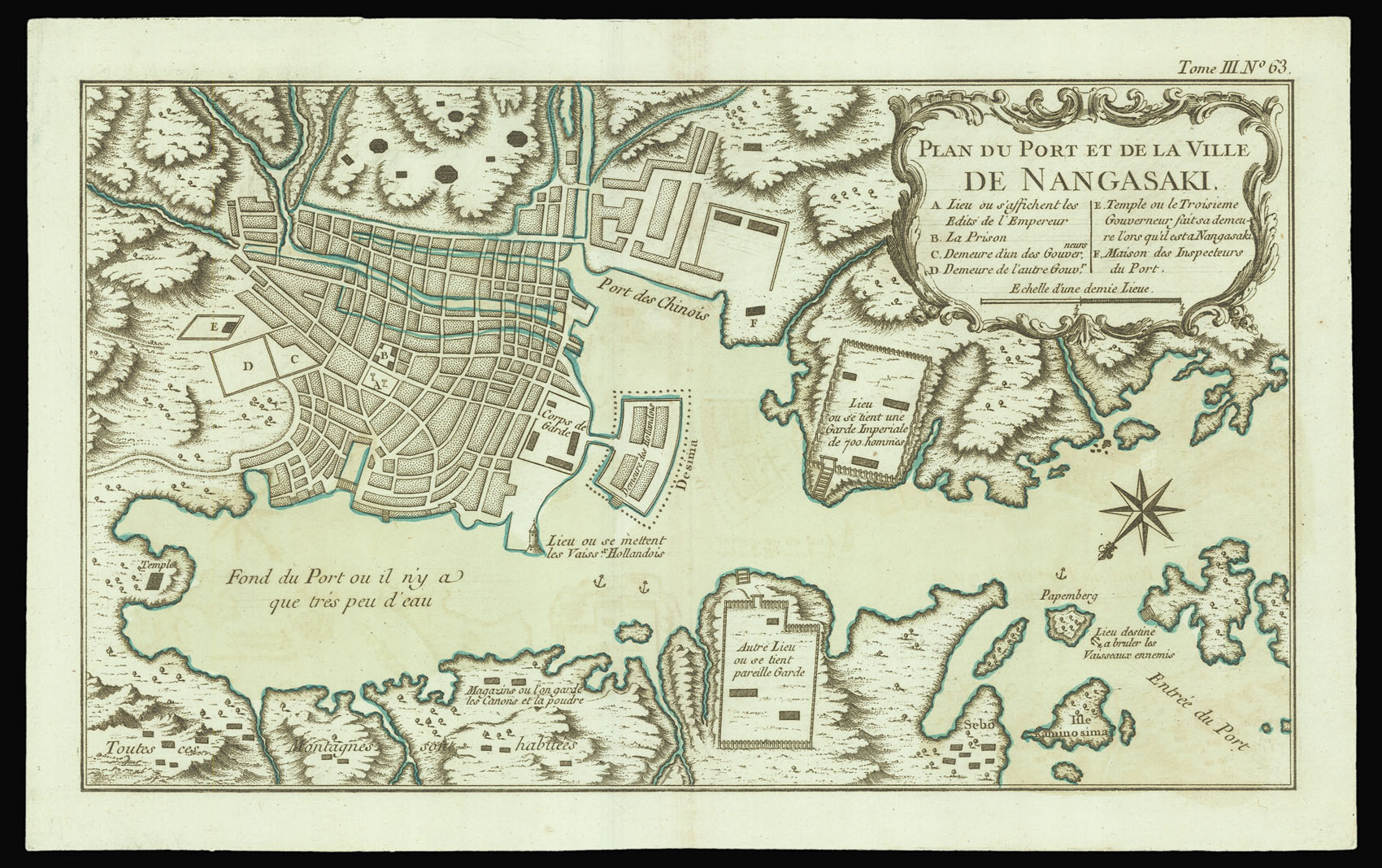 |
Plan of Nagasaki from Bellin's 'Petit Atlas Maritime'
1 x
£150
|
£150 |
|
£150 |
|
× |
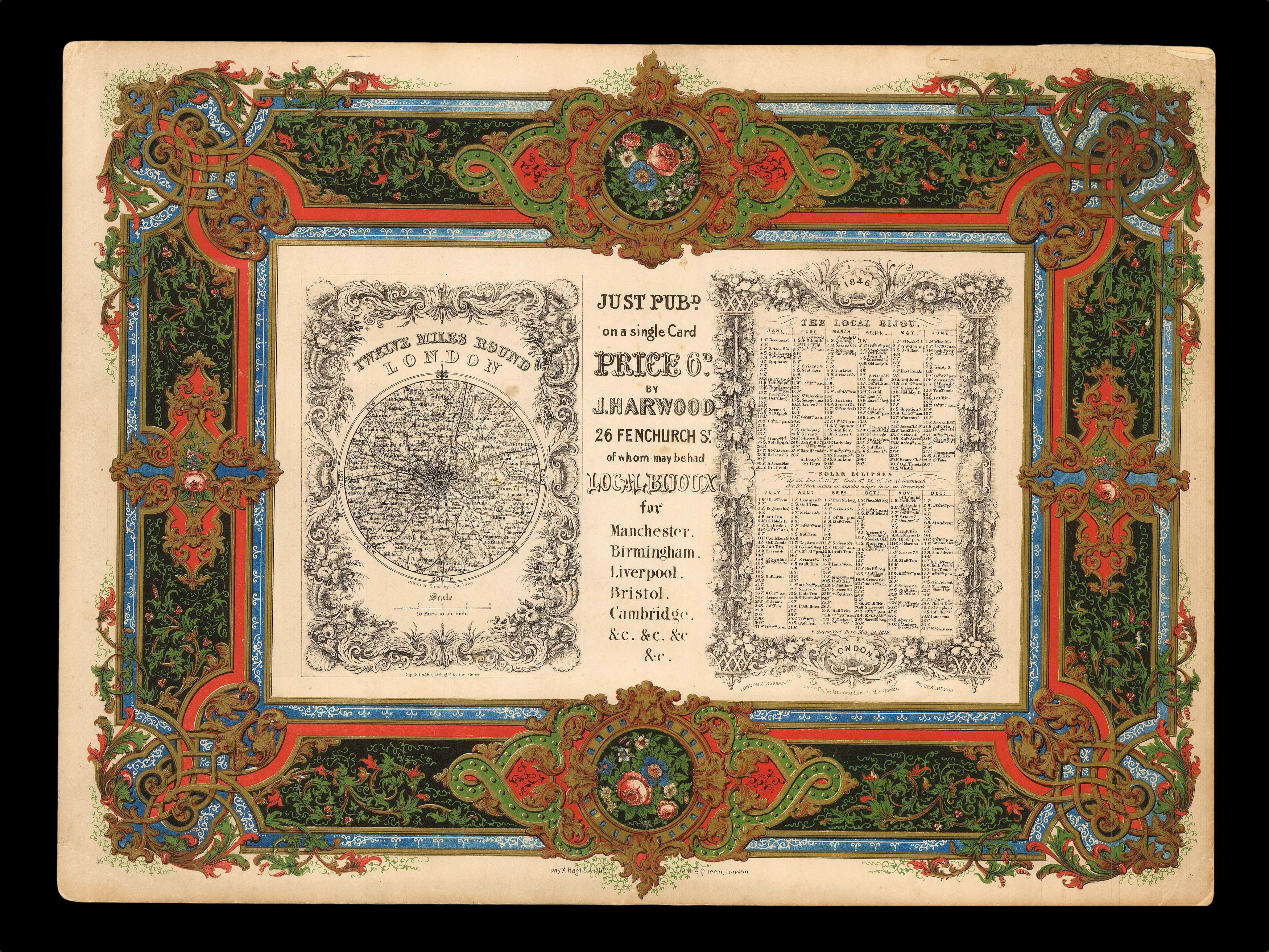 |
Lavishly lithographed prospectus from the house of Day & Haghe
1 x
£600
|
£600 |
|
£600 |
|
× |
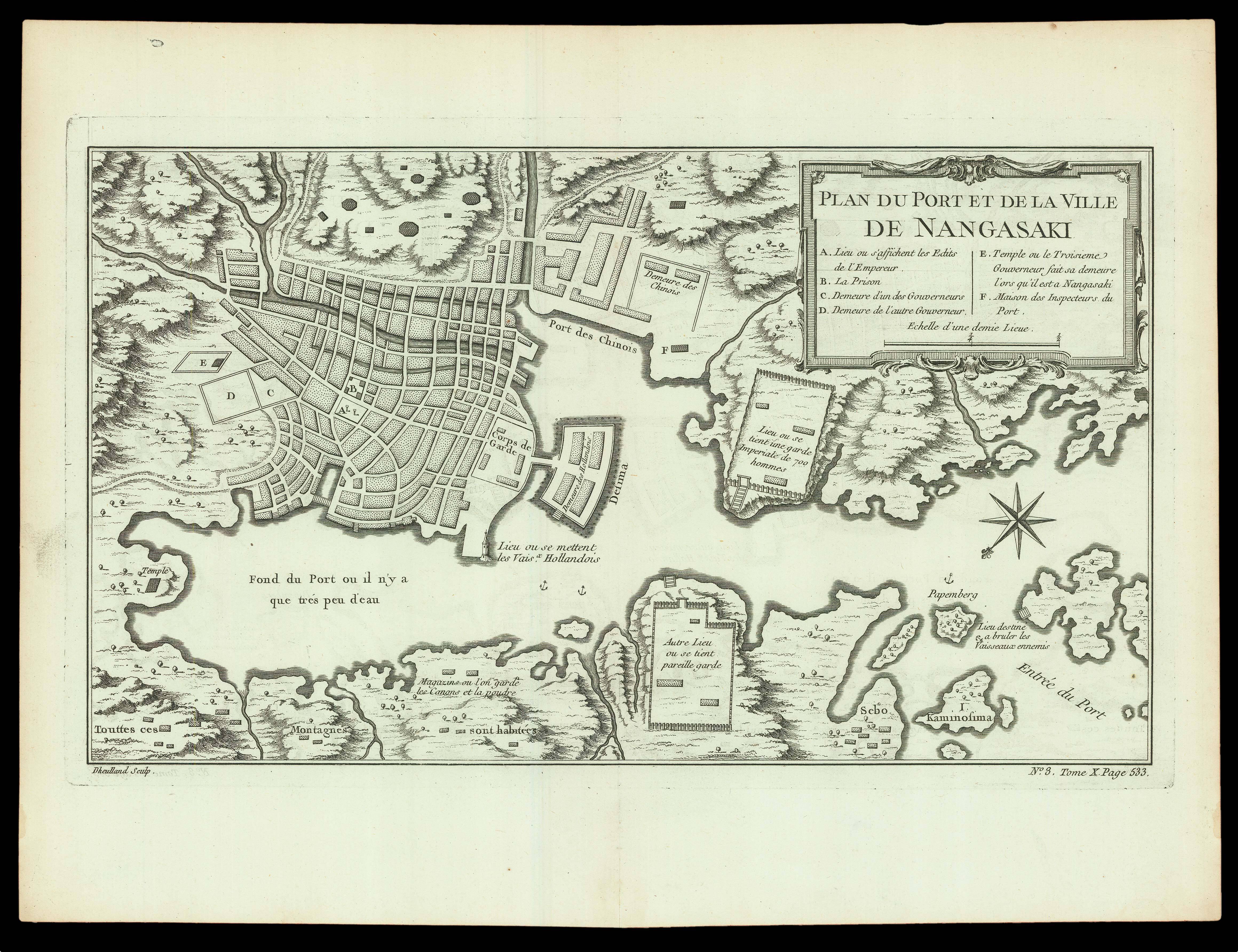 |
Port of Nagasaki
1 x
£200
|
£200 |
|
£200 |
|
× |
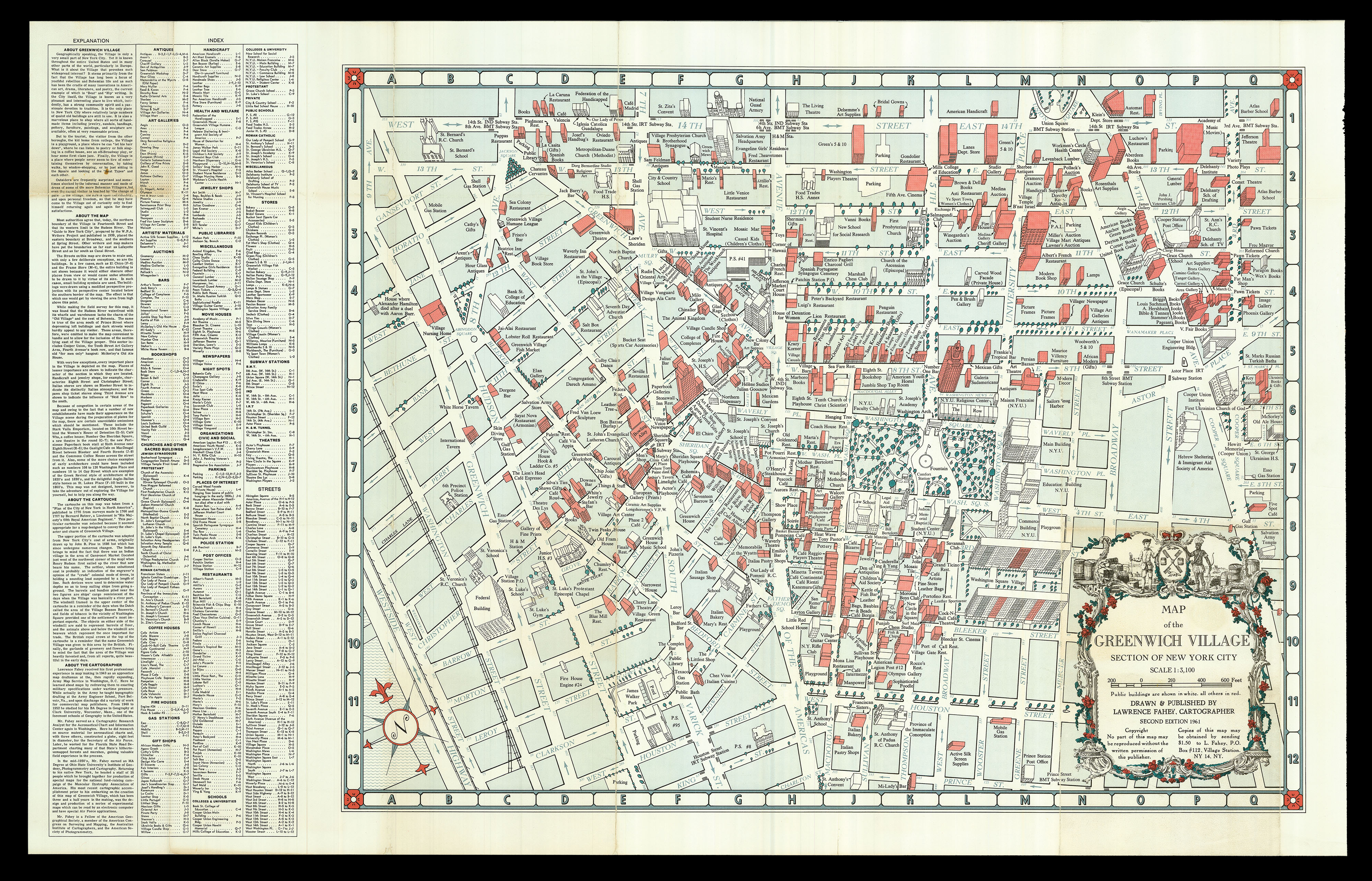 |
"the Village is a playground, a place where he can "let his hair down"" (Fahey)
1 x
£1,500
|
£1,500 |
|
£1,500 |
|
× |
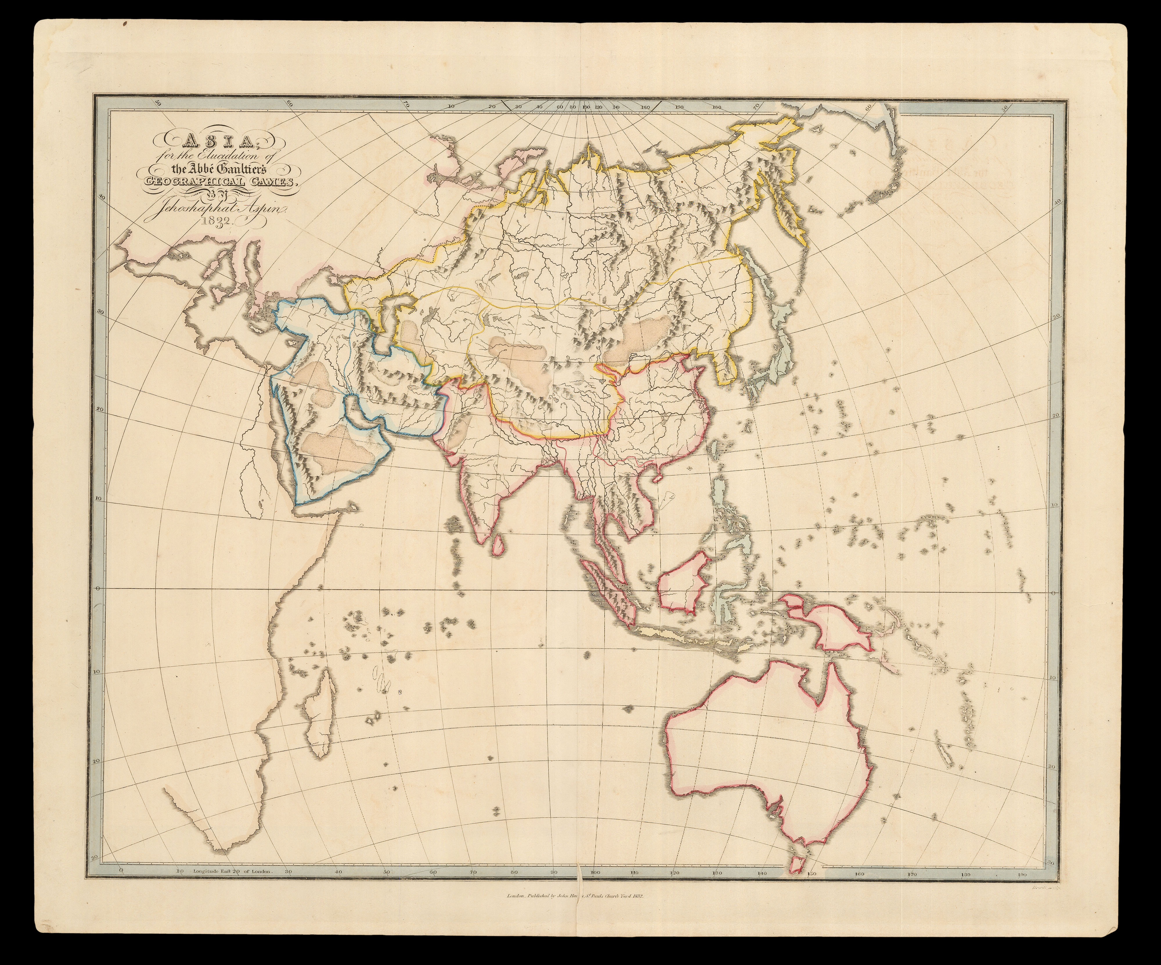 |
A game plan for all of Asia
1 x
£300
|
£300 |
|
£300 |
|
× |
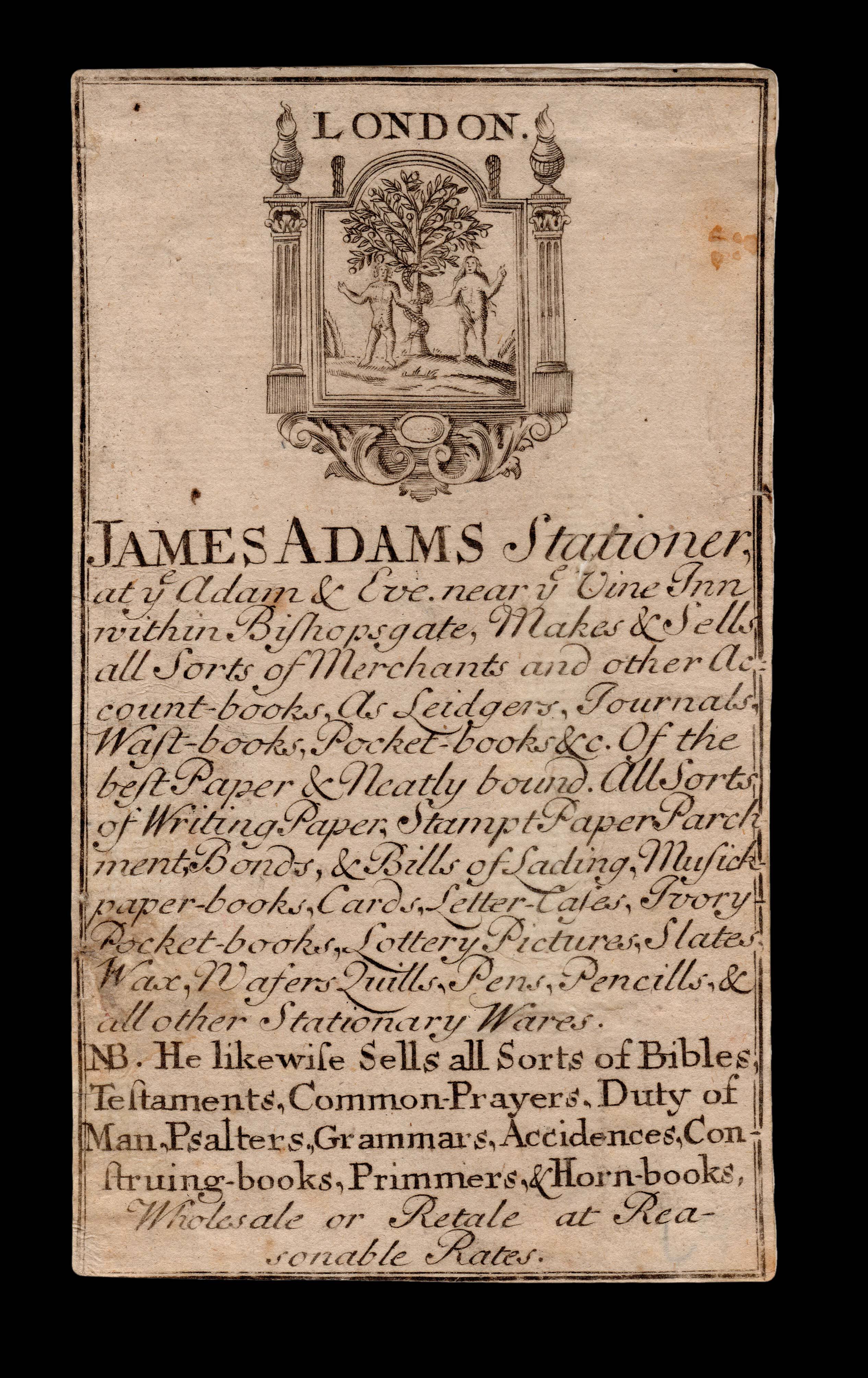 |
S is for Stationer
1 x
£1,500
|
£1,500 |
|
£1,500 |
|
× |
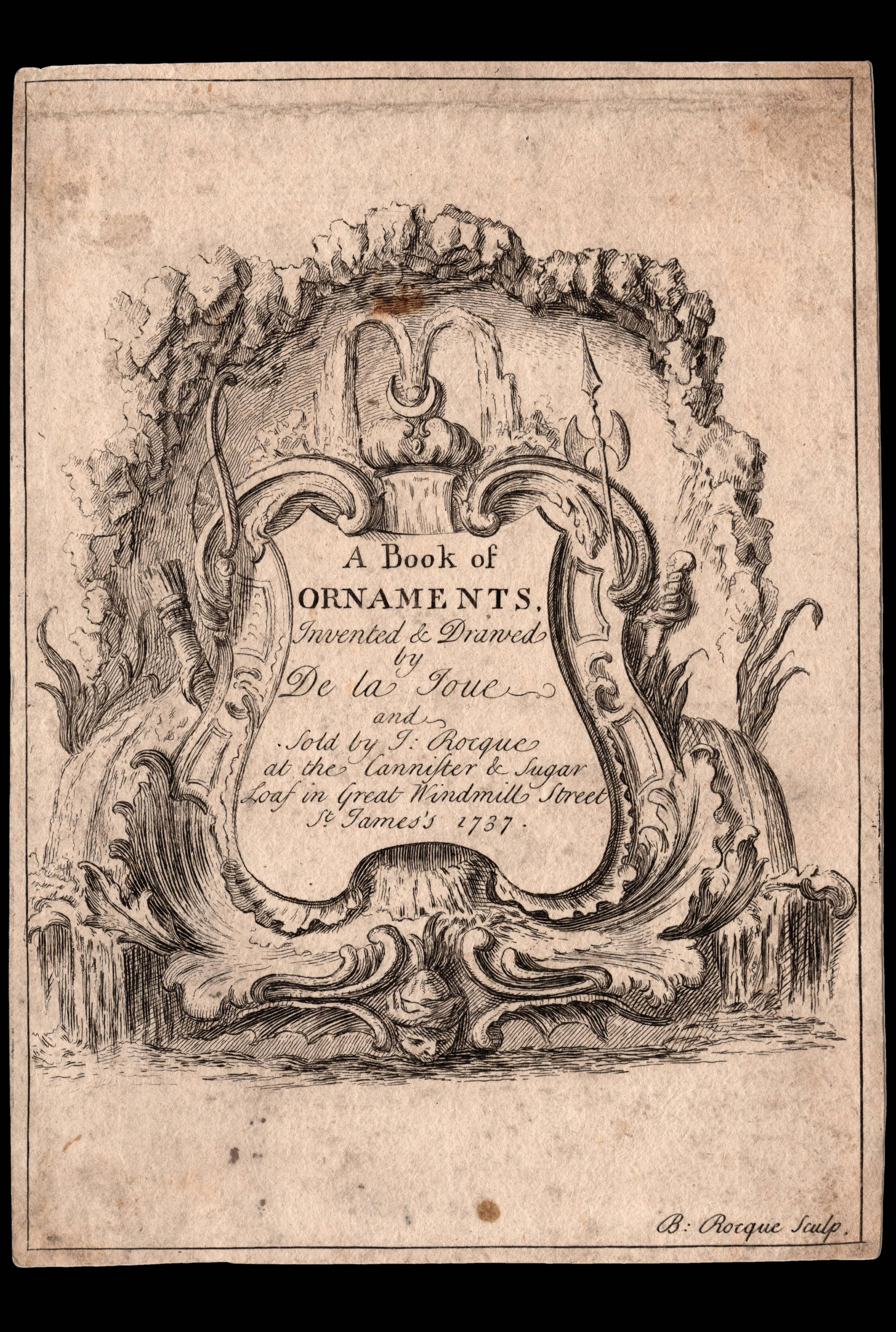 |
Advertising an unpublished book of rococo ornaments
1 x
£2,000
|
£2,000 |
|
£2,000 |
|
× |
 |
"Vuyle hoeck"
1 x
£800
|
£800 |
|
£800 |
|
× |
 |
Kandy land
1 x
£200
|
£200 |
|
£200 |
|
× |
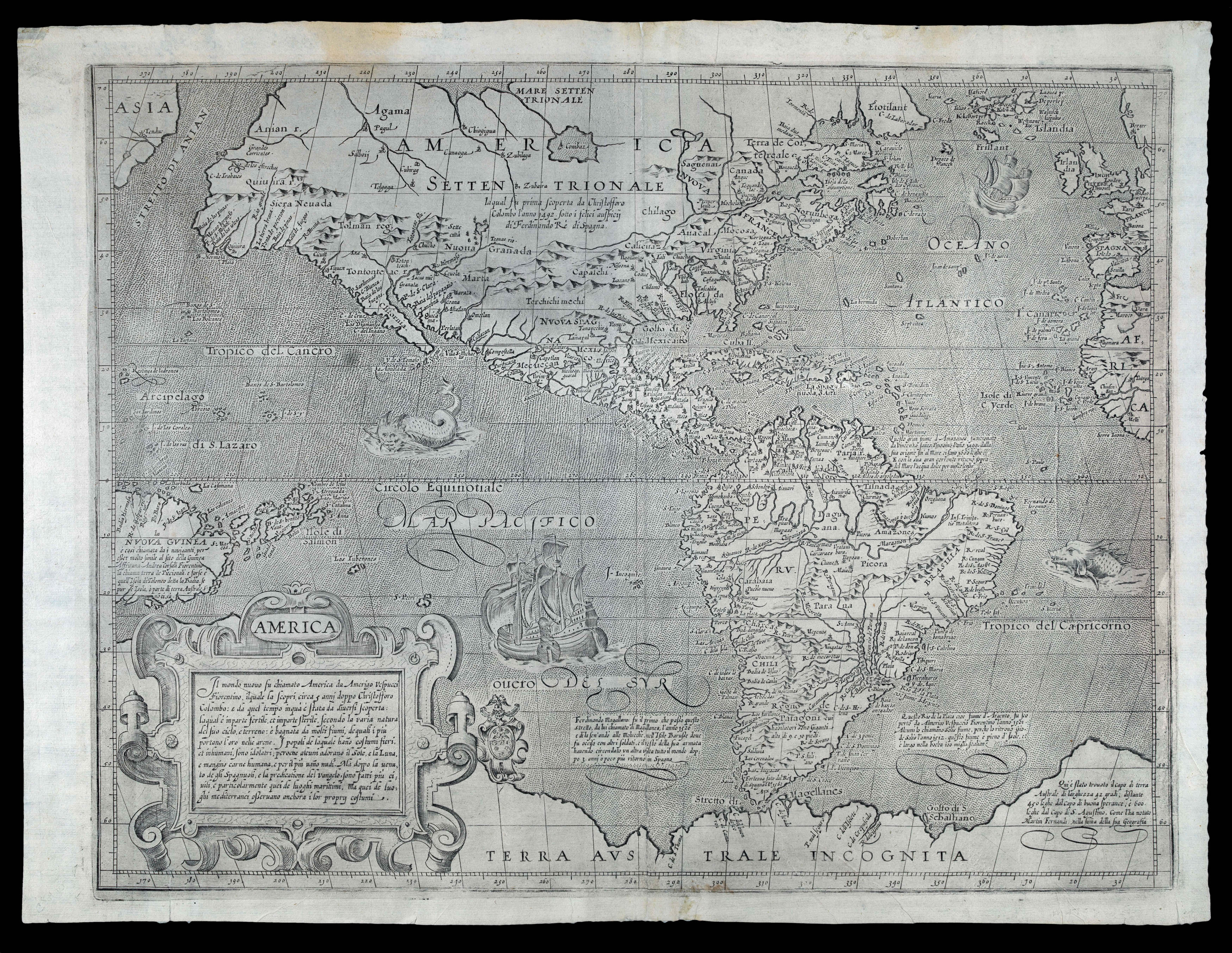 |
Arnoldi's separately-published map of the Americas, with the thumb print of the printer!
1 x
£30,000
|
£30,000 |
|
£30,000 |
|
× |
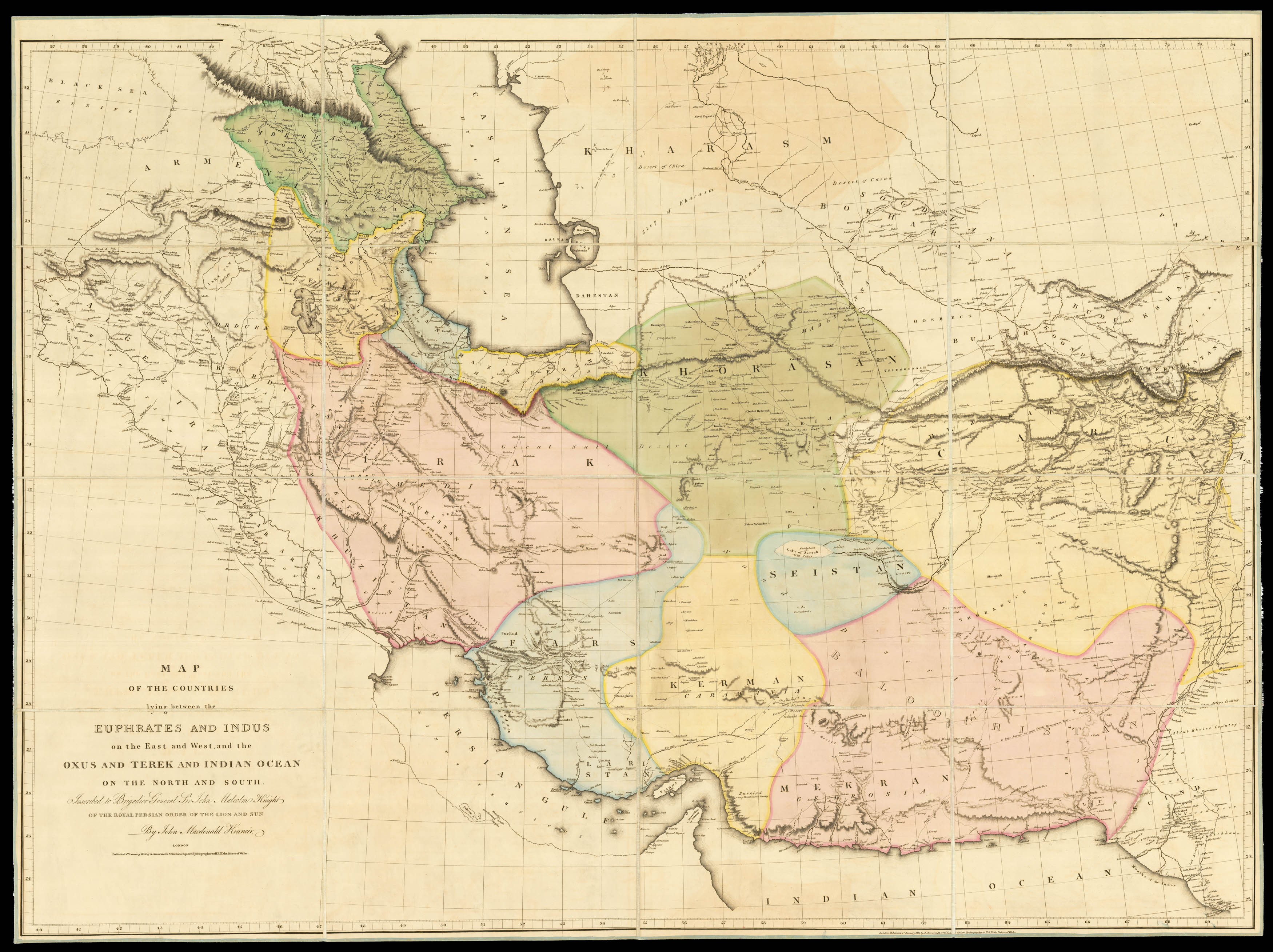 |
Rare map of Persia published at the beginning of the Anglo Persian War
1 x
£10,000
|
£10,000 |
|
£10,000 |
|
× |
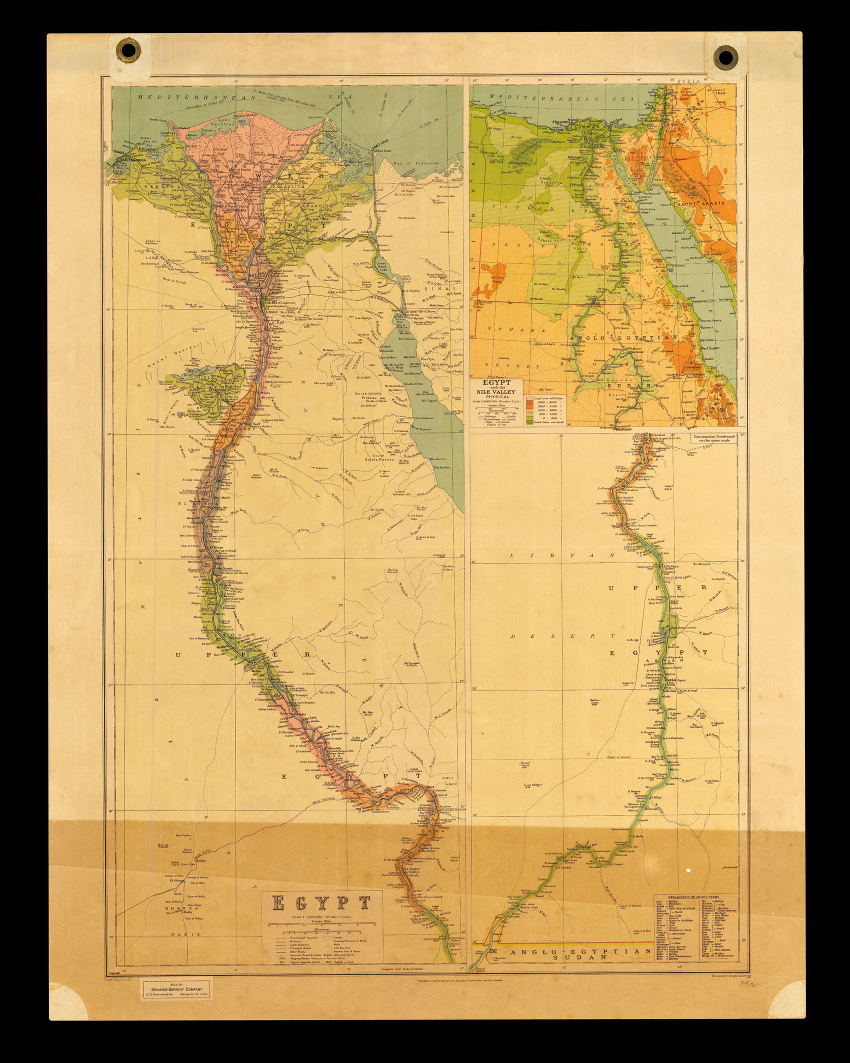 |
Egypt
1 x
£100
|
£100 |
|
£100 |
|
× |
 |
Charts of the Mediterranean for sale
1 x
£650
|
£650 |
|
£650 |
|
× |
![[SCHARF, George; after] St. Martin's Church in 1825 &c.](https://omega.crouchrarebooks.com/wp-content/uploads/2025/03/18132_1H.jpg) |
Old Dukes Court
1 x
£1,200
|
£1,200 |
|
£1,200 |
|
× |
![KROTOVII [Russian Globe] Terrestrial Globe](https://omega.crouchrarebooks.com/wp-content/uploads/2025/03/2930_1H.jpg) |
A Cyrillic globe
1 x
£10,000
|
£10,000 |
|
£10,000 |
|
× |
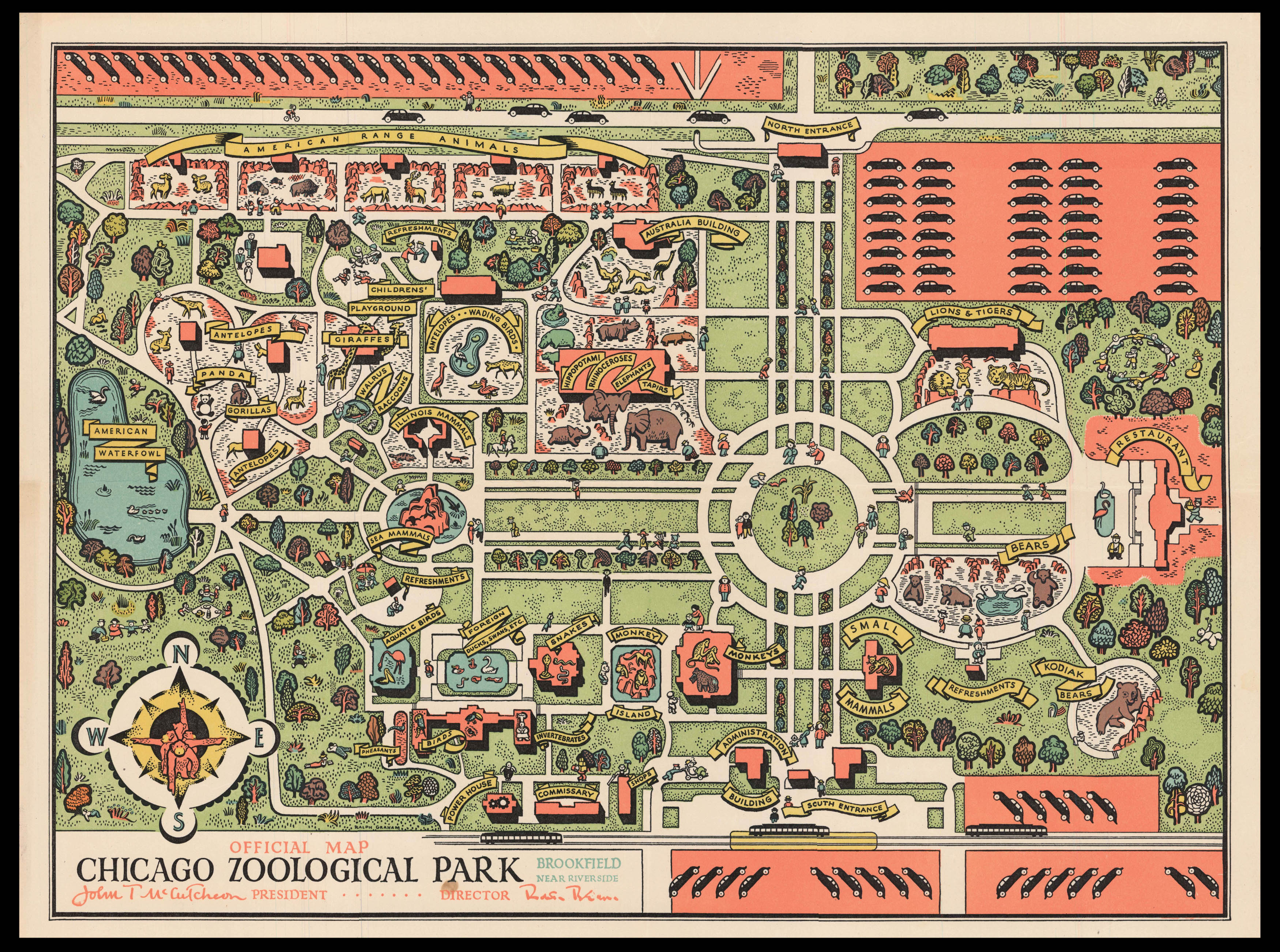 |
Chicago Zoo
1 x
£400
|
£400 |
|
£400 |
|
× |
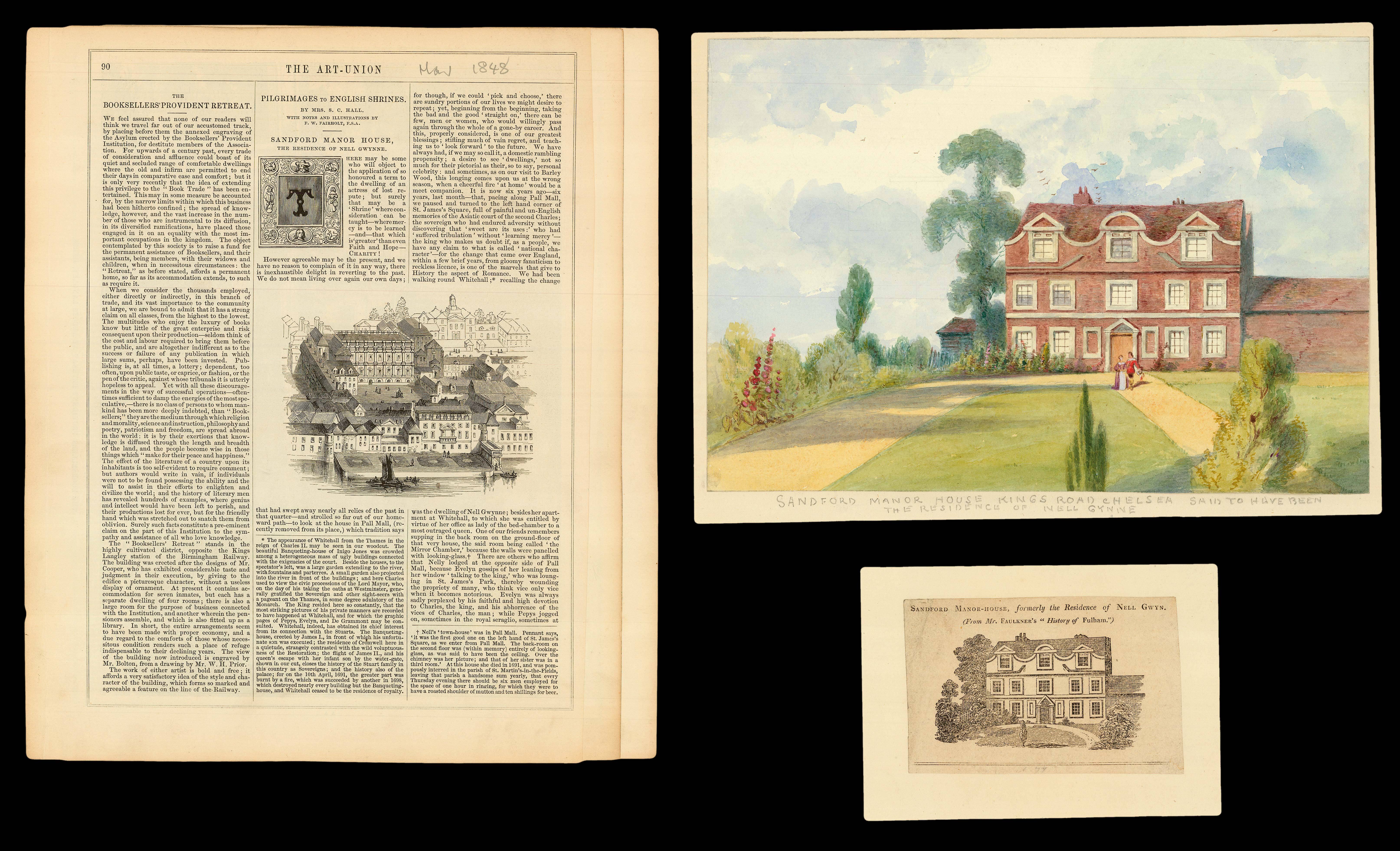 |
The mystery of Sandford Manor House
1 x
£750
|
£750 |
|
£750 |
|
× |
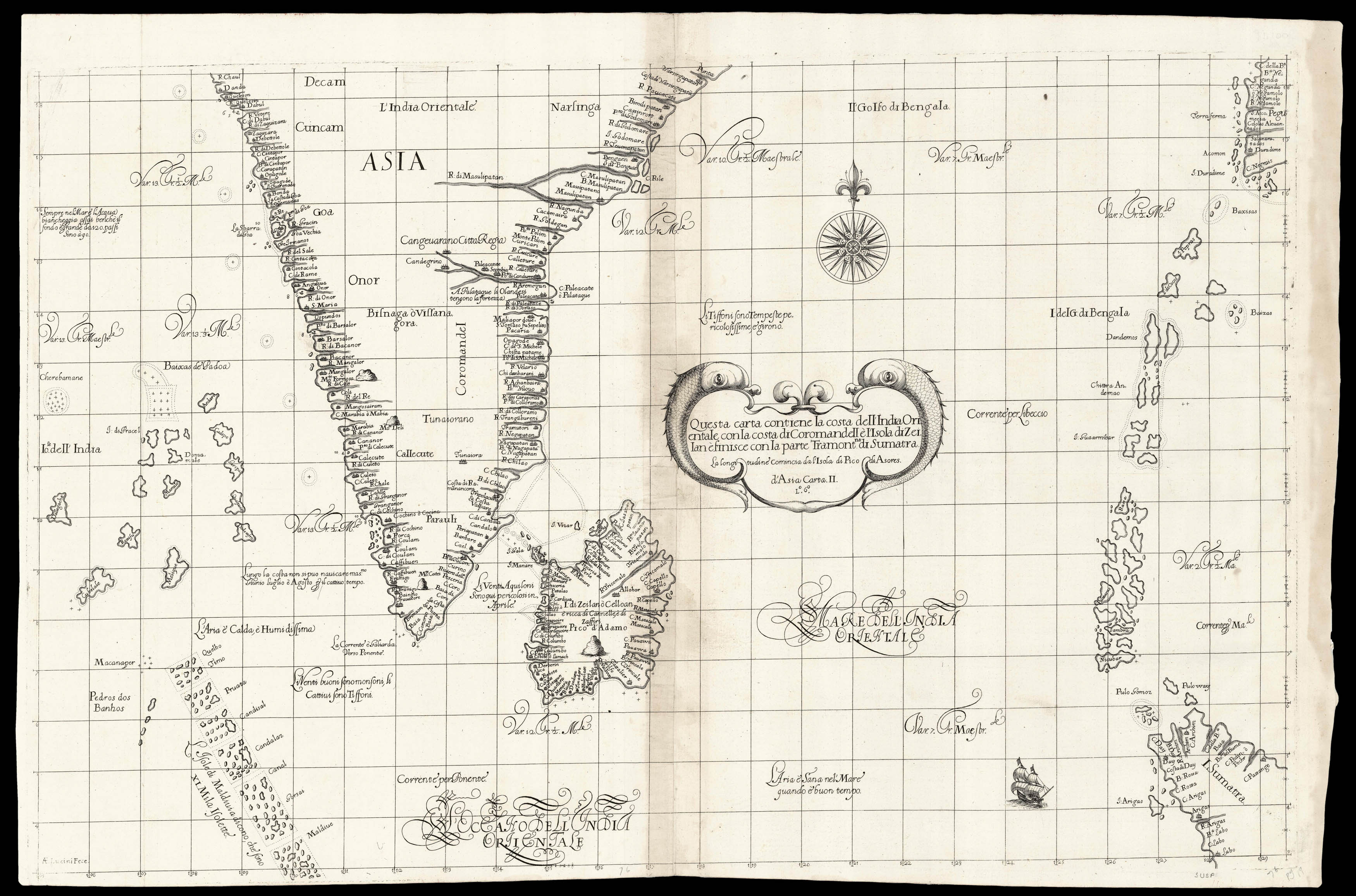 |
Dudley's chart of southern India
1 x
£8,000
|
£8,000 |
|
£8,000 |
|
× |
![DUFOUR, A[dolphe] H[ippolyte] Japon par A. H. Dufour. (pl 66).](https://omega.crouchrarebooks.com/wp-content/uploads/2025/03/15797_1H.jpg) |
Map of Japan published in Dufour's 'Atlas Populaire'
1 x
£40
|
£40 |
|
£40 |
|
× |
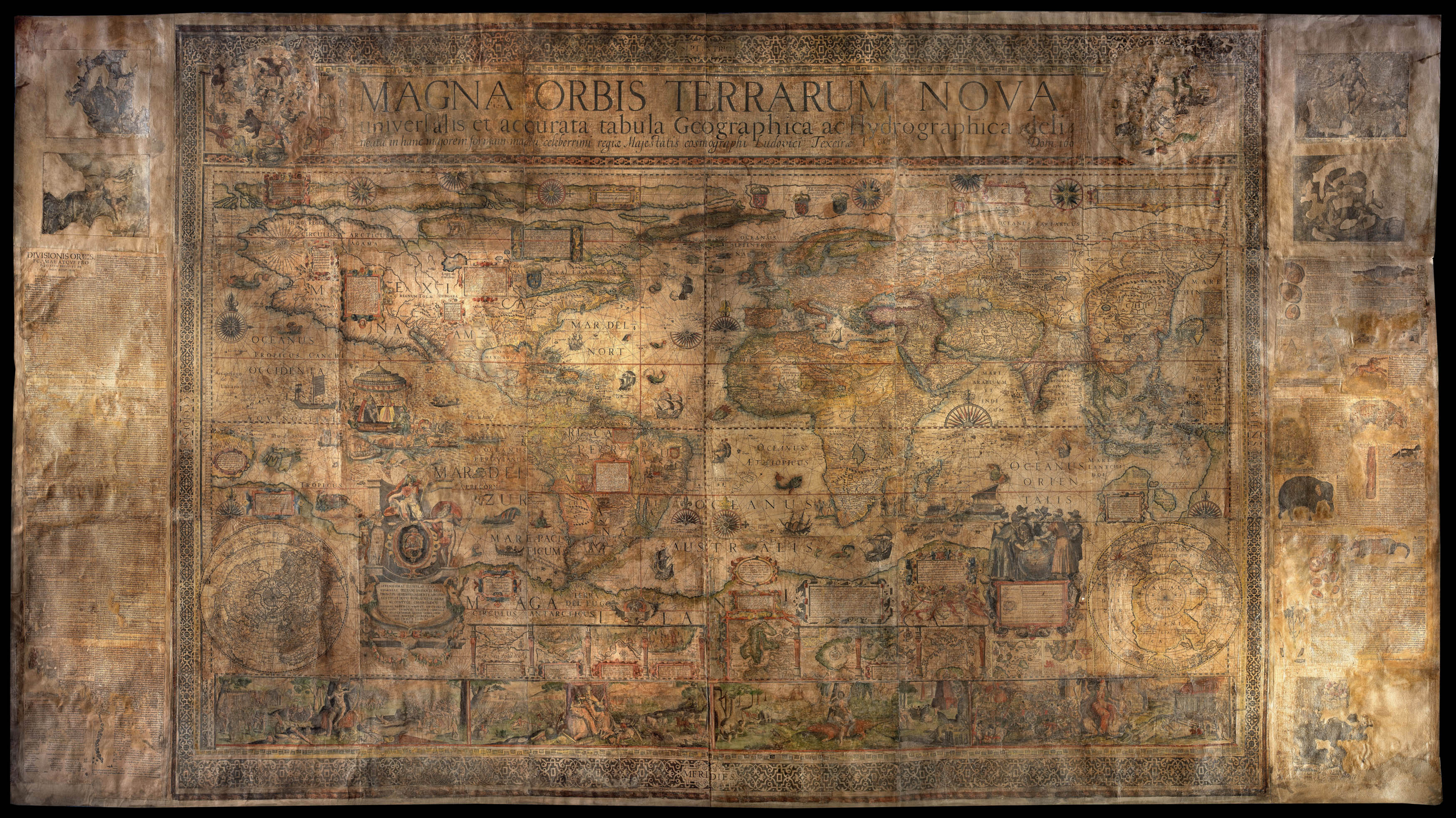 |
The Great Southern Continent
1 x
£450,000
|
£450,000 |
|
£450,000 |
|
× |
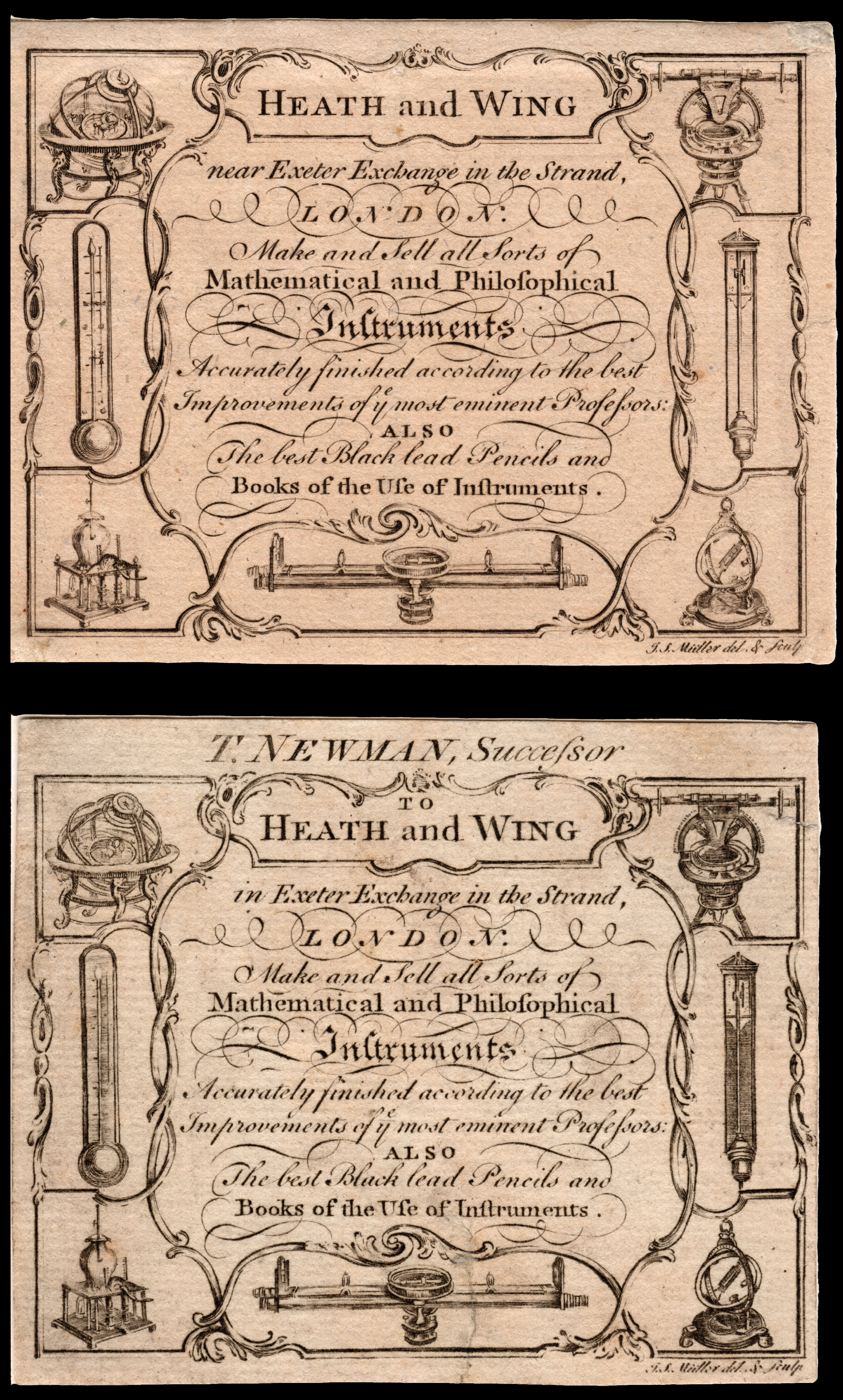 |
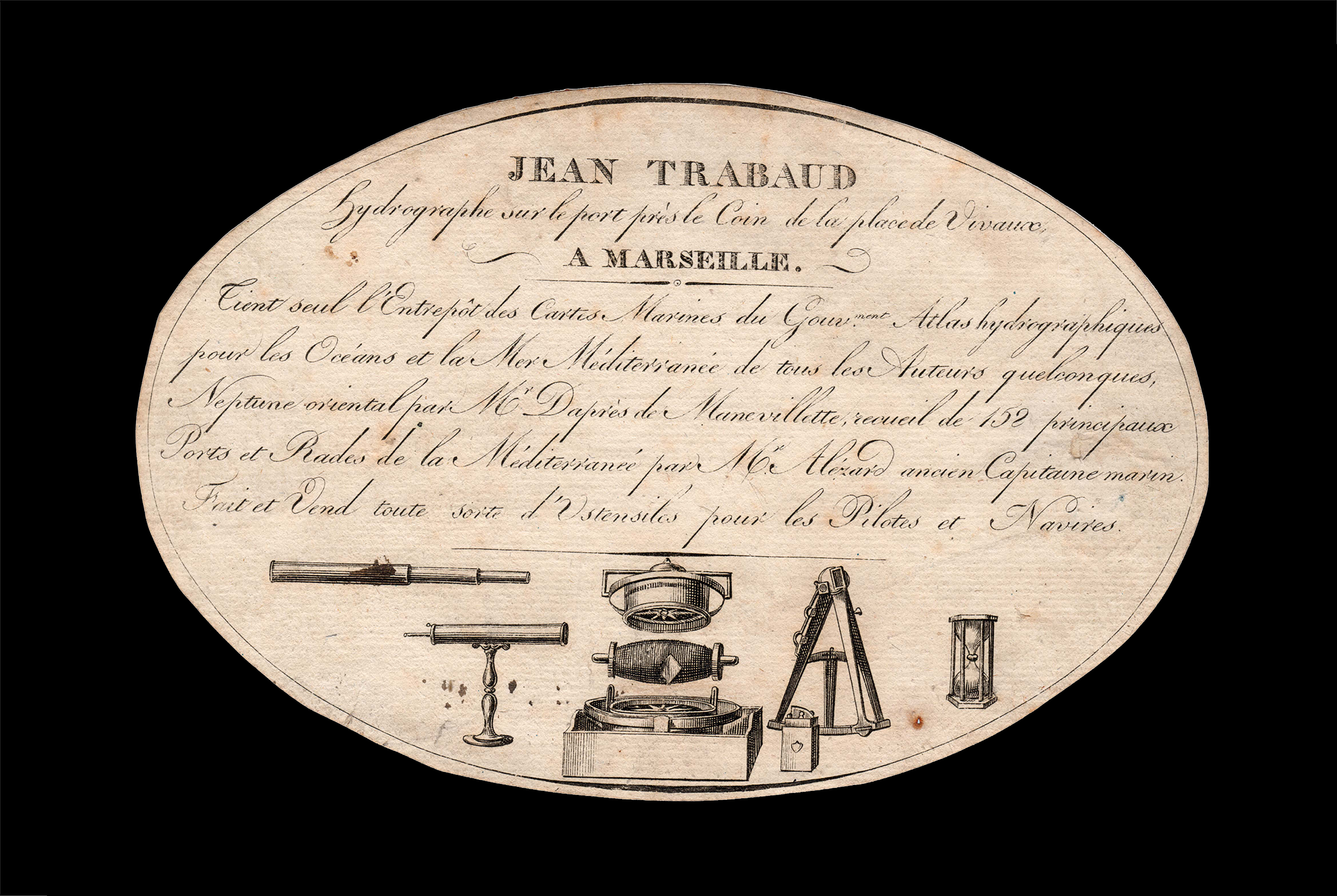
Trade card for maker of Philosophical Instruments
1 x
£2,800
|
£2,800 |
|
£2,800 |
|
× |
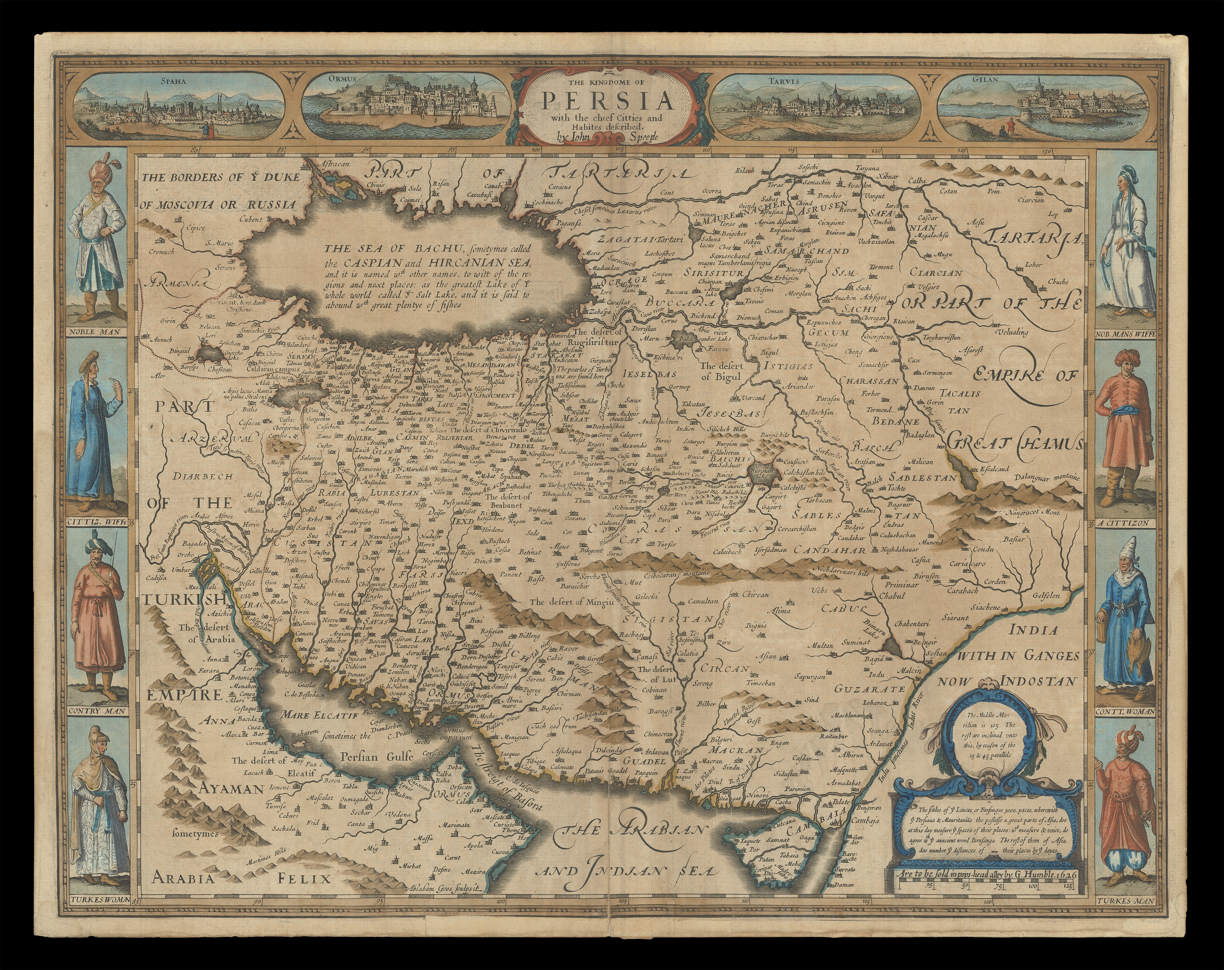 |
Speed's map of Persia
1 x
£1,800
|
£1,800 |
|
£1,800 |
|
× |
![[ANONYMOUS] Frost Fair on the Thames in February, 1814.](https://omega.crouchrarebooks.com/wp-content/uploads/2025/03/18216_1H.jpg) |
"all the usual Sports and Festivities of a Fair were kept up for several days"... on ice
1 x
£1,750
|
£1,750 |
|
£1,750 |
|
× |
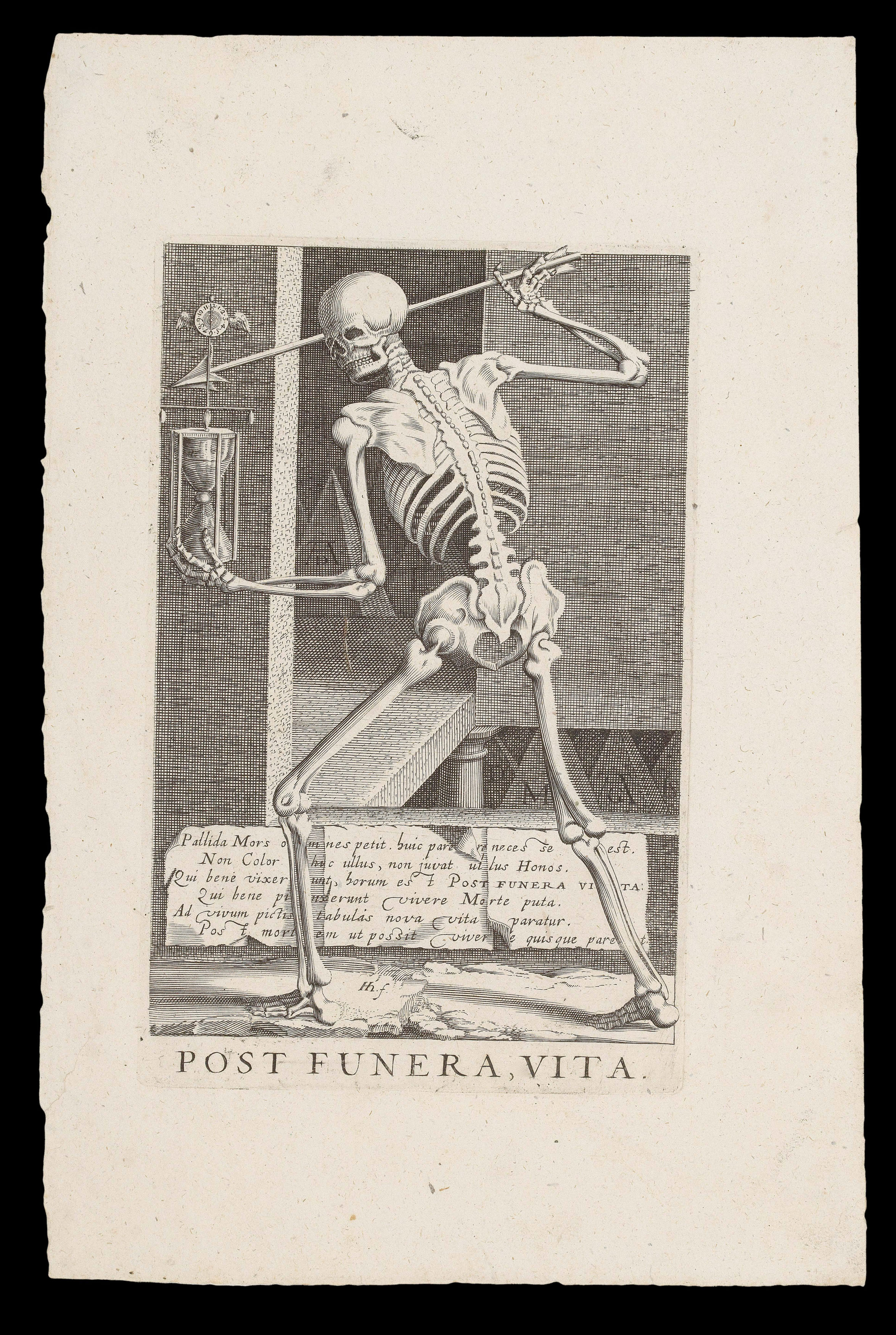 |
After death, LIFE!
1 x
£2,000
|
£2,000 |
|
£2,000 |
|
× |
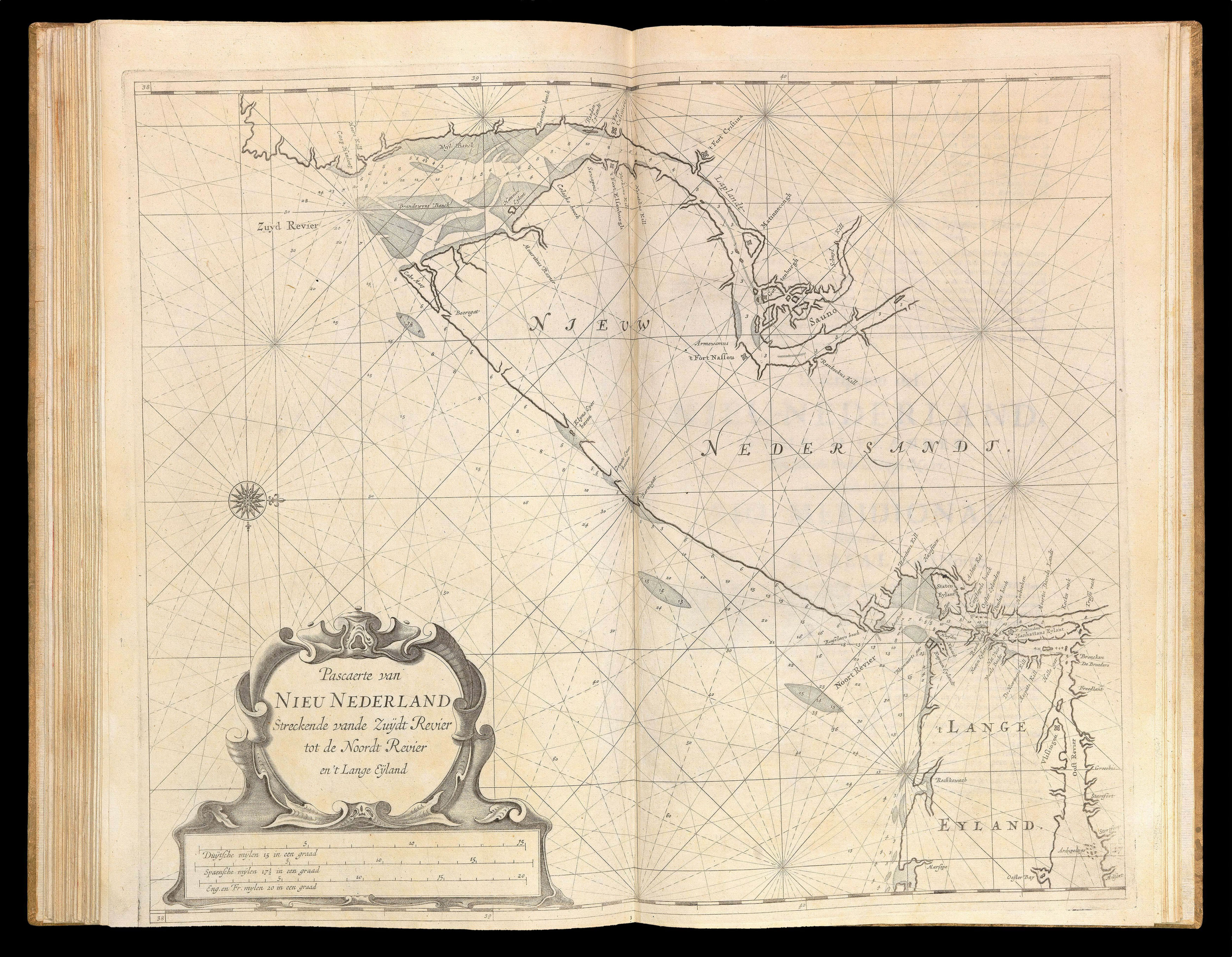 |
Unrecorded Spanish edition of the First Sea Atlas of America
1 x
£180,000
|
£180,000 |
|
£180,000 |
|
× |
![HORSBURGH, James and INGLIS Sir Hugh [Two autograph letters concerning the East India Company and the War of 1812].](https://omega.crouchrarebooks.com/wp-content/uploads/2025/03/18376_1H.jpg) |
"more knowledge of the Eastern Seas than perhaps any other man"
1 x
£3,000
|
£3,000 |
|
£3,000 |
|
× |
 |
Trade card for the creator of the Royal Observatory's eight-foot telescope
1 x
£1,600
|
£1,600 |
|
£1,600 |
|
× |
![AP HUW, D. ap G.; Eben FARDD; and George PHILIP Gwlad yr aur [Country of Gold (trans.)]](https://omega.crouchrarebooks.com/wp-content/uploads/2025/03/12995_1H.jpg) |
Philip's new map of the Gold Fields of Australia, for the Welsh
1 x
£1,000
|
£1,000 |
|
£1,000 |
|
× |
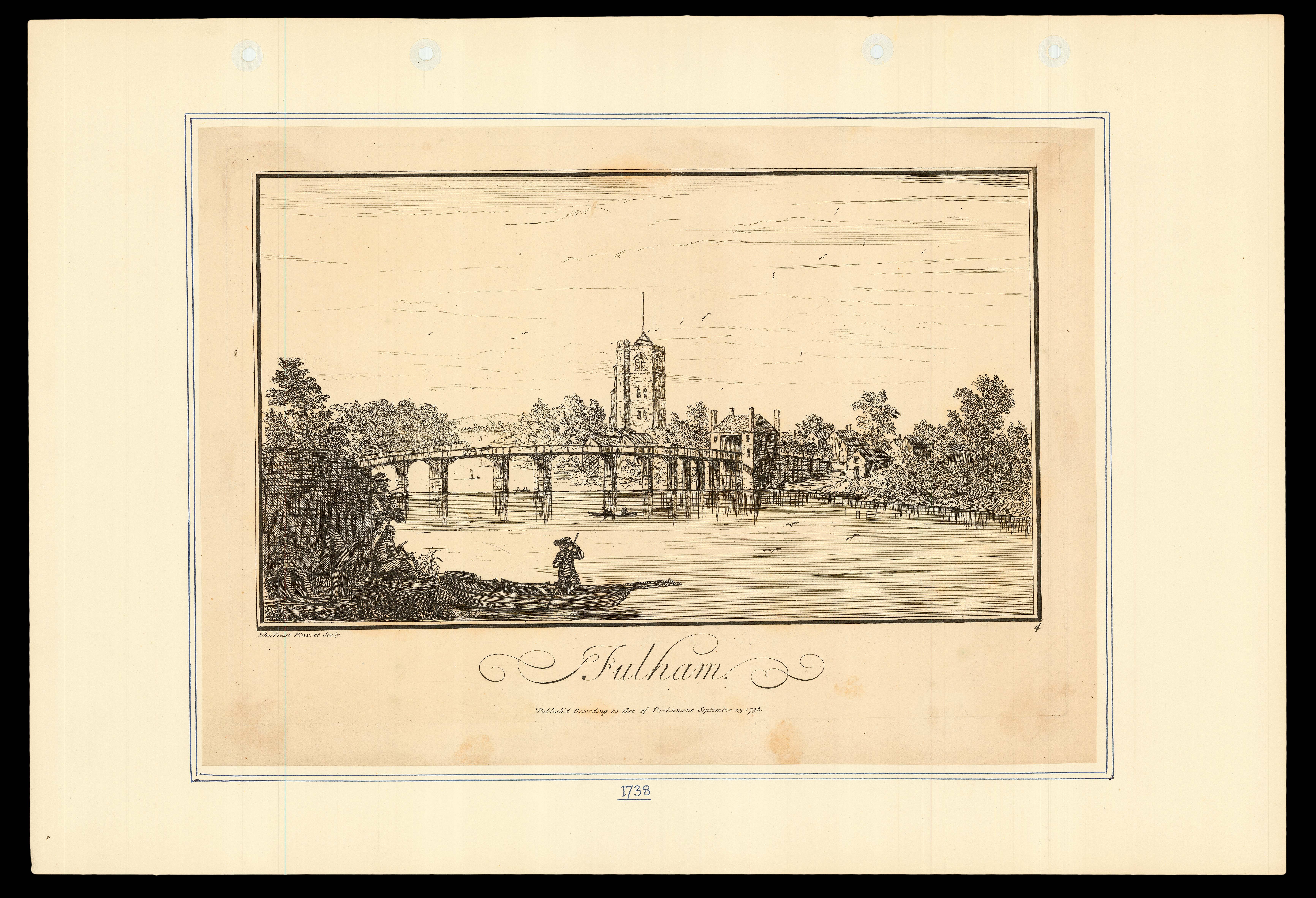 |
Fulham
1 x
£175
|
£175 |
|
£175 |
|
× |
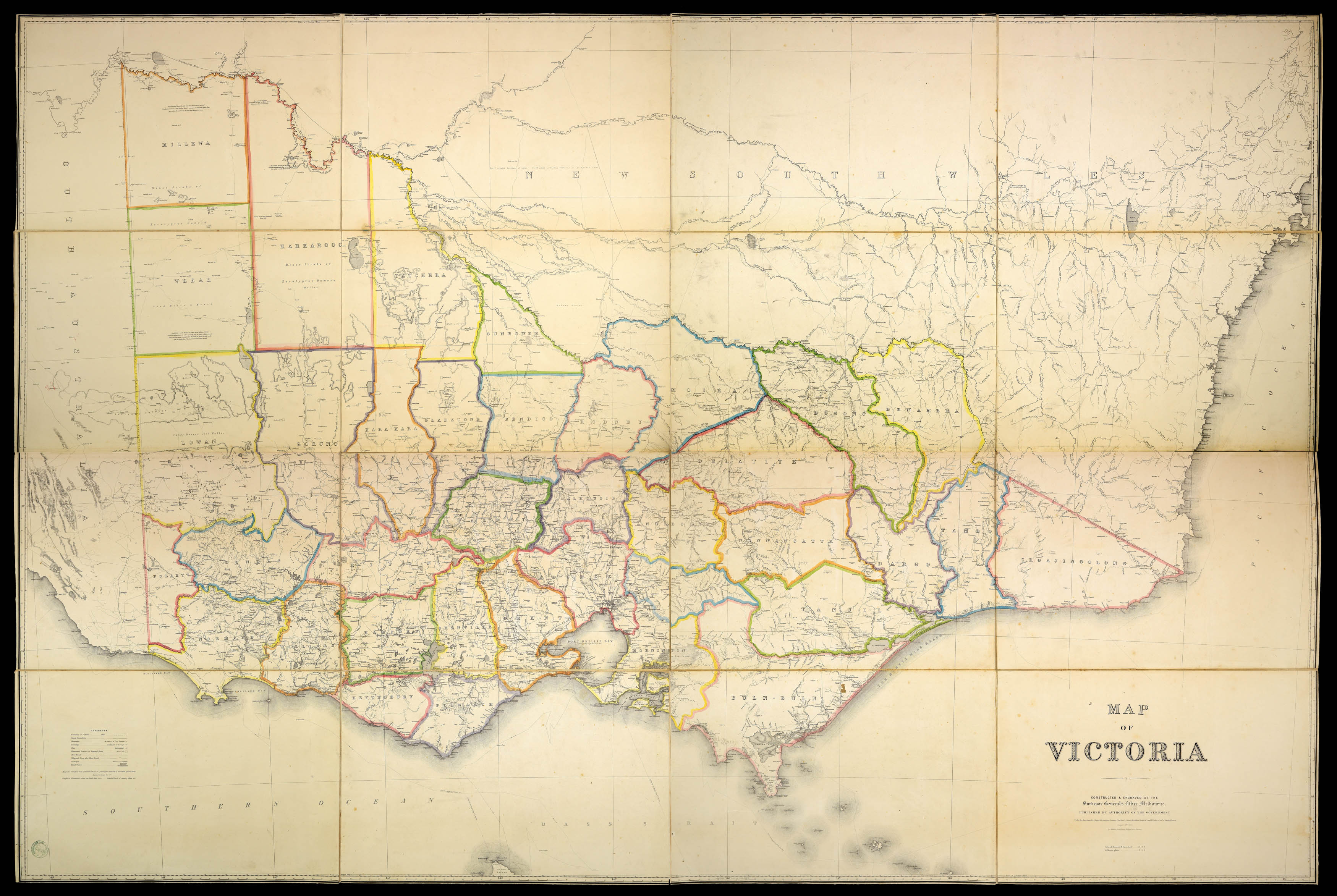 |
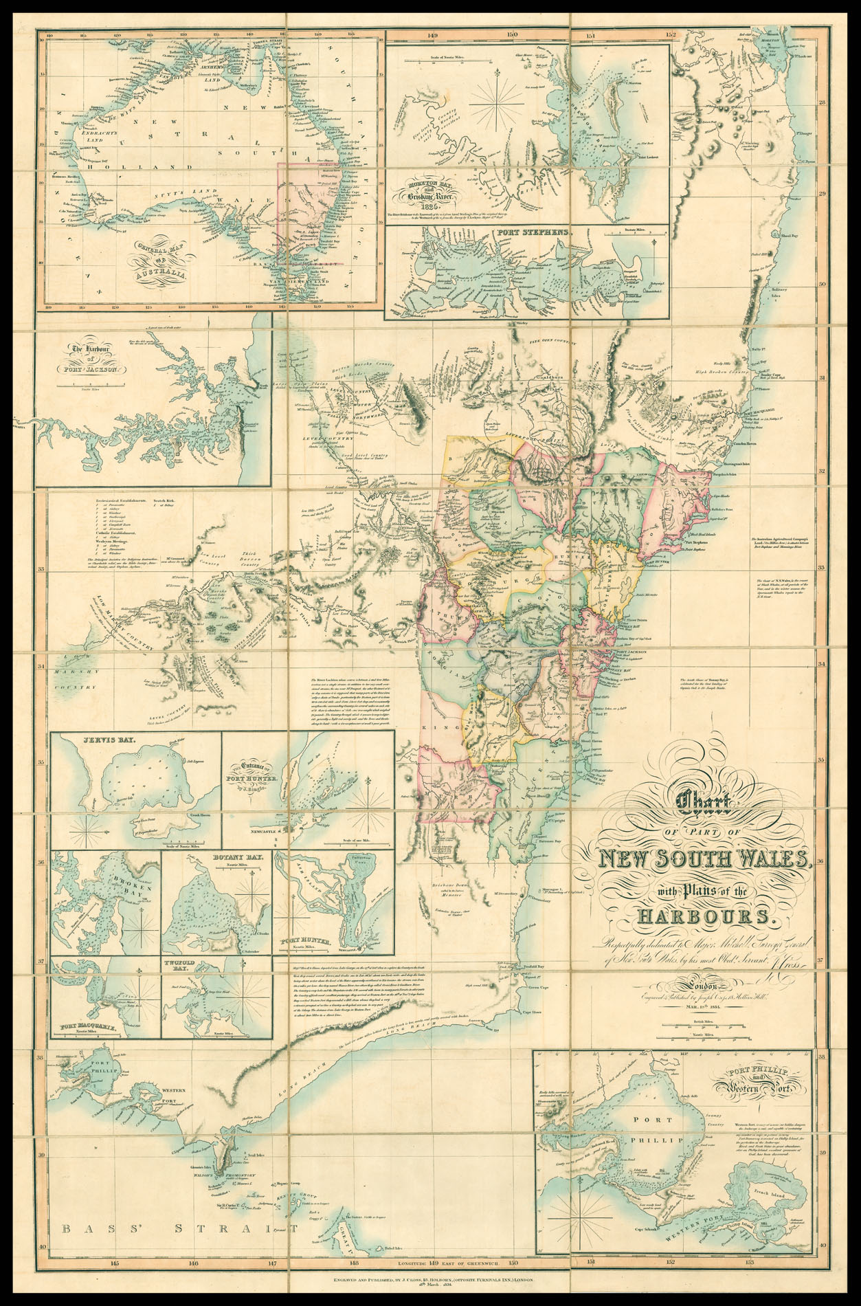
Victoria during the Gold Rush
1 x
£5,000
|
£5,000 |
|
£5,000 |
|
× |
 |
The Book that "sealed the fate of 'America' as the name of the New World"
1 x
£50,000
|
£50,000 |
|
£50,000 |
|
× |
![PTOLEMAEUS, Claudius [translated by ANGELUS, Jacobus, edited by GERMANUS, Nicolaus] [Sri Lanka] Duodecima et ultima Asie tabula.](https://omega.crouchrarebooks.com/wp-content/uploads/2025/03/18411_1H.jpg) |
A striking map of Sri Lanka from the 1482 Ulm Ptolemy
1 x
£15,000
|
£15,000 |
|
£15,000 |
|
× |
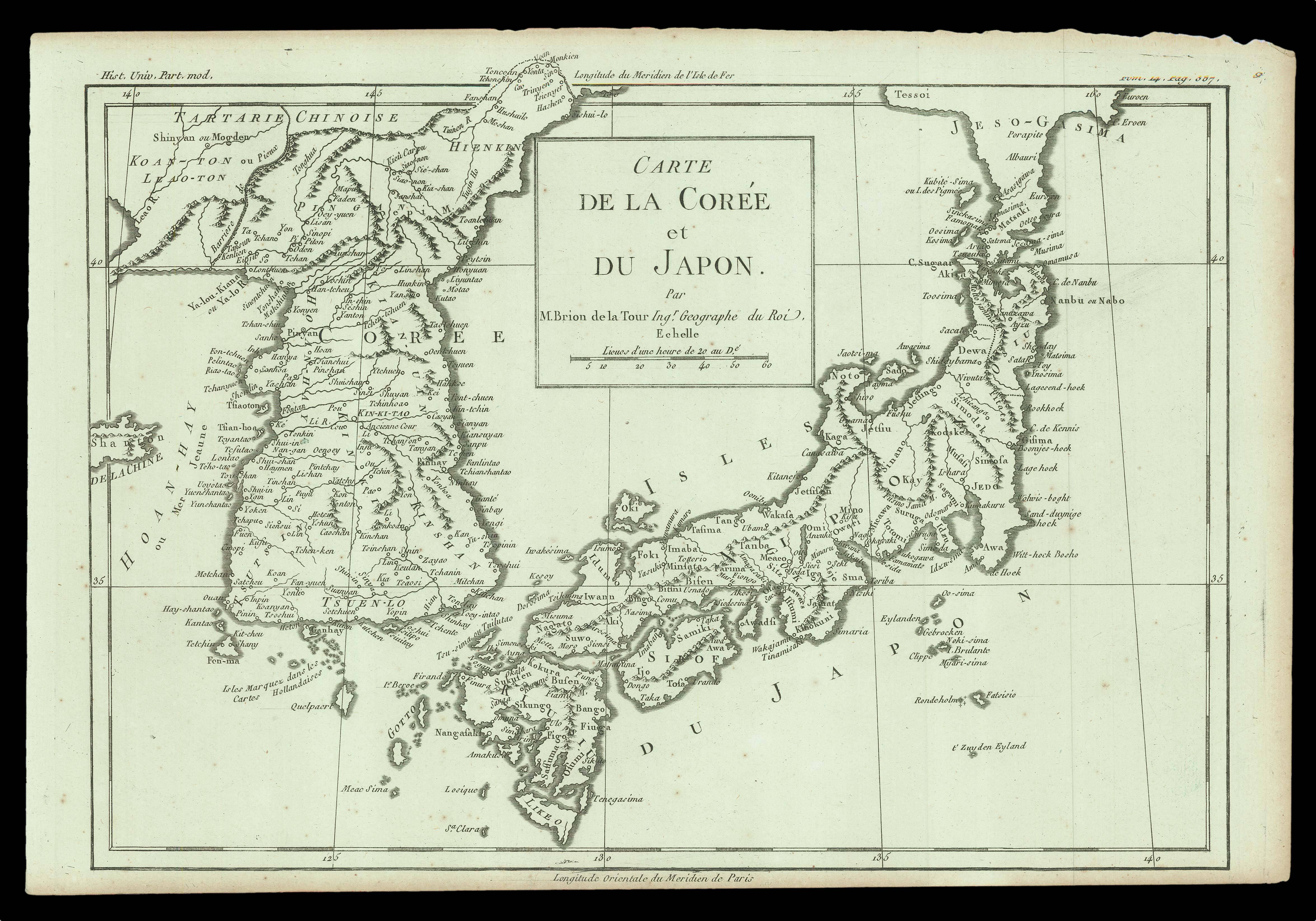 |
A map of Japan and Korea following d'Anville map of 1732
1 x
£135
|
£135 |
|
£135 |
|
× |
 |
The first European to enter Mecca and Medina
1 x
£20,000
|
£20,000 |
|
£20,000 |
|
× |
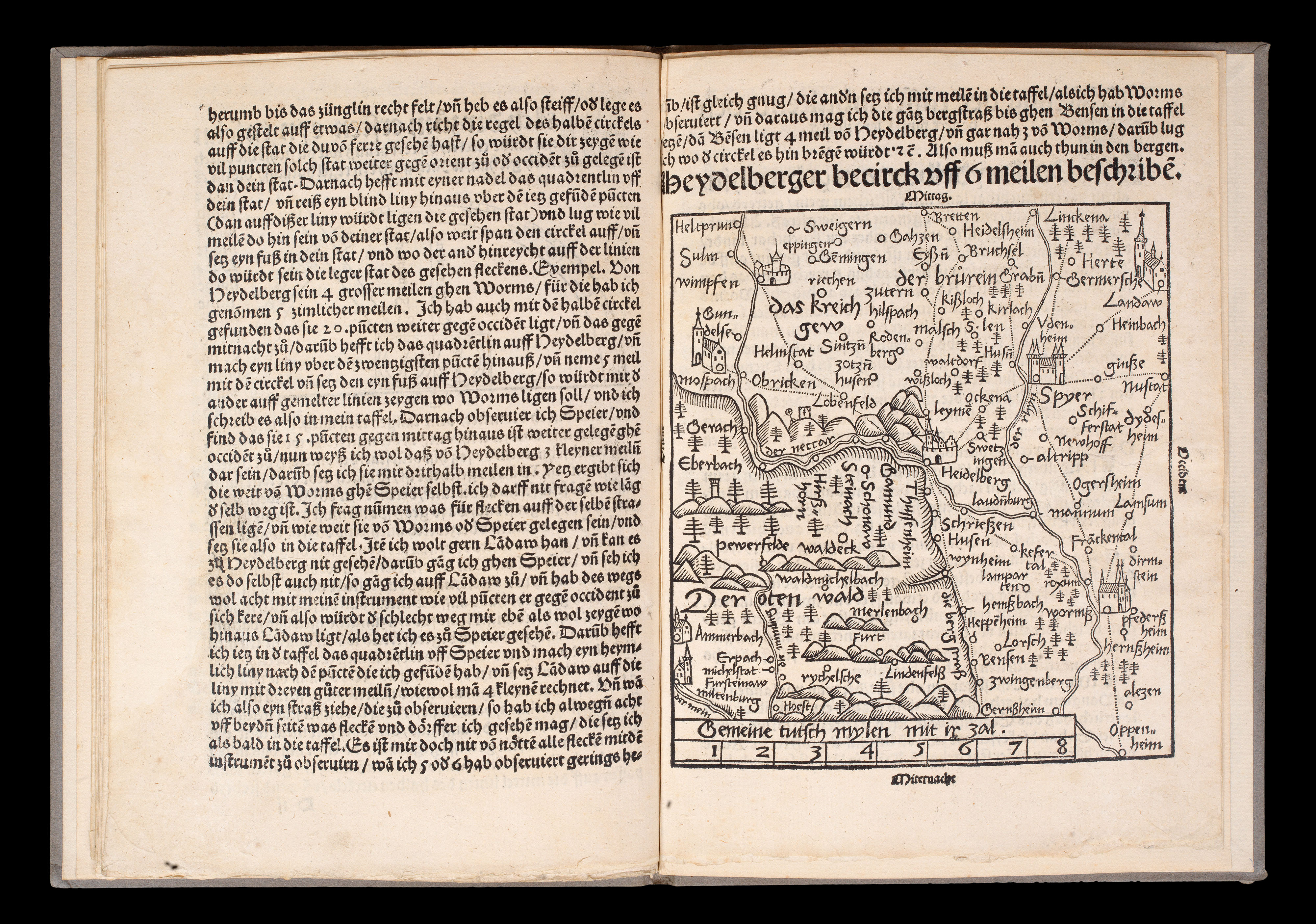 |
The seminal standardization of cartography
1 x
£18,000
|
£18,000 |
|
£18,000 |
|
× |
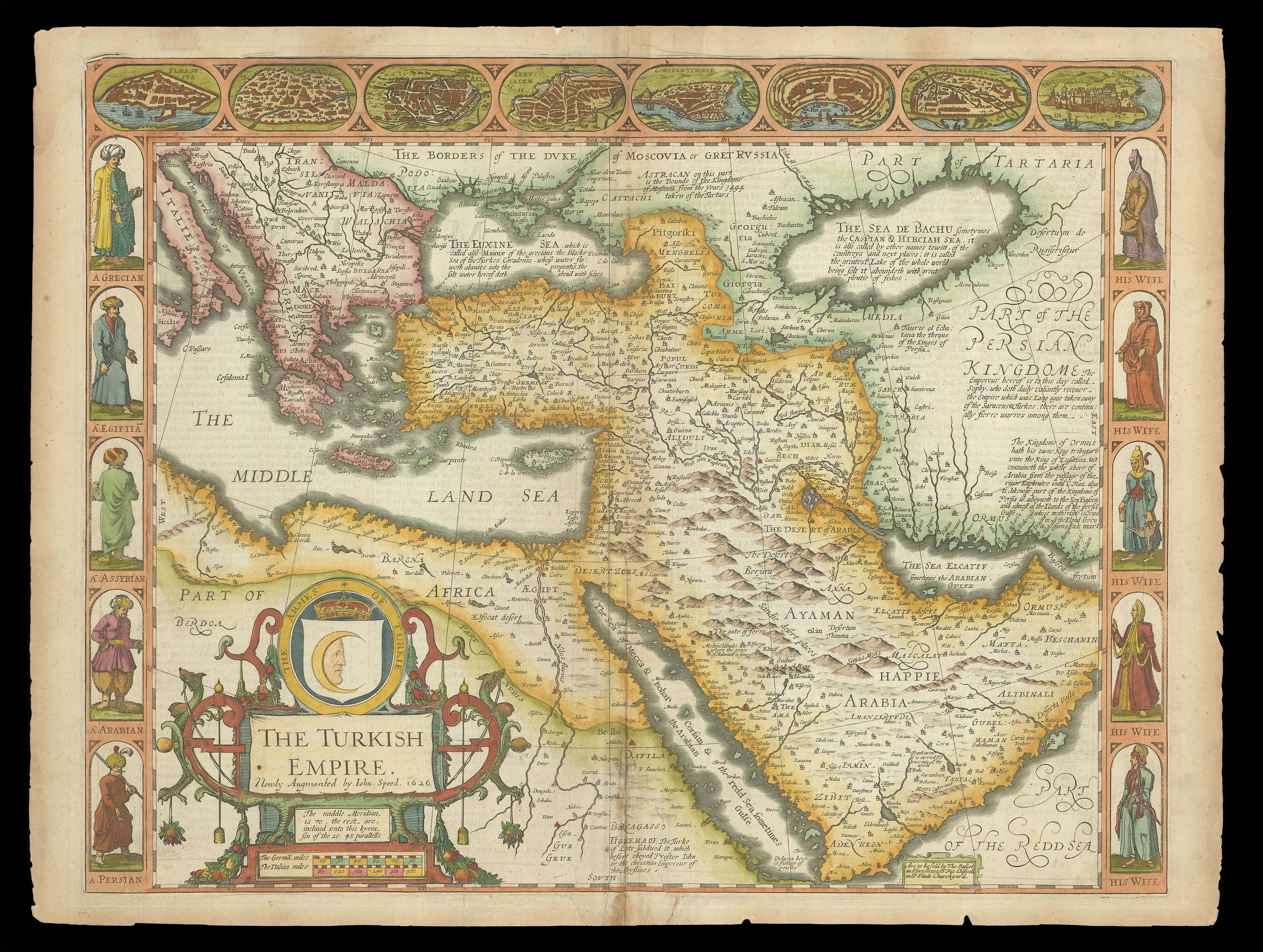 |
Speed's map of the Ottoman Empire
1 x
£2,000
|
£2,000 |
|
£2,000 |
|
× |
![MILLIEU, Louys [Toulouse/Girona pattern playing cards]](https://omega.crouchrarebooks.com/wp-content/uploads/2025/03/21529_1H.jpg) |
The Toulouse-Girona pattern
1 x
£85,000
|
£85,000 |
|
£85,000 |
|
× |
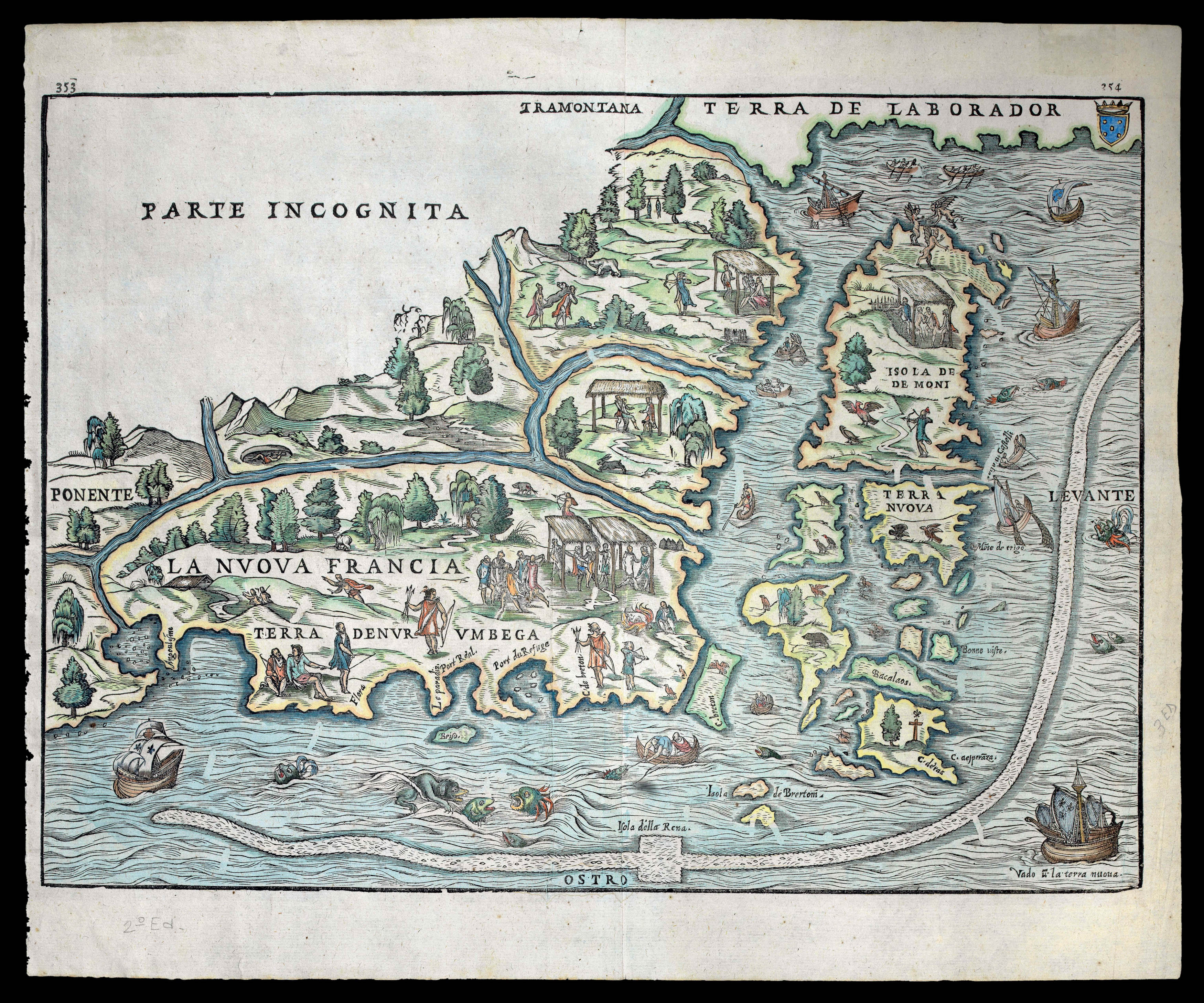 |
The first printed map of Northeastern America
1 x
£6,000
|
£6,000 |
|
£6,000 |
|
× |
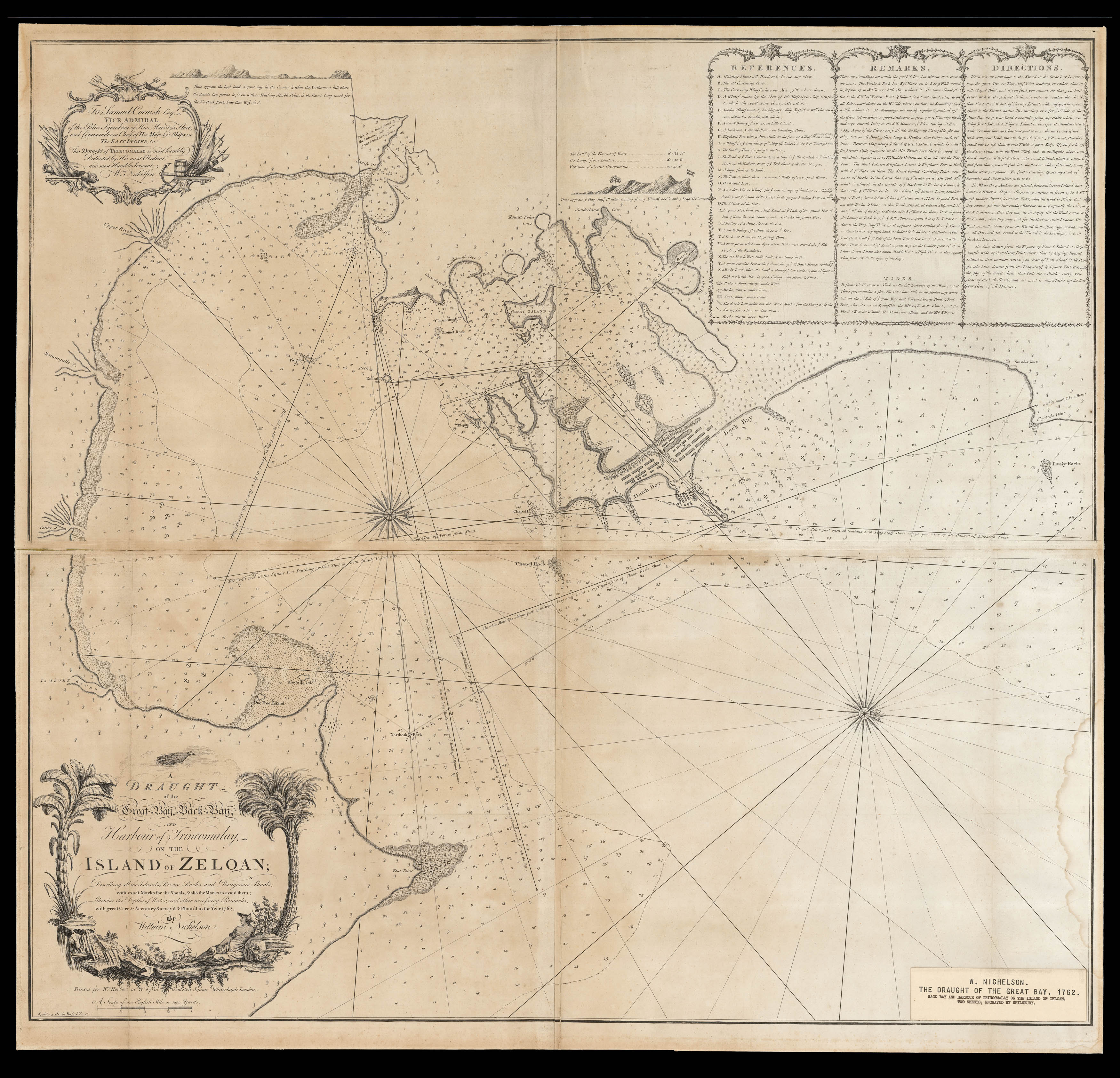 |
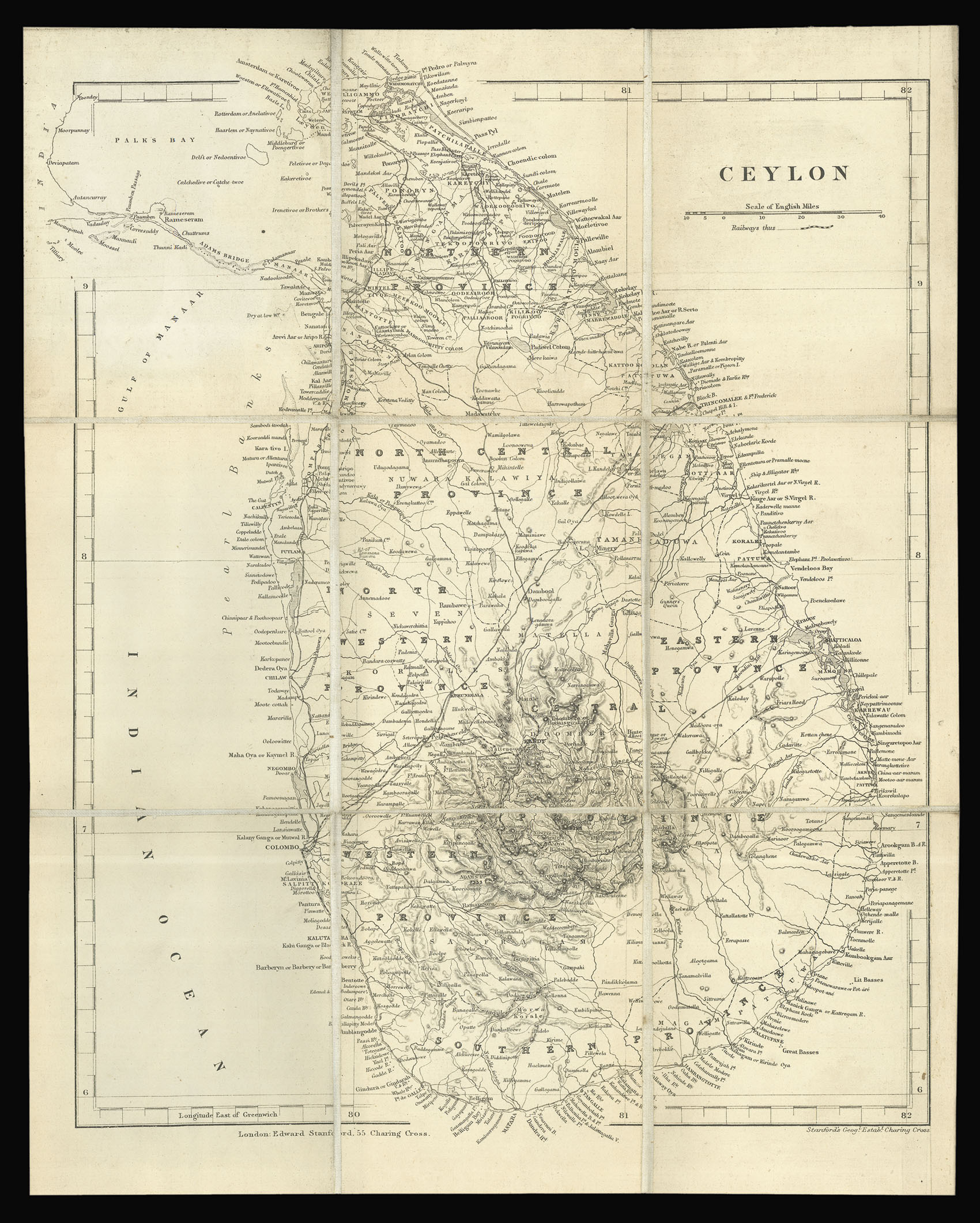
Rare eighteenth-century chart of Northeastern Sri Lanka
1 x
£2,500
|
£2,500 |
|
£2,500 |
|
× |
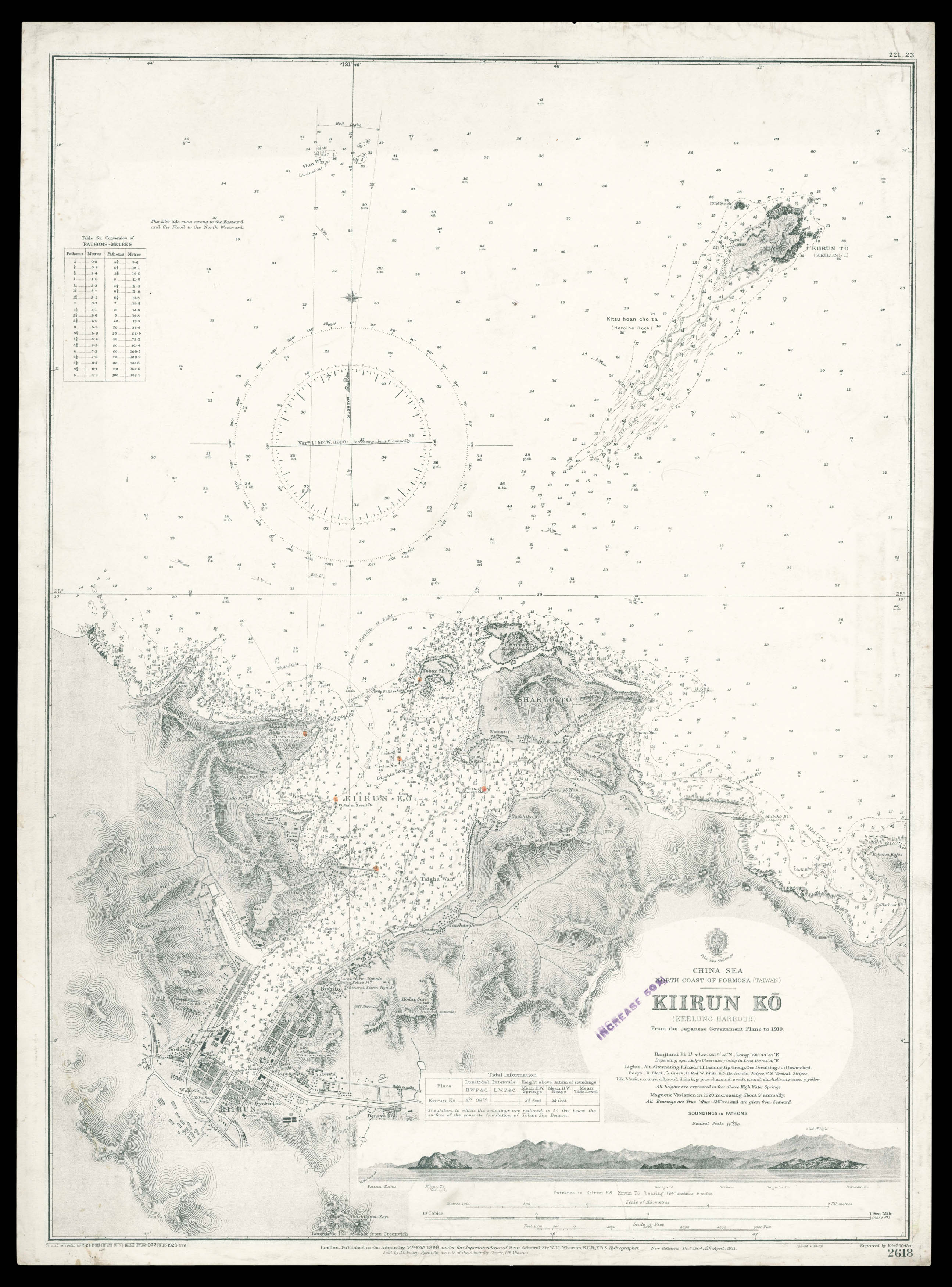 |
Admiralty chart of northern Taiwan
1 x
£950
|
£950 |
|
£950 |
|
× |
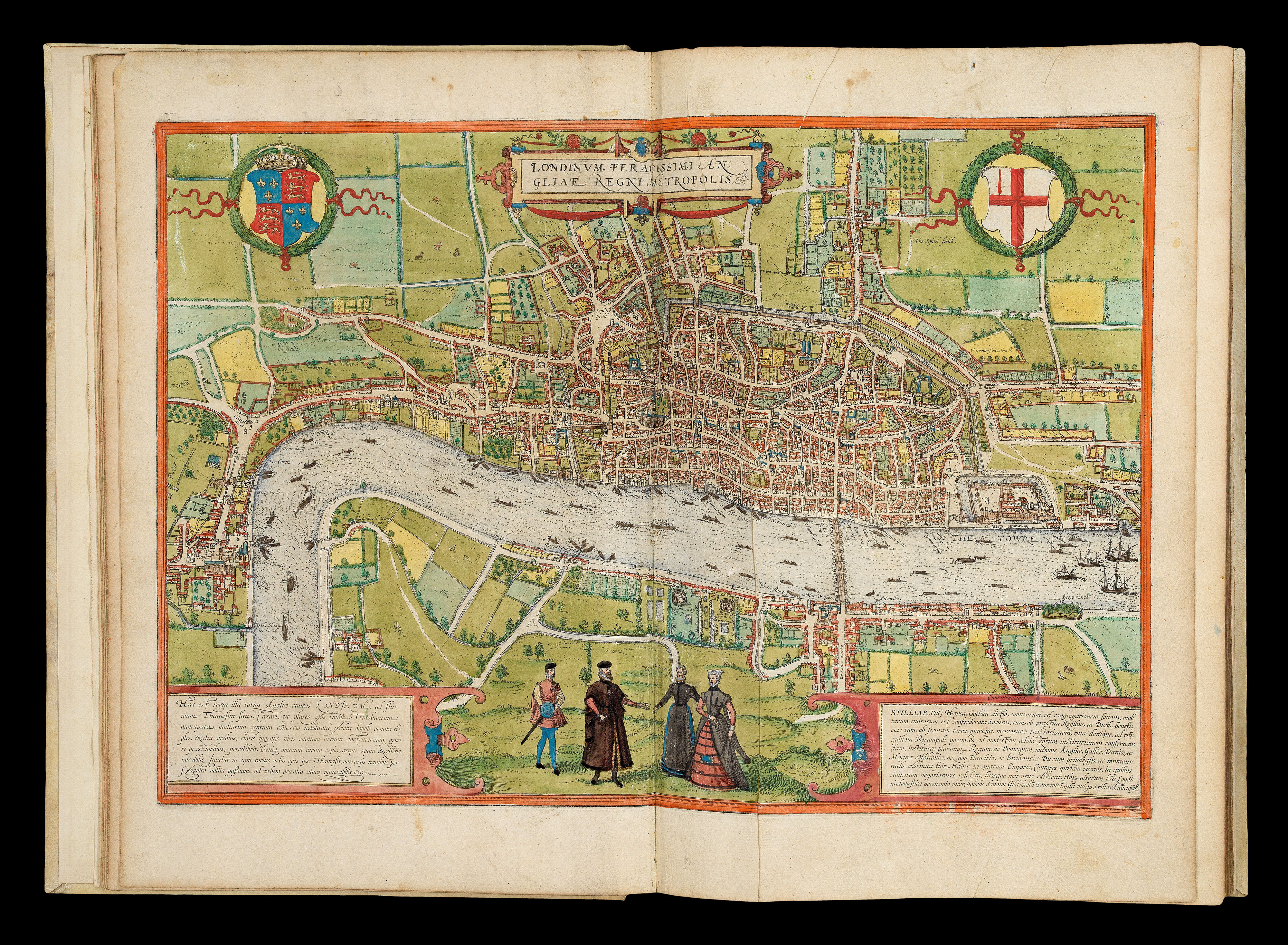 |
The earliest systematic city atlas
1 x
£300,000
|
£300,000 |
|
£300,000 |
|
|


