![[Anonymous]. [The San Zeno Instrument].](https://omega.crouchrarebooks.com/wp-content/uploads/2025/03/15438_1H.jpg) A unique late Medieval/early Renaissance volvelle astronomical calendar
A unique late Medieval/early Renaissance volvelle astronomical calendar ![DOPPELMAYR, Johann Gabriel. Globus Terrestris Novus [and] Globus Coelestis Novus](https://omega.crouchrarebooks.com/wp-content/uploads/2025/03/15669_1H.jpg) Popularising the new scientific ideas of the Enlightenment in Germany
Popularising the new scientific ideas of the Enlightenment in Germany 
Rare Maps

Rare Atlases

Rare Books

Rare Prints

![PURCHAS, Samuel Purchas his pilgrimes... [WITH] Purchas his pilgrimage. Or relations of the world and the religions observed in all ages and places.](https://omega.crouchrarebooks.com/wp-content/uploads/2025/03/1008_1H.jpg)
By PURCHAS, Samuel, 1625 [but 1626].
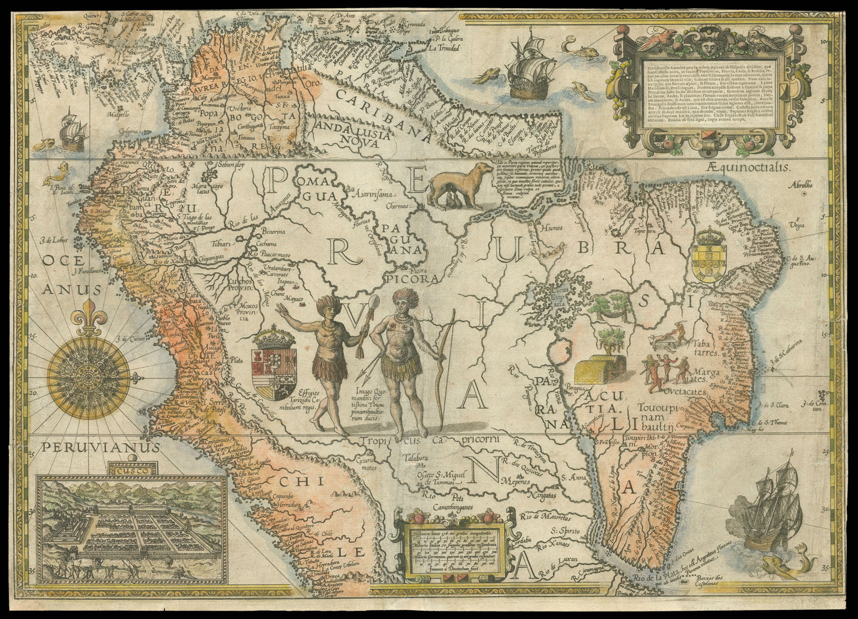
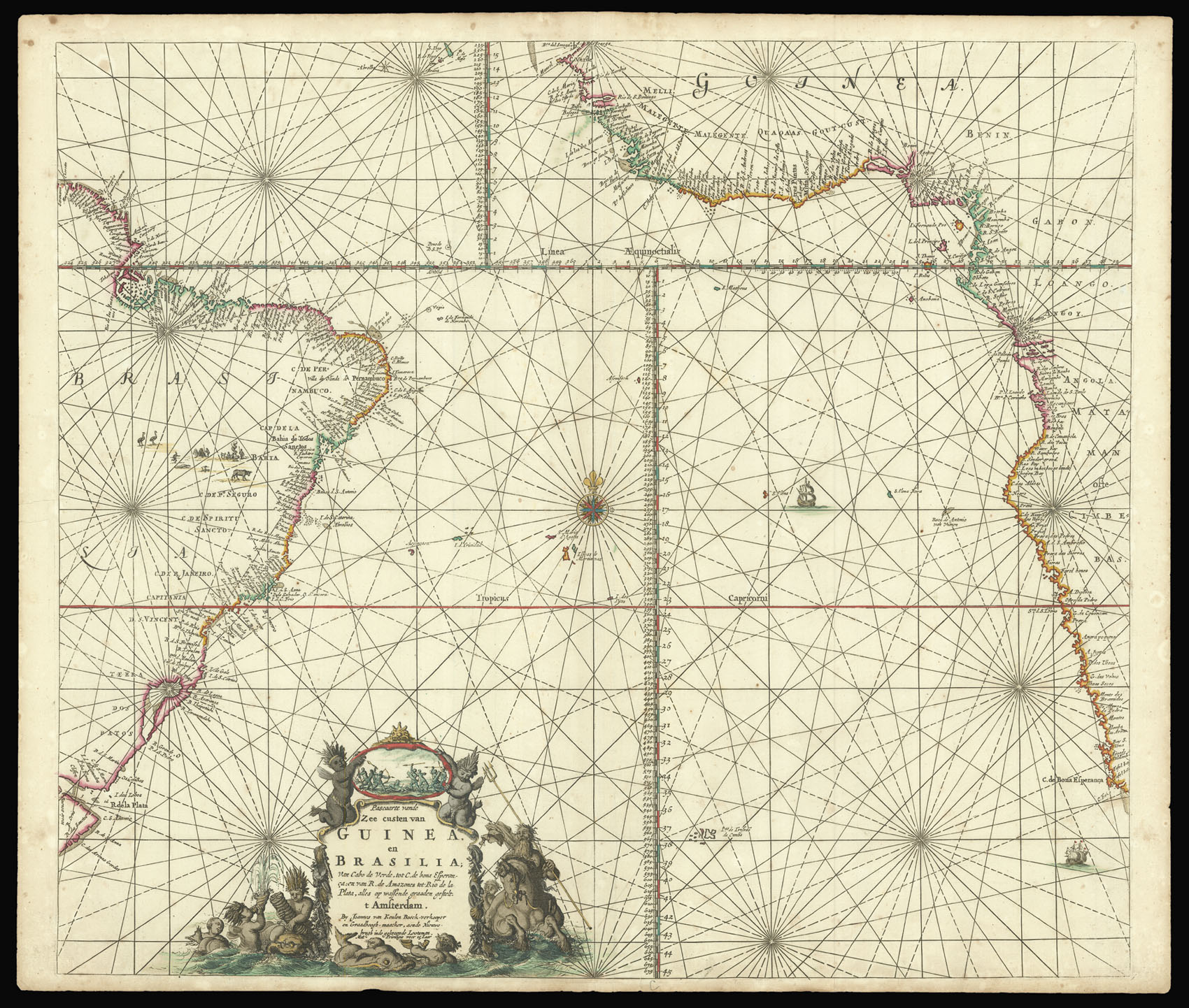
![MARGGRAF [or MARGCARF], George Brasilia qua partie paret Belgis.](https://omega.crouchrarebooks.com/wp-content/uploads/2025/03/18481_1H.jpg)
By MARGGRAF [or MARGCARF], George, 1647
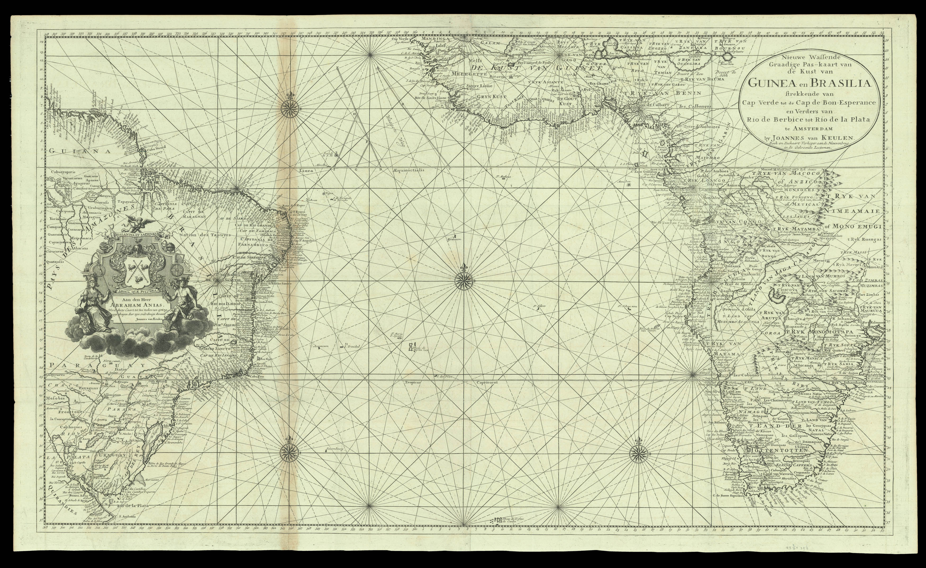
By KEULEN, Johannes II van and KEULEN, Gerard van, [c1728].