|
× |
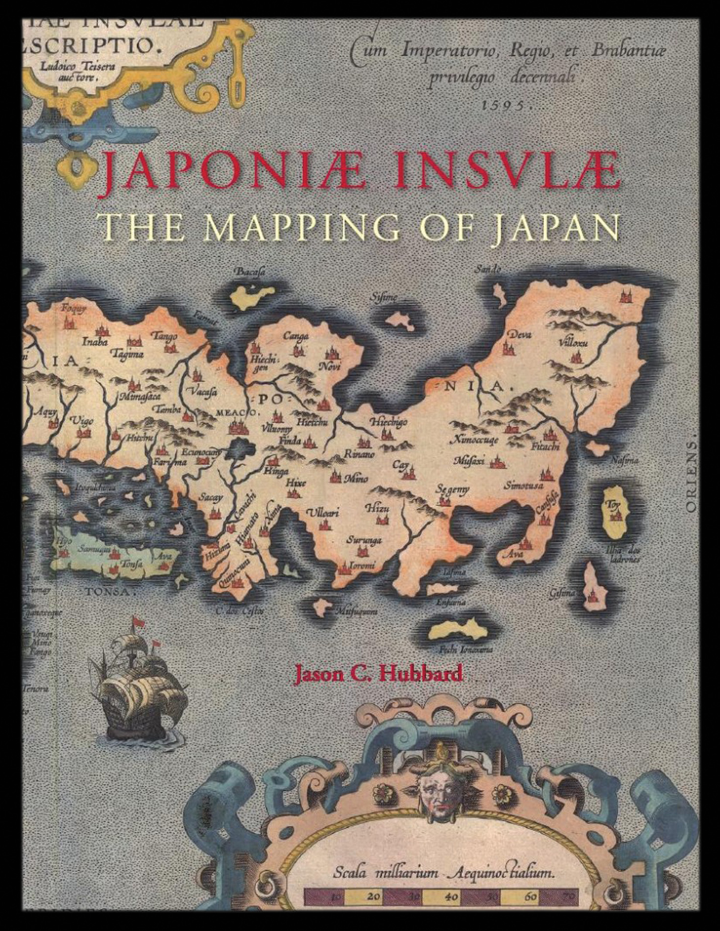 |
Hubbard's cartobibliography of Japan
1 x
£159
|
£159 |
|
£159 |
|
× |
![MANDERSON, Captain [James] An Enquiry into the causes of The Stream which sets through the Gulf of Florida into the Atlantic Ocean: with Directions for Navigating that Passage from Jamaica.](https://omega.crouchrarebooks.com/wp-content/uploads/2025/03/22654_1H.jpg) |
Manderson's pilot of the Gulf of Florida
1 x
£5,000
|
£5,000 |
|
£5,000 |
|
× |
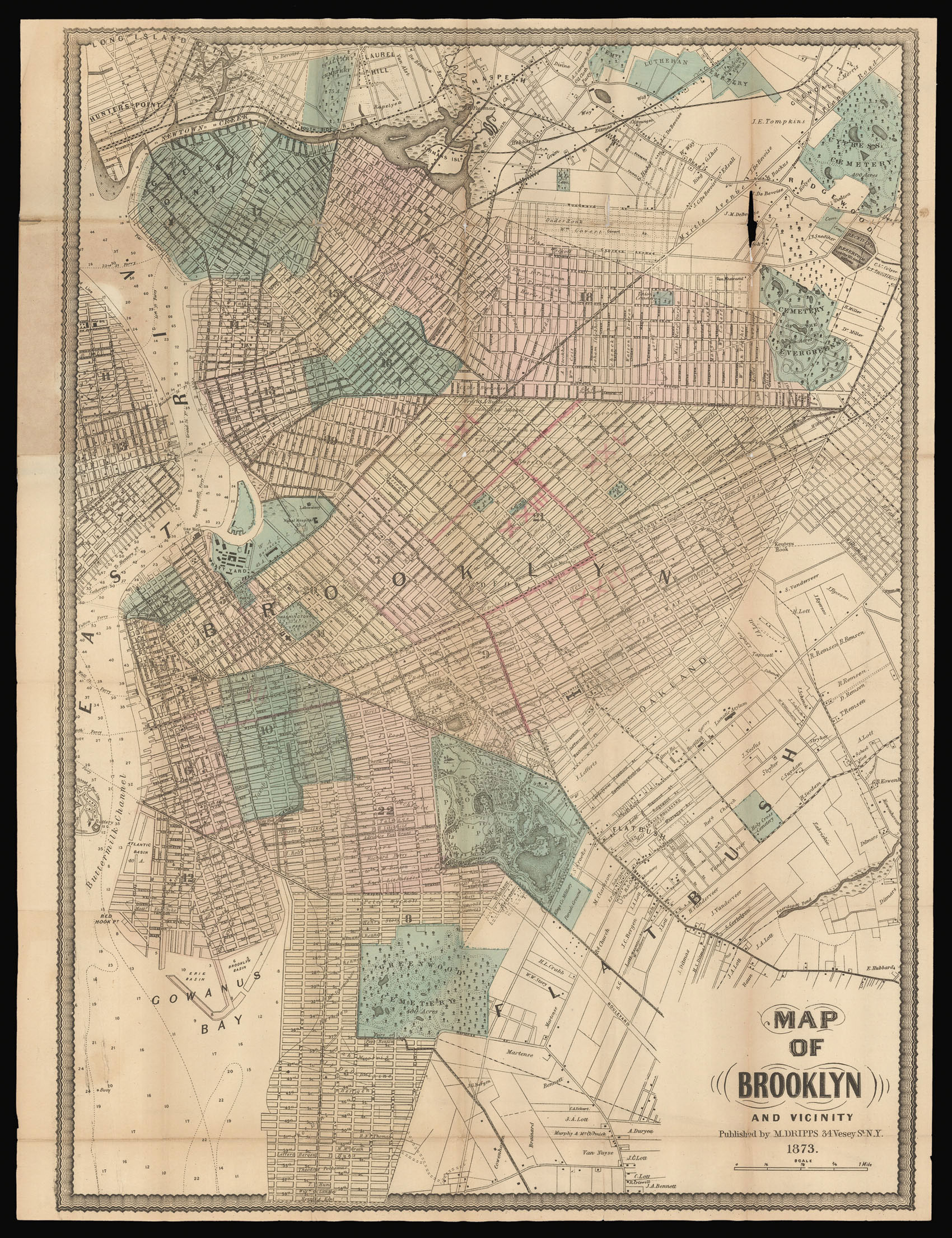 |
Brooklyn as the third largest city in the United States
1 x
£1,200
|
£1,200 |
|
£1,200 |
|
× |
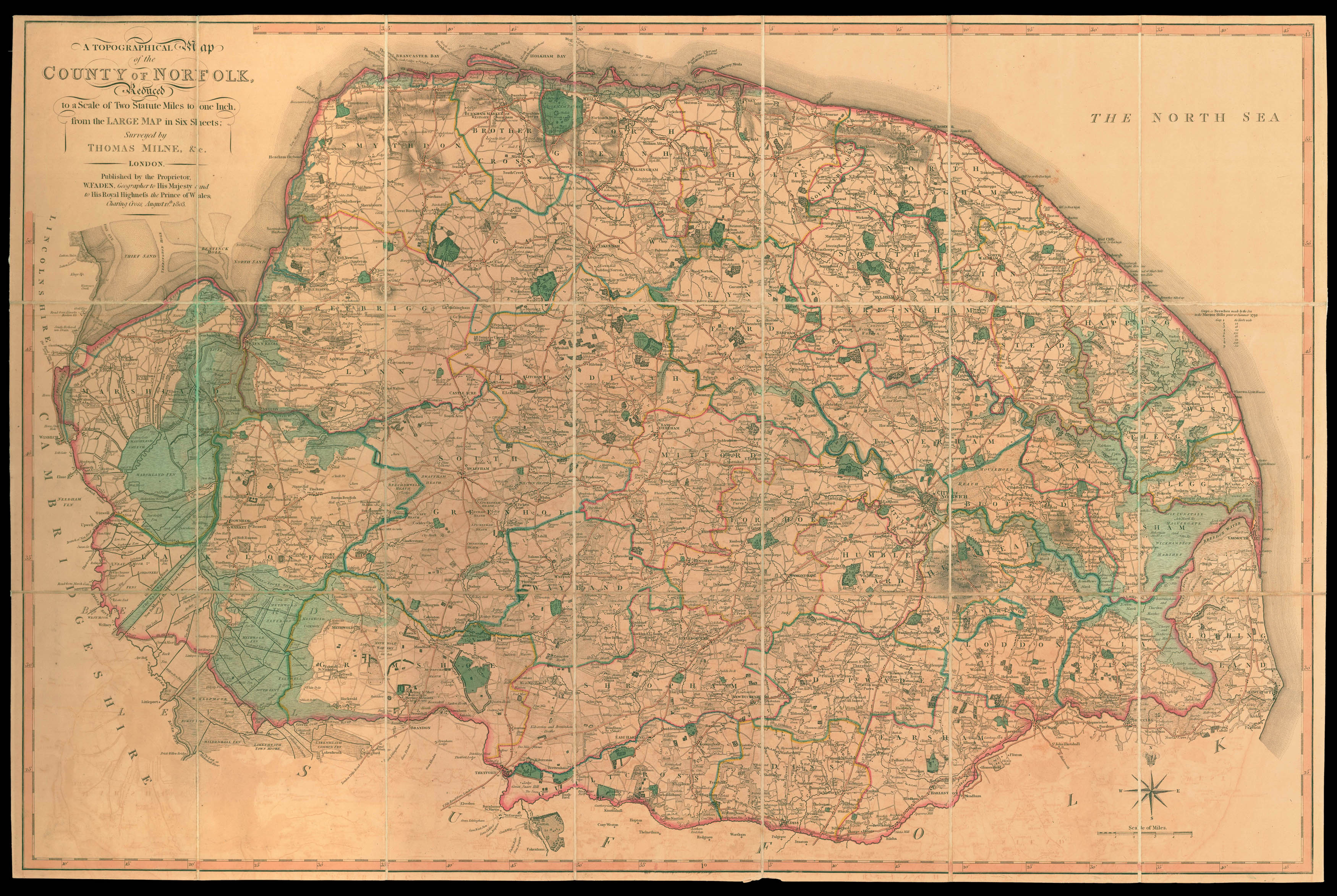 |
Norfolk - Milne's reduced survey of Norfolk
1 x
£900
|
£900 |
|
£900 |
|
× |
![GÖBL, Andreas Benedict Baierische Hochzeit [Bavarian Wedding]](https://omega.crouchrarebooks.com/wp-content/uploads/2025/03/20704_1H.jpg) |
A royal wedding
1 x
£20,000
|
£20,000 |
|
£20,000 |
|
× |
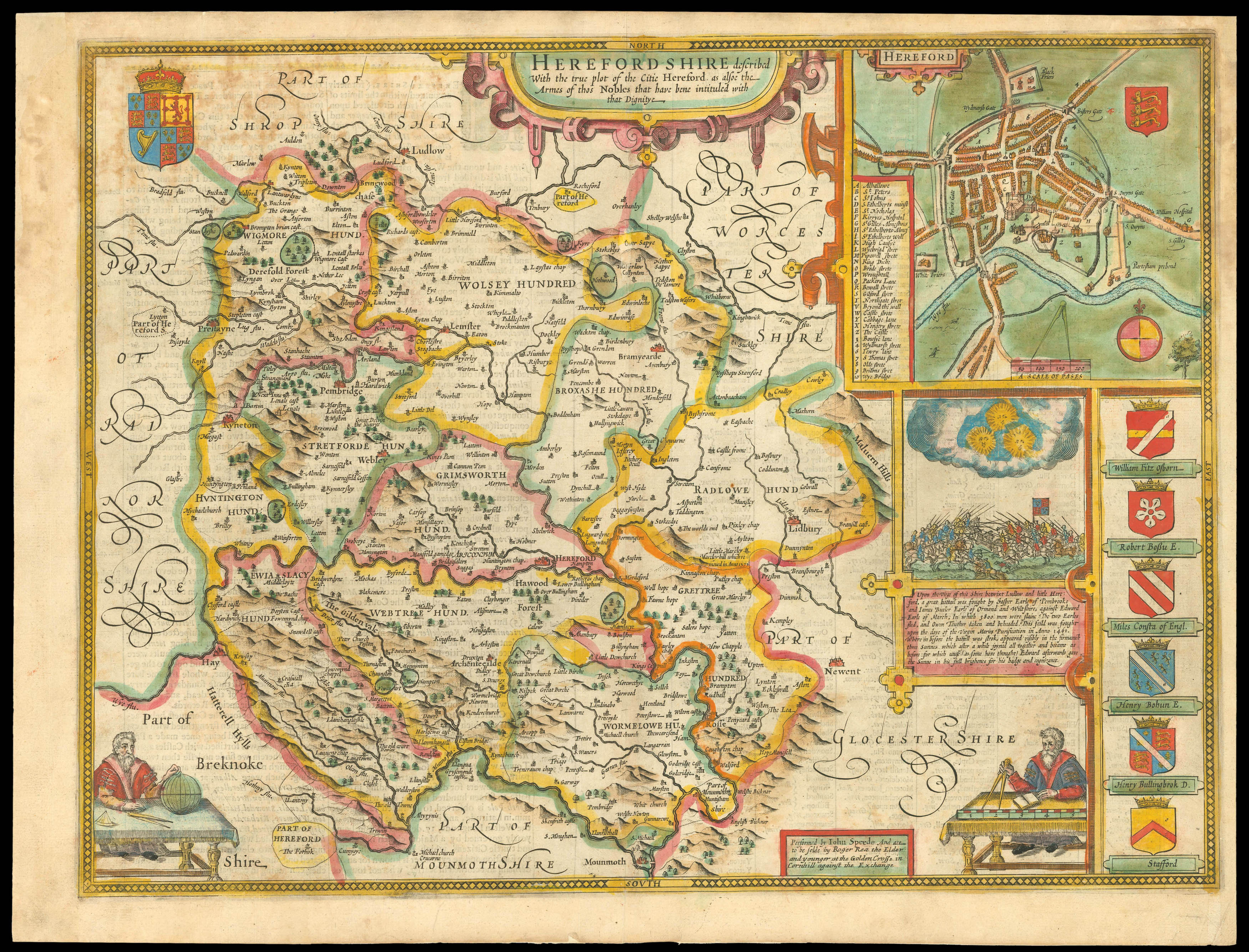 |
Rare Roger Rea edition of Speed's map of Herefordshire
1 x
£1,000
|
£1,000 |
|
£1,000 |
|
× |
![WYLD, James [Junior] [Manuscript map of the Arabian Peninsula].](https://omega.crouchrarebooks.com/wp-content/uploads/2025/03/15158_1H.jpg) |
Manuscript map of the Arabian Peninsula
1 x
£30,000
|
£30,000 |
|
£30,000 |
|
× |
![[CHURCH MISSIONARY SOCIETY] Atlas, ay majmu' kharitat rasm al-ard...](https://omega.crouchrarebooks.com/wp-content/uploads/2025/03/14768_1H.jpg) |
The earliest obtainable atlas printed in Arabic
1 x
£60,000
|
£60,000 |
|
£60,000 |
|
× |
![[?BOAZIO, Giovanni Battista] S. Iacob.](https://omega.crouchrarebooks.com/wp-content/uploads/2025/03/15989_1H.jpg) |
The first printed view of Santiago, Cape Verde
1 x
£12,000
|
£12,000 |
|
£12,000 |
|
× |
 |
Venezuela and Curaçao
1 x
£600
|
£600 |
|
£600 |
|
× |
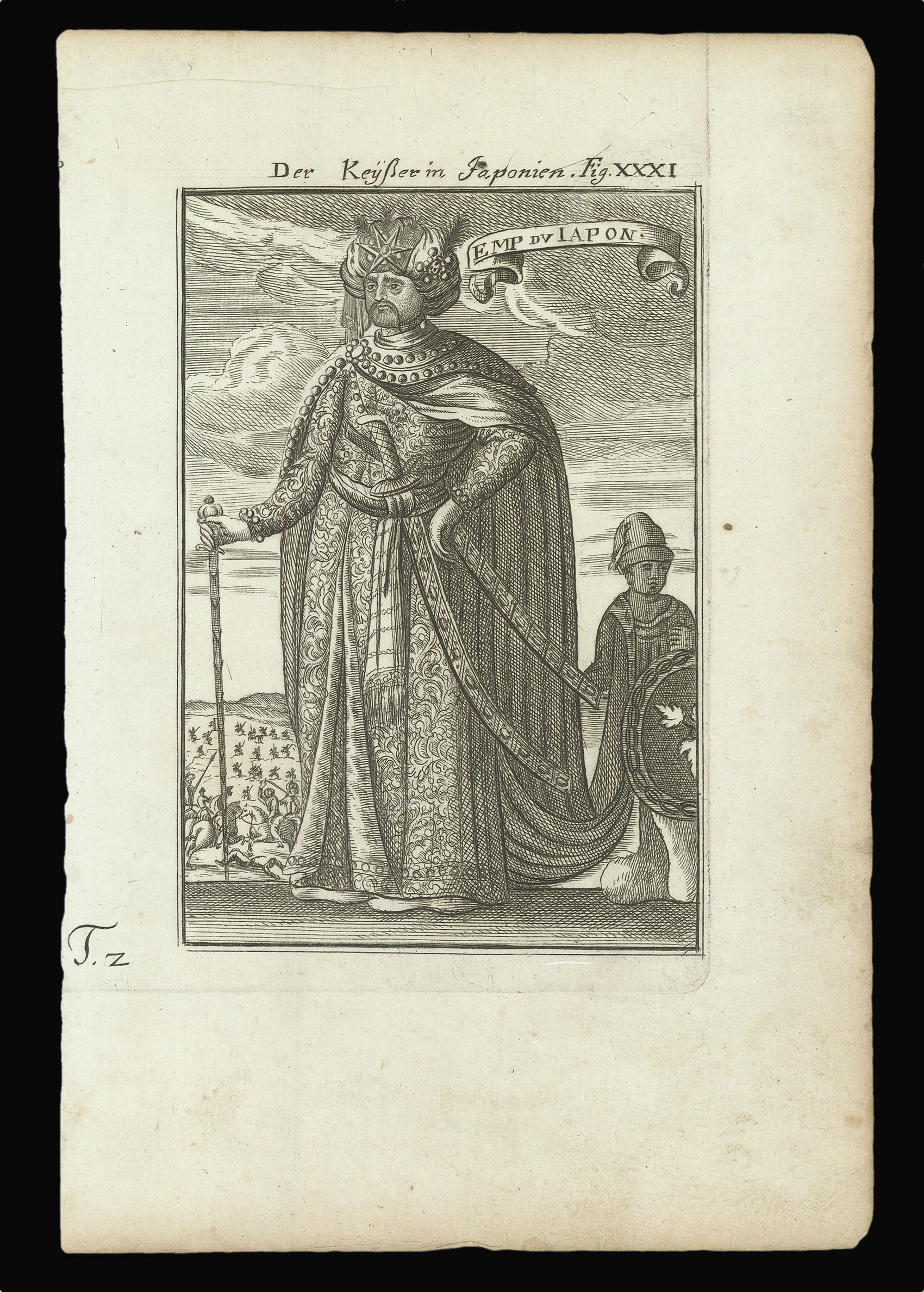 |
The Emperor of Japan
1 x
£60
|
£60 |
|
£60 |
|
× |
 |
A German reprint after Gilles Robert de Vaugondy
1 x
£175
|
£175 |
|
£175 |
|
× |
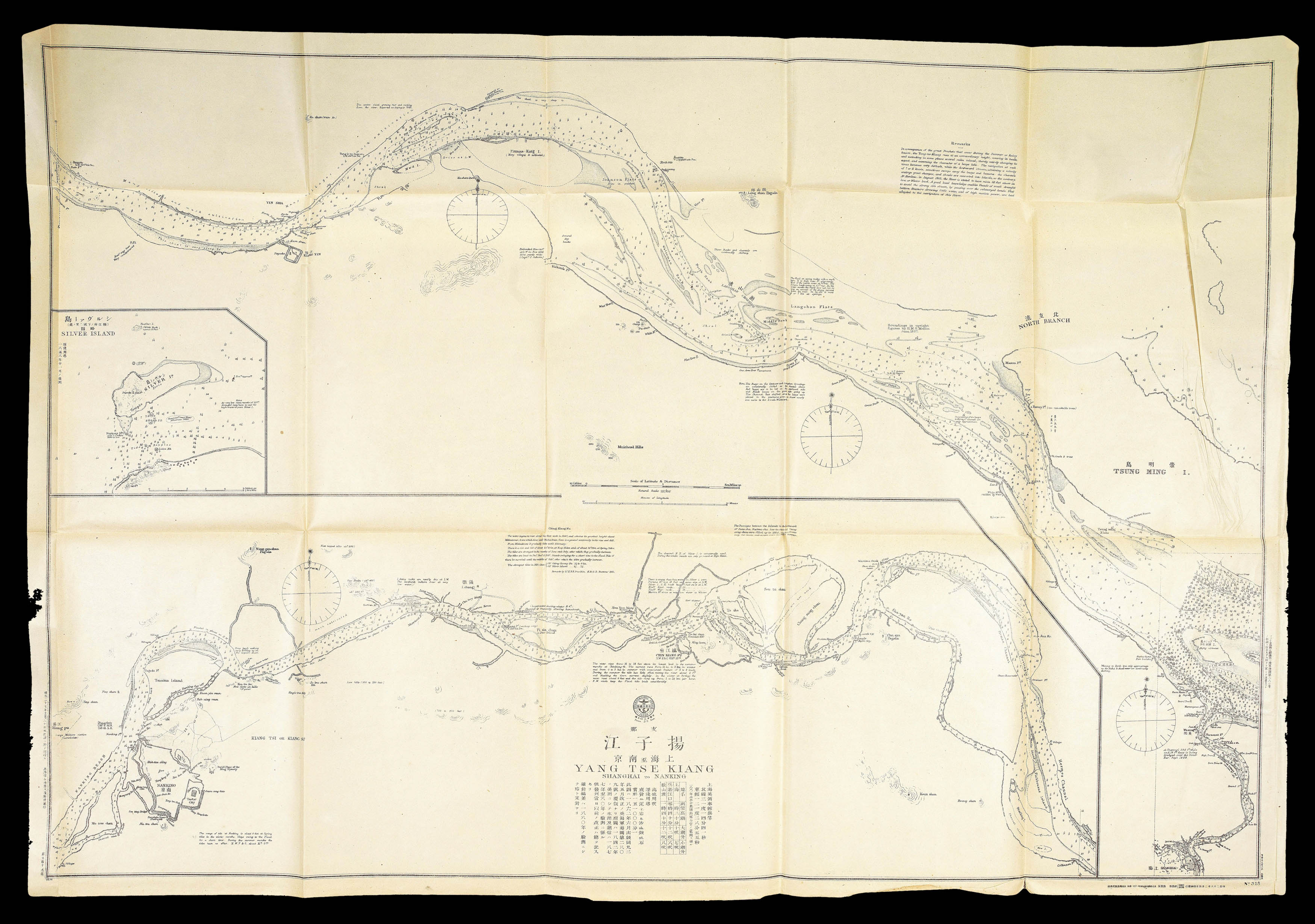 |
Japanese Admiralty chart of Shanghai and the Yangtze River
1 x
£2,500
|
£2,500 |
|
£2,500 |
|
× |
![BERGERON, [Louis-Eloy] [but Louis-Georges-Isaac SALIVET] Manuel du tourneur](https://omega.crouchrarebooks.com/wp-content/uploads/2025/03/15093_1H-3.jpg) |
Rare first edition of woodworker's manual
1 x
£1,000
|
£1,000 |
|
£1,000 |
|
× |
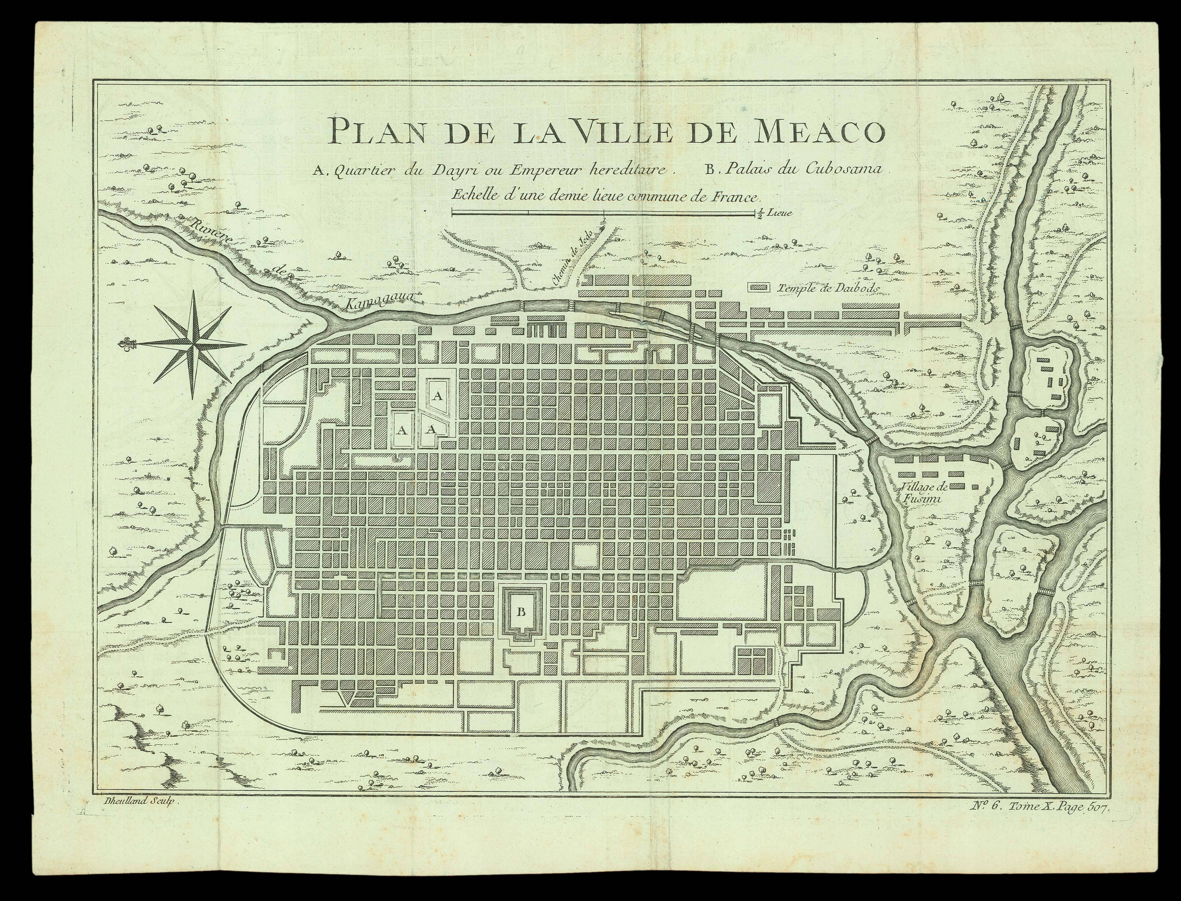 |
Plan of Kyoto
1 x
£150
|
£150 |
|
£150 |
|
× |
![HOLLAR, W[enceslaus] Autumnus [and] Hiems [and] Aestas [and] Ver](https://omega.crouchrarebooks.com/wp-content/uploads/2025/03/18290_1H.jpg) |
The Half-Length Seasons
1 x
£8,000
|
£8,000 |
|
£8,000 |
|
× |
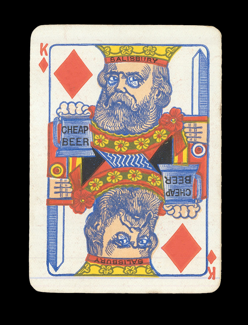 |
Playing Politics
1 x
£1,200
|
£1,200 |
|
£1,200 |
|
× |
![KEULEN, Johannes van [Bay of Nagasaki].](https://omega.crouchrarebooks.com/wp-content/uploads/2025/03/15644_1H.jpg) |
Manuscript Bay of Nagasaki
1 x
£50,000
|
£50,000 |
|
£50,000 |
|
× |
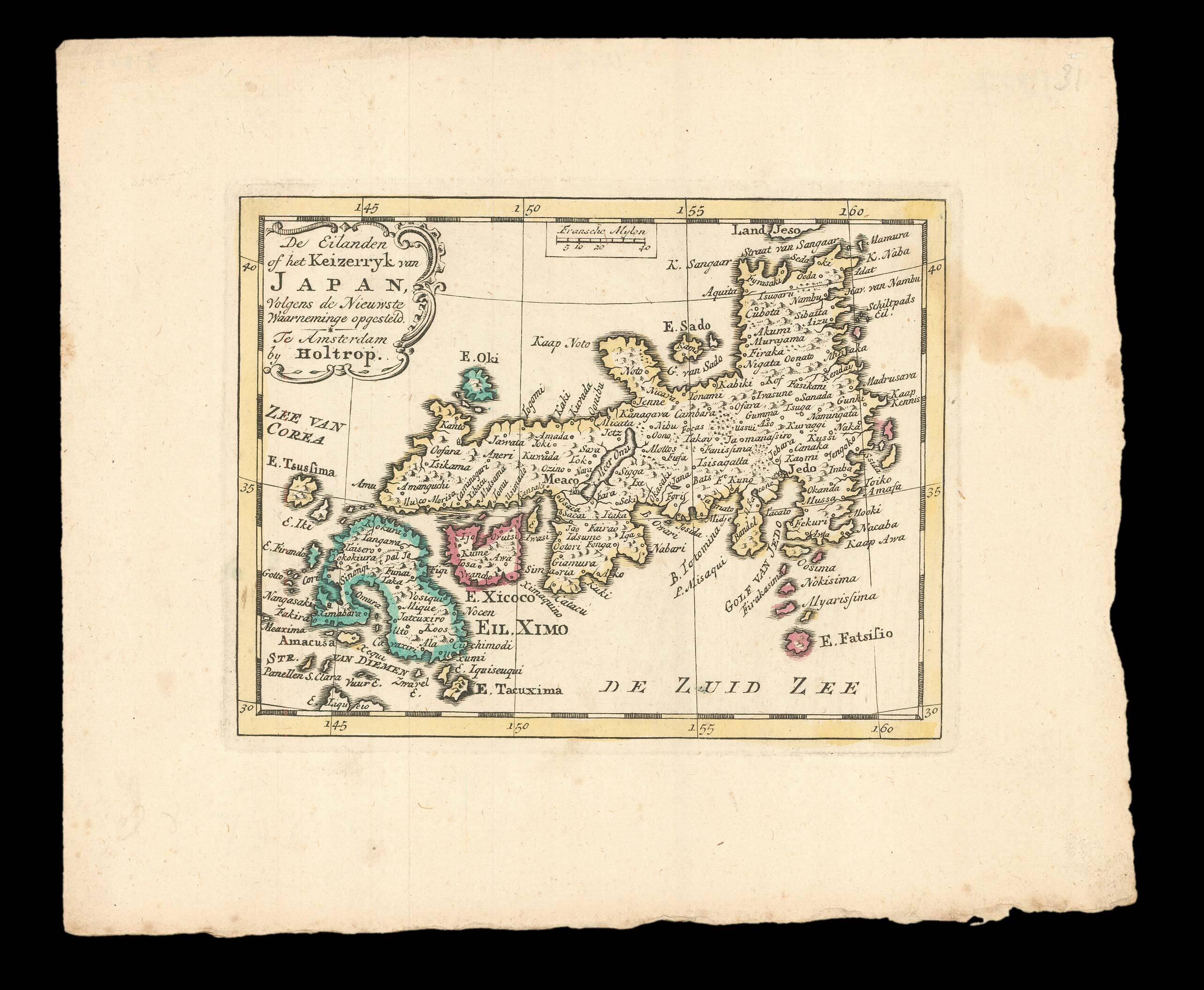 |
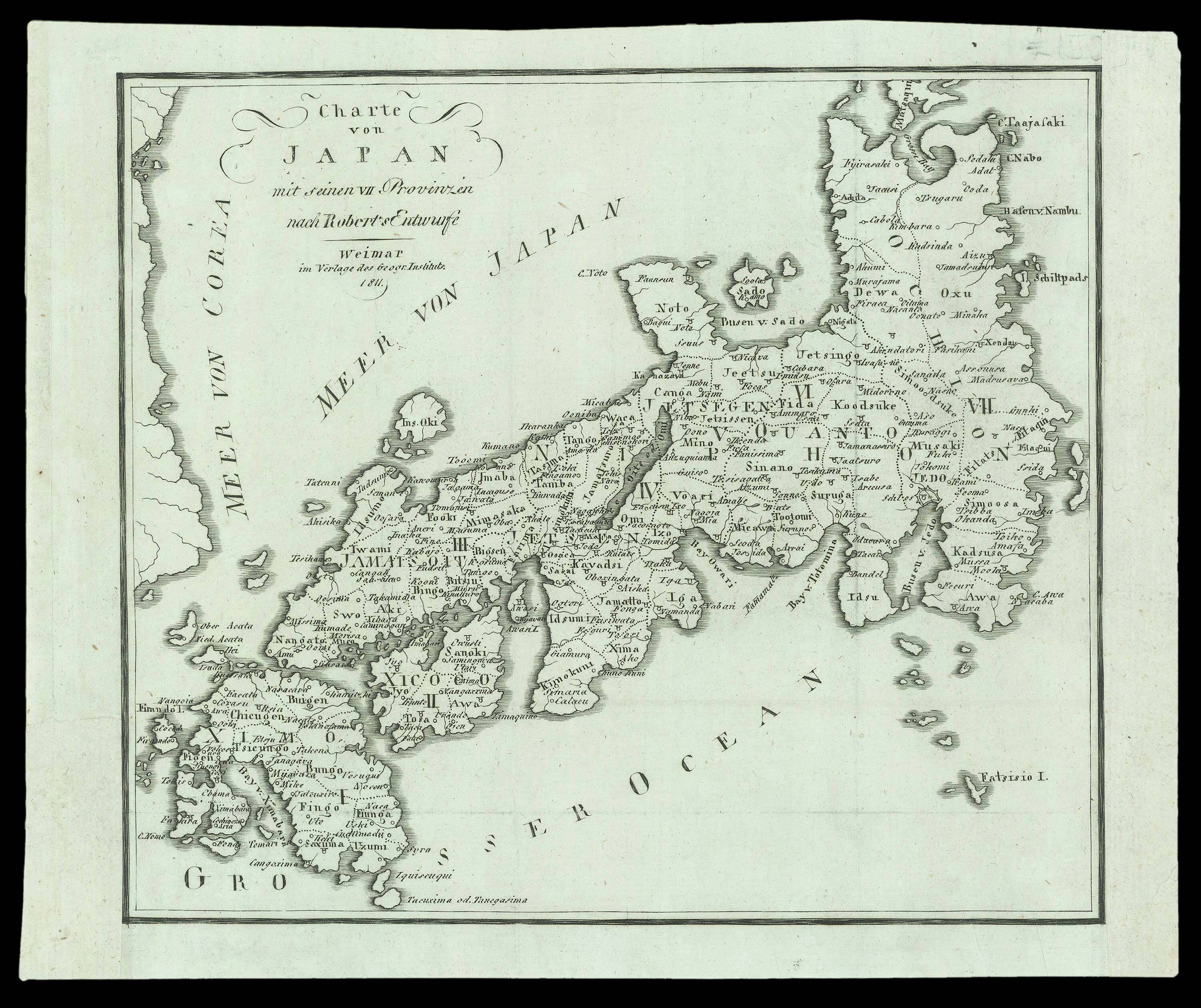
Miniature map of Japan
1 x
£200
|
£200 |
|
£200 |
|
× |
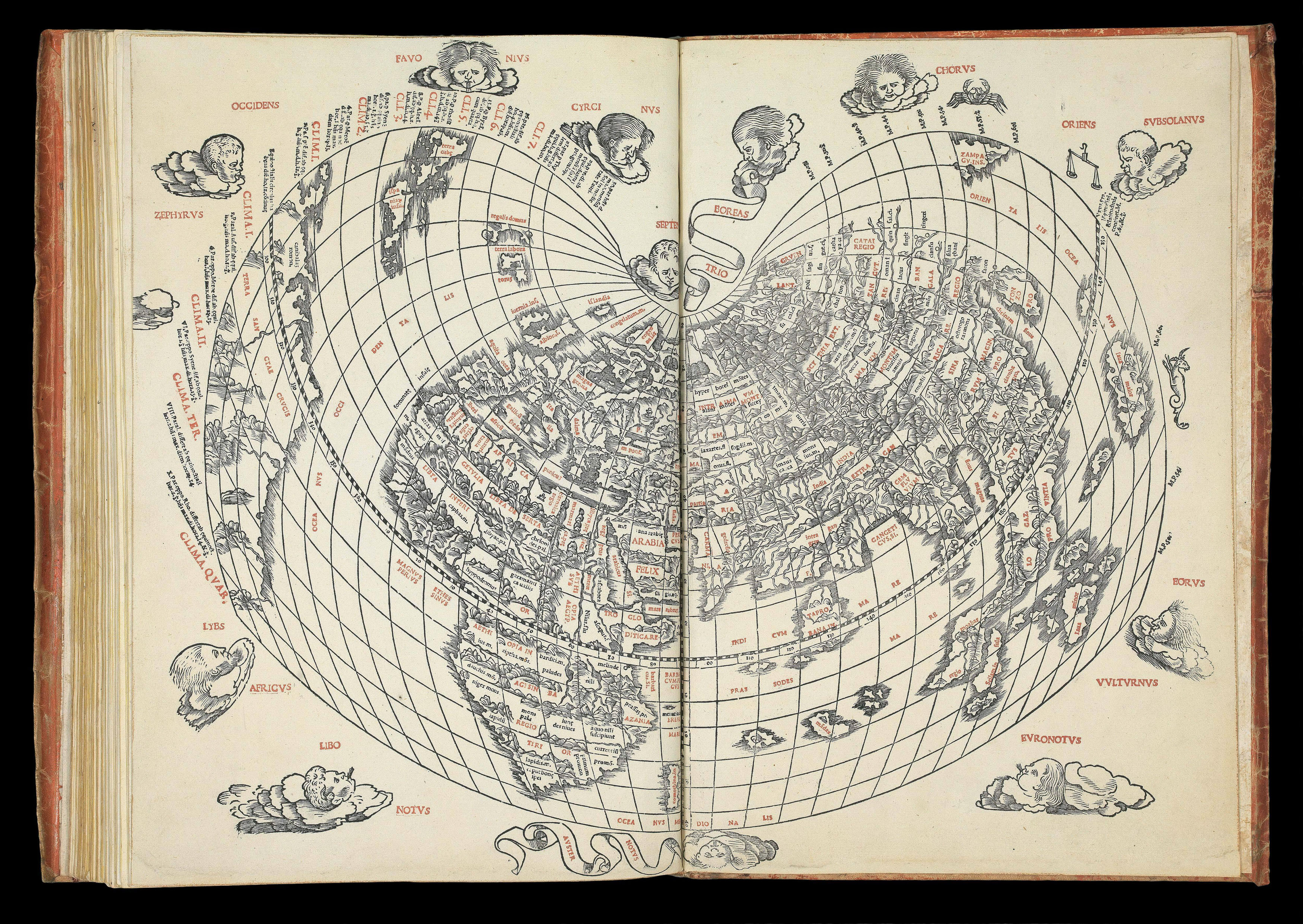 |
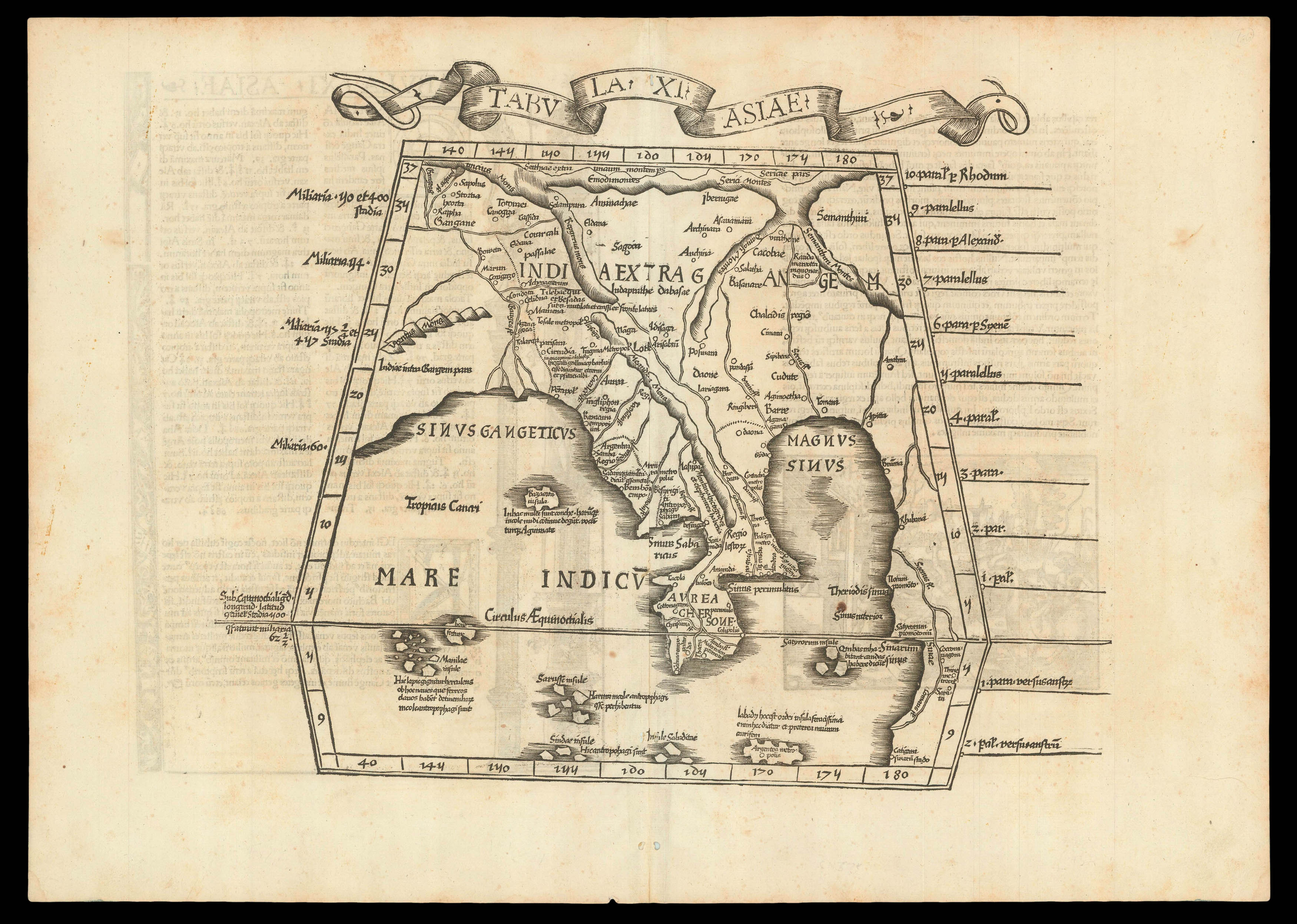
The first atlas printed in Venice, the first wholly printed in colours, incorporating the first map to indicate Japan, the second map in a Ptolemaic atlas to show America.
1 x
£150,000
|
£150,000 |
|
£150,000 |
|
× |
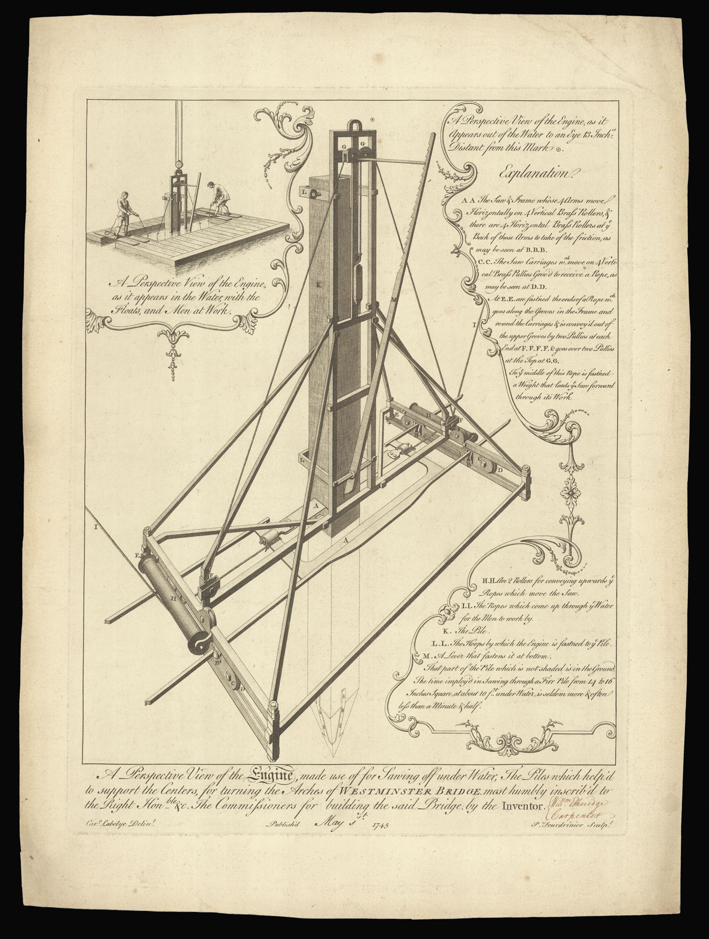 |
An underwater saw
1 x
£950
|
£950 |
|
£950 |
|
× |
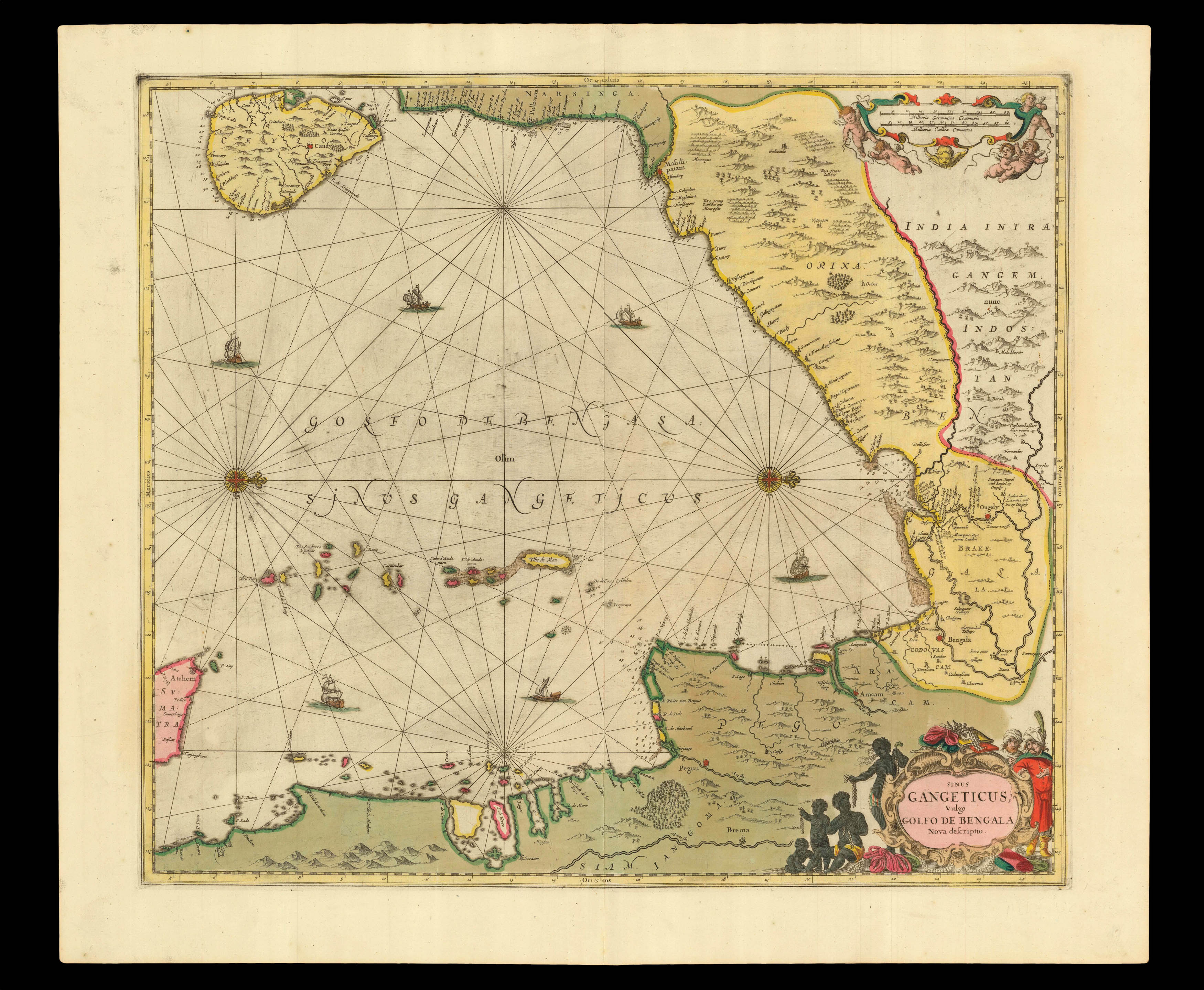 |
One of the earliest printed sea charts of the Bay of Bengal
1 x
£750
|
£750 |
|
£750 |
|
× |
 |
Kingdoms of gold and silver
1 x
£1,100
|
£1,100 |
|
£1,100 |
|
× |
![TAYLOR, Isaac [City of Hereford] To the right Hon[oura]ble ye Earl of Oxford High Steward of the City of Hereford...](https://omega.crouchrarebooks.com/wp-content/uploads/2025/03/21794_1H.jpg) |
Taylor's Plan of Hereford
1 x
£2,500
|
£2,500 |
|
£2,500 |
|
× |
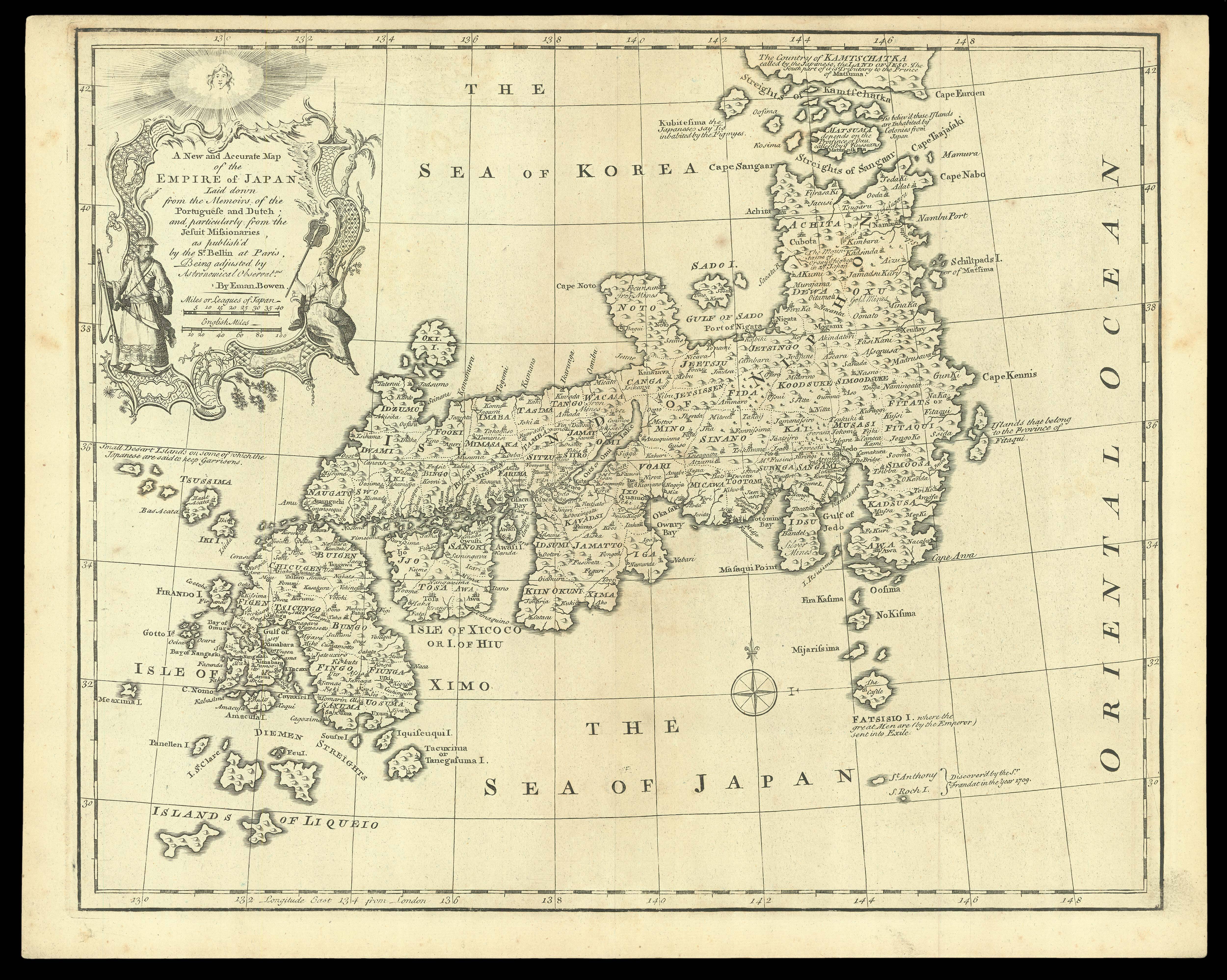 |
A New and Accurate Map of the Empire of Japan
1 x
£1,750
|
£1,750 |
|
£1,750 |
|
× |
![DUFOUR, A[dolphe] H[ippolyte] Japon par A. H. Dufour. (pl 66).](https://omega.crouchrarebooks.com/wp-content/uploads/2025/03/15797_1H.jpg) |
Map of Japan published in Dufour's 'Atlas Populaire'
1 x
£40
|
£40 |
|
£40 |
|
× |
![KILIAN, Wolf[gang] Conradus Peutinger Decimus Quintus Reipub. Augustanae. Duumuir. XVIII.](https://omega.crouchrarebooks.com/wp-content/uploads/2025/03/17754_1H.jpg) |
Konrad Peutinger
1 x
£200
|
£200 |
|
£200 |
|
× |
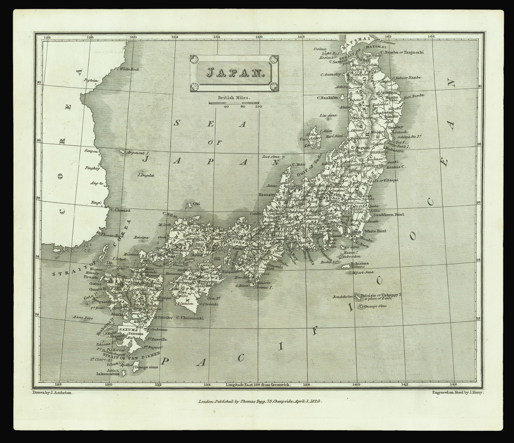 |
From the first edition of Thomas Tegg's 'A London Encyclopaedia'
1 x
£40
|
£40 |
|
£40 |
|
× |
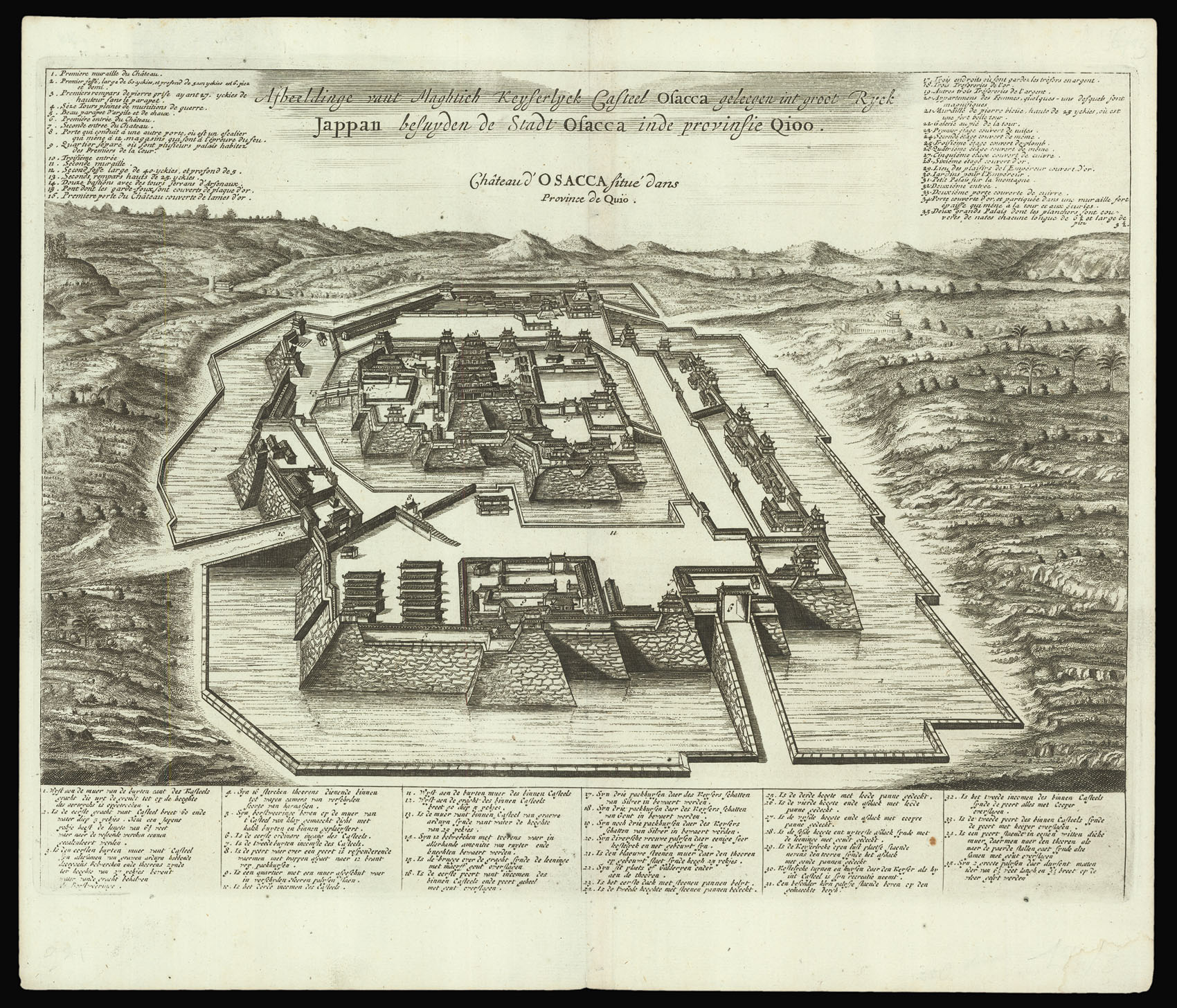 |
Osaka Castle
1 x
£250
|
£250 |
|
£250 |
|
× |
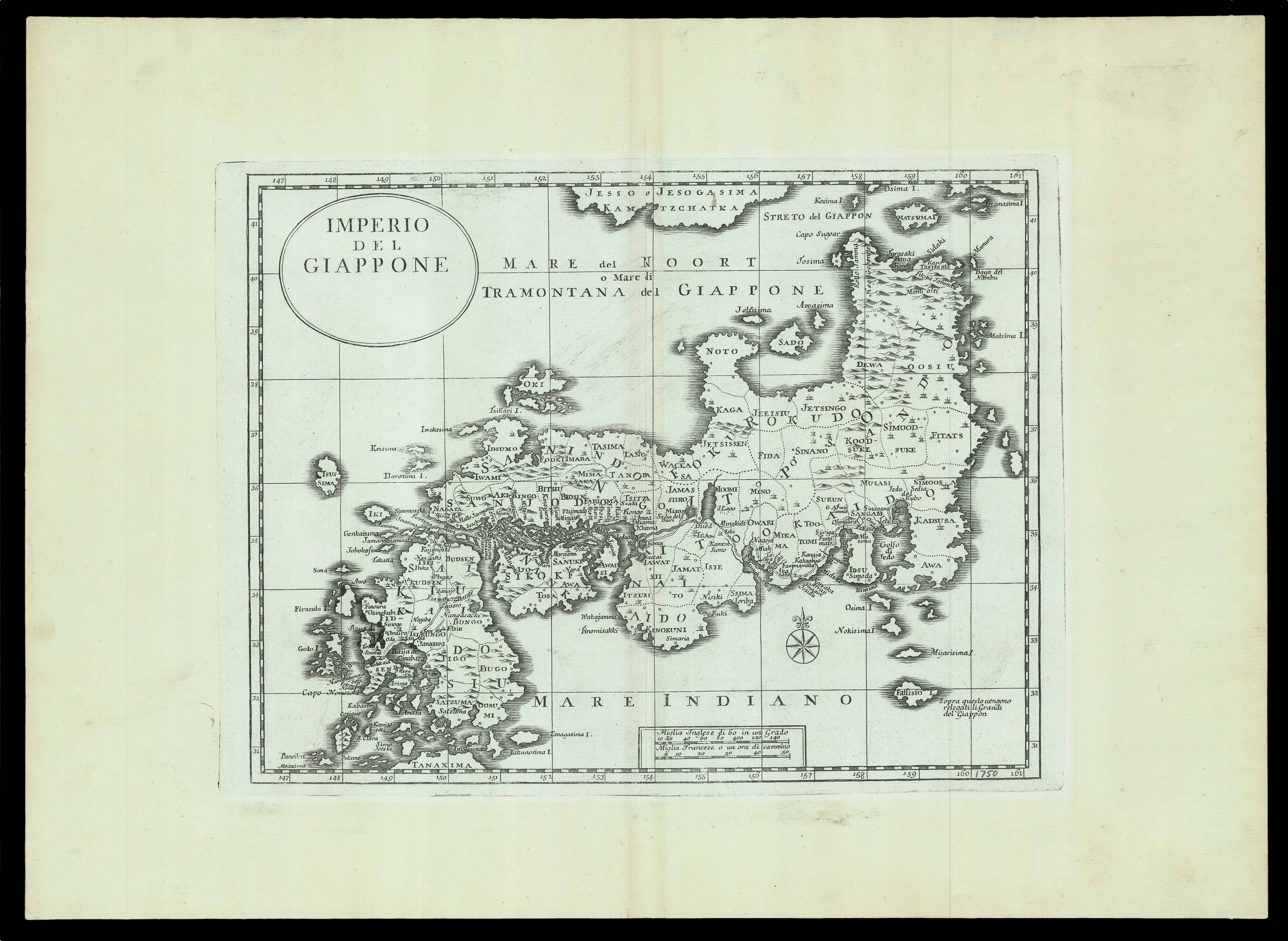 |
Italian map of Japan
1 x
£500
|
£500 |
|
£500 |
|
× |
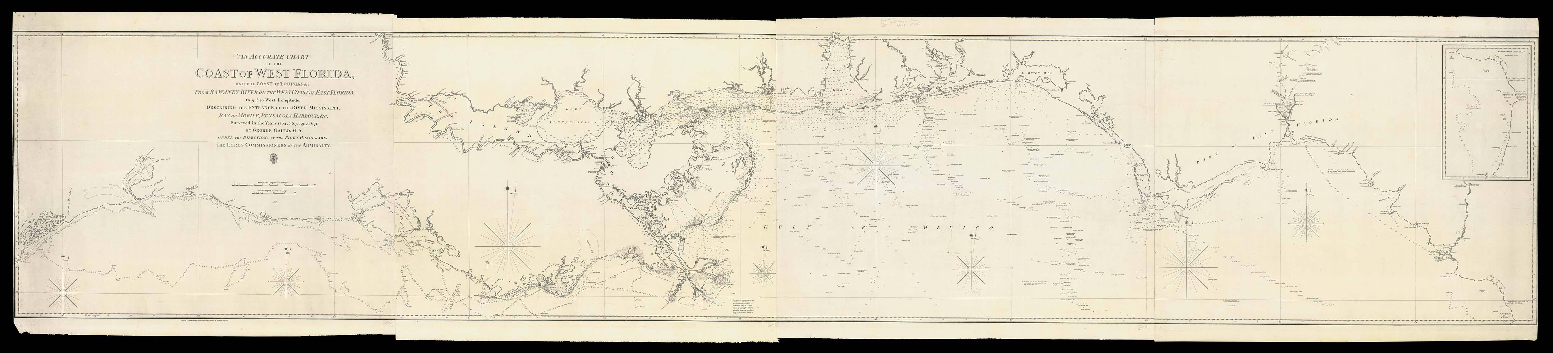 |
Gauld's chart of the Coast of West Florida
1 x
£36,000
|
£36,000 |
|
£36,000 |
|
× |
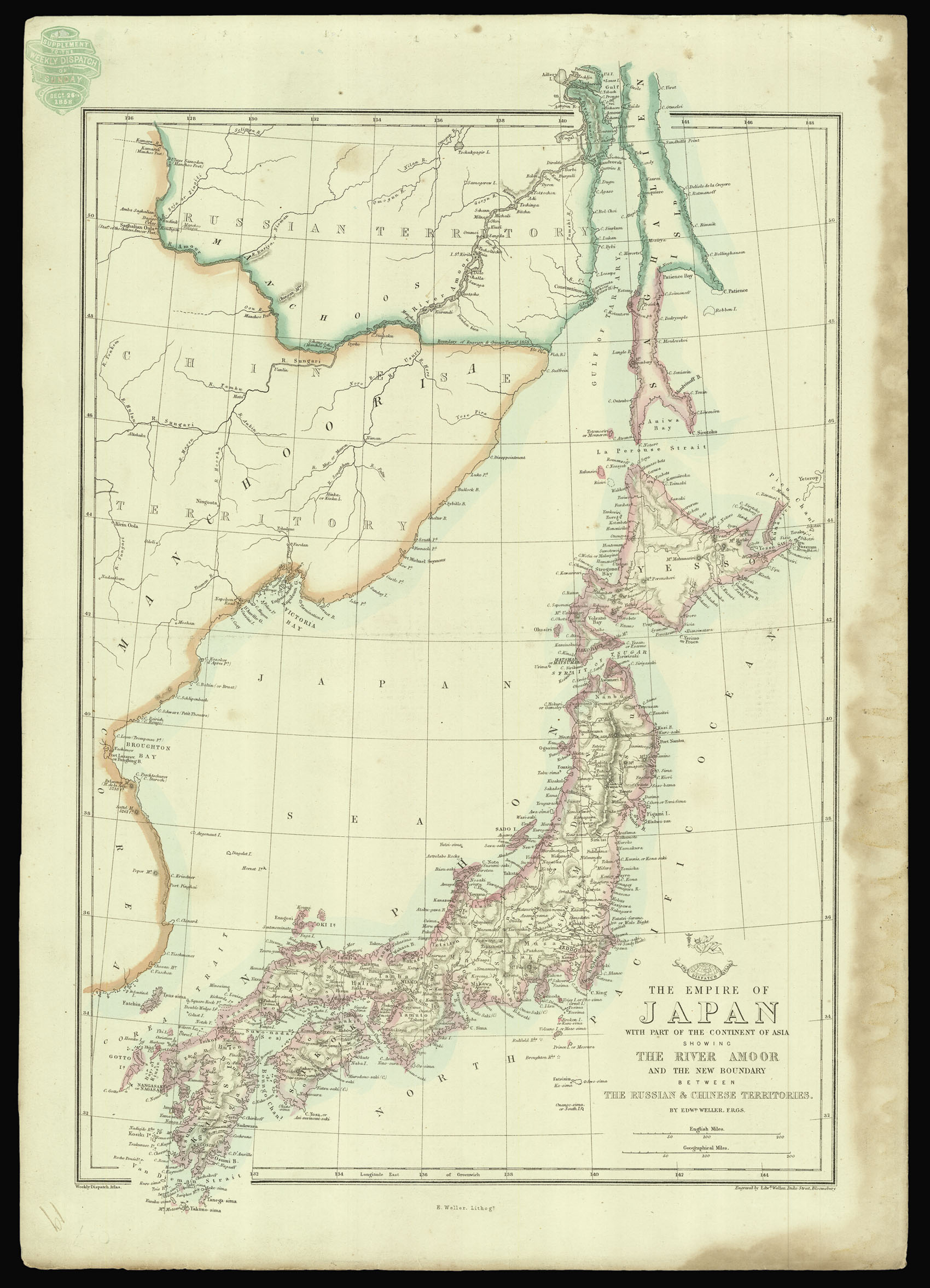 |
A map of Japan by Edward Weller from the 'Weekly Dispatch Atlas'
1 x
£150
|
£150 |
|
£150 |
|
× |
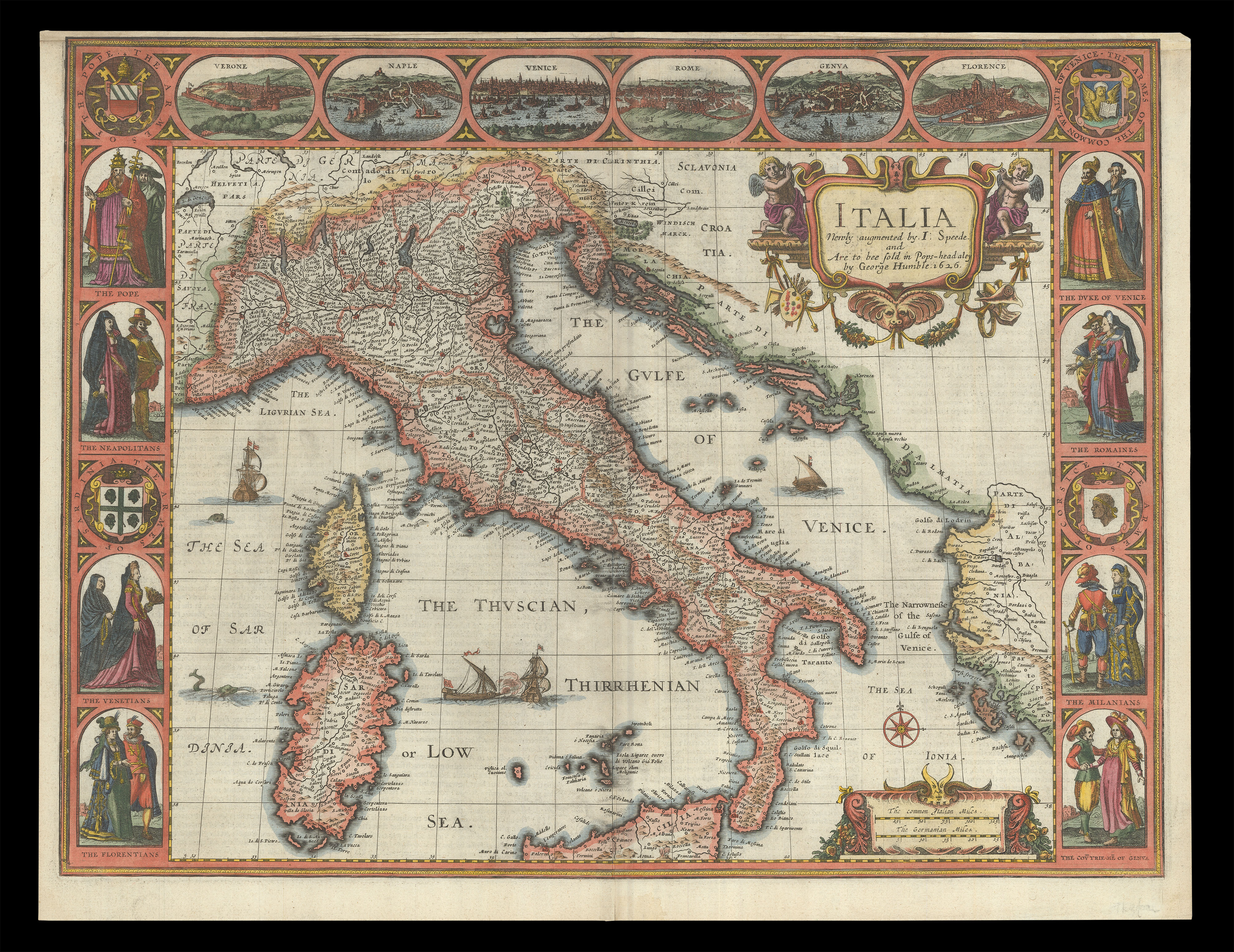 |
Speed's map of Italy
1 x
£2,500
|
£2,500 |
|
£2,500 |
|
× |
![[ANONYMOUS] [Mughal Ganjifa]](https://omega.crouchrarebooks.com/wp-content/uploads/2025/03/20708_1H.jpg) |
Mughal Ganjifa
1 x
£1,200
|
£1,200 |
|
£1,200 |
|
|


