No products in the basket.
Return to shop
Speed’s view of the world
By SPEED, John, [1631].
Admiralty charts of Jamaica
By [Various authors], 1815-1831
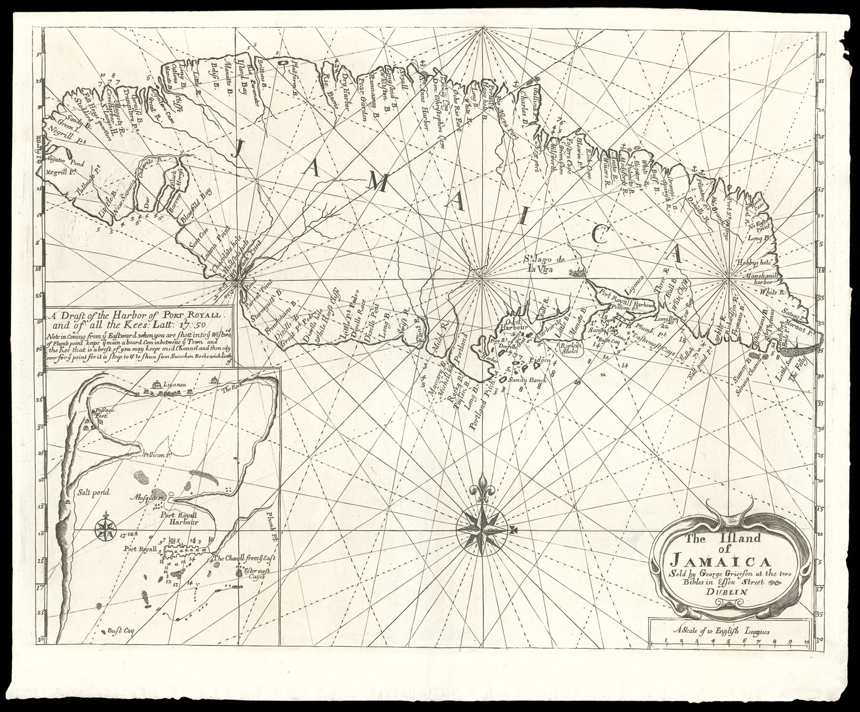
Rare chart of Jamaica printed in Dublin
By GRIERSON, George, [1749].
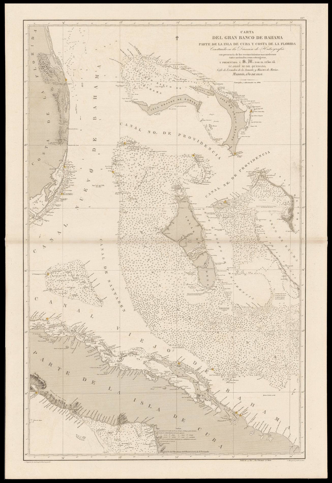
A chart of the Bahamas
By QUESADA, Jose Maria de & NOGUERA, Juan., 1858-66.
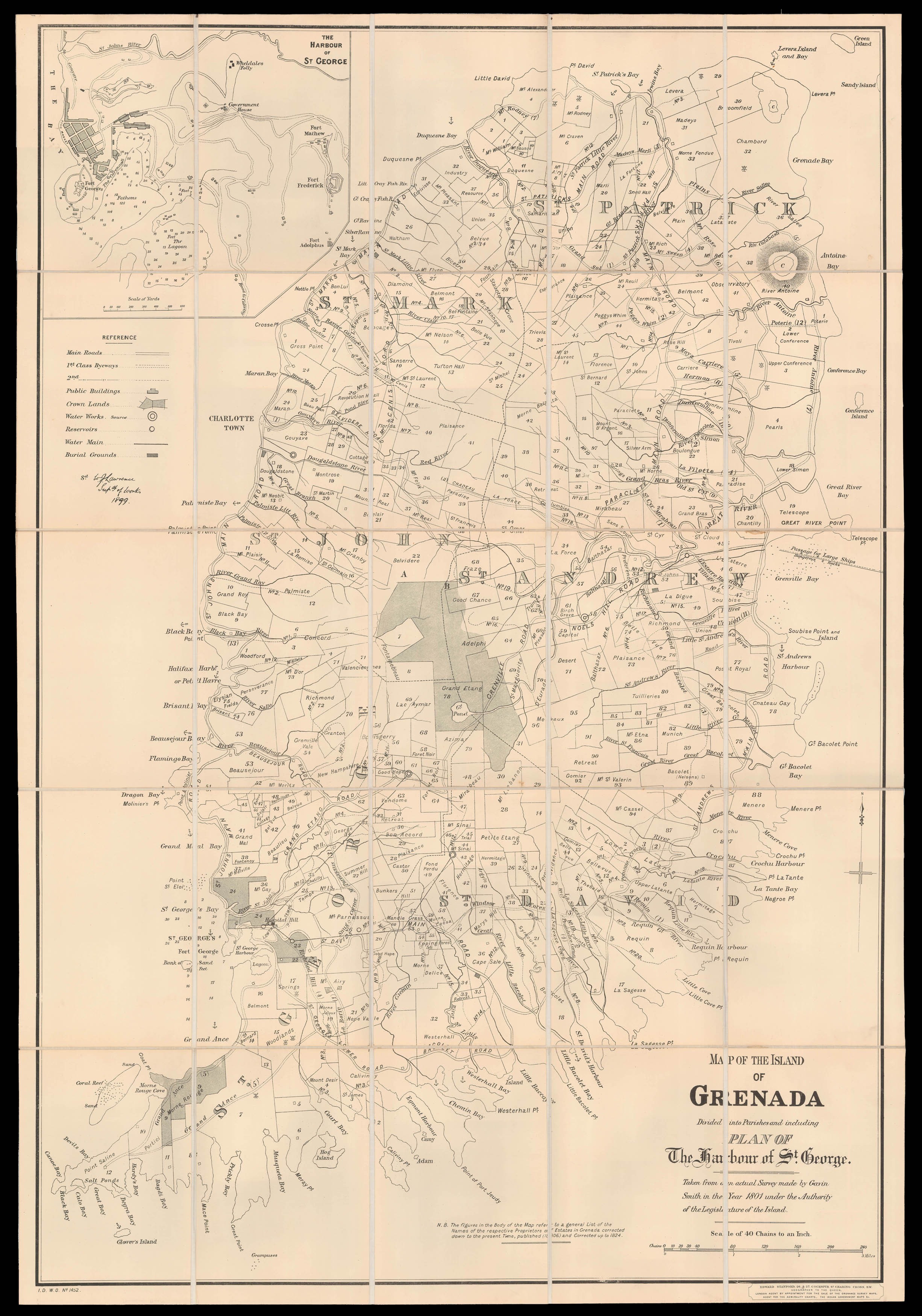
One of the most detailed maps of Grenada published in the nineteenth century
By SMITH, Gavin, 1806 [but 1899].
A rare chart of the Bahama Channel
By FADEN, William; and J[oseph] FOSS DESSIOU, May 1823.
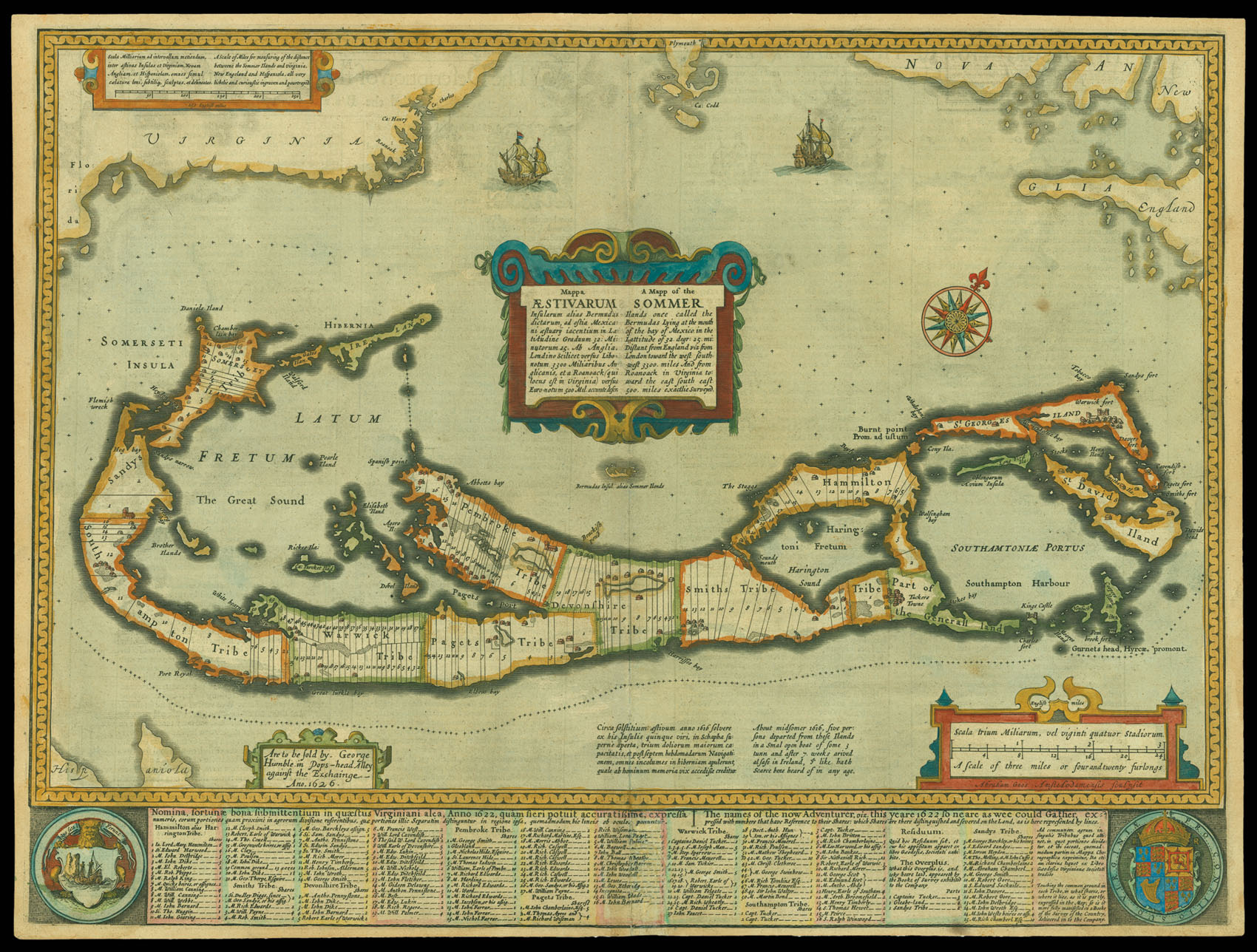
Speed’s map of the Bermudas
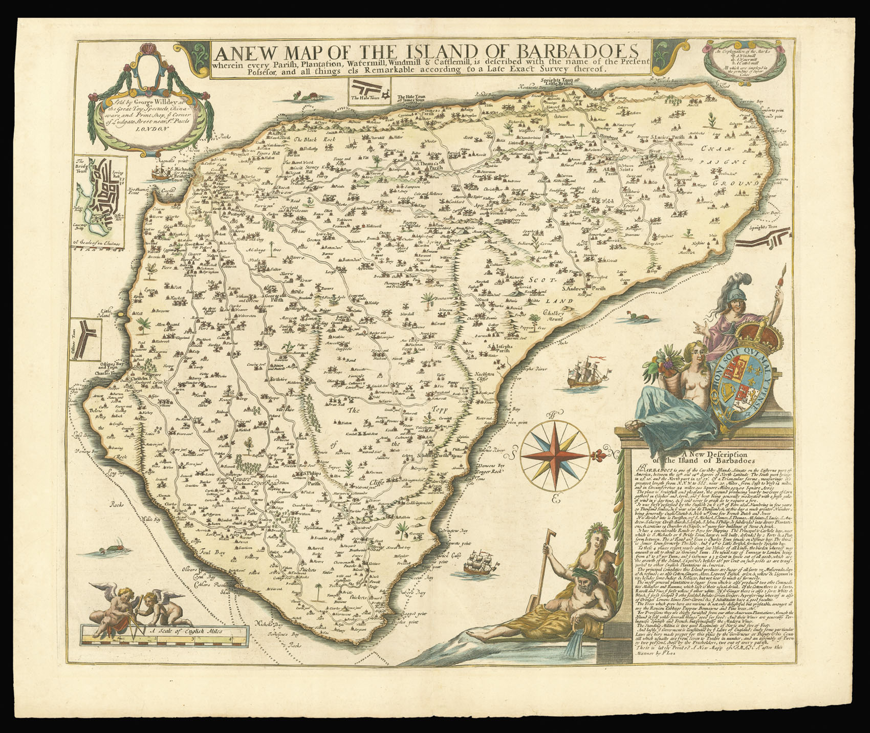
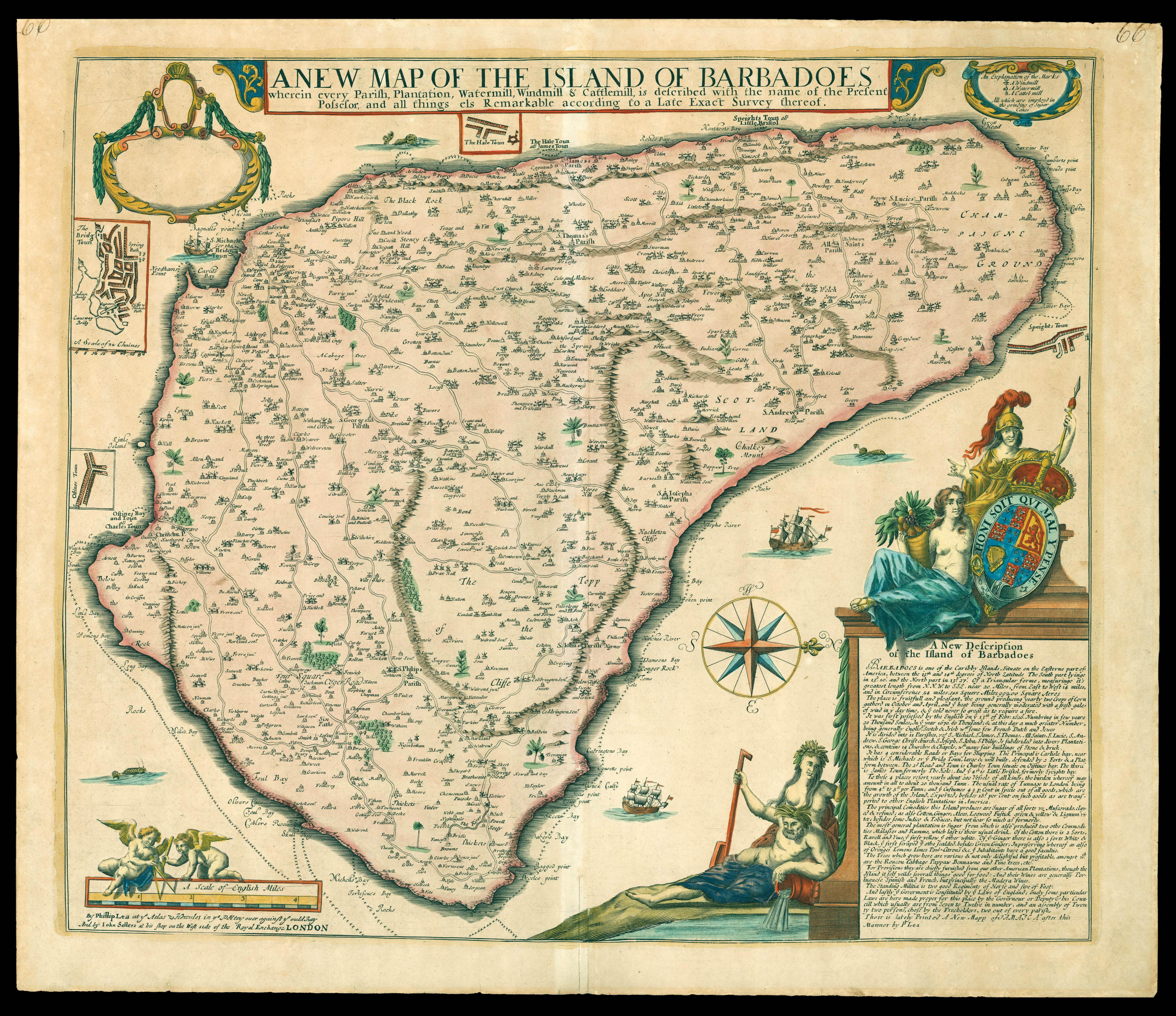
First systematic map of the island
By LEA, Philip; FORD, Richard, [c.1682].
St Kitts, St Lucia, Nevis
By THOMSON, John, 1817].
By LEA, Philip; FORD, Richard, [c.1710].
“The navigator’s vade mecum for the Eastern seas”
By LINSCHOTEN, Jan Huyghen, 1638
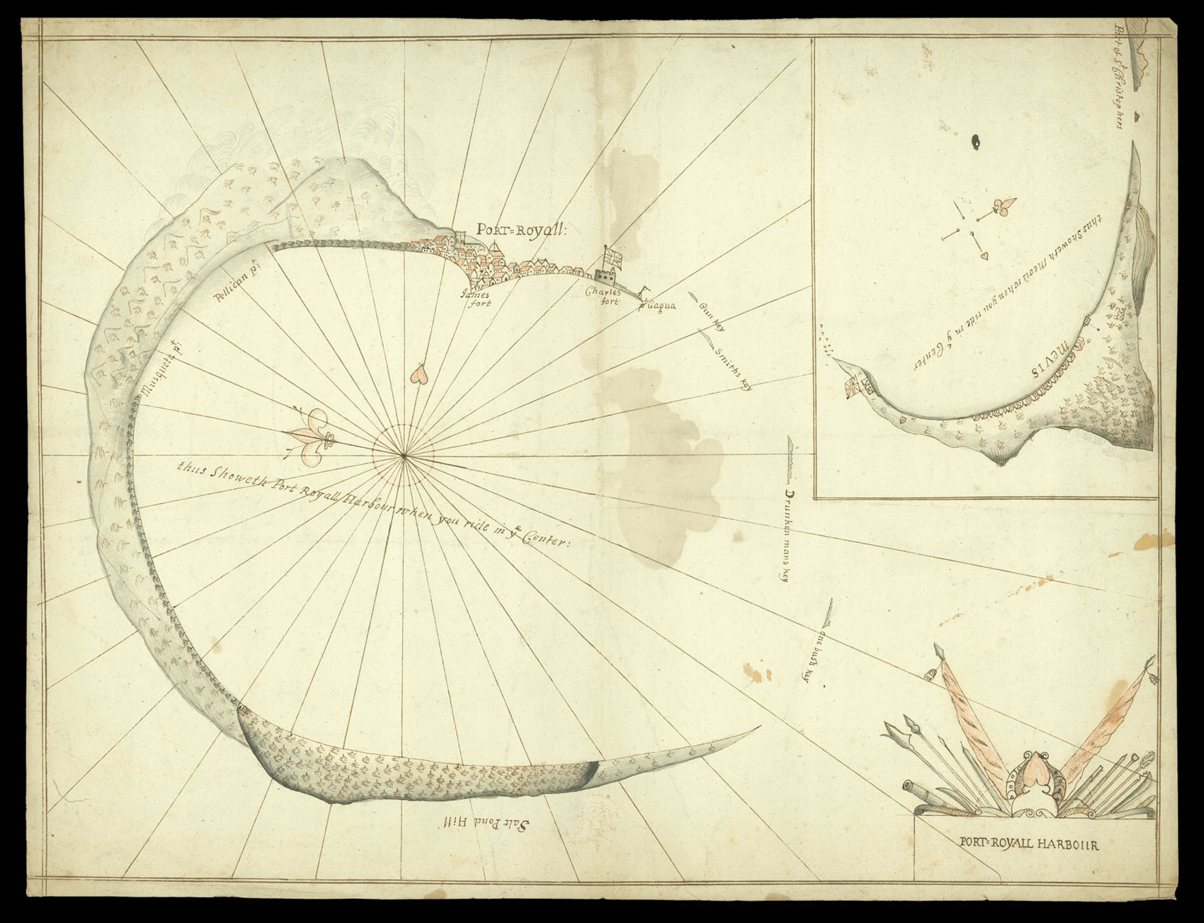
Port Royal Jamaica
By ANONYMOUS, [1700 ?]
Username or email address *Required
Password *Required
Remember me Log in
Lost your password?
Email address *Required
A link to set a new password will be sent to your email address.
Your personal data will be used to support your experience throughout this website, to manage access to your account, and for other purposes described in our privacy policy.
Register


![SPEED, John [Set of the world and continents]](https://omega.crouchrarebooks.com/wp-content/uploads/2025/03/11414_1H.jpg)
![[Various authors] [Admiralty charts of Jamaica]](https://omega.crouchrarebooks.com/wp-content/uploads/2025/03/11674_1H.jpg)
![FADEN, William; and J[oseph] FOSS DESSIOU Chart of the Old Bahama Channel](https://omega.crouchrarebooks.com/wp-content/uploads/2025/03/1096_1H.jpg)
![THOMSON, John St Christophers... [and] St Lucia... [and] Nevis.](https://omega.crouchrarebooks.com/wp-content/uploads/2025/03/1141_1H.jpg)