|
× |
 |
The first steam railway to have a terminus in the capital
1 x
£1,600
|
£1,600 |
|
£1,600 |
|
× |
 |
John Rocque's rare index to his large wall map of Dublin, including a price list of all Rocque's published works
1 x
£1,200
|
£1,200 |
|
£1,200 |
|
× |
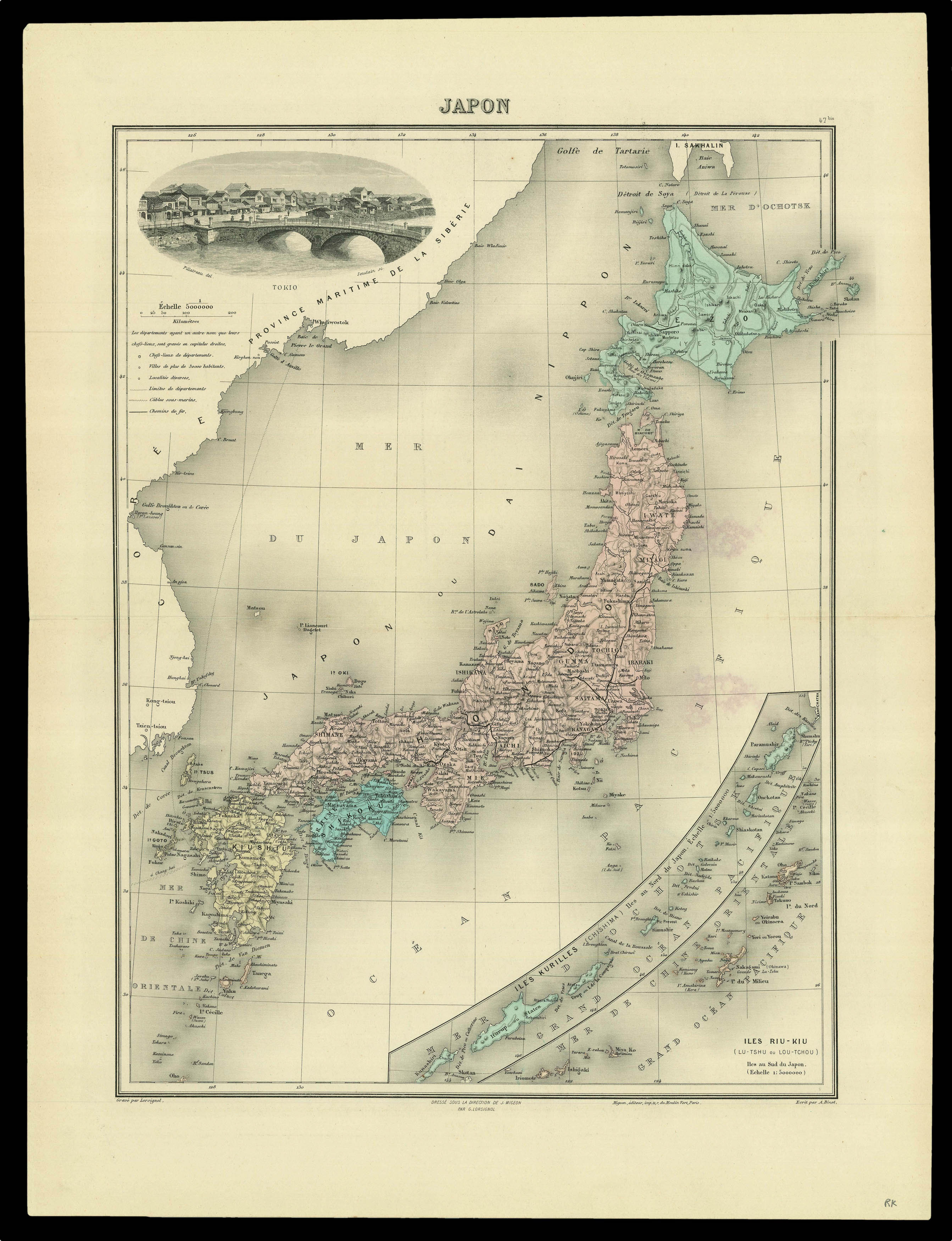 |
A map of Japan from Jean Migeon's 'Nouvel Atlas Illustre Geographie Universelle'
1 x
£60
|
£60 |
|
£60 |
|
× |
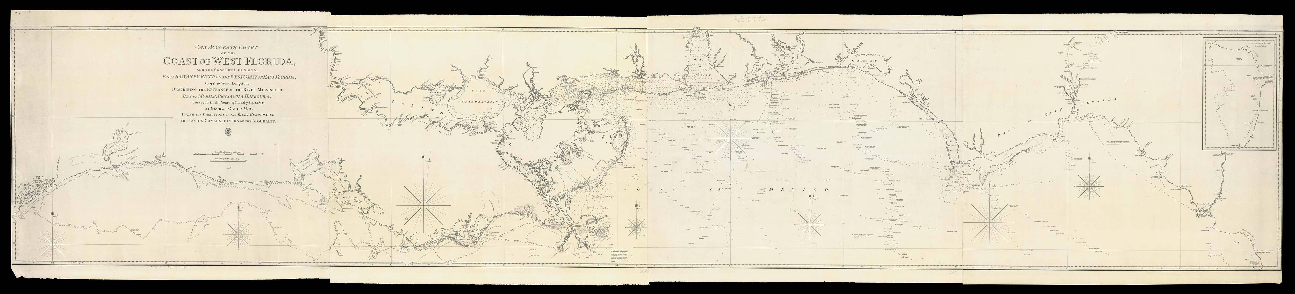 |
Gauld's chart of the Coast of West Florida
1 x
£36,000
|
£36,000 |
|
£36,000 |
|
× |
 |
Catalogue of maps and atlases published by the Spanish Admiralty
1 x
£12,000
|
£12,000 |
|
£12,000 |
|
× |
![LUFFMAN, John A Map of the Western Pyrenees Mount[ai]ns](https://omega.crouchrarebooks.com/wp-content/uploads/2025/03/11348_1H.jpg) |
The final phase of the Peninsular War
1 x
£1,200
|
£1,200 |
|
£1,200 |
|
× |
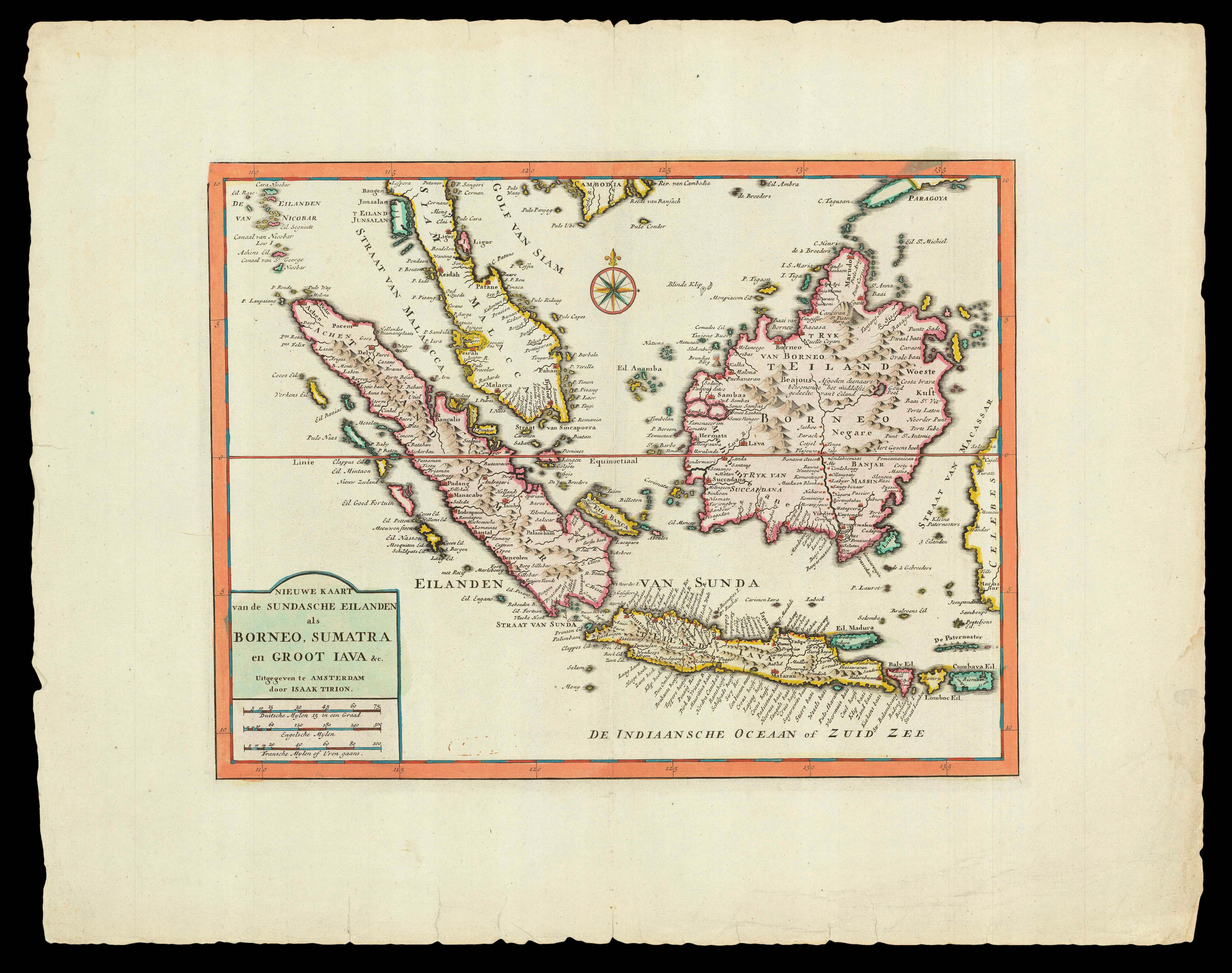 |
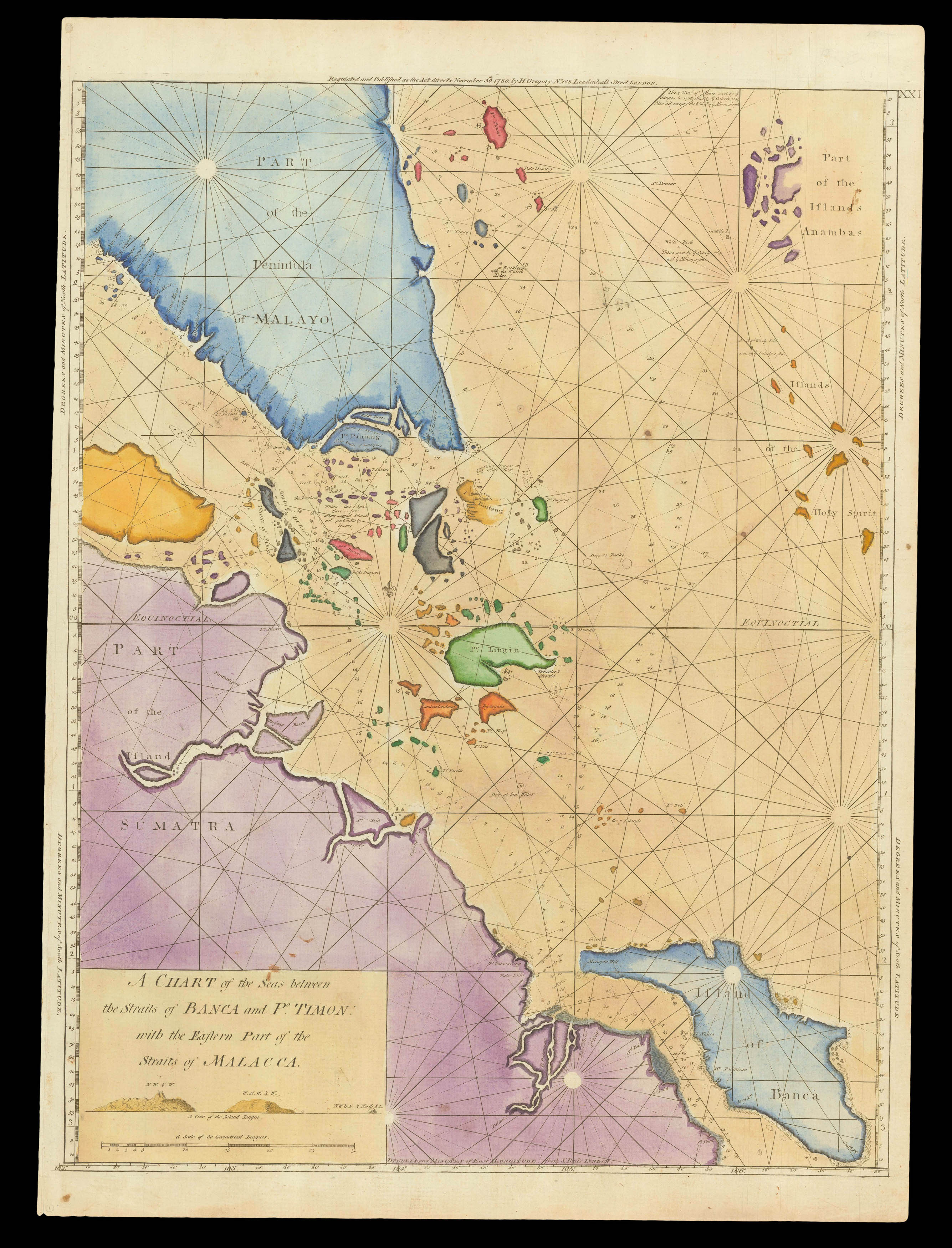
Trion's map of southwest Southeast Asia
1 x
£470
|
£470 |
|
£470 |
|
× |
![PTOLEMAEUS, Claudius [Modern Holy Land].](https://omega.crouchrarebooks.com/wp-content/uploads/2025/03/18404_1H.jpg) |
The modern Holy Land
1 x
£37,500
|
£37,500 |
|
£37,500 |
|
× |
![[Anonymous] Londres.](https://omega.crouchrarebooks.com/wp-content/uploads/2025/03/12363_1H.jpg) |
A French variant of De Jonghe's view of London
1 x
£2,400
|
£2,400 |
|
£2,400 |
|
× |
 |
Forlani's map of the Holy Land
1 x
£13,000
|
£13,000 |
|
£13,000 |
|
× |
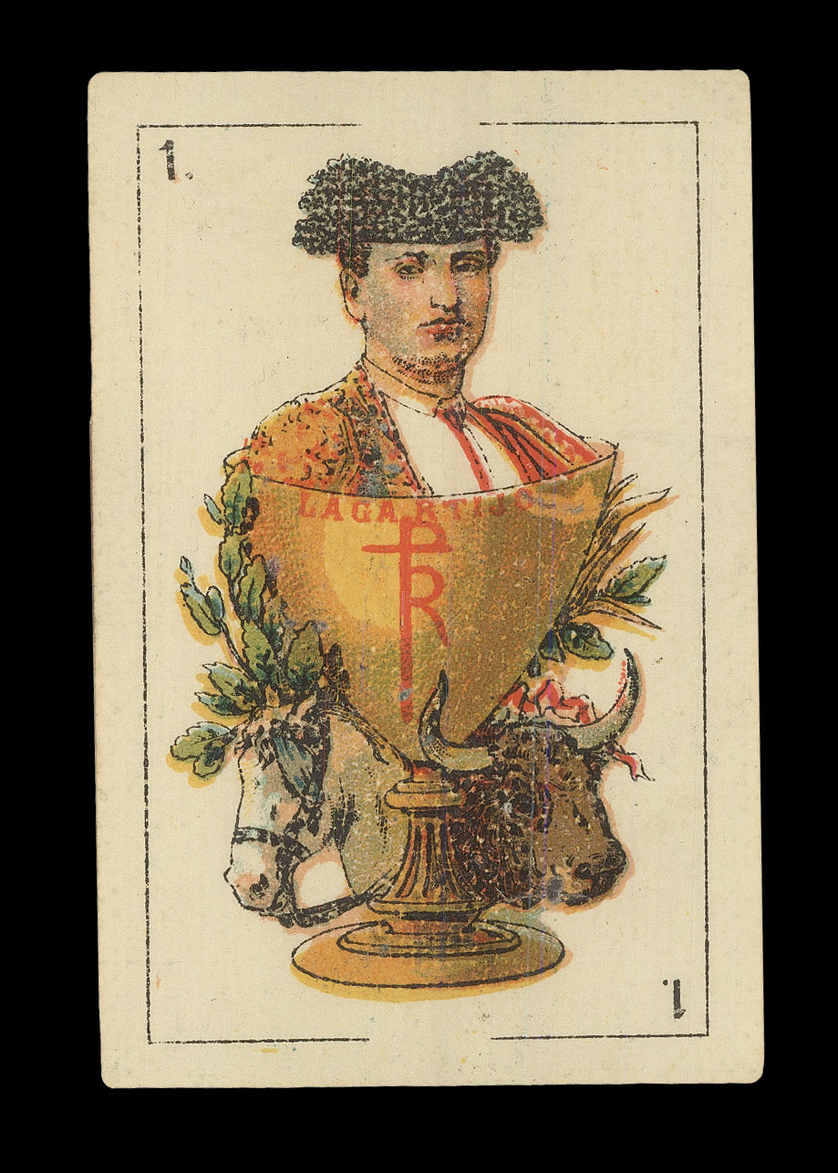 |
Toréador, en garde
1 x
£800
|
£800 |
|
£800 |
|
× |
 |
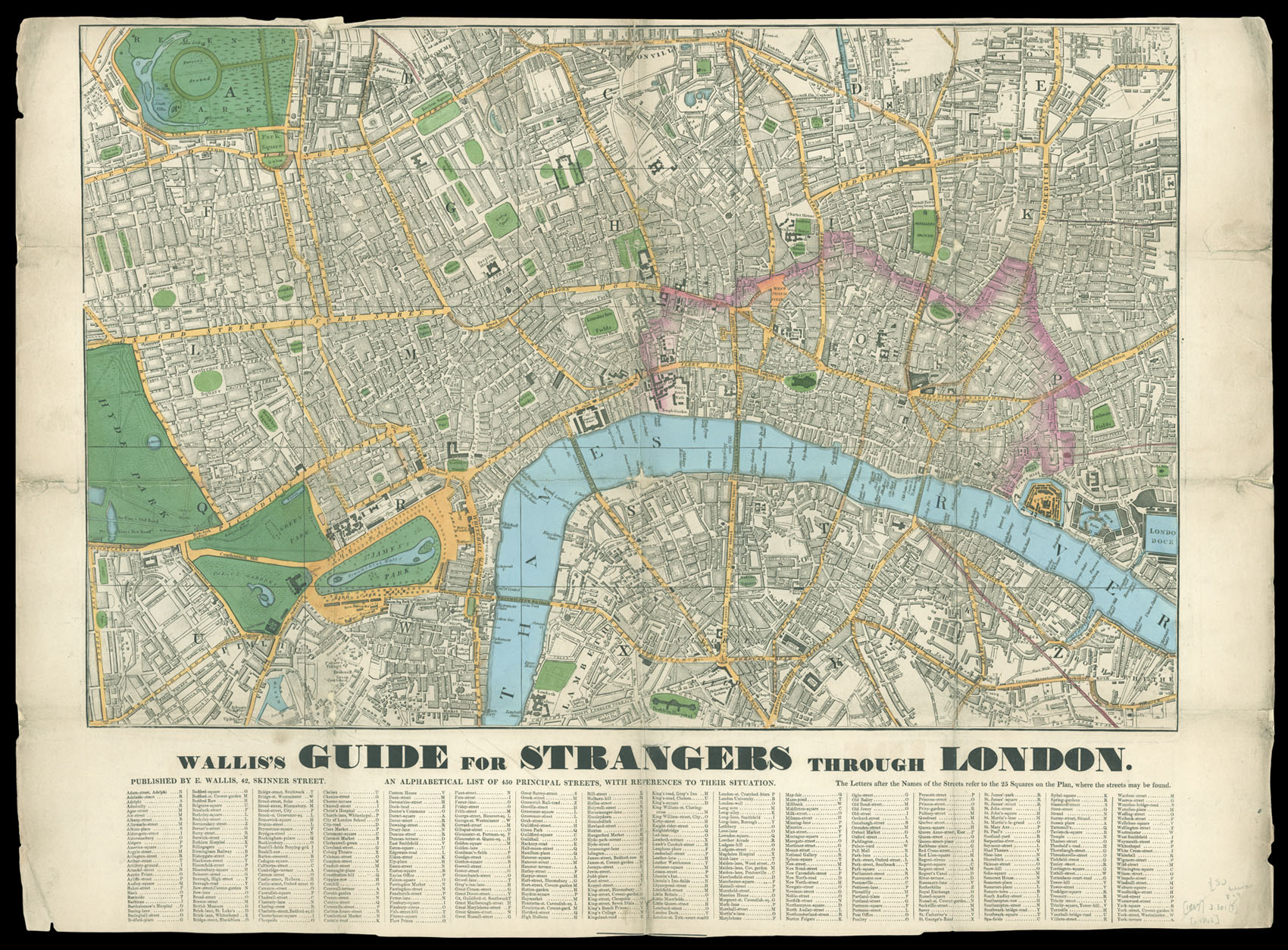
Plan of London showing troop dispositions
1 x
£1,500
|
£1,500 |
|
£1,500 |
|
× |
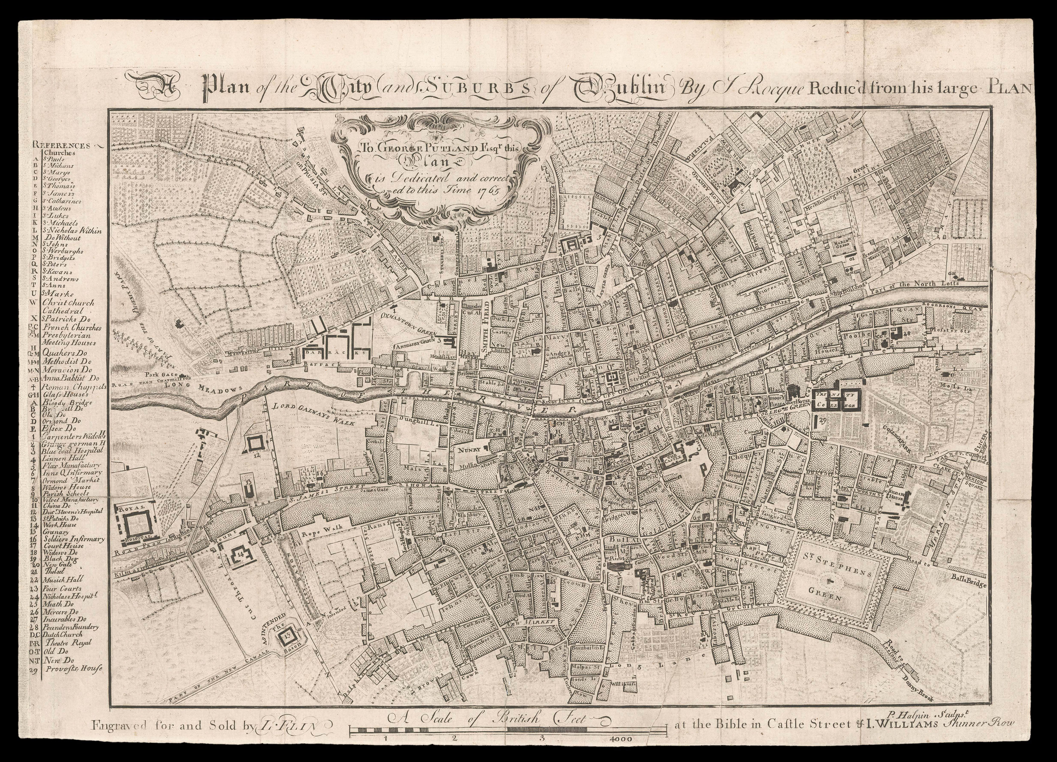 |
Rare reduction of Rocque's plan of Dublin
1 x
£4,000
|
£4,000 |
|
£4,000 |
|
× |
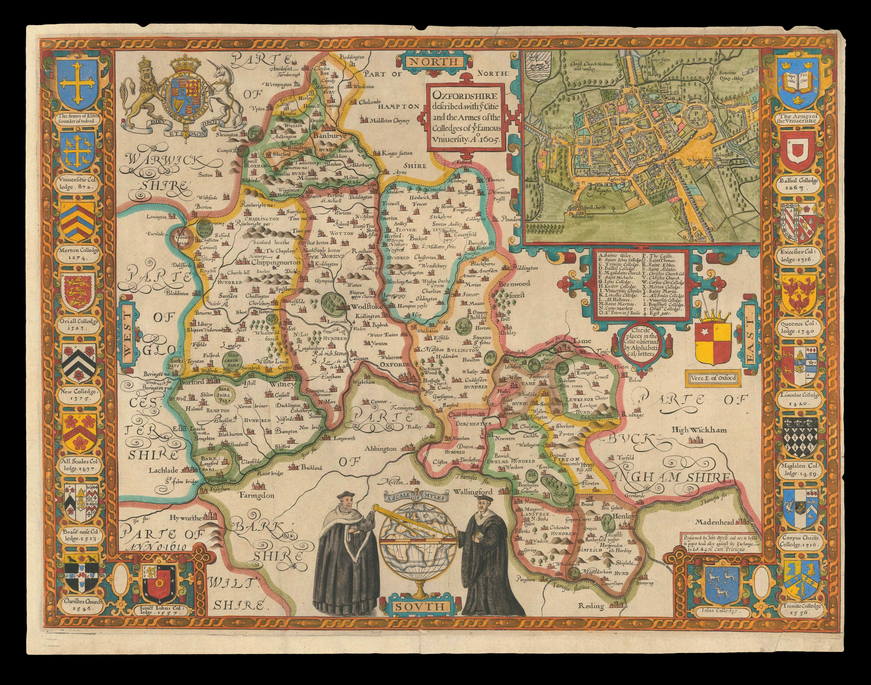 |
Speed's map of Oxfordshire
1 x
£2,000
|
£2,000 |
|
£2,000 |
|
× |
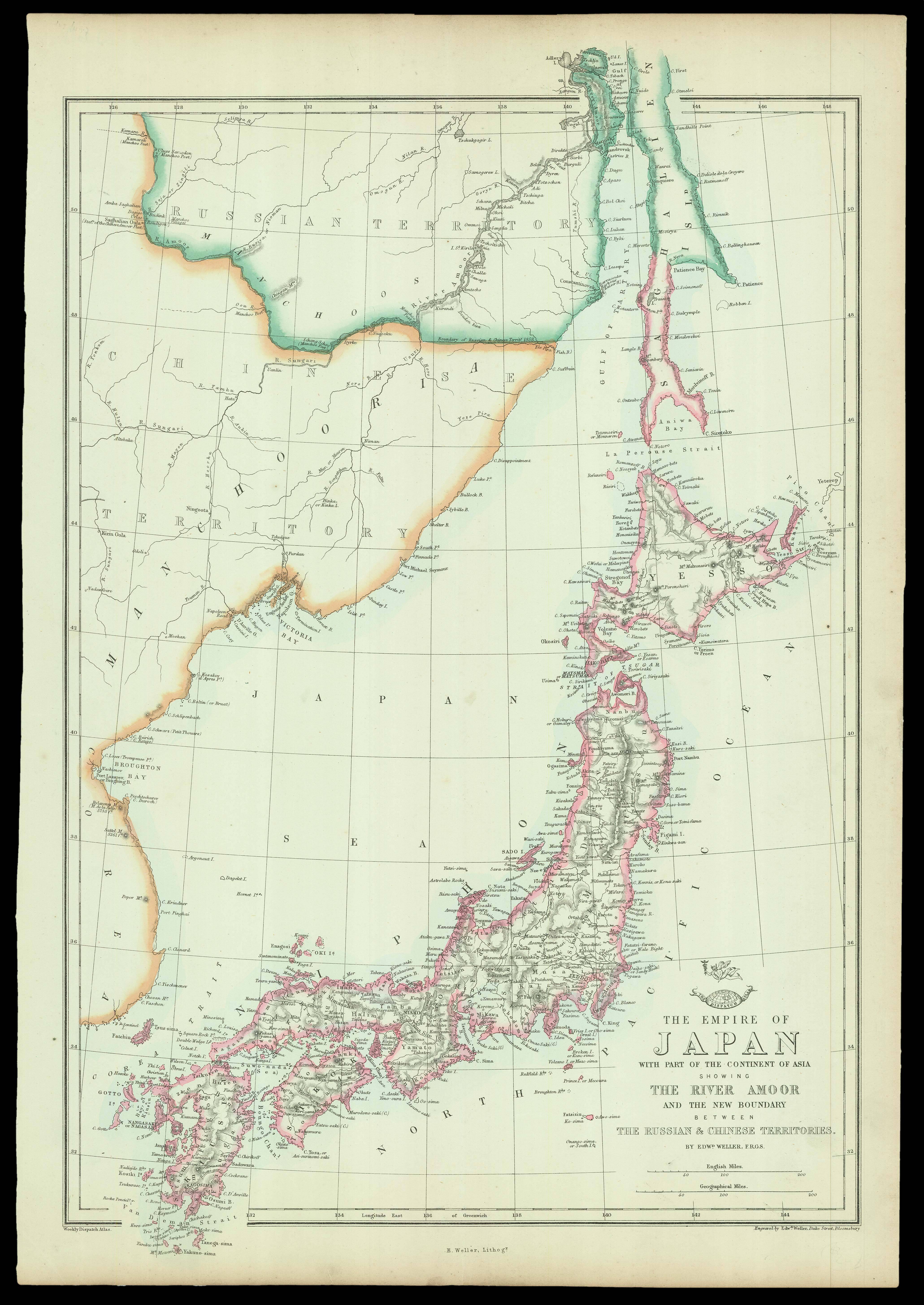 |
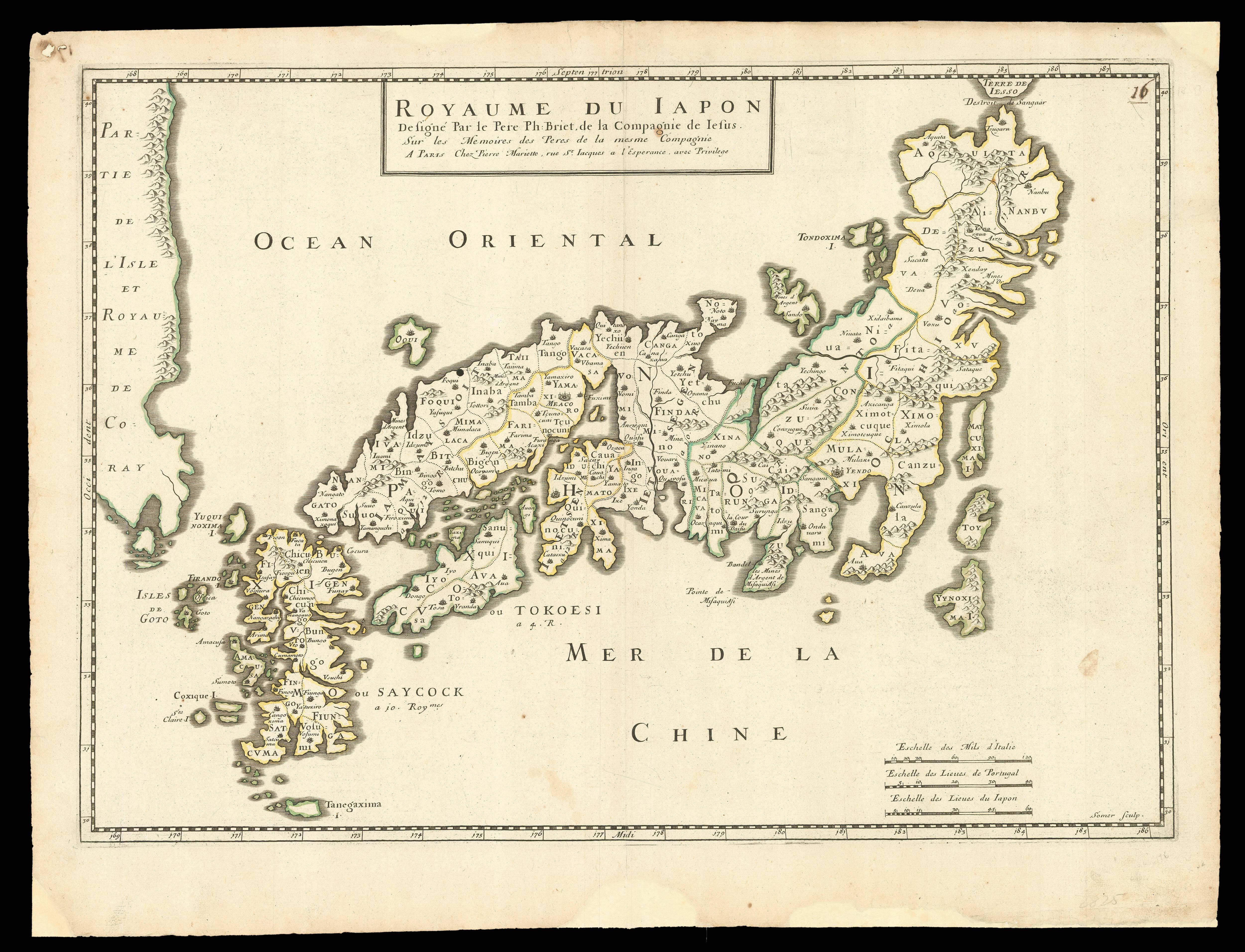
The Empire of Japan with part of the Continent of Asia
1 x
£150
|
£150 |
|
£150 |
|
× |
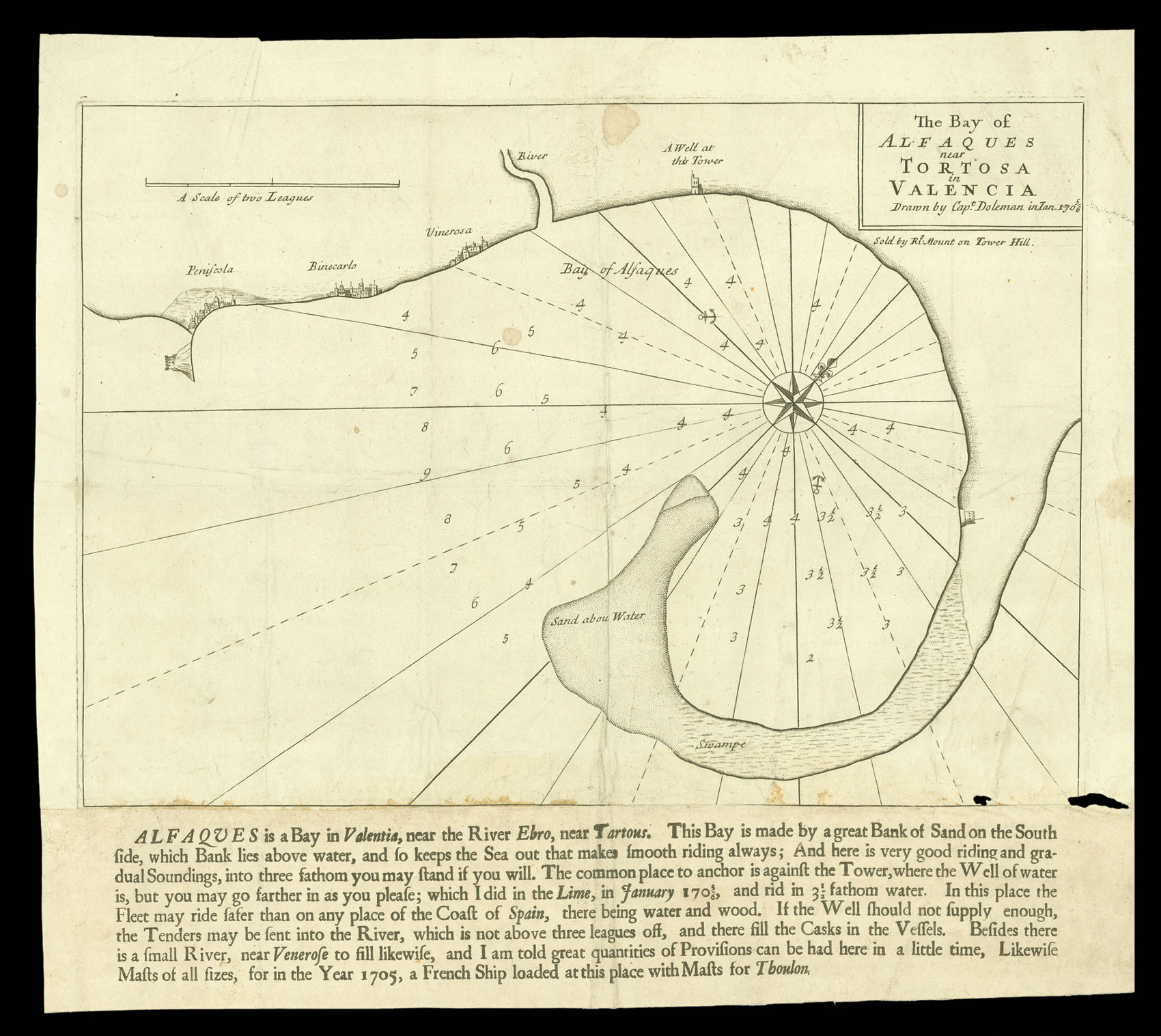 |
Alfaques Bay
1 x
£500
|
£500 |
|
£500 |
|
× |
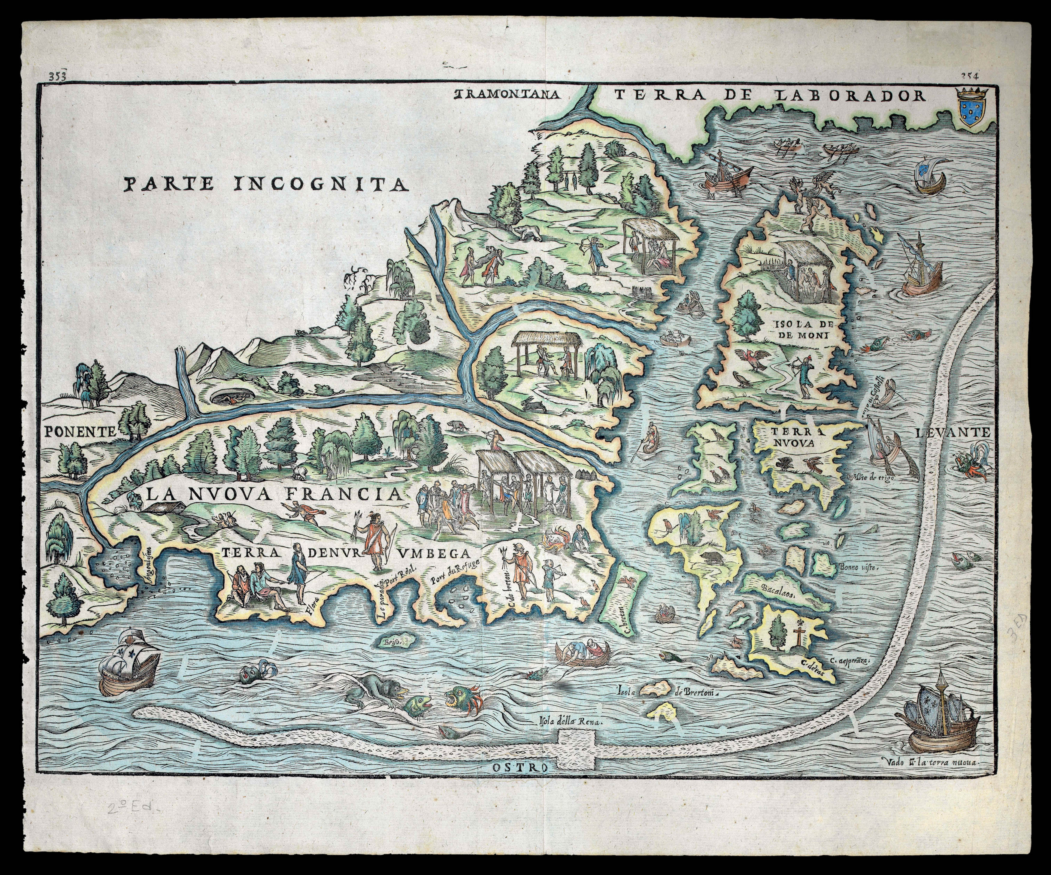 |
The first printed map of Northeastern America
1 x
£6,000
|
£6,000 |
|
£6,000 |
|
× |
![LEWIS, G[eorge Robert] [after] BUCKLER, J[ohn] To the Right Honourable and Right Reverend William Howley, D.D. Lord Bishop of London and the Right Reverend the Dean and Chapter;](https://omega.crouchrarebooks.com/wp-content/uploads/2025/03/12493_1H.jpg) |
St Paul's Cathedral
1 x
£1,500
|
£1,500 |
|
£1,500 |
|
× |
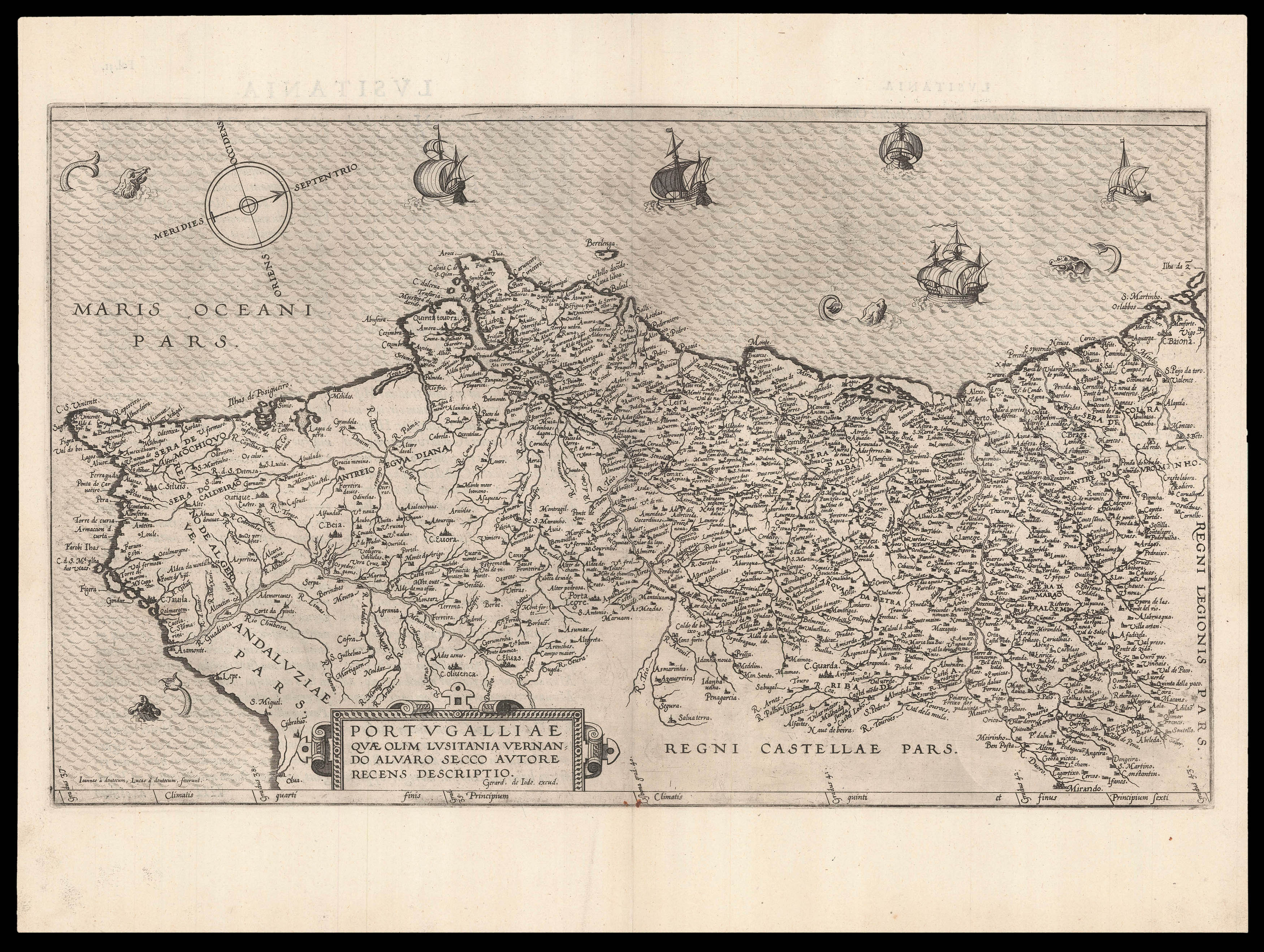 |
De Jode's rare map of Portugal
1 x
£1,500
|
£1,500 |
|
£1,500 |
|
× |
![KROTOVII [Russian Globe] Terrestrial Globe](https://omega.crouchrarebooks.com/wp-content/uploads/2025/03/2930_1H.jpg) |
A Cyrillic globe
1 x
£10,000
|
£10,000 |
|
£10,000 |
|
× |
![HOLLAR, W[enceslaus] Oxforde](https://omega.crouchrarebooks.com/wp-content/uploads/2025/03/18346_1H.jpg) |
Hollar's view of Oxford
1 x
£2,500
|
£2,500 |
|
£2,500 |
|
× |
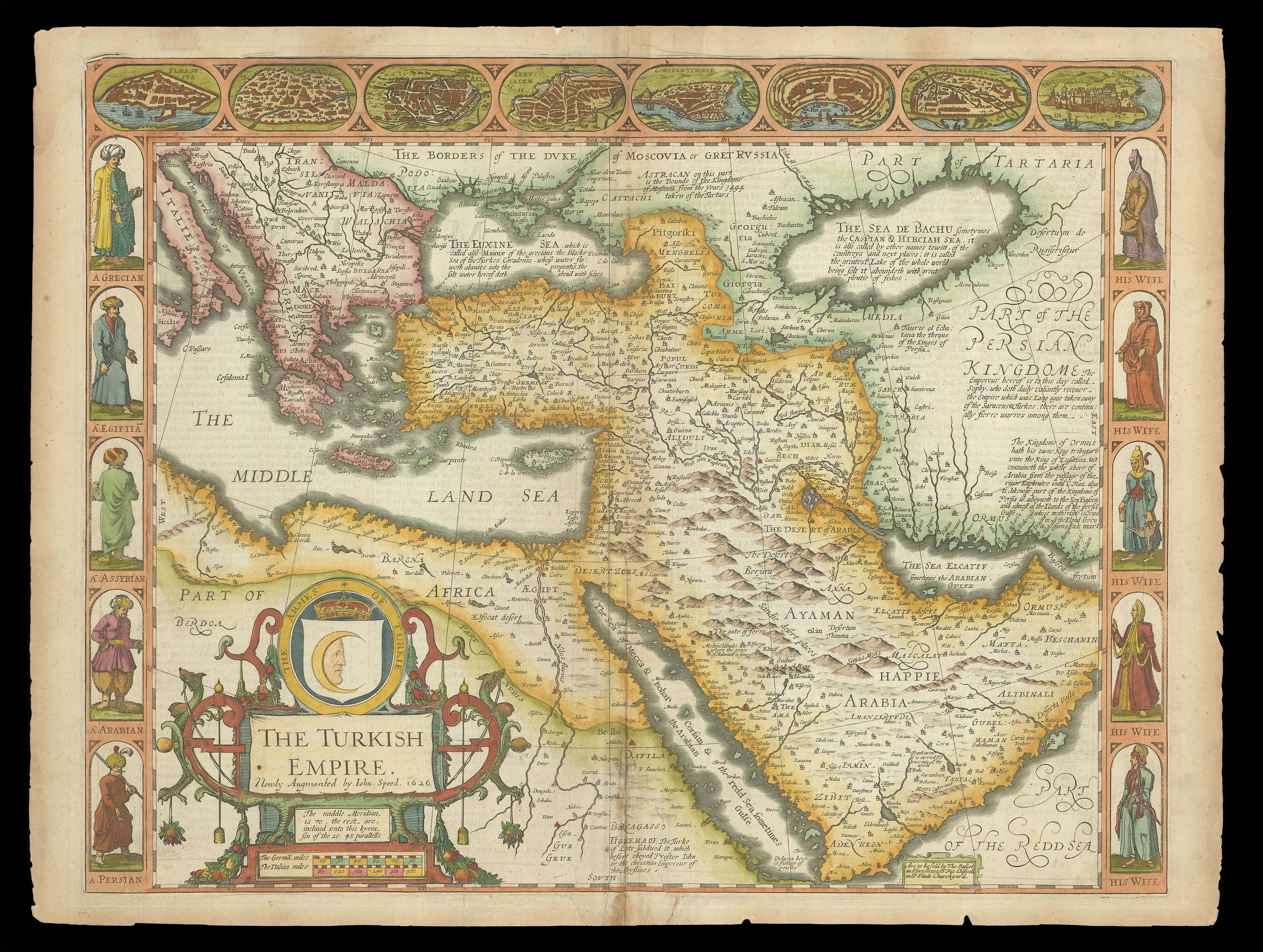 |
Speed's map of the Ottoman Empire
1 x
£2,000
|
£2,000 |
|
£2,000 |
|
× |
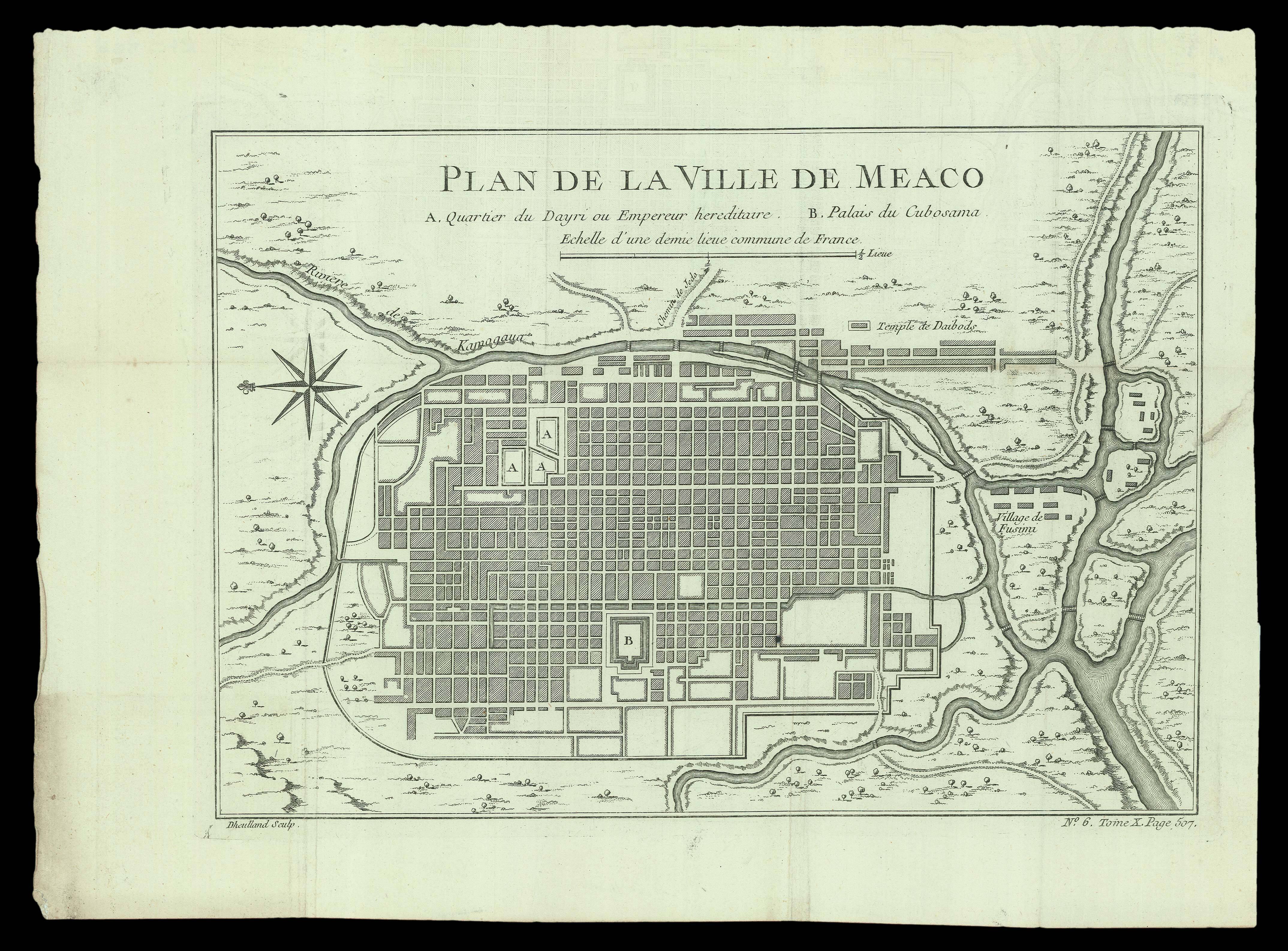 |
Plan of Kyoto
1 x
£150
|
£150 |
|
£150 |
|
× |
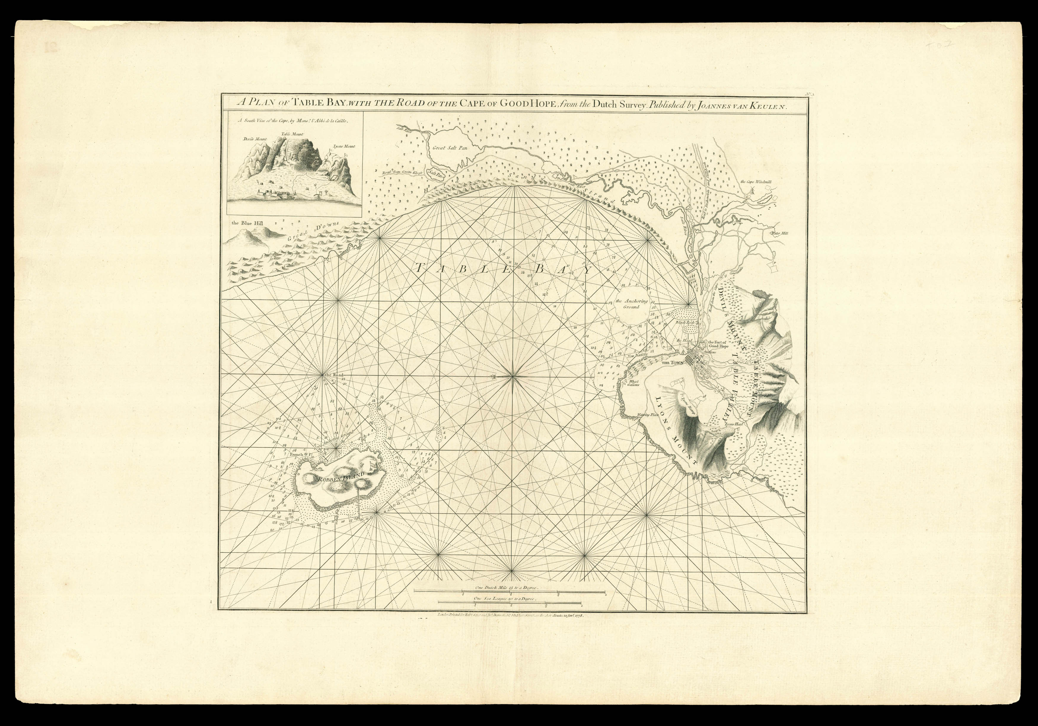 |
A rare sea chart of Cape Town
1 x
£3,200
|
£3,200 |
|
£3,200 |
|
× |
 |
Produced for an unfinished atlas, with a rare proof state
1 x
£2,000
|
£2,000 |
|
£2,000 |
|
× |
 |
The Great Southern Continent
1 x
£450,000
|
£450,000 |
|
£450,000 |
|
× |
![BAUERKELLER, G[eorge] Bauerkeller's New Embossed Plan of London 1841](https://omega.crouchrarebooks.com/wp-content/uploads/2025/03/12163_1H.jpg) |
George Bauerkeller's rare and strikingly modern embossed plan of London with its Index
1 x
£7,500
|
£7,500 |
|
£7,500 |
|
× |
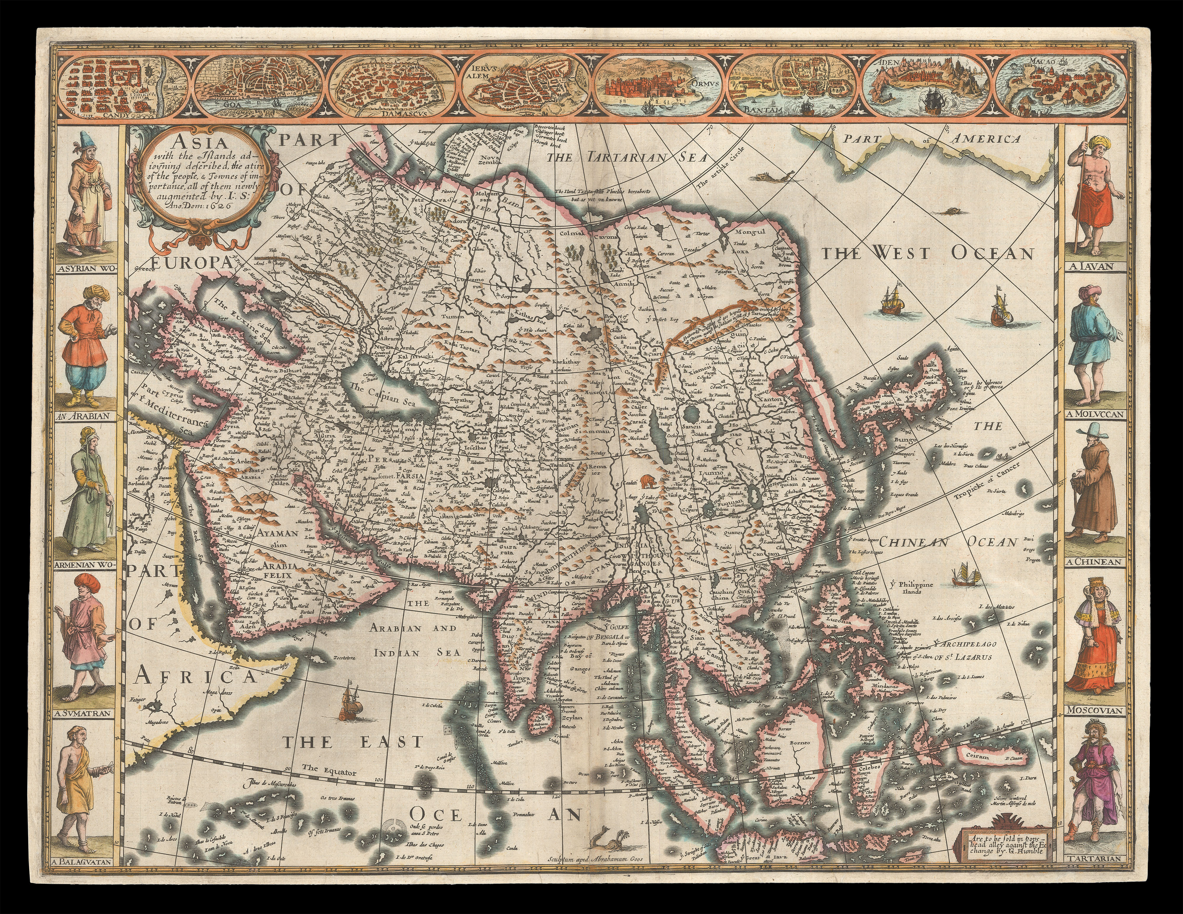 |
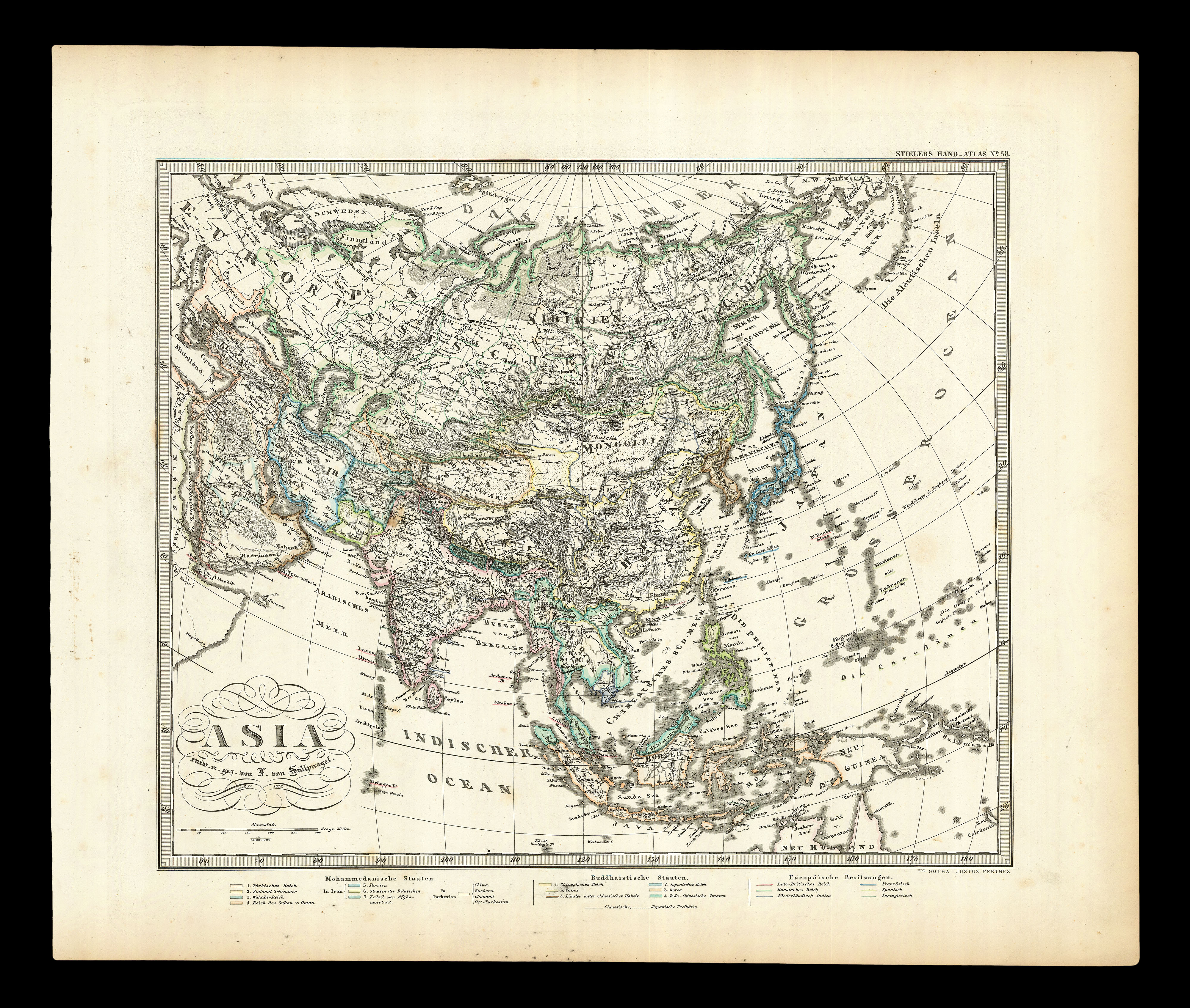
The first English printed map of Asia
1 x
£2,500
|
£2,500 |
|
£2,500 |
|
× |
![SMITH, C[harles] A New Map of the County of Sussex Divided into Rapes and Hundreds](https://omega.crouchrarebooks.com/wp-content/uploads/2025/03/18105_1H.jpg) |
Second edition published 1808
1 x
£100
|
£100 |
|
£100 |
|
× |
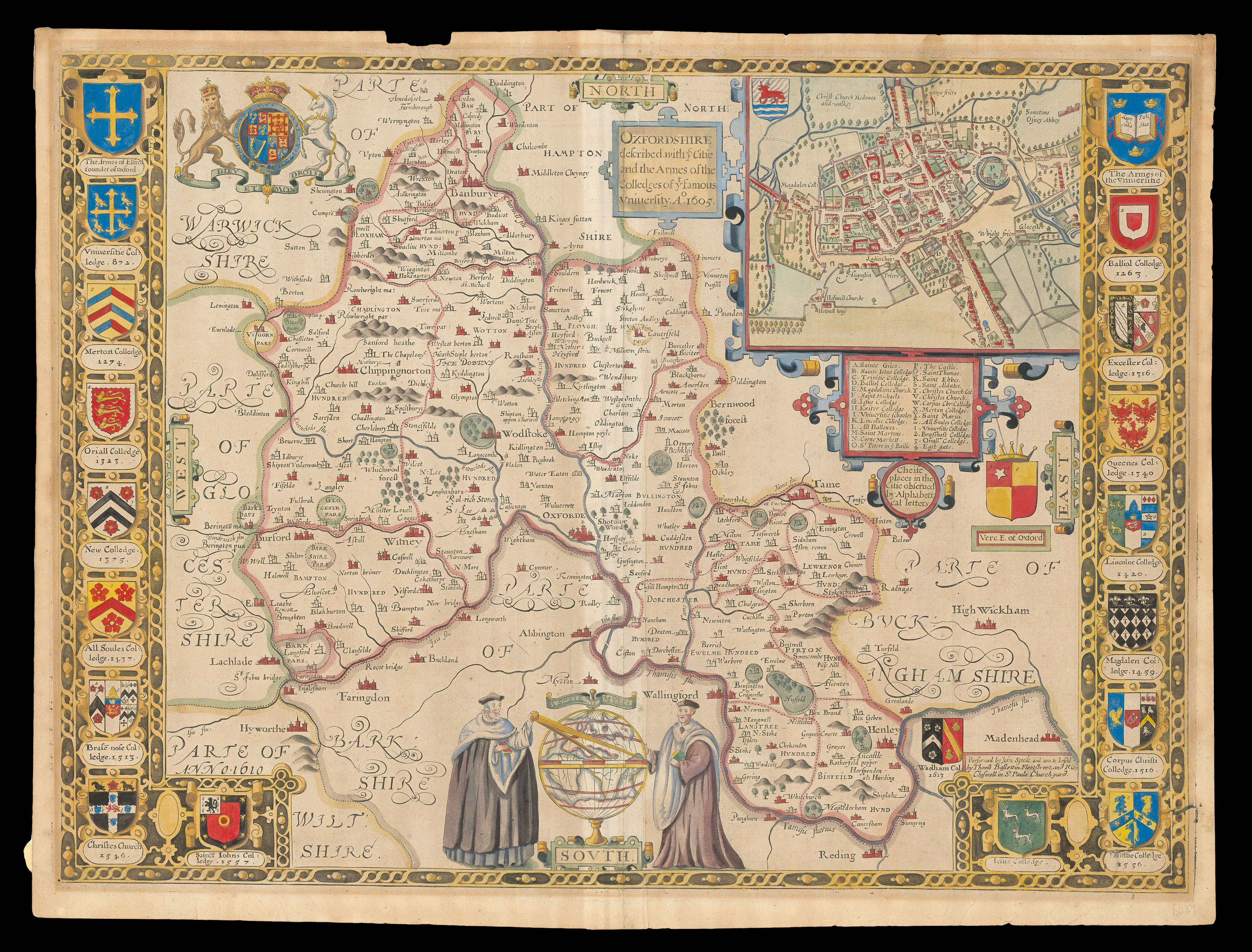 |
Speed's map of Oxfordshire
1 x
£1,200
|
£1,200 |
|
£1,200 |
|
× |
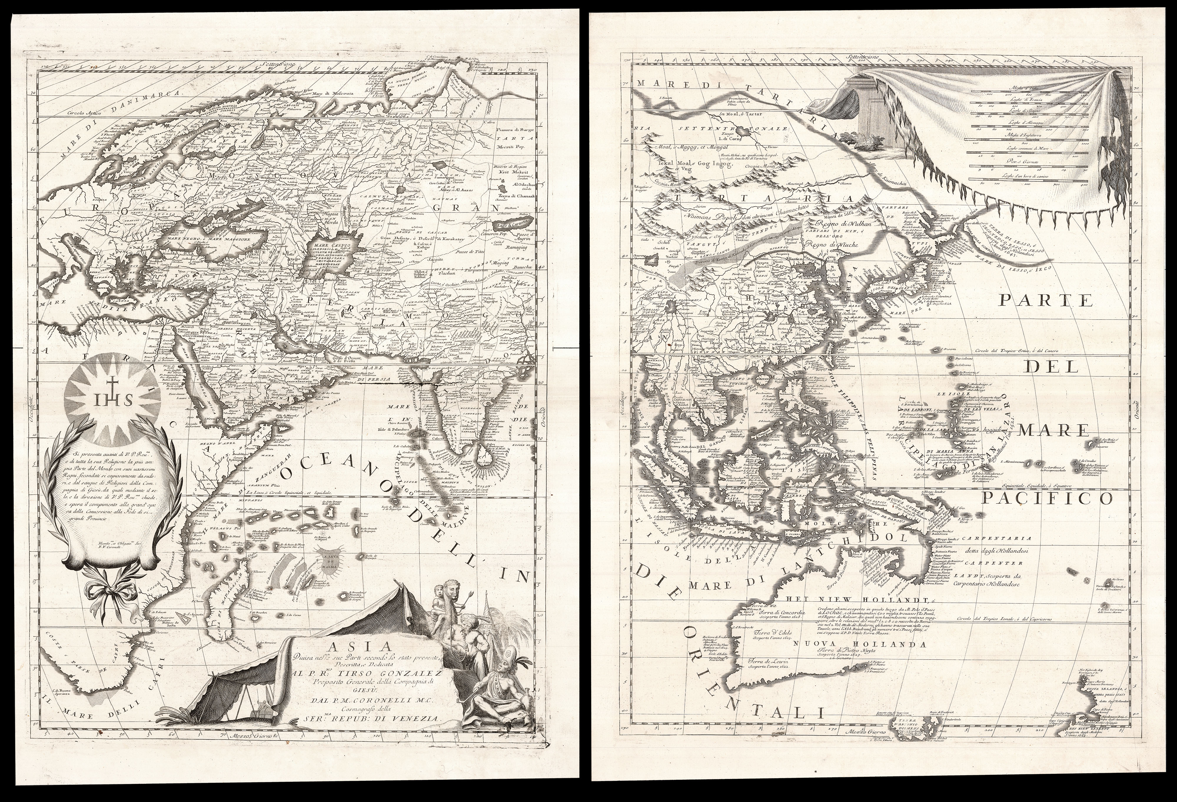 |
Coronelli's Asia showing the discoveries of the Jesuits and the Dutch
1 x
£6,000
|
£6,000 |
|
£6,000 |
|
× |
![[?MARKE, John] [Brass Astrolabe and Slide Rule]](https://omega.crouchrarebooks.com/wp-content/uploads/2025/03/22198_1H.jpg) |
The "Panchronologia"
1 x
£500,000
|
£500,000 |
|
£500,000 |
|
× |
 |
A comprehensive northern coastline of Australia
1 x
£1,100
|
£1,100 |
|
£1,100 |
|
× |
![VINKELES, Rein; [after] J[an] BUYS Gerardus Mercator](https://omega.crouchrarebooks.com/wp-content/uploads/2025/03/17793_1H.jpg) |
Gerard Mercator
1 x
£150
|
£150 |
|
£150 |
|
× |
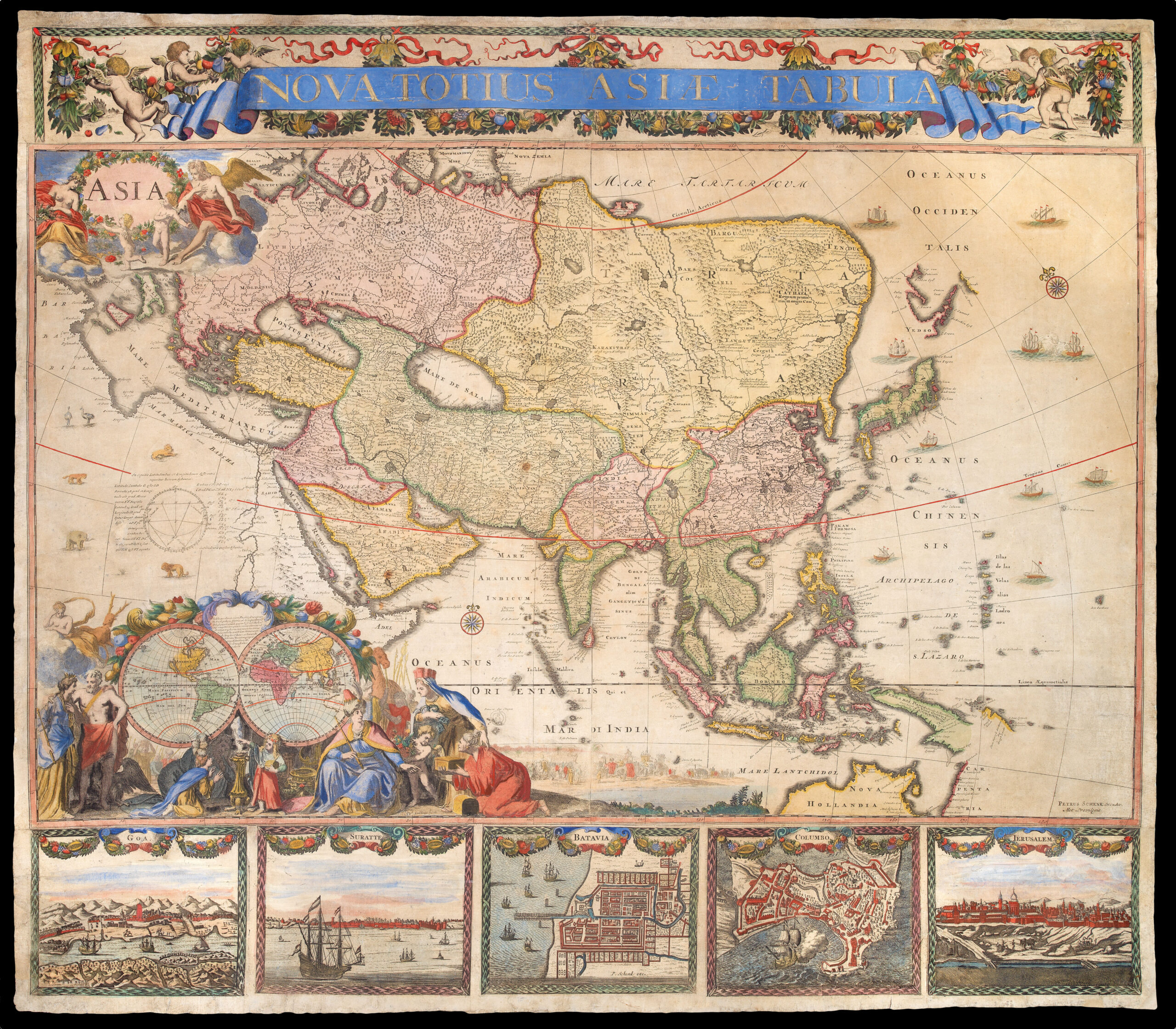 |
The only known example of Peter Schenk's wall map of Asia
1 x
£150,000
|
£150,000 |
|
£150,000 |
|
× |
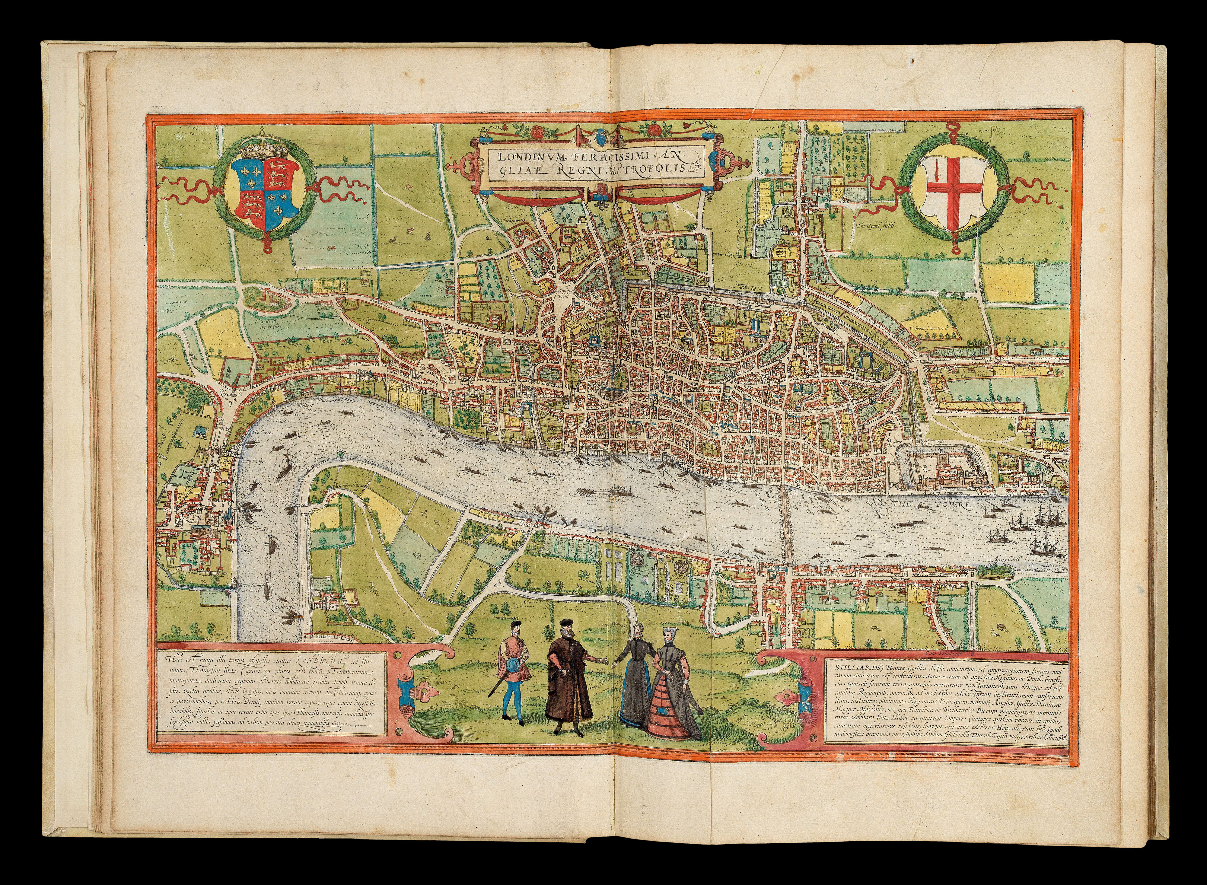 |
The earliest systematic city atlas
1 x
£300,000
|
£300,000 |
|
£300,000 |
|
× |
 |
The Poly-olbion
1 x
£12,500
|
£12,500 |
|
£12,500 |
|
× |
![[KHALIL, Muhammad and Abd AL-A'IMMA] [Brass Persian astrolabe]](https://omega.crouchrarebooks.com/wp-content/uploads/2025/03/23117_2H.jpg) |
Safavid astrolabe
1 x
£550,000
|
£550,000 |
|
£550,000 |
|
× |
![BEAURAIN, [Jean de] Plan de la Ville et du Port Mahon et du Fort St. Philippe](https://omega.crouchrarebooks.com/wp-content/uploads/2025/03/14981_1H.jpg) |
Map of Mahon and Fort St Philip
1 x
£800
|
£800 |
|
£800 |
|
× |
 |
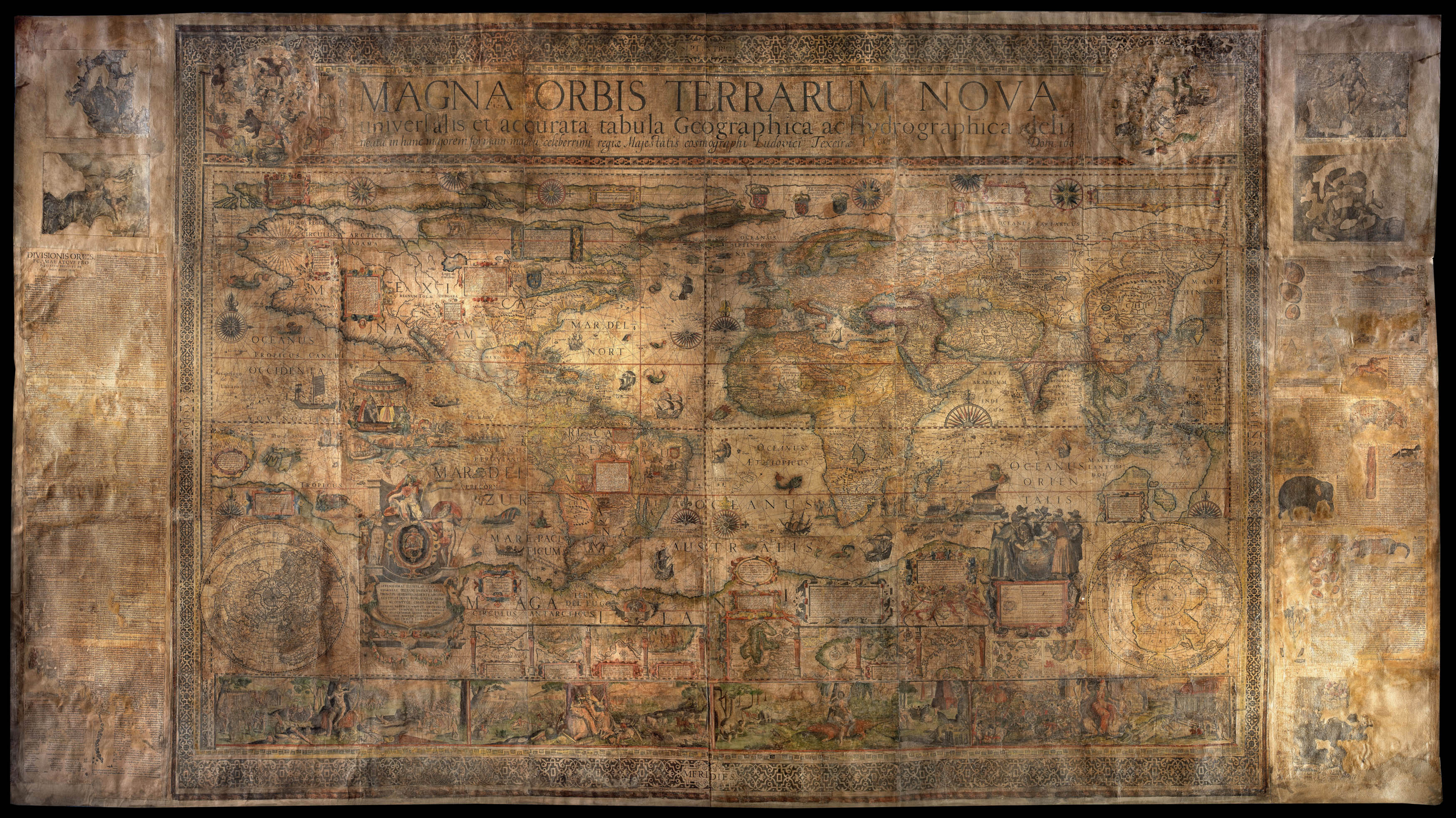
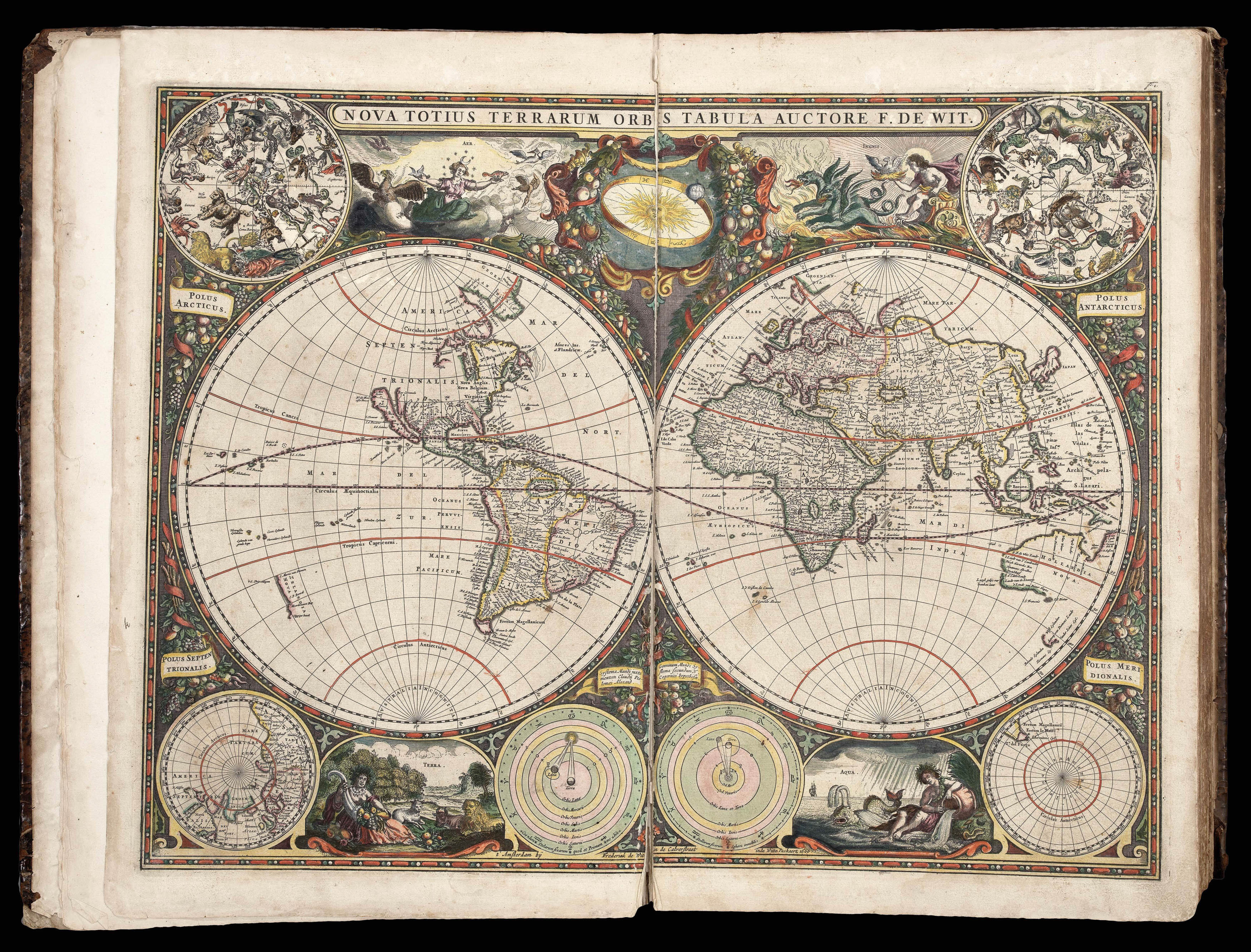
One of the largest world maps ever printed
1 x
£180,000
|
£180,000 |
|
£180,000 |
|
× |
 |
Rare Russian world map
1 x
£10,000
|
£10,000 |
|
£10,000 |
|
× |
![Dong Fangli (Youcheng) 董方立(佑誠) (1791-1823), Li Zhaoluo 李兆洛 (1769-1841) Huangchao yitong yudi quantu 皇朝壹统舆地全圖 [Complete Map of the Unified Qing Empire].](https://omega.crouchrarebooks.com/wp-content/uploads/2025/03/14998_1H.jpg) |
Longitude and Latitude on a map of the Qing Empire
1 x
£65,000
|
£65,000 |
|
£65,000 |
|
× |
 |
"the great prose epic of the Elizabethan period" - the first English map on Mercator's projection; the first map to name Lake Ontario; and one of the first maps to use the name "Virginia"
1 x
£800,000
|
£800,000 |
|
£800,000 |
|
× |
 |
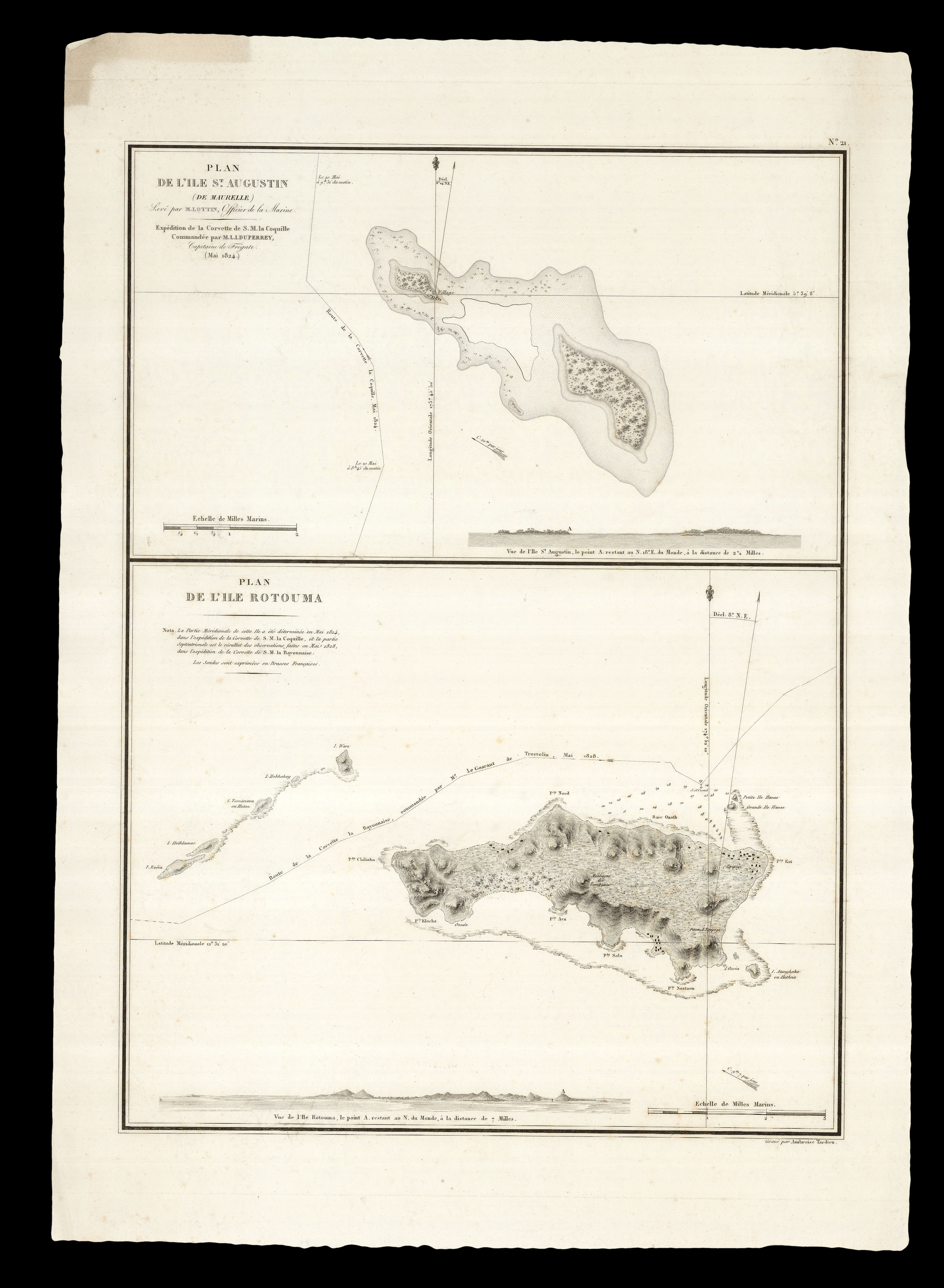
Unrecorded issue of this rare chart of the Singapore Strait
1 x
£4,500
|
£4,500 |
|
£4,500 |
|
× |
![FEUERLEIN, Johann Peter [after] Petrus Schenck, Elberveldensis / magni nominis apud Batavos sculptor.](https://omega.crouchrarebooks.com/wp-content/uploads/2025/03/17725_1H.jpg) |
Pieter Schenck
1 x
£500
|
£500 |
|
£500 |
|
× |
![BAUERKELLER, G[eorge] Bauerkeller's New Embossed Plan of London 1841.](https://omega.crouchrarebooks.com/wp-content/uploads/2025/03/13860_1H.jpg) |
George Bauerkeller's rare and strikingly modern embossed plan of London
1 x
£7,000
|
£7,000 |
|
£7,000 |
|
× |
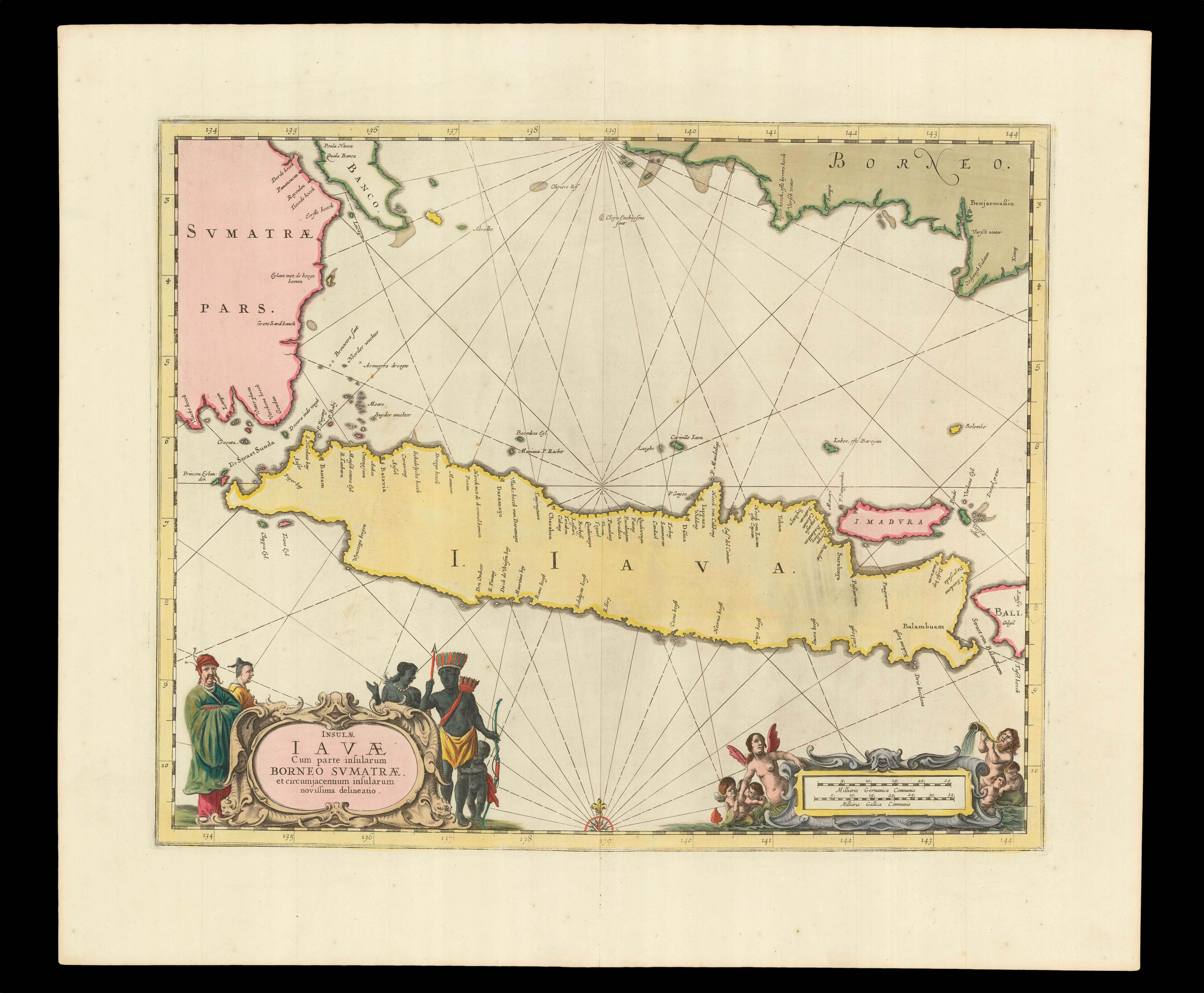 |
The heart of VOC territory in Southeast Asia
1 x
£750
|
£750 |
|
£750 |
|
× |
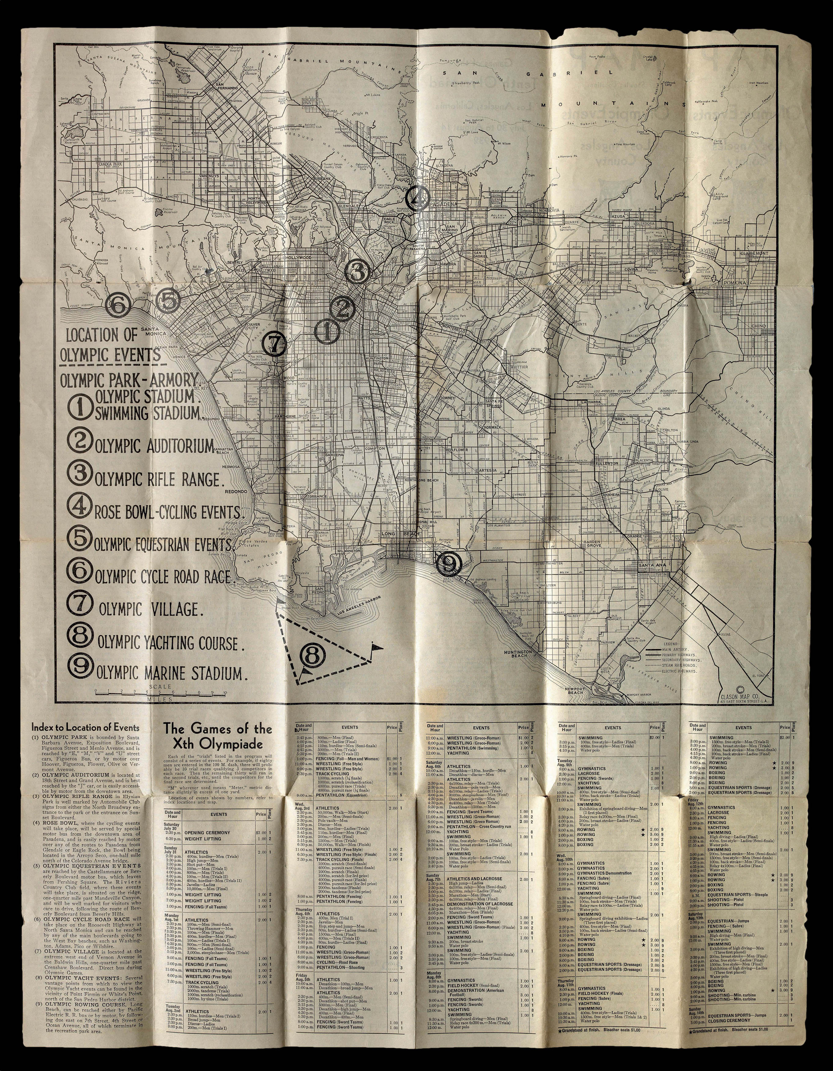 |
Los Angeles goes for the gold!
1 x
£350
|
£350 |
|
£350 |
|
× |
![[?BOAZIO, Giovanni Battista] S. Dominico](https://omega.crouchrarebooks.com/wp-content/uploads/2025/03/15990_1H.jpg) |
The first printed view of Santo Domingo
1 x
£20,000
|
£20,000 |
|
£20,000 |
|
× |
 |
Following in Louis Freycinet's "footsteps"
1 x
£250
|
£250 |
|
£250 |
|
× |
![DE JODE, Cornelis Novae Guineae Formus and Situs; Quivirae Regnu[m], cum alijs versus Borea[lem]](https://omega.crouchrarebooks.com/wp-content/uploads/2025/03/21877_1H.jpg) |
The first printed map of Alaska and the first map to focus on "Australia"
1 x
£18,000
|
£18,000 |
|
£18,000 |
|
× |
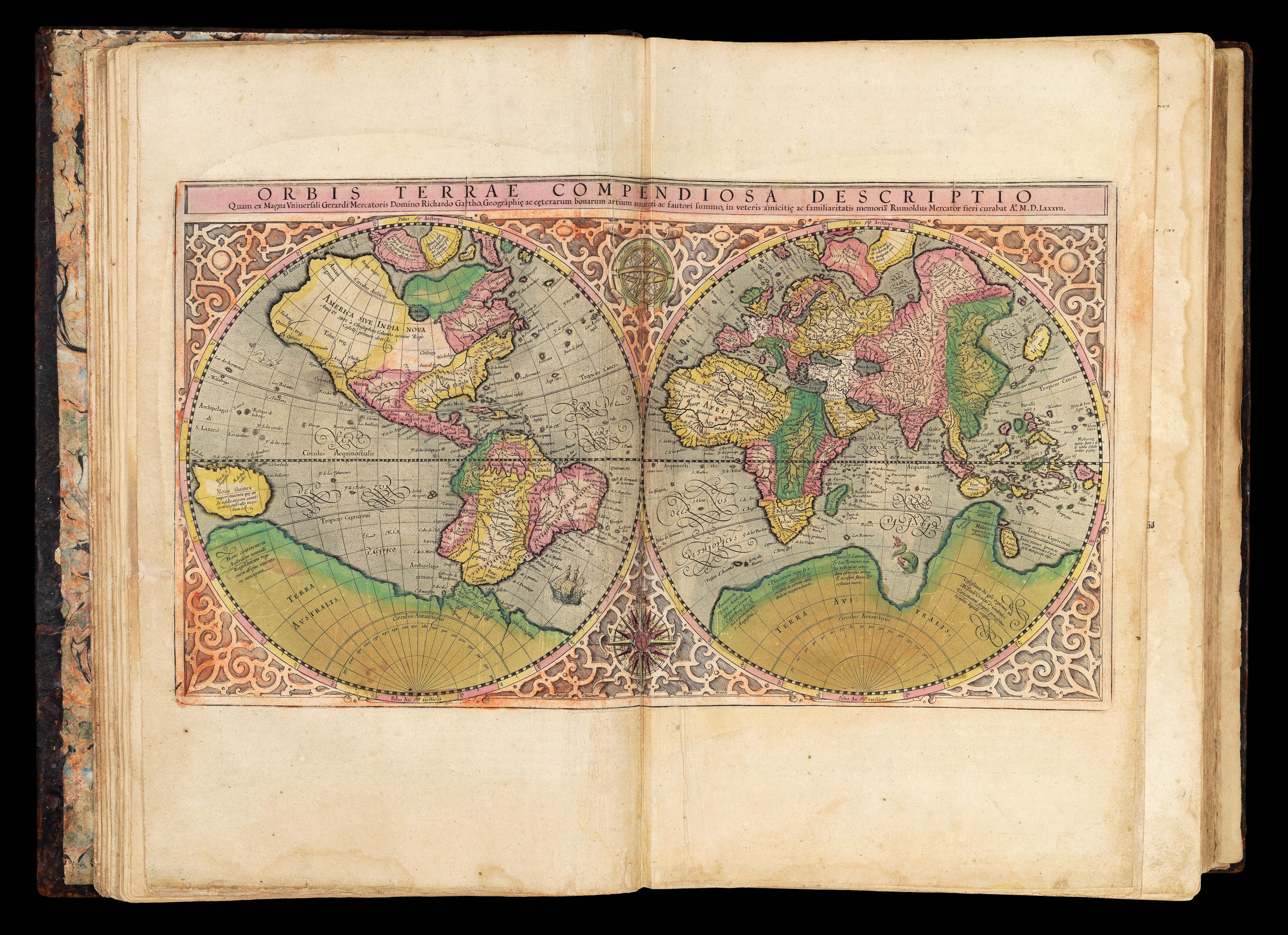 |
The first 'atlas'
1 x
£100,000
|
£100,000 |
|
£100,000 |
|
× |
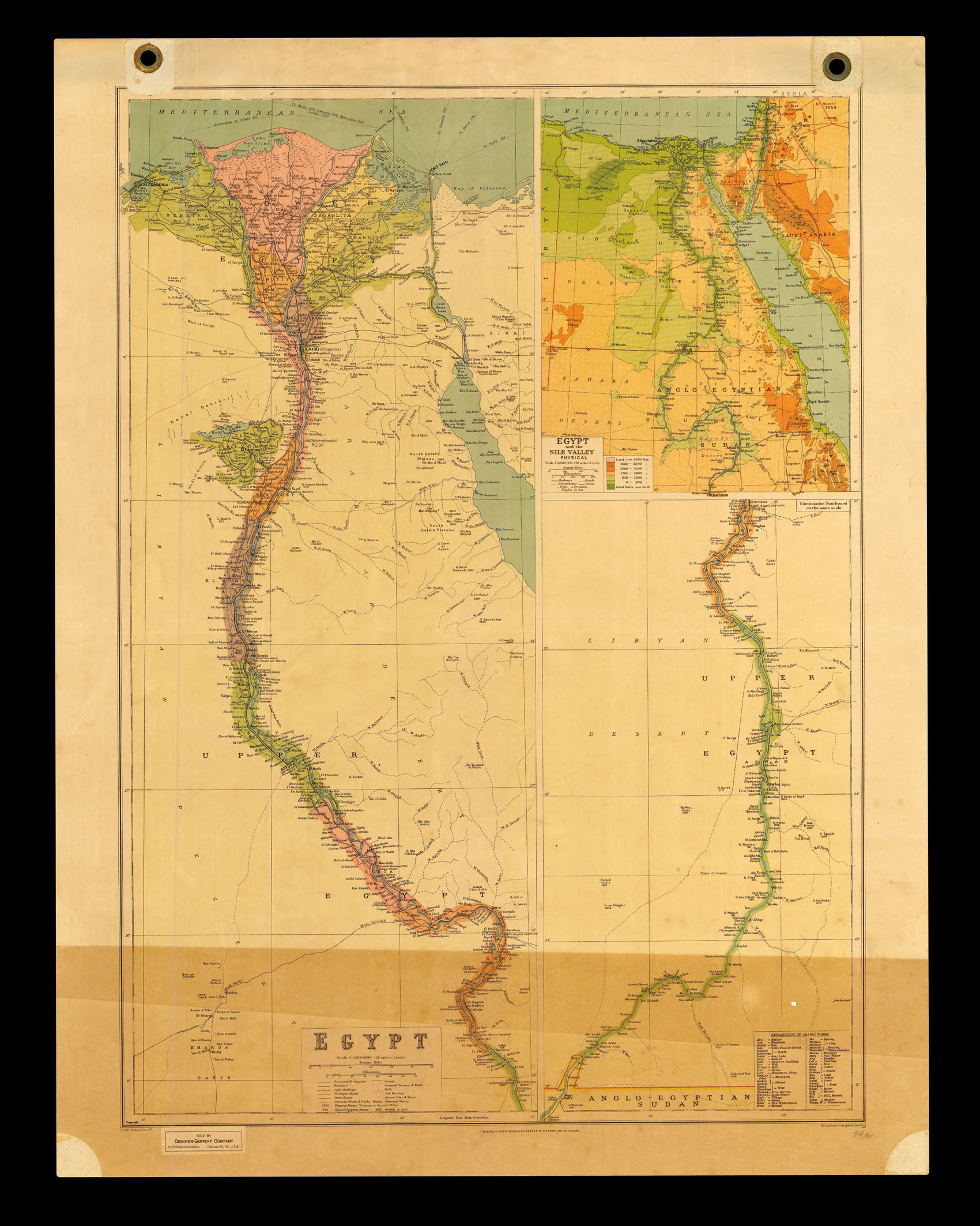 |
Egypt
1 x
£100
|
£100 |
|
£100 |
|
× |
![PICCOLOMINI, Alessandro De la Sfera del Mondo. [and] De Le Stelle Fisse.](https://omega.crouchrarebooks.com/wp-content/uploads/2025/03/22607_1H.jpg) |
The first printed star atlas
1 x
£12,000
|
£12,000 |
|
£12,000 |
|
× |
 |
The latest information
1 x
£100
|
£100 |
|
£100 |
|
× |
 |
The most up-to-date sea atlas of the second half of the seventeenth century
1 x
£80,000
|
£80,000 |
|
£80,000 |
|
× |
 |
Precipitous prospectus for Lewis and Clark's monumental work,... a whole seven years before it was finally published
1 x
£2,500
|
£2,500 |
|
£2,500 |
|
× |
 |
Unrecorded second state of De Jode's map of Asia
1 x
£25,000
|
£25,000 |
|
£25,000 |
|
× |
 |
Sixth planet from the sun
1 x
£10,000
|
£10,000 |
|
£10,000 |
|
× |
![[ANONYMOUS] [Shop Sign].](https://omega.crouchrarebooks.com/wp-content/uploads/2025/03/14862_1H.jpg) |
Nautical instrument maker's shop sign
1 x
£2,500
|
£2,500 |
|
£2,500 |
|
× |
 |
Madrid of the Bourbons
1 x
£40,000
|
£40,000 |
|
£40,000 |
|
× |
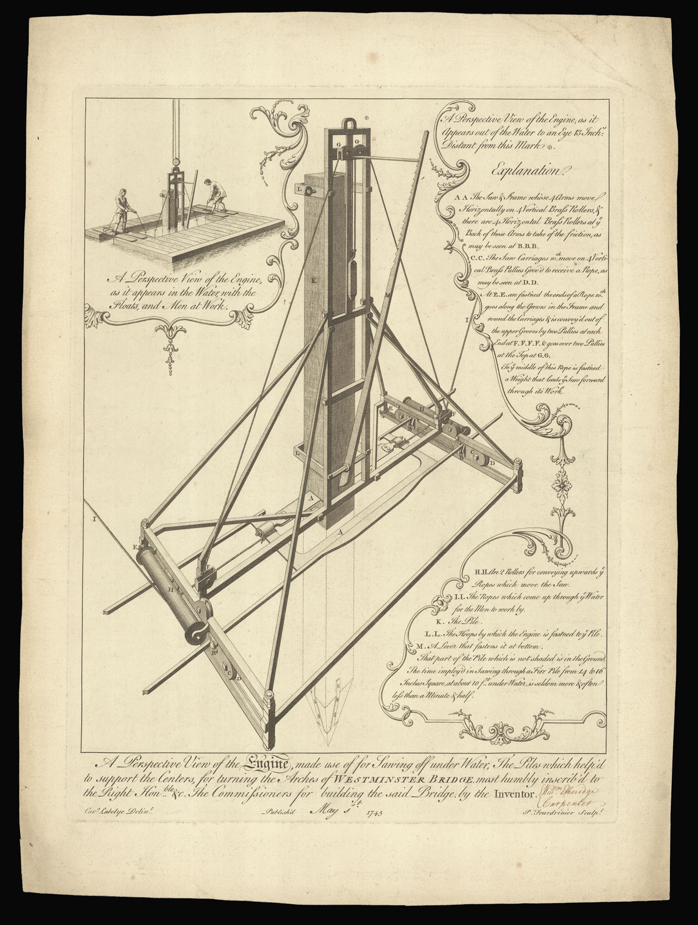 |
An underwater saw
1 x
£950
|
£950 |
|
£950 |
|
× |
![HOLLAR, W[enceslaus] [after] VAN DYCK, Anton[y] Marguerite Lemon Angloise](https://omega.crouchrarebooks.com/wp-content/uploads/2025/03/18369_1H.jpg) |
When life gives you Lemon...
1 x
£600
|
£600 |
|
£600 |
|
× |
![[Anonymous] [Mariner's Chest]](https://omega.crouchrarebooks.com/wp-content/uploads/2025/03/2196_1H.jpg) |
A dead man's chest...
1 x
£20,000
|
£20,000 |
|
£20,000 |
|
|


