|
× |
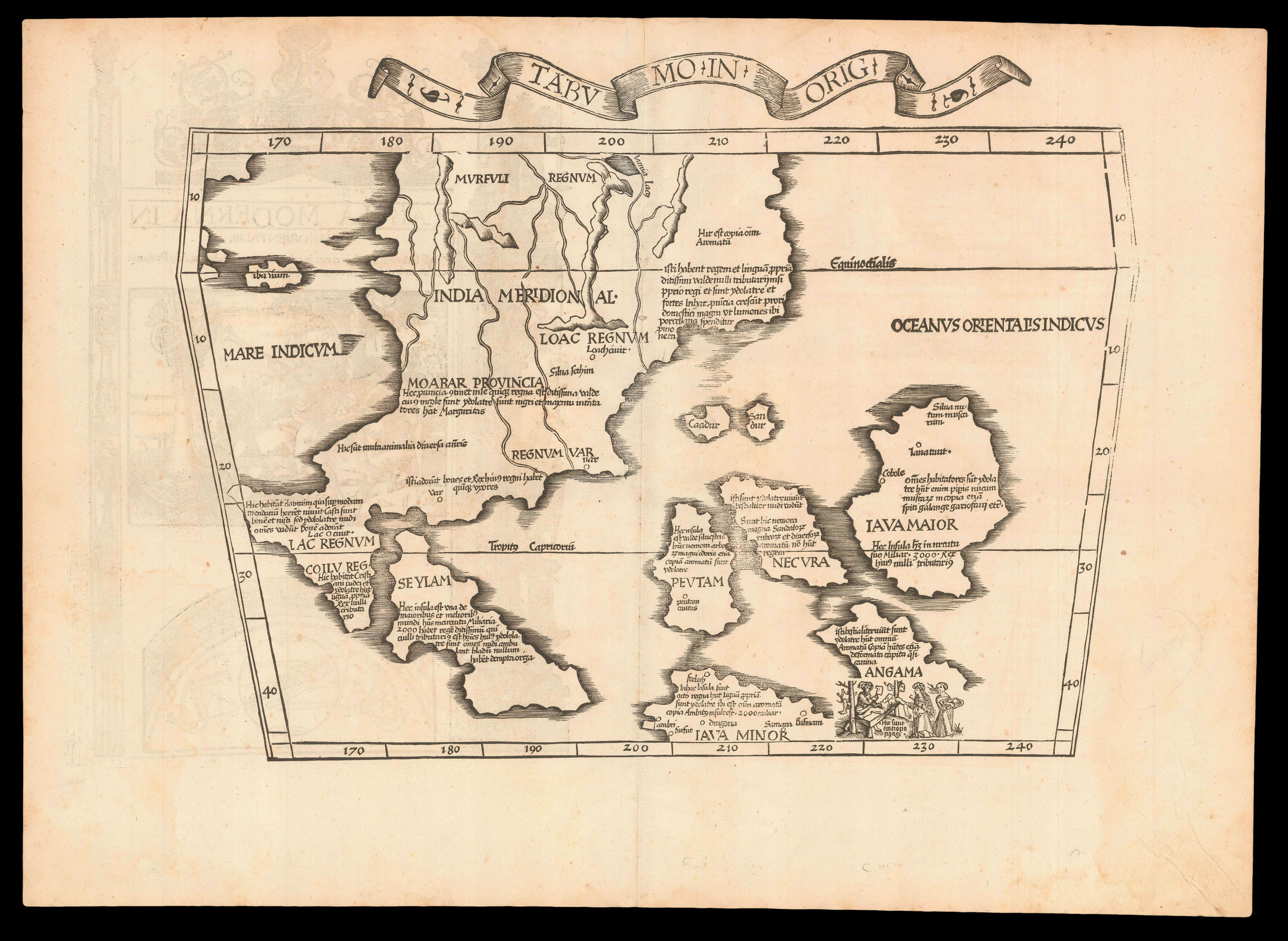 |
"The first printed map of European origin devoted to Southeast Asia and its islands" (Suarez)
1 x
£7,200
|
£7,200 |
|
£7,200 |
|
× |
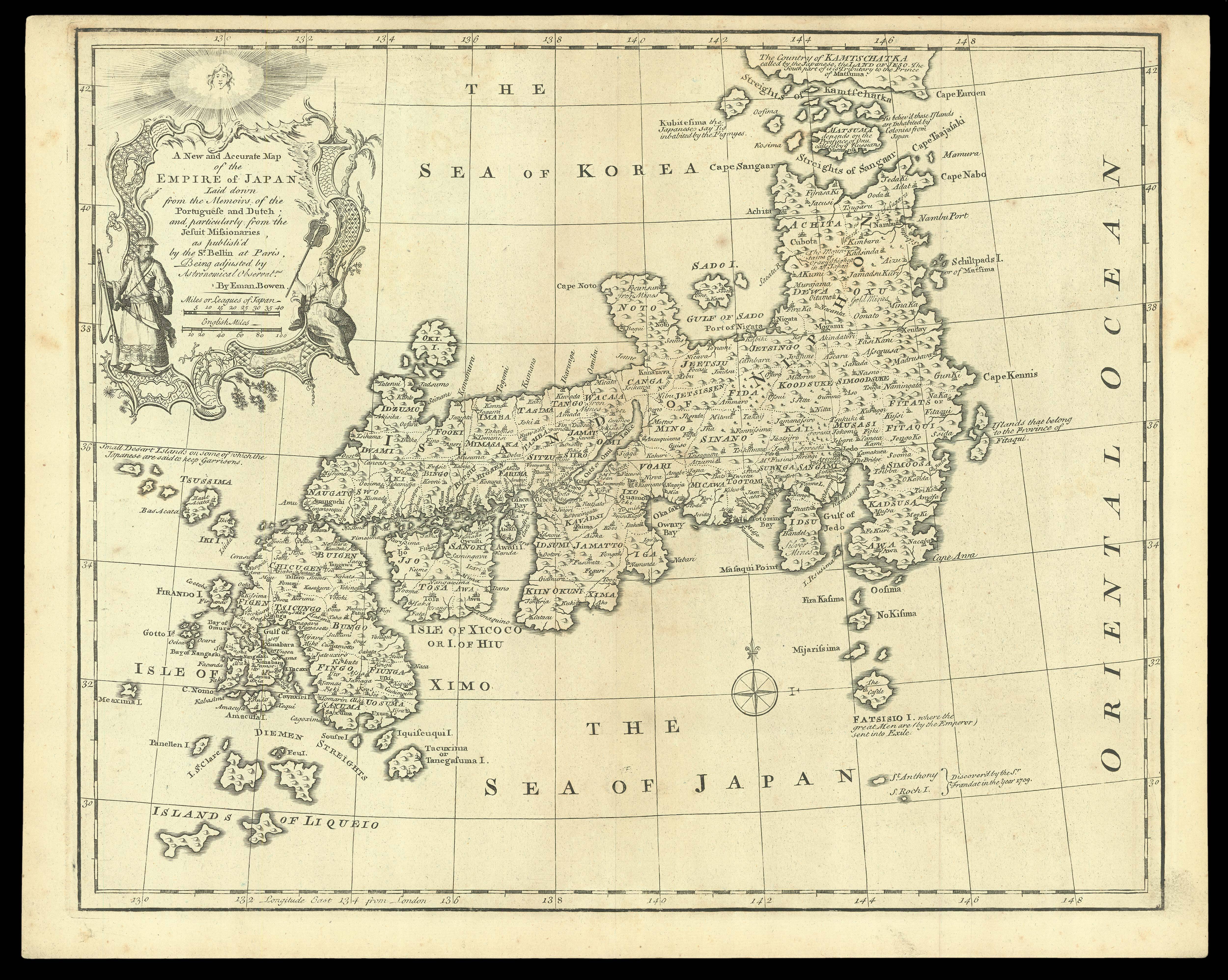 |
A New and Accurate Map of the Empire of Japan
1 x
£1,750
|
£1,750 |
|
£1,750 |
|
× |
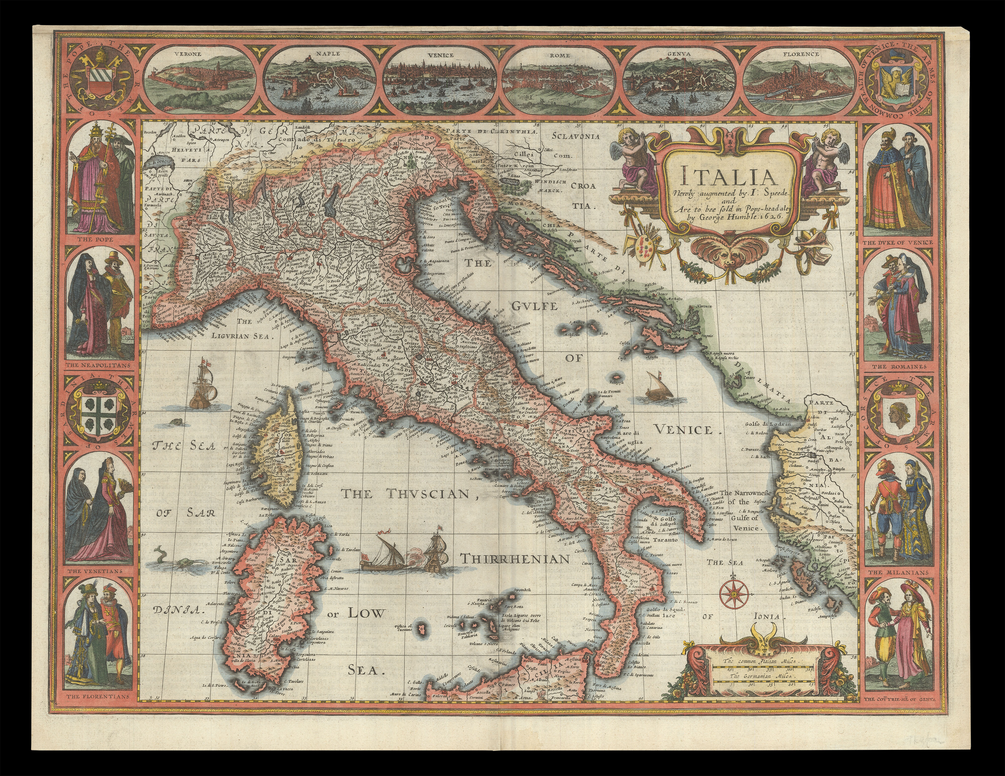 |
Speed's map of Italy
1 x
£2,500
|
£2,500 |
|
£2,500 |
|
× |
![BERGERON, [Louis-Eloy] [but Louis-Georges-Isaac SALIVET] Manuel du tourneur](https://omega.crouchrarebooks.com/wp-content/uploads/2025/03/15093_1H-3.jpg) |
Rare first edition of woodworker's manual
1 x
£1,000
|
£1,000 |
|
£1,000 |
|
× |
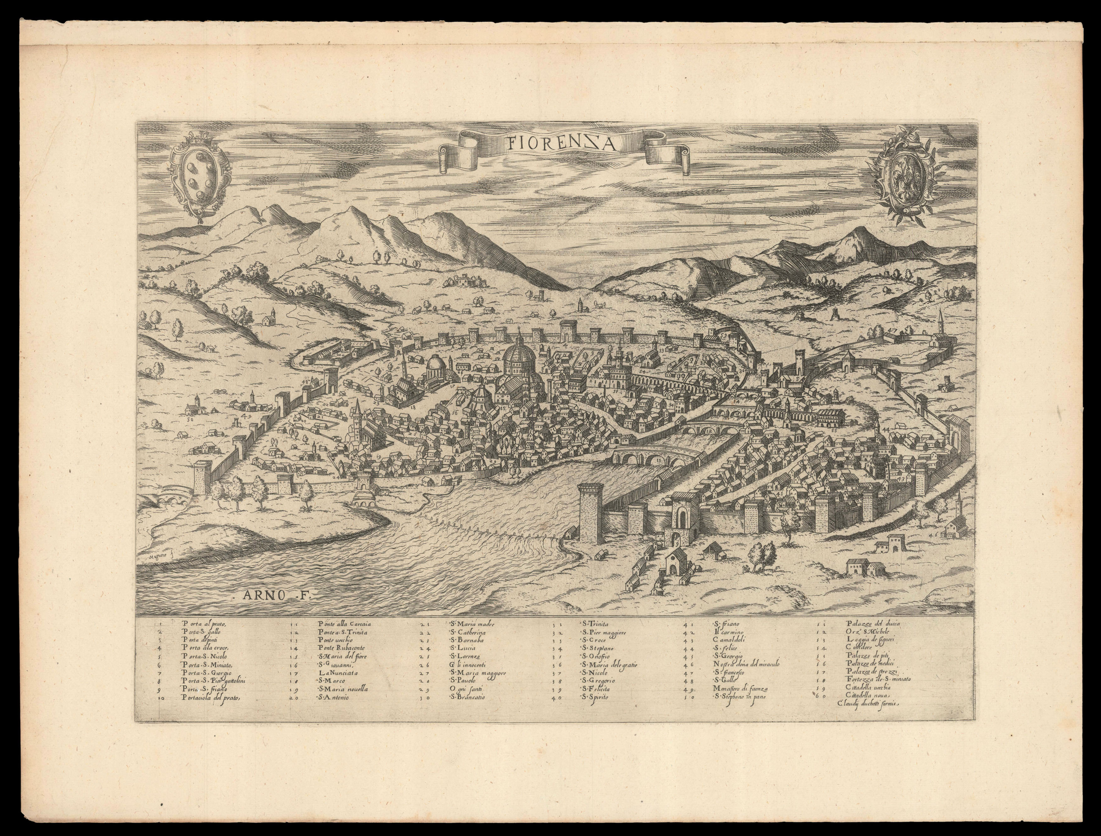 |
Duchetti's plan of Florence
1 x
£2,200
|
£2,200 |
|
£2,200 |
|
× |
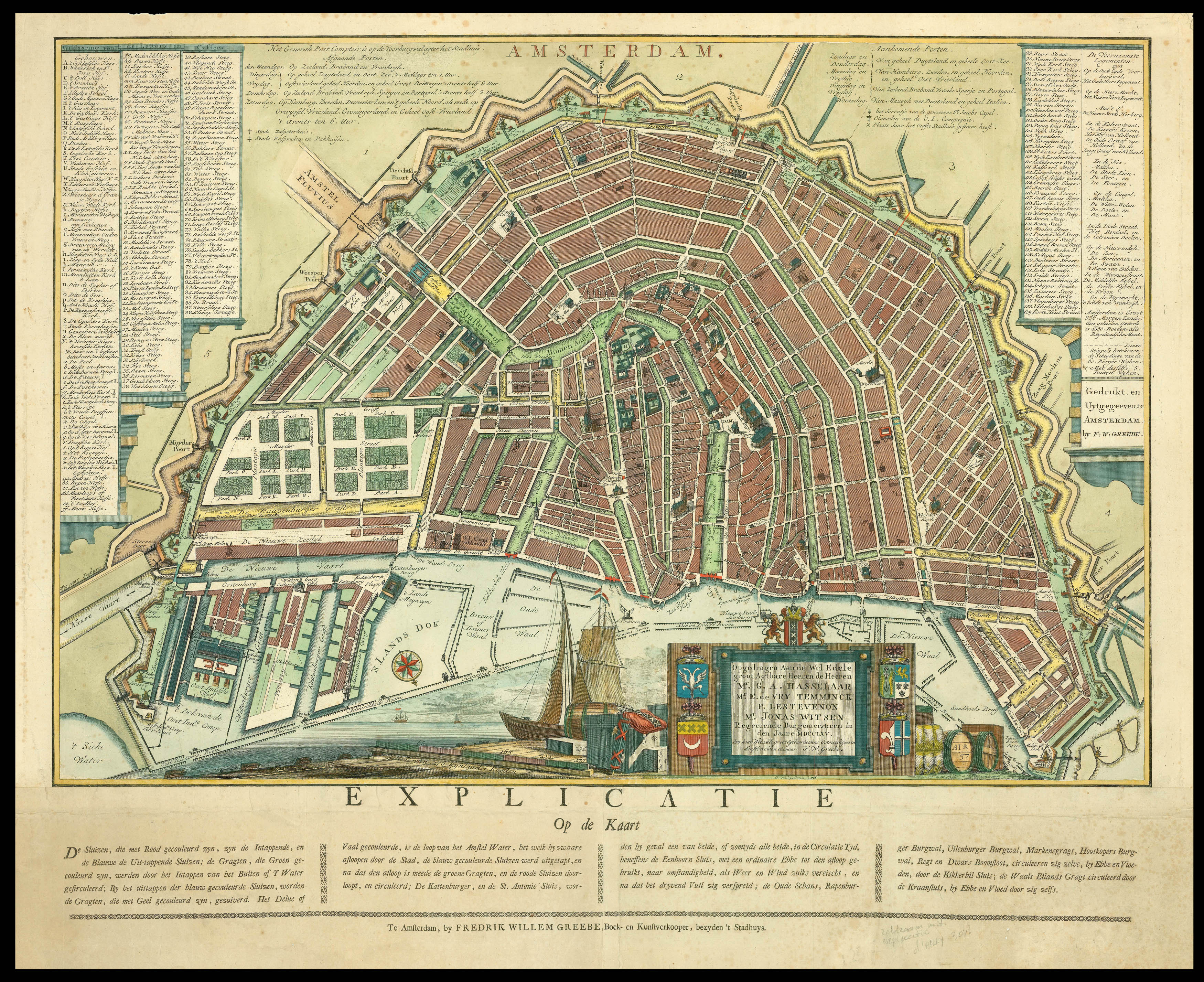 |
A rare plan of Amsterdam
1 x
£8,800
|
£8,800 |
|
£8,800 |
|
× |
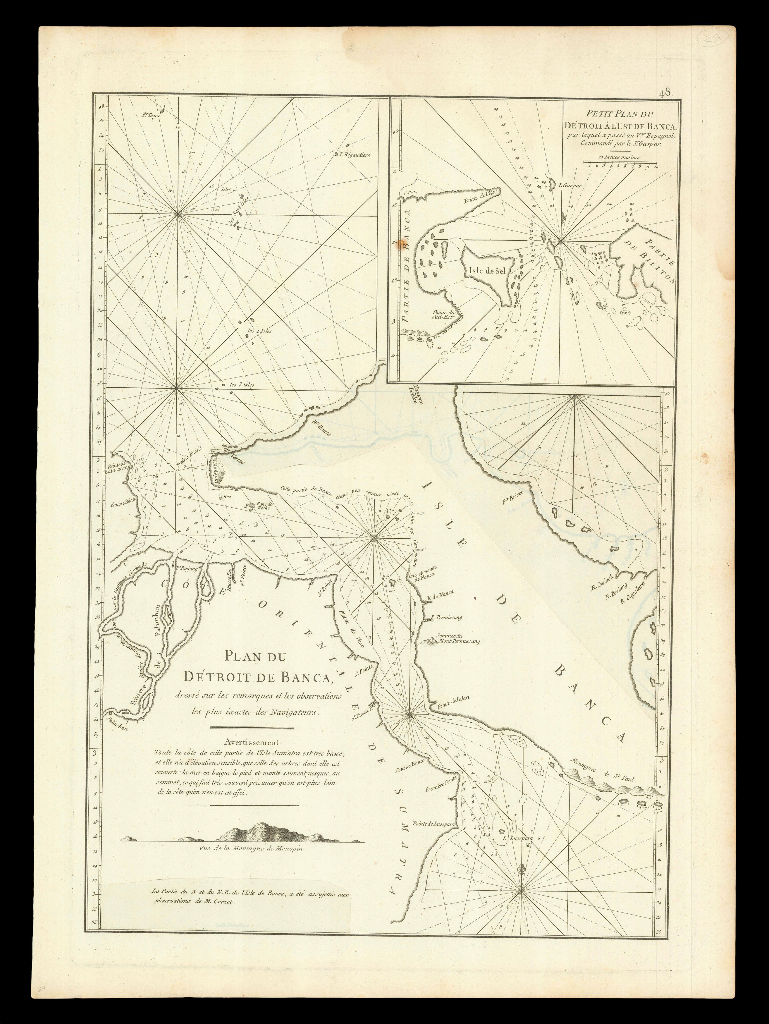 |
The Bangka Strait
1 x
£300
|
£300 |
|
£300 |
|
× |
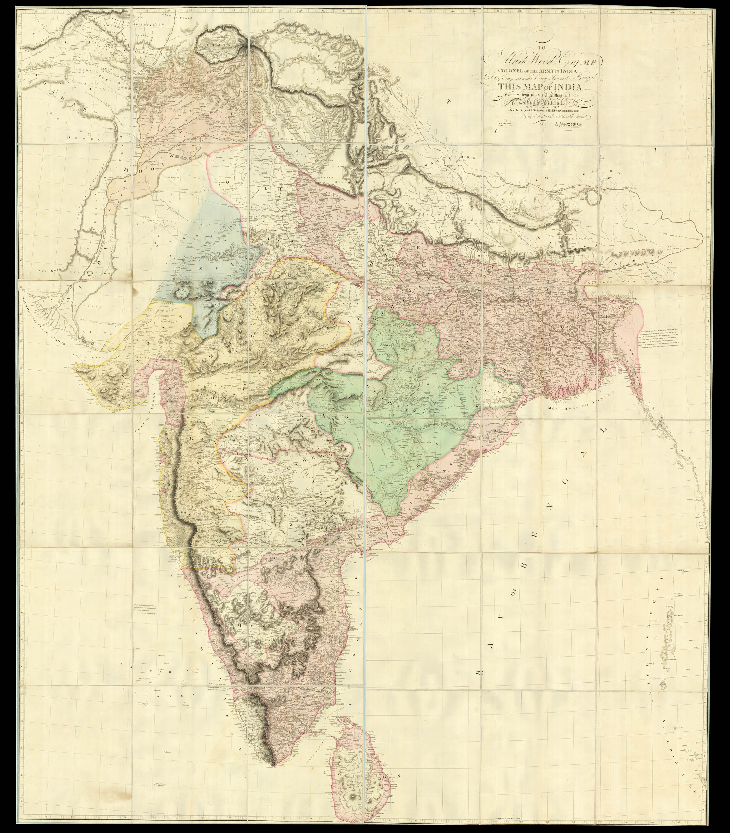 |
Rare large-scale map of India in full original colour
1 x
£10,000
|
£10,000 |
|
£10,000 |
|
× |
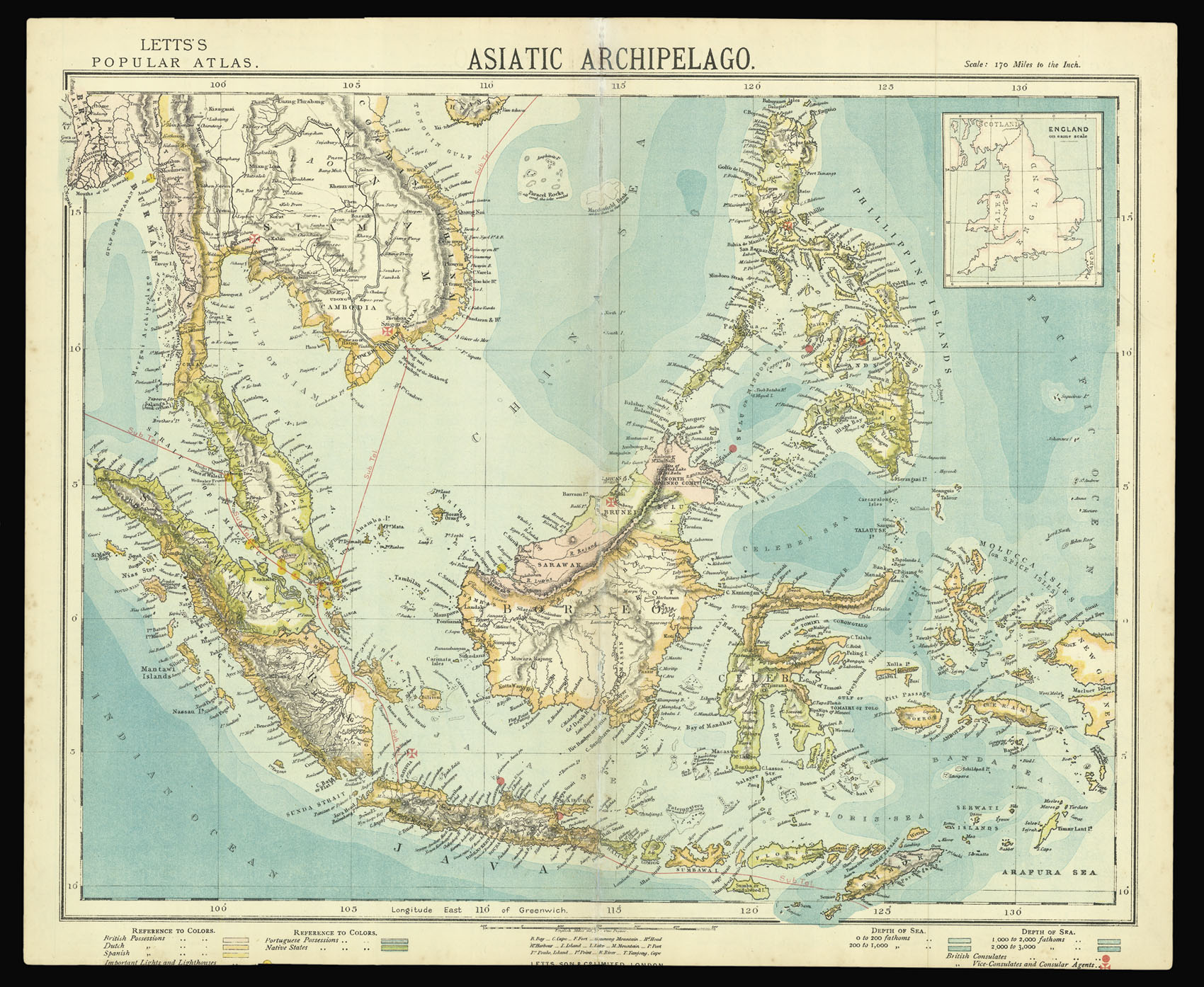 |
Southeast Asia
1 x
£60
|
£60 |
|
£60 |
|
× |
![PTOLEMAEUS, Claudius [translated by ANGELUS, Jacobus, edited by GERMANUS, Nicolaus] [North Africa, Sardinia and Sicily] Secunda Affrice Tabula.](https://omega.crouchrarebooks.com/wp-content/uploads/2025/03/18400_1H.jpg) |
A striking map of North Africa, Sardinia and Sicily from the 1482 Ulm Ptolemy
1 x
£7,500
|
£7,500 |
|
£7,500 |
|
× |
![[CRANE, Walter] World. Imperial Federation](https://omega.crouchrarebooks.com/wp-content/uploads/2025/03/22196_1H.jpg) |
The high watermark of the British Empire
1 x
£7,000
|
£7,000 |
|
£7,000 |
|
× |
 |
A comprehensive northern coastline of Australia
1 x
£1,100
|
£1,100 |
|
£1,100 |
|
× |
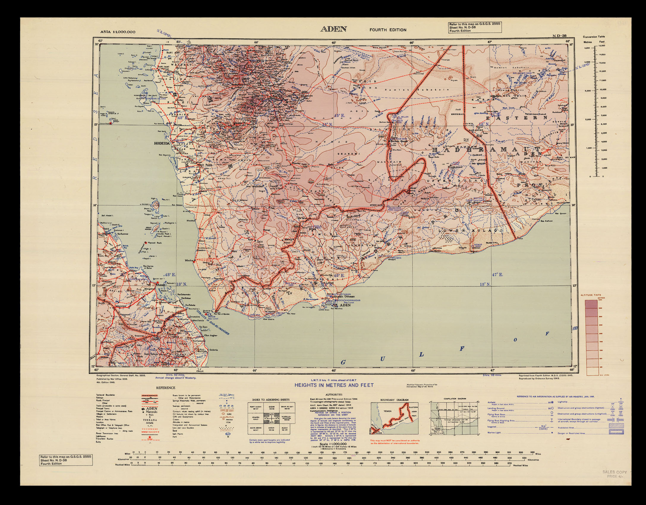 |
Aden: the "choke point" between the Red Sea and the Indian Ocean
1 x
£100
|
£100 |
|
£100 |
|
× |
 |
Dudley's chart of southern India
1 x
£8,000
|
£8,000 |
|
£8,000 |
|
× |
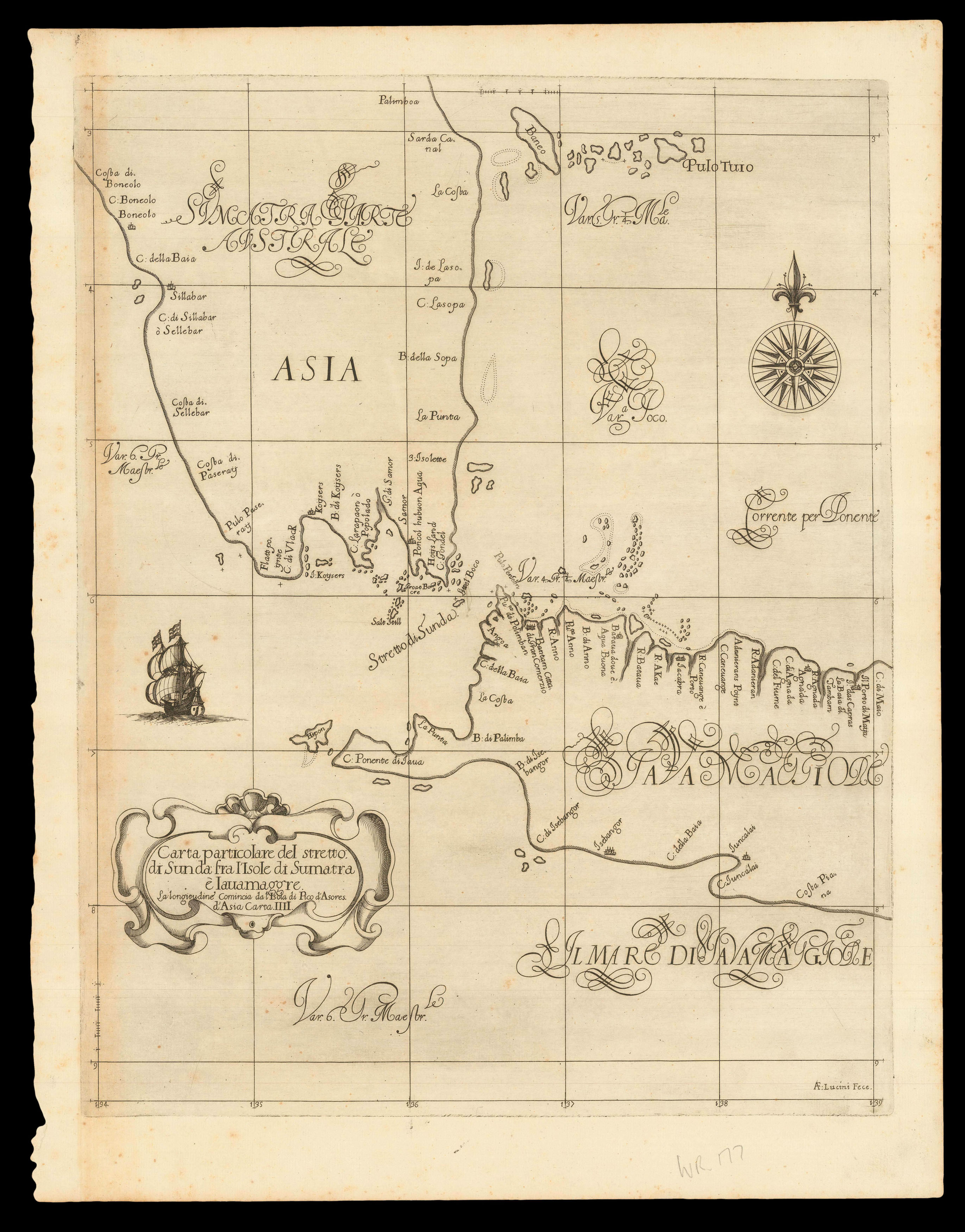 |
The Sunda Strait
1 x
£3,000
|
£3,000 |
|
£3,000 |
|
× |
![HOLLAR, W[enceslaus] Plan de Londres tel quil etoi avant l'incendie de 1666 grave par Hollar](https://omega.crouchrarebooks.com/wp-content/uploads/2025/03/18351_1H.jpg) |
With the arms of the Livery Companies of the City of London
1 x
£500
|
£500 |
|
£500 |
|
× |
![ANONYMOUS 東國輿誌 [동국여지 - Geographical depiction of the Eastern country - Korea]](https://omega.crouchrarebooks.com/wp-content/uploads/2025/03/19466_1H.jpg) |
Manuscript map of Korea showing Dokdo
1 x
£50,000
|
£50,000 |
|
£50,000 |
|
× |
 |
"in all these straits Piratical Proas usually Lurk, ready to Assault Defenceless Vessels..."
1 x
£2,500
|
£2,500 |
|
£2,500 |
|
× |
![LE SAGE, P. Carte depuis la fin du Detroit de la Sonde jusqu'a la fin D'Etroit de Banca faitte en l'anne 1734 – [Singapore Strait] – [South China Sea].](https://omega.crouchrarebooks.com/wp-content/uploads/2025/03/17525_1H.jpg) |
Charting a voyage of nearly two thousand nautical miles from the Sunda Strait to Hong Kong
1 x
£87,000
|
£87,000 |
|
£87,000 |
|
× |
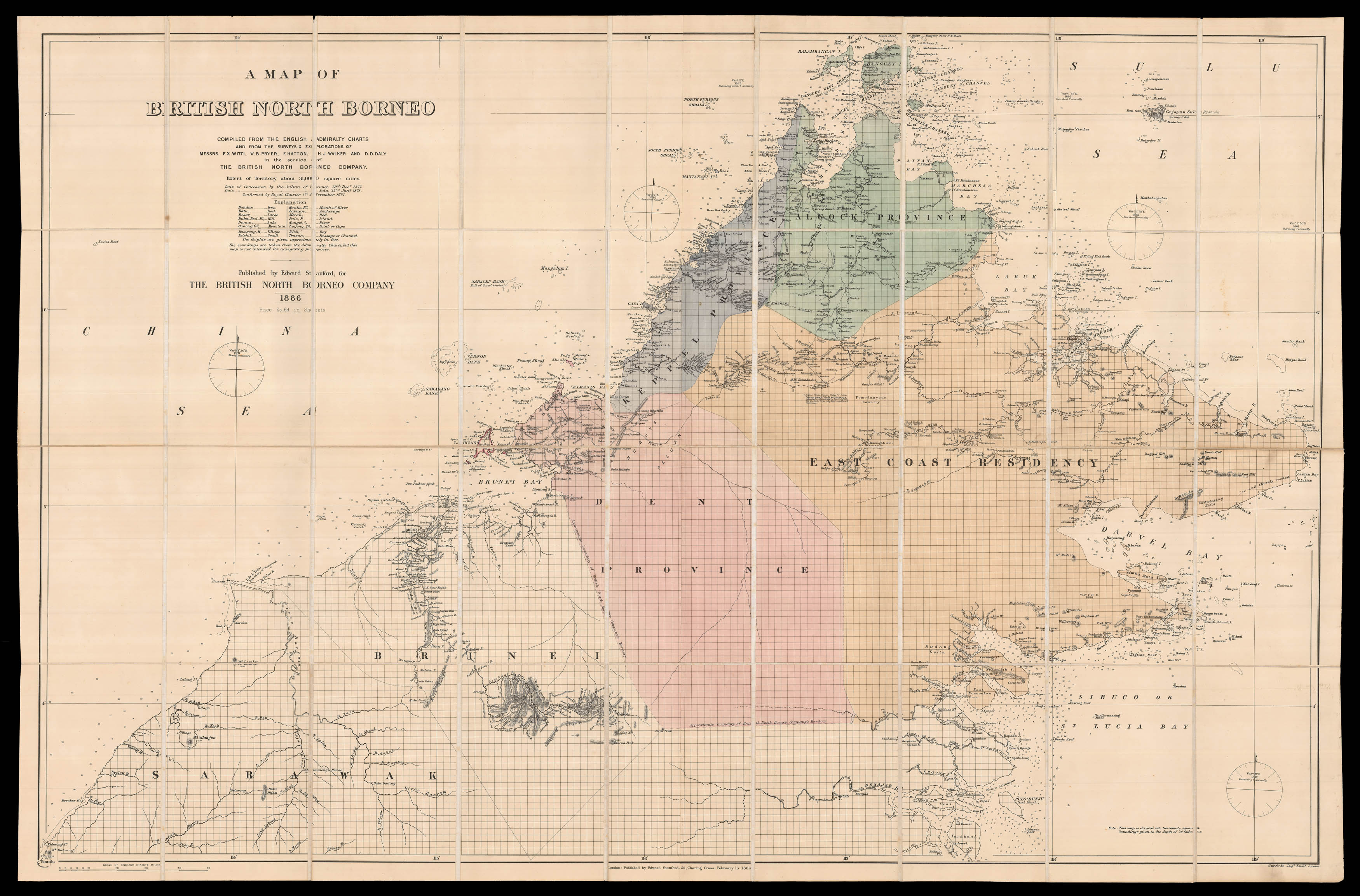 |
The British North Borneo Company
1 x
£4,500
|
£4,500 |
|
£4,500 |
|
× |
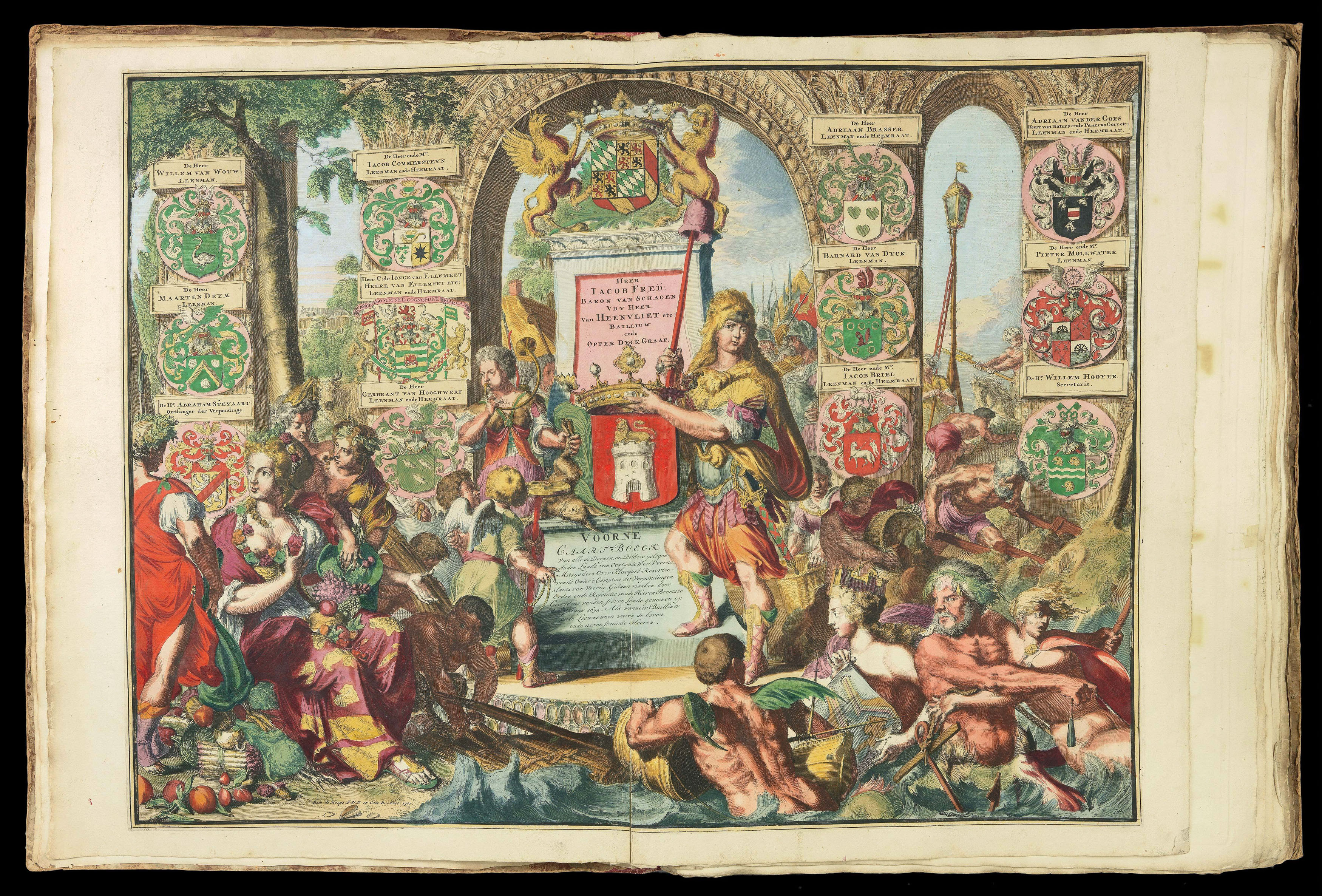 |
Fine atlas of Southern Holland in full original colour
1 x
£18,000
|
£18,000 |
|
£18,000 |
|
× |
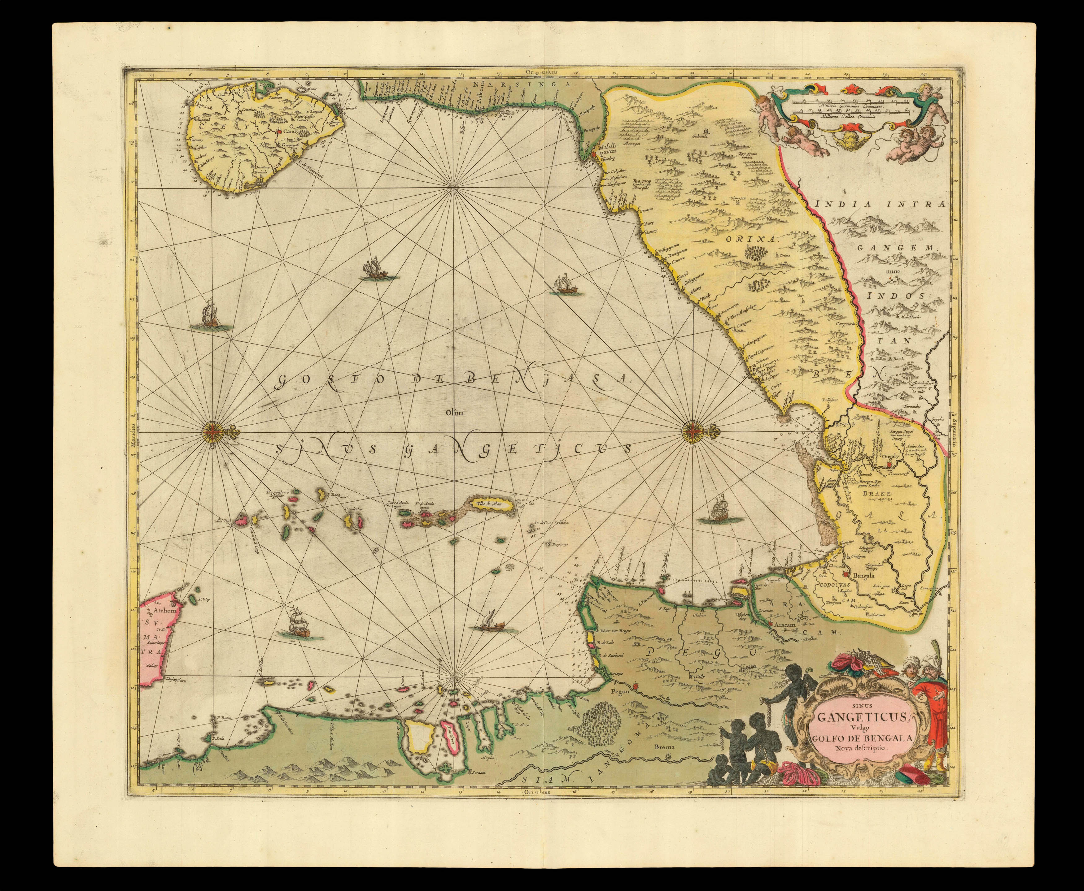 |
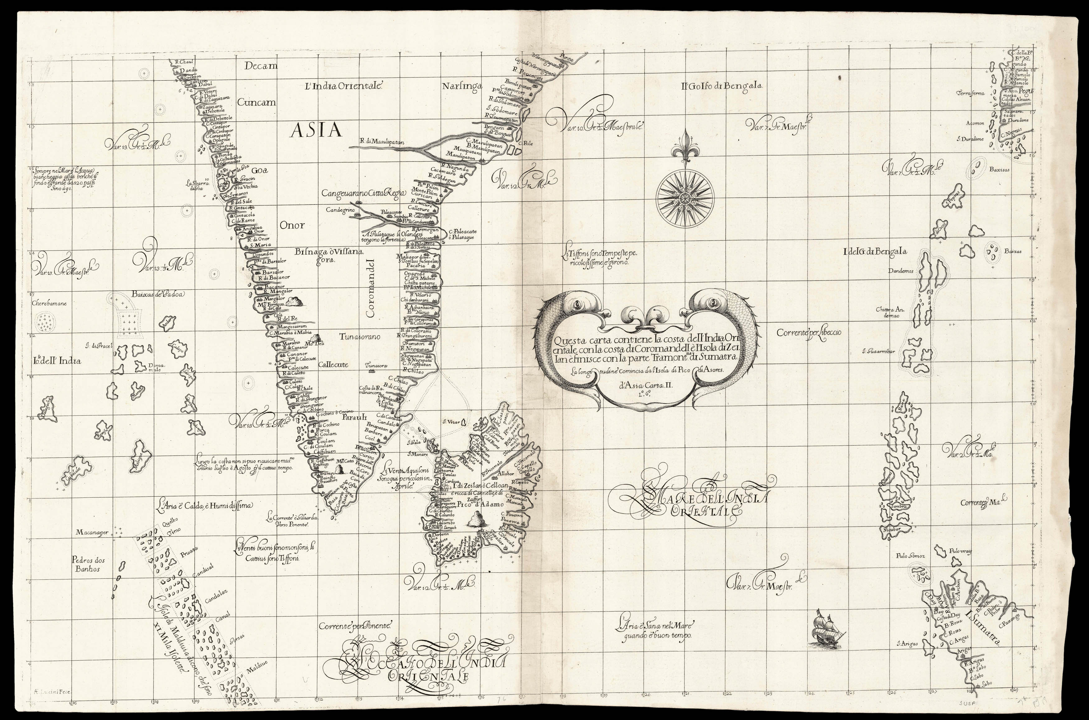
One of the earliest printed sea charts of the Bay of Bengal
1 x
£750
|
£750 |
|
£750 |
|
× |
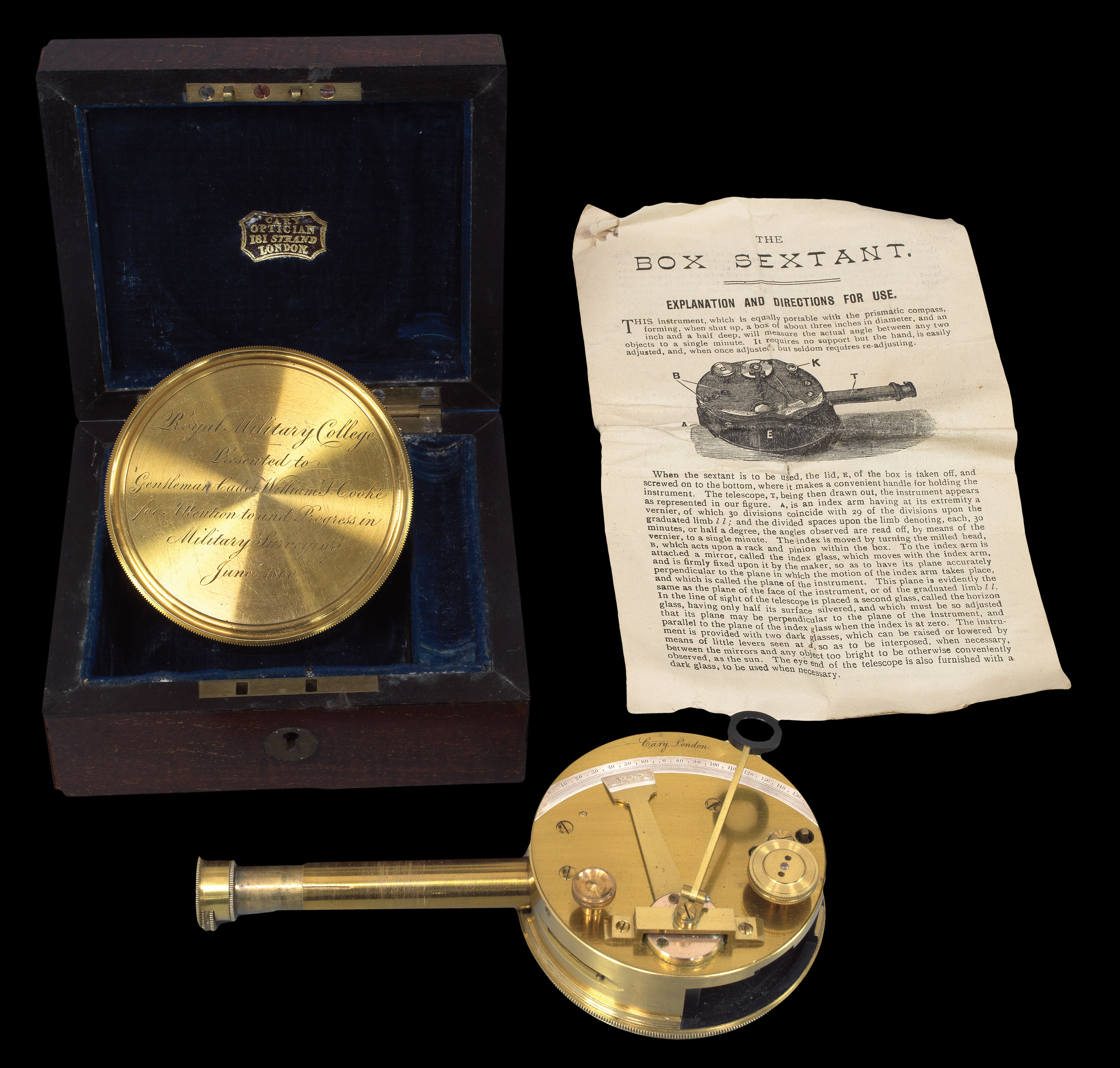 |
Rare Pocket Sextant
1 x
£1,500
|
£1,500 |
|
£1,500 |
|
× |
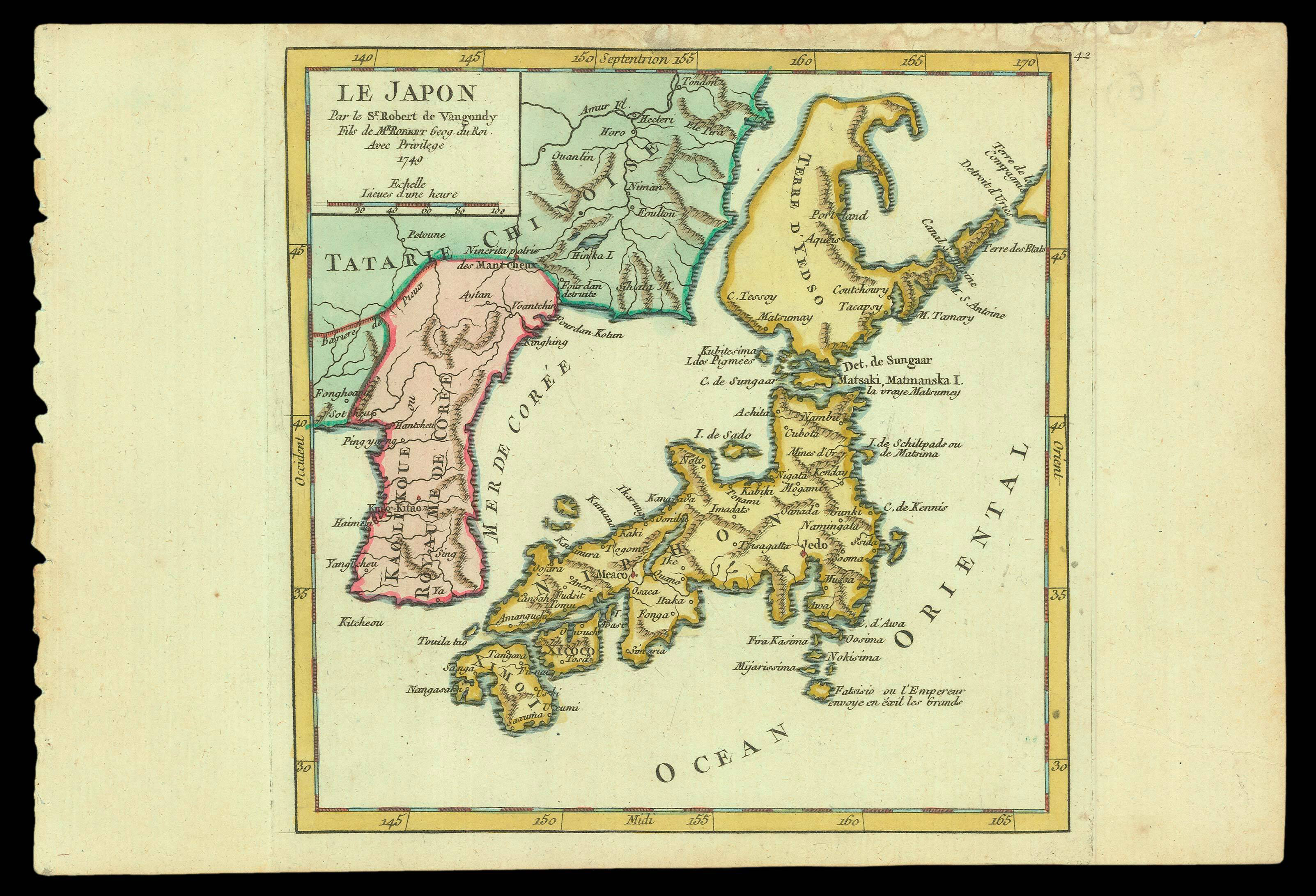 |
Hokkaido identified as an island
1 x
£390
|
£390 |
|
£390 |
|
|


