No products in the basket.
Return to shop
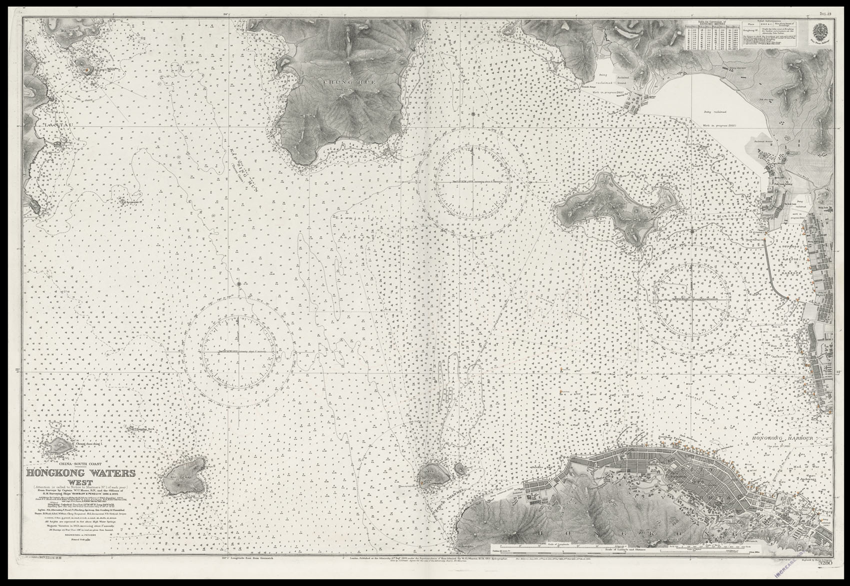
Detailed chart of Hong Kong’s Western Waters
By HYDROGRAPHIC OFFICE, New Edition 11th March, 1927.
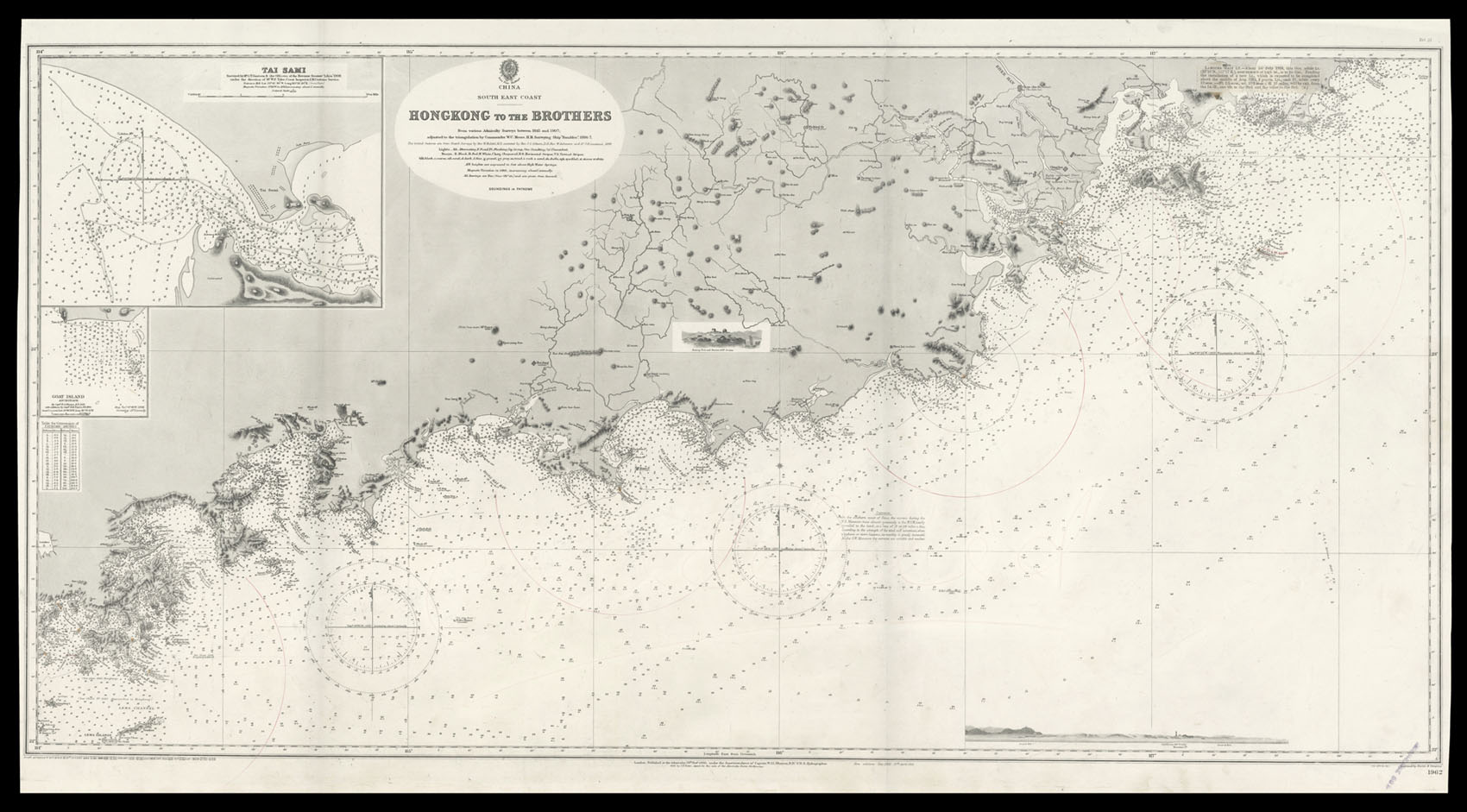
Admiralty chart of the China coast from Hong Kong to Dongshan
By HYDROGRAPHIC OFFICE, New Edition 27th April, 1912.
Large plan of 1930s Hong Kong showing the cyclone scale
By [SANXING PRESS], c1931].
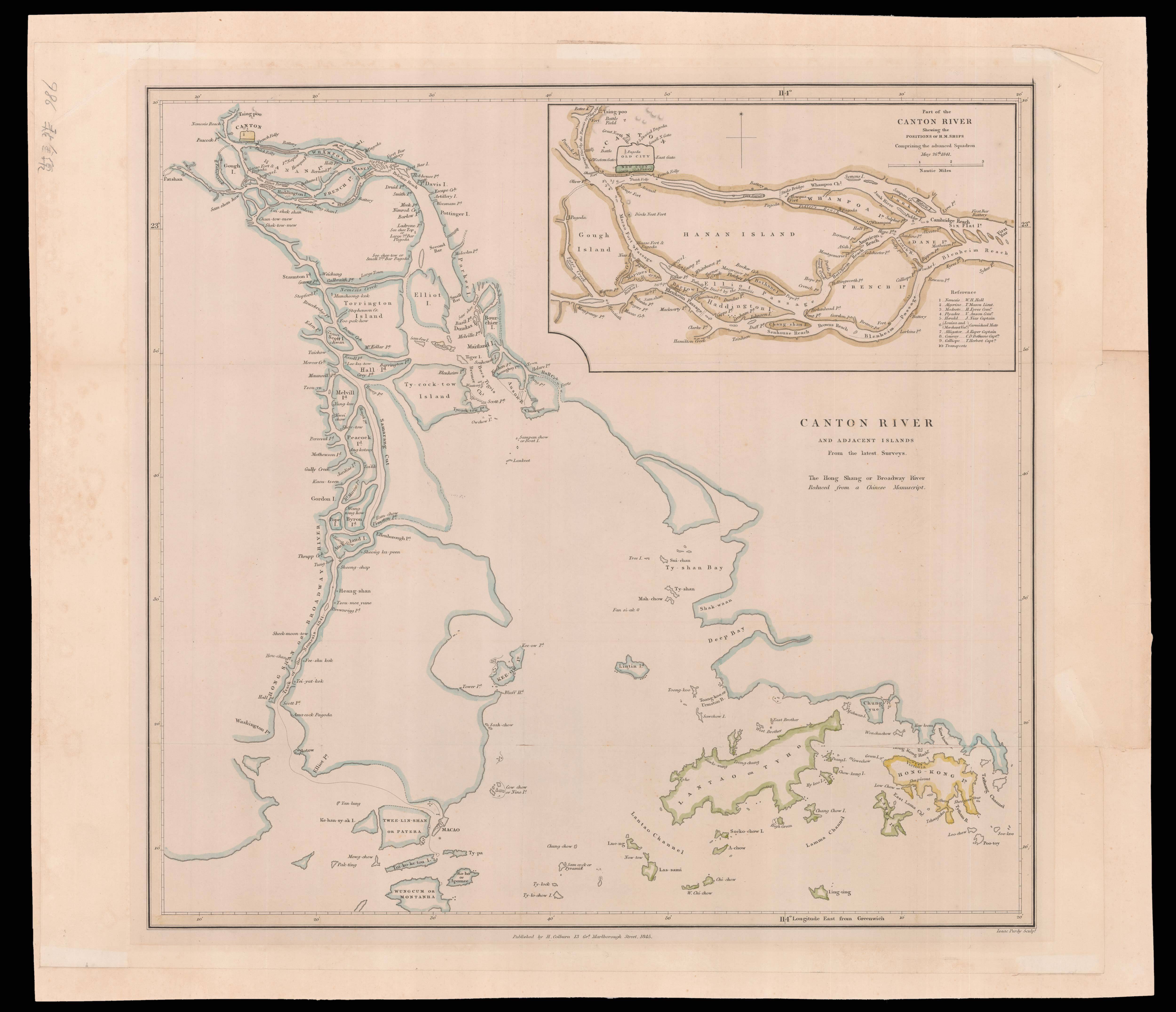
A map of Canton and Hong Kong by “Nemesis Hall”
By HALL, Admiral Sir William Hutcheon, 1845
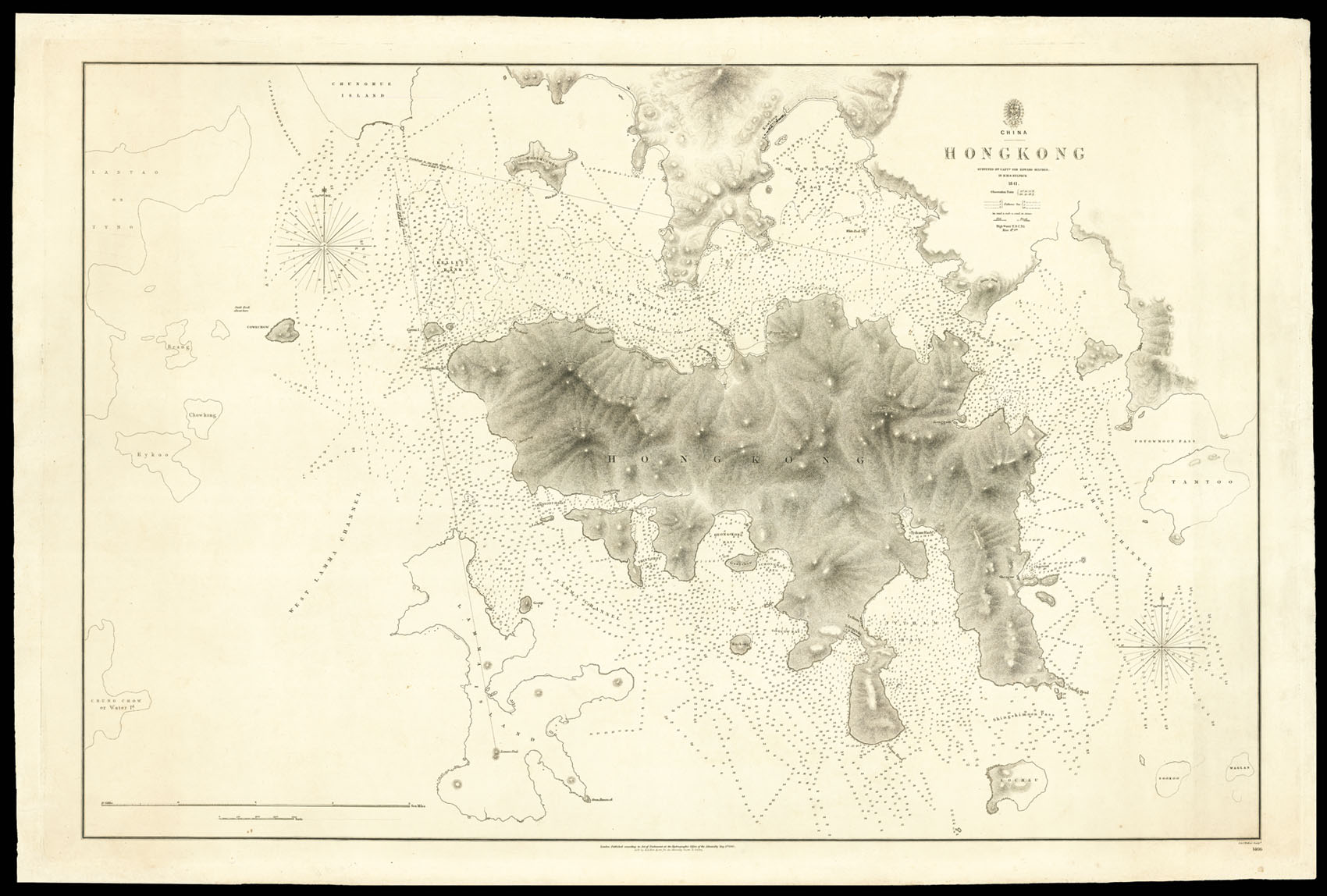
First British Survey of Hong Kong
By [OUR HALF SHARE] BELCHER, Captain, 1846
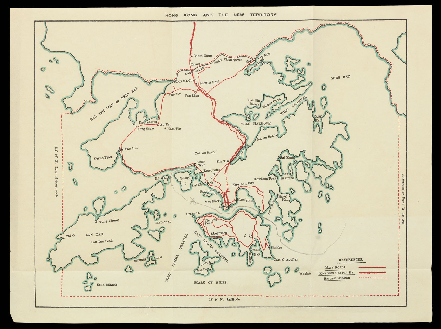
Hong Kong, Kowloon, and the New Territories
By PEPLOW, S.H. and BARKER, M., 1931
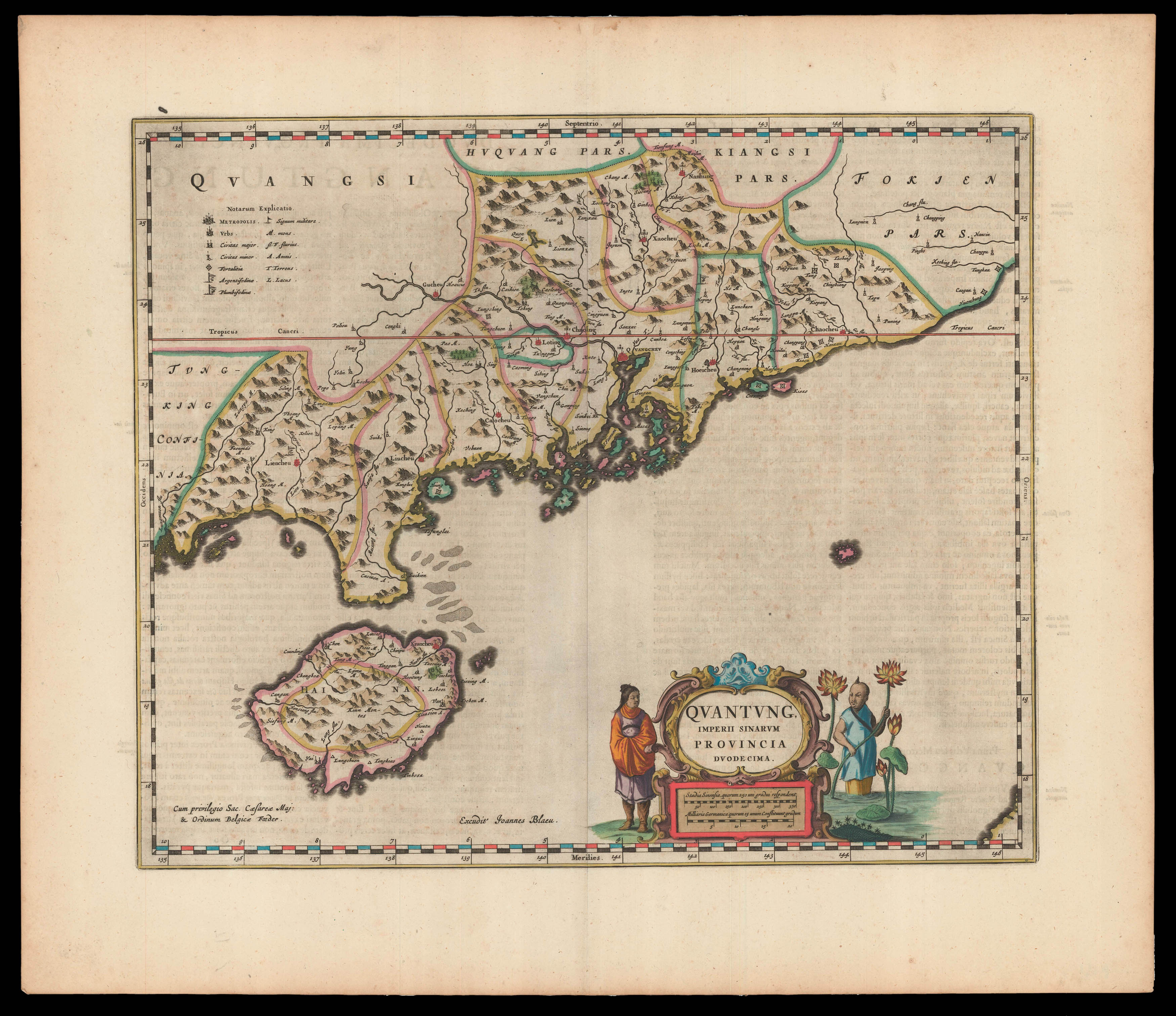
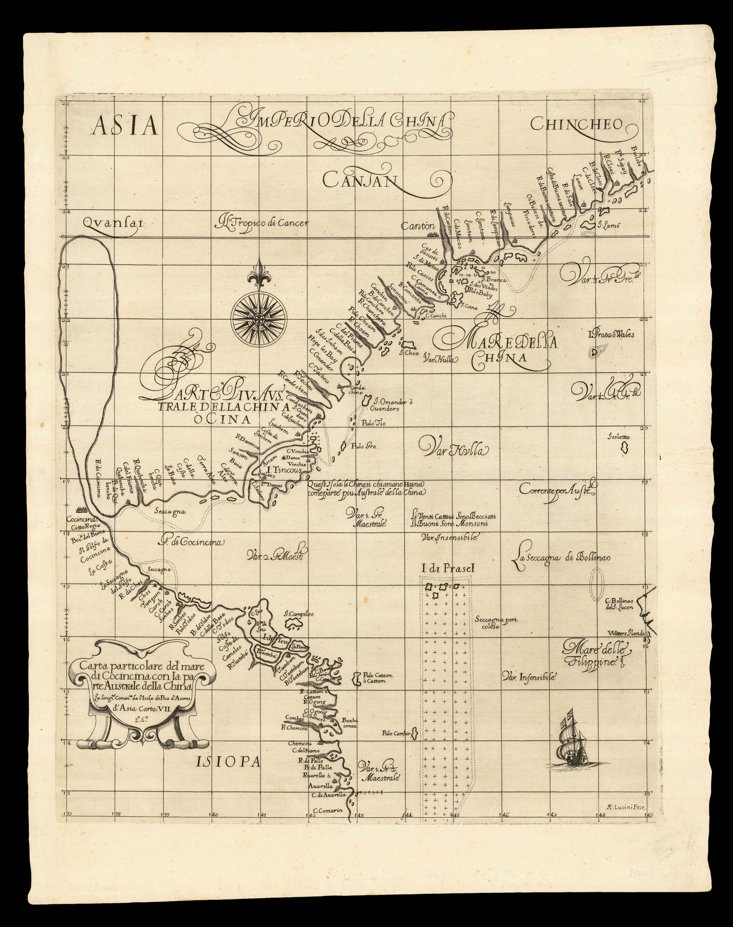
First Western Map of Quantung
By BLAEU, Johannes, 1655
The first chart of the Chinese Coast on Mercator’s Projection
By DUDLEY, Robert, 1661].
The Typhoon’s Toll
By [ANONYMOUS], 1937
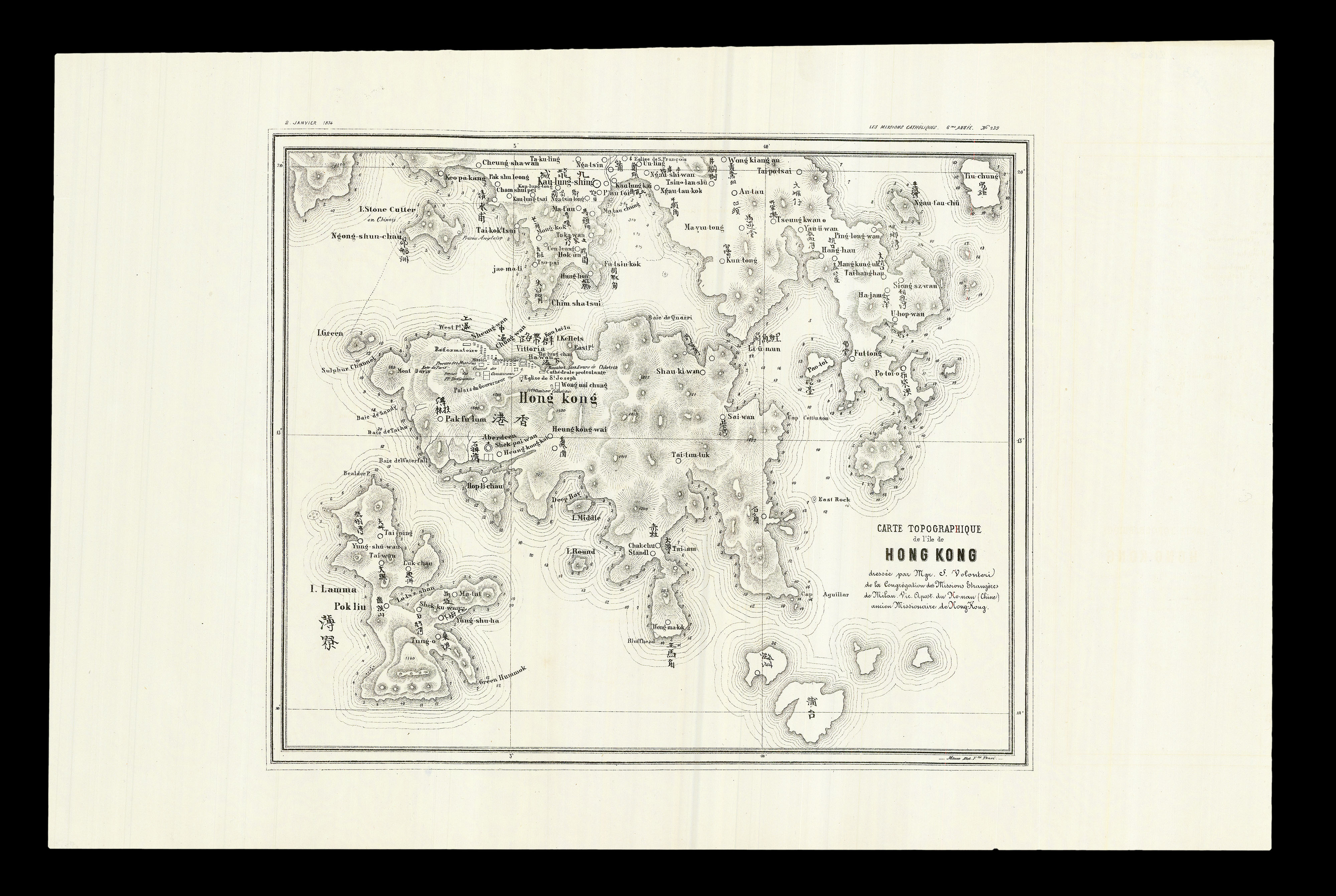
“The First Ever Bilingual Map of its Kind”
By VOLONTERI, Simeone, January 2nd, 1874.
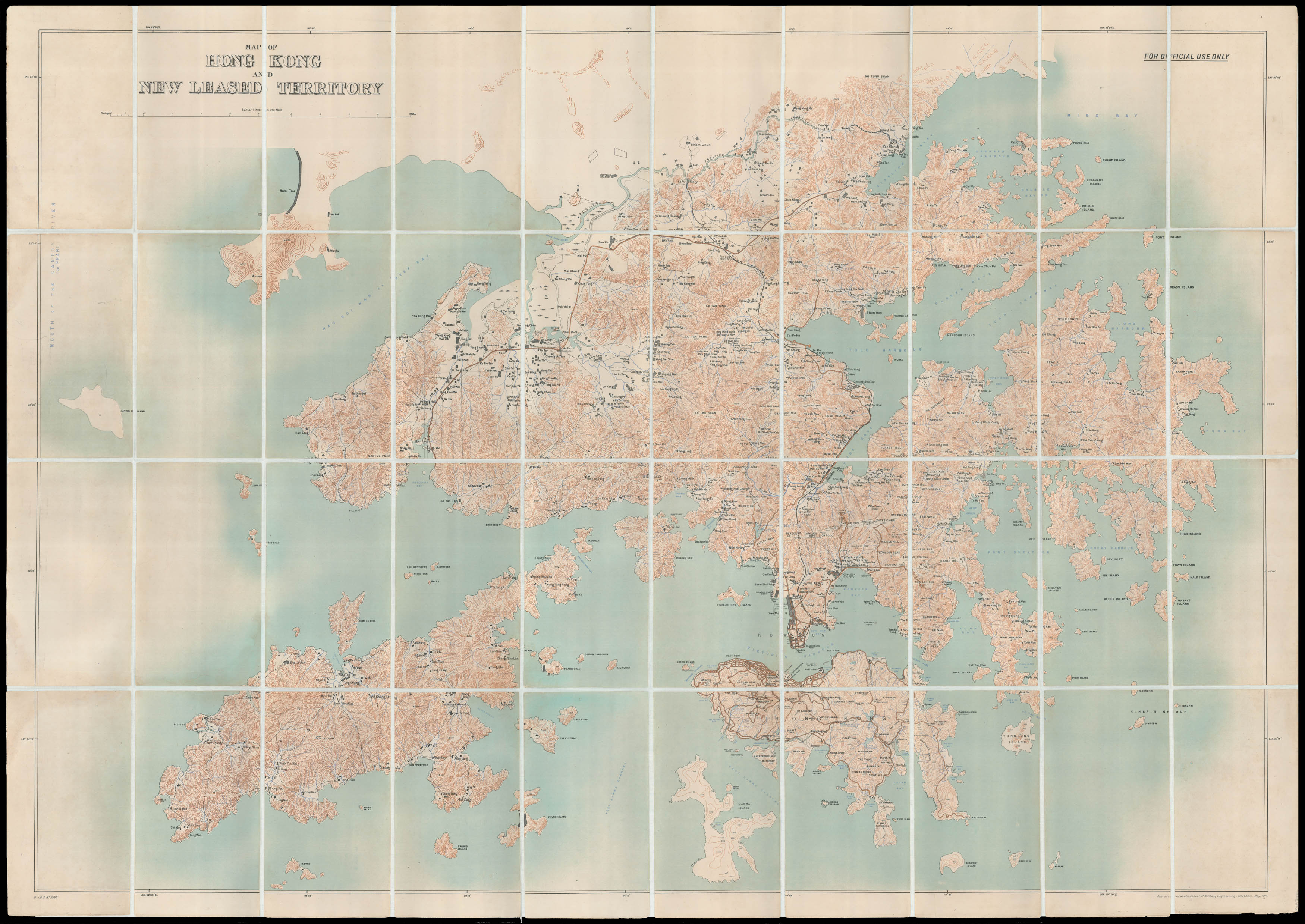
Hong Kong and the New Territories
By SCHOOL OF MILITARY ENGINEERING, CHATHAM, May, 1911.
By BELCHER, Captain, May 1st, 1843.
Username or email address *Required
Password *Required
Remember me Log in
Lost your password?
Email address *Required
A link to set a new password will be sent to your email address.
Your personal data will be used to support your experience throughout this website, to manage access to your account, and for other purposes described in our privacy policy.
Register


![[SANXING PRESS] [The latest edition of the map of Hong Kong in full detail;](https://omega.crouchrarebooks.com/wp-content/uploads/2025/03/14291_1H.jpg)
![[OUR HALF SHARE] BELCHER, Captain Hong Kong surveyed by Capt. Sir Edward Belcher.](https://omega.crouchrarebooks.com/wp-content/uploads/2025/03/11254_1H.jpg)
![[ANONYMOUS] Colony Of Hong Kong](https://omega.crouchrarebooks.com/wp-content/uploads/2025/03/18467_1H.jpg)