|
× |
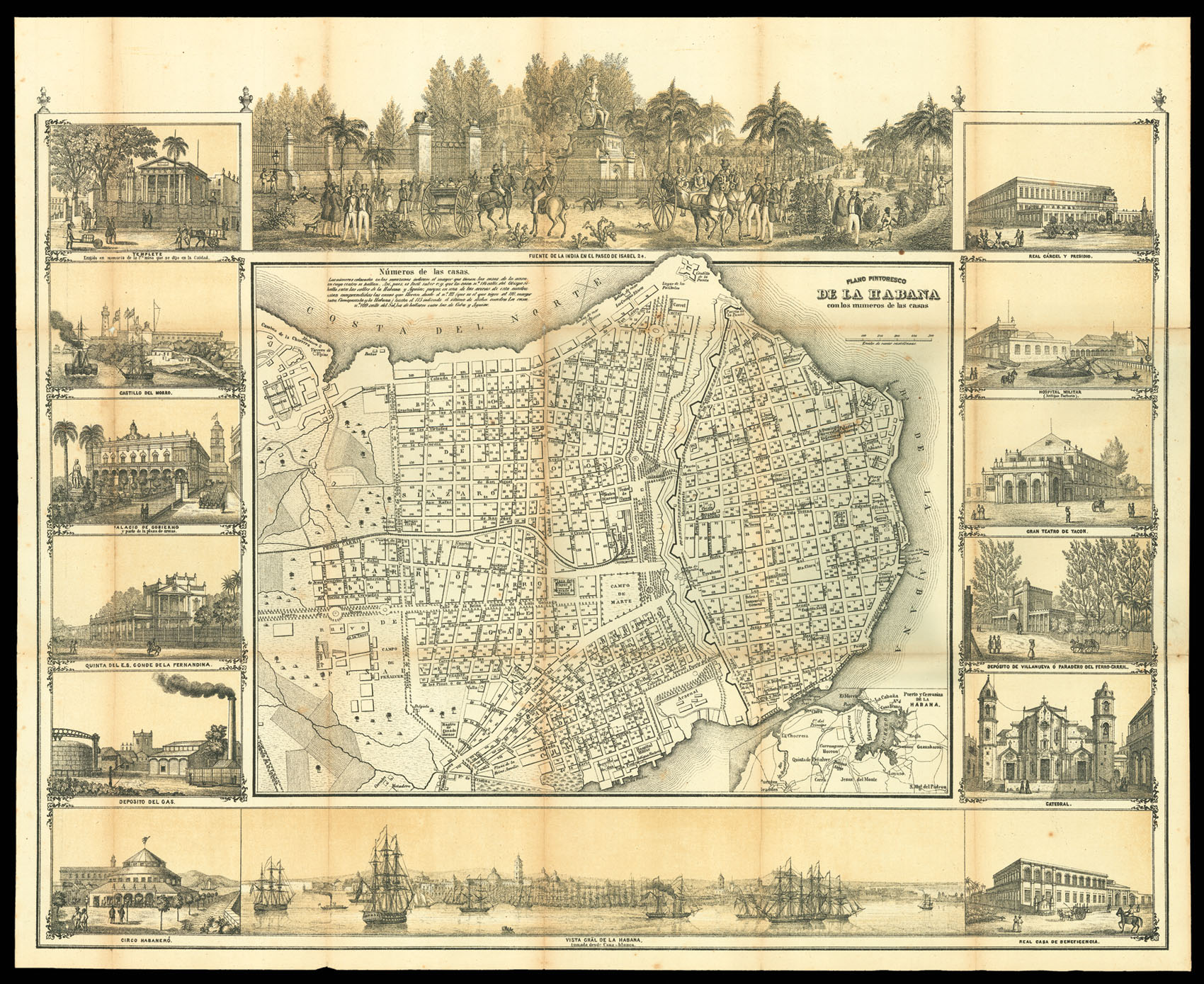 |
May's plan of Havana
1 x
£4,000
|
£4,000 |
|
£4,000 |
|
× |
![PARSONS, J[ohn] West Indies. Island of Grenada](https://omega.crouchrarebooks.com/wp-content/uploads/2025/03/12869_1H.jpg) |
Parson's chart of Grenada
1 x
£1,000
|
£1,000 |
|
£1,000 |
|
× |
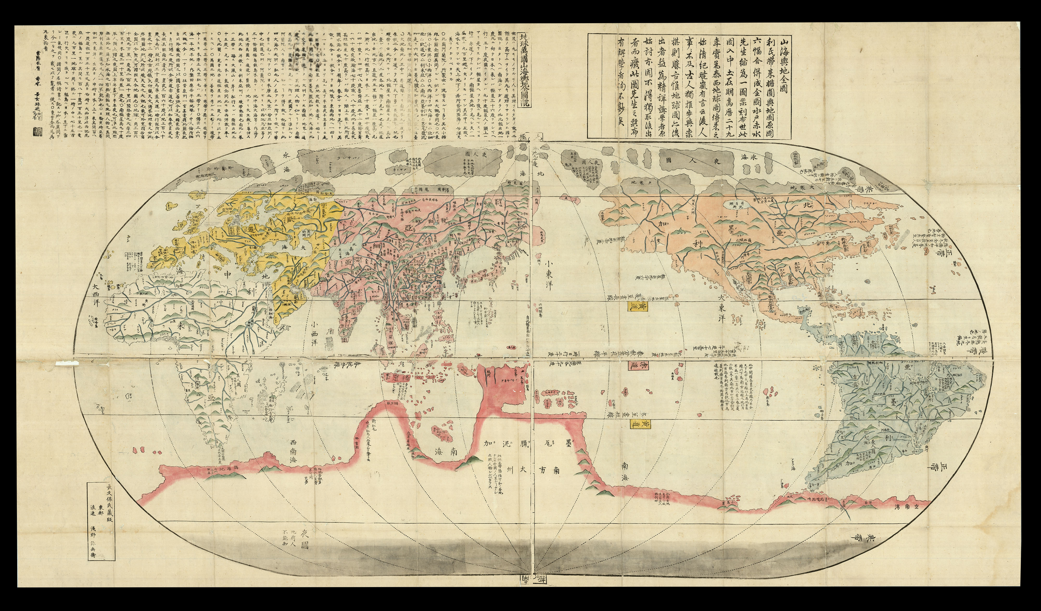 |
The first Japanese world map with latitudes and longitudes
1 x
£20,000
|
£20,000 |
|
£20,000 |
|
× |
 |
A confused view of Australia
1 x
£1,200
|
£1,200 |
|
£1,200 |
|
× |
![WOUTNEEL, Hans; Crispin de PASSE, the elder and younger; and VISSCHER, Claez Jansz, after Jacob and Joris HOEFNAGEL, Assuerus van LONDERSEEL, Nicolaes de BRUYN, and Adrian COLLAERT [Untitled album of Natural History engravings].](https://omega.crouchrarebooks.com/wp-content/uploads/2025/03/16352_1H.jpg) |
An album of engravings from the most famous natural history artists of the late sixteenth and early seventeenth centuries, collected and bound for an English patron
1 x
£45,000
|
£45,000 |
|
£45,000 |
|
× |
 |
Blaeu's user's manual for globes, spheres and sundials
1 x
£4,000
|
£4,000 |
|
£4,000 |
|
× |
![HECKFORD, N[athaniel] Practical Sailing Directions and Coasting Guide,](https://omega.crouchrarebooks.com/wp-content/uploads/2025/03/18225_1H.jpg) |
A Sailing Guide to the Colonies of South East Asia
1 x
£600
|
£600 |
|
£600 |
|
× |
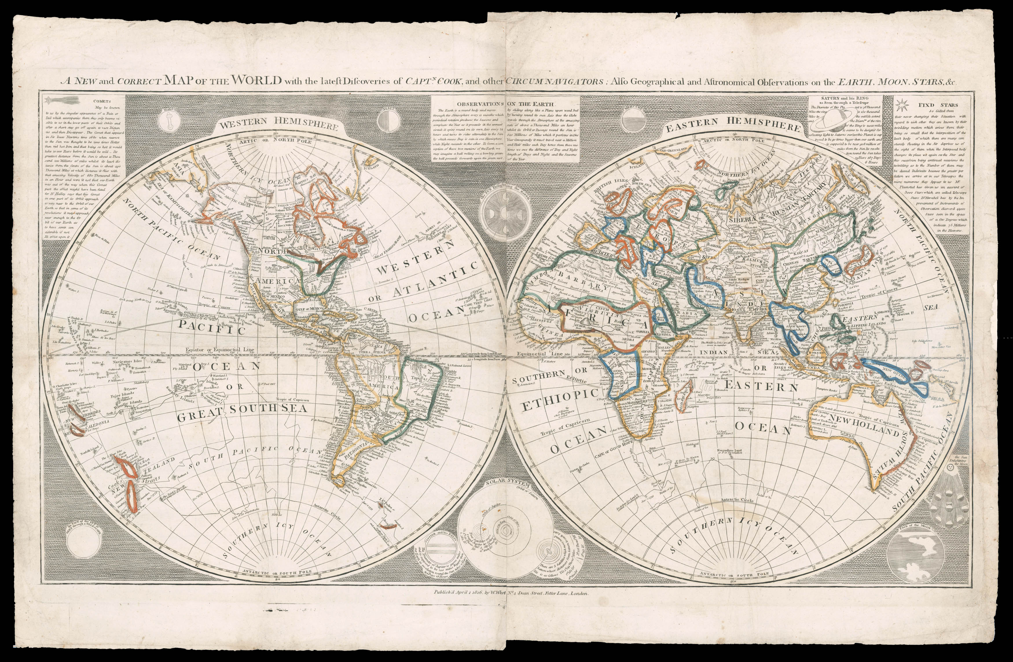 |
Unrecorded state of William West's two sheet world map
1 x
£5,000
|
£5,000 |
|
£5,000 |
|
× |
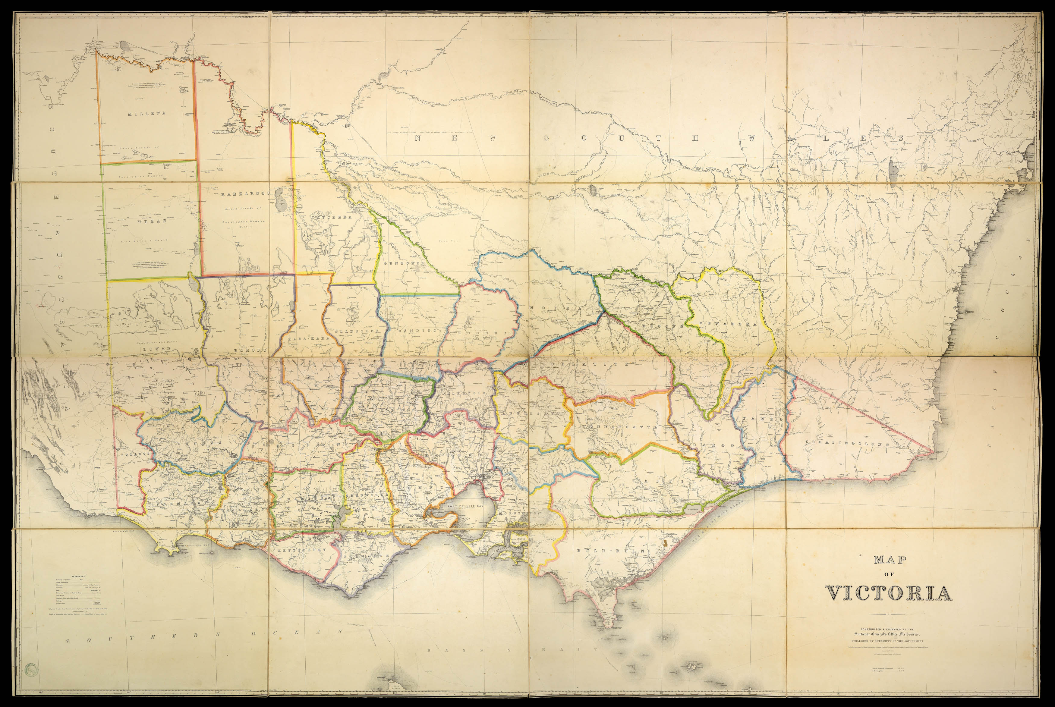 |
Victoria during the Gold Rush
1 x
£5,000
|
£5,000 |
|
£5,000 |
|
× |
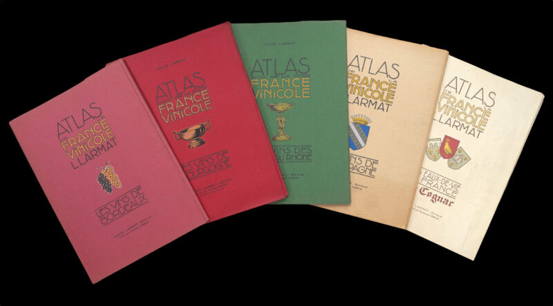 |
Complete set of the world's first national wine atlas
1 x
£12,000
|
£12,000 |
|
£12,000 |
|
× |
![QUIN, Edward [An historical atlas: in a series of maps of the world known at different periods]](https://omega.crouchrarebooks.com/wp-content/uploads/2025/03/1829_1H.jpg) |
The world unveiled
1 x
£15,000
|
£15,000 |
|
£15,000 |
|
× |
 |
"Roguery's classic shore" (Rose Freycinet)
1 x
£1,000
|
£1,000 |
|
£1,000 |
|
× |
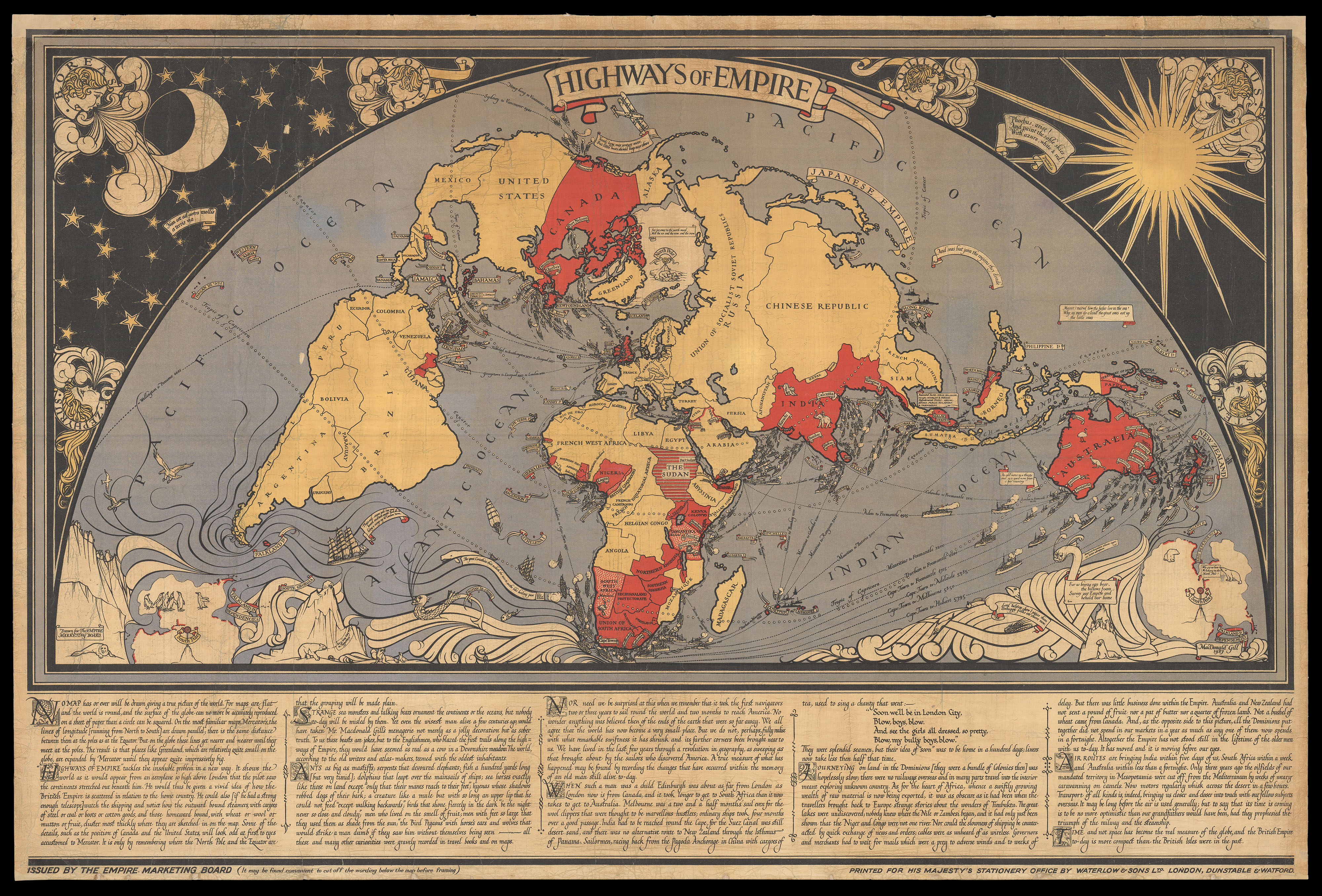 |
So striking "as to cause congestion of the highways of London"
1 x
£10,000
|
£10,000 |
|
£10,000 |
|
× |
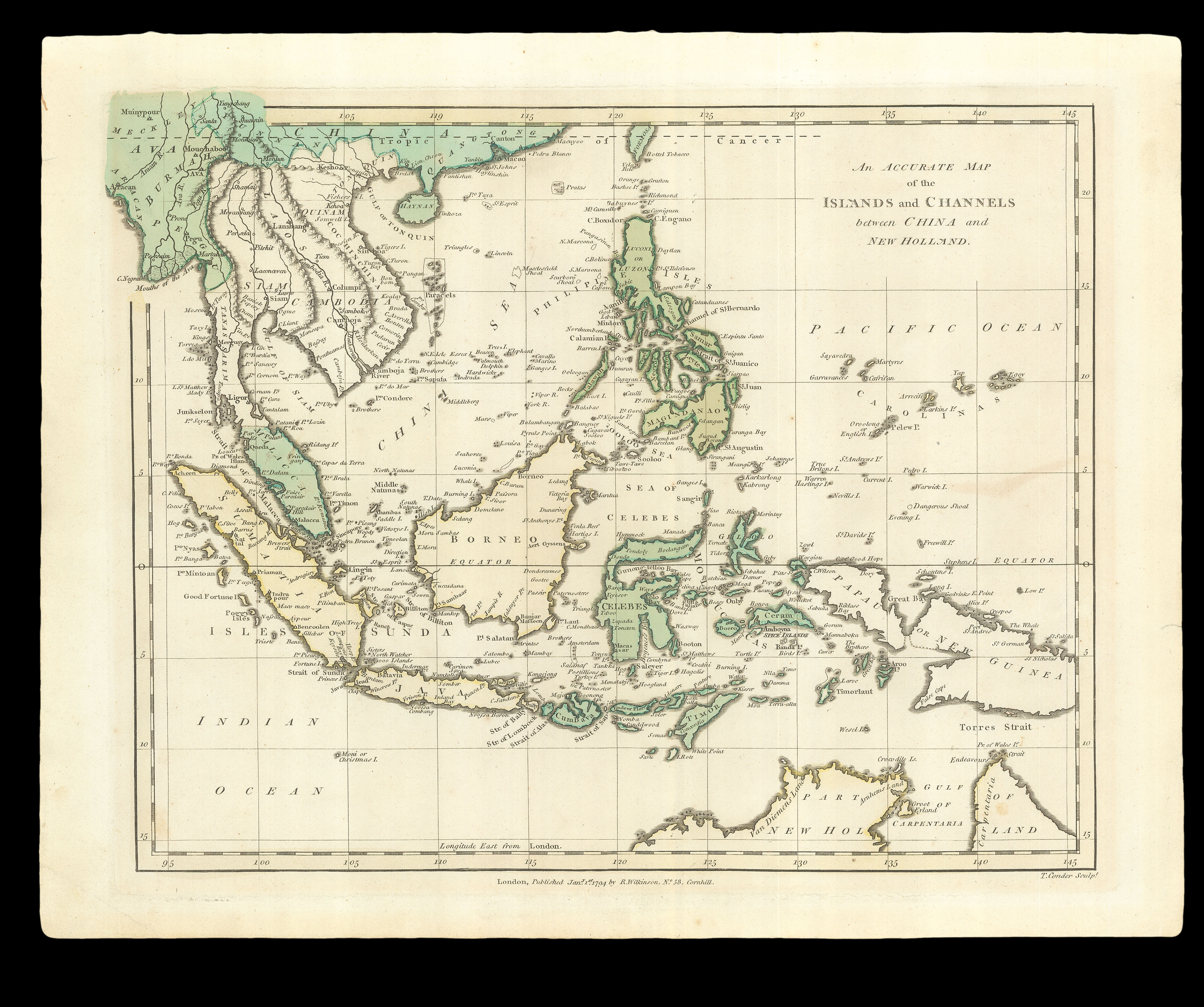 |
How to get from China to Australia
1 x
£200
|
£200 |
|
£200 |
|
× |
 |
Visscher family catalogue
1 x
£10,000
|
£10,000 |
|
£10,000 |
|
× |
![AP HUW, D. ap G.; Eben FARDD; and George PHILIP Gwlad yr aur [Country of Gold (trans.)]](https://omega.crouchrarebooks.com/wp-content/uploads/2025/03/12995_1H.jpg) |
Philip's new map of the Gold Fields of Australia, for the Welsh
1 x
£1,000
|
£1,000 |
|
£1,000 |
|
× |
![HOLLAR, W[enceslaus] [after] Francis BARLOW Diversae Avium Species Studiosissime ad Vitam Delineatae](https://omega.crouchrarebooks.com/wp-content/uploads/2025/03/18306_1H.jpg) |
Bird prints
1 x
£8,000
|
£8,000 |
|
£8,000 |
|
× |
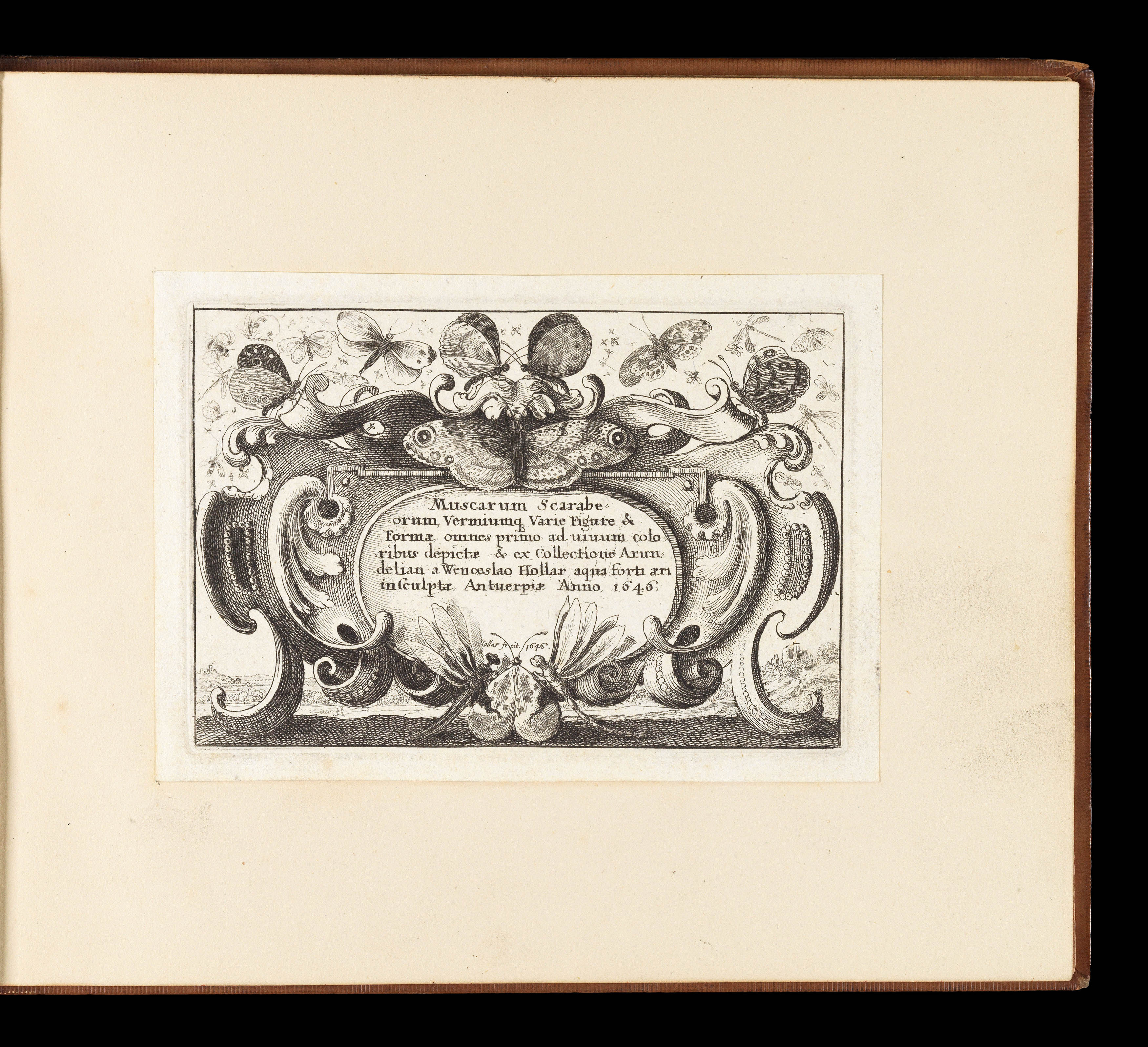 |
Butterflies and insects
1 x
£12,000
|
£12,000 |
|
£12,000 |
|
× |
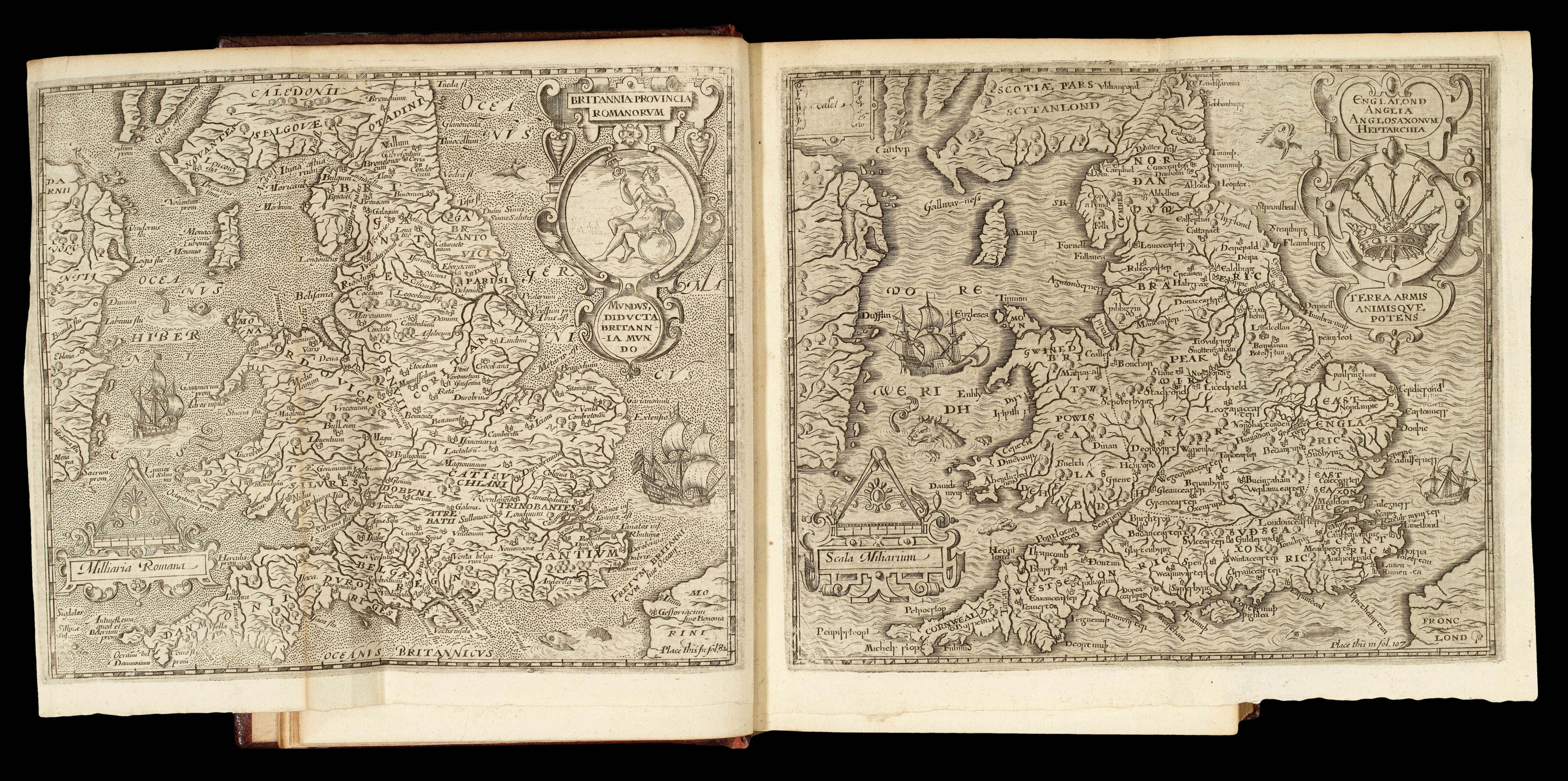 |
A fine example of Camden's Britannia in a contemporary binding
1 x
£16,000
|
£16,000 |
|
£16,000 |
|
× |
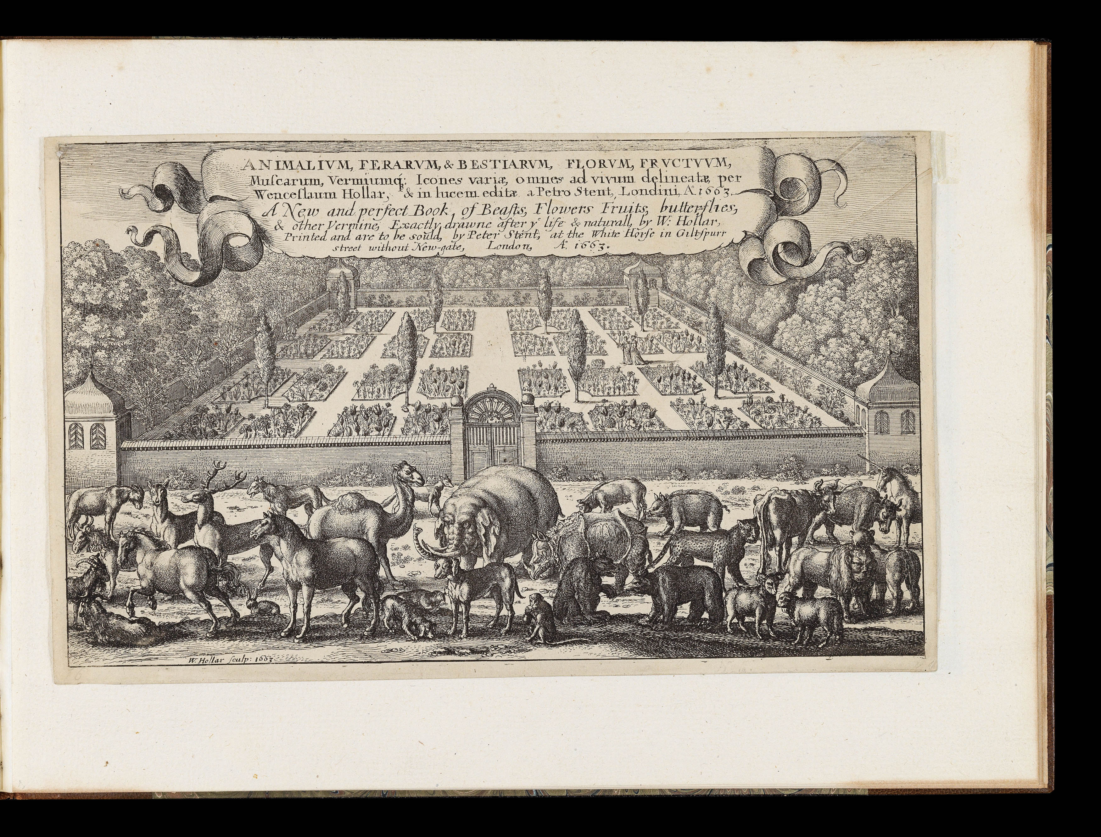 |
All creatures great and small
1 x
£20,000
|
£20,000 |
|
£20,000 |
|
× |
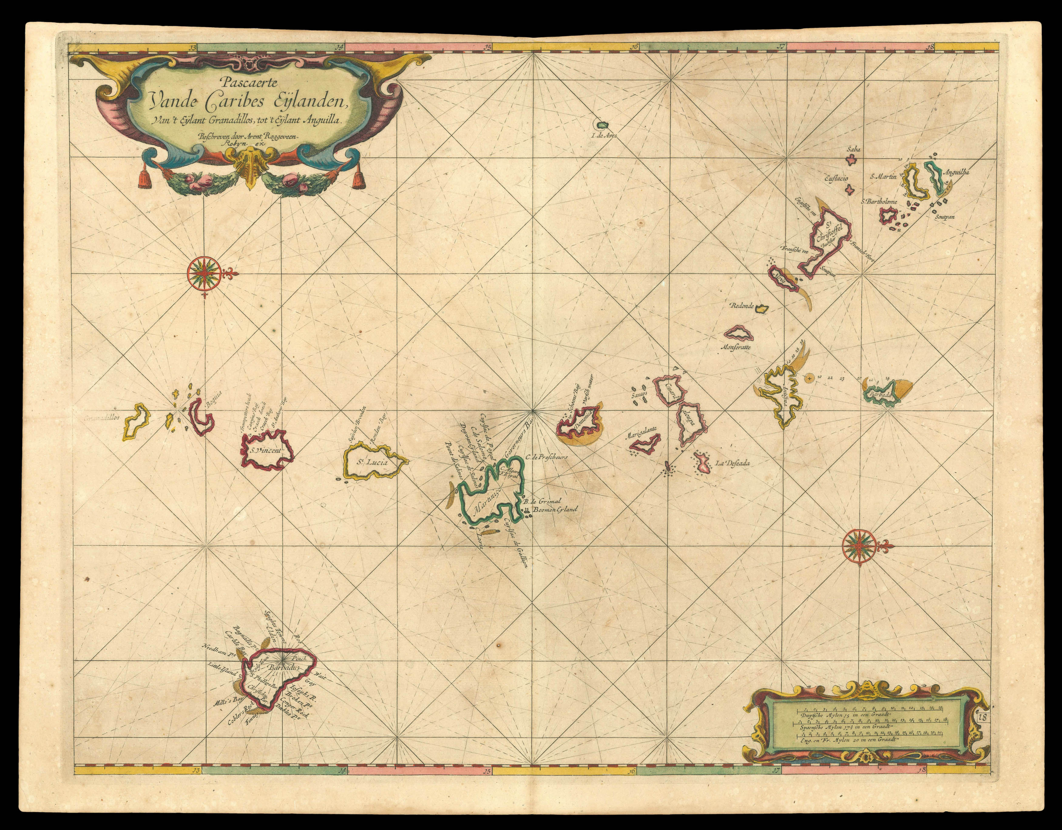 |
Lesser Antilles
1 x
£4,000
|
£4,000 |
|
£4,000 |
|
× |
![ARROWSMITH, Aaron To The Hon[oura]ble the Court Directors of the East India Company This Improved Map of India](https://omega.crouchrarebooks.com/wp-content/uploads/2025/03/15255_1H.jpg) |
The largest map of India produced before the trigonometrical survey
1 x
£10,000
|
£10,000 |
|
£10,000 |
|
× |
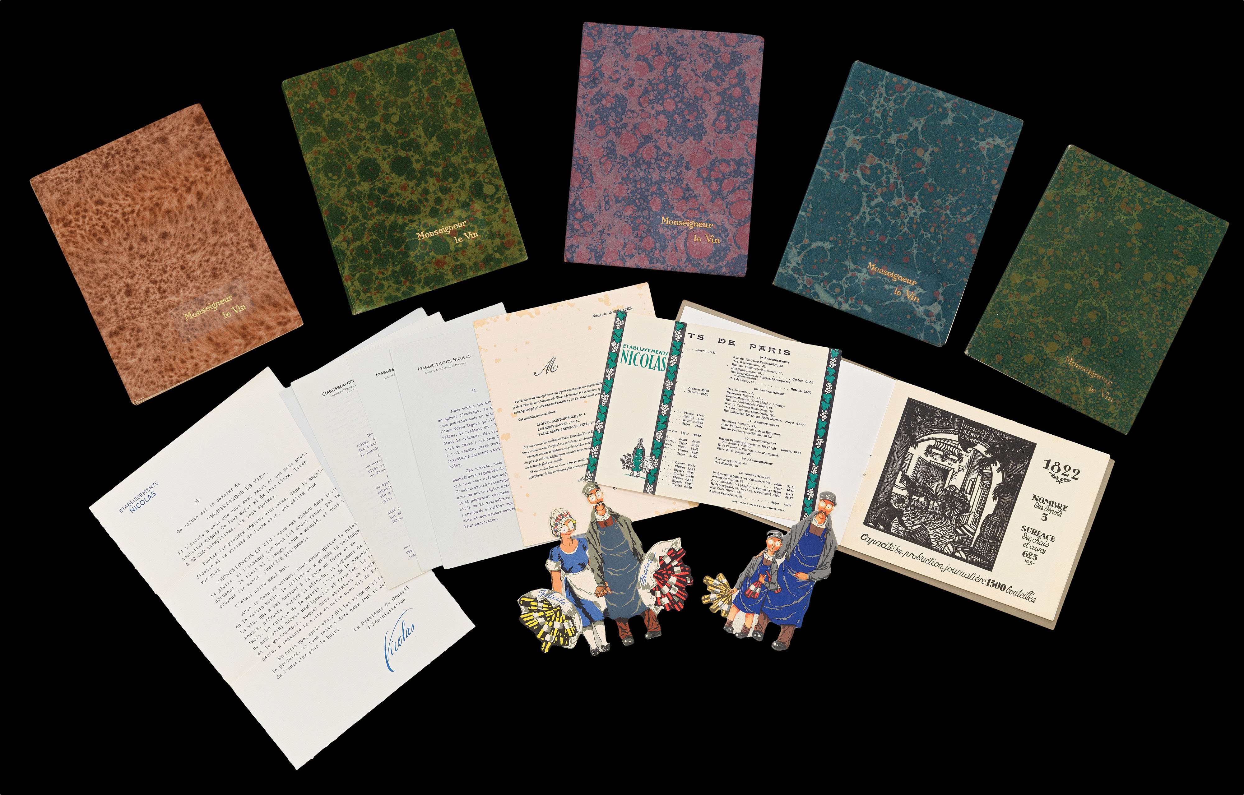 |
Du vin, Monseigneur?
1 x
£2,000
|
£2,000 |
|
£2,000 |
|
× |
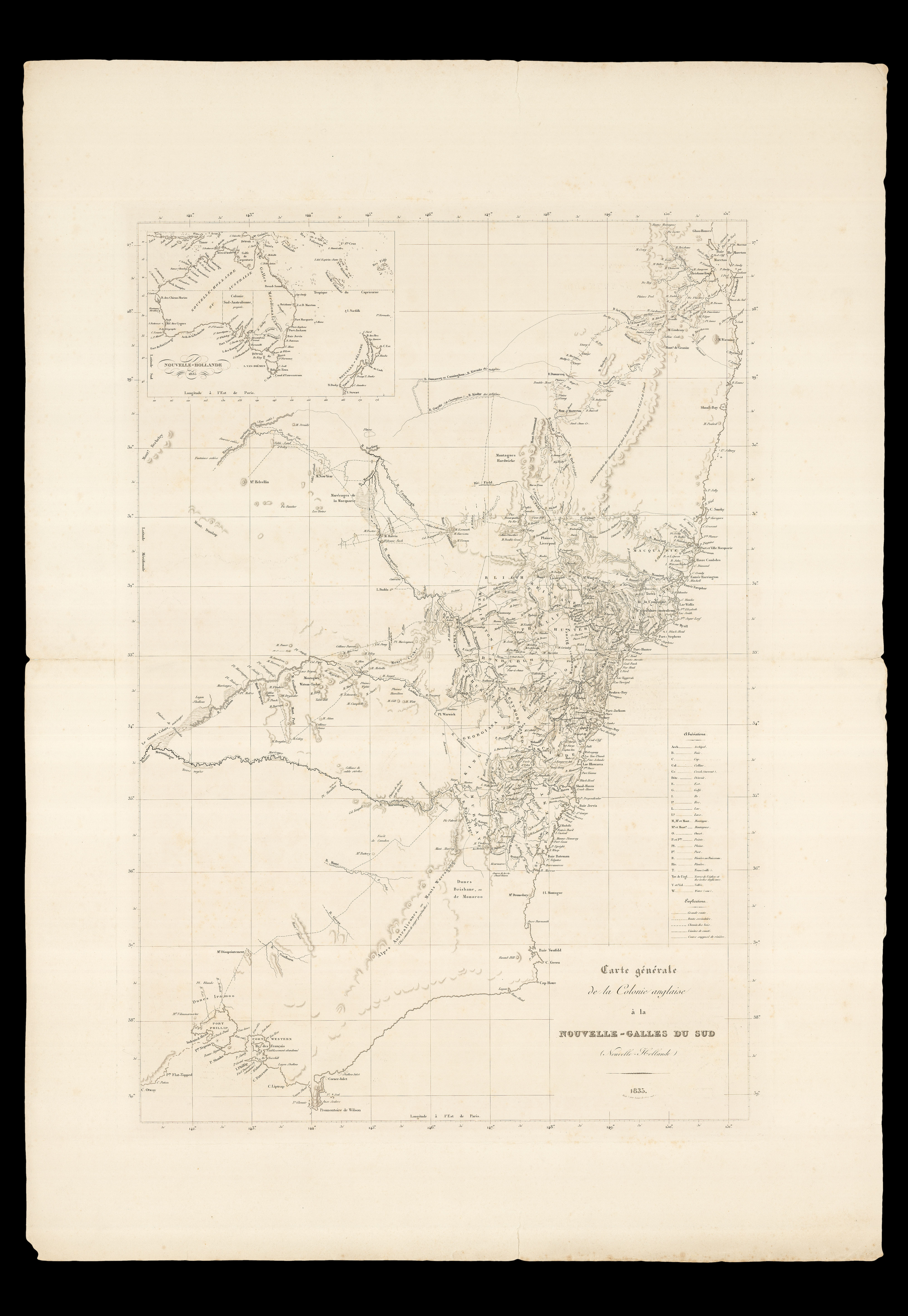 |
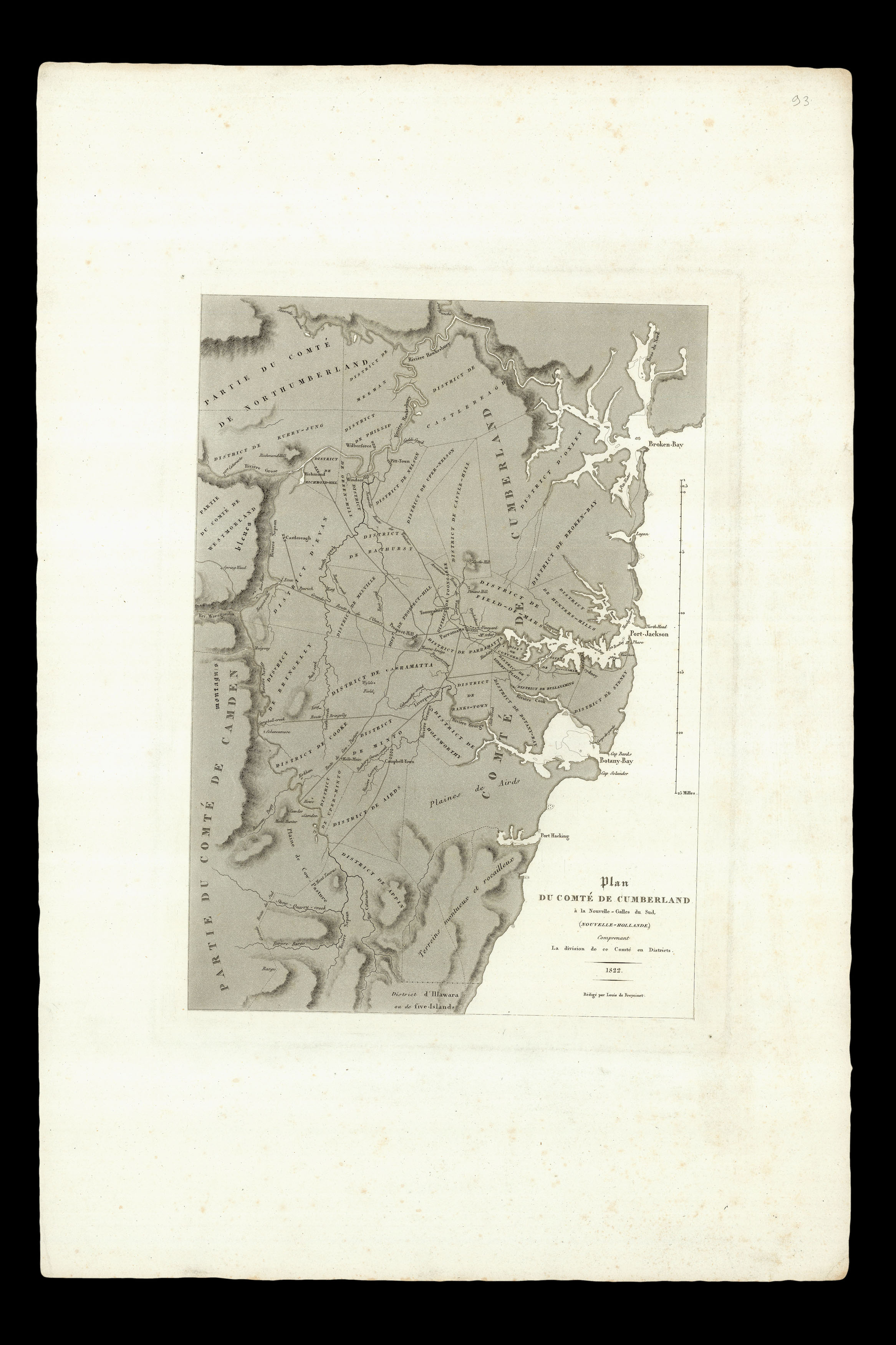
The colonisation of New South Wales
1 x
£1,500
|
£1,500 |
|
£1,500 |
|
× |
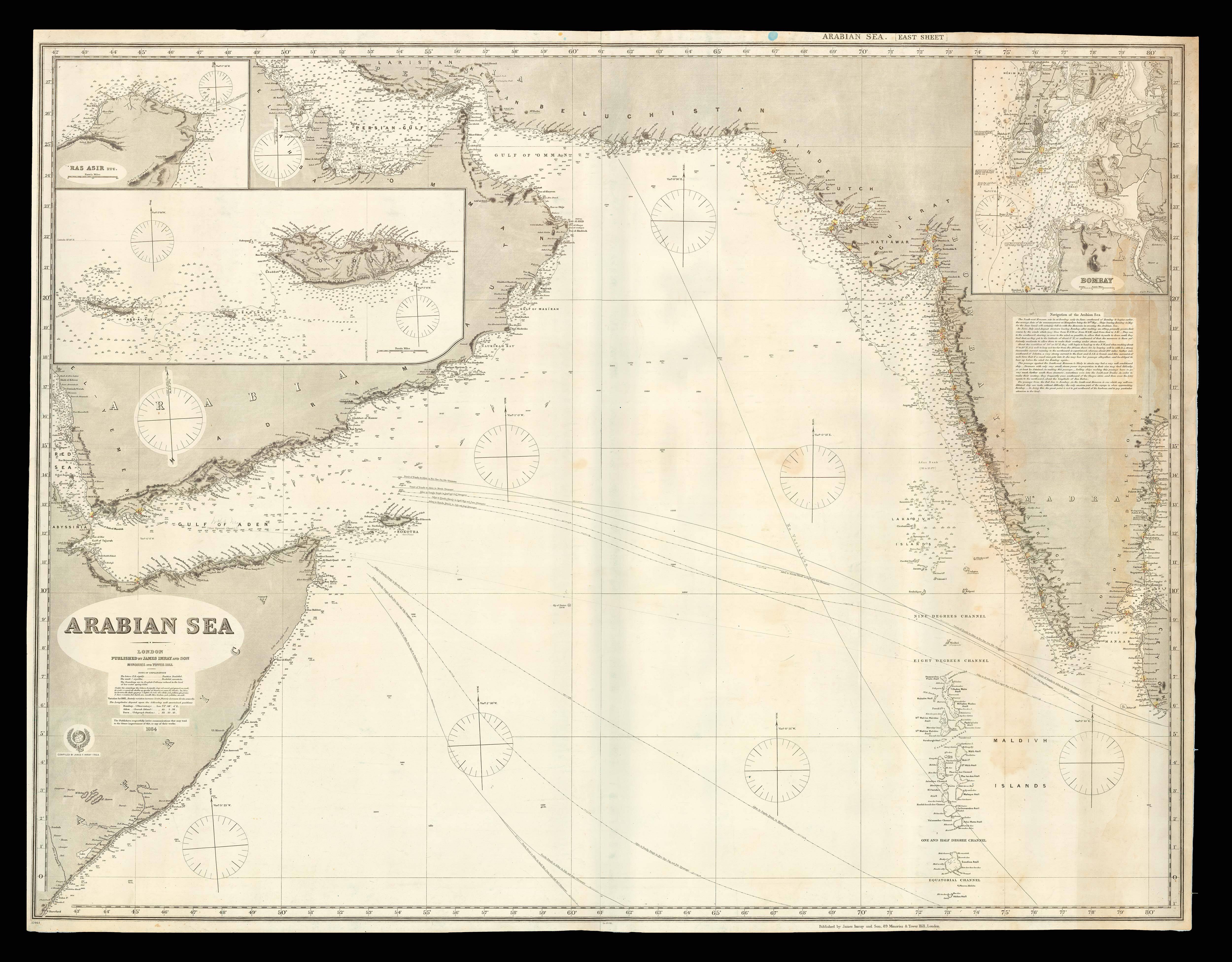 |
Steamer routes in the Arabian Sea
1 x
£2,500
|
£2,500 |
|
£2,500 |
|
× |
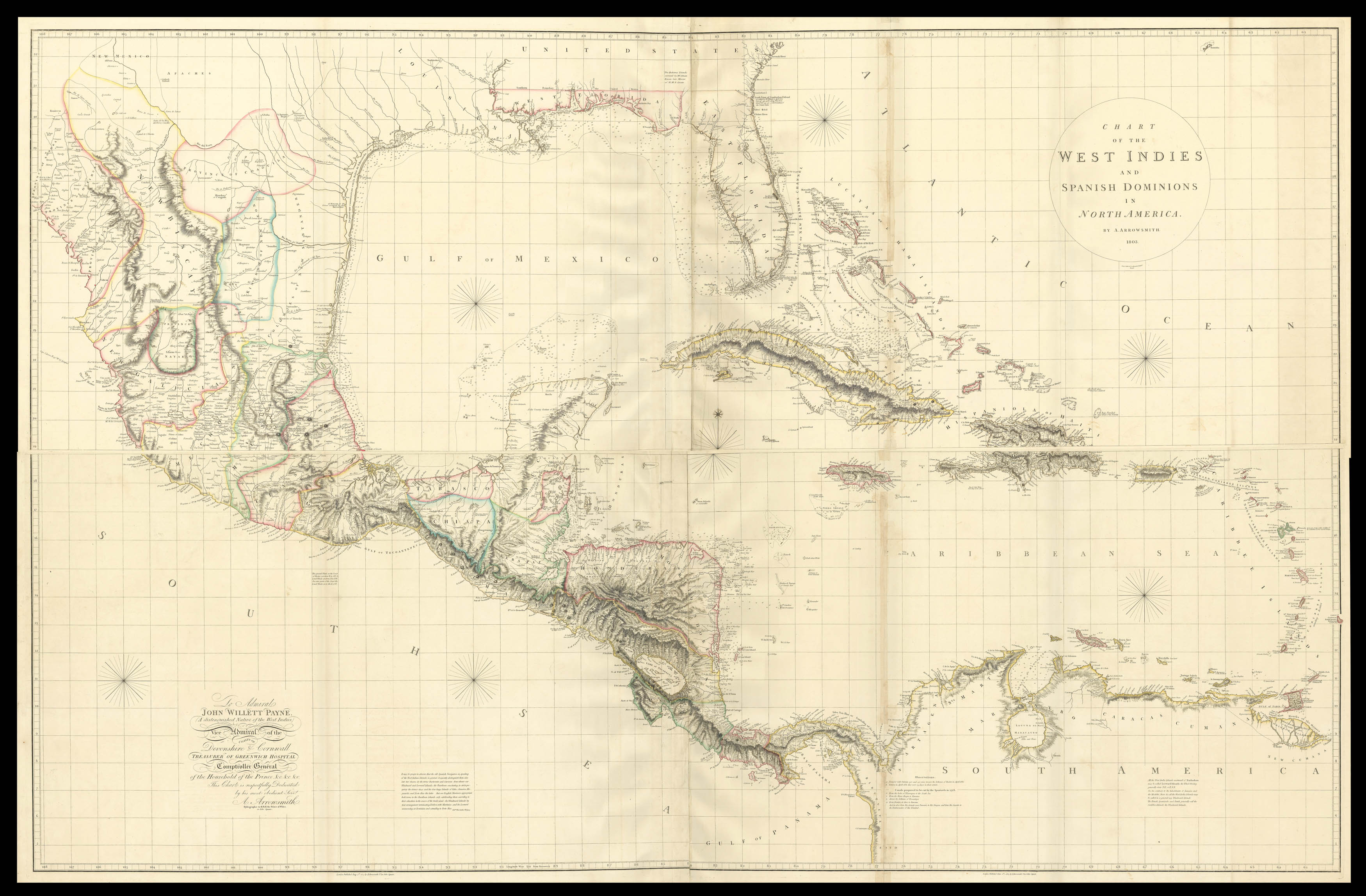 |
The most accurate representation of the West Indies and its environs
1 x
£20,000
|
£20,000 |
|
£20,000 |
|
× |
 |
"OWhyhee where Capt. Cook was Kill'd".
1 x
£800
|
£800 |
|
£800 |
|
× |
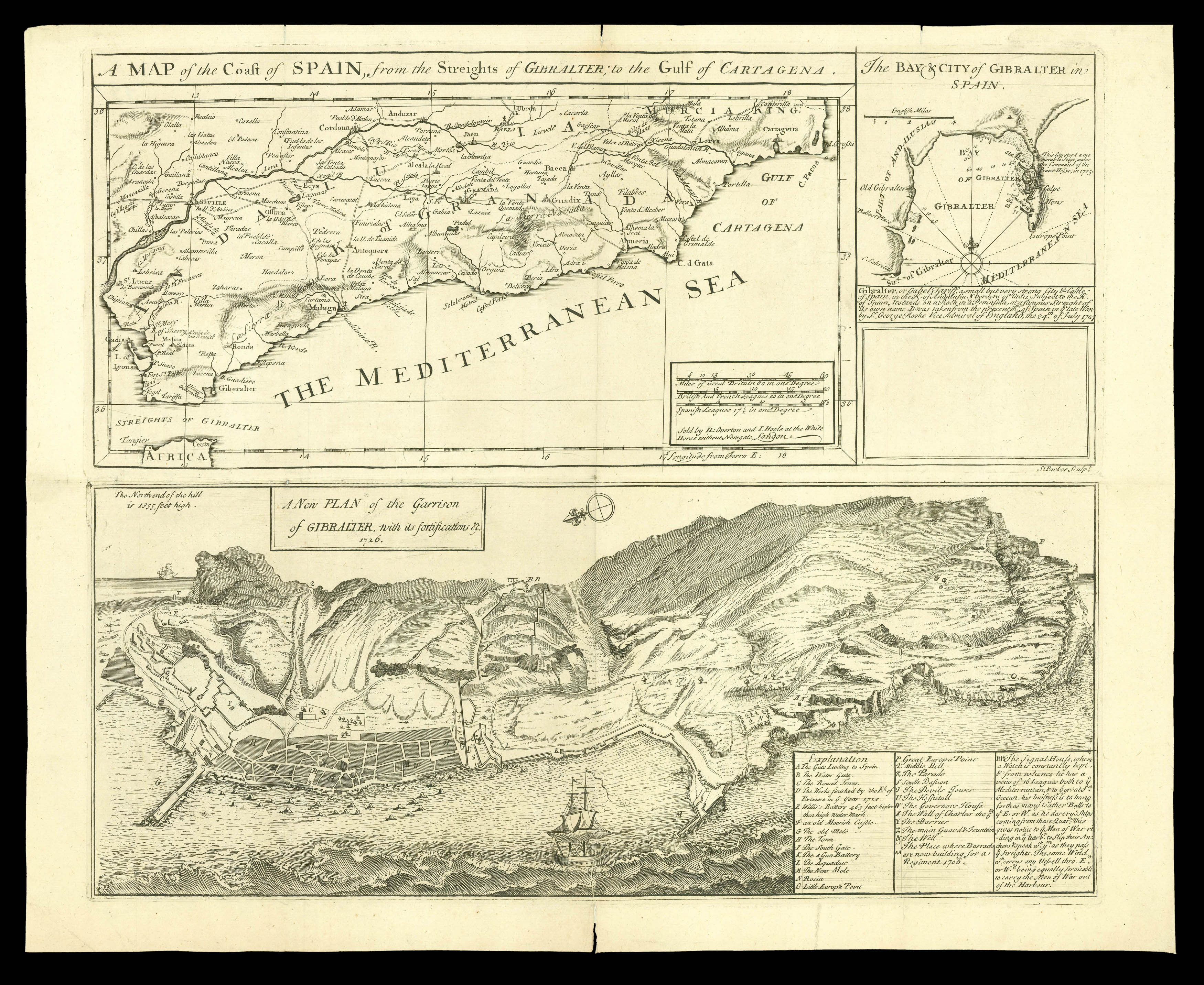 |
The siege of Gibraltar
1 x
£1,800
|
£1,800 |
|
£1,800 |
|
× |
 |
Fixing the Centre of the Continent of Australia
1 x
£4,000
|
£4,000 |
|
£4,000 |
|
× |
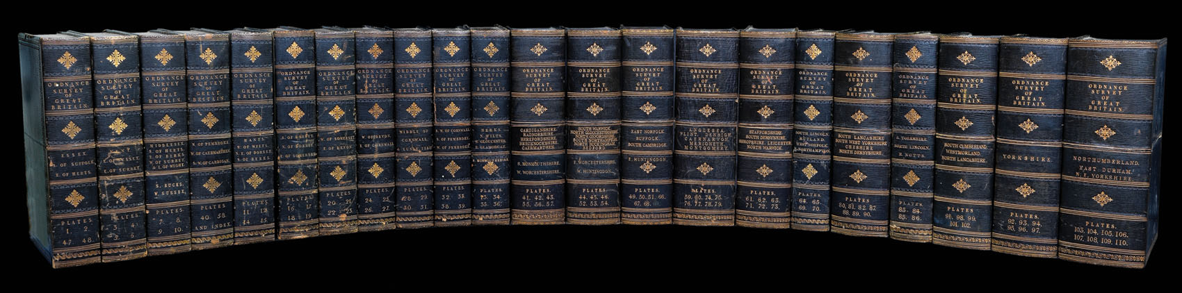 |
Complete set of the Ordnance Survey of England and Wales in a fine presentation box
1 x
£12,000
|
£12,000 |
|
£12,000 |
|
× |
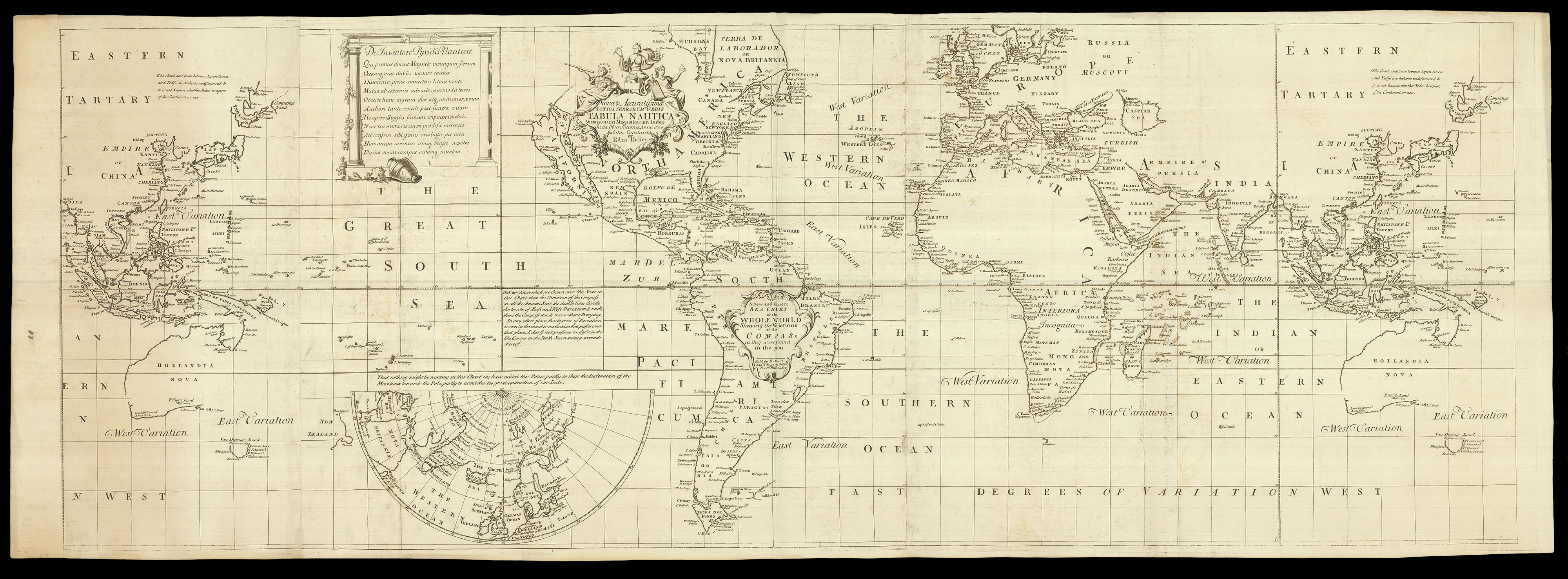 |
One of the most important scientific maps ever published
1 x
£30,000
|
£30,000 |
|
£30,000 |
|
× |
![WAGHENAER, Lucas Janszoon Teerste Deel vande Spieghel der Zeevaert... [and] Der ander Theil. Dess Spiegels der Seefart](https://omega.crouchrarebooks.com/wp-content/uploads/2025/03/23910_1H.jpg) |
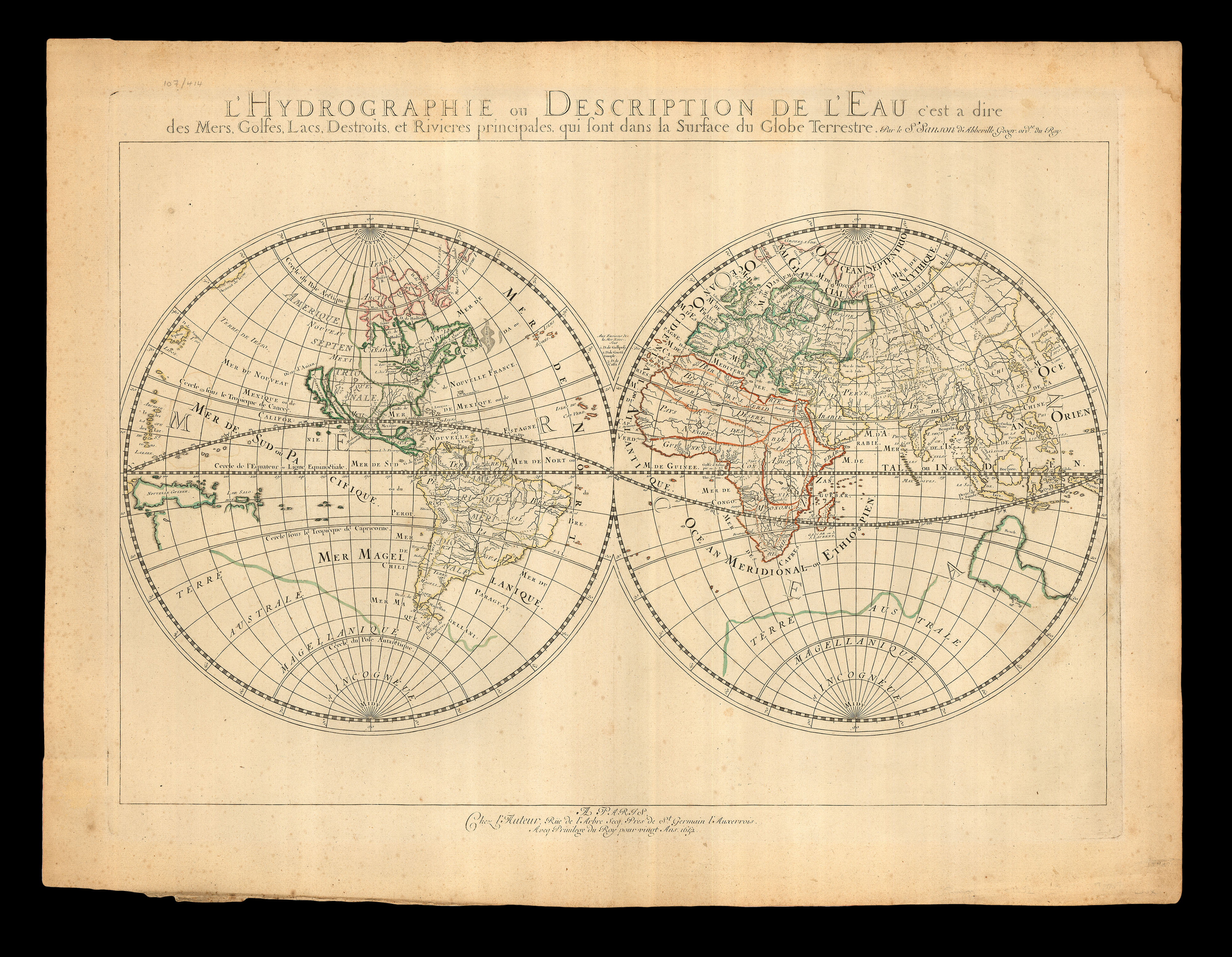
The first printed sea pilot
1 x
£325,000
|
£325,000 |
|
£325,000 |
|
× |
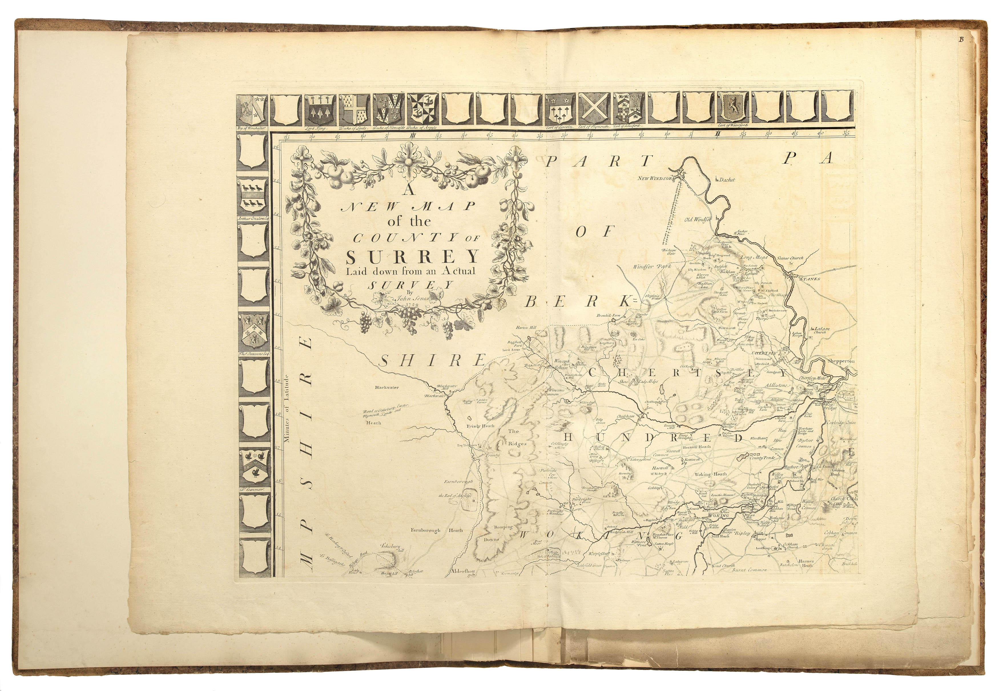 |
Senex's Surrey
1 x
£4,000
|
£4,000 |
|
£4,000 |
|
× |
![TAKAI, Ranzan [O-Edo ōezu]/Takai Ranzan zu.](https://omega.crouchrarebooks.com/wp-content/uploads/2025/03/15206_1H.jpg) |
Map of Edo
1 x
£7,500
|
£7,500 |
|
£7,500 |
|
× |
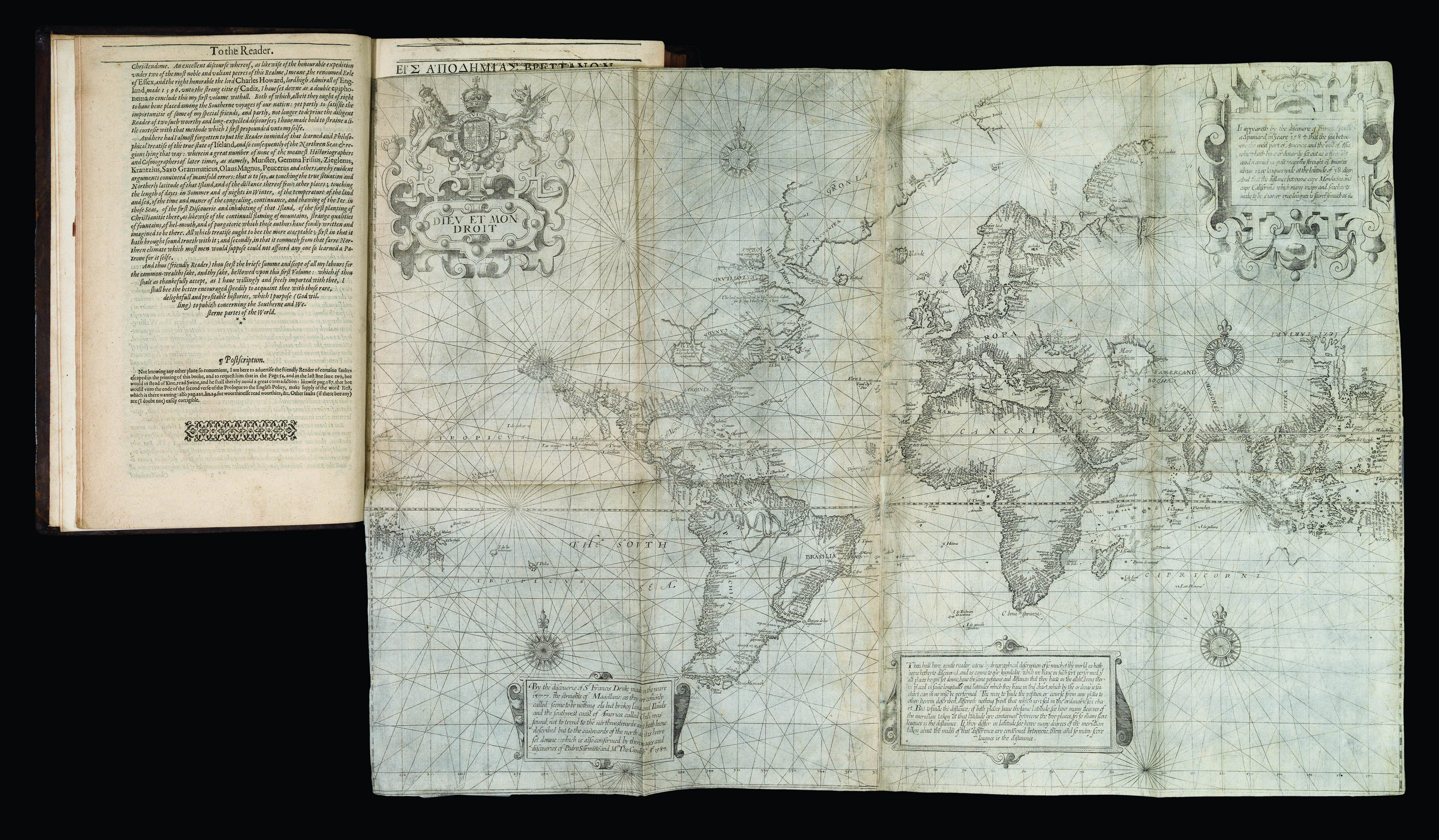 |
"the great prose epic of the Elizabethan period" - the first English map on Mercator's projection; the first map to name Lake Ontario; and one of the first maps to use the name "Virginia"
1 x
£800,000
|
£800,000 |
|
£800,000 |
|
× |
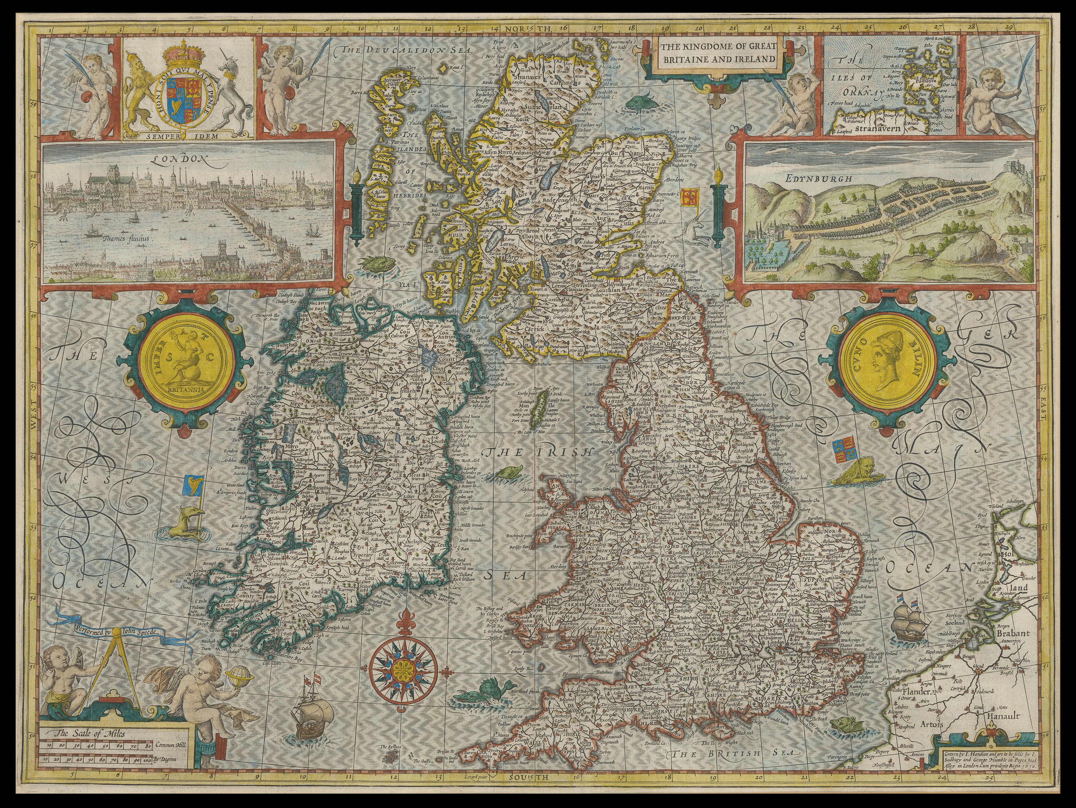 |
Speed's map of Great Britain and Ireland
1 x
£2,750
|
£2,750 |
|
£2,750 |
|
× |
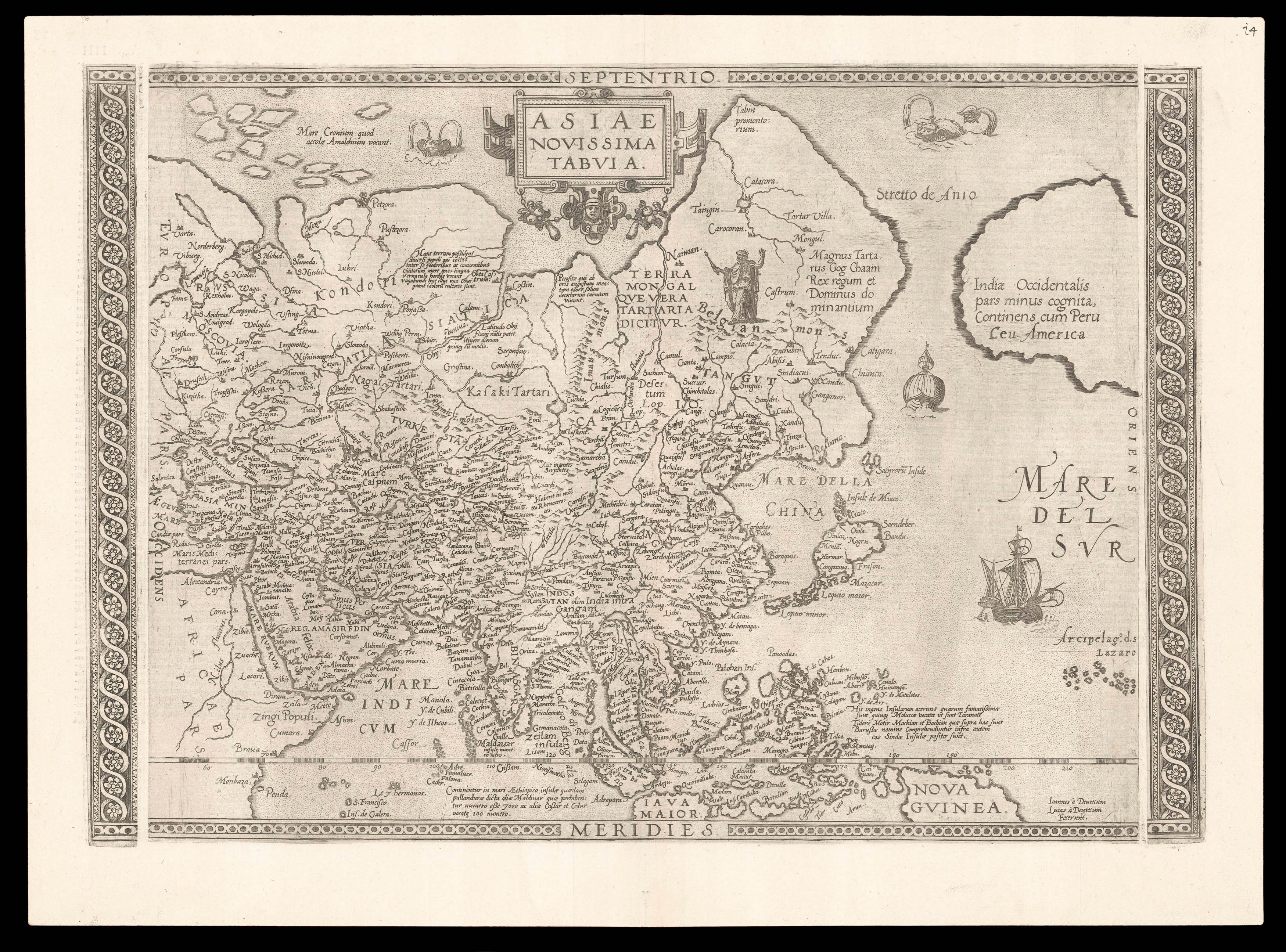 |
Unrecorded second state of De Jode's map of Asia
1 x
£25,000
|
£25,000 |
|
£25,000 |
|
× |
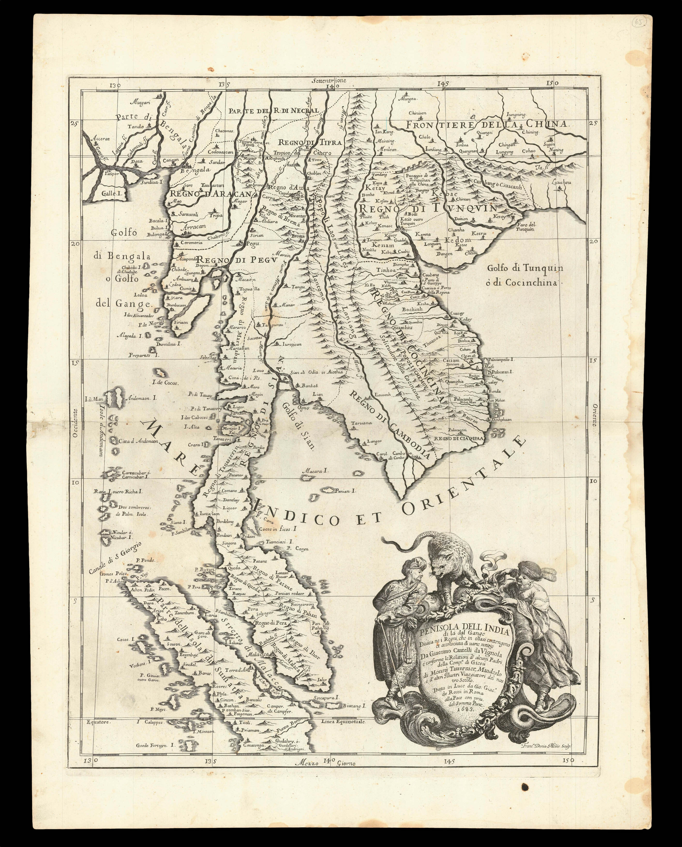 |
Delineating individual sultanates
1 x
£2,550
|
£2,550 |
|
£2,550 |
|
|


