|
× |
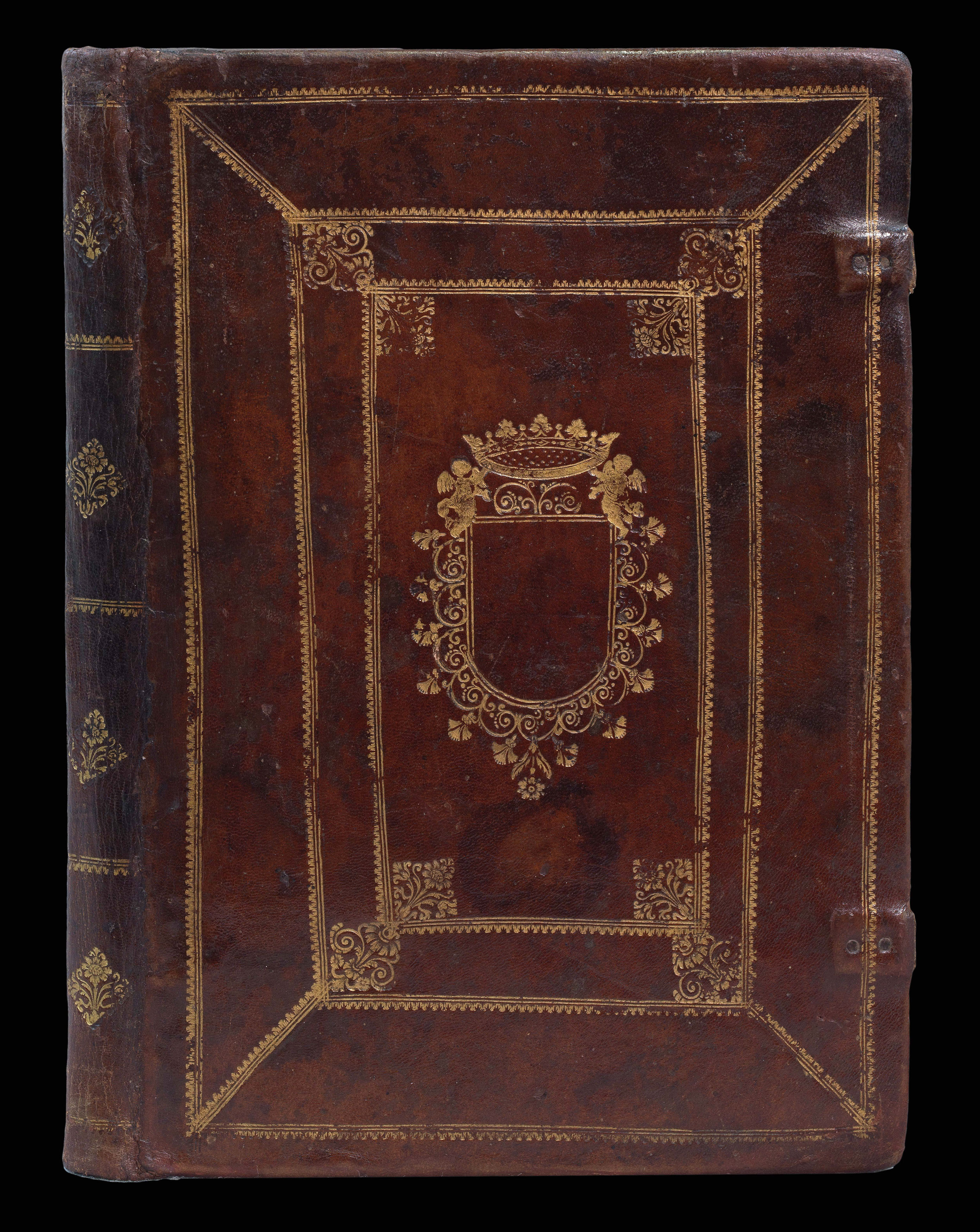 |
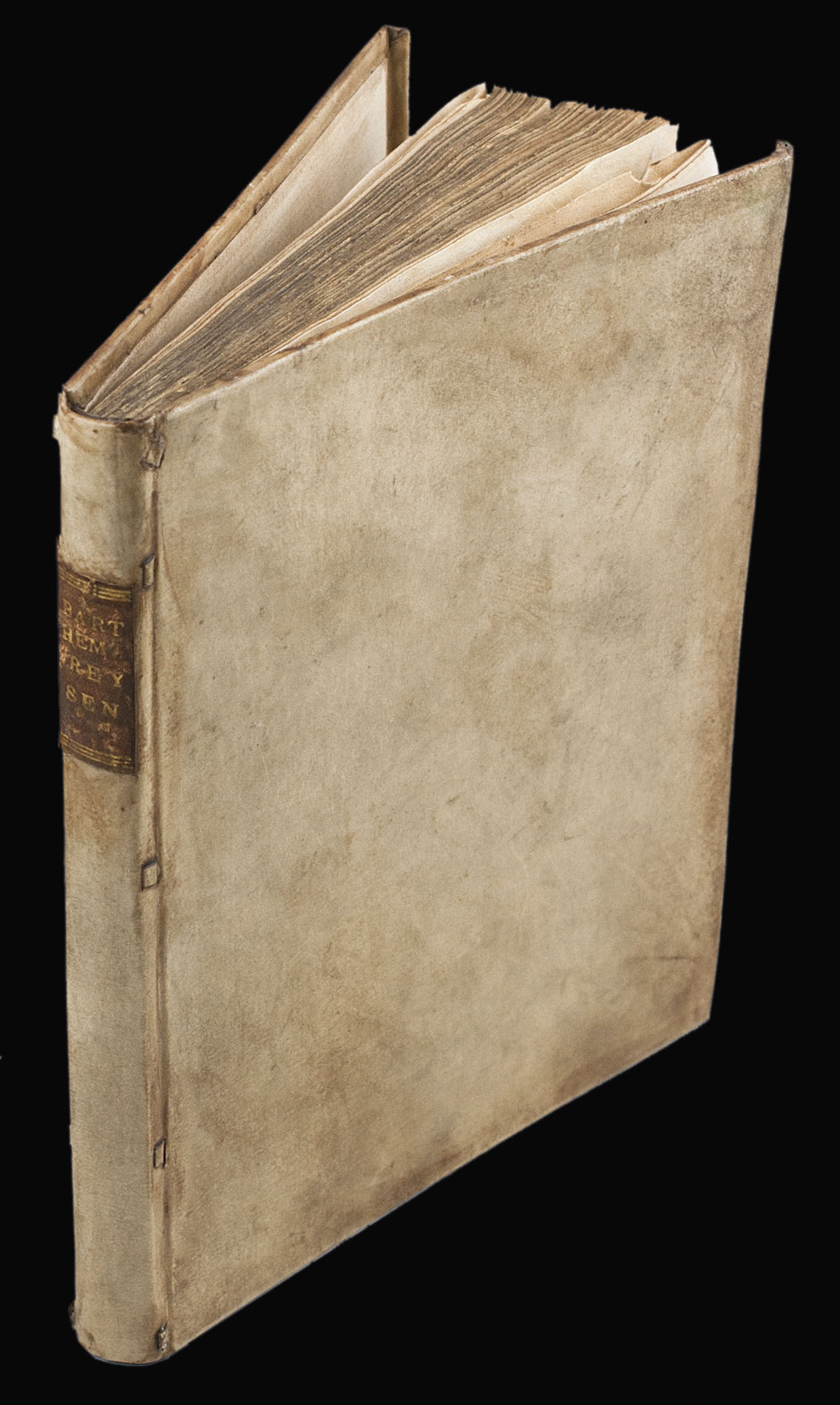
Bordone's Isolario in contemporary binding
1 x
£40,000
|
£40,000 |
|
£40,000 |
|
× |
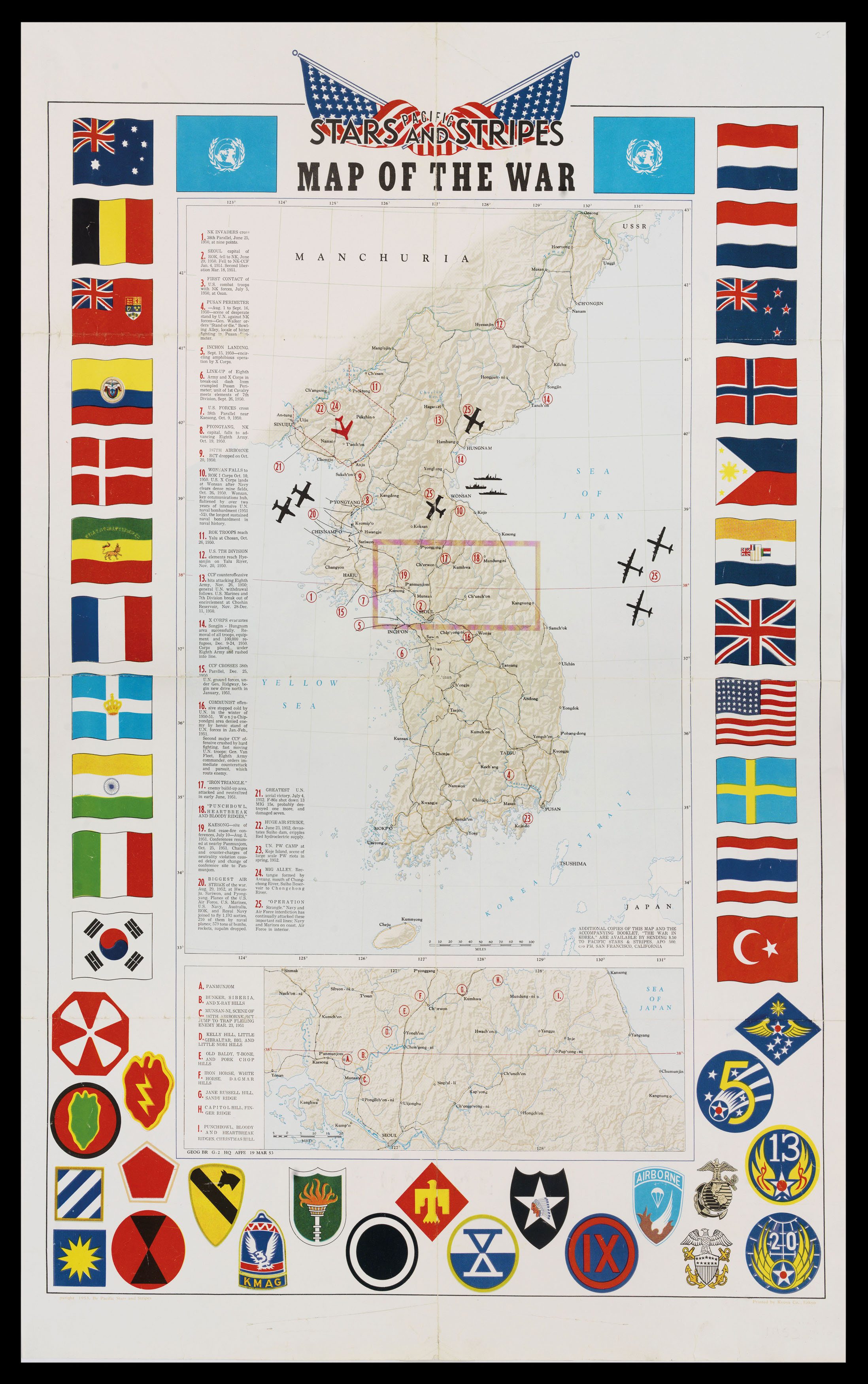 |
Map of the Korean War
1 x
£700
|
£700 |
|
£700 |
|
× |
![[ISRAEL DEFENCE FORCES] Arabia - Oil Fields](https://omega.crouchrarebooks.com/wp-content/uploads/2025/03/20574_1H.jpg) |
The Middle East after the Suez Crisis
1 x
£5,000
|
£5,000 |
|
£5,000 |
|
× |
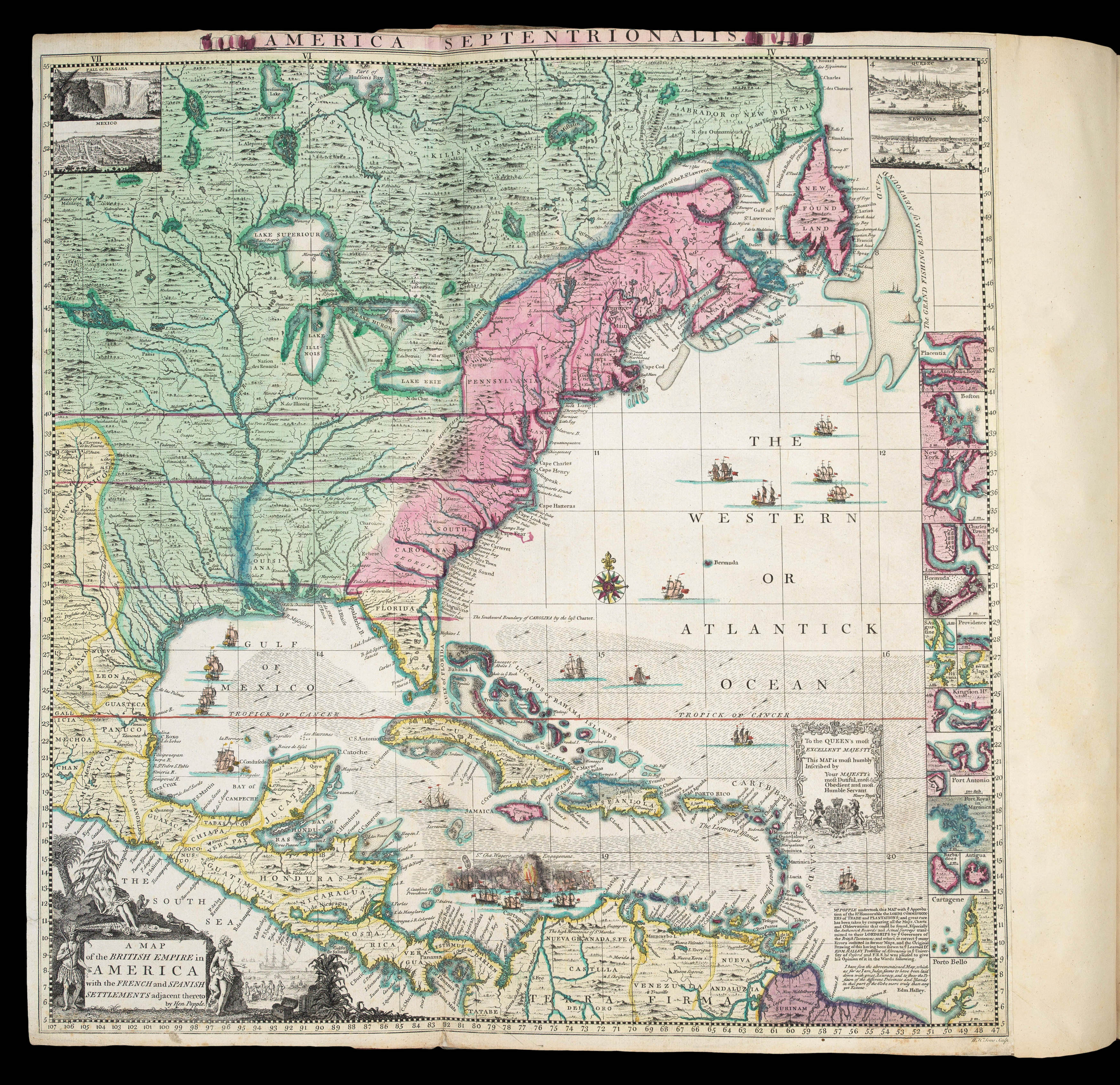 |
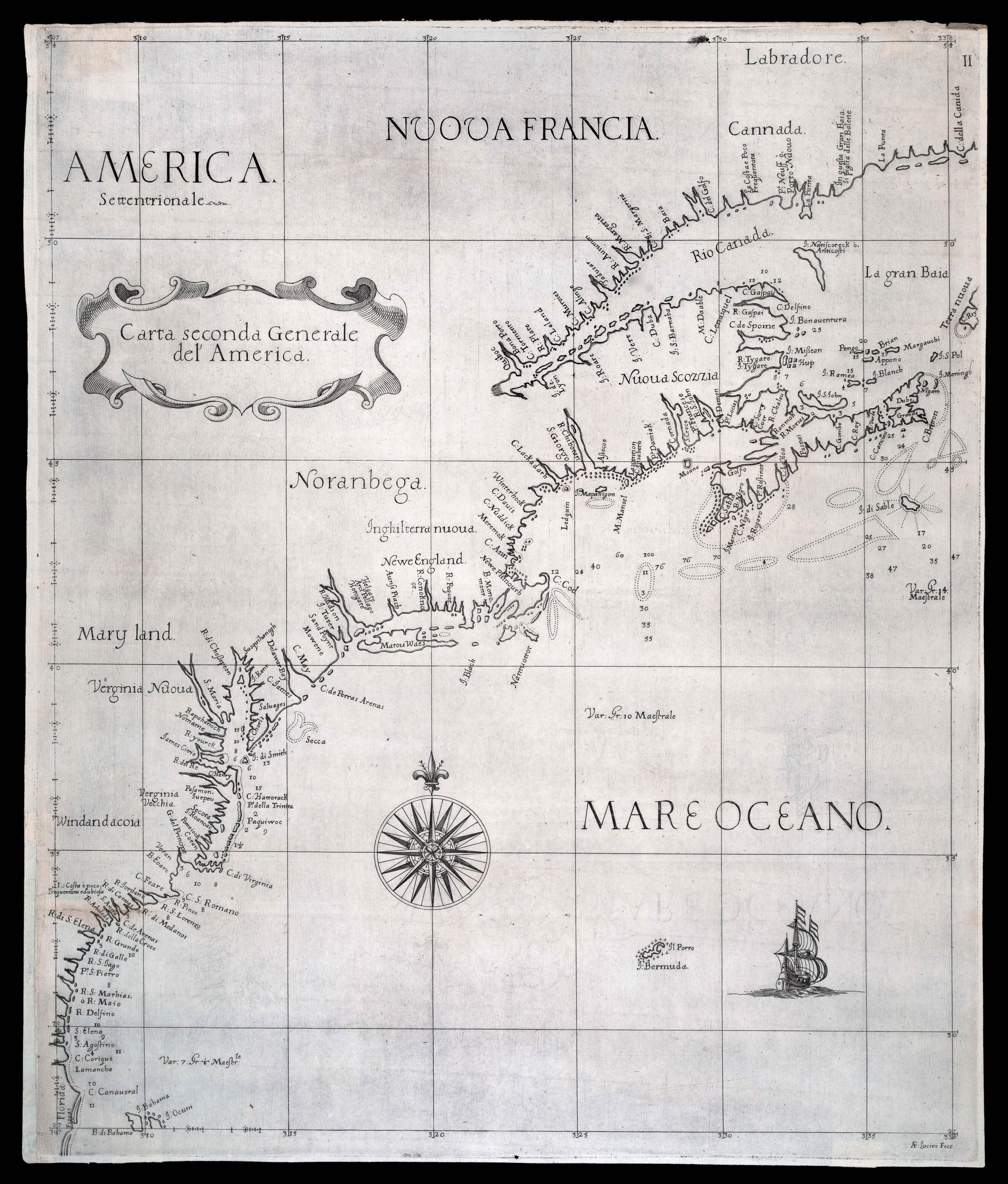
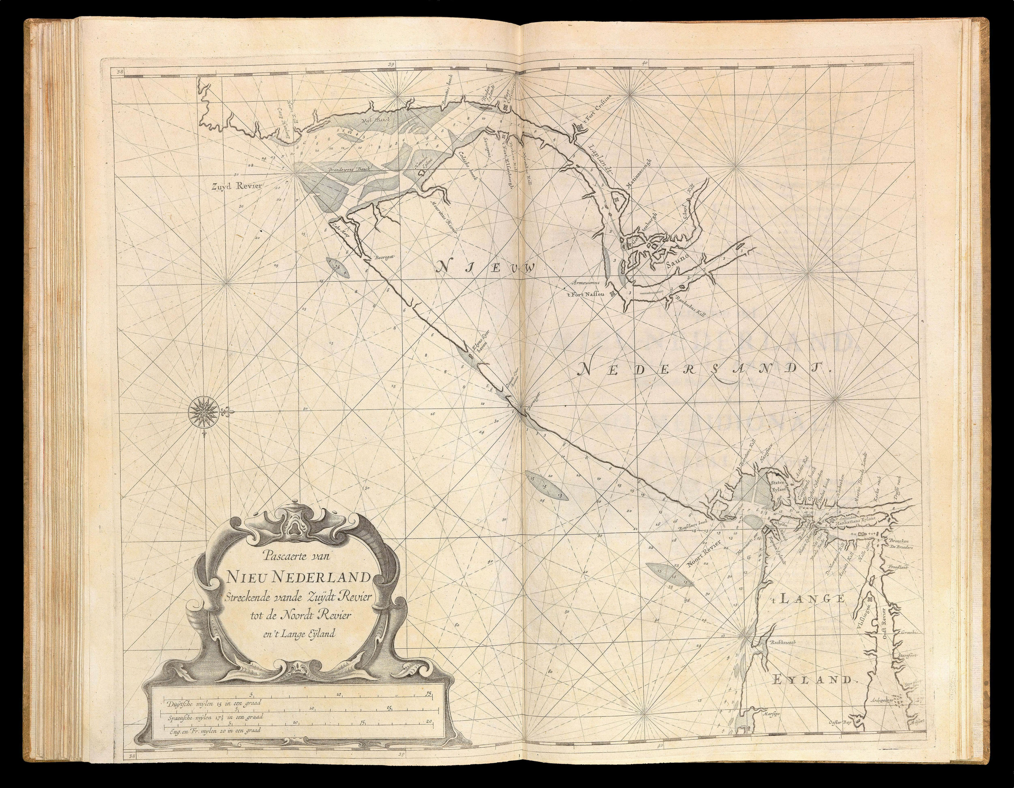
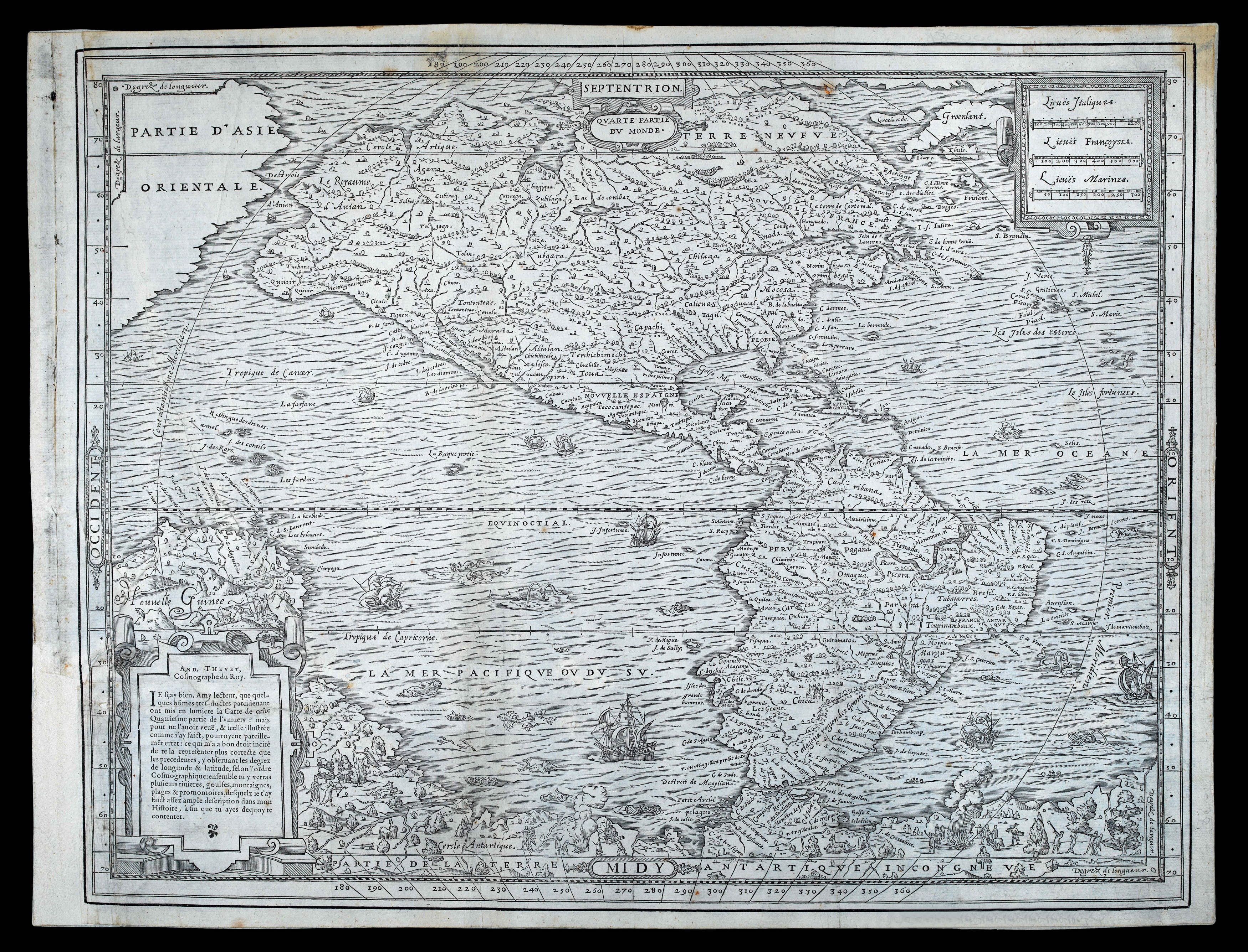
A profound statement of England's designs for dominance of the North American continent; at a time when colonial control of North America was by no means certain
1 x
£180,000
|
£180,000 |
|
£180,000 |
|
× |
 |
Captain William Shakespear's Last Journey
1 x
£2,000
|
£2,000 |
|
£2,000 |
|
× |
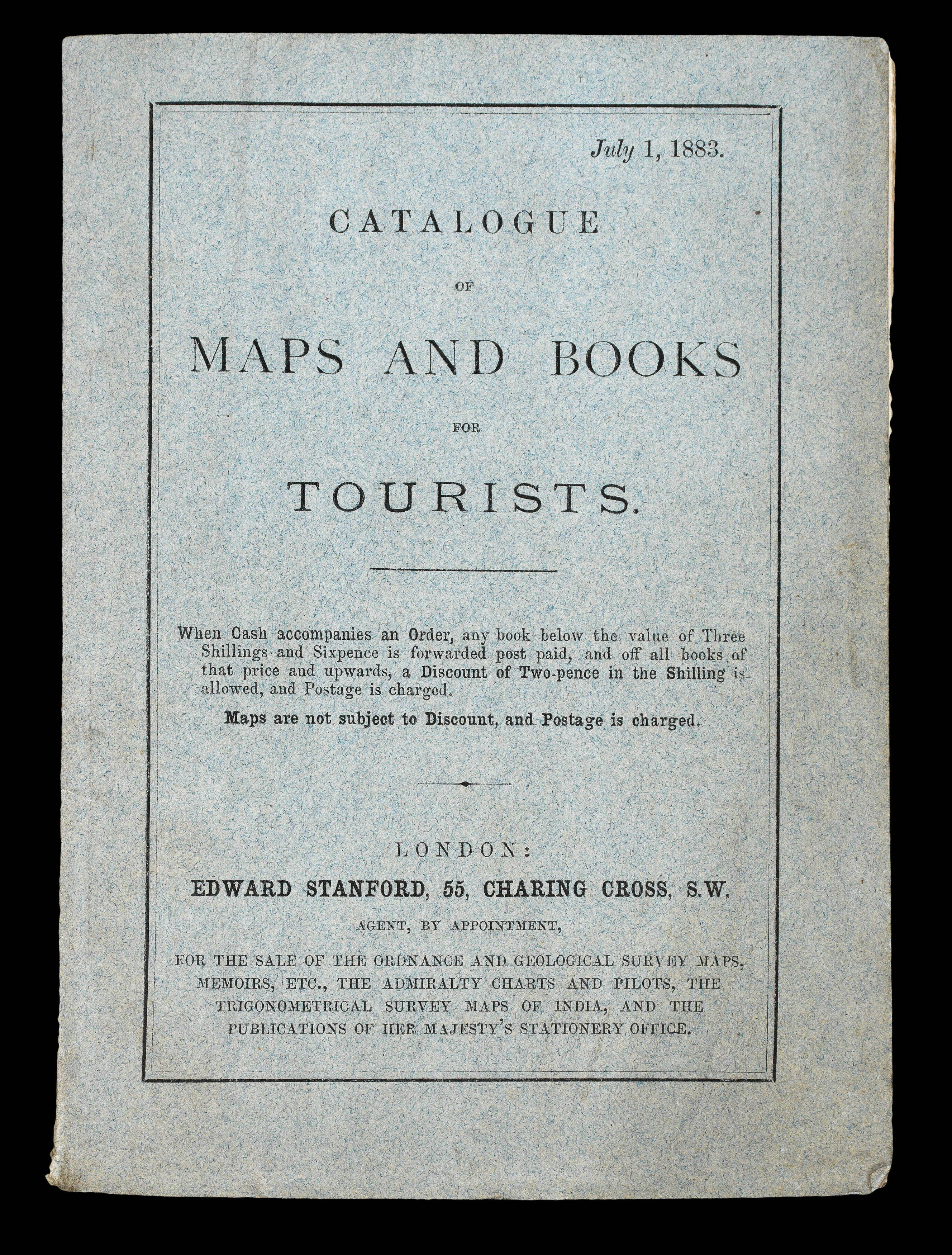 |
"Tourists' Books and Maps, selected from the stock of Edward Stanford"
1 x
£450
|
£450 |
|
£450 |
|
× |
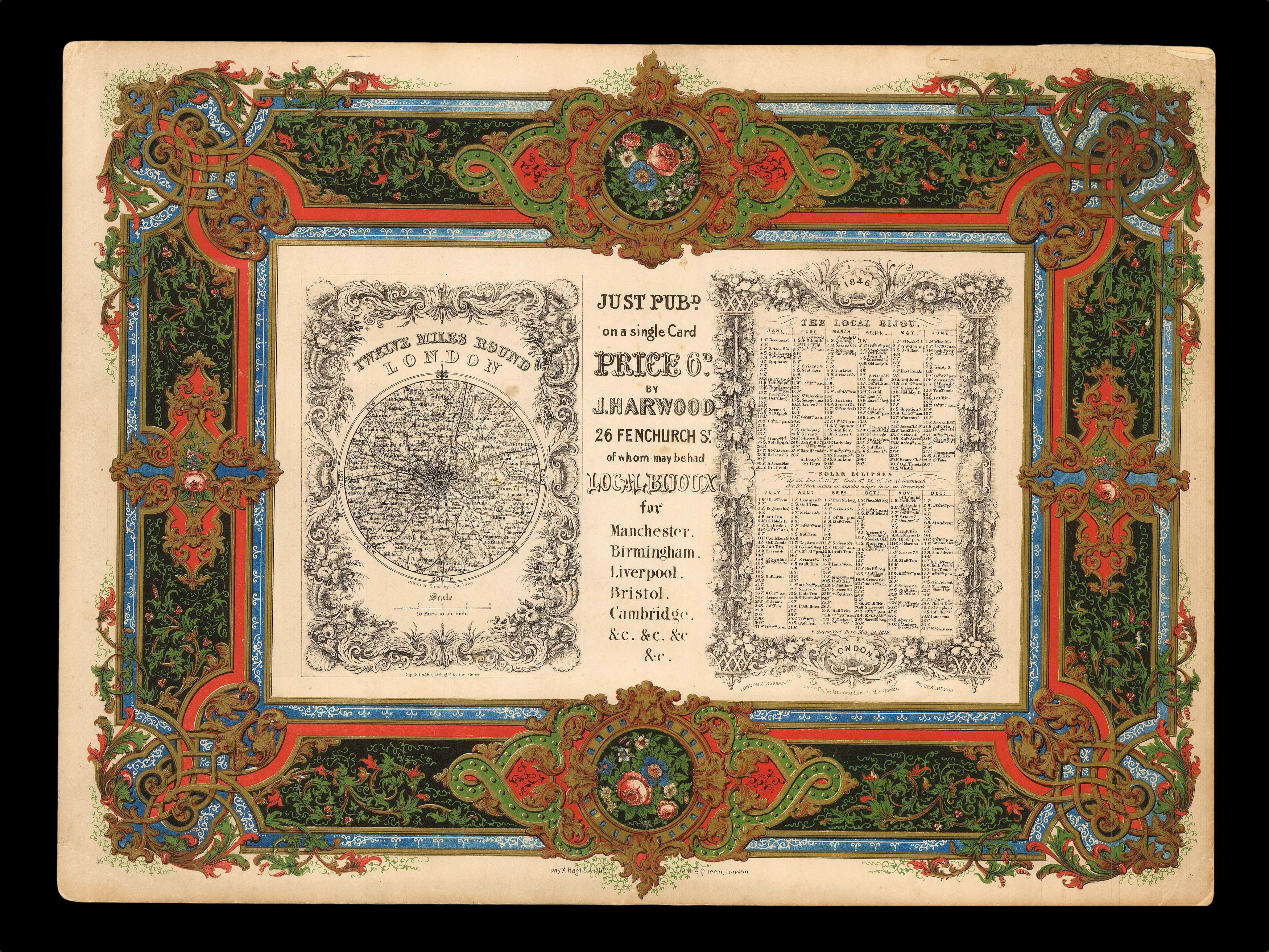 |
Lavishly lithographed prospectus from the house of Day & Haghe
1 x
£600
|
£600 |
|
£600 |
|
× |
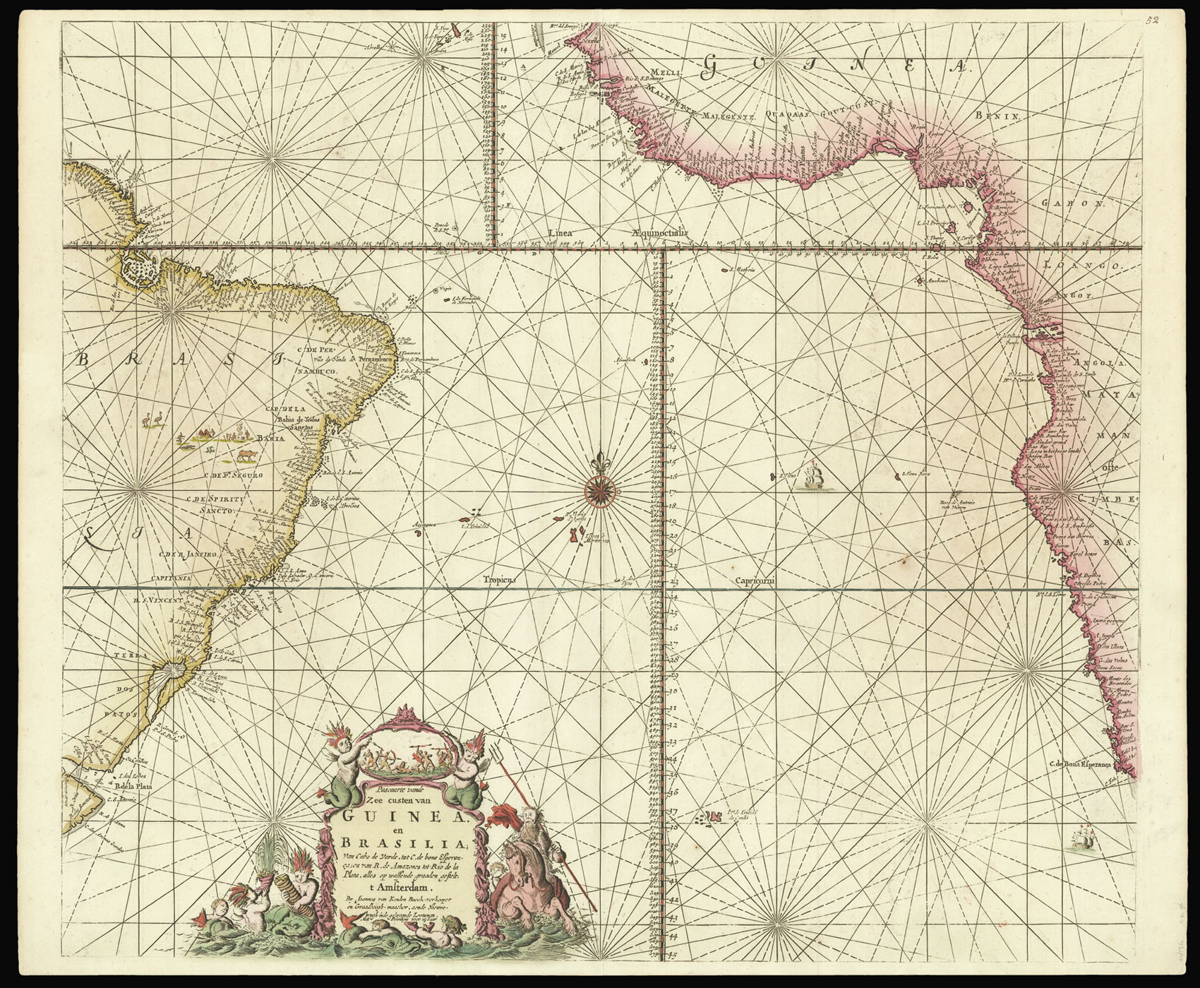 |
An early chart of the Southern Atlantic
1 x
£1,200
|
£1,200 |
|
£1,200 |
|
× |
 |
The first European to enter Mecca and Medina
1 x
£20,000
|
£20,000 |
|
£20,000 |
|
× |
![TAKAI, Ranzan [O-Edo ōezu]/Takai Ranzan zu.](https://omega.crouchrarebooks.com/wp-content/uploads/2025/03/15206_1H.jpg) |
Map of Edo
1 x
£7,500
|
£7,500 |
|
£7,500 |
|
× |
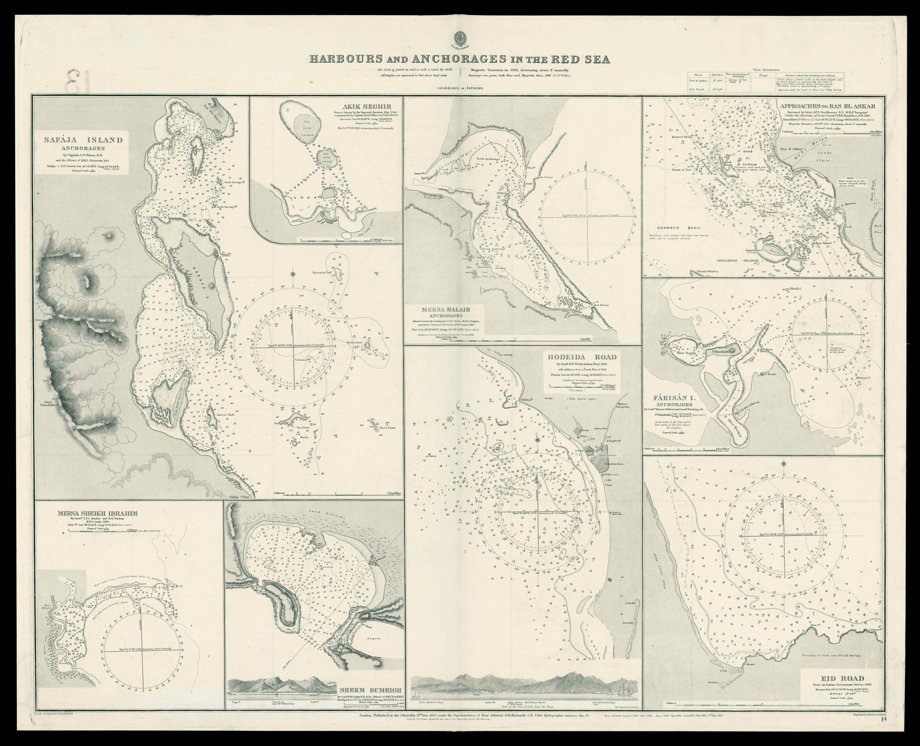 |
Admiralty chart of the harbour's and Anchorages in the Red Sea
1 x
£700
|
£700 |
|
£700 |
|
× |
![MILLIEU, Louys [Toulouse/Girona pattern playing cards]](https://omega.crouchrarebooks.com/wp-content/uploads/2025/03/21529_1H.jpg) |
The Toulouse-Girona pattern
1 x
£85,000
|
£85,000 |
|
£85,000 |
|
× |
 |
First printed sea chart of the northeastern seaboard by an Englishman, and the first with soundings
1 x
£25,000
|
£25,000 |
|
£25,000 |
|
× |
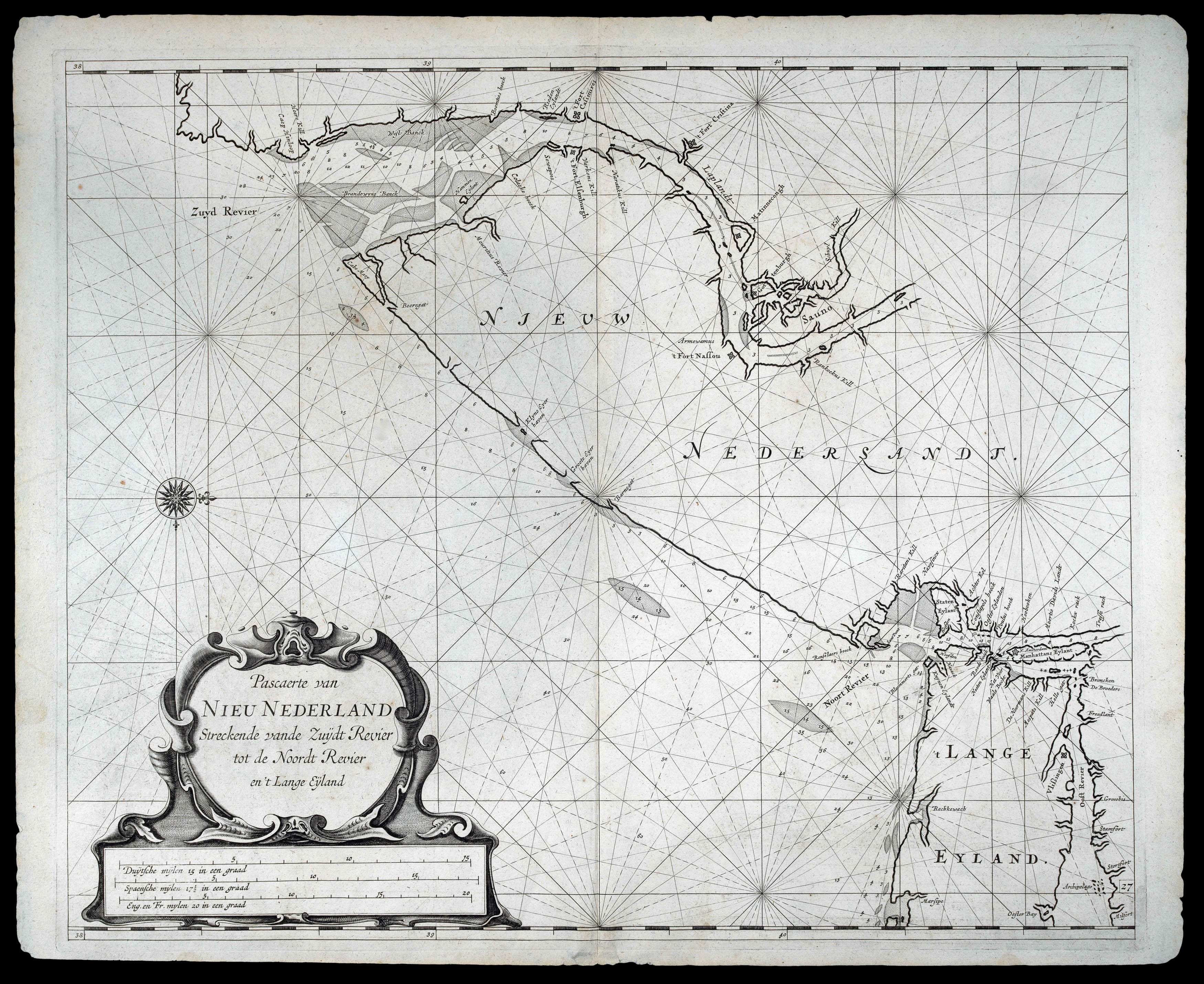 |
Rare chart of New Jersey published in "the first maritime atlas to be devoted to the Americas"
1 x
£35,000
|
£35,000 |
|
£35,000 |
|
× |
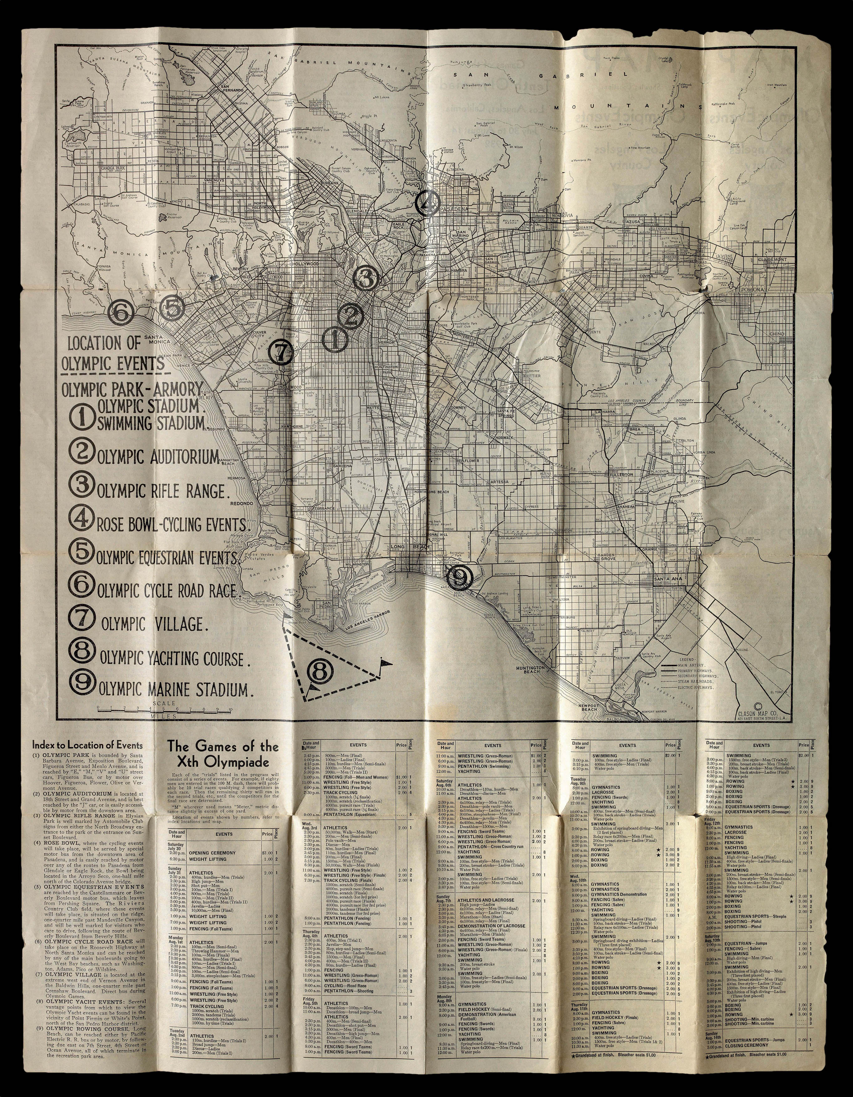 |
Los Angeles goes for the gold!
1 x
£350
|
£350 |
|
£350 |
|
× |
![LE SAGE, P. Carte depuis la fin du Detroit de la Sonde jusqu'a la fin D'Etroit de Banca faitte en l'anne 1734 – [Singapore Strait] – [South China Sea].](https://omega.crouchrarebooks.com/wp-content/uploads/2025/03/17525_1H.jpg) |
Charting a voyage of nearly two thousand nautical miles from the Sunda Strait to Hong Kong
1 x
£87,000
|
£87,000 |
|
£87,000 |
|
× |
![GASTALDI, Giacomo & LAFRERI, Antonio La descrittione della prima parte dell'Asia. [and] Il disegno della seconda parte dell'Asia.](https://omega.crouchrarebooks.com/wp-content/uploads/2025/03/15701_1H.jpg) |
The most important maps of the Middle East and Arabia published in the sixteenth century
1 x
£125,000
|
£125,000 |
|
£125,000 |
|
× |
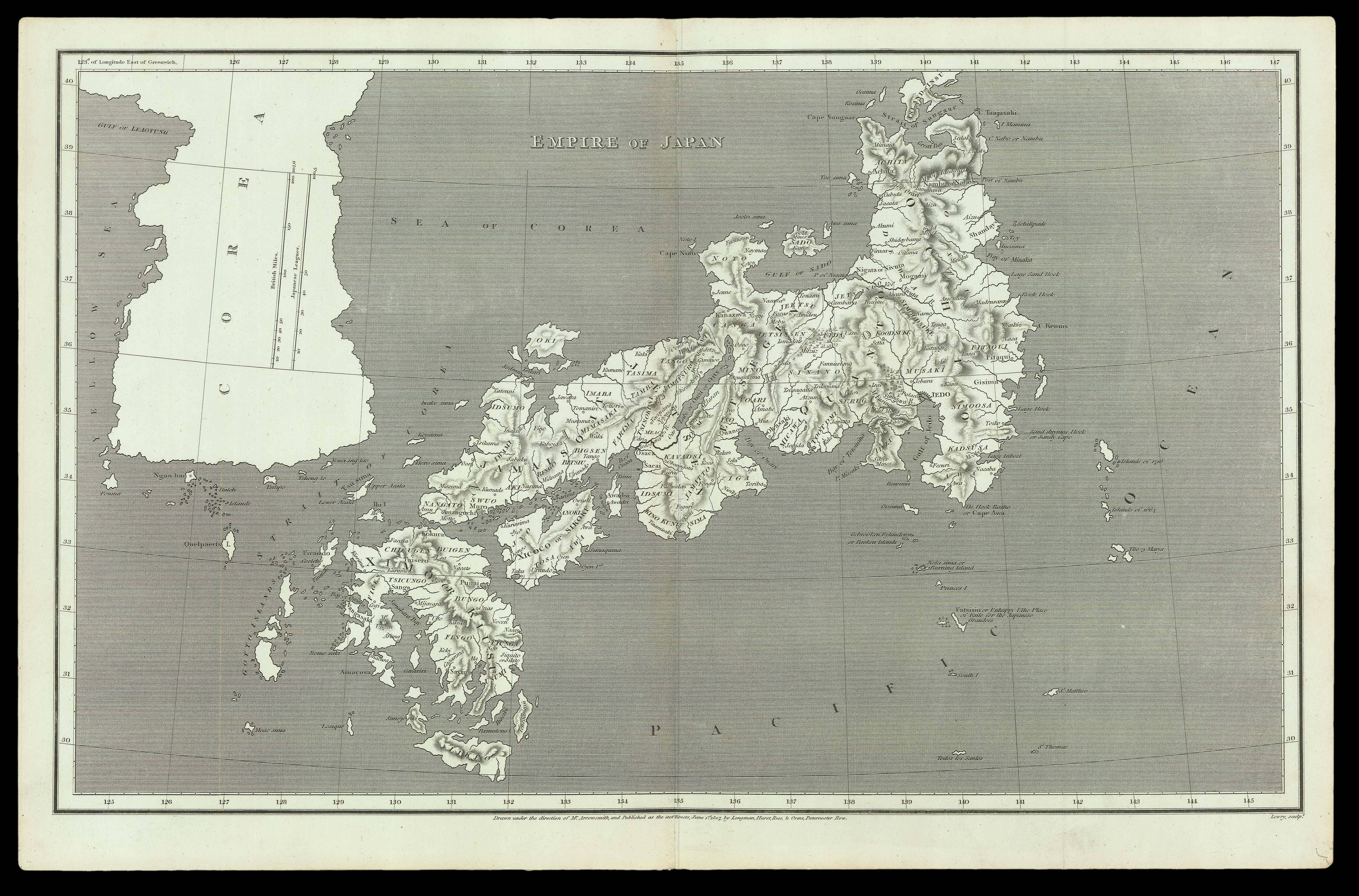 |
Map of Japan by Aaron Arrowsmith
1 x
£235
|
£235 |
|
£235 |
|
× |
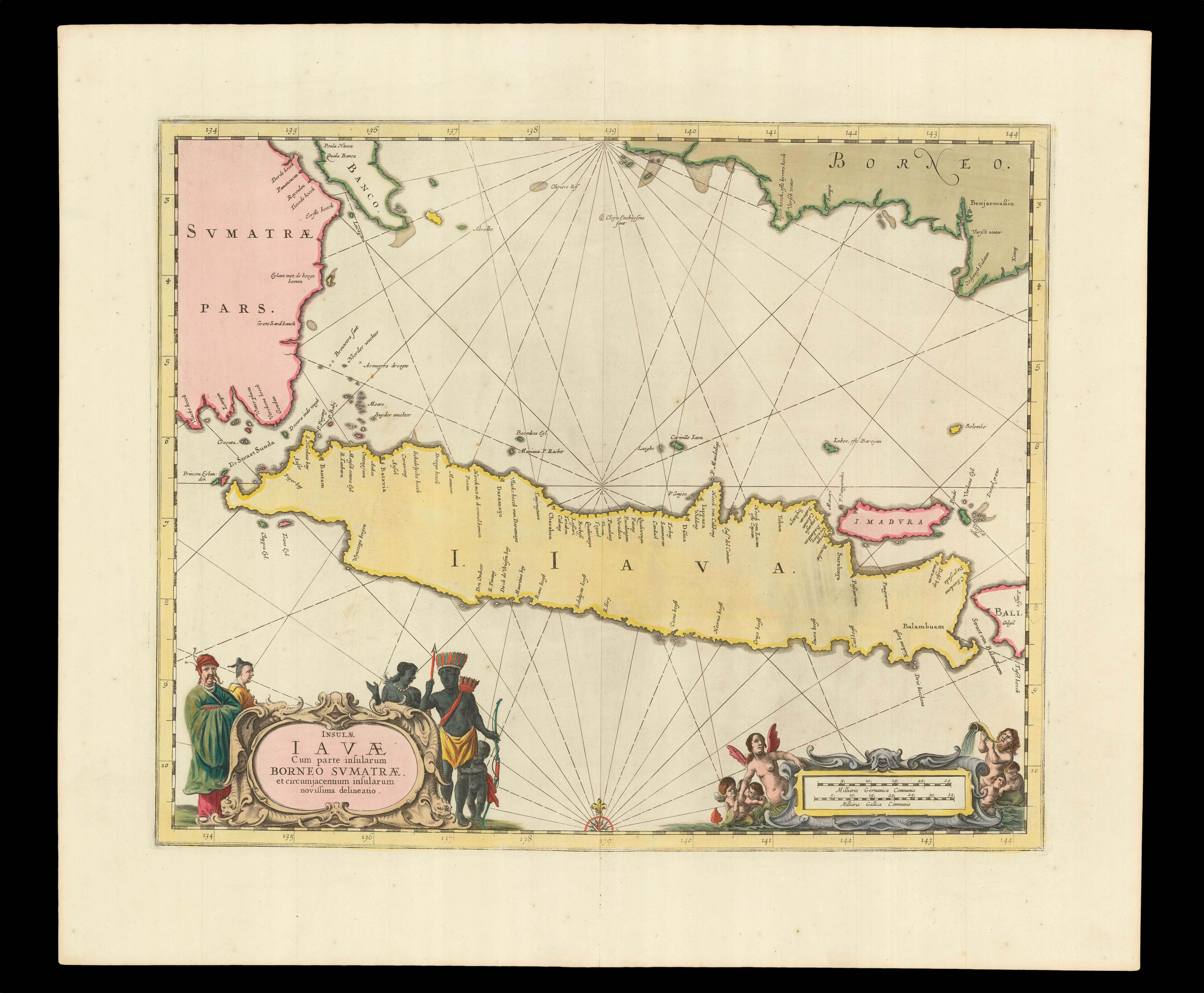 |
The heart of VOC territory in Southeast Asia
1 x
£750
|
£750 |
|
£750 |
|
× |
 |
Unrecorded Spanish edition of the First Sea Atlas of America
1 x
£180,000
|
£180,000 |
|
£180,000 |
|
× |
![PIATNIK, Ferd[inand] Narrentarock](https://omega.crouchrarebooks.com/wp-content/uploads/2025/03/21528_1H.jpg) |
Play the fool
1 x
£1,800
|
£1,800 |
|
£1,800 |
|
× |
![CARY, John [World and four continents]](https://omega.crouchrarebooks.com/wp-content/uploads/2025/03/1759_1H.jpg) |
Cary's rare wall maps of the world and four continents
1 x
£15,000
|
£15,000 |
|
£15,000 |
|
× |
![BAKER, W[illiam] E[merson]. This Porcineograph.](https://omega.crouchrarebooks.com/wp-content/uploads/2025/03/15815_1H.jpg) |
America Hams it Up
1 x
£12,000
|
£12,000 |
|
£12,000 |
|
× |
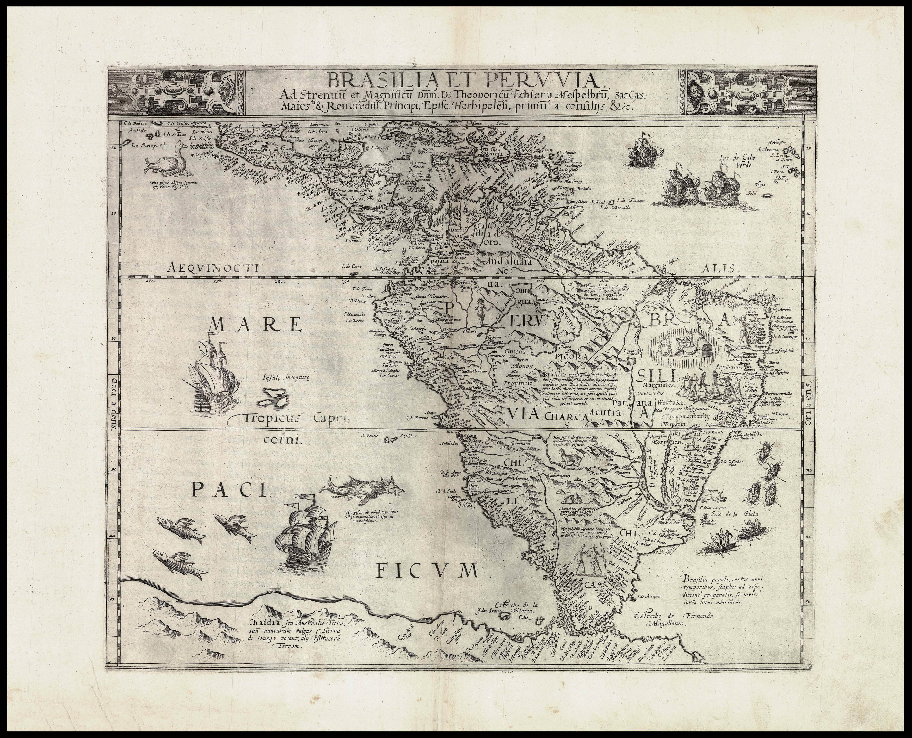 |
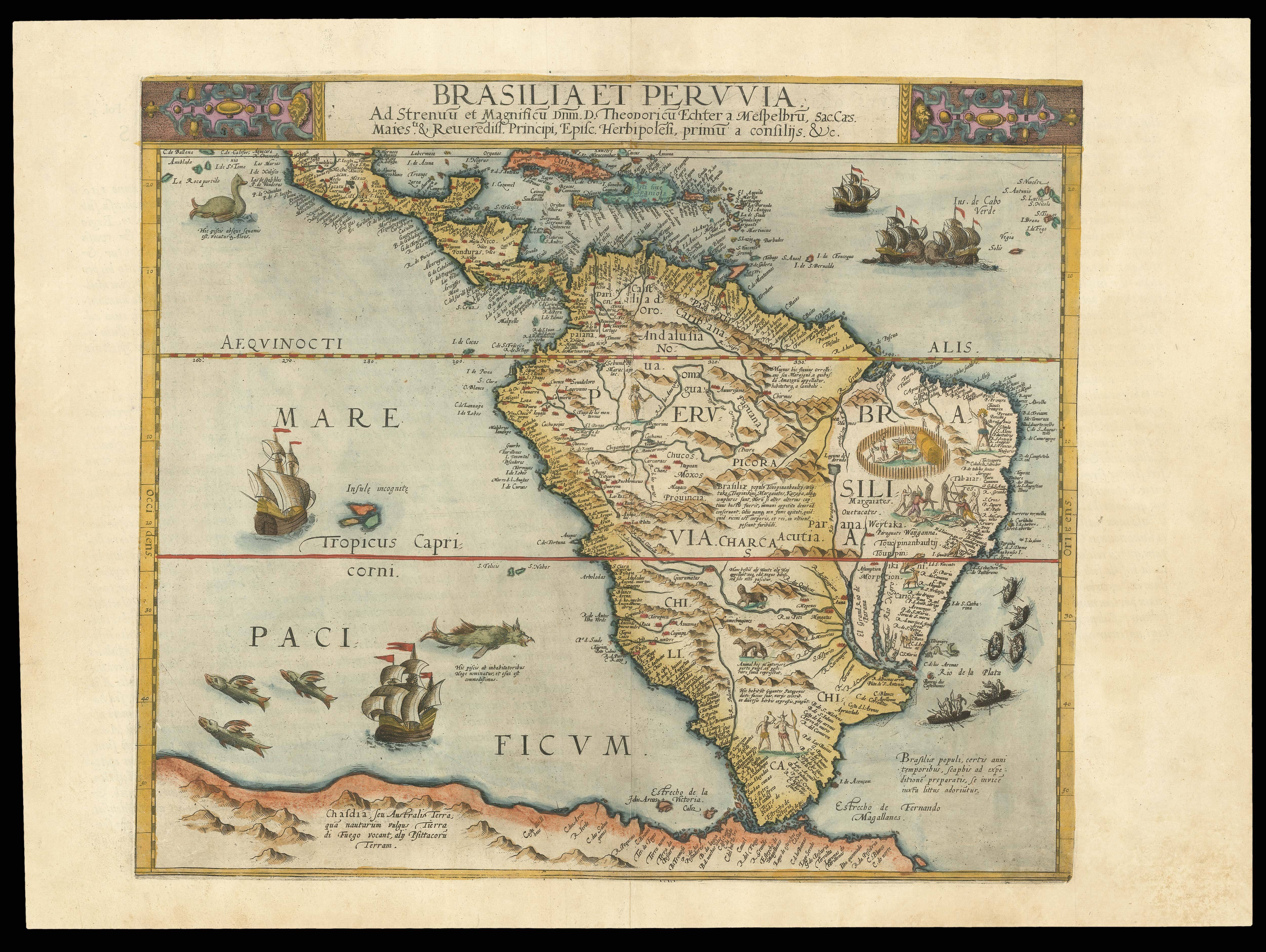
De Jode's map of South America
1 x
£12,000
|
£12,000 |
|
£12,000 |
|
× |
![HAINES, Captain [Stafford Bettesworth]; Lieutenant CARLESS; and Lieutenant A. M. GRIEVE Chart of the Gulf of Aden on Mercator's Projection](https://omega.crouchrarebooks.com/wp-content/uploads/2025/03/16481_1H.jpg) |
Haines's deatiled chart of southern Arabia
1 x
£100
|
£100 |
|
£100 |
|
× |
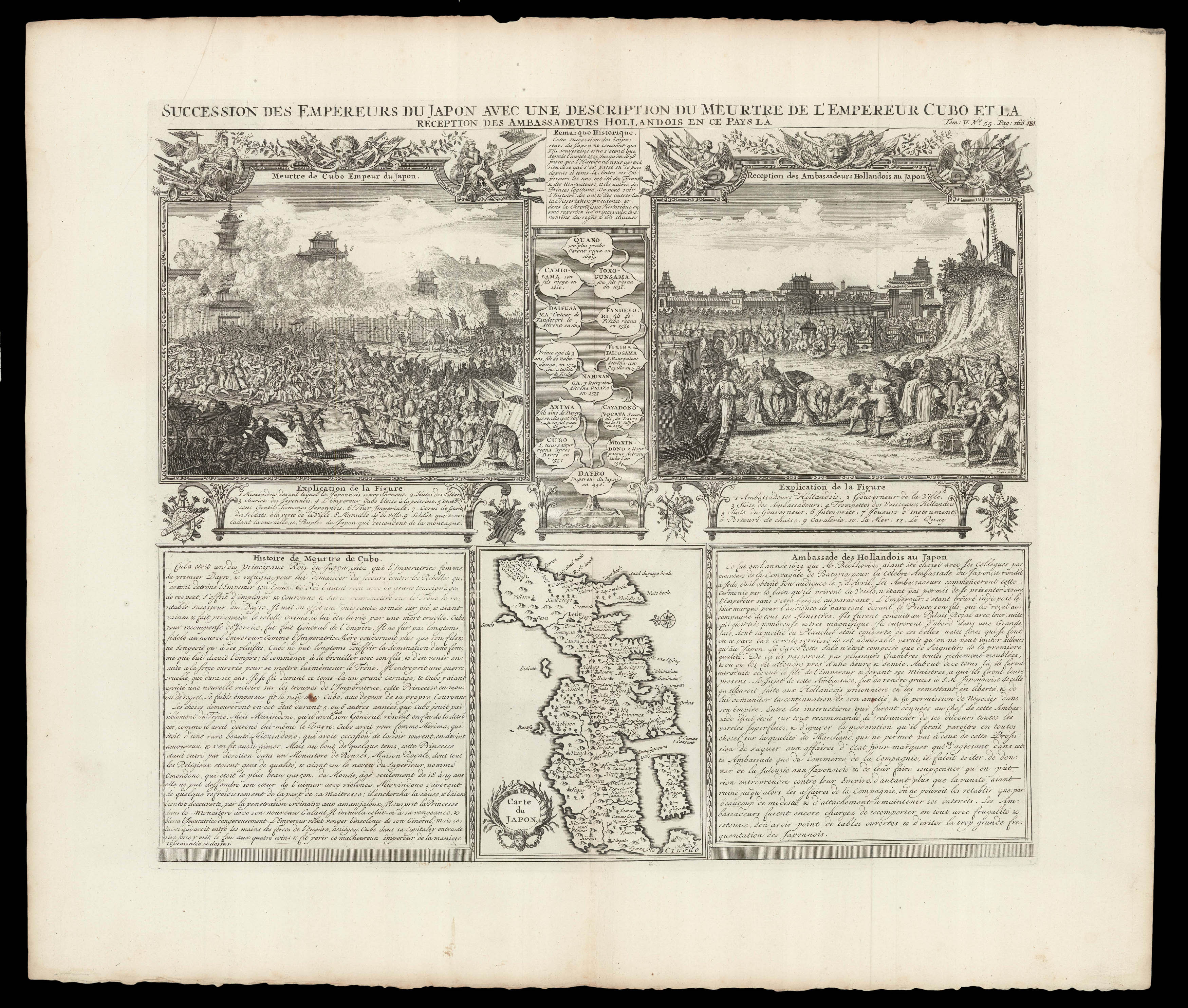 |
The Emperors' lineage
1 x
£300
|
£300 |
|
£300 |
|
× |
![[GASTALDI, Giacomo; after] India tercera nuova tavola.](https://omega.crouchrarebooks.com/wp-content/uploads/2025/03/17576_1H.jpg) |
One of the earliest maps to reference Singapore
1 x
£600
|
£600 |
|
£600 |
|
× |
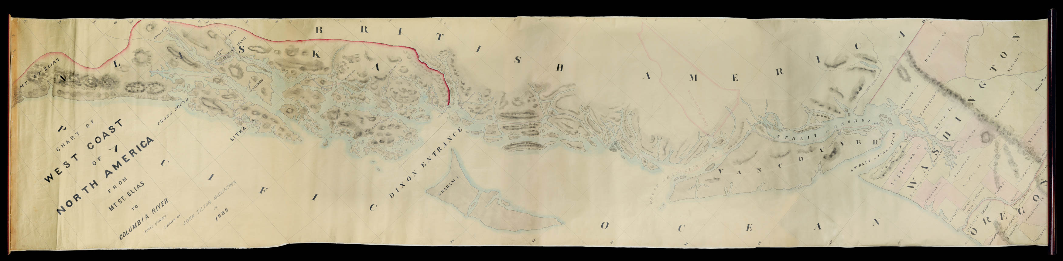 |
A unique, accomplished, and mammoth manuscript of the American West Coast
1 x
£16,000
|
£16,000 |
|
£16,000 |
|
× |
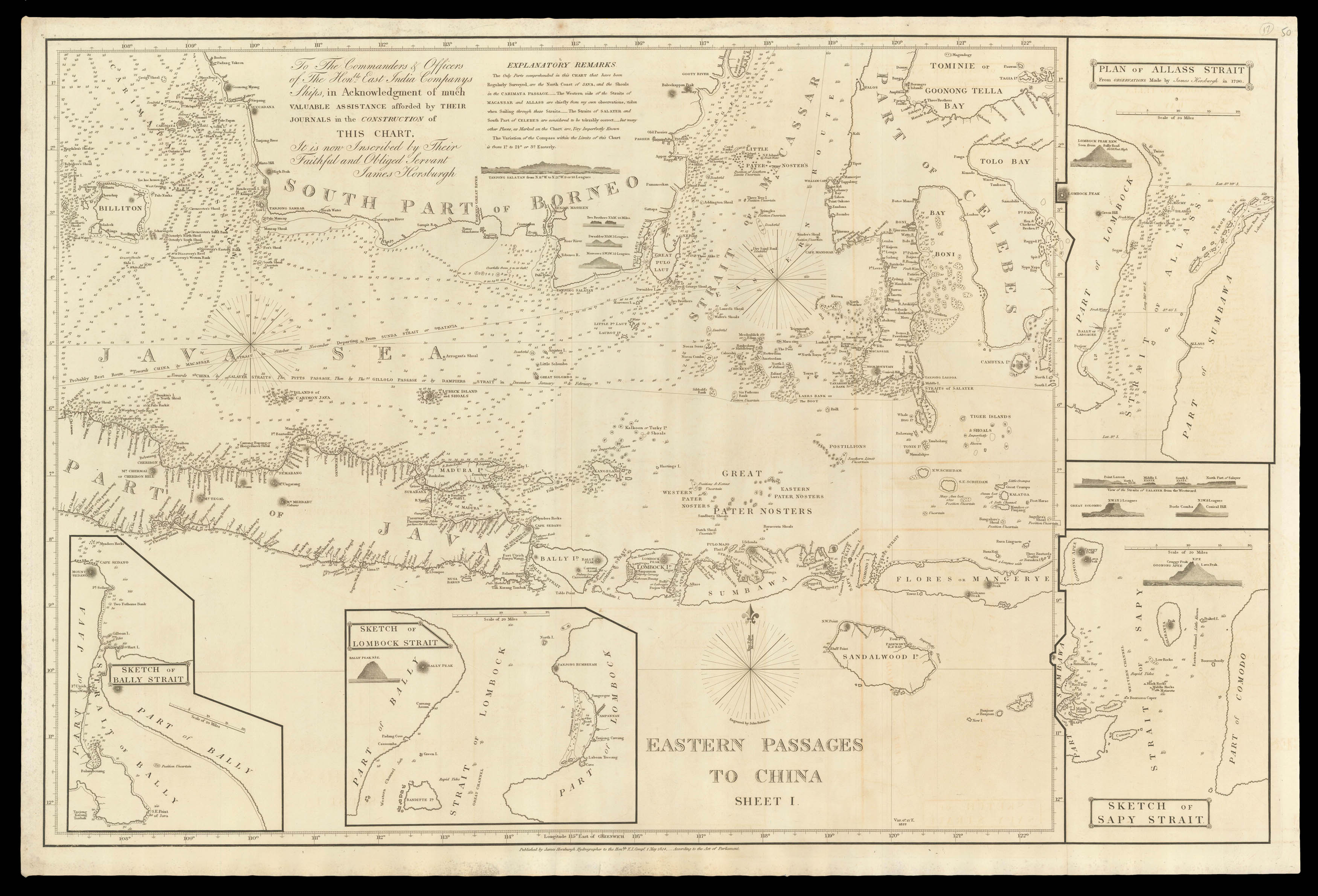 |
Offering the best route through the eastern islands of the Indonesian archipelago towards China
1 x
£750
|
£750 |
|
£750 |
|
× |
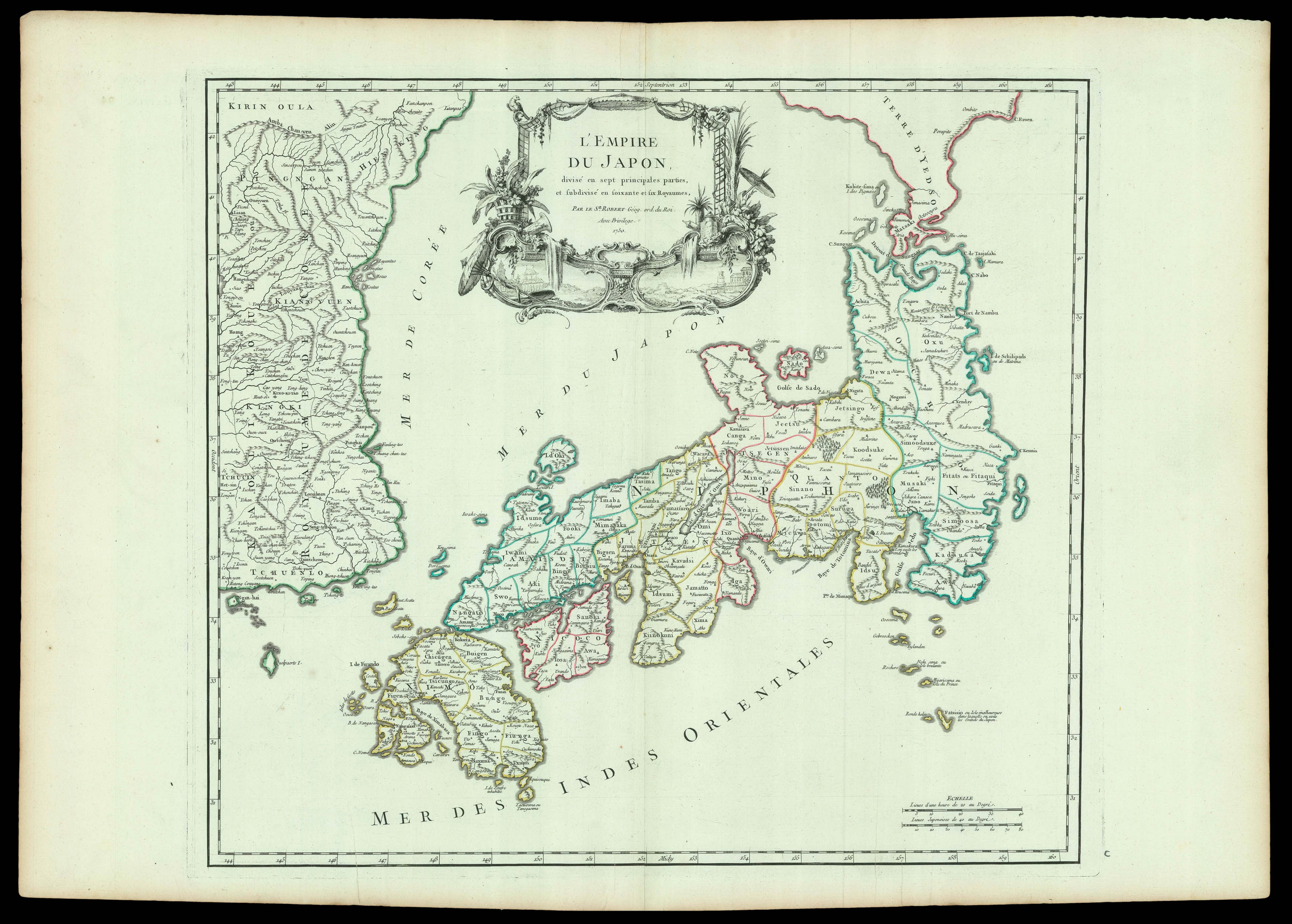 |
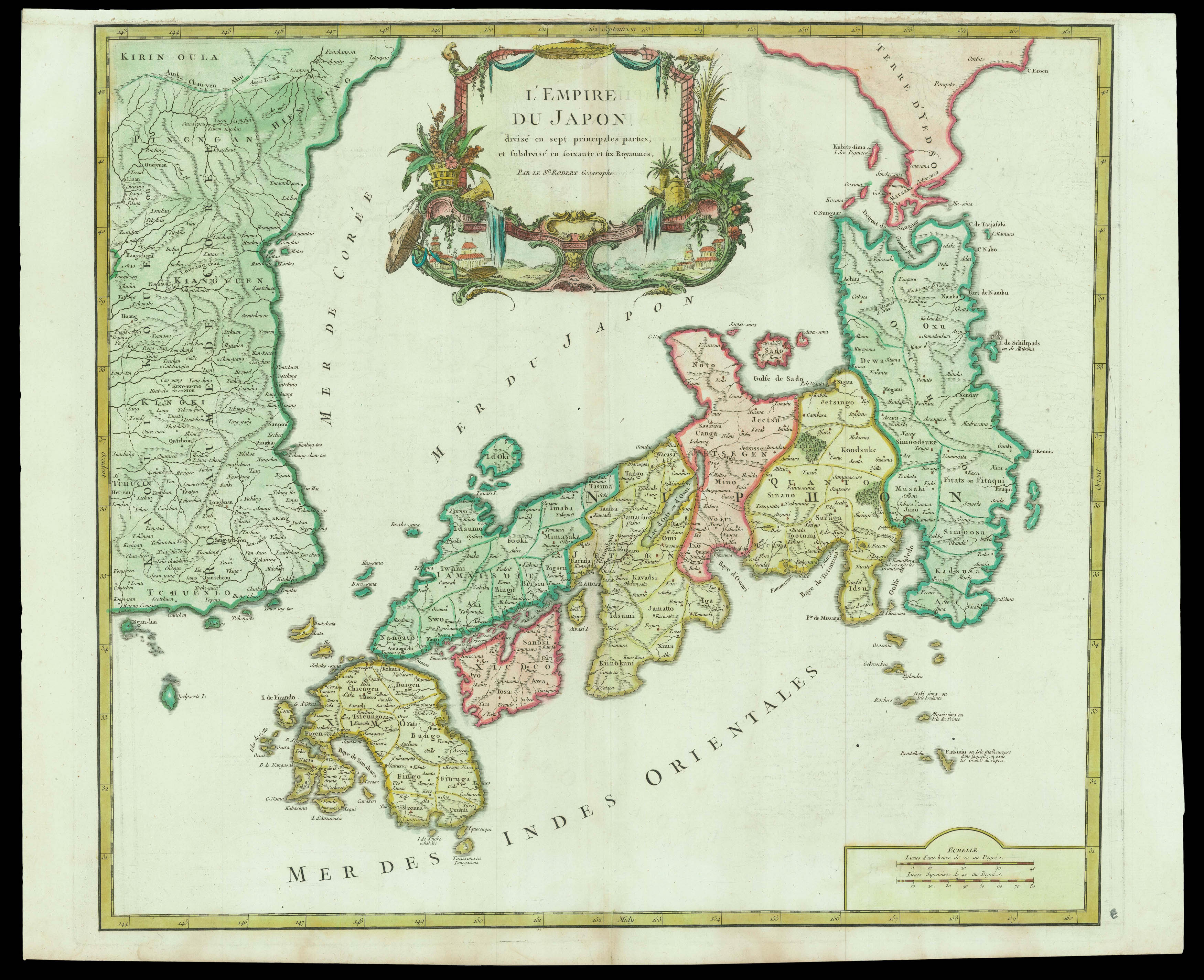
The Empire of Japan
1 x
£800
|
£800 |
|
£800 |
|
× |
 |
Luck of the Irish
1 x
£800
|
£800 |
|
£800 |
|
× |
 |
One of only a few maps of the period created from first-hand knowledge
1 x
£13,000
|
£13,000 |
|
£13,000 |
|
× |
 |
De Jode's map of South America in original colour
1 x
£15,000
|
£15,000 |
|
£15,000 |
|
× |
 |
Rocque's Index to his monumental 24-sheet plan of London
1 x
£1,500
|
£1,500 |
|
£1,500 |
|
× |
![[ANONYMOUS] [Shop Sign].](https://omega.crouchrarebooks.com/wp-content/uploads/2025/03/14862_1H.jpg) |
Nautical instrument maker's shop sign
1 x
£2,500
|
£2,500 |
|
£2,500 |
|
× |
 |
The Empire of Japan
1 x
£800
|
£800 |
|
£800 |
|
× |
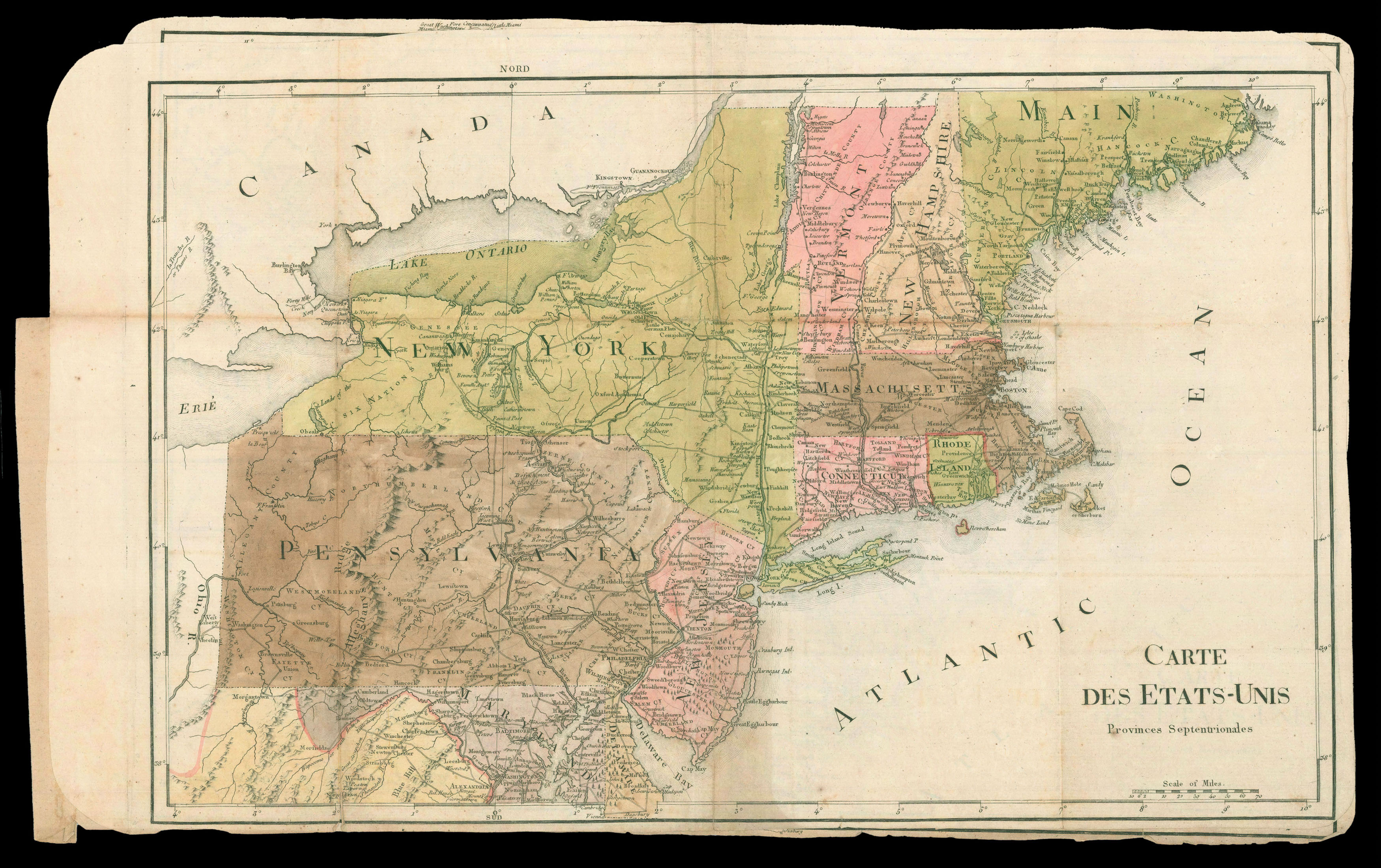 |
Rochambeau family maps of North America
1 x
£25,000
|
£25,000 |
|
£25,000 |
|
× |
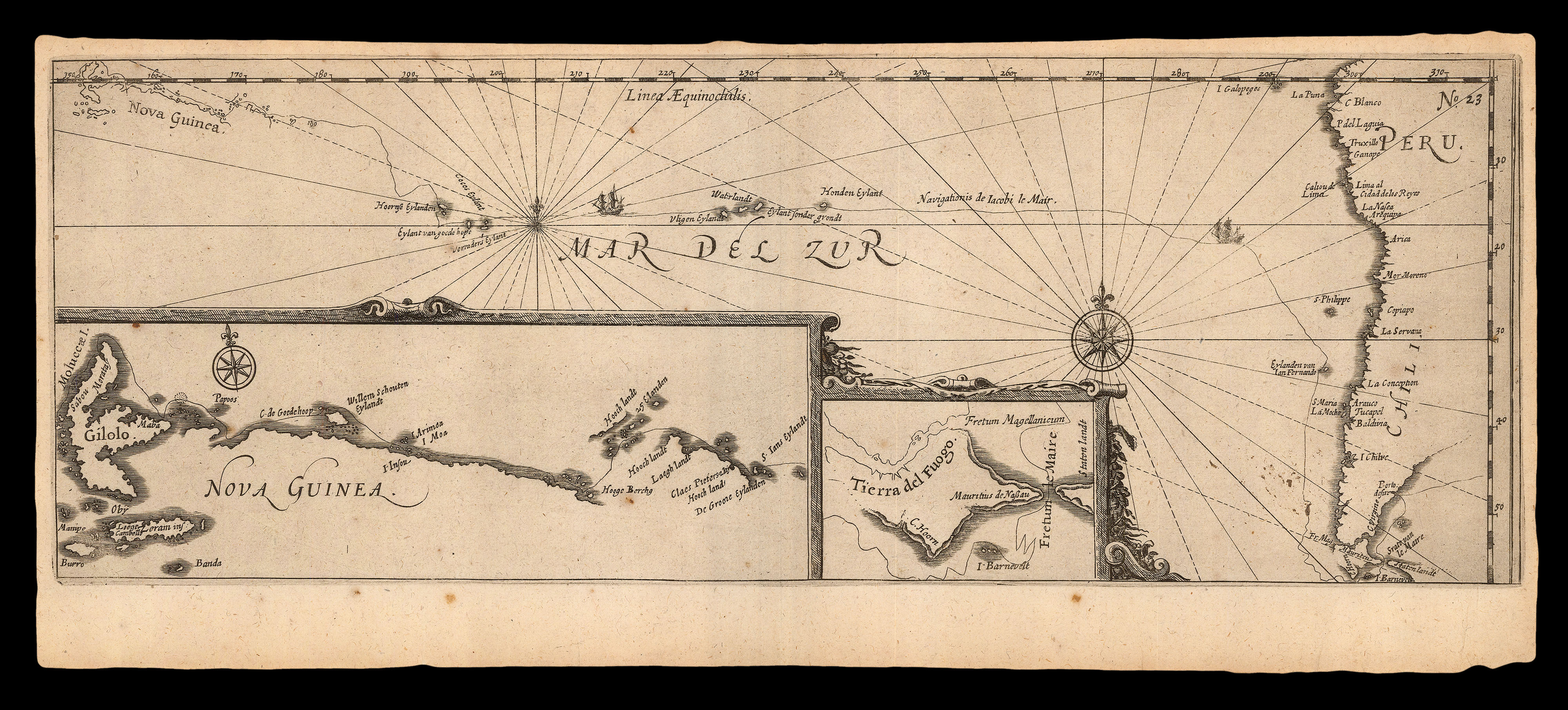 |
"Fretum le Maire"
1 x
£1,400
|
£1,400 |
|
£1,400 |
|
× |
![ROWLEY AND CO. [Rowley's new deck]](https://omega.crouchrarebooks.com/wp-content/uploads/2025/03/20705_1H.jpg) |
Monarchs of Europe
1 x
£3,000
|
£3,000 |
|
£3,000 |
|
× |
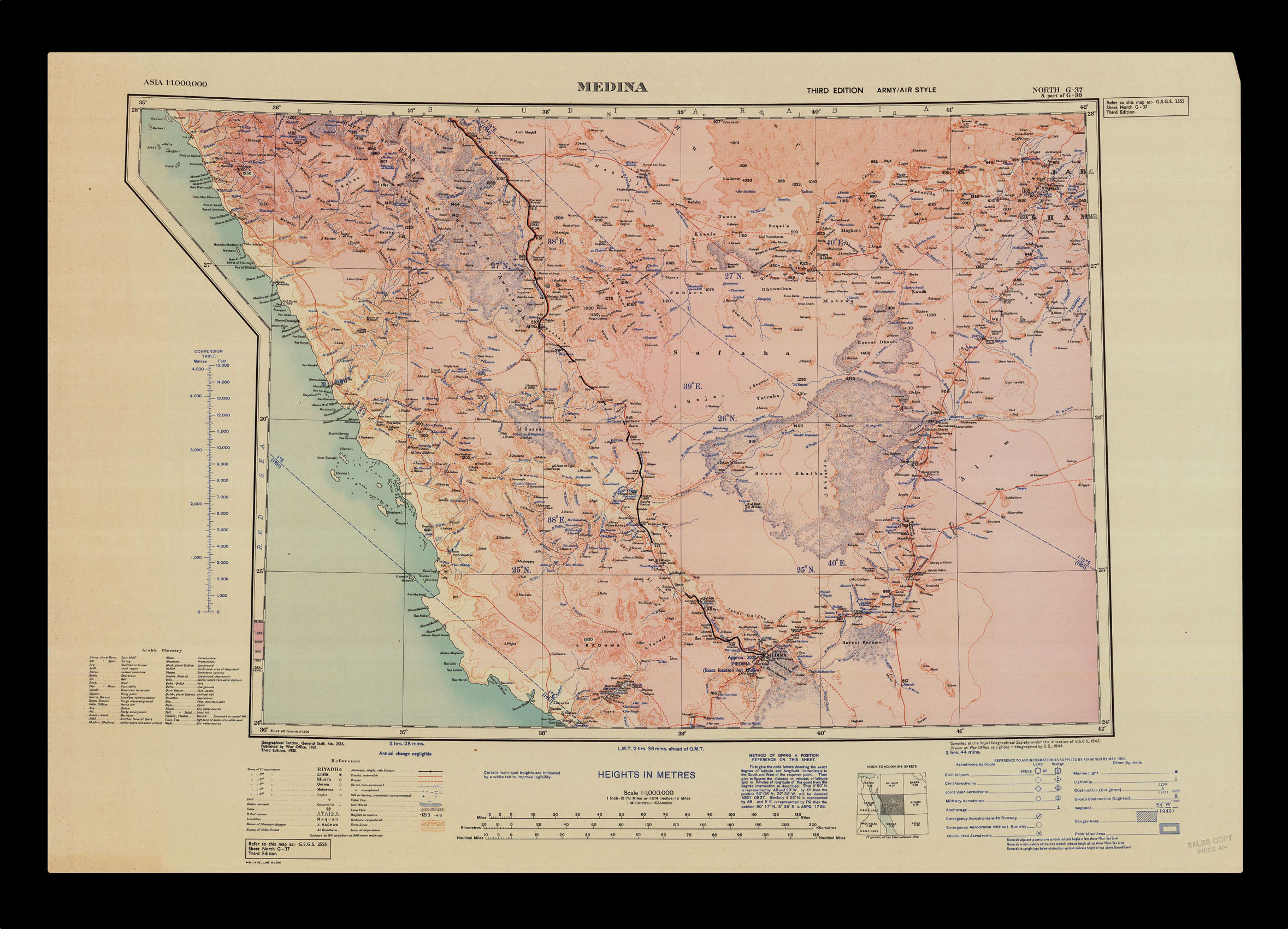 |
Medina
1 x
£250
|
£250 |
|
£250 |
|
× |
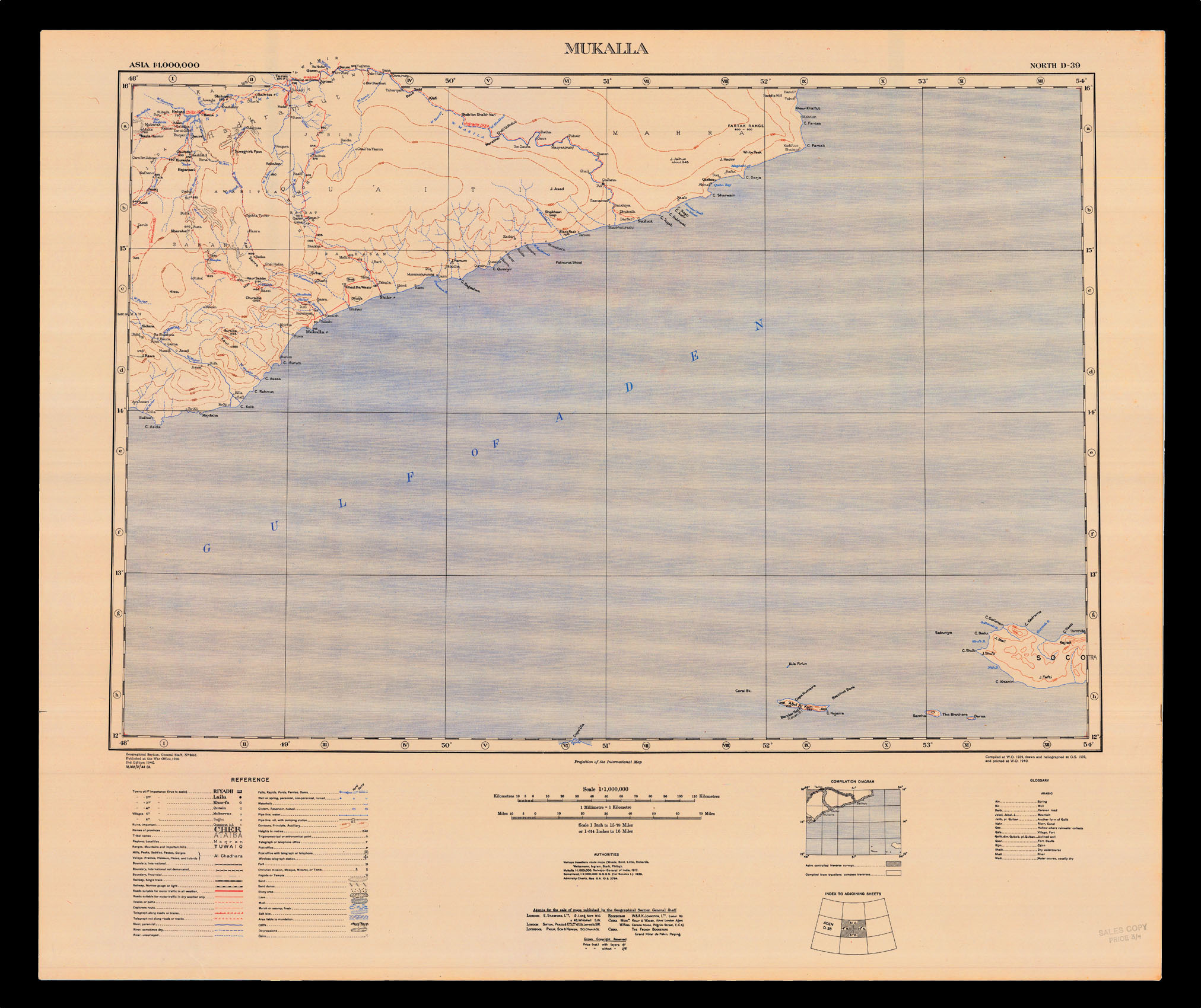 |
Mukalla
1 x
£100
|
£100 |
|
£100 |
|
× |
![D'ANVILLE, [Jean Baptiste Bourguignon] Memoire de M. D'Anville, Premier Geographe du Roi,](https://omega.crouchrarebooks.com/wp-content/uploads/2025/03/17504_1H.jpg) |
D'Anville's maps of China
1 x
£4,500
|
£4,500 |
|
£4,500 |
|
× |
![WAR OFFICE Singapore [and] Penang](https://omega.crouchrarebooks.com/wp-content/uploads/2025/03/17485_1H.jpg) |
The Malayan Emergency
1 x
£250
|
£250 |
|
£250 |
|
× |
 |
Index to Rouge's Mitchell Map
1 x
£10,000
|
£10,000 |
|
£10,000 |
|
× |
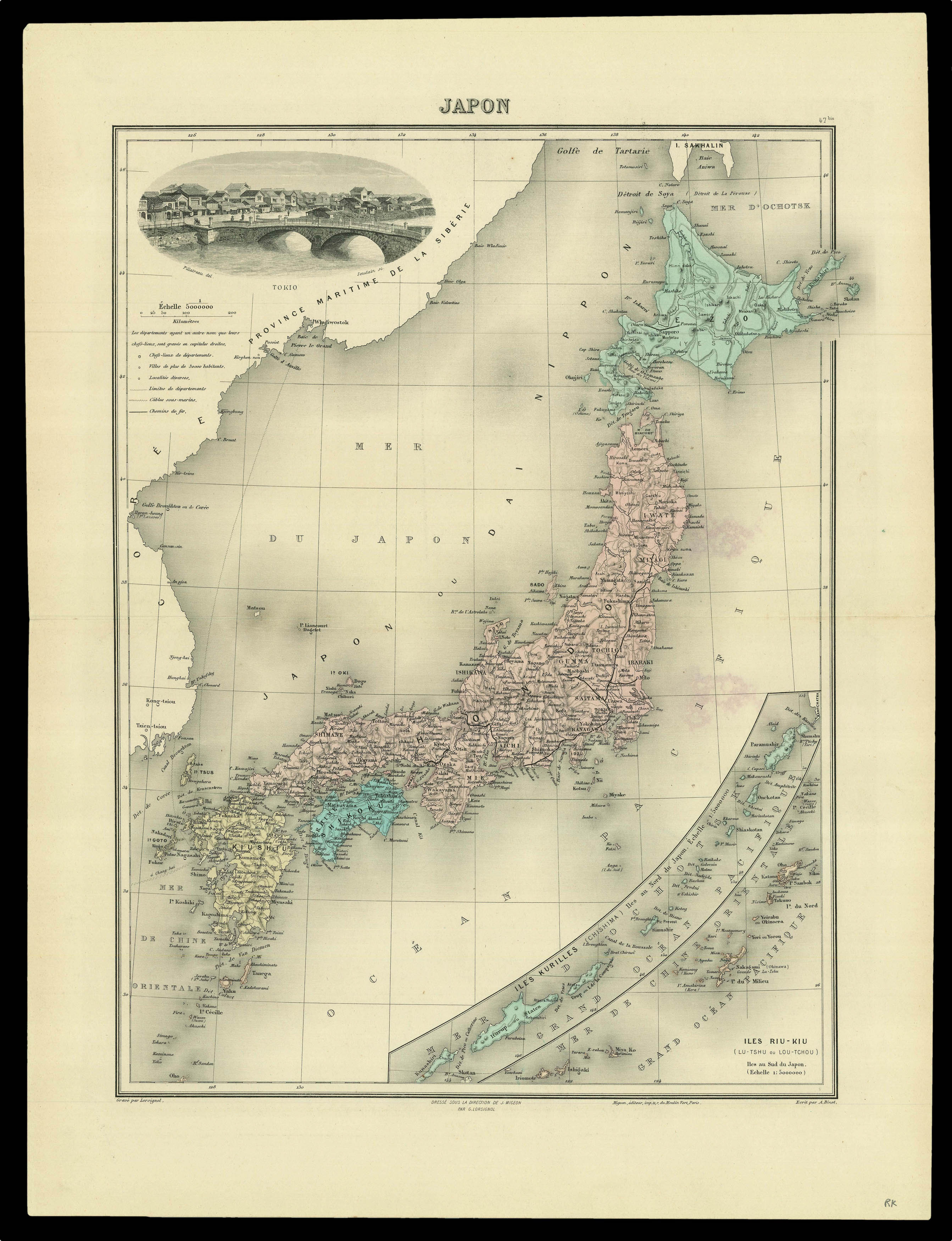 |
A map of Japan from Jean Migeon's 'Nouvel Atlas Illustre Geographie Universelle'
1 x
£60
|
£60 |
|
£60 |
|
× |
![[ARROWSMITH, Aaron] Japon.](https://omega.crouchrarebooks.com/wp-content/uploads/2025/03/15836_1H.jpg) |
Map of Japan drawn after Aaron Arrowsmith
1 x
£100
|
£100 |
|
£100 |
|
× |
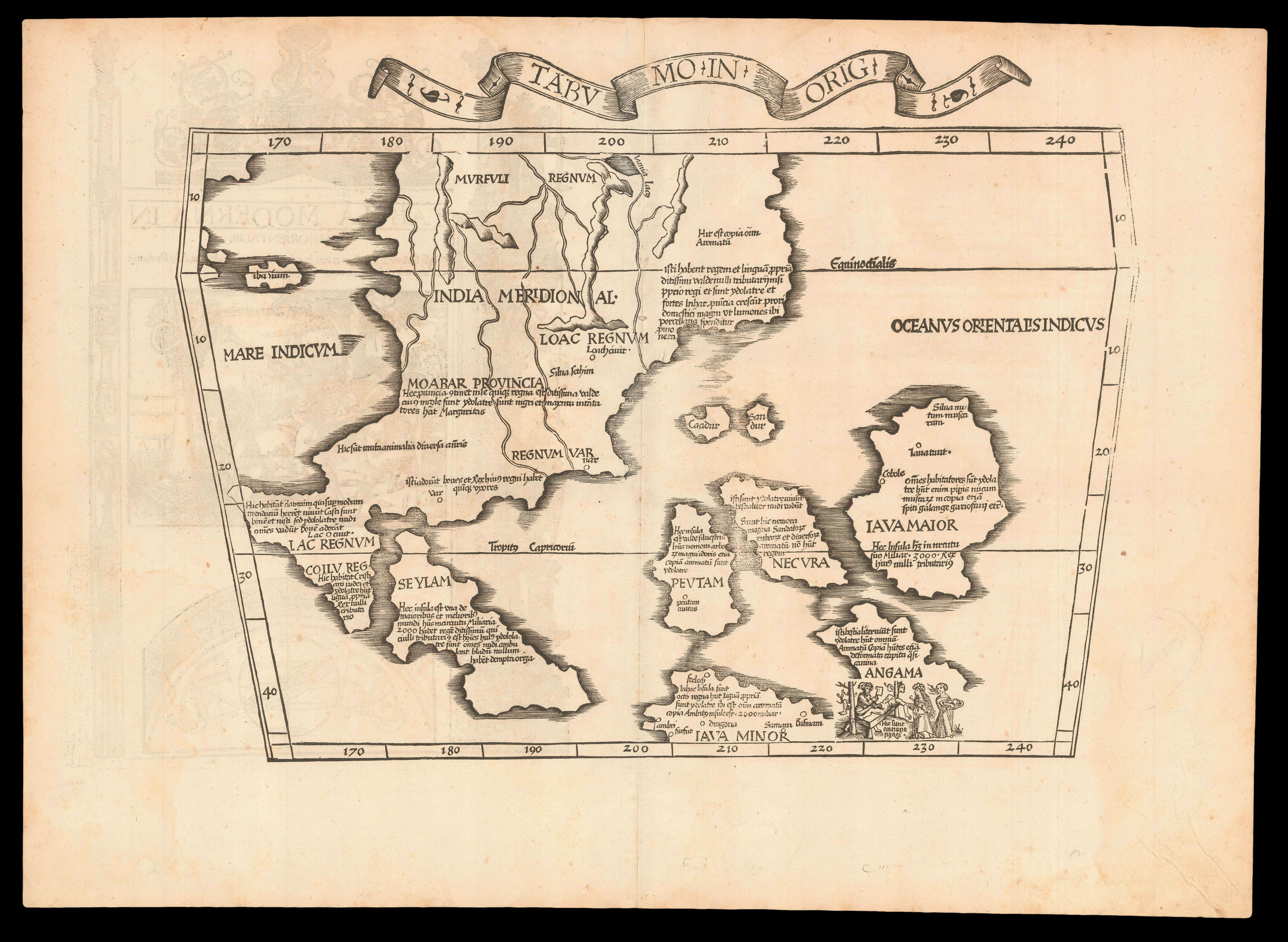 |
"The first printed map of European origin devoted to Southeast Asia and its islands" (Suarez)
1 x
£7,200
|
£7,200 |
|
£7,200 |
|
× |
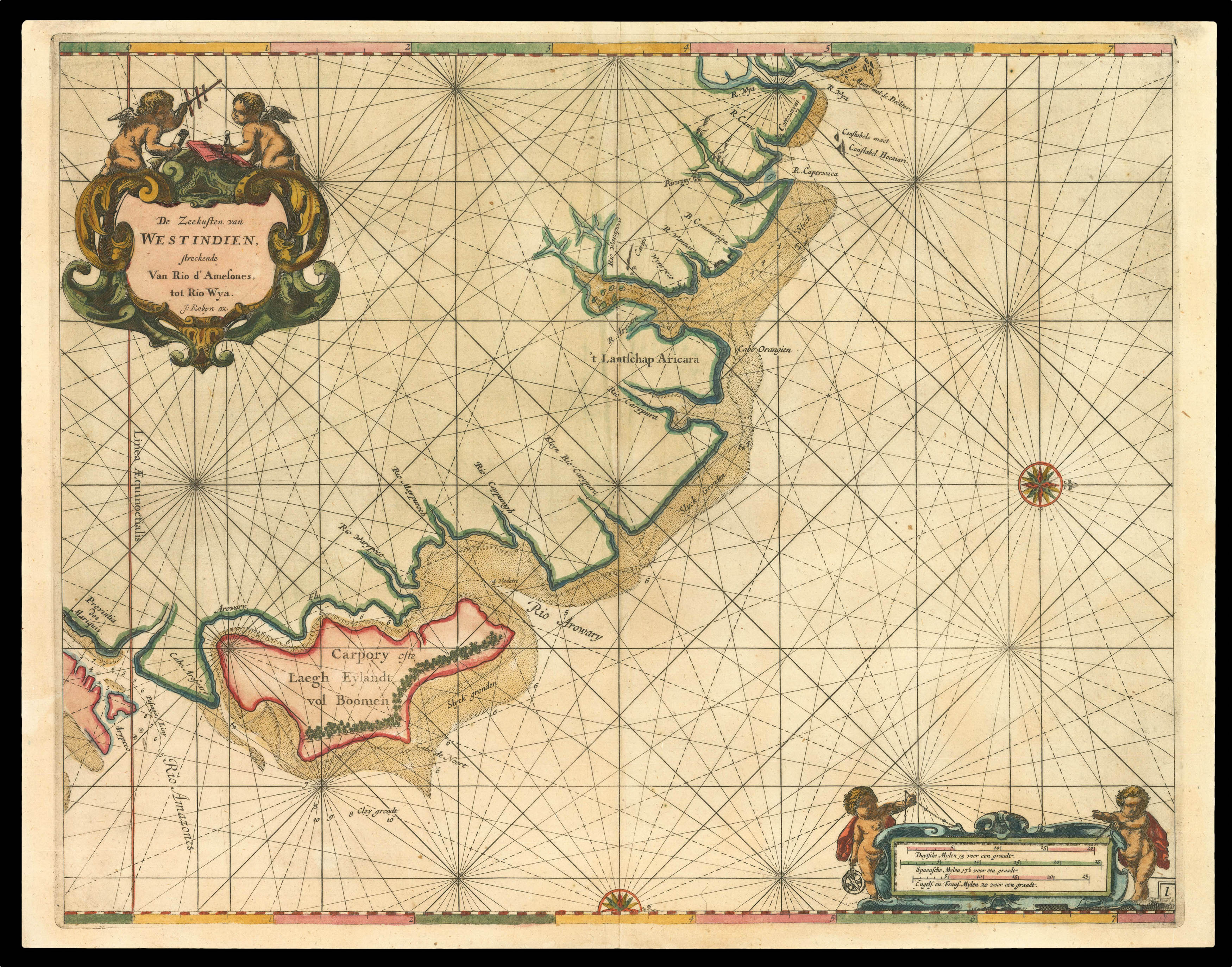 |
This first large scale printed chart of Brazil and the Amazon
1 x
£2,500
|
£2,500 |
|
£2,500 |
|
× |
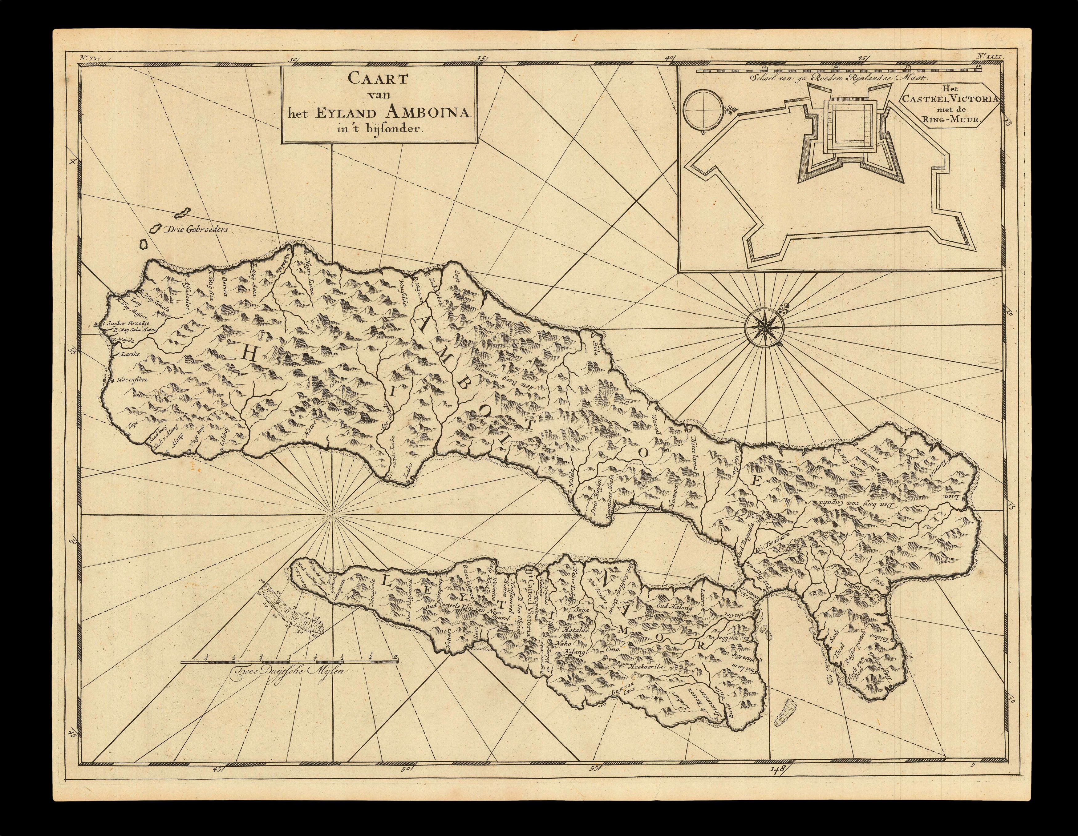 |
Early headquarters of the VOC in Southeast Asia
1 x
£370
|
£370 |
|
£370 |
|
|


