No products in the basket.
Return to shop
Speed’s view of the world
By SPEED, John, [1631].
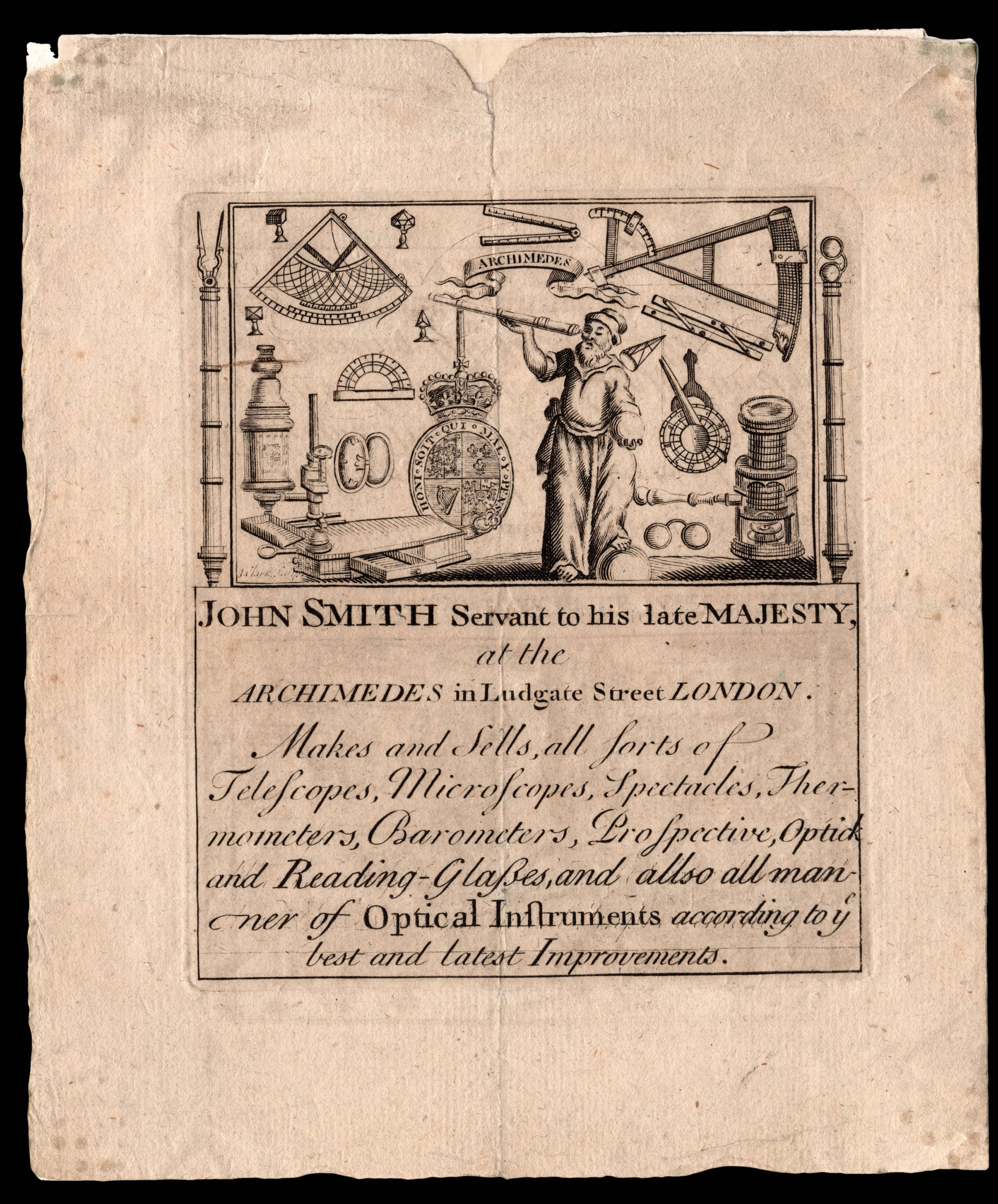
Optical navigational and mapping instruments made and sold
By SMITH, John, [after 1727].
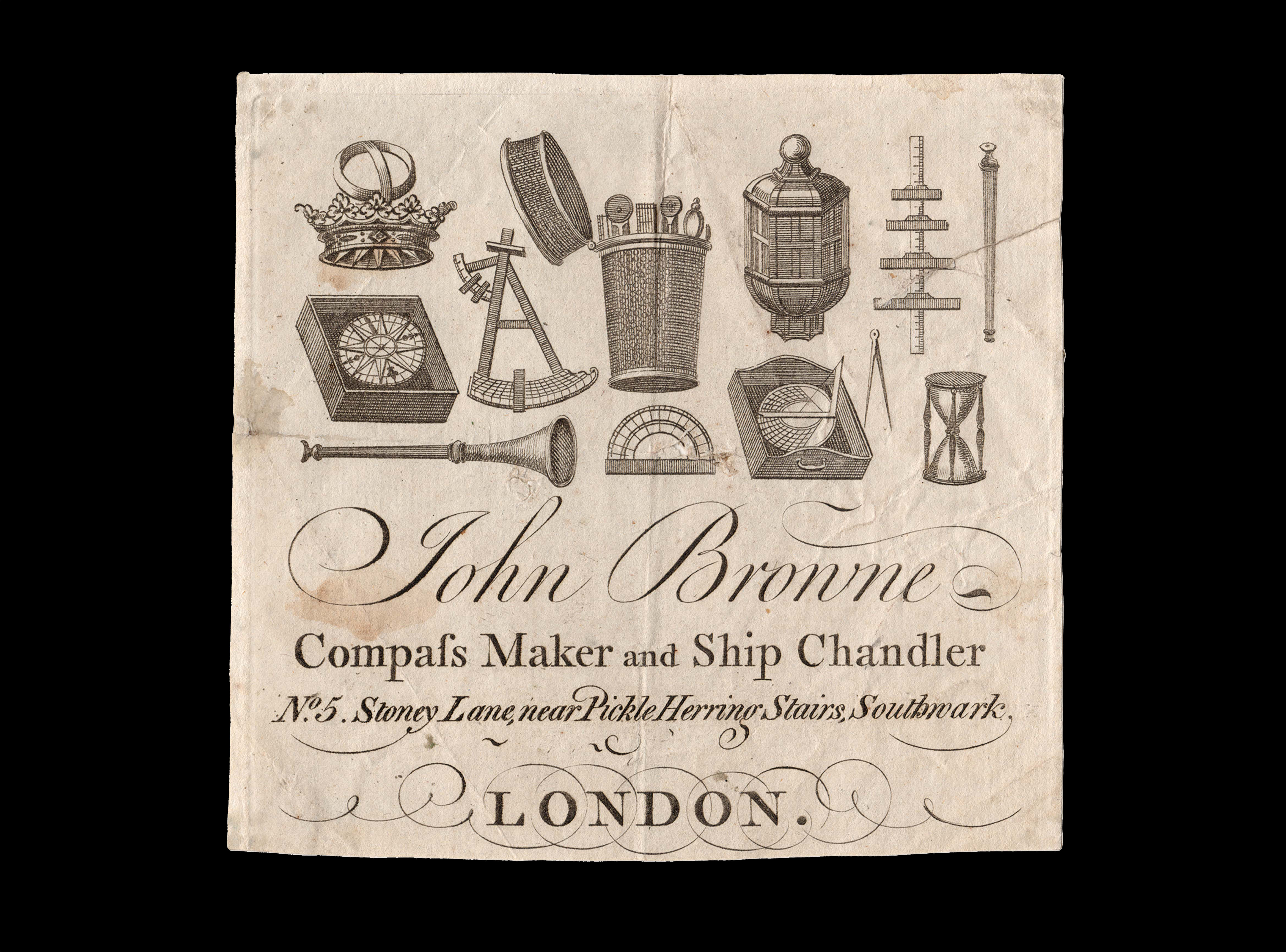
Offering “All Sorts of Instruments for Sea and Land”
By BROWNE, John, [before 1750].
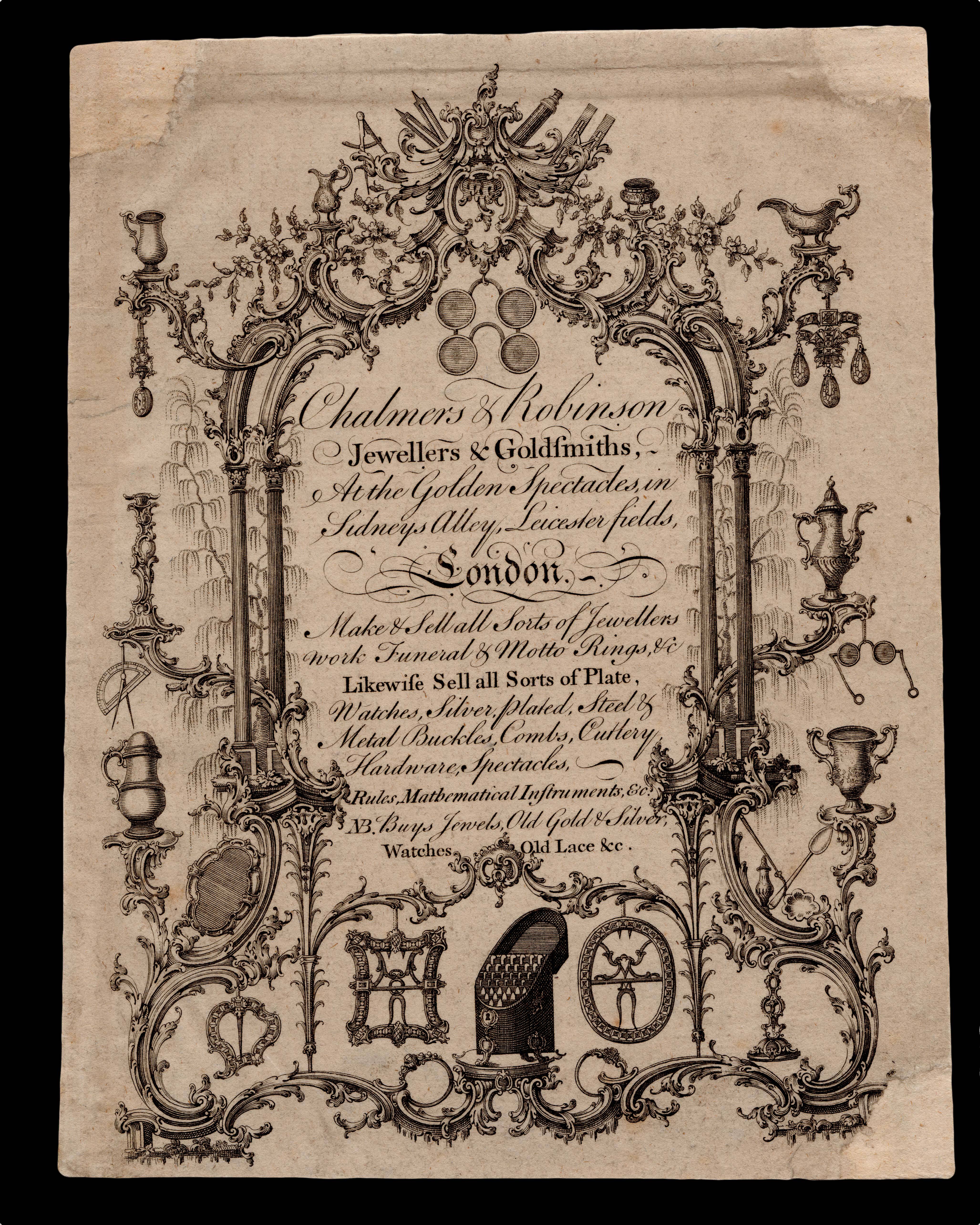
M is for Metal Worker
By CHALMERS, George; and ROBINSON, [from 1773]
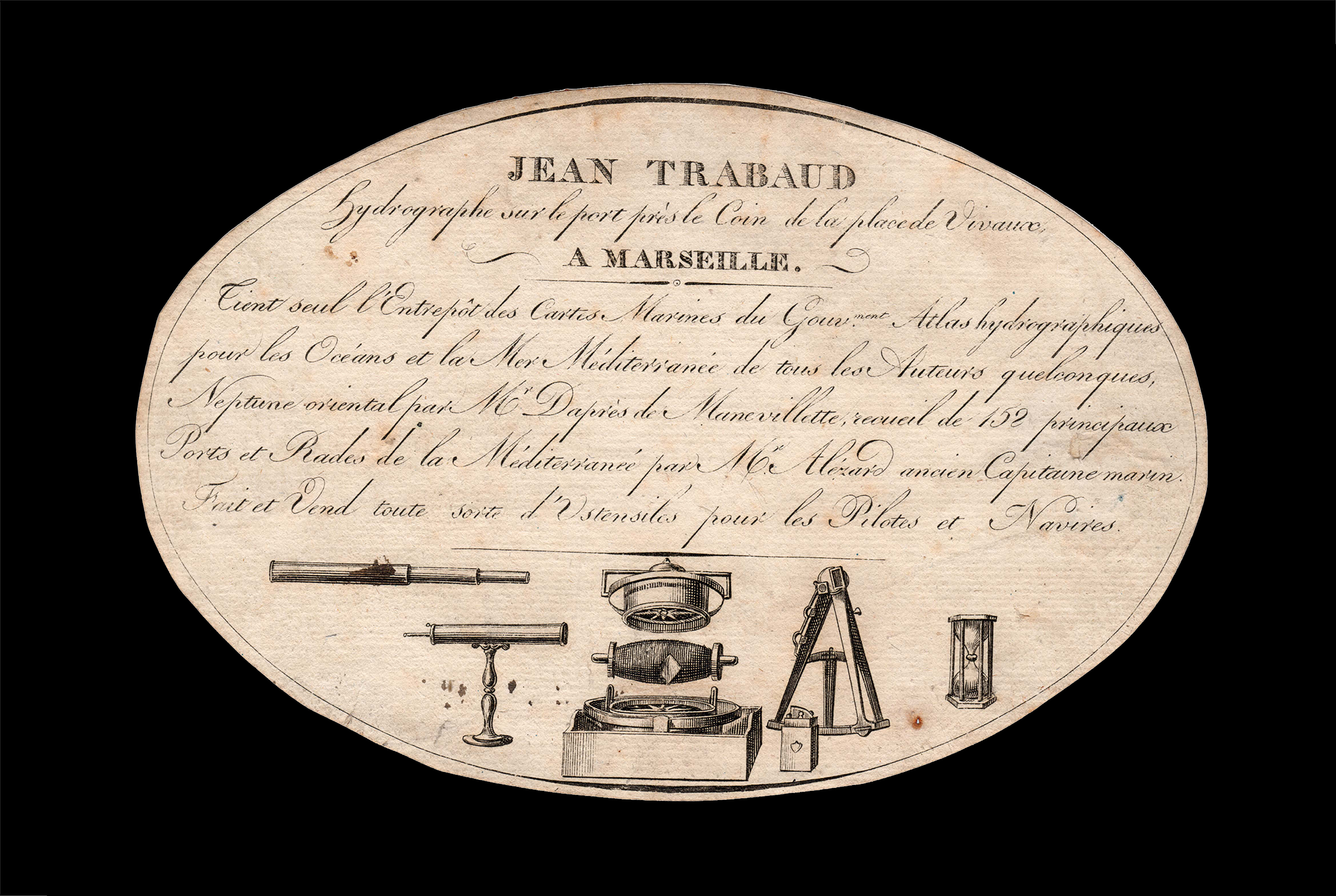
Charts of the Mediterranean for sale
By TRABAUD, Jean, [after 1781].
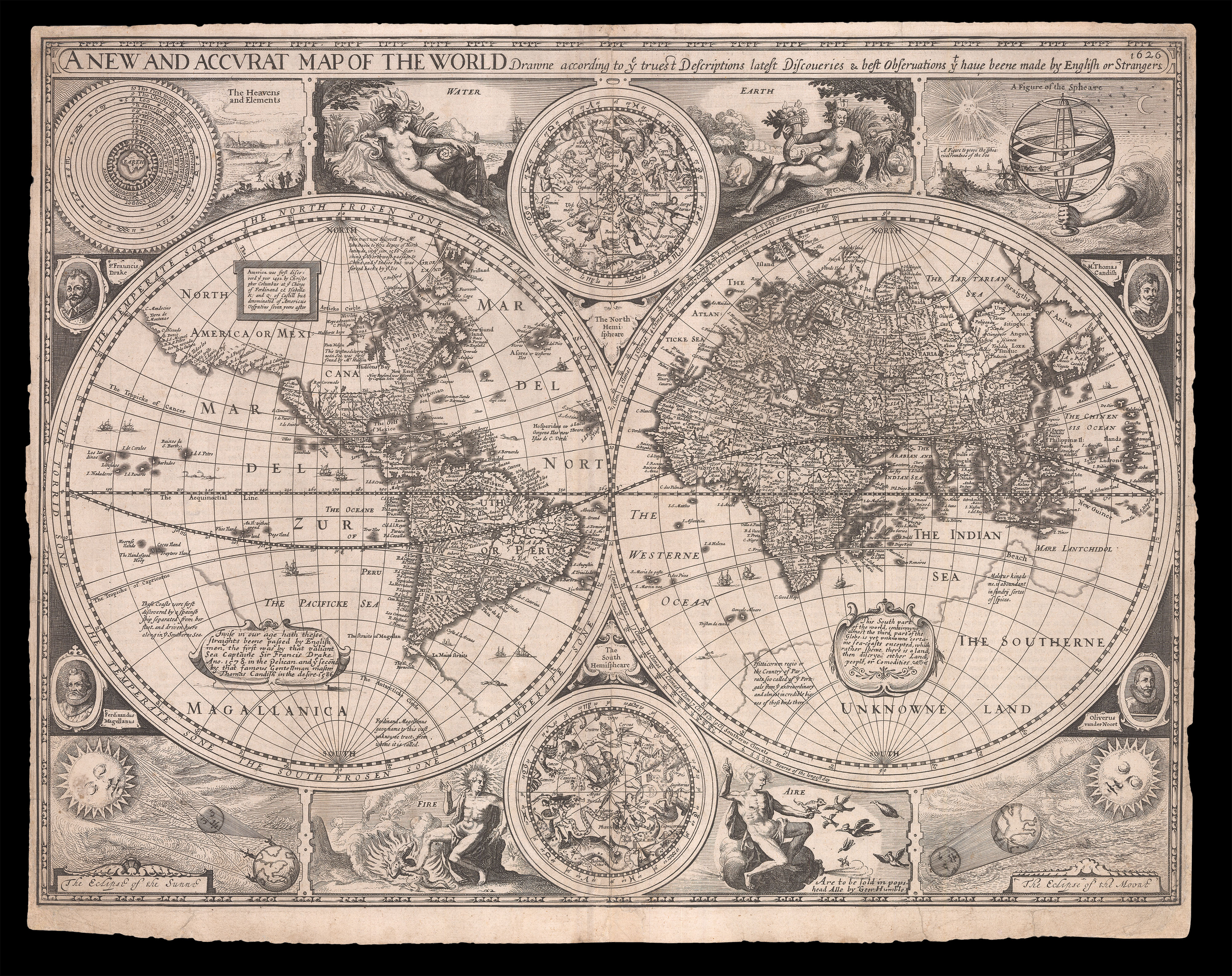
The first world map in a world atlas compiled and published by an Englishman
By SPEED, John, 1626 [but 1627-1632].
X is for Xylophone-maker
By SMART, Geo[rge], [c1770-1793].
Username or email address *Required
Password *Required
Remember me Log in
Lost your password?
Email address *Required
A link to set a new password will be sent to your email address.
Your personal data will be used to support your experience throughout this website, to manage access to your account, and for other purposes described in our privacy policy.
Register


![SPEED, John [Set of the world and continents]](https://omega.crouchrarebooks.com/wp-content/uploads/2025/03/11414_1H.jpg)
![SMART, Geo[rge] Geo. Smart, Musical Instrument Maker,...](https://omega.crouchrarebooks.com/wp-content/uploads/2025/03/17937_1H.jpg)