Rare Maps

Rare Atlases

Rare Books

Rare Prints

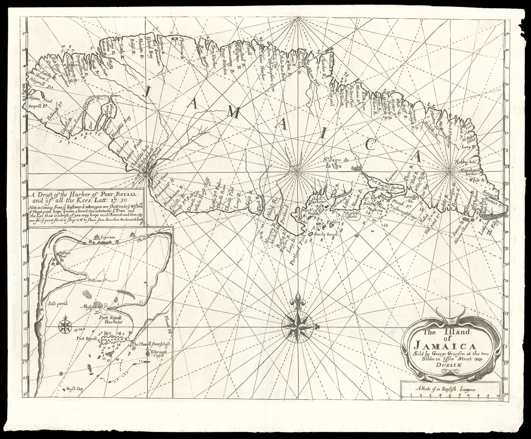
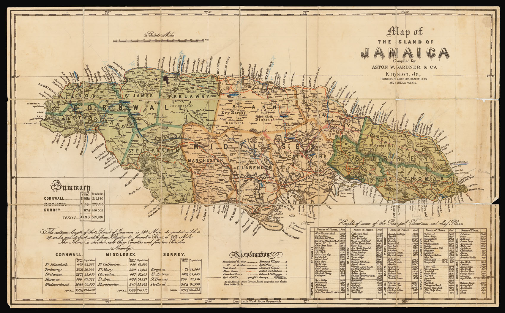
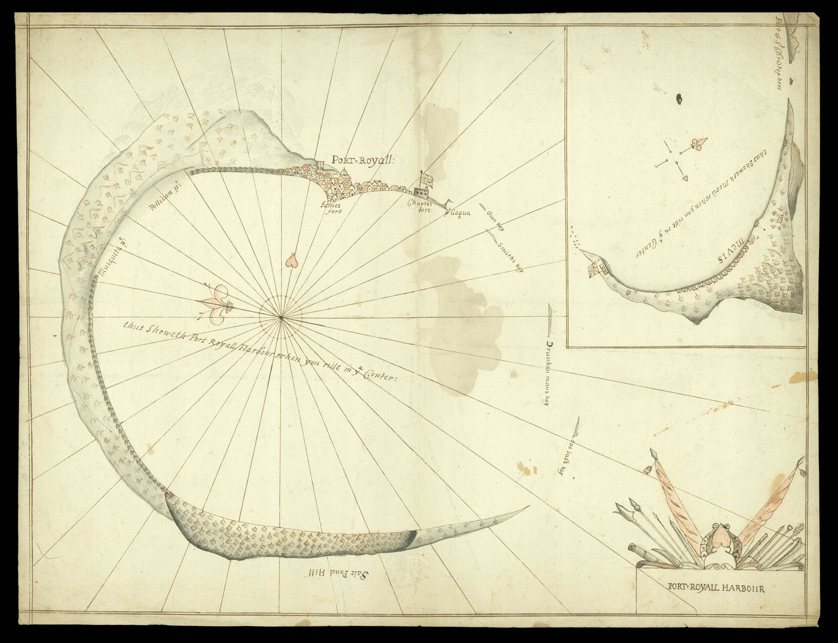
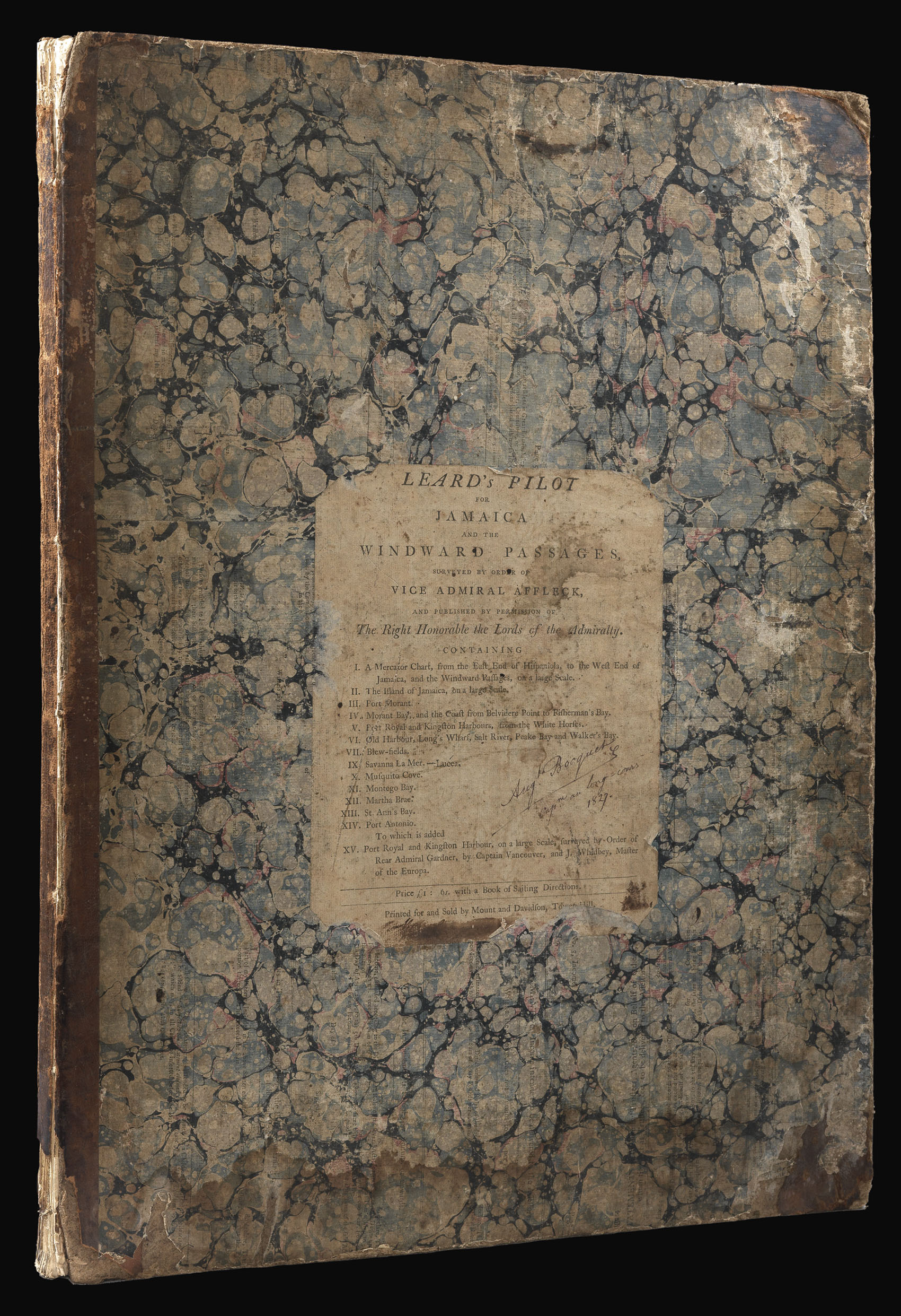
![[Various authors] [Admiralty charts of Jamaica]](https://omega.crouchrarebooks.com/wp-content/uploads/2025/03/11674_1H.jpg)

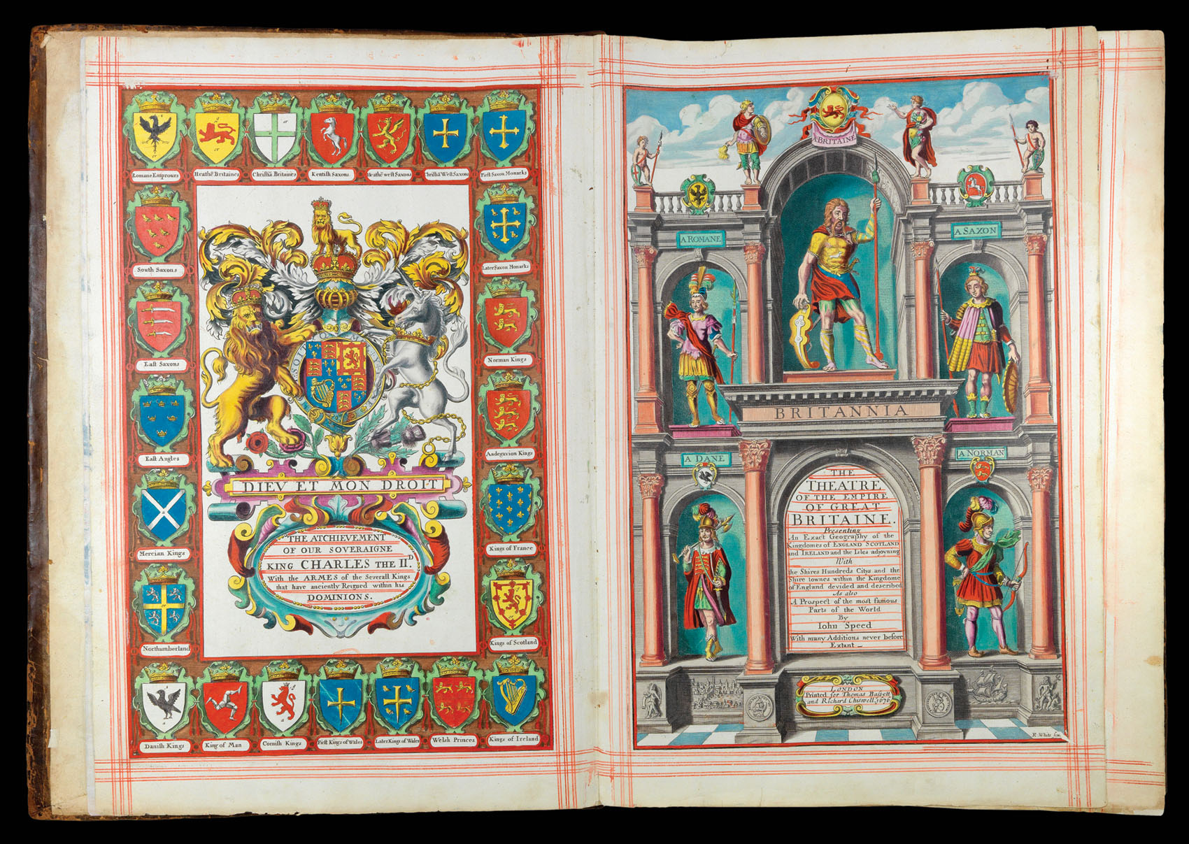
By SPEED, John, 1676
By BISHOP, Captain Robert; John STEPHENSON; and Robert SAYER, [?c.1796].