No products in the basket.
Return to shop
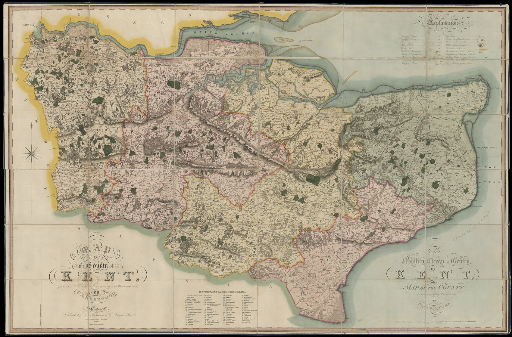
A fine set of Greenwood’s large-scale county maps
By GREENWOOD, Christopher, 1818-1831.
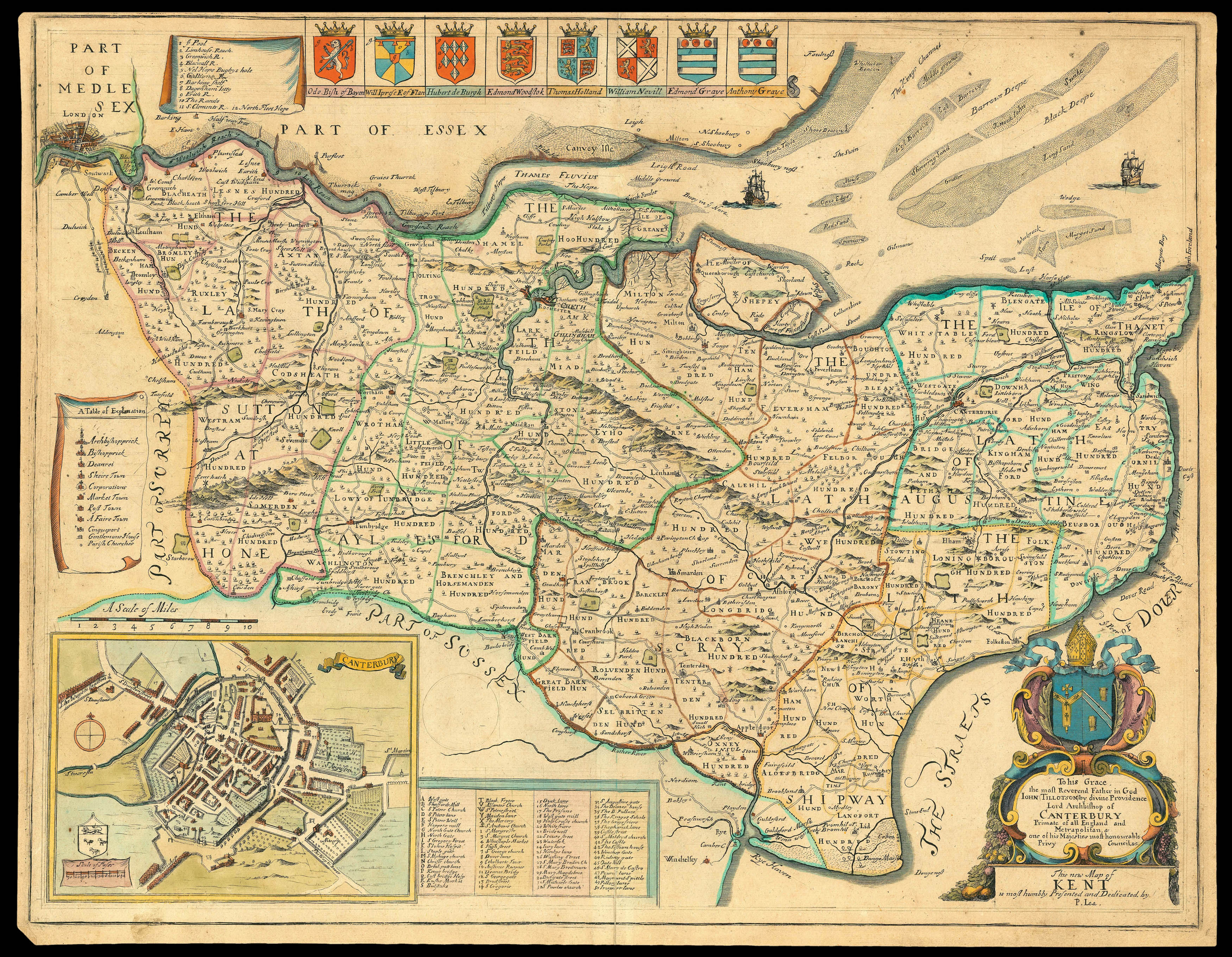
Ogilby and Morgan’s rare map of Kent
By MORGAN, William and John OGILBY, [c1689].
Rare survey of Sandwich in Kent
By LABELYE, Charles, 1744
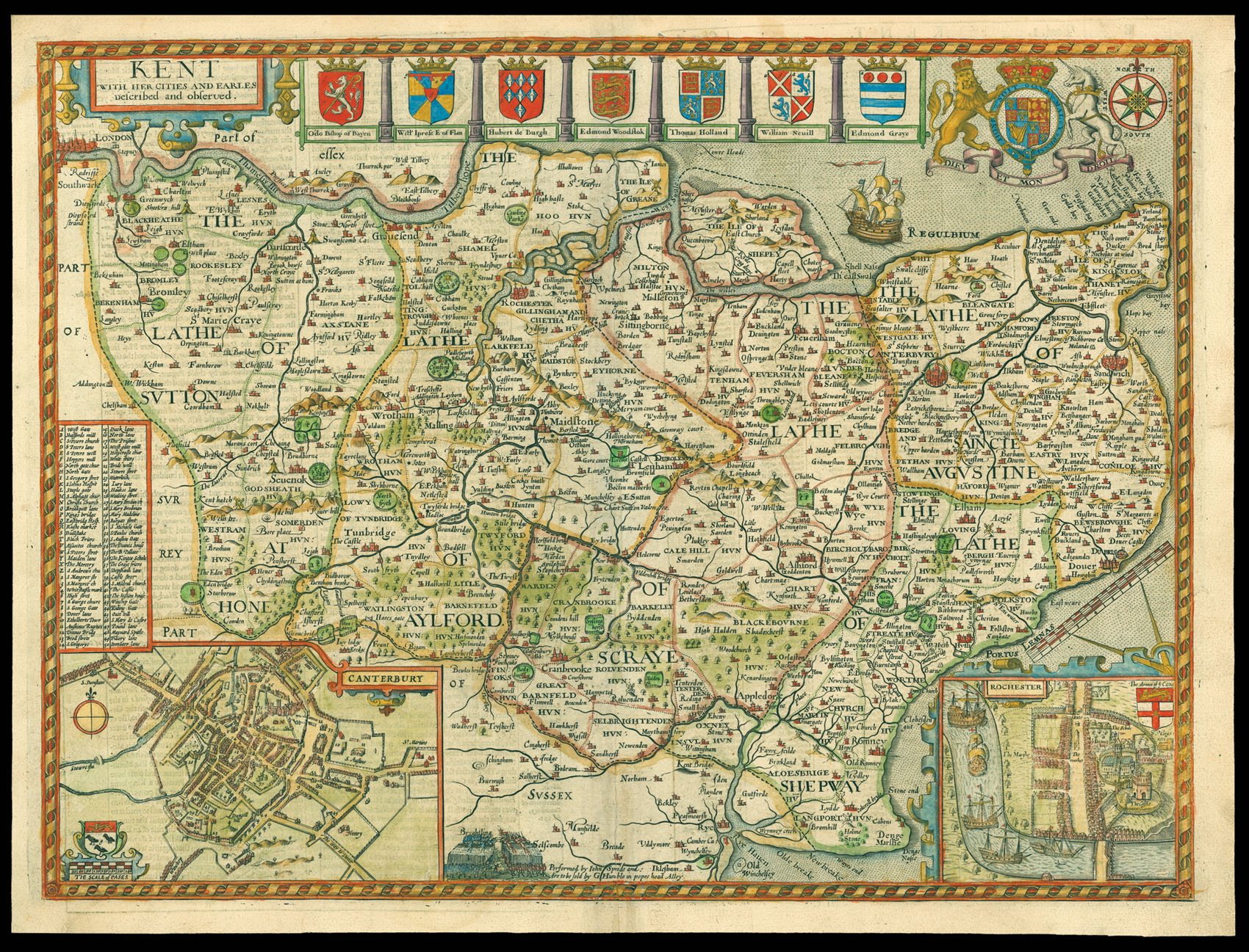
Speed’s map of Kent
By SPEED, John, [1627].
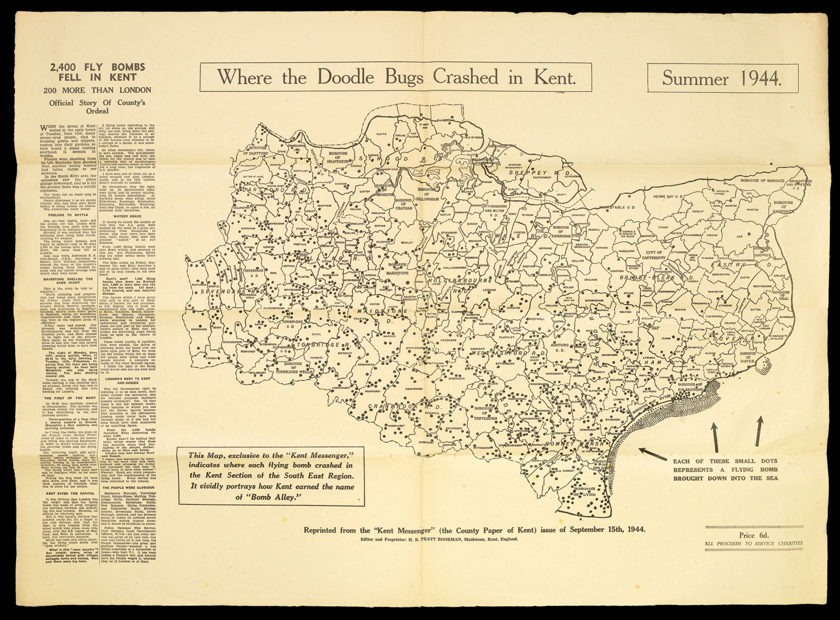
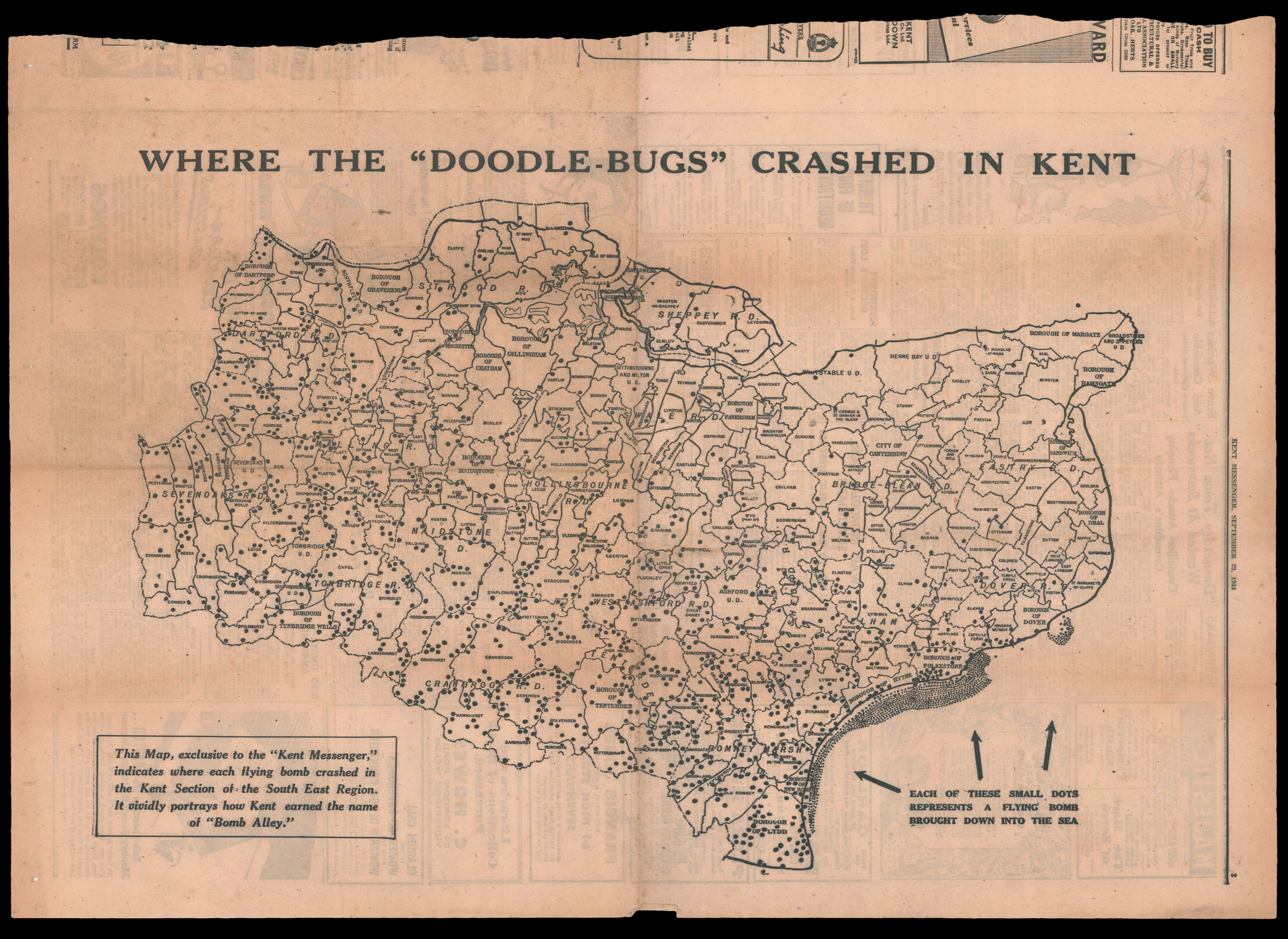
“Where the Doodle Bugs Crashed”
By The Kent Messenger, 1944
Greenwood’s large-scale map of Kent
By GREENWOOD, Christopher, July 19th, 1821.
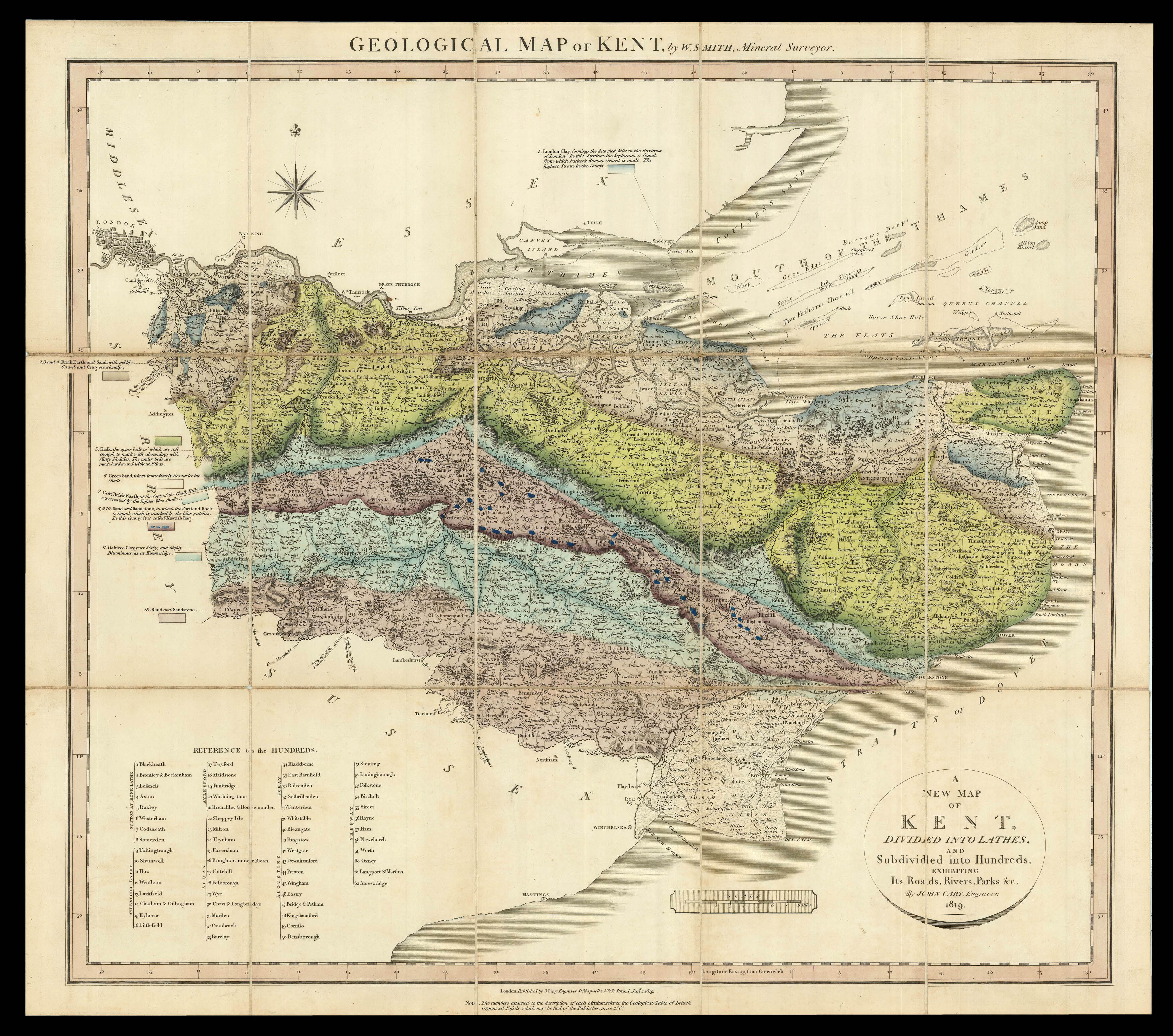
Smith’s rare geological survey of Kent
By SMITH, William, January 1st, 1819.
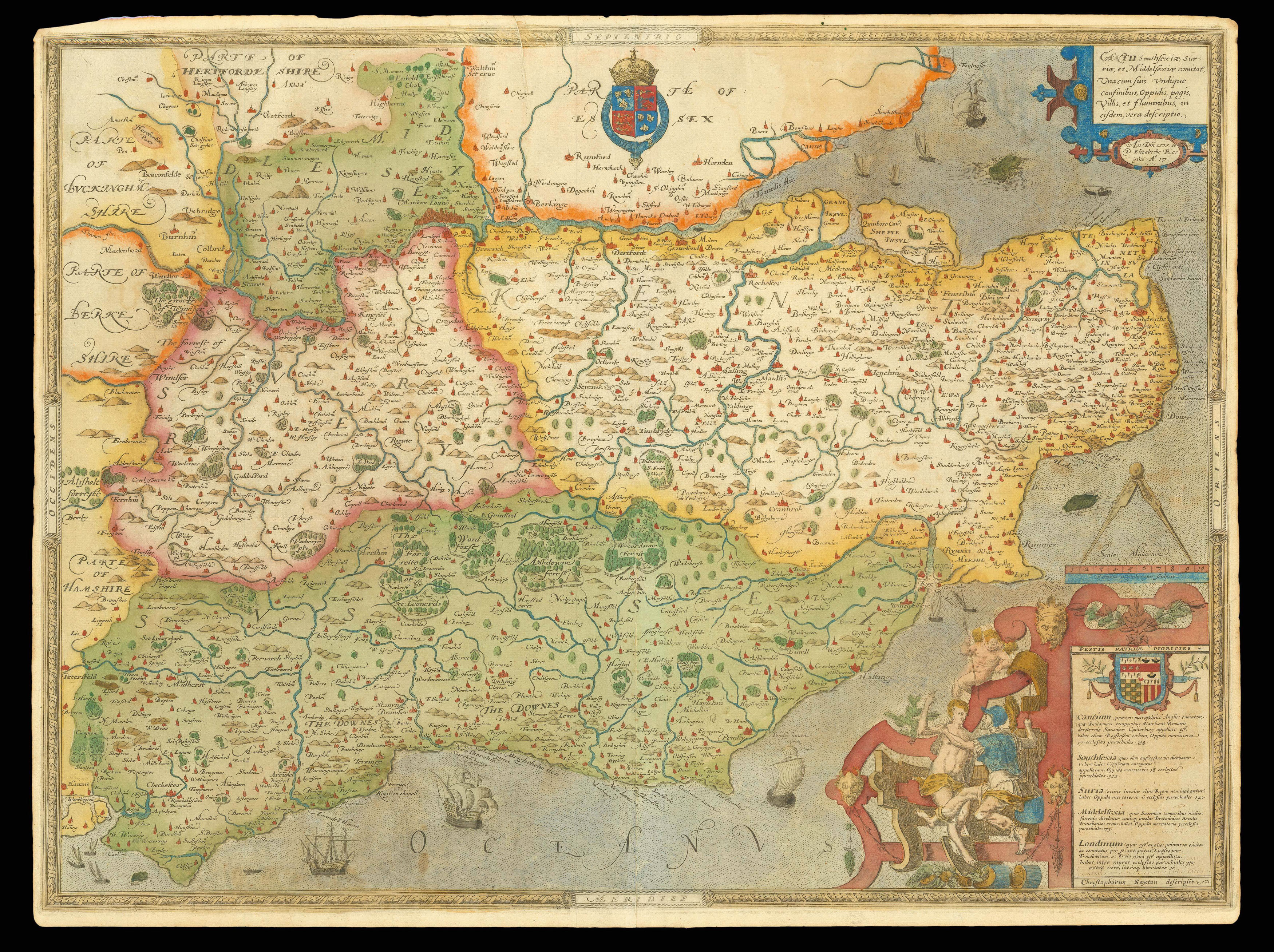
The first printed map of Kent, Sussex, Middlesex and Surrey
By SAXTON, Christopher, 1579
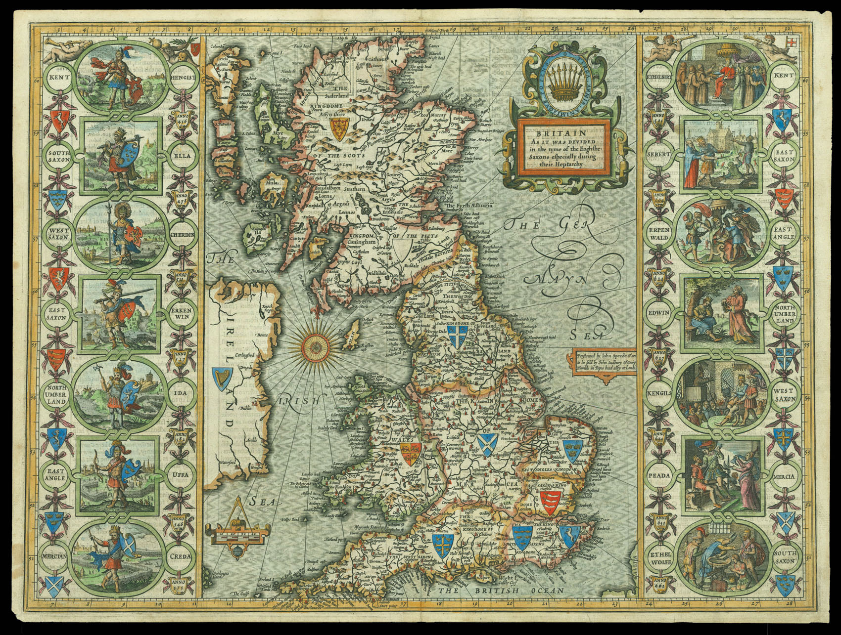
Speed’s map of Britain during the Heptarchy
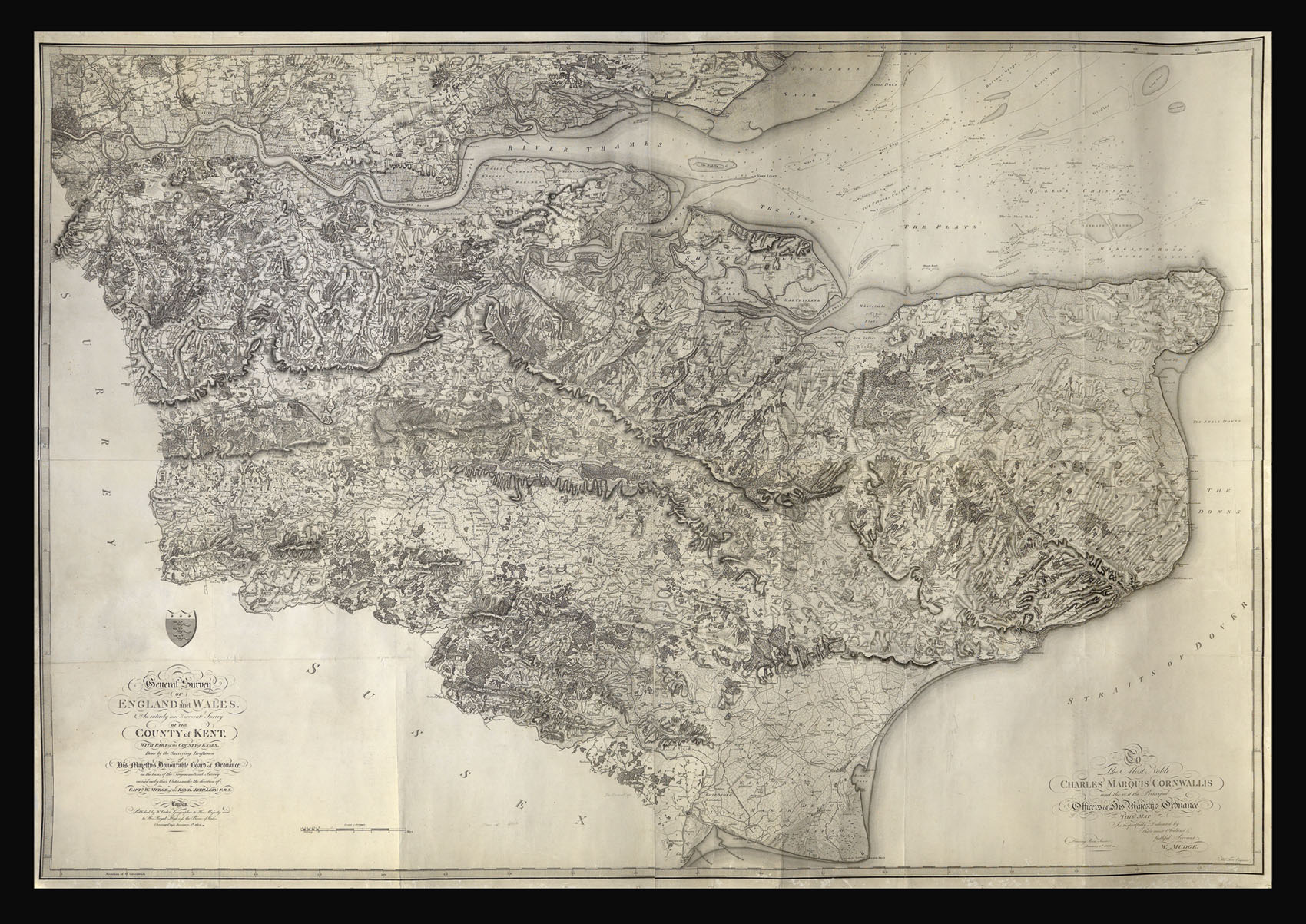
Kent
By MUDGE, Captain William, 1801
Username or email address *Required
Password *Required
Remember me Log in
Lost your password?
Email address *Required
A link to set a new password will be sent to your email address.
Your personal data will be used to support your experience throughout this website, to manage access to your account, and for other purposes described in our privacy policy.
Register


![GREENWOOD, Christopher [Collection of Greenwood's Large Scale County Maps].](https://omega.crouchrarebooks.com/wp-content/uploads/2025/03/1160_1H.jpg)
![LABELYE, Charles [Kent] A Mapp of the Downes](https://omega.crouchrarebooks.com/wp-content/uploads/2025/03/11318_1H.jpg)