|
× |
![[GREENOUGH, George Bellas] A Geological Map of England and Wales](https://omega.crouchrarebooks.com/wp-content/uploads/2025/03/12588_1H.jpg) |
Rare reduction of Greenough's geological map of England and Wales
1 x
£5,000
|
£5,000 |
|
£5,000 |
|
× |
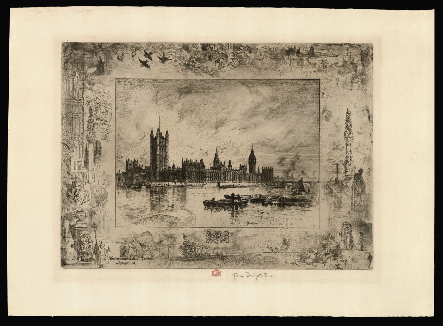 |
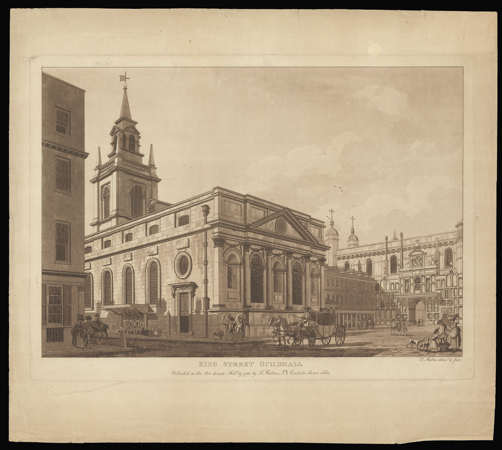
The Palace of Westminster
1 x
£3,000
|
£3,000 |
|
£3,000 |
|
× |
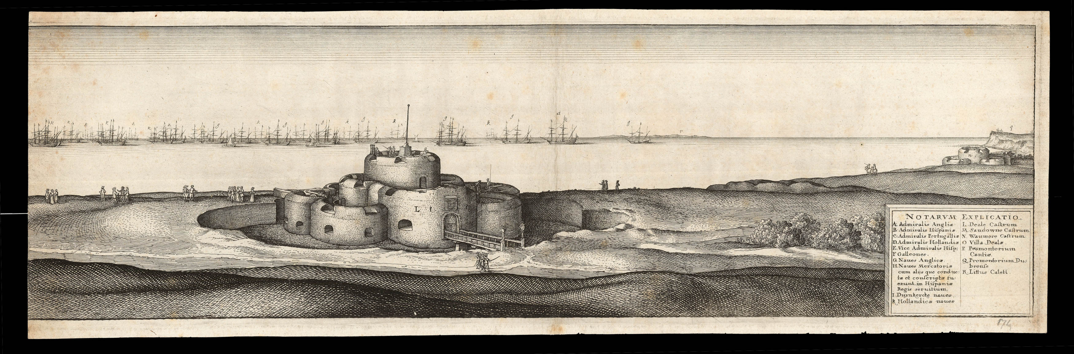 |
The Battle of the Downs
1 x
£2,000
|
£2,000 |
|
£2,000 |
|
× |
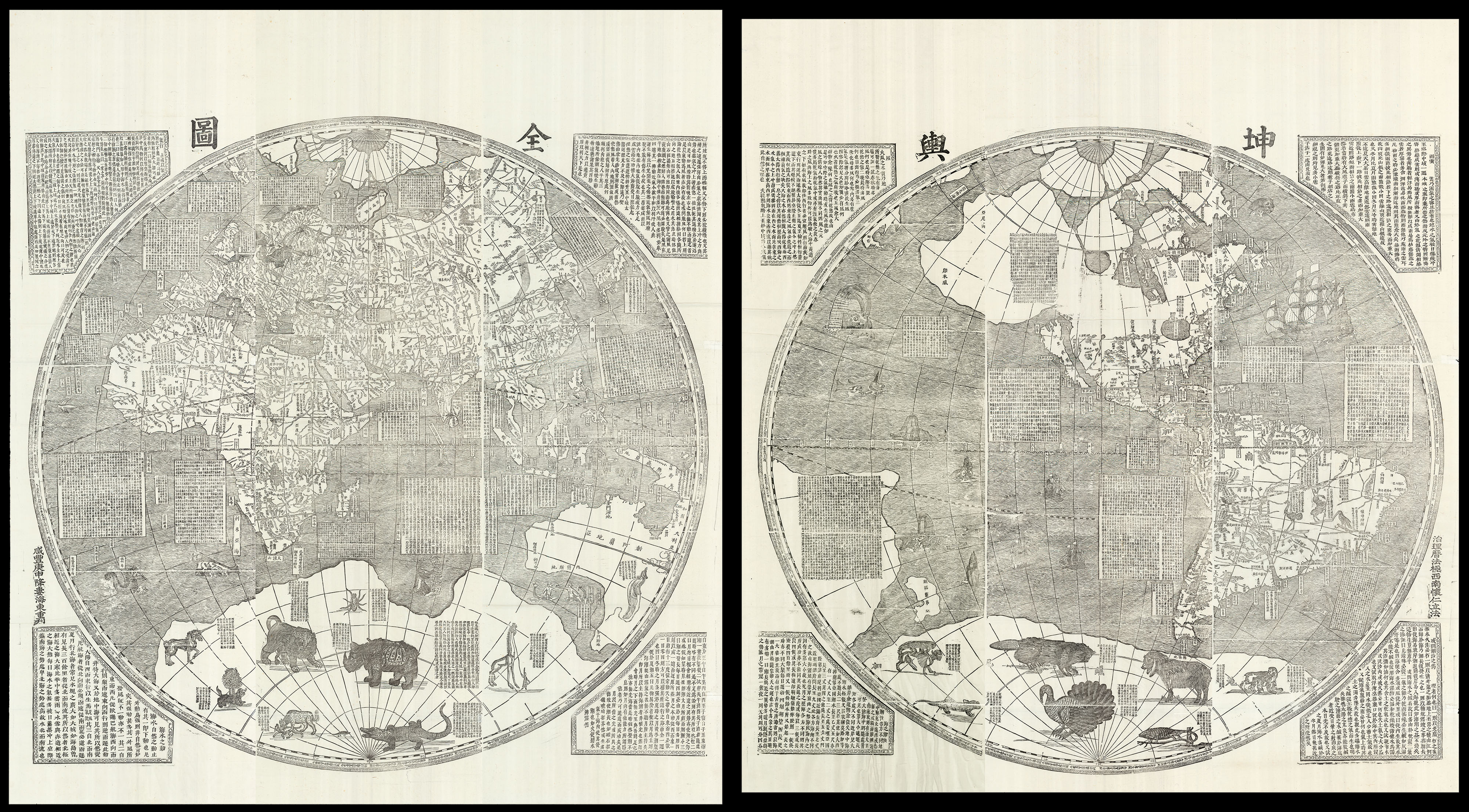 |
One of the largest world maps ever printed
1 x
£180,000
|
£180,000 |
|
£180,000 |
|
× |
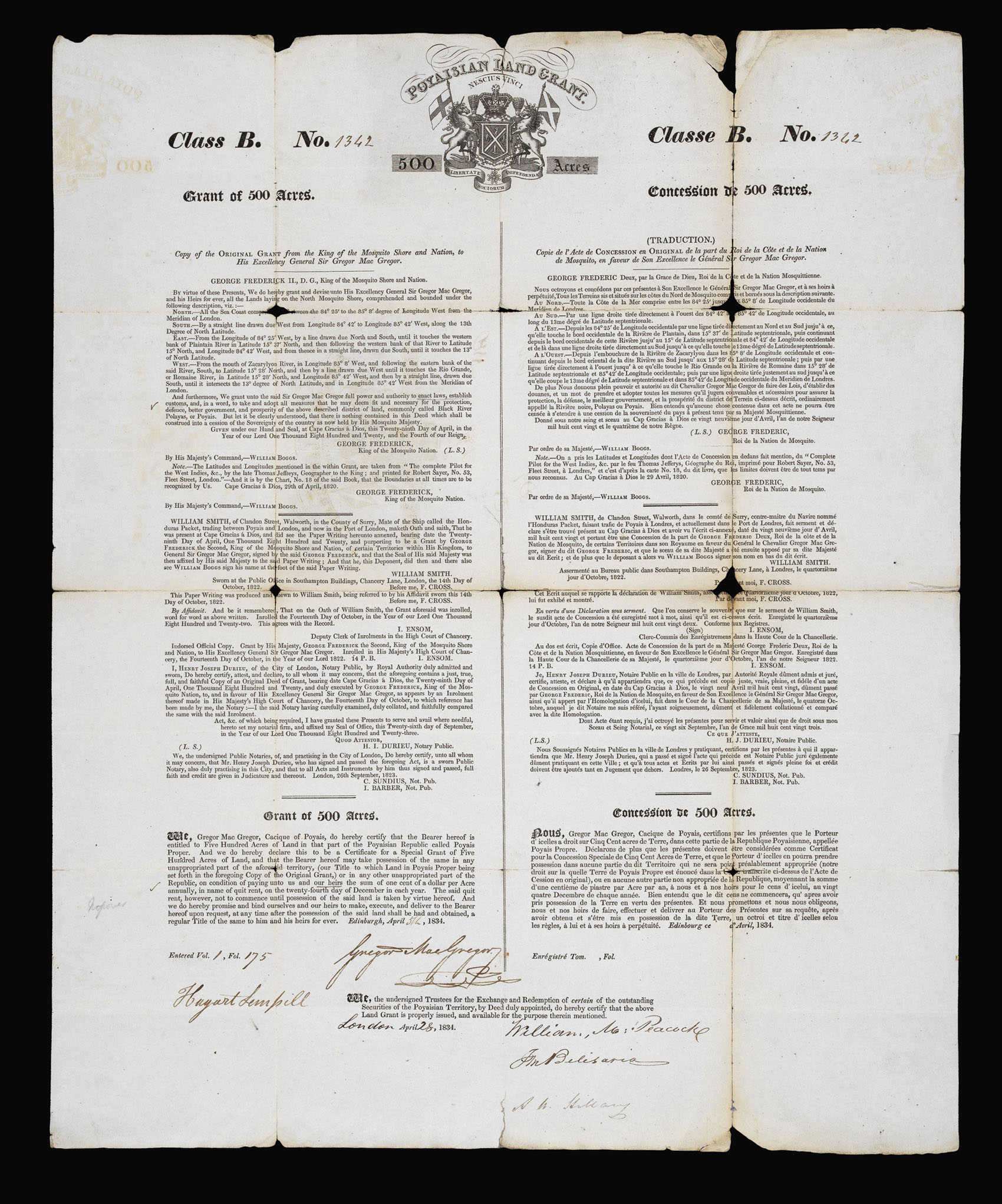 |
"The Fraud of the Prince of Poyais"
1 x
£800
|
£800 |
|
£800 |
|
× |
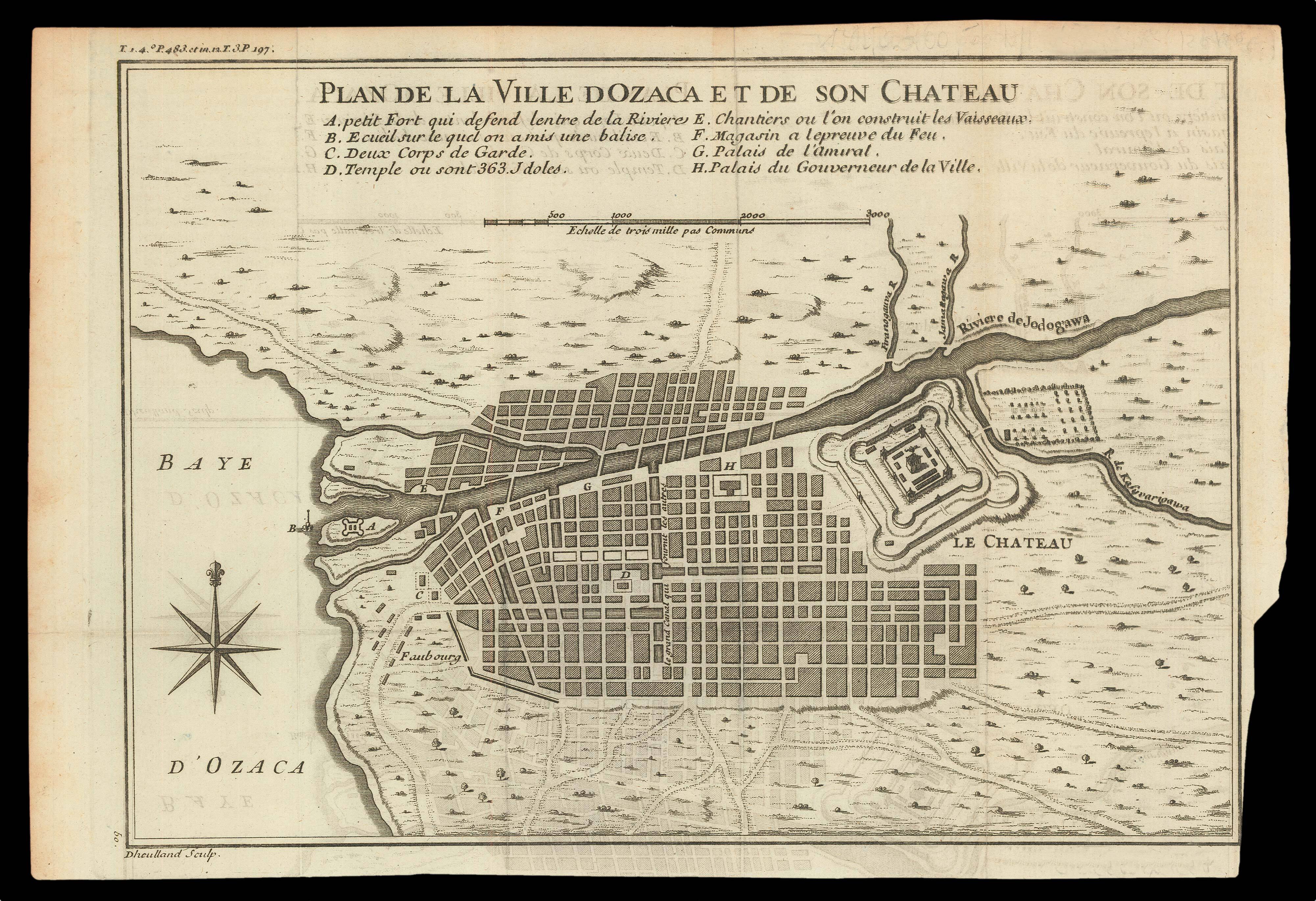 |
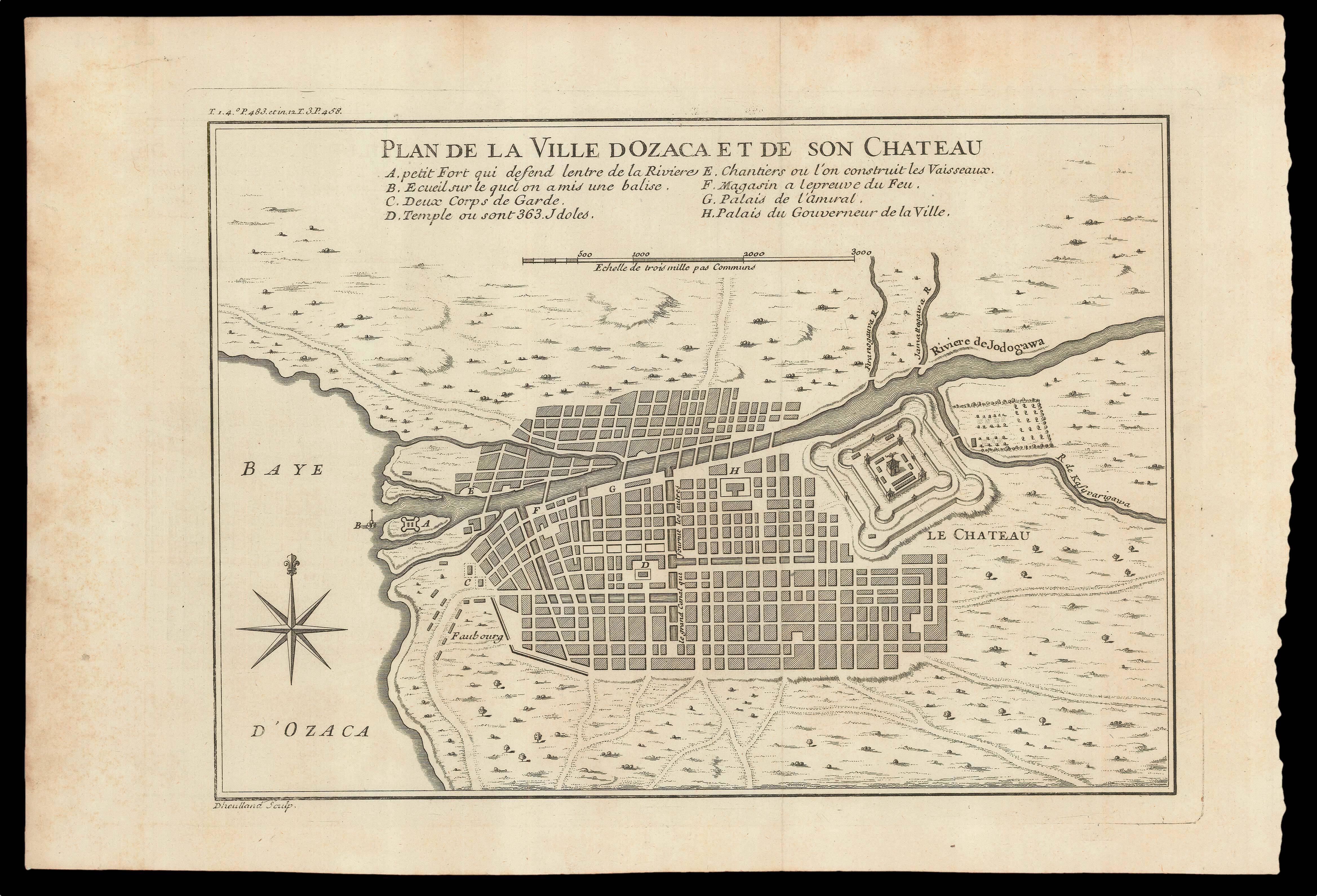
Plan of Osaka castle
1 x
£150
|
£150 |
|
£150 |
|
× |
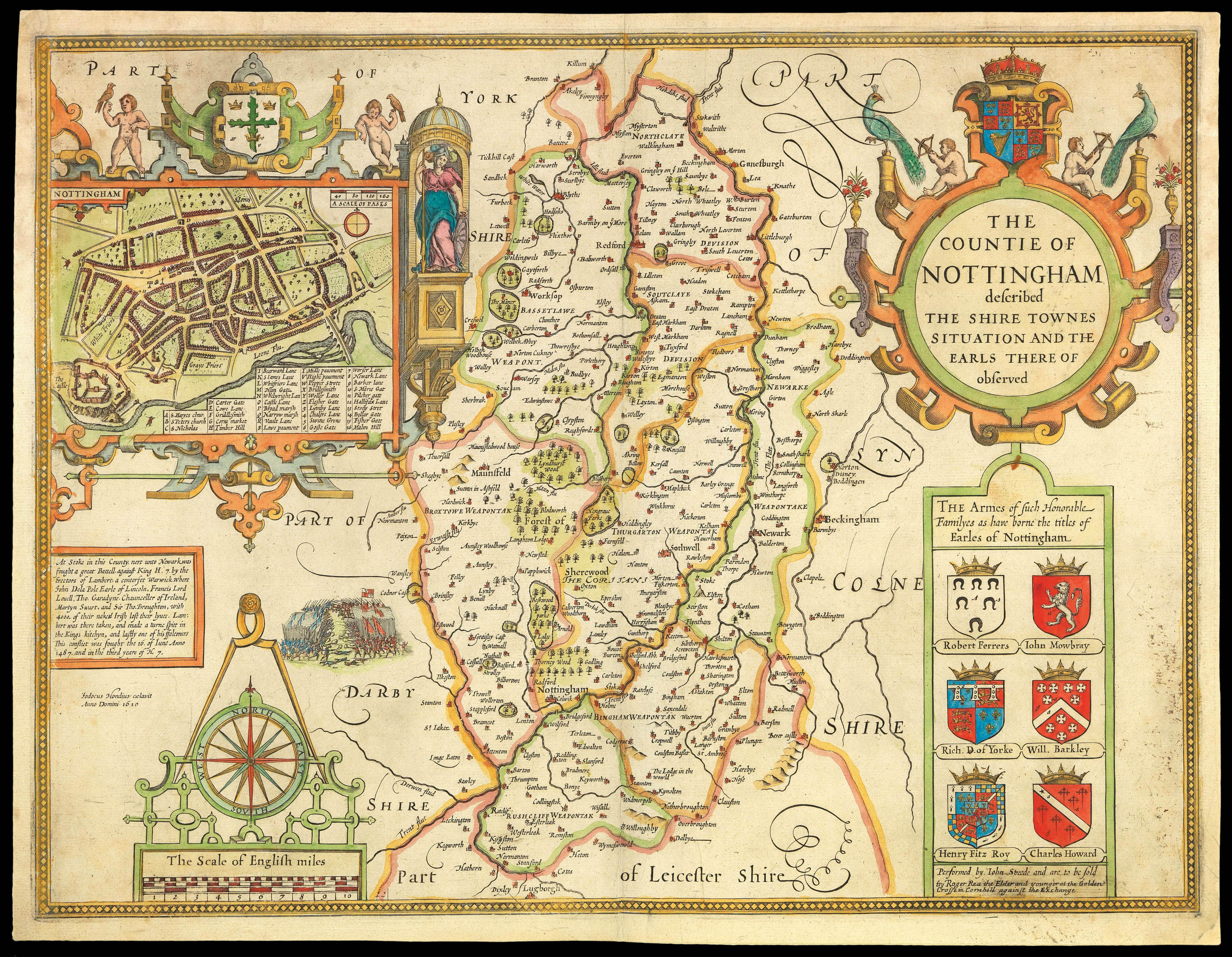 |
Rare Roger Rea edition of Speed's map of Nottinghamshire
1 x
£400
|
£400 |
|
£400 |
|
× |
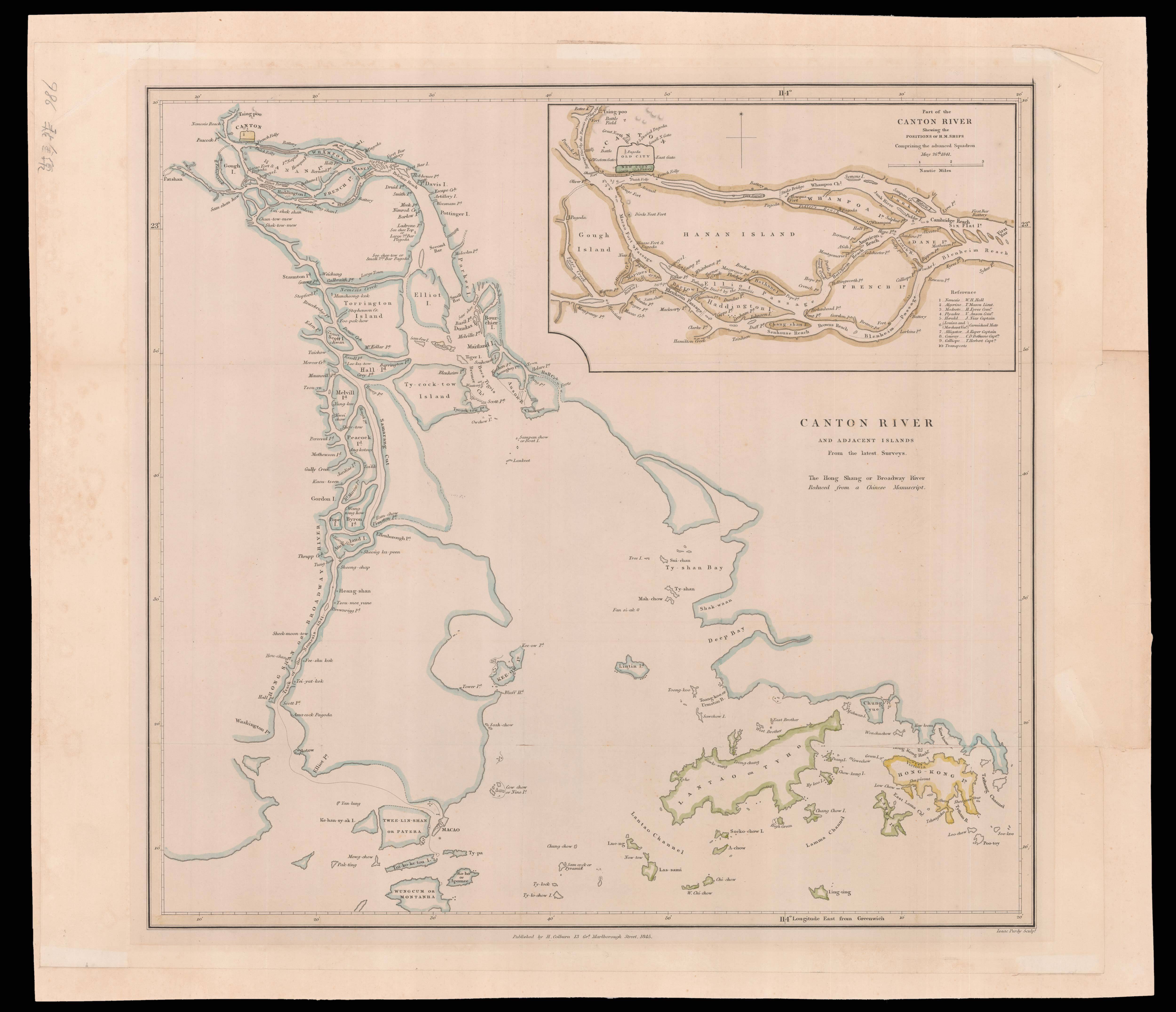 |
A map of Canton and Hong Kong by "Nemesis Hall"
1 x
£1,200
|
£1,200 |
|
£1,200 |
|
× |
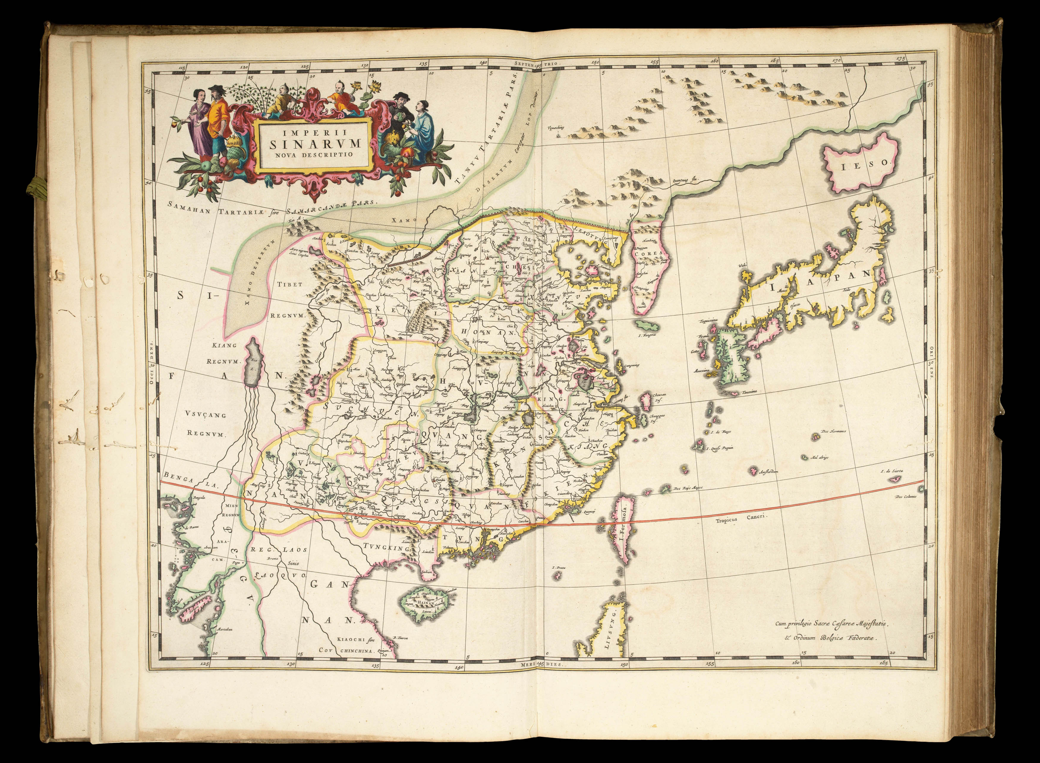 |
First atlas of China made in Europe
1 x
£35,000
|
£35,000 |
|
£35,000 |
|
× |
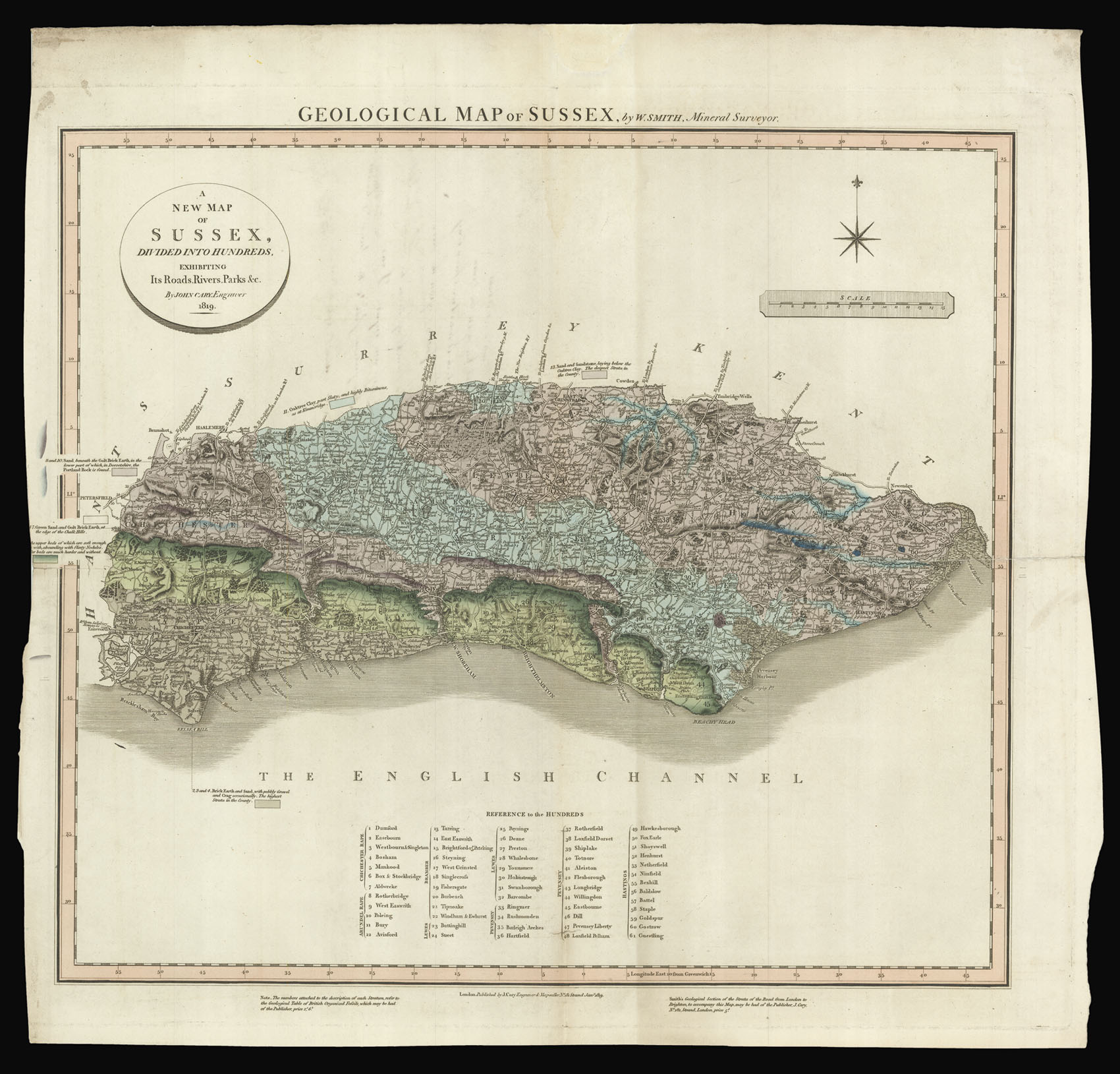 |
Smith's rare geological survey of Sussex
1 x
£10,000
|
£10,000 |
|
£10,000 |
|
× |
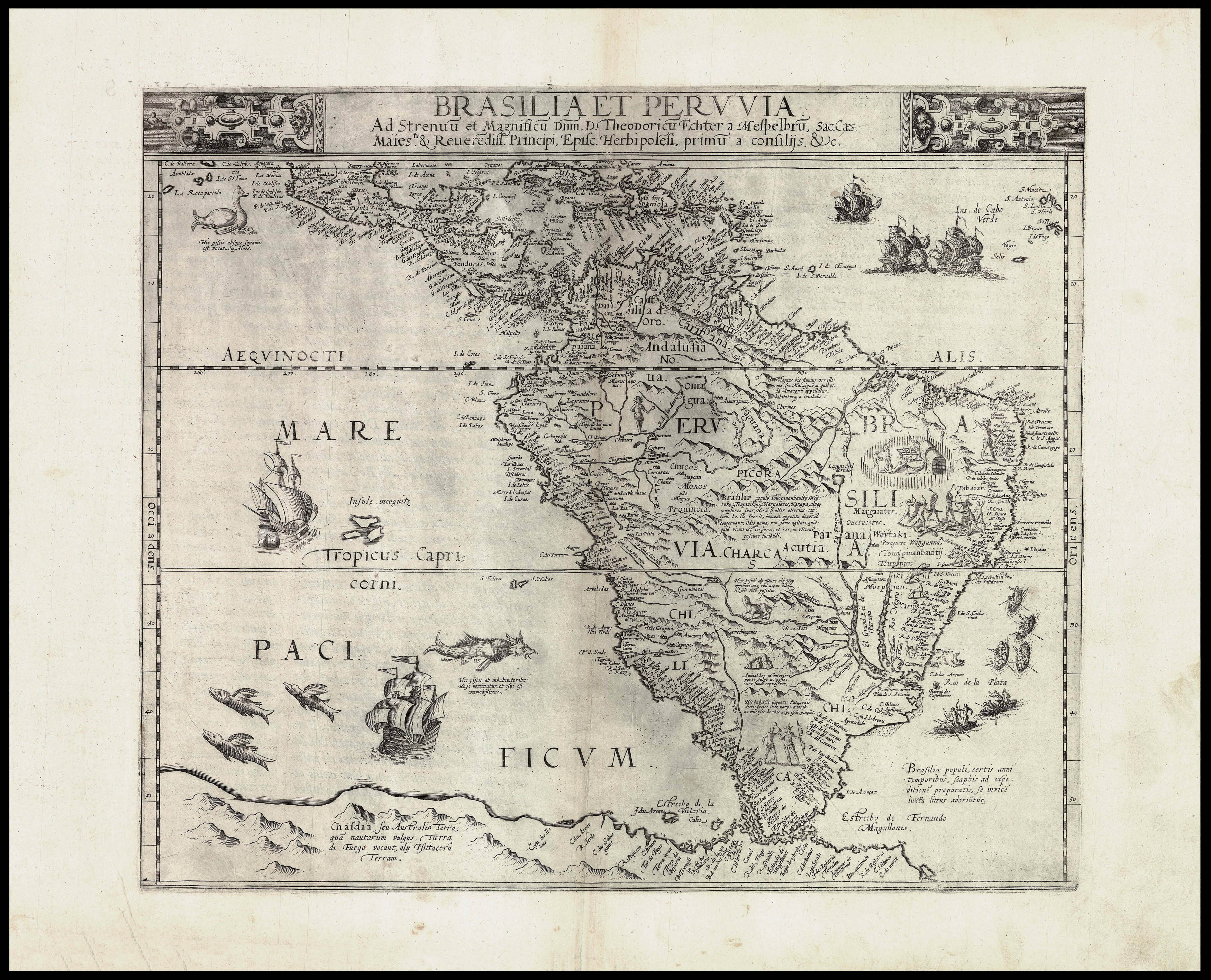 |
De Jode's map of South America
1 x
£12,000
|
£12,000 |
|
£12,000 |
|
× |
 |
"My real Master"
1 x
£4,000
|
£4,000 |
|
£4,000 |
|
× |
 |
Plan of Osaka castle
1 x
£175
|
£175 |
|
£175 |
|
× |
![[Anonymous] Attaque de Landau commencé la nuit de 24 au 25 juin et compris le 19 Aout 1713 quil a capitulé](https://omega.crouchrarebooks.com/wp-content/uploads/2025/03/11380_1H.jpg) |
Manuscript map of Landau
1 x
£2,200
|
£2,200 |
|
£2,200 |
|
× |
![HORSBURGH, James and INGLIS Sir Hugh [Two autograph letters concerning the East India Company and the War of 1812].](https://omega.crouchrarebooks.com/wp-content/uploads/2025/03/18376_1H.jpg) |
"more knowledge of the Eastern Seas than perhaps any other man"
1 x
£3,000
|
£3,000 |
|
£3,000 |
|
× |
![[BUHOT, Félix] Westminster Palace; Westminster Clock Tower.](https://omega.crouchrarebooks.com/wp-content/uploads/2025/03/12352_1H.jpg) |
A foggy day
1 x
£3,000
|
£3,000 |
|
£3,000 |
|
× |
 |
The first separately-issued map to depict Hawaii
1 x
£1,000
|
£1,000 |
|
£1,000 |
|
× |
 |
De Jode's map of South America in original colour
1 x
£15,000
|
£15,000 |
|
£15,000 |
|
× |
![HAVELL, D[aniel] after HASELER, H[enry] A View of London, from near the Adelphi.](https://omega.crouchrarebooks.com/wp-content/uploads/2025/03/12329_1H.jpg) |
Waterloo sunset
1 x
£2,000
|
£2,000 |
|
£2,000 |
|
× |
![CAMPBELL, Lieutenant [Robert] A New and Correct Map of Scotland or North Britain.](https://omega.crouchrarebooks.com/wp-content/uploads/2025/03/16491_1H.jpg) |
Campbell's map of Scotland
1 x
£2,500
|
£2,500 |
|
£2,500 |
|
× |
 |
Osaka
1 x
£250
|
£250 |
|
£250 |
|
× |
 |
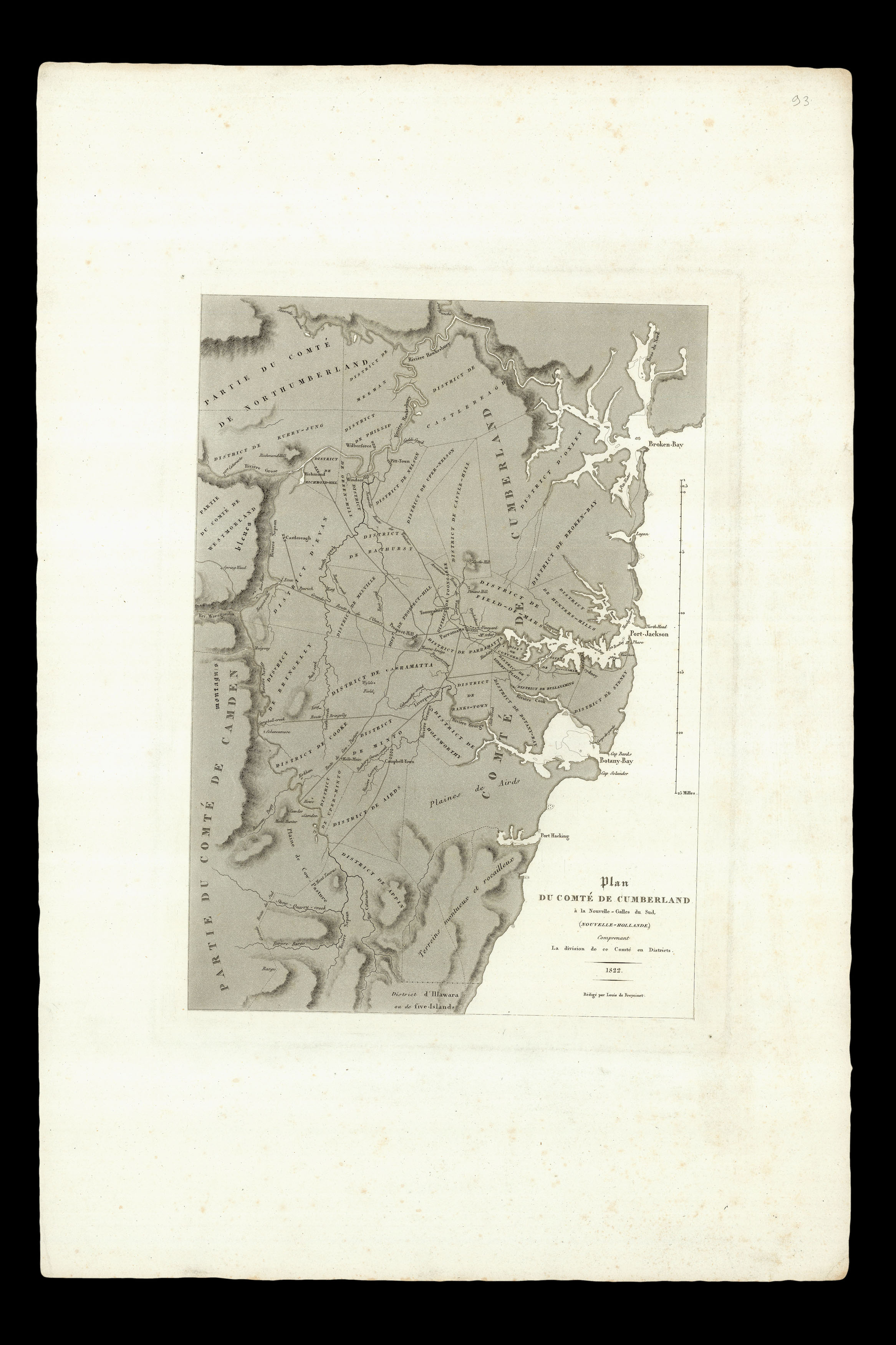
Sydney's CBD
1 x
£8,000
|
£8,000 |
|
£8,000 |
|
× |
![JODE, Gerard de Moscoviae Maximi amplissimi Que Ducatus. [WITH] Livoniae Provinciae ac Eius.](https://omega.crouchrarebooks.com/wp-content/uploads/2025/03/13044_1H.jpg) |
De Jode's rare map of Russia in full original colour
1 x
£5,000
|
£5,000 |
|
£5,000 |
|
× |
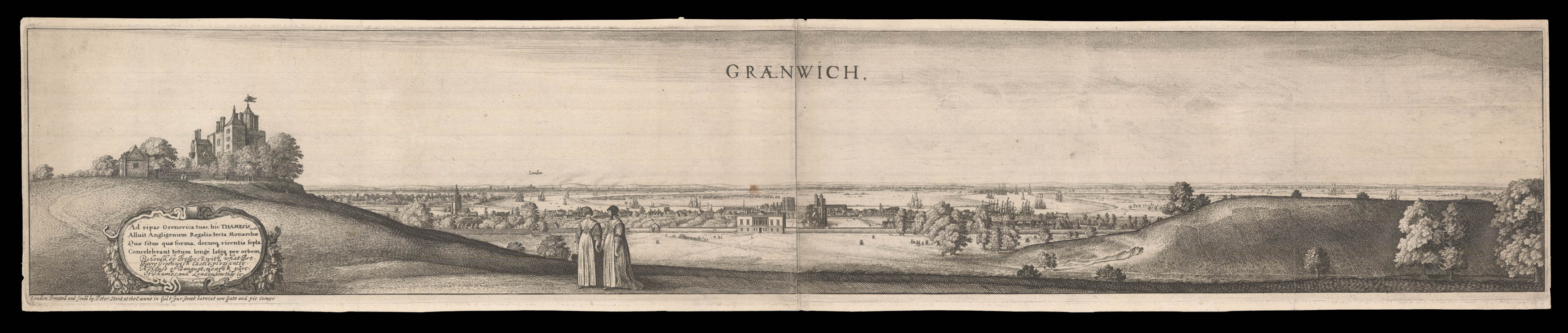 |
Greenwich
1 x
£2,500
|
£2,500 |
|
£2,500 |
|
× |
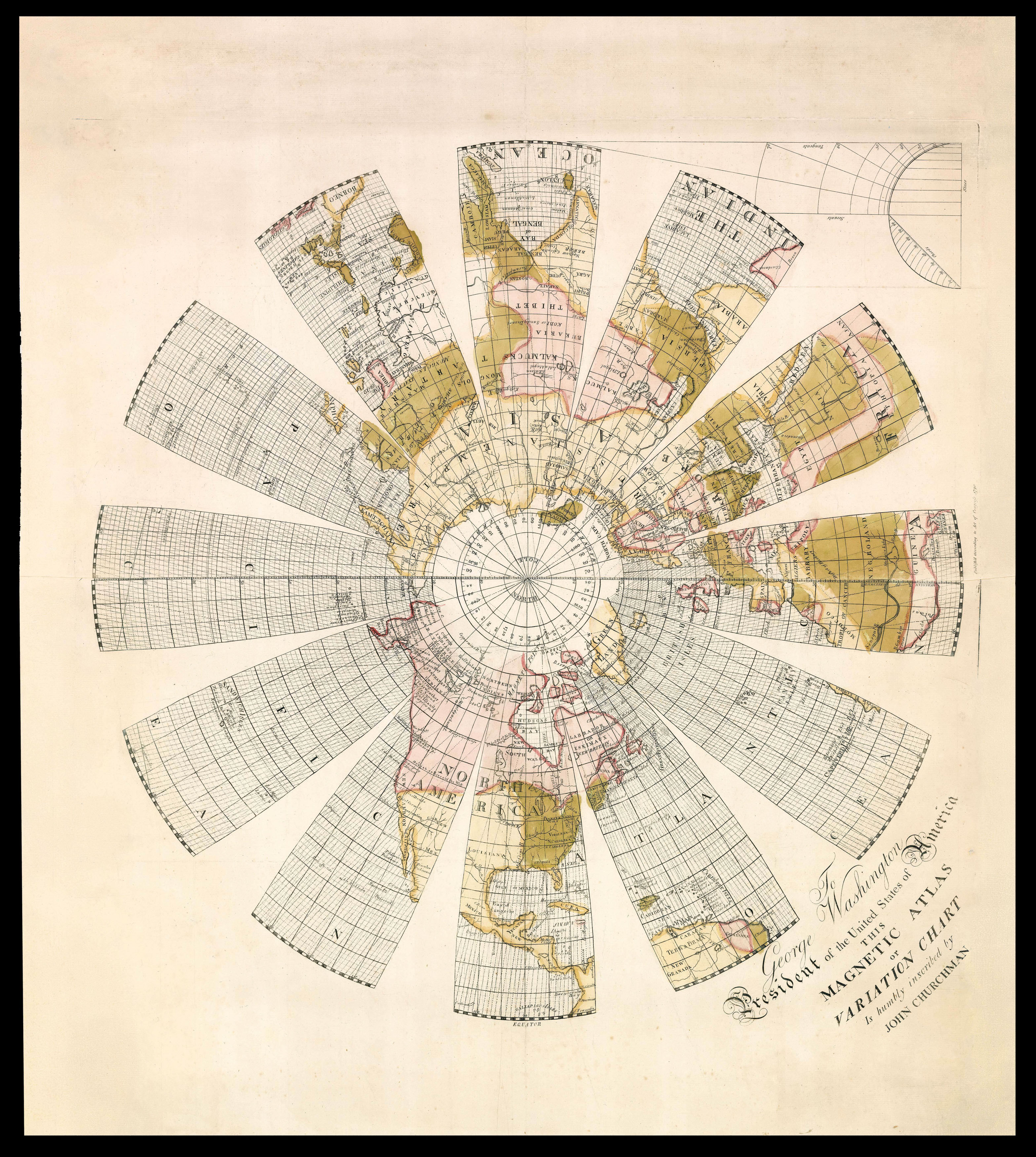 |
A presentation copy of the last gasp for Edmund Halley's theory for the determination of longitude by magnetic declination
1 x
£50,000
|
£50,000 |
|
£50,000 |
|
× |
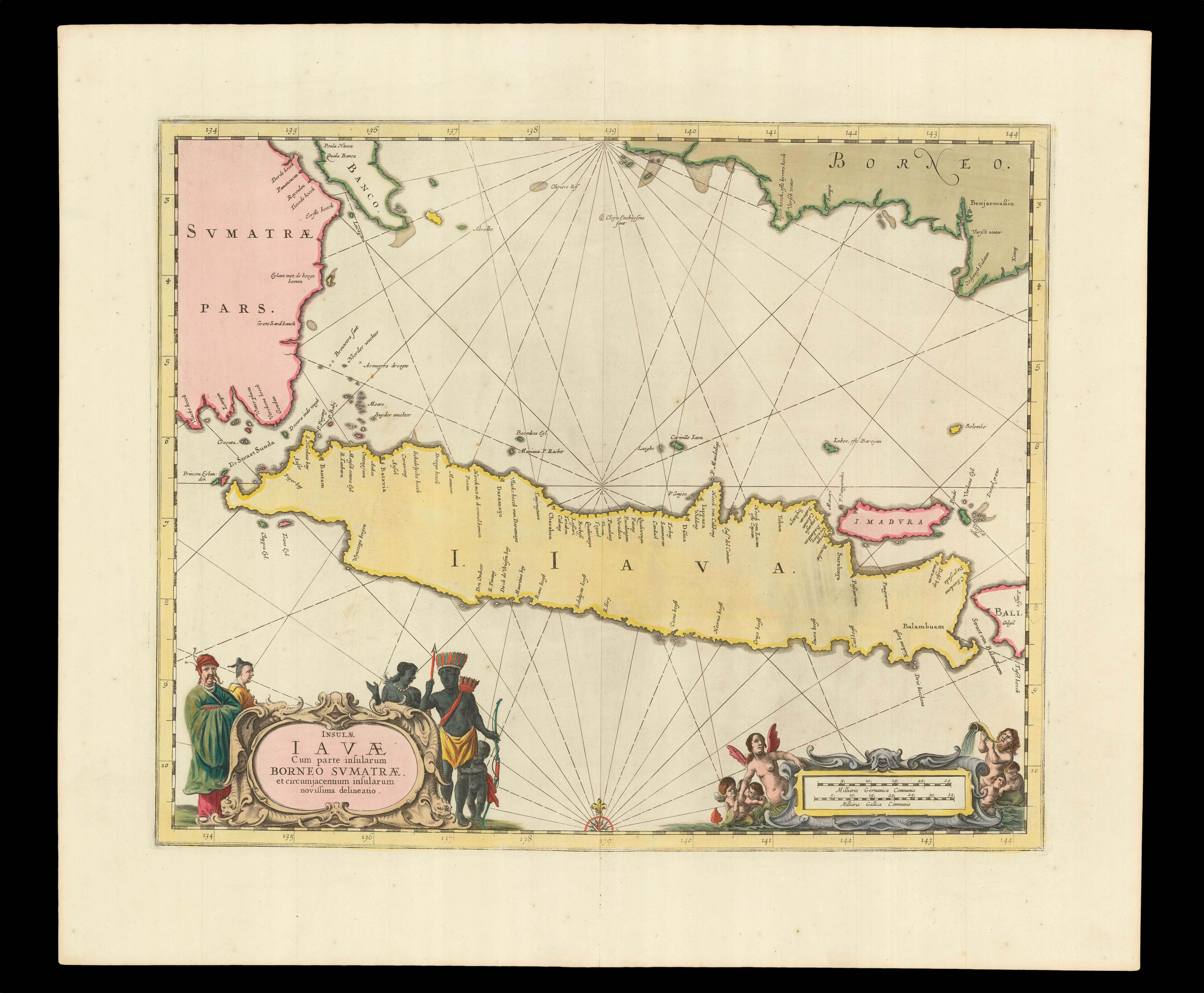 |
The heart of VOC territory in Southeast Asia
1 x
£750
|
£750 |
|
£750 |
|
× |
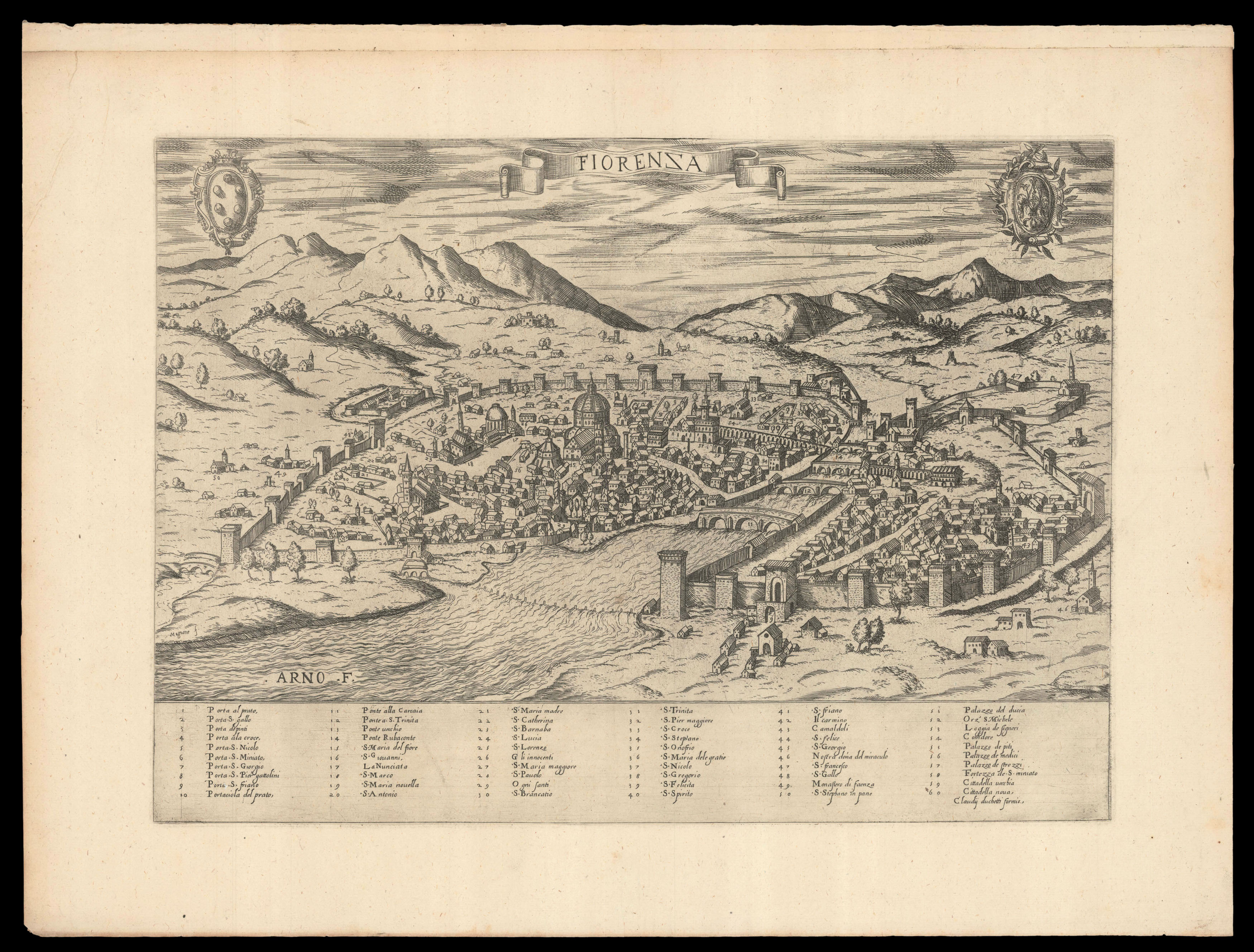 |
Duchetti's plan of Florence
1 x
£2,200
|
£2,200 |
|
£2,200 |
|
× |
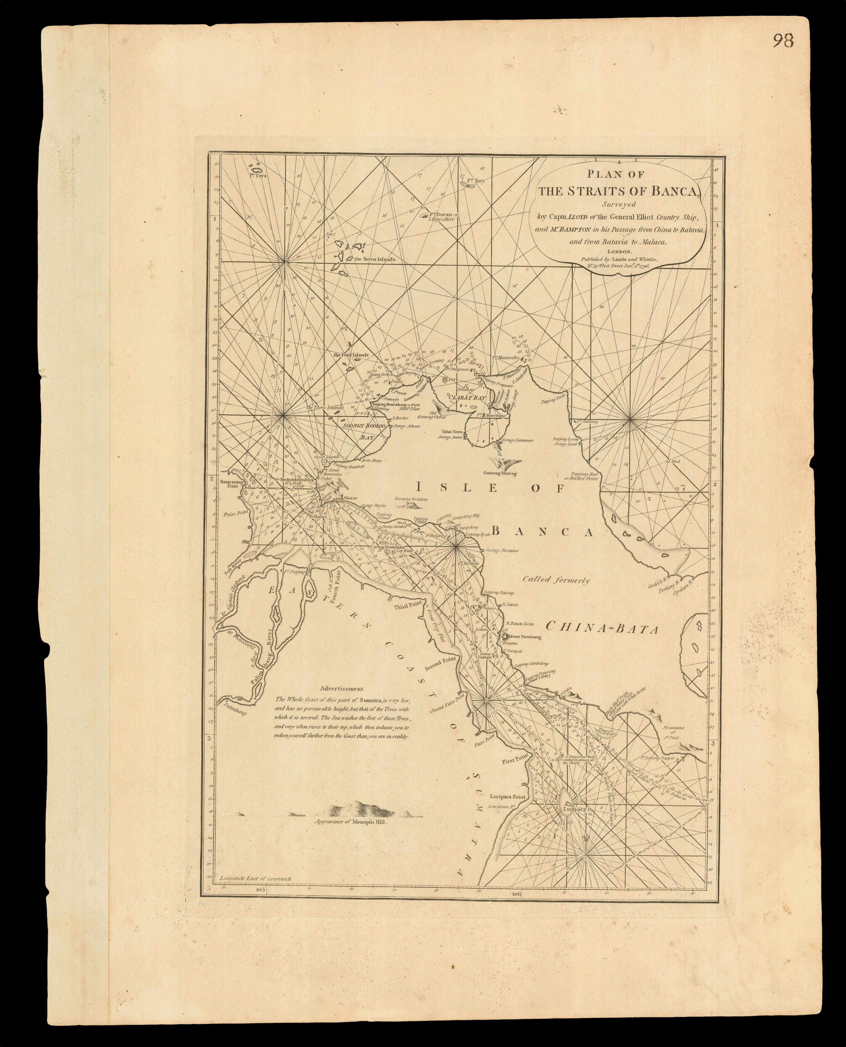 |
Navigating the Bangka Strait
1 x
£550
|
£550 |
|
£550 |
|
× |
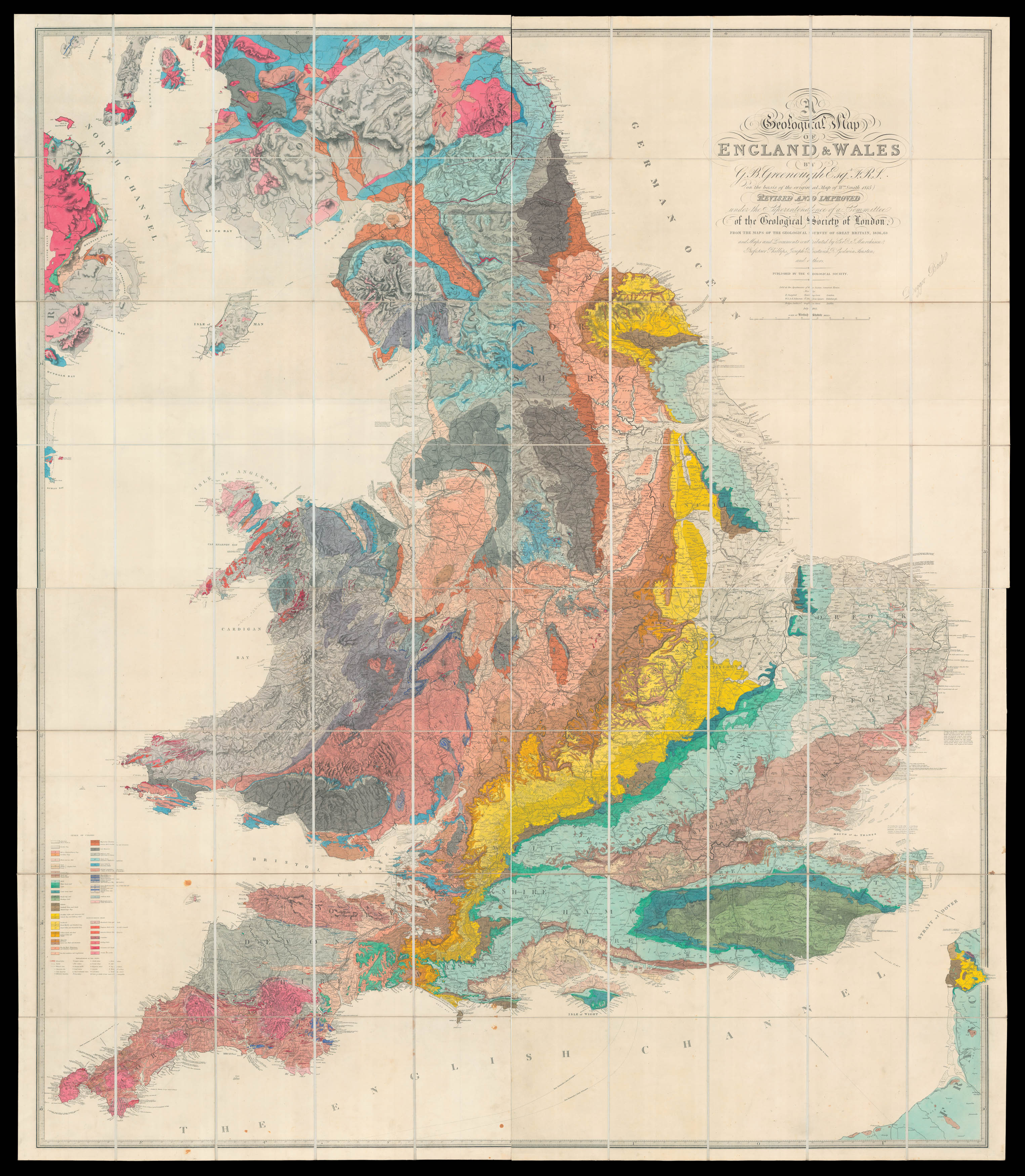 |
Greenough recognises his debt to William Smith
1 x
£18,500
|
£18,500 |
|
£18,500 |
|
× |
 |
"Roguery's classic shore" (Rose Freycinet)
1 x
£1,000
|
£1,000 |
|
£1,000 |
|
× |
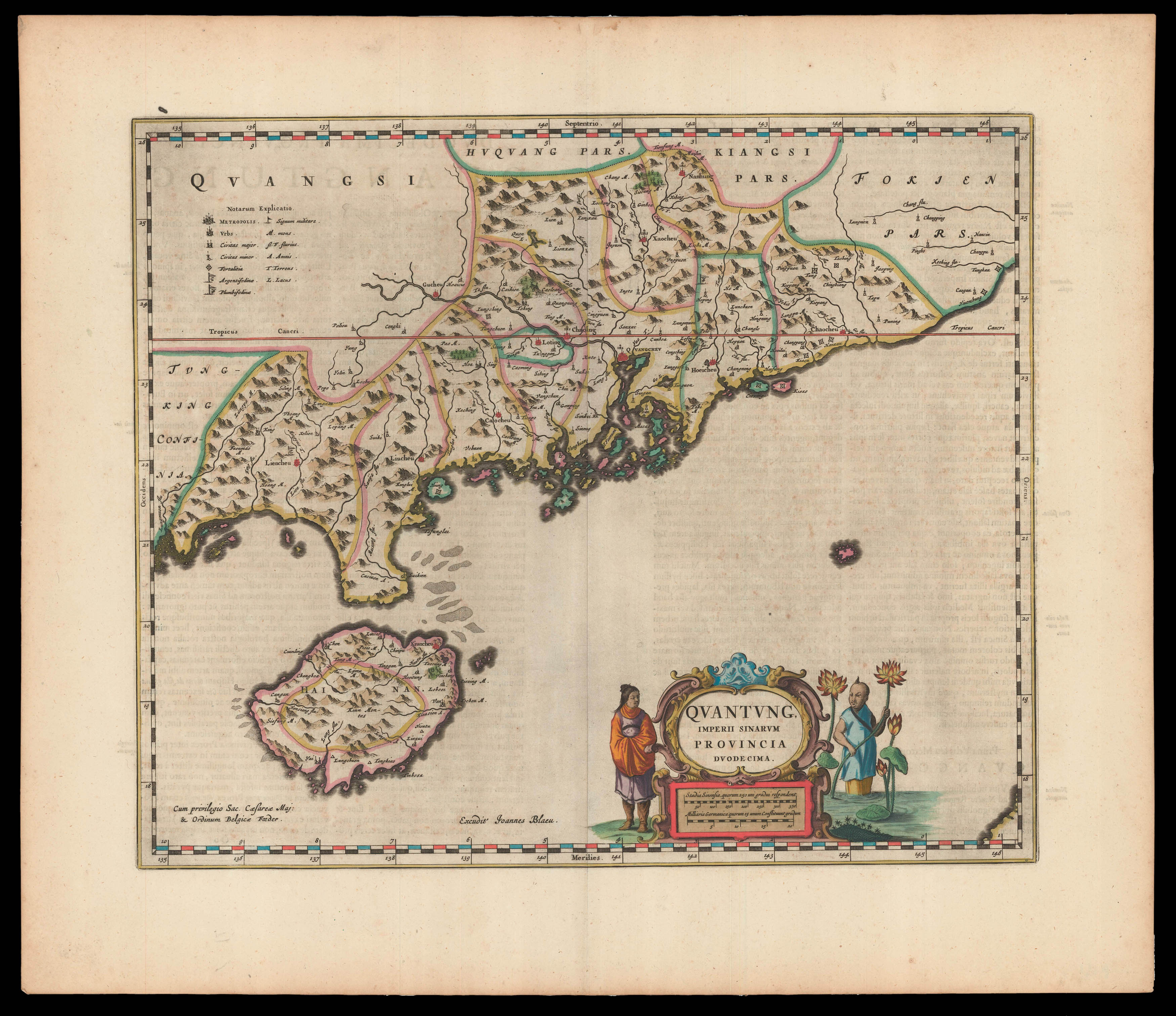 |
First Western Map of Quantung
1 x
£3,500
|
£3,500 |
|
£3,500 |
|
× |
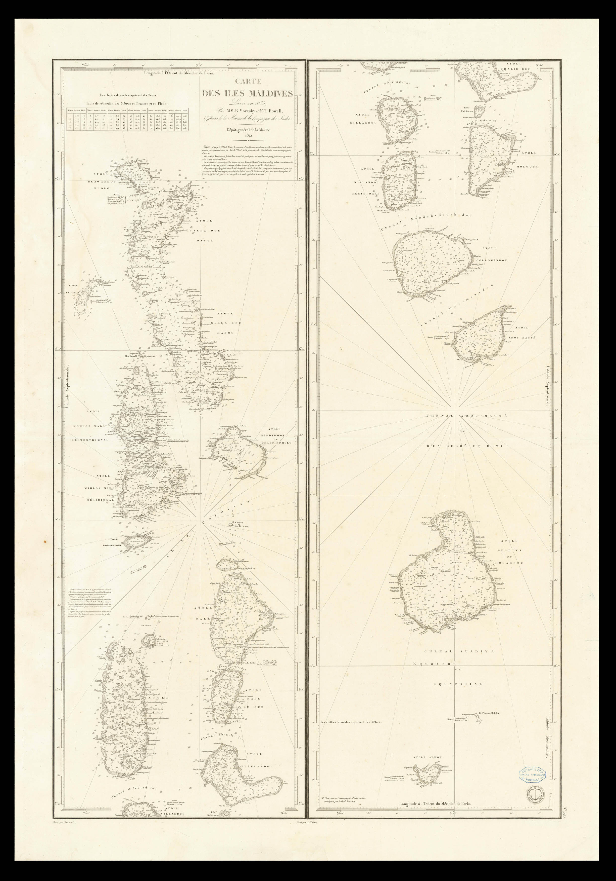 |
French edition of Moresby's charting of the Maldives
1 x
£420
|
£420 |
|
£420 |
|
× |
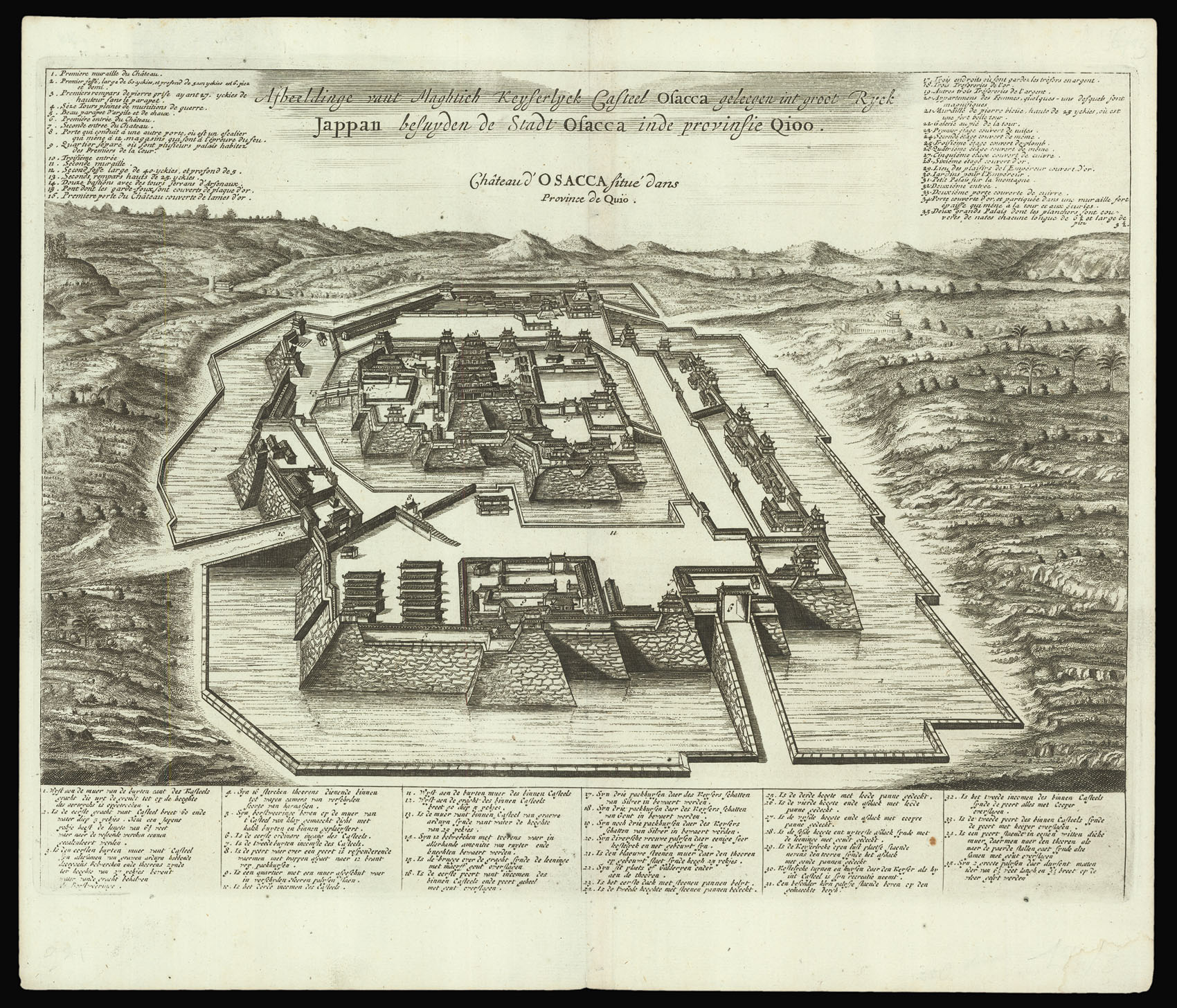 |
Osaka Castle
1 x
£250
|
£250 |
|
£250 |
|
× |
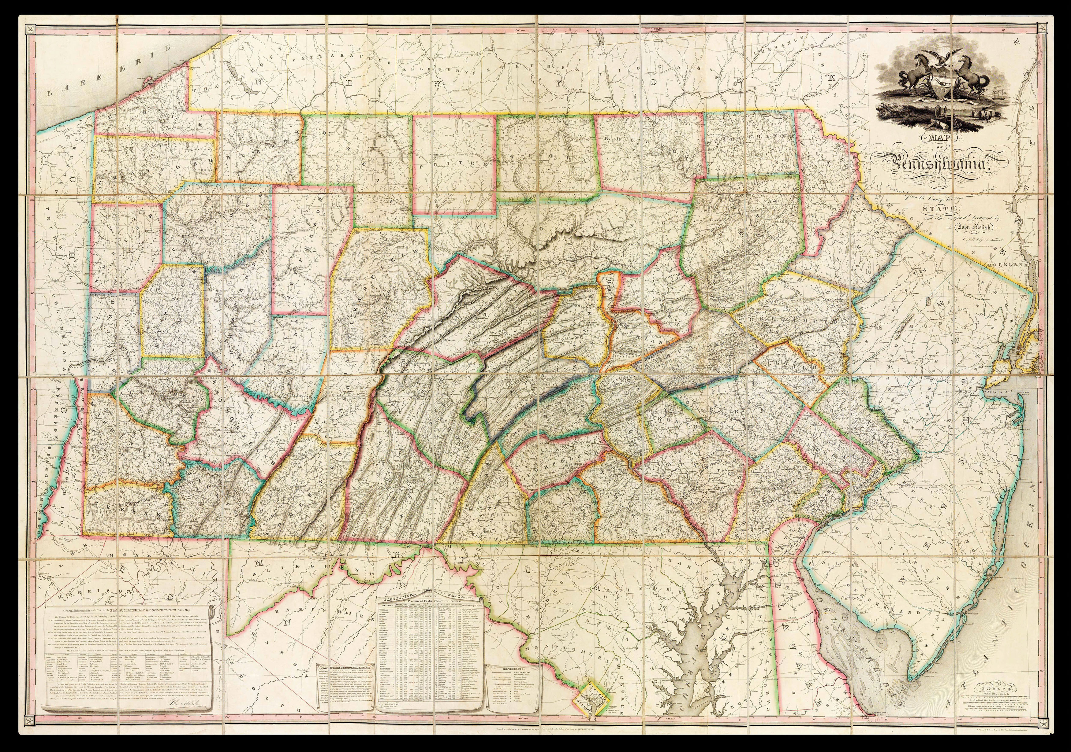 |
Unrecorded example of Melish's map of Pennsylvania
1 x
£26,000
|
£26,000 |
|
£26,000 |
|
× |
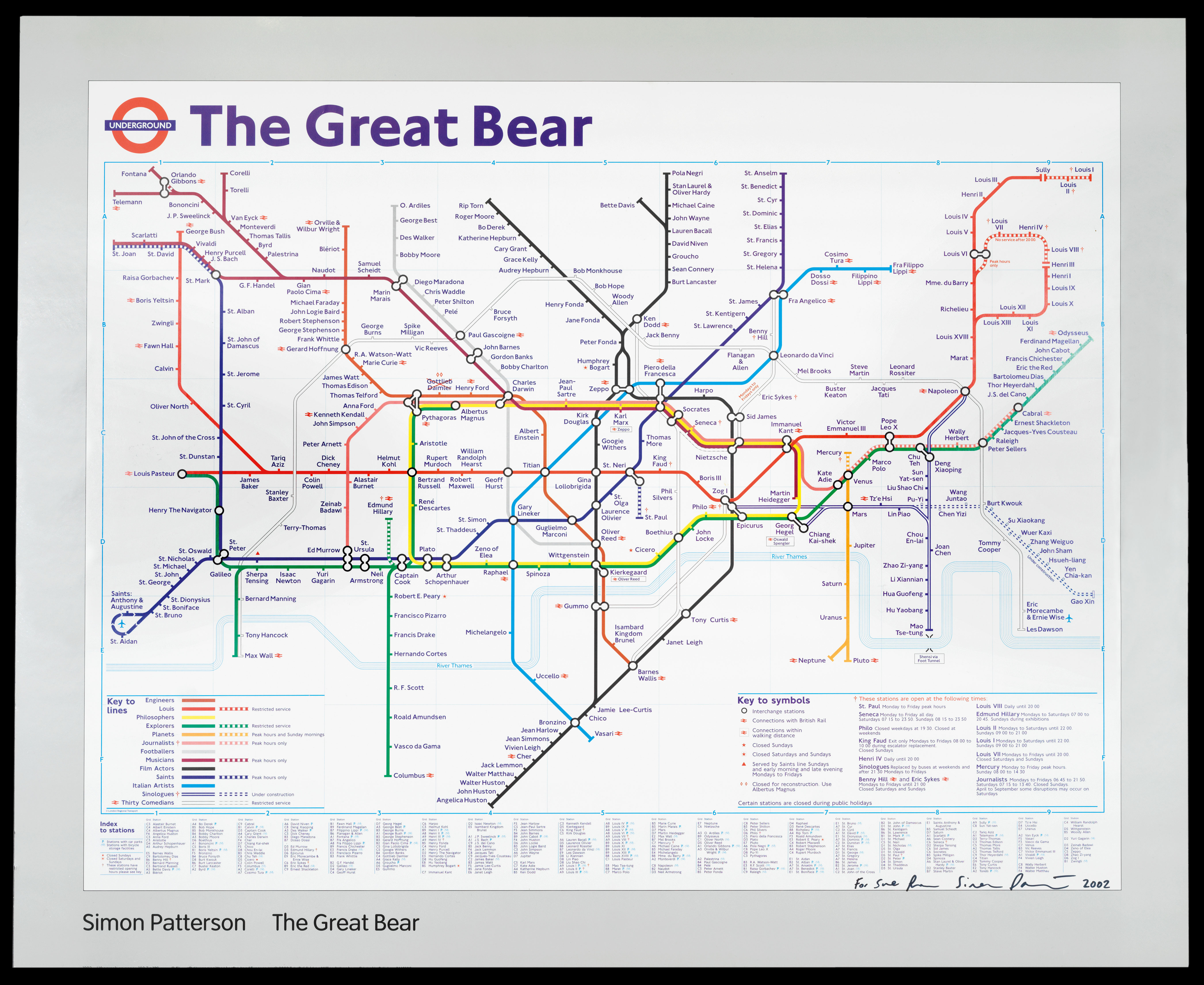 |
The Great Bear
1 x
£5,000
|
£5,000 |
|
£5,000 |
|
× |
 |
The first European to enter Mecca and Medina
1 x
£20,000
|
£20,000 |
|
£20,000 |
|
× |
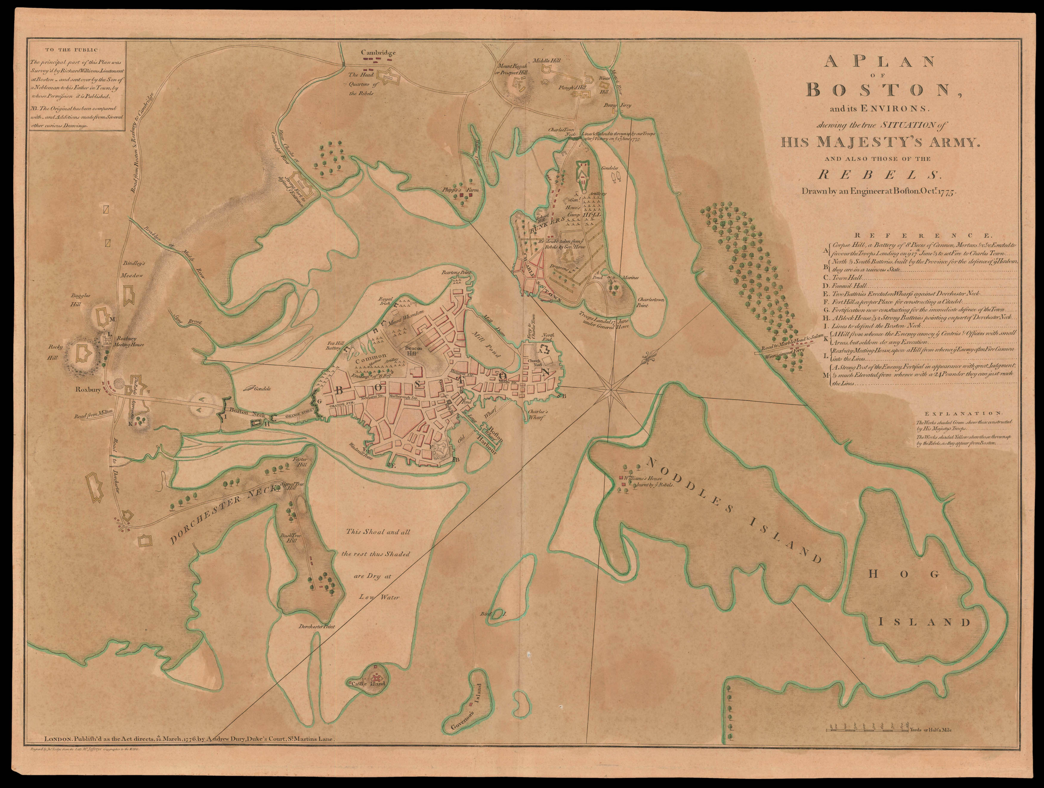 |
"don't one of you fire until you see the white of their eyes"
1 x
£45,000
|
£45,000 |
|
£45,000 |
|
× |
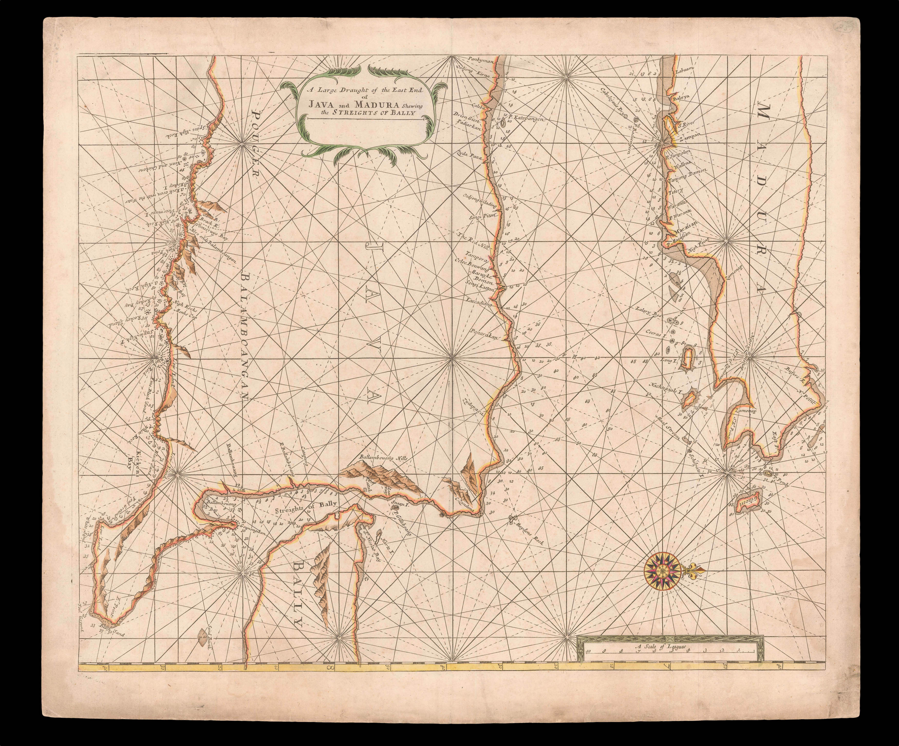 |
The Bali Strait
1 x
£750
|
£750 |
|
£750 |
|
× |
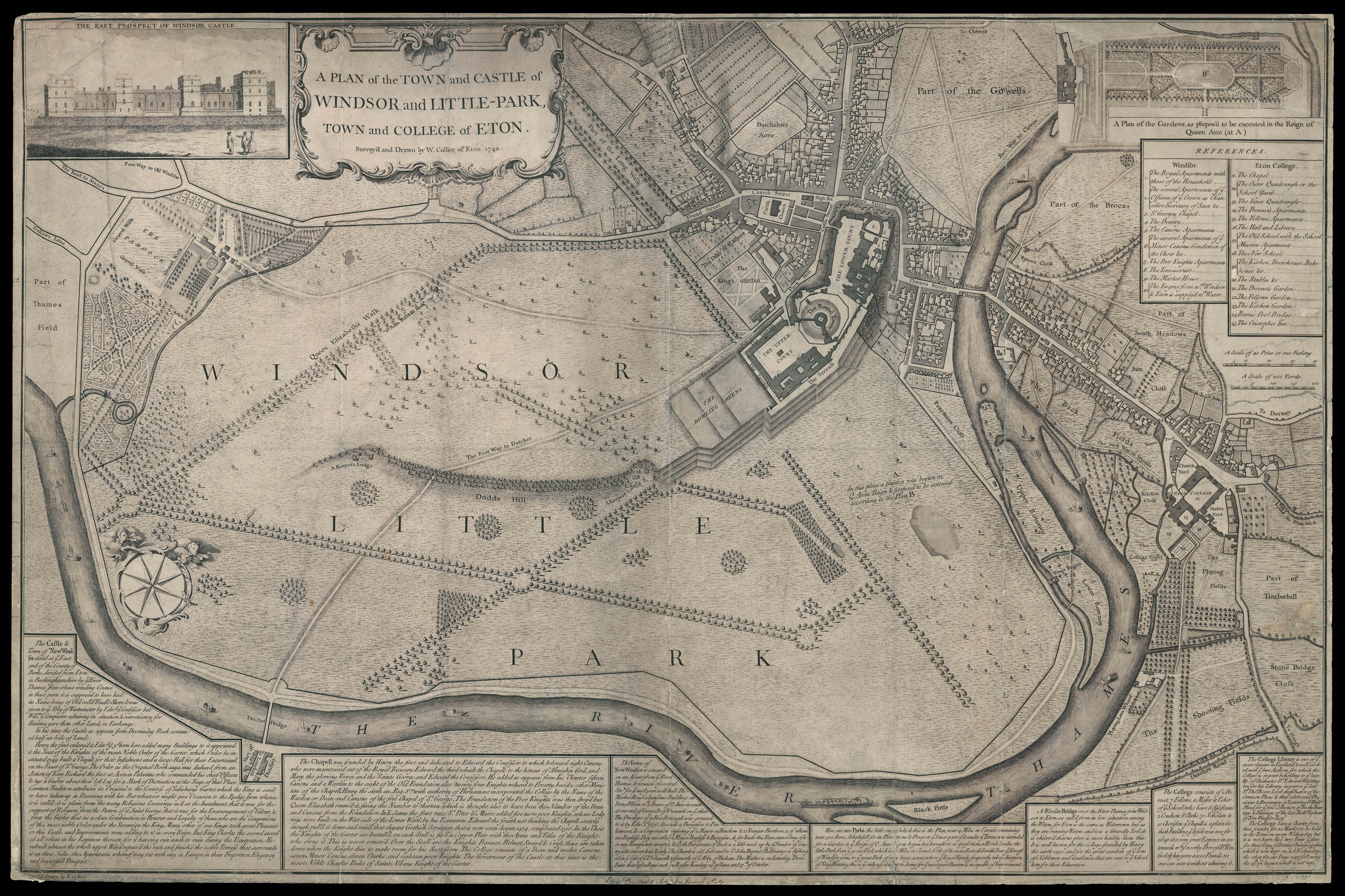 |
Rare eighteenth century plan of Eton
1 x
£10,000
|
£10,000 |
|
£10,000 |
|
× |
![[MULLER, Johann Ulrich] Insulae Maldivae.](https://omega.crouchrarebooks.com/wp-content/uploads/2025/03/15220_1H.jpg) |
Miniature map of the Maldives
1 x
£150
|
£150 |
|
£150 |
|
× |
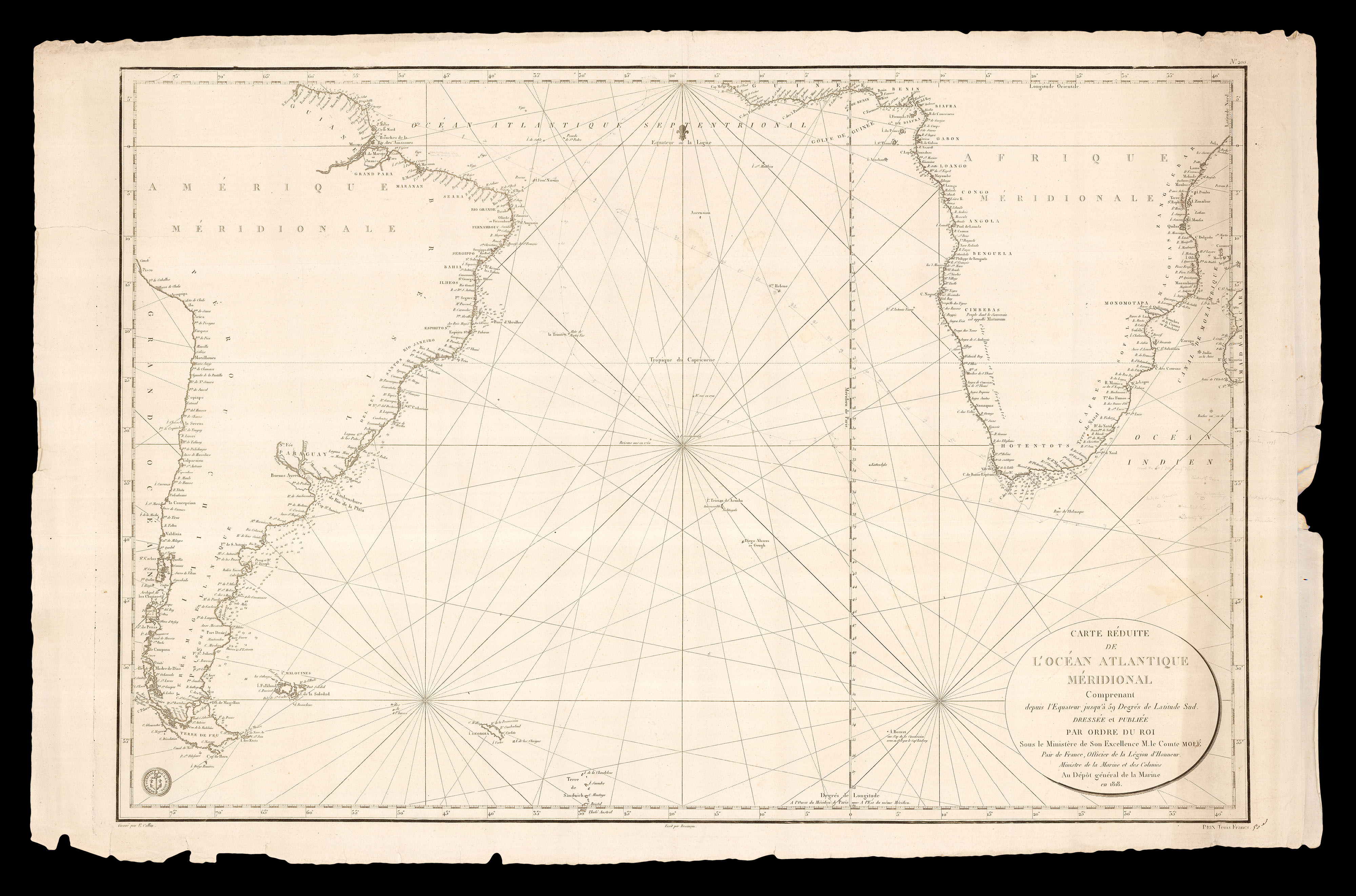 |
Crossing the Atlantic
1 x
£1,500
|
£1,500 |
|
£1,500 |
|
× |
 |
Map of the Maldives playing card
1 x
£1,500
|
£1,500 |
|
£1,500 |
|
|


