No products in the basket.
Return to shop
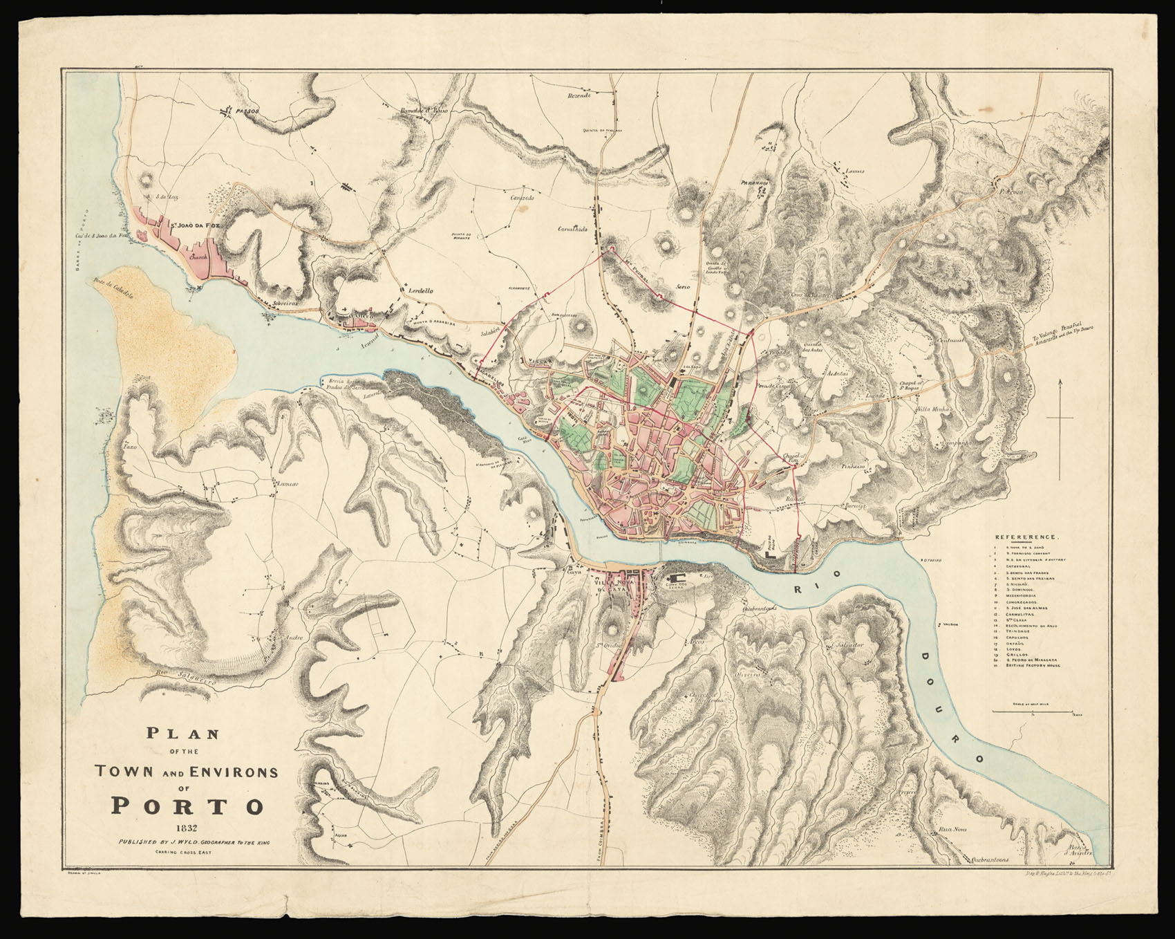
Separately issued plan illustrating the siege of Porto during the Portuguese Civil War
By WYLD, James, 1832
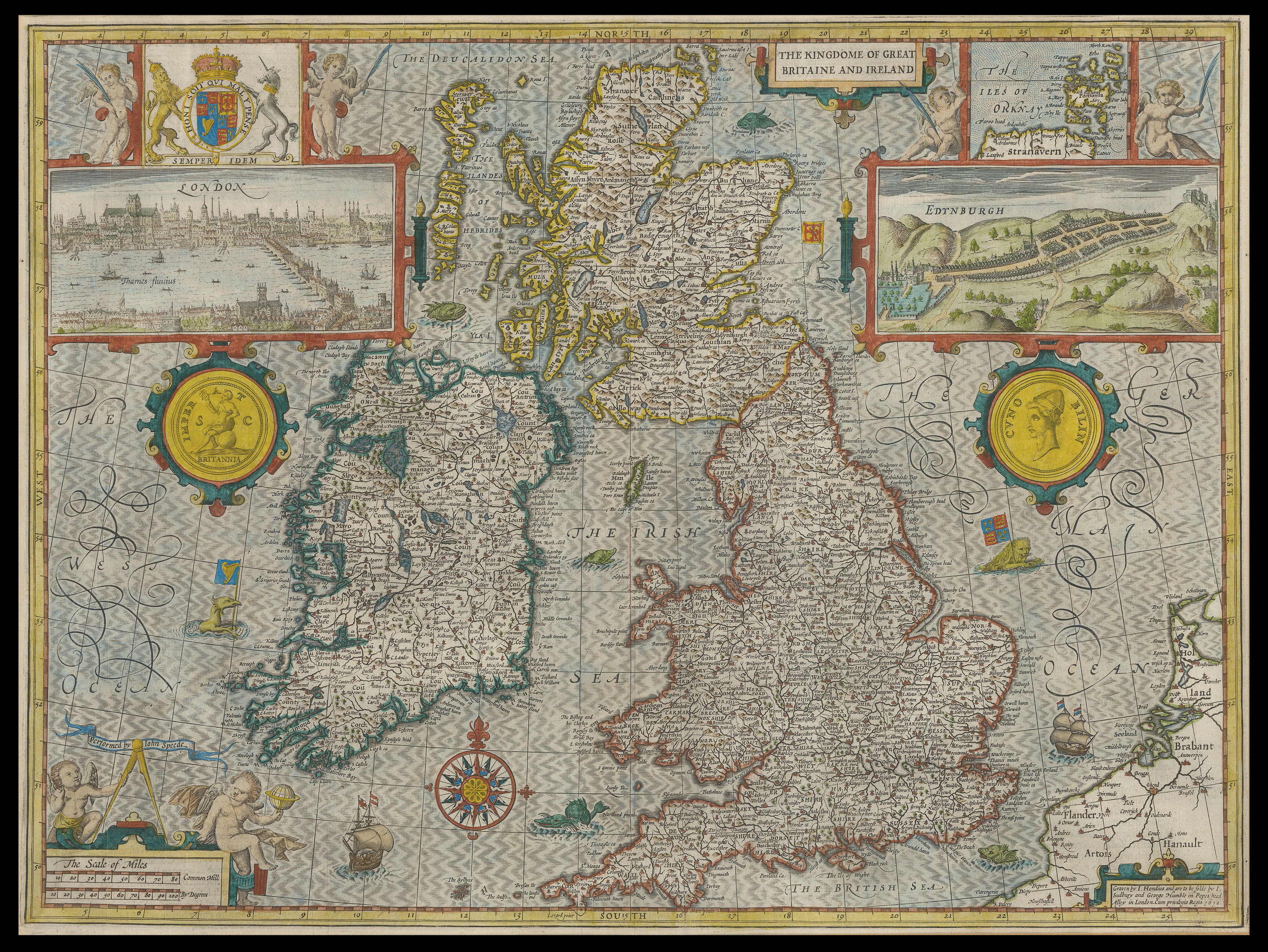
Speed’s map of Great Britain and Ireland
By SPEED, John, [1627].
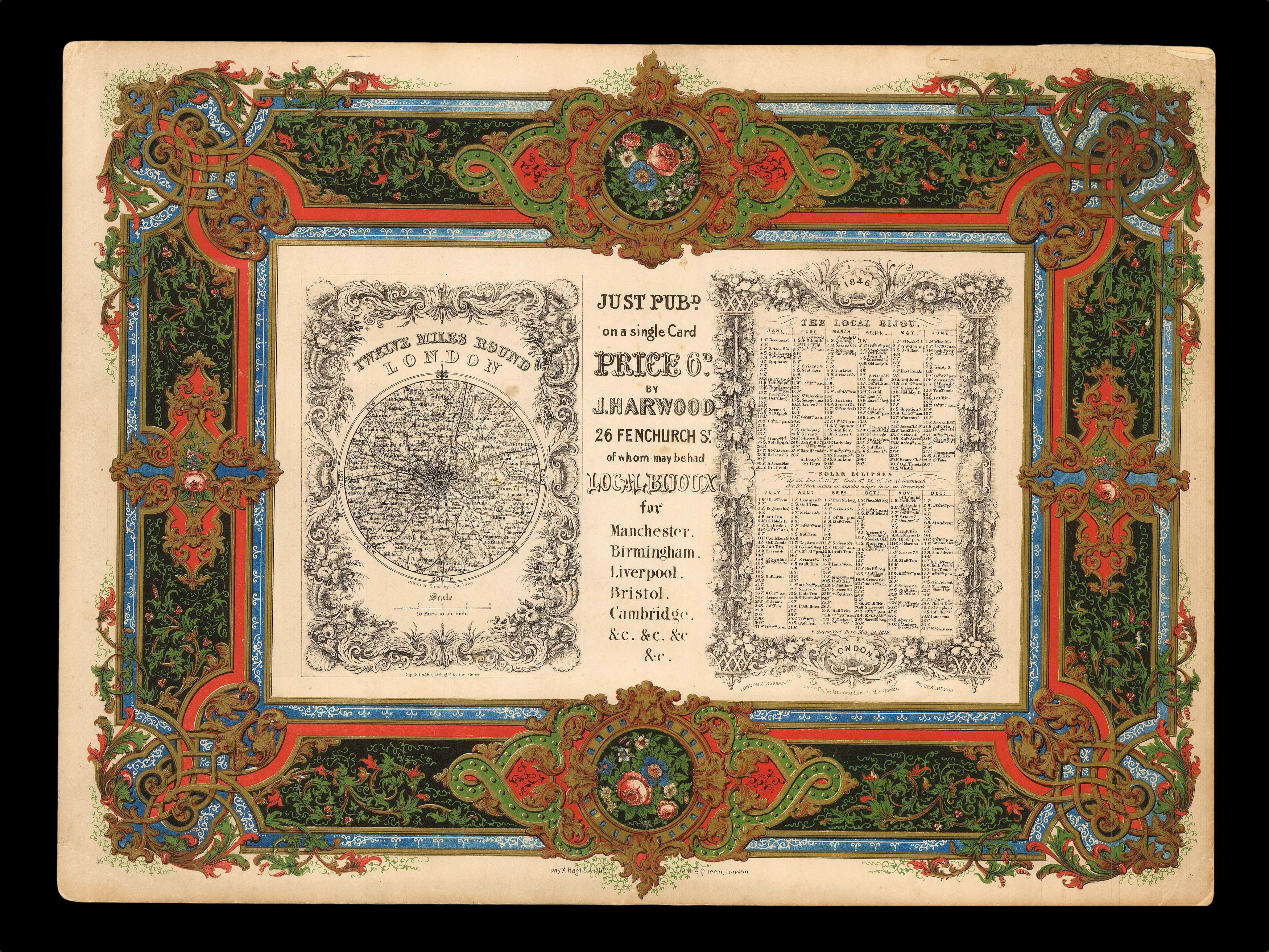
Lavishly lithographed prospectus from the house of Day & Haghe
By DAY, William; Louis HAGHE; and John HARWOOD, 1846
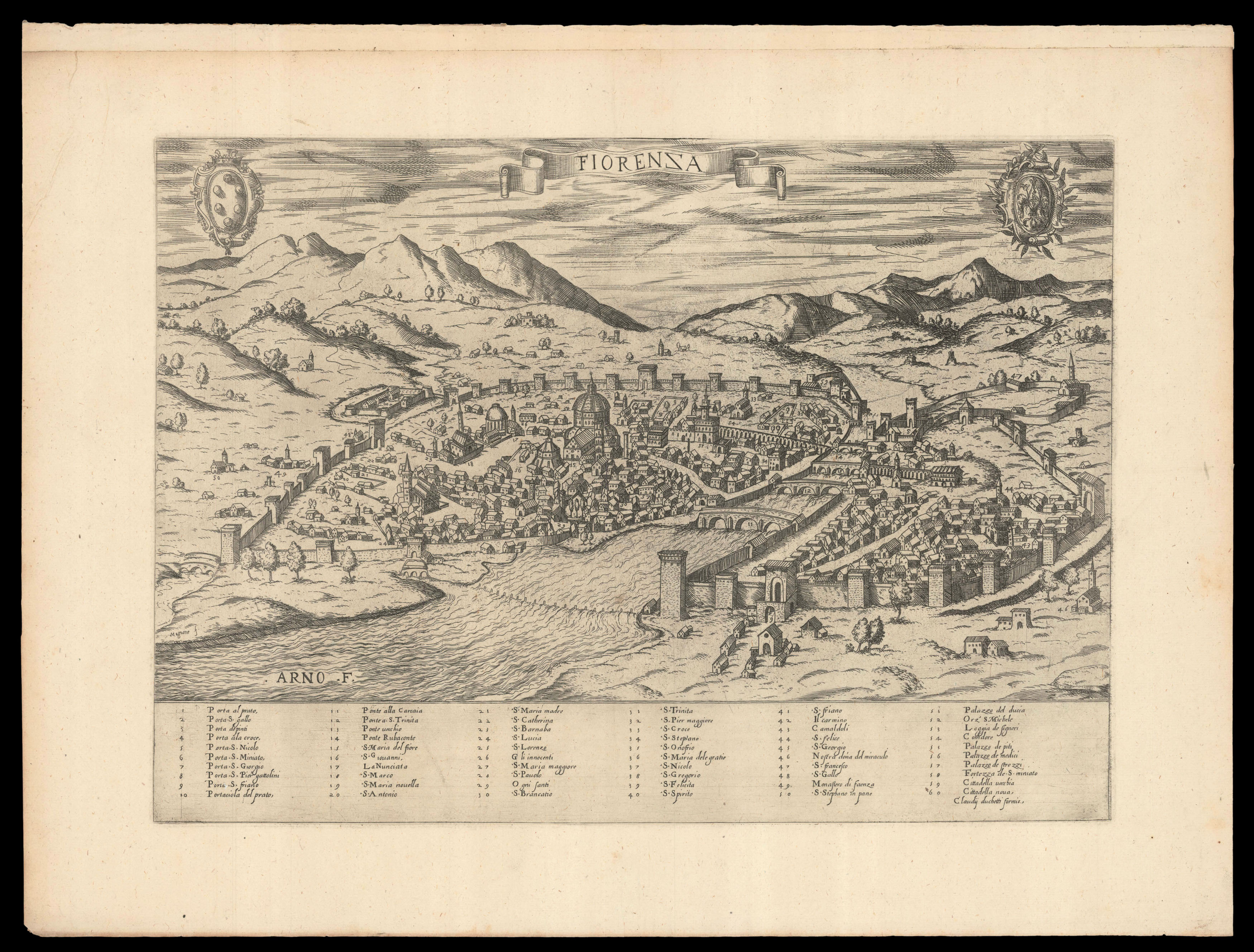
Duchetti’s plan of Florence
By DUCHETTI, Claudio, [c1580].
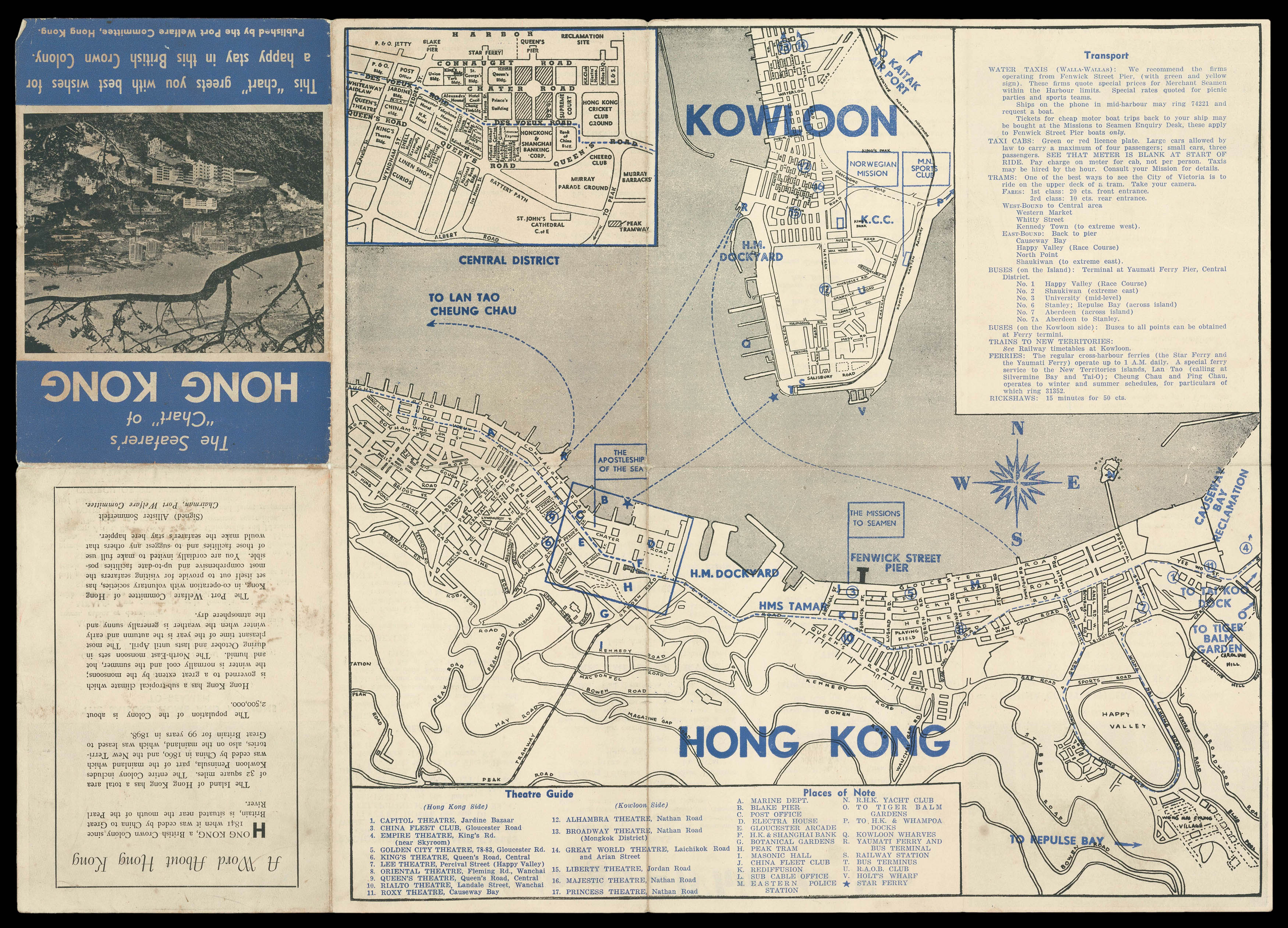
A tourist map of Hong Kong
By PORT WELFARE COMMITTEE, [1950s].
Willdey’s map of Oxford
By [PARKER, Samuel], attributed to, [c1710].
Wallis’ game map of Europe
By WALLIS, John, 1794
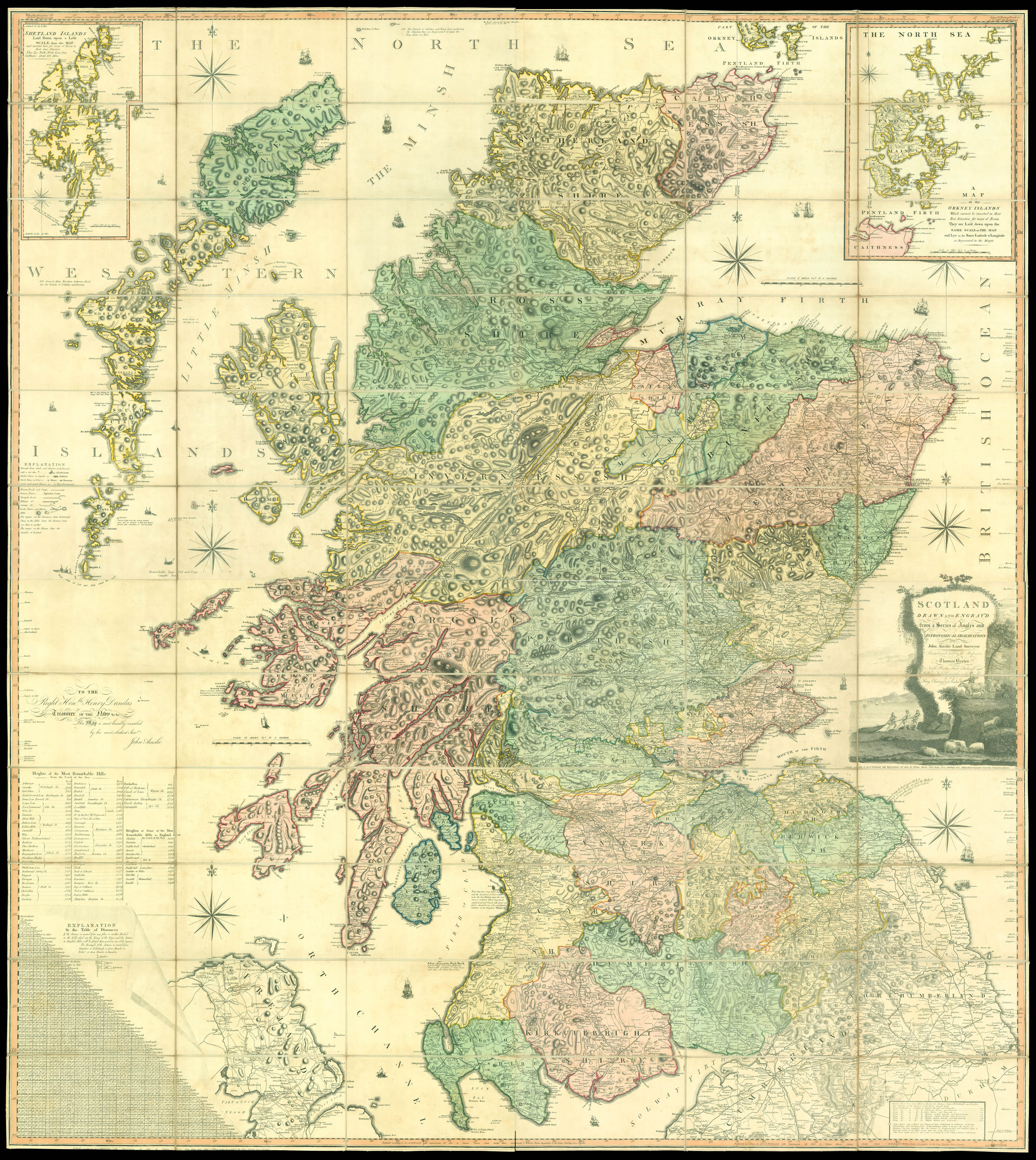
John Ainslie’s Landmark Map of Scotland
By AINSLIE, John, Jan[uar]y 1st 1800.
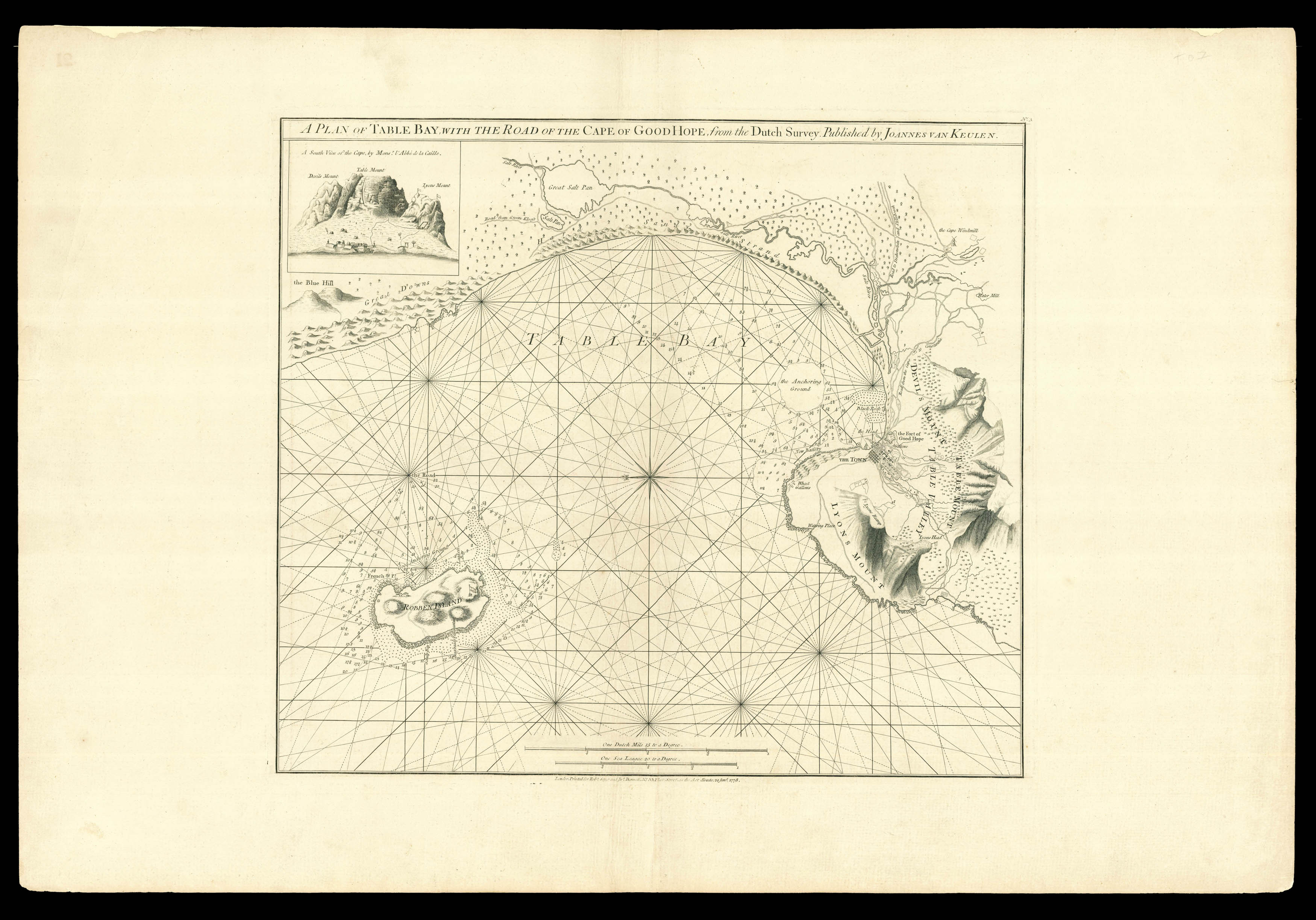
A rare sea chart of Cape Town
By SAYER, Robert and BENNETT, John, 1778
The final phase of the Peninsular War
By LUFFMAN, John, 1813
Username or email address *Required
Password *Required
Remember me Log in
Lost your password?
Email address *Required
A link to set a new password will be sent to your email address.
Your personal data will be used to support your experience throughout this website, to manage access to your account, and for other purposes described in our privacy policy.
Register


![[PARKER, Samuel], attributed to<br /> Oxford.](https://omega.crouchrarebooks.com/wp-content/uploads/2025/03/19463_1H.jpg)

![LUFFMAN, John A Map of the Western Pyrenees Mount[ai]ns](https://omega.crouchrarebooks.com/wp-content/uploads/2025/03/11348_1H.jpg)