|
× |
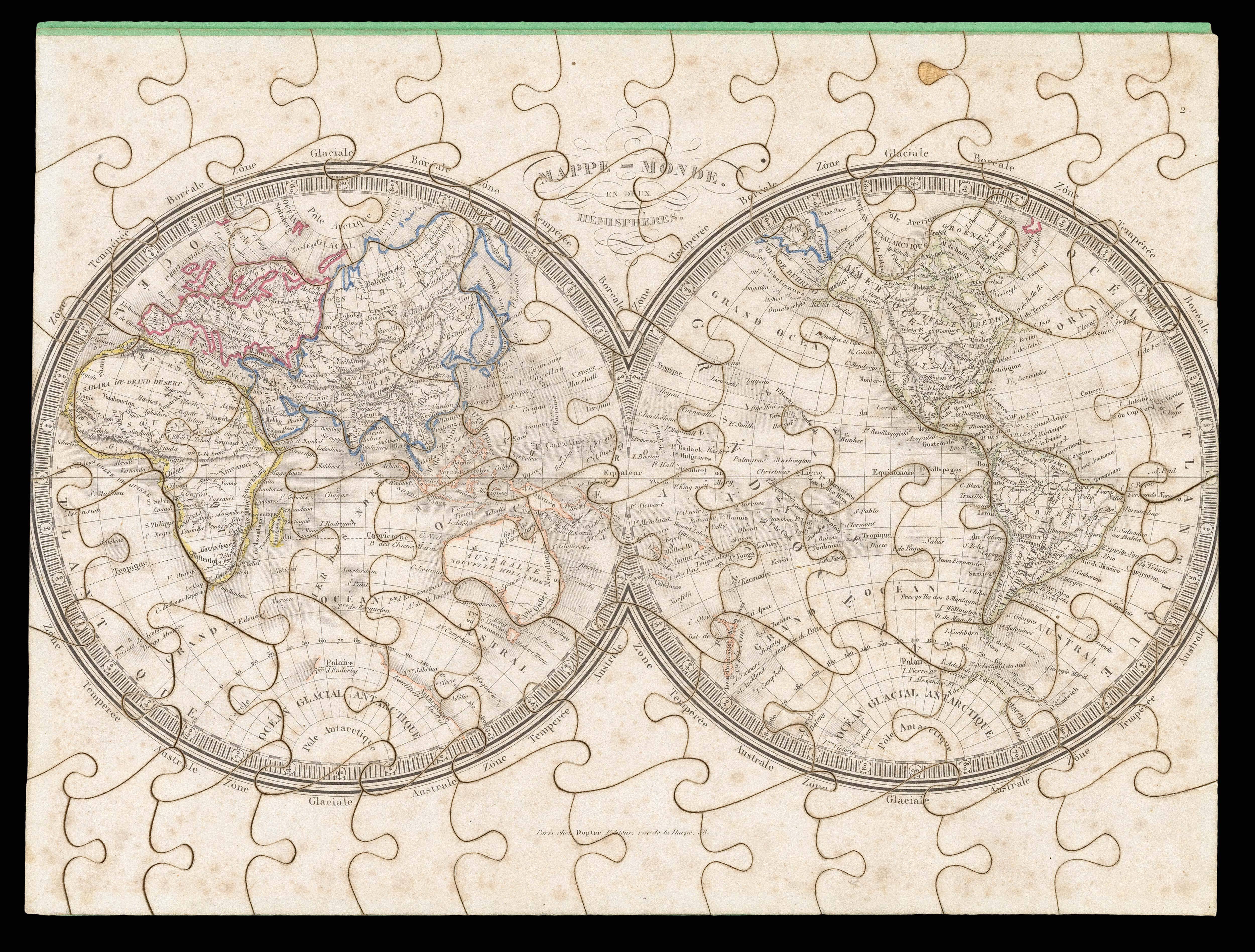 |
A puzzling gift
1 x
£5,000
|
£5,000 |
|
£5,000 |
|
× |
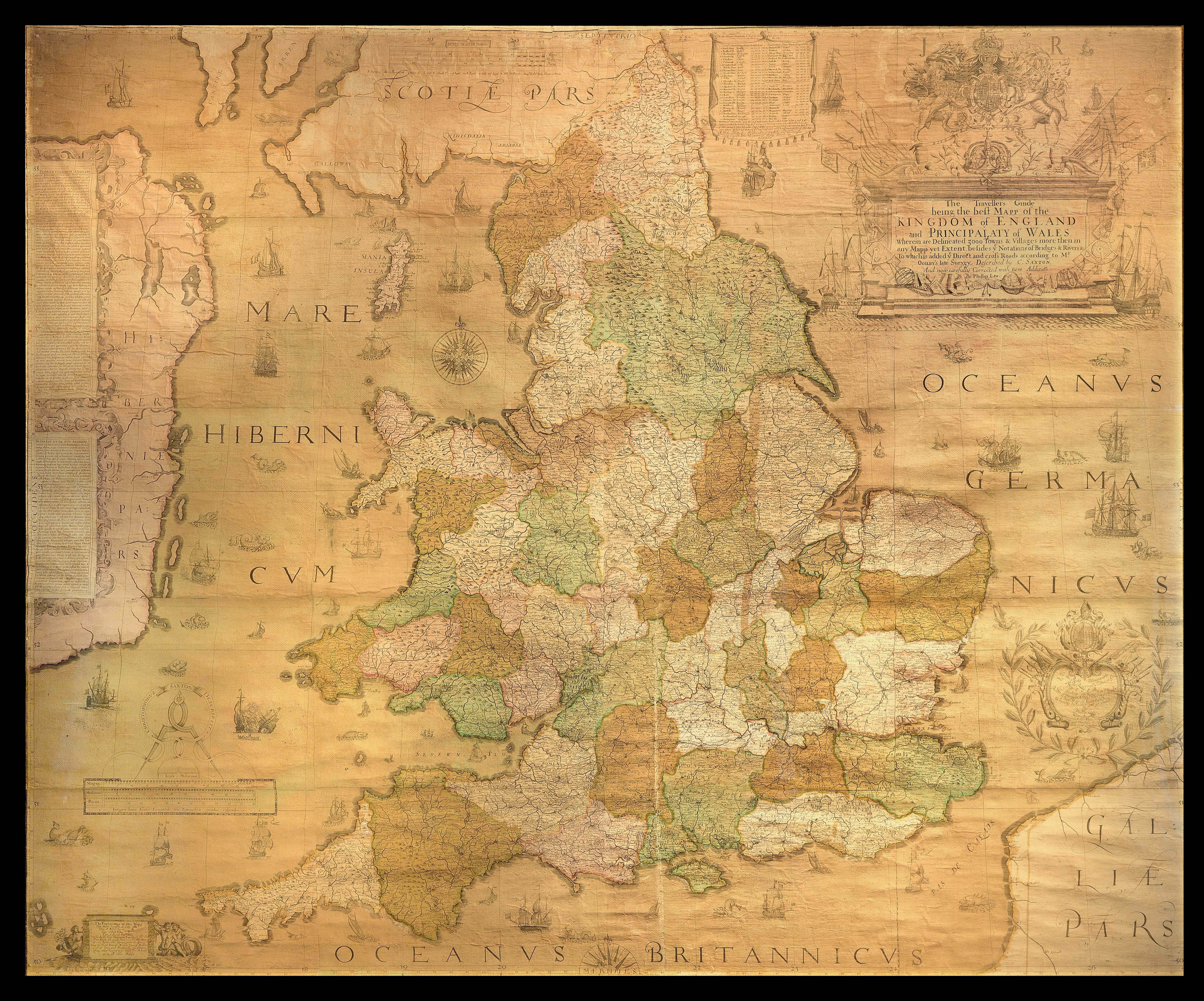 |
A nation defined… An Elizabethan wall map by "the father of English cartography"
1 x
£75,000
|
£75,000 |
|
£75,000 |
|
× |
!["The first [map] published in an atlas to depict California as an island, and an accurate east coast of North America" (Burden)](https://omega.crouchrarebooks.com/wp-content/uploads/2025/04/21911_1H.jpg) |
"The first [map] published in an atlas to depict California as an island, and an accurate east coast of North America" (Burden)
1 x
£3,500
|
£3,500 |
|
£3,500 |
|
× |
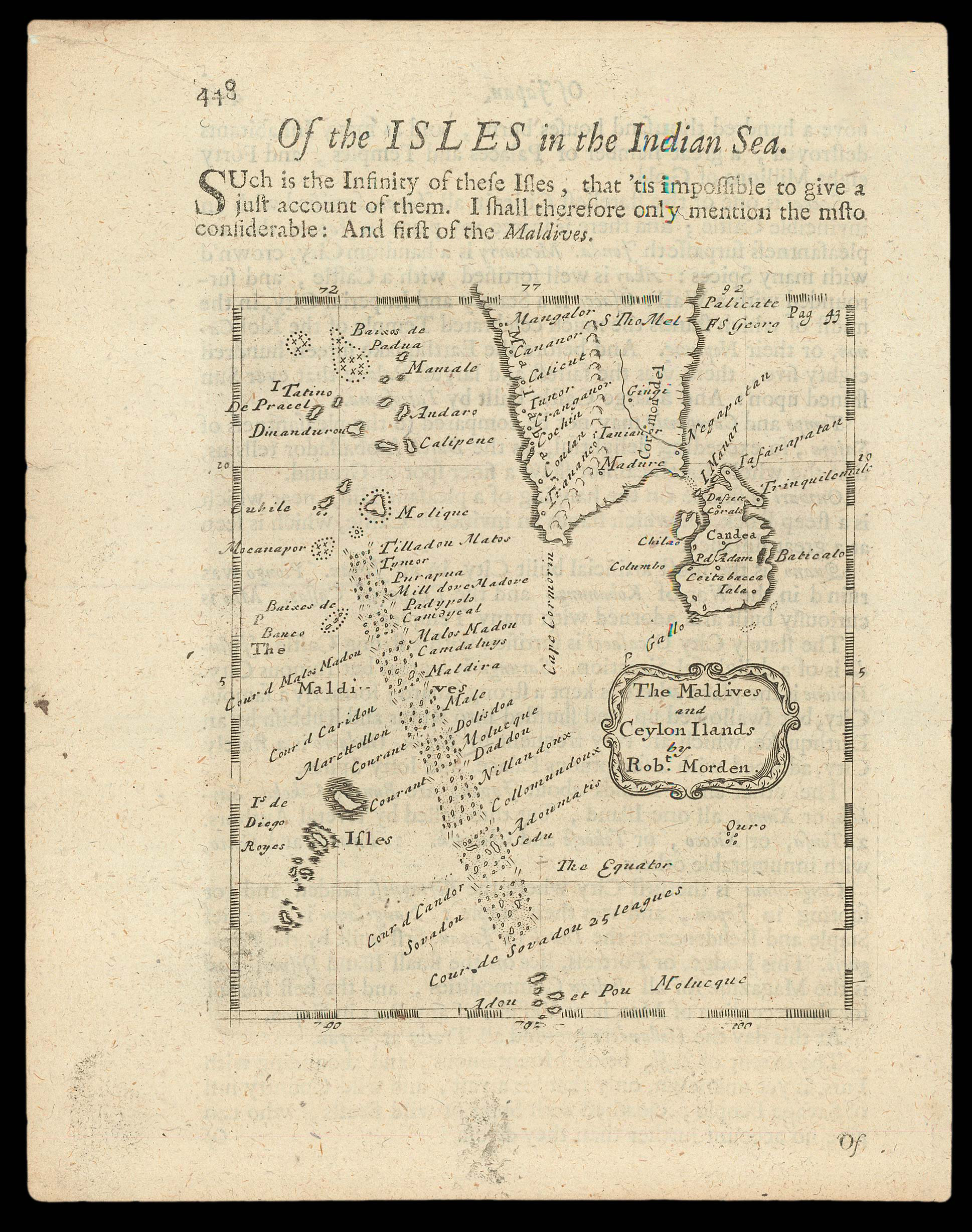 |
"Such is the Infinity of these Isles…"
1 x
£400
|
£400 |
|
£400 |
|
× |
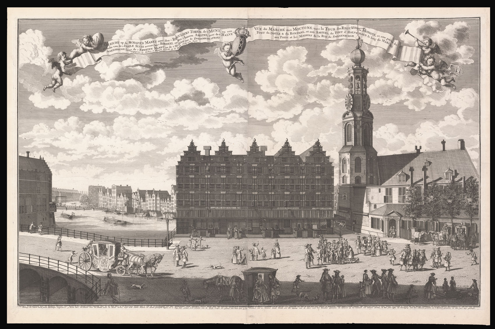 |
A view of the Muntplien with the Munttoren and the Englese Huizen
1 x
£3,800
|
£3,800 |
|
£3,800 |
|
× |
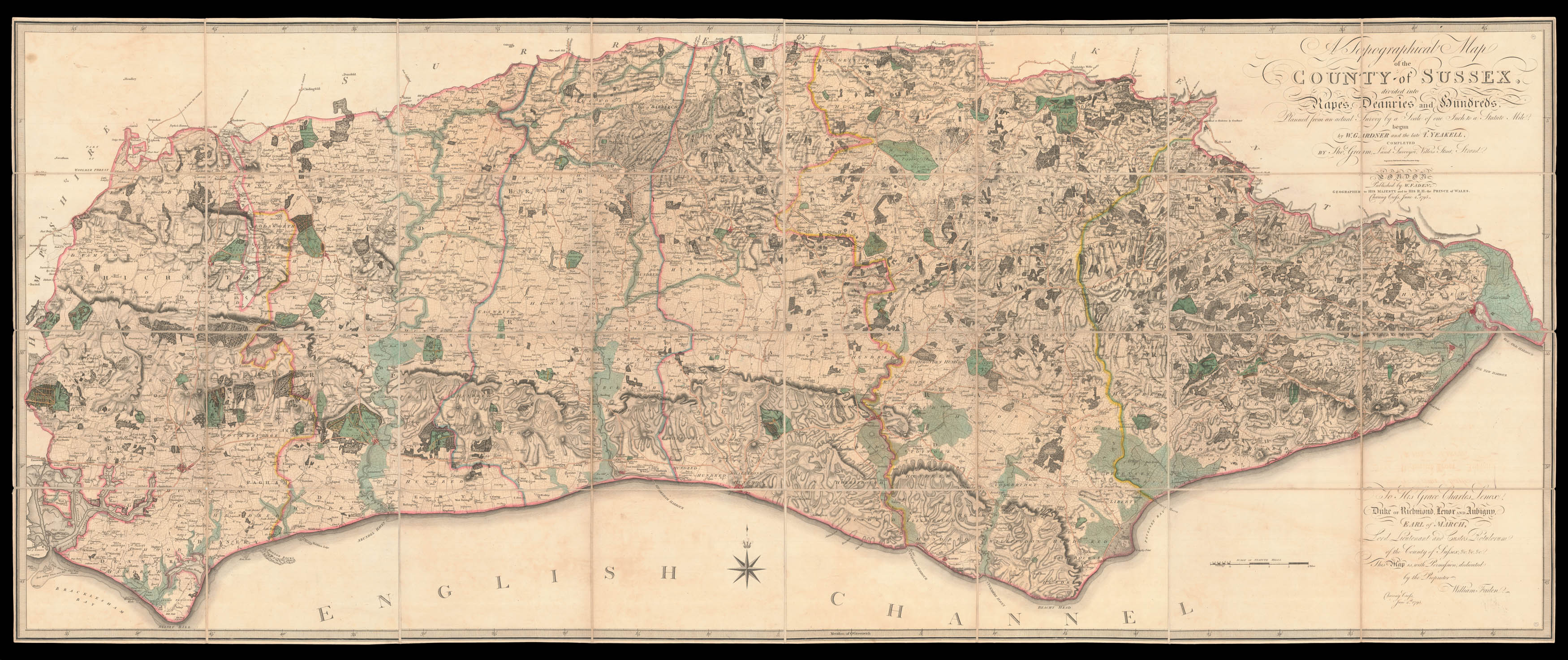 |
Yeakell and Gardner's landmark map of Sussex
1 x
£5,000
|
£5,000 |
|
£5,000 |
|
× |
![[ANONYMOUS] An Illustrated Map of London.](https://omega.crouchrarebooks.com/wp-content/uploads/2025/03/2366_1H.jpg) |
Rare map of London printed on cloth
1 x
£1,200
|
£1,200 |
|
£1,200 |
|
× |
 |
The General's Post Office
1 x
£1,200
|
£1,200 |
|
£1,200 |
|
× |
![DODD, R[obert] A Plan of the Attack by Lord Nelson of the Combined Fleet, October 21st, 1805.](https://omega.crouchrarebooks.com/wp-content/uploads/2025/03/15156_1H.jpg) |
Rare Broadsheet of the Battle of Trafalgar
1 x
£3,000
|
£3,000 |
|
£3,000 |
|
× |
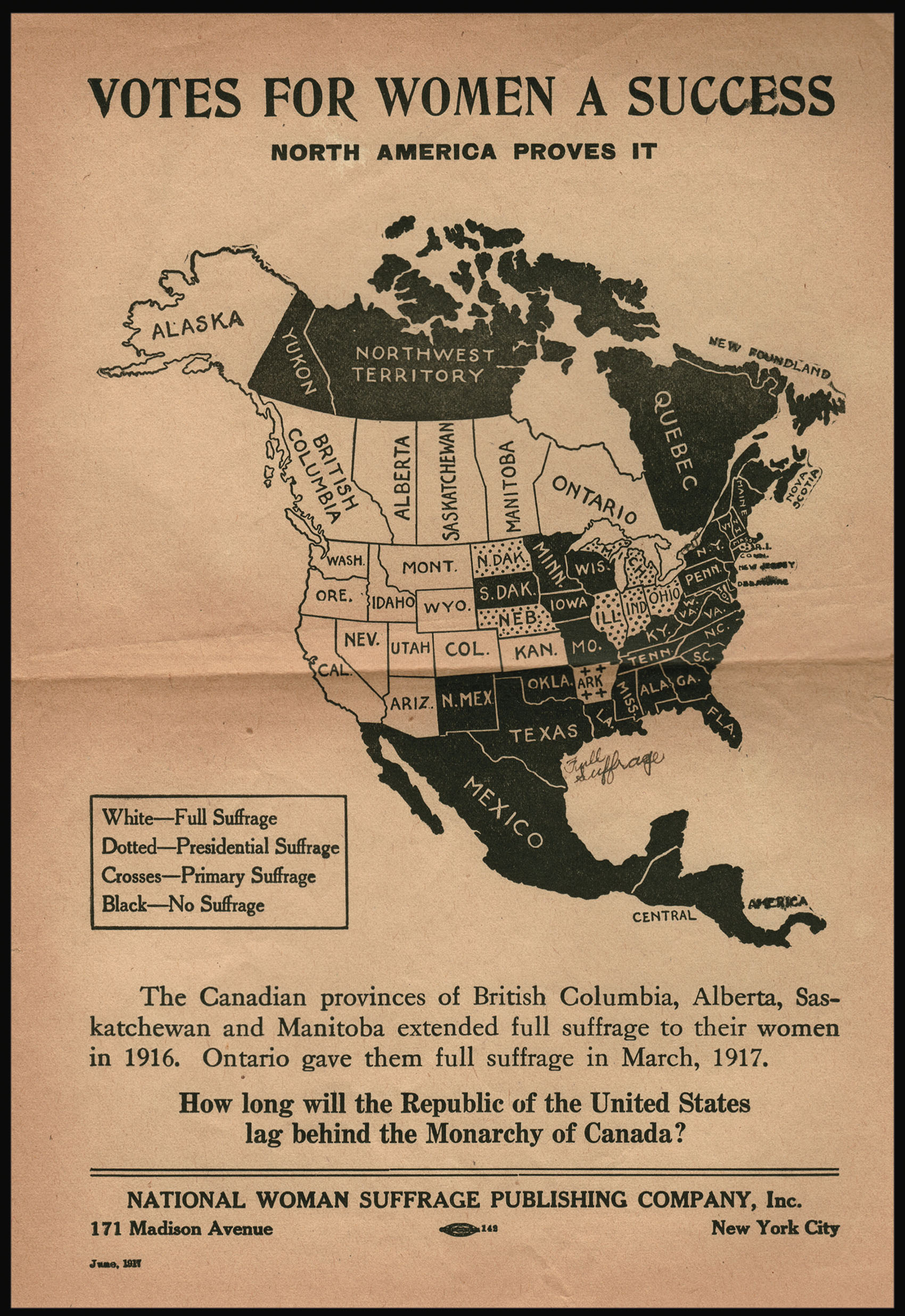 |
"How long will the Republic of the United States lag behind the Monarchy of Canada?"
1 x
£1,200
|
£1,200 |
|
£1,200 |
|
× |
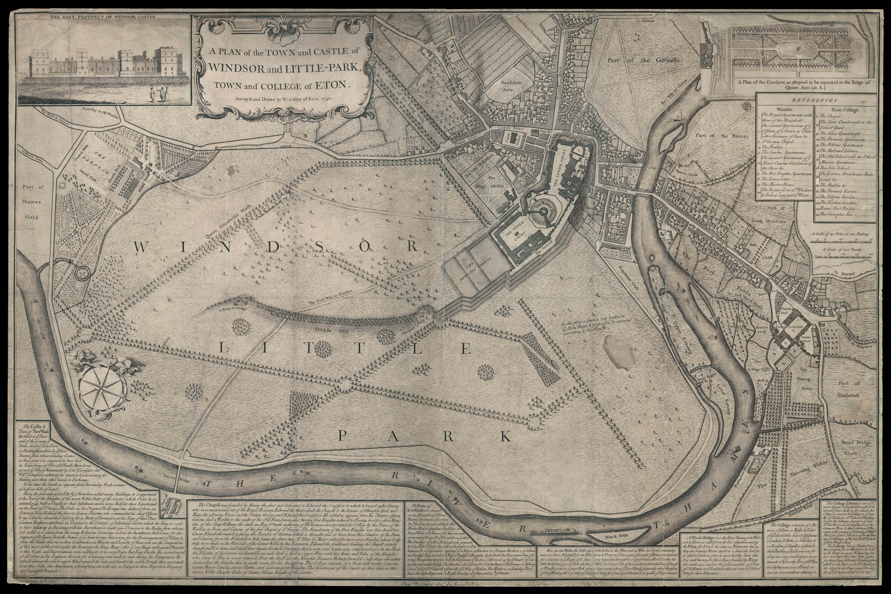 |
Rare eighteenth century plan of Eton
1 x
£10,000
|
£10,000 |
|
£10,000 |
|
× |
![DUDLEY, Robert [Chart of Iceland].](https://omega.crouchrarebooks.com/wp-content/uploads/2025/03/13956_1H.jpg) |
Dudley's chart of Iceland, the first map of the Island on Mercator's projection
1 x
£9,000
|
£9,000 |
|
£9,000 |
|
× |
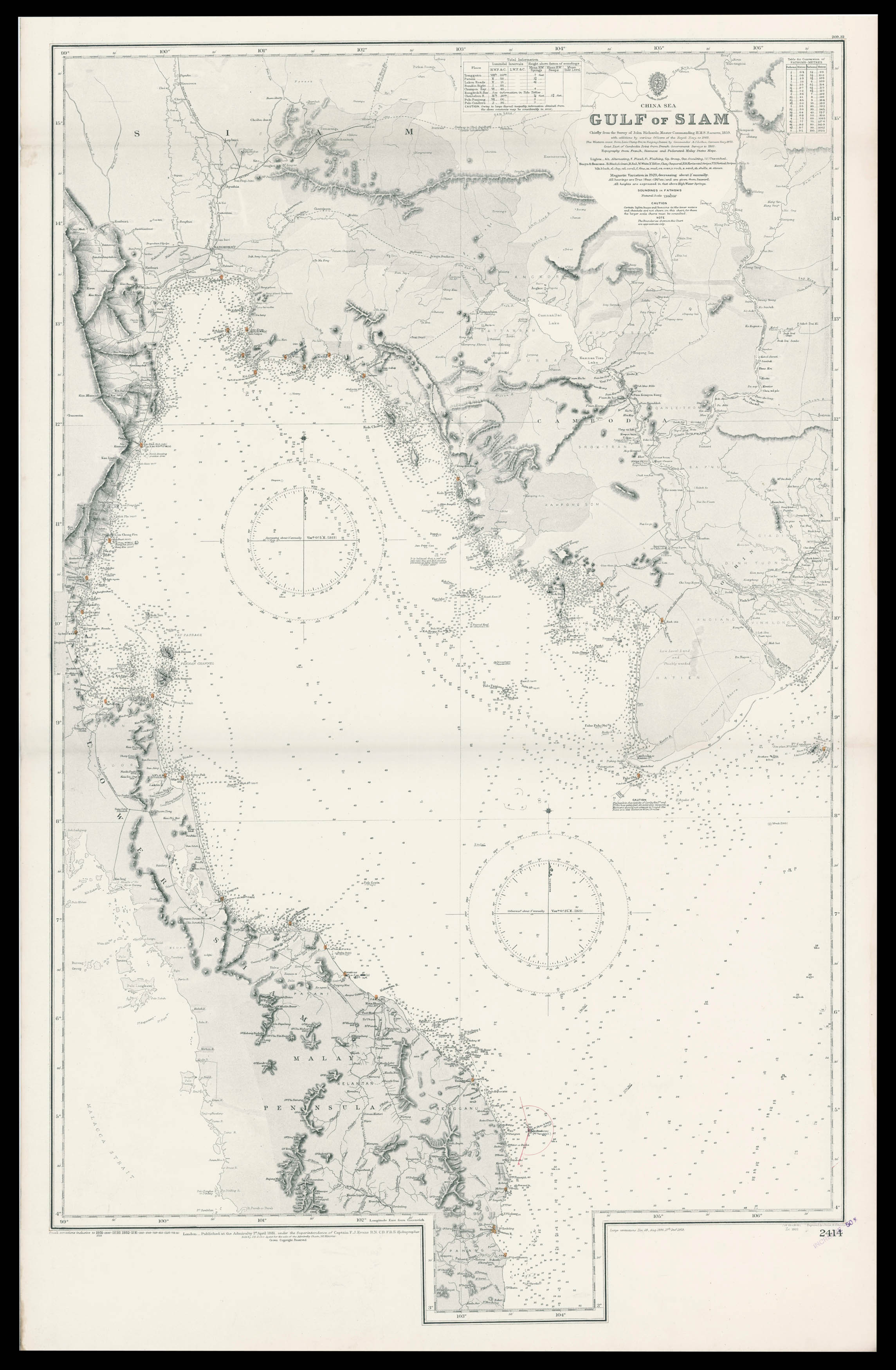 |
Admiralty chart of the Gulf of Thailand
1 x
£1,600
|
£1,600 |
|
£1,600 |
|
× |
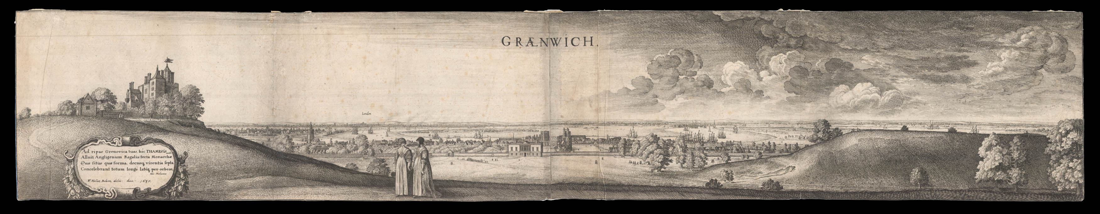 |
Greenwich
1 x
£4,000
|
£4,000 |
|
£4,000 |
|
× |
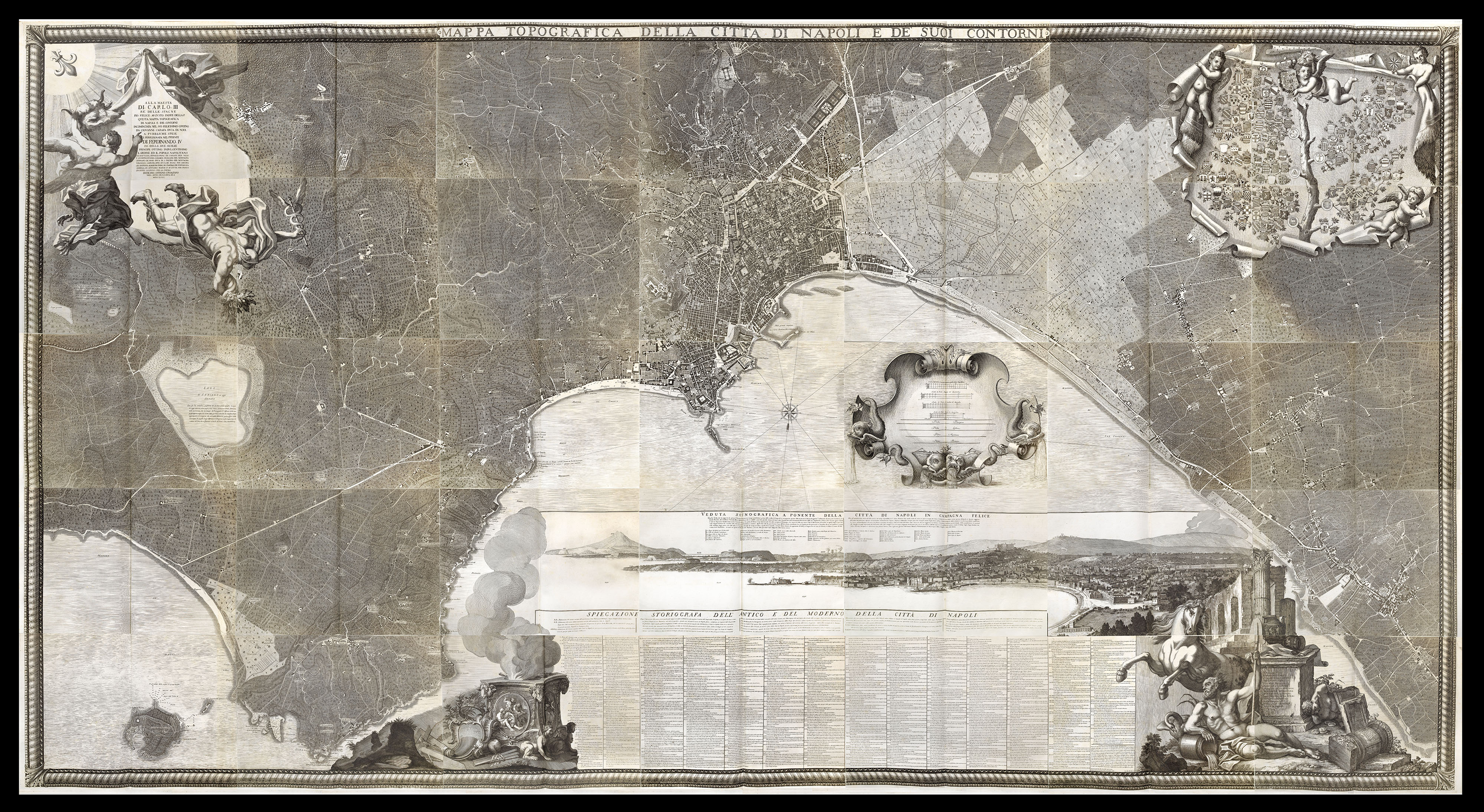 |
Carletti's magnificent plan of Naples
1 x
£45,000
|
£45,000 |
|
£45,000 |
|
× |
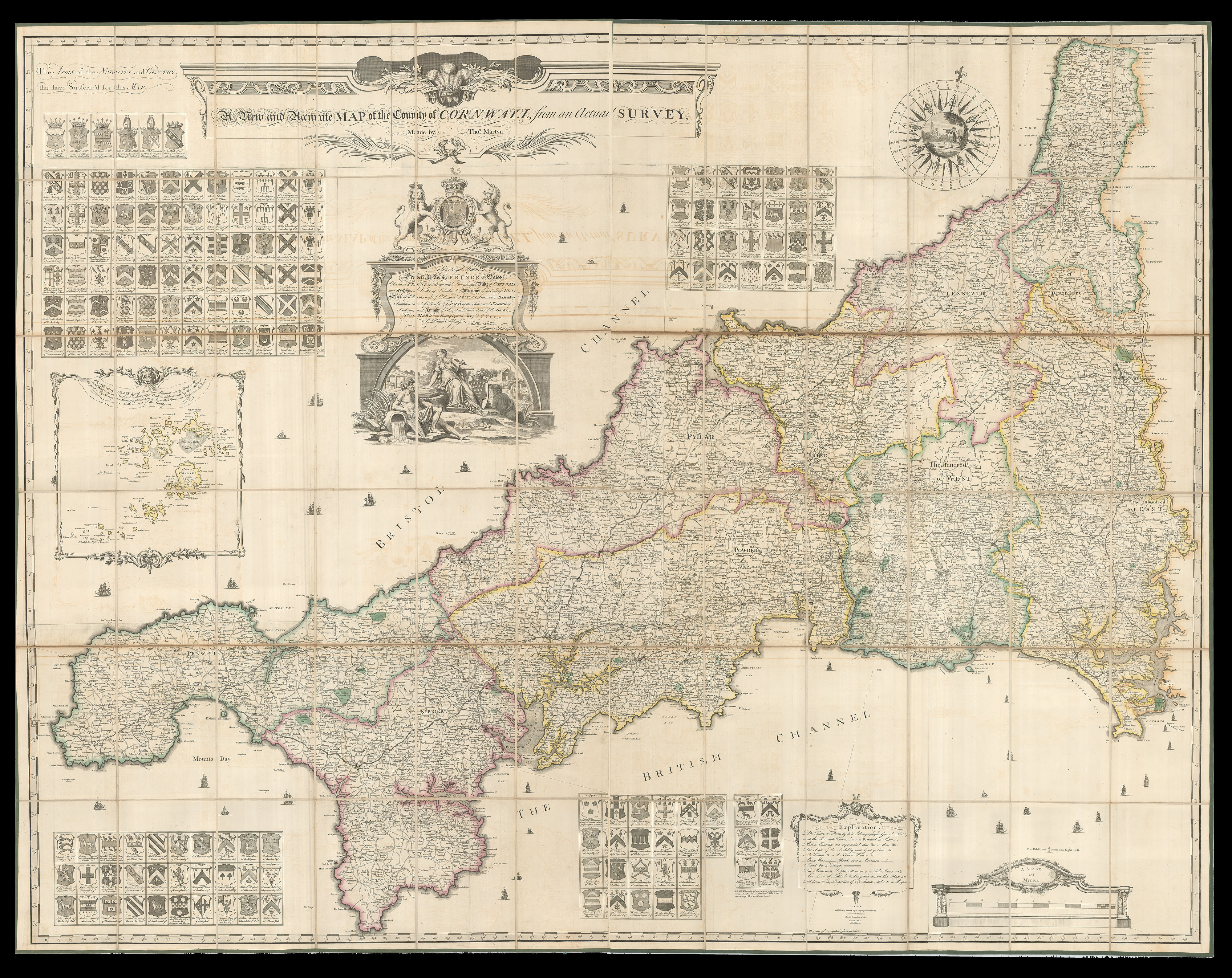 |
1827 edition of Martyn's large-scale map of Cornwall, with the 1816 index
1 x
£10,000
|
£10,000 |
|
£10,000 |
|
× |
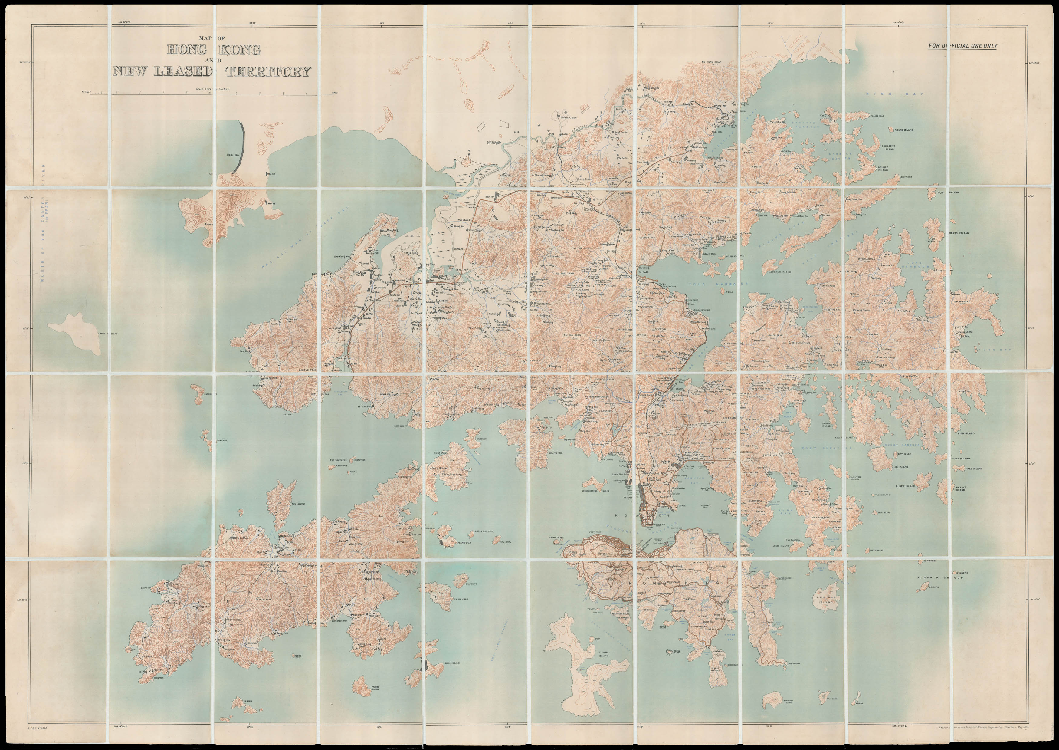 |
Hong Kong and the New Territories
1 x
£15,000
|
£15,000 |
|
£15,000 |
|
× |
![[ANONYMOUS, after MOLL, Herman] A Correct Globe with the new Discoveries. [and] A Correct Globe with ye New Constelations of Dr. Halley &c.](https://omega.crouchrarebooks.com/wp-content/uploads/2025/03/15661_1H.jpg) |
Showing the track of Cook's 'Endeavour' voyage
1 x
£9,000
|
£9,000 |
|
£9,000 |
|
× |
![HOLLAR, W[enceslaus] [after] Francis BARLOW Seuerall Wayes of Hunting, Hawking, and Fishing, According to the English Manner](https://omega.crouchrarebooks.com/wp-content/uploads/2025/03/18303_1H.jpg) |
English hunting scenes
1 x
£6,000
|
£6,000 |
|
£6,000 |
|
× |
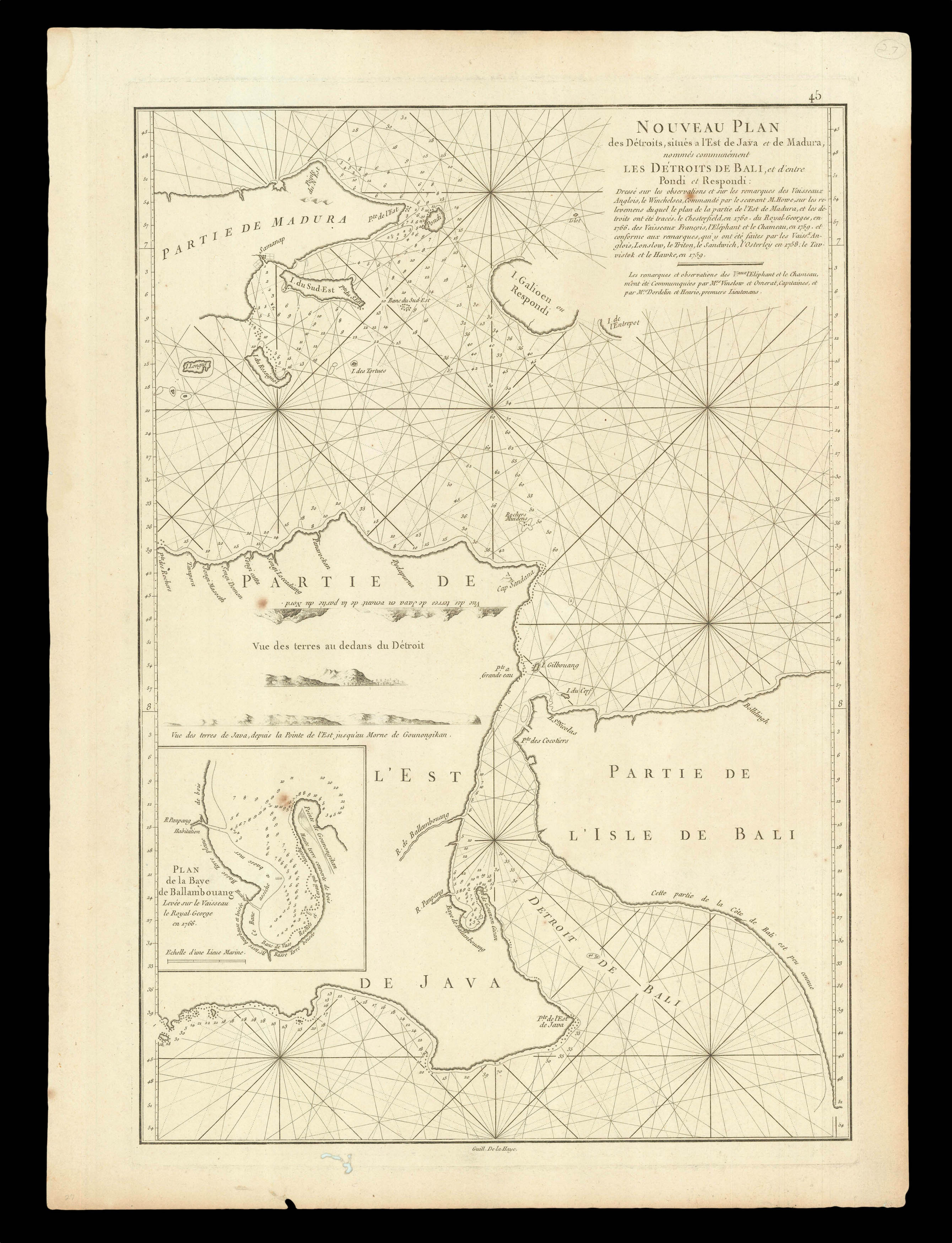 |
The Bali Strait
1 x
£300
|
£300 |
|
£300 |
|
× |
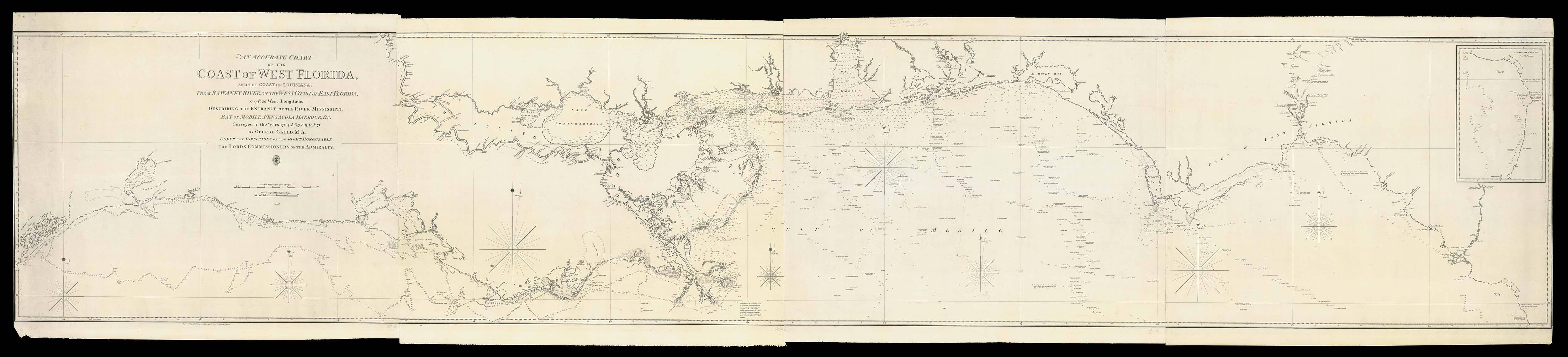 |
Gauld's chart of the Coast of West Florida
1 x
£36,000
|
£36,000 |
|
£36,000 |
|
× |
![[SANXING PRESS] [The latest edition of the map of Hong Kong in full detail;](https://omega.crouchrarebooks.com/wp-content/uploads/2025/03/14291_1H.jpg) |
Large plan of 1930s Hong Kong showing the cyclone scale
1 x
£5,000
|
£5,000 |
|
£5,000 |
|
|


