|
× |
![PTOLEMAEUS, Claudius [translated by ANGELUS, Jacobus, edited by GERMANUS, Nicolaus] [Himilayas and Central Asia] Octava Asie tabula.](https://omega.crouchrarebooks.com/wp-content/uploads/2025/03/18407_1H.jpg) |
A striking map of the Himilayas and Central Asia and China from the 1482 Ulm Ptolemy
1 x
£9,000
|
£9,000 |
|
£9,000 |
|
× |
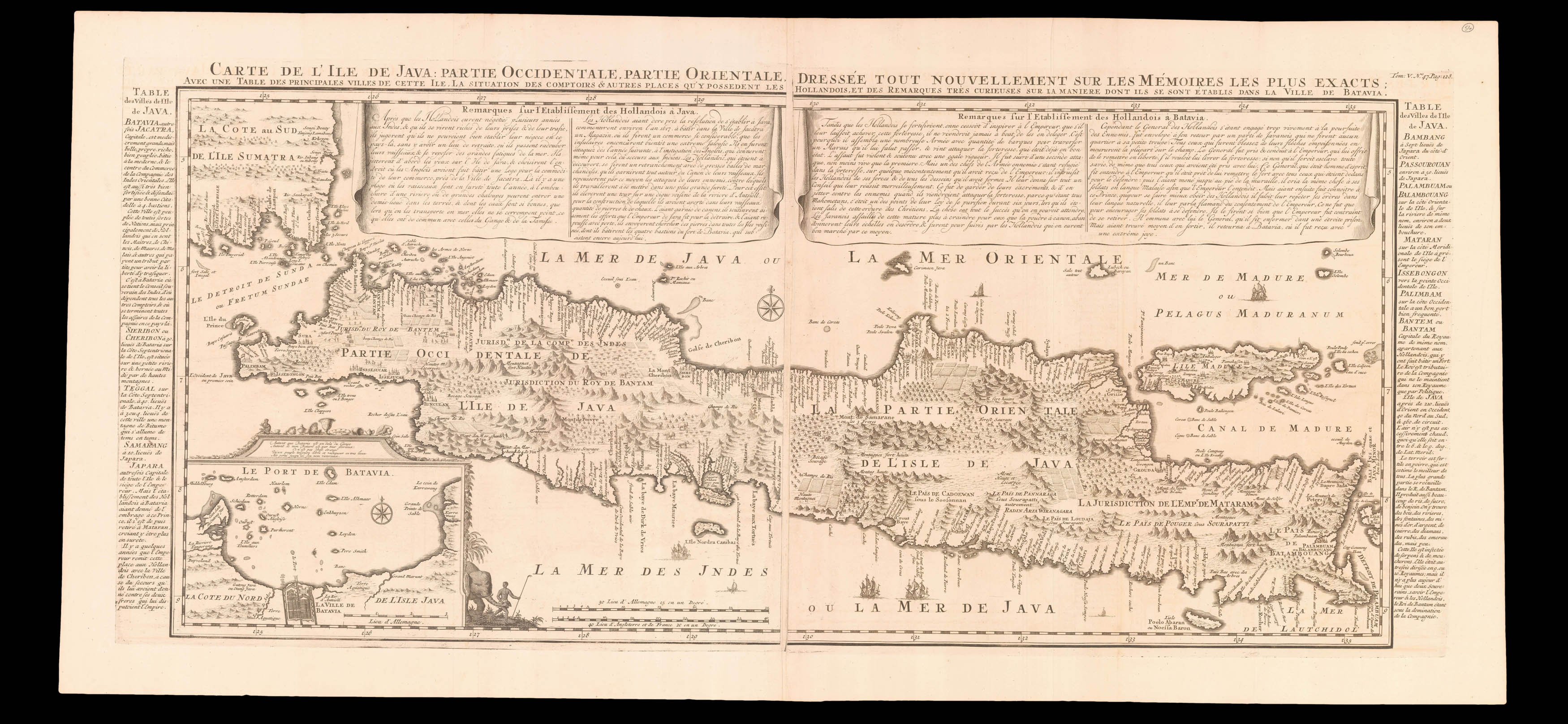 |
One of the earliest printed detailed charts of Java
1 x
£1,850
|
£1,850 |
|
£1,850 |
|
× |
![PTOLEMAEUS, Claudius [translated by ANGELUS, Jacobus, edited by GERMANUS, Nicolaus] [Balkans] Nona Europe tabula.](https://omega.crouchrarebooks.com/wp-content/uploads/2025/03/18445_1H.jpg) |
A striking map of Balkans from the 1482 Ulm Ptolemy
1 x
£12,000
|
£12,000 |
|
£12,000 |
|
× |
![LABELYE, Charles [Kent] A Mapp of the Downes](https://omega.crouchrarebooks.com/wp-content/uploads/2025/03/11318_1H.jpg) |
Rare survey of Sandwich in Kent
1 x
£1,000
|
£1,000 |
|
£1,000 |
|
× |
![ARROWSMITH, Aaron To The Hon[oura]ble the Court Directors of the East India Company This Improved Map of India](https://omega.crouchrarebooks.com/wp-content/uploads/2025/03/15255_1H.jpg) |
The largest map of India produced before the trigonometrical survey
1 x
£10,000
|
£10,000 |
|
£10,000 |
|
× |
 |
The first atlas on Mercator's Projection
1 x
£900,000
|
£900,000 |
|
£900,000 |
|
× |
 |
Pivot to the Pacific
1 x
£35,000
|
£35,000 |
|
£35,000 |
|
× |
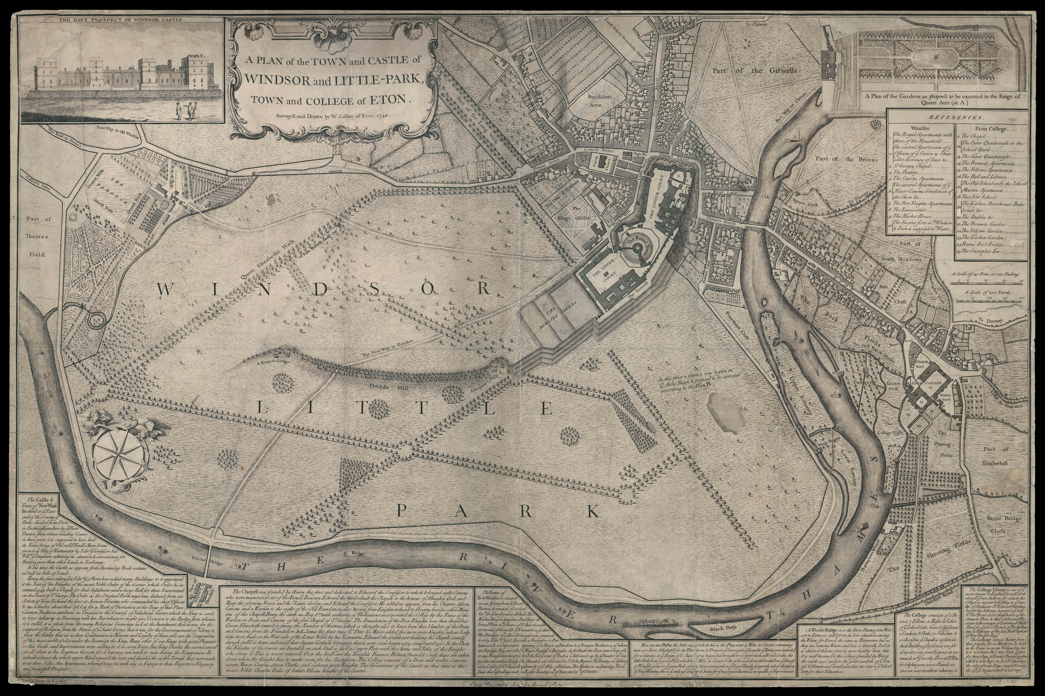 |
Rare eighteenth century plan of Eton
1 x
£10,000
|
£10,000 |
|
£10,000 |
|
× |
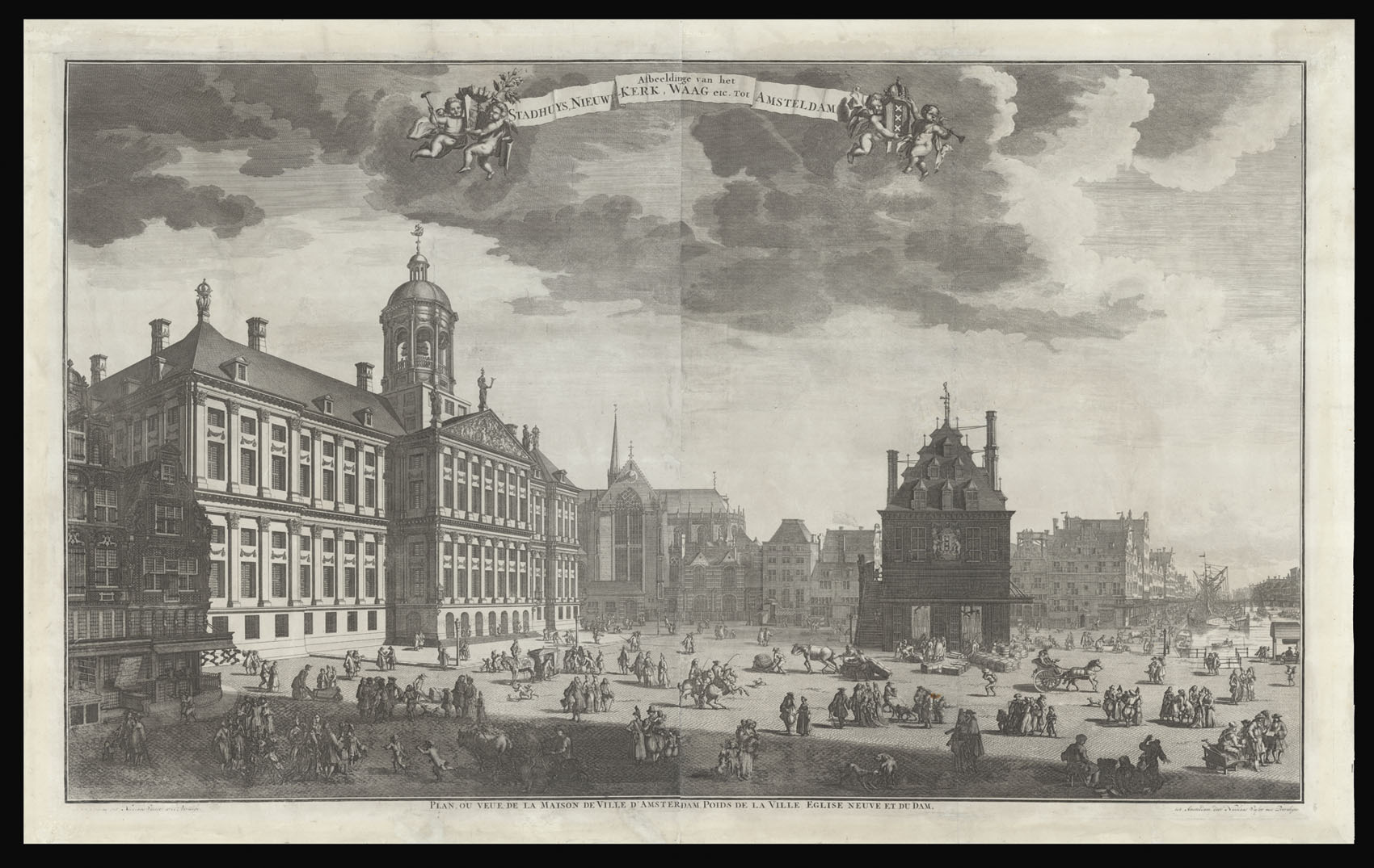 |
View of the Dam with the Koninklijk Paleis and the Waag
1 x
£4,600
|
£4,600 |
|
£4,600 |
|
× |
![GAGE, Michael Alexander [Lancashire] This Trigonometrical Plan of the Town and Port of Liverpool](https://omega.crouchrarebooks.com/wp-content/uploads/2025/03/18468_1H.jpg) |
Lancashire - Gage's striking plan of early nineteenth century Liverpool
1 x
£3,000
|
£3,000 |
|
£3,000 |
|
× |
 |
Black Gold
1 x
£15,000
|
£15,000 |
|
£15,000 |
|
× |
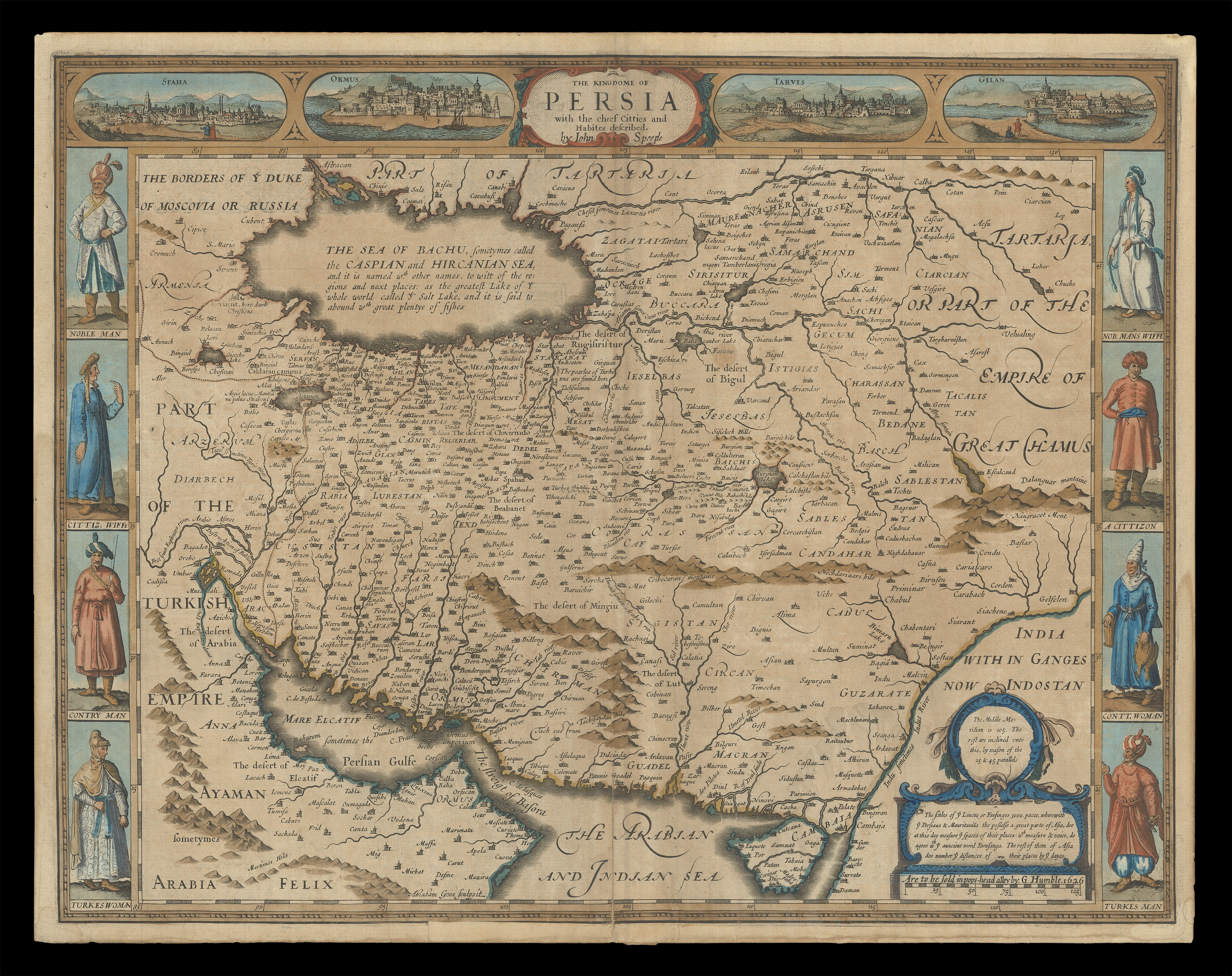 |
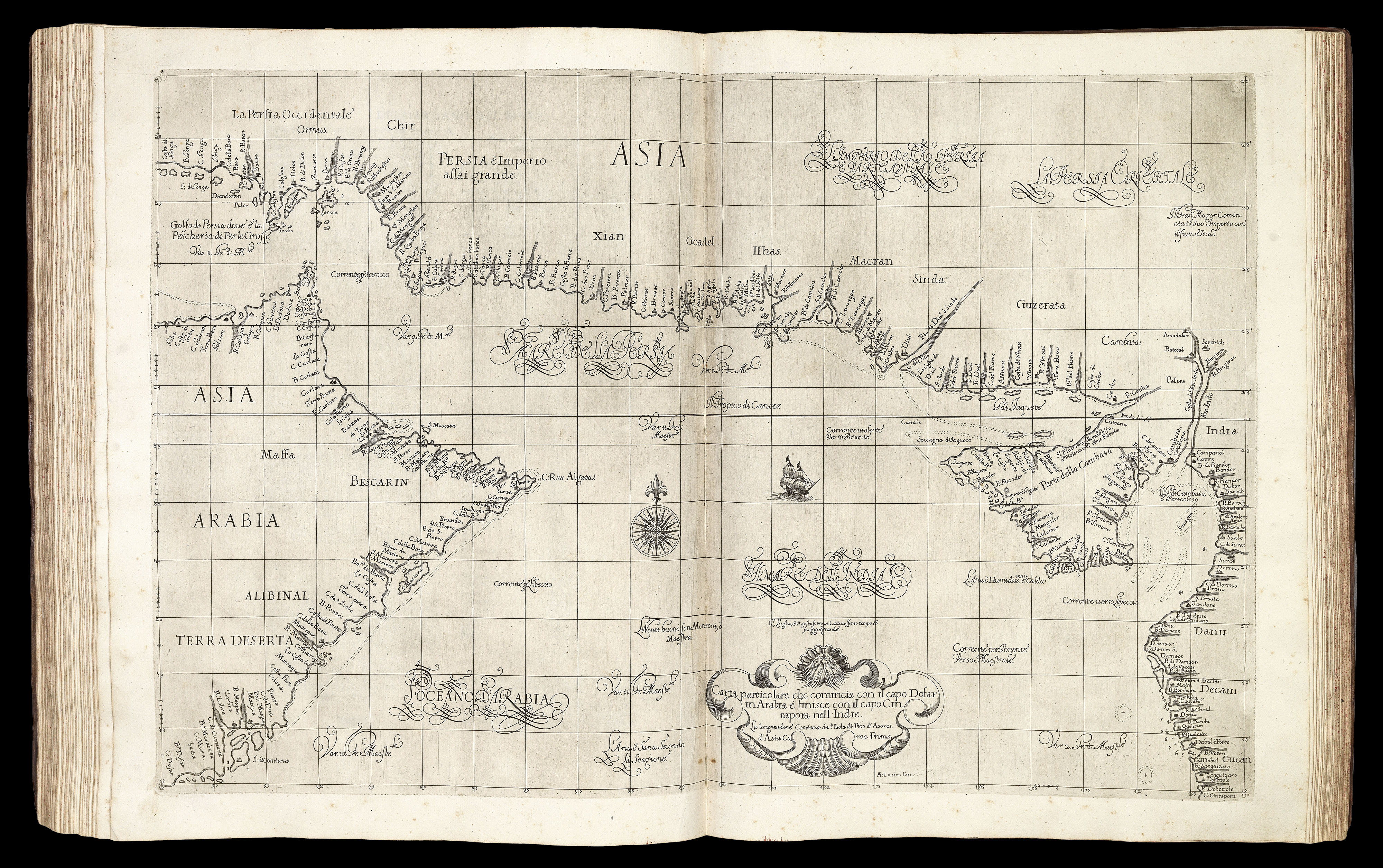
Speed's map of Persia
1 x
£1,800
|
£1,800 |
|
£1,800 |
|
× |
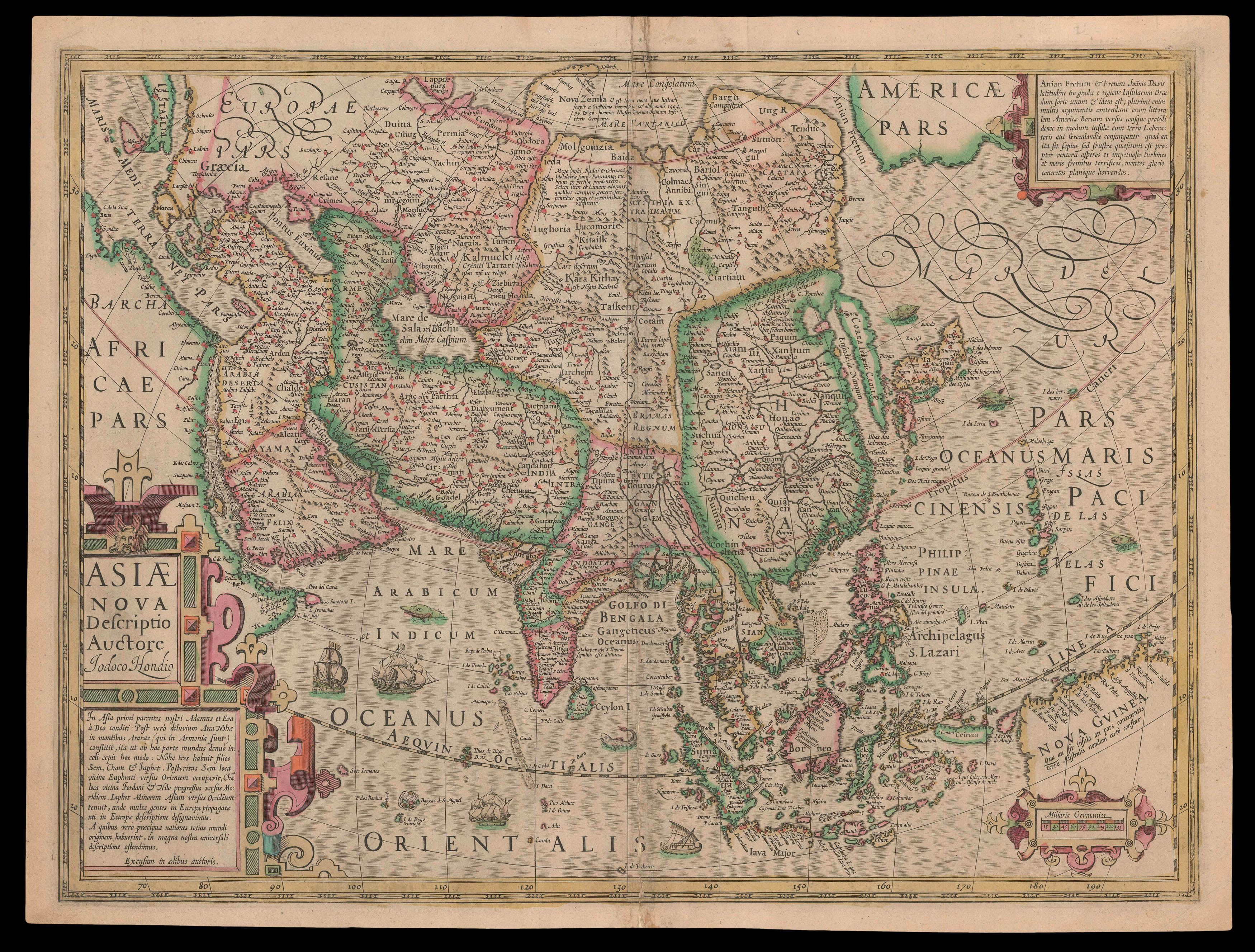 |
Hondius updates Mercator
1 x
£1,250
|
£1,250 |
|
£1,250 |
|
× |
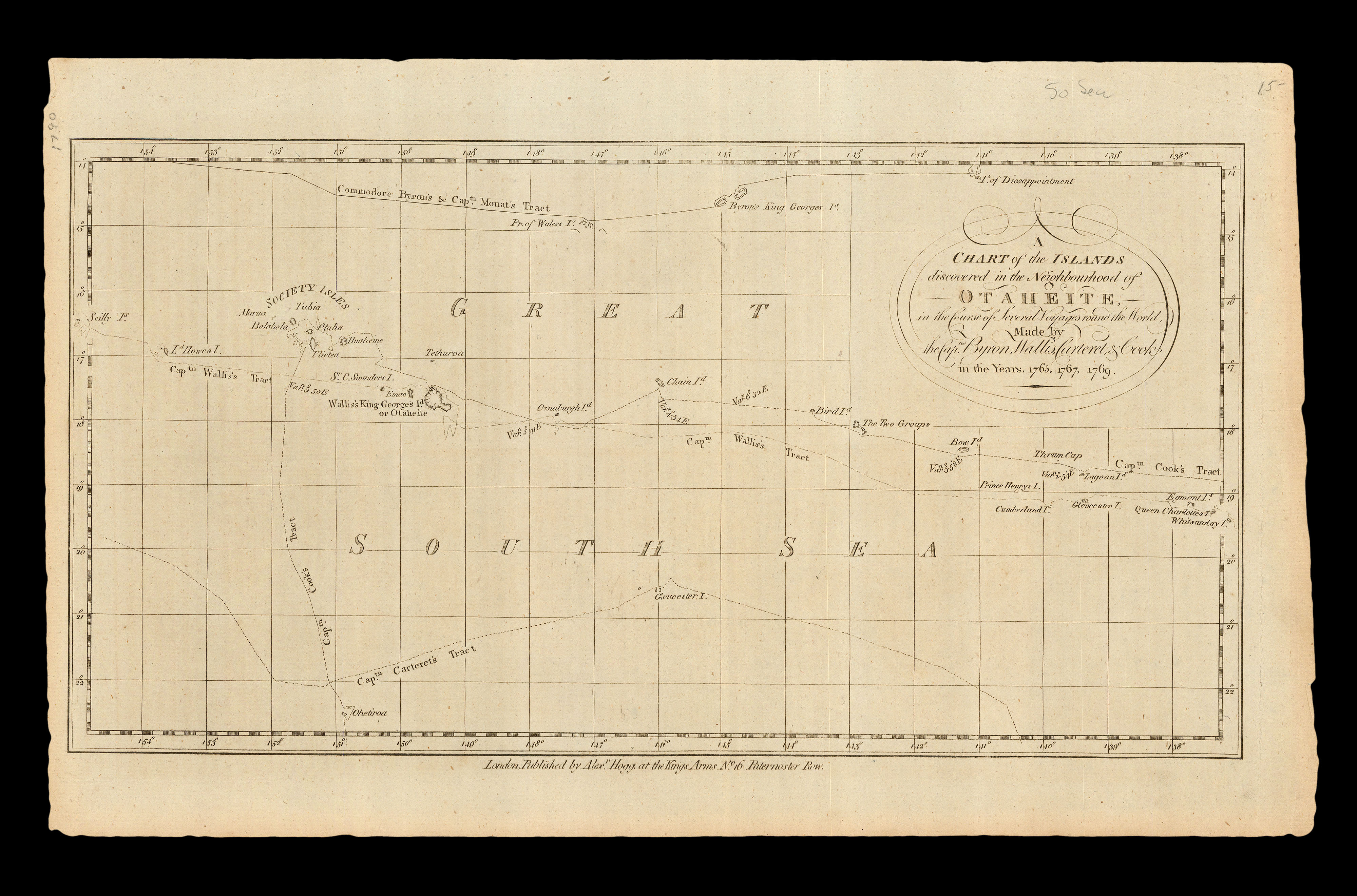 |
The Society Islands
1 x
£750
|
£750 |
|
£750 |
|
× |
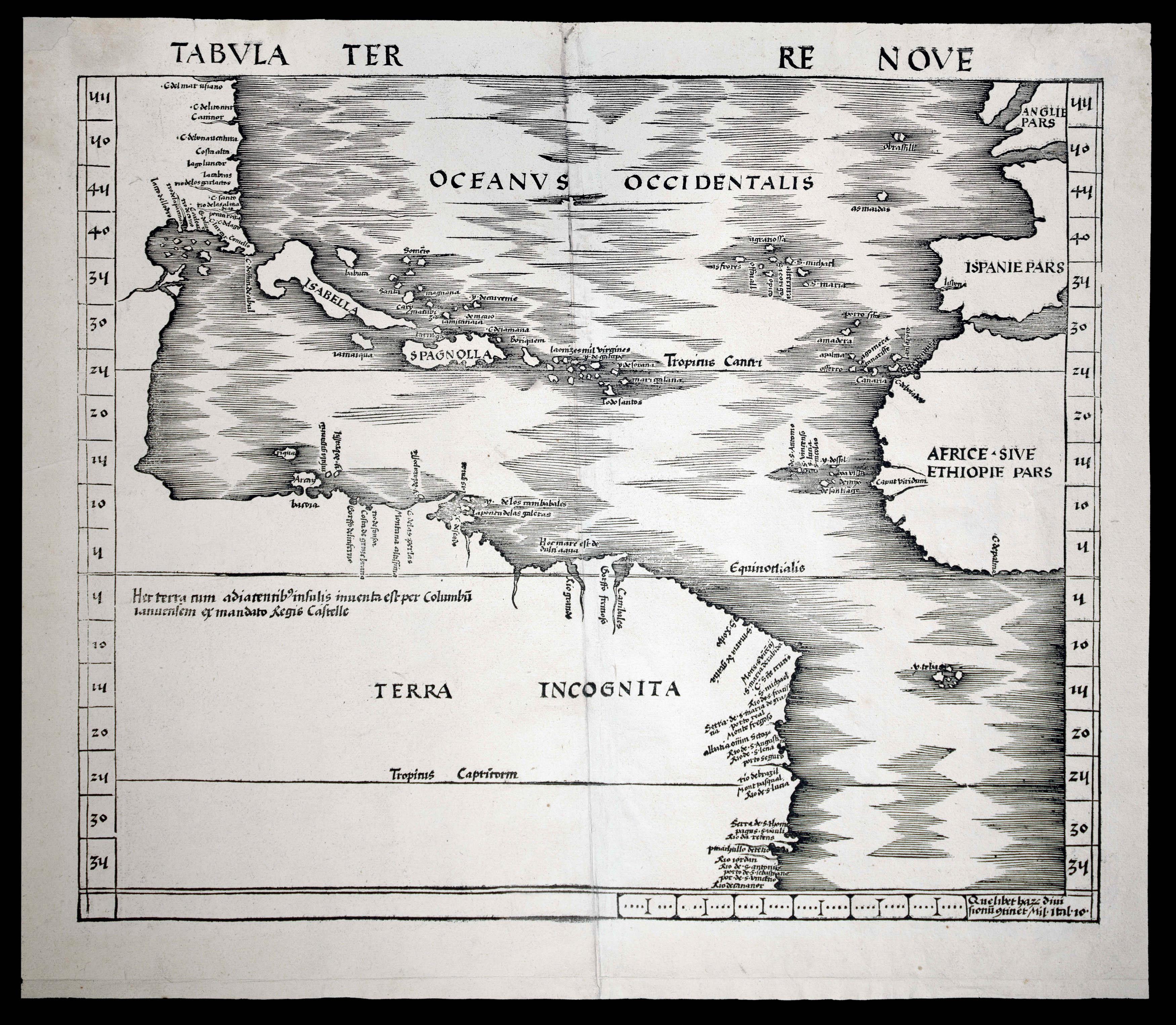 |
The first map devoted to America to appear in an atlas
1 x
£50,000
|
£50,000 |
|
£50,000 |
|
× |
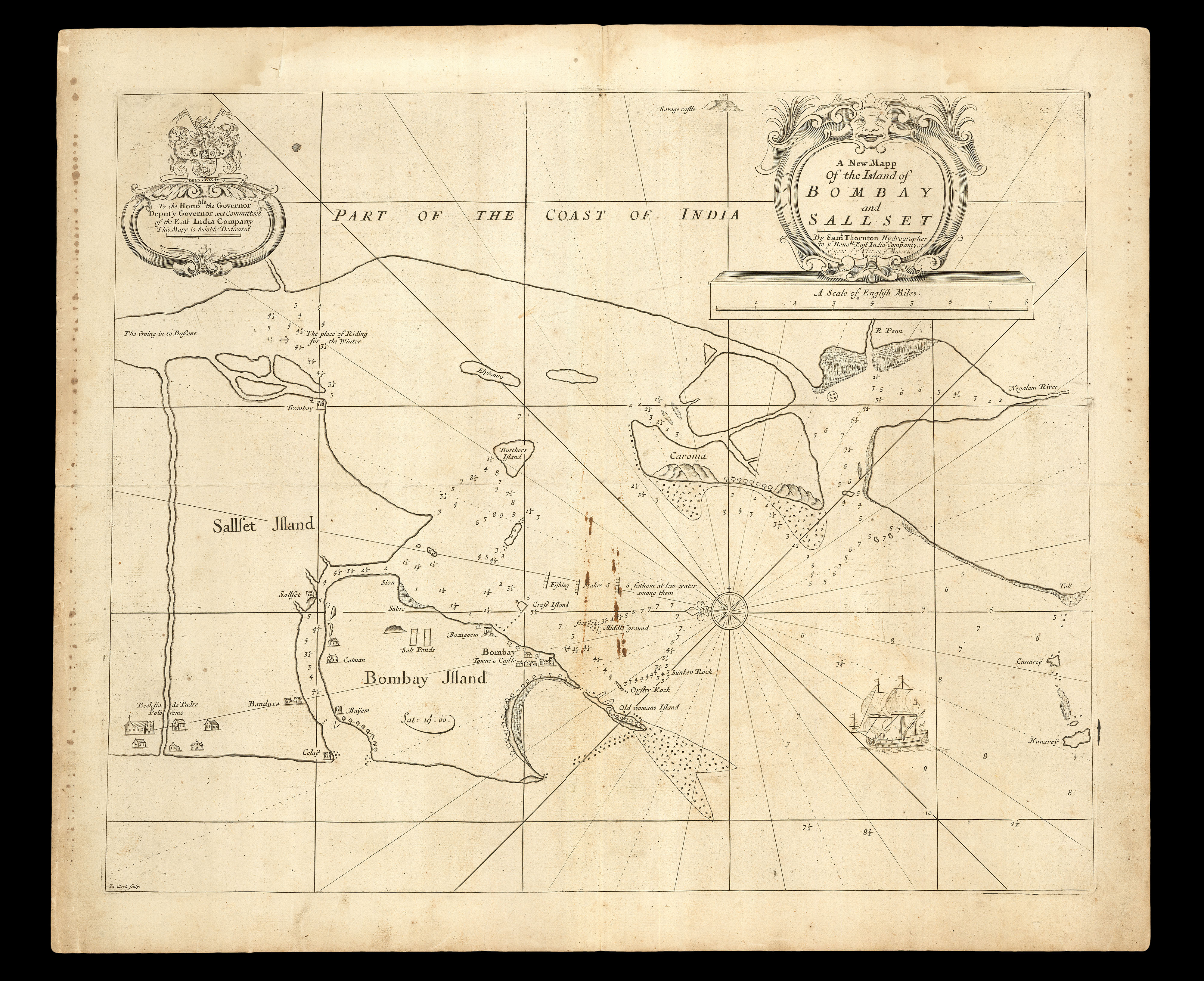 |
The first printed chart to show a recognisable Bombay - with a manuscript chart of the Malabar Coast on the verso
1 x
£6,000
|
£6,000 |
|
£6,000 |
|
× |
![HOLLAR, W[enceslaus] [after] Francis BARLOW Seuerall Wayes of Hunting, Hawking, and Fishing, According to the English Manner](https://omega.crouchrarebooks.com/wp-content/uploads/2025/03/18303_1H.jpg) |
English hunting scenes
1 x
£6,000
|
£6,000 |
|
£6,000 |
|
× |
 |
The northern Malacca Strait
1 x
£1,100
|
£1,100 |
|
£1,100 |
|
× |
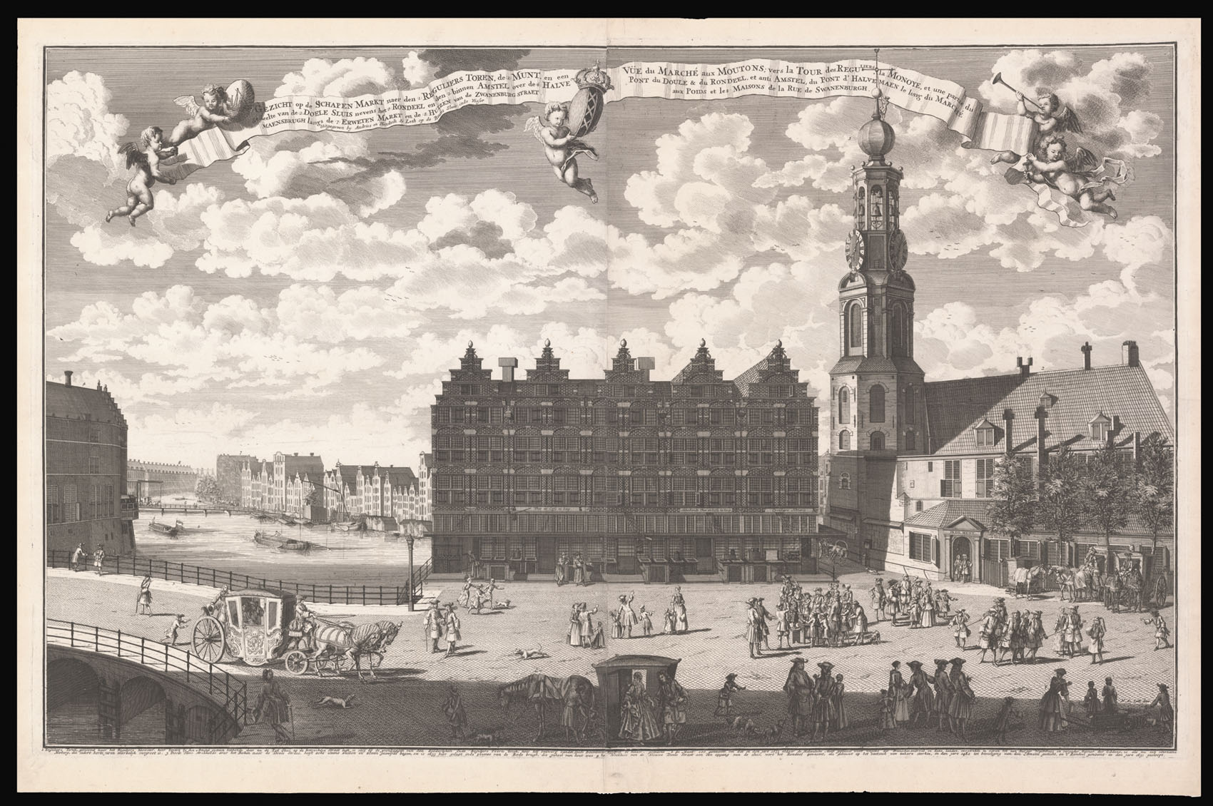 |
A view of the Muntplien with the Munttoren and the Englese Huizen
1 x
£3,800
|
£3,800 |
|
£3,800 |
|
× |
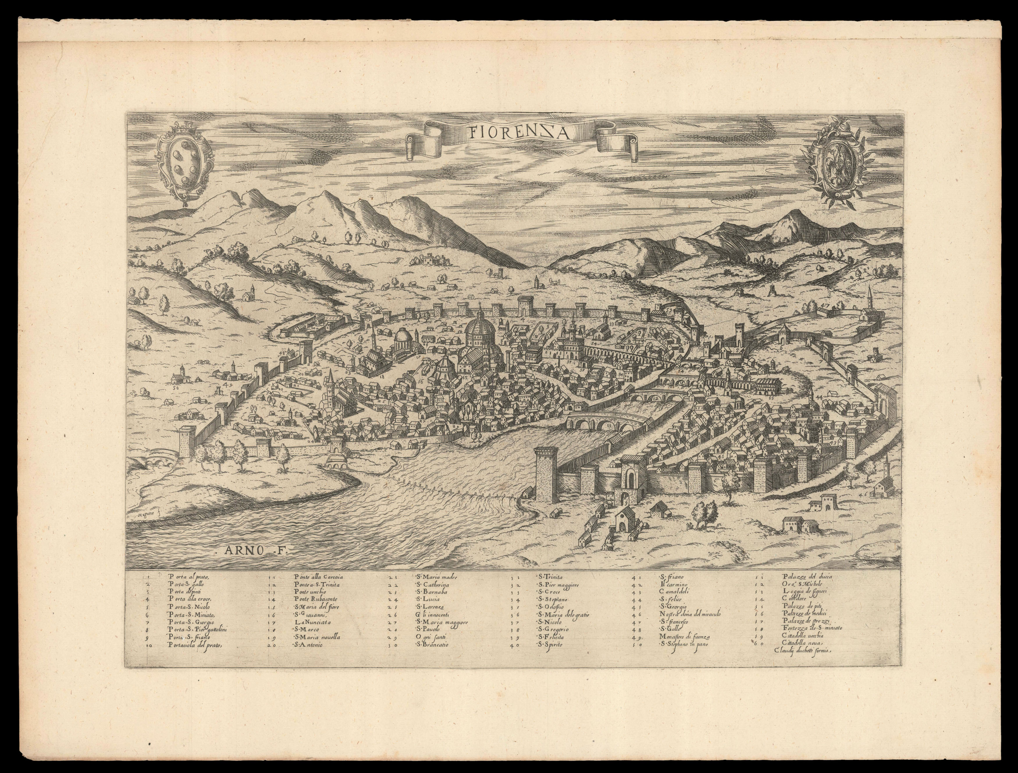 |
Duchetti's plan of Florence
1 x
£2,200
|
£2,200 |
|
£2,200 |
|
× |
![HOLLAR, W[enceslaus] bey Albury in Surrey](https://omega.crouchrarebooks.com/wp-content/uploads/2025/03/18258_1H.jpg) |
Views of Albury
1 x
£3,000
|
£3,000 |
|
£3,000 |
|
× |
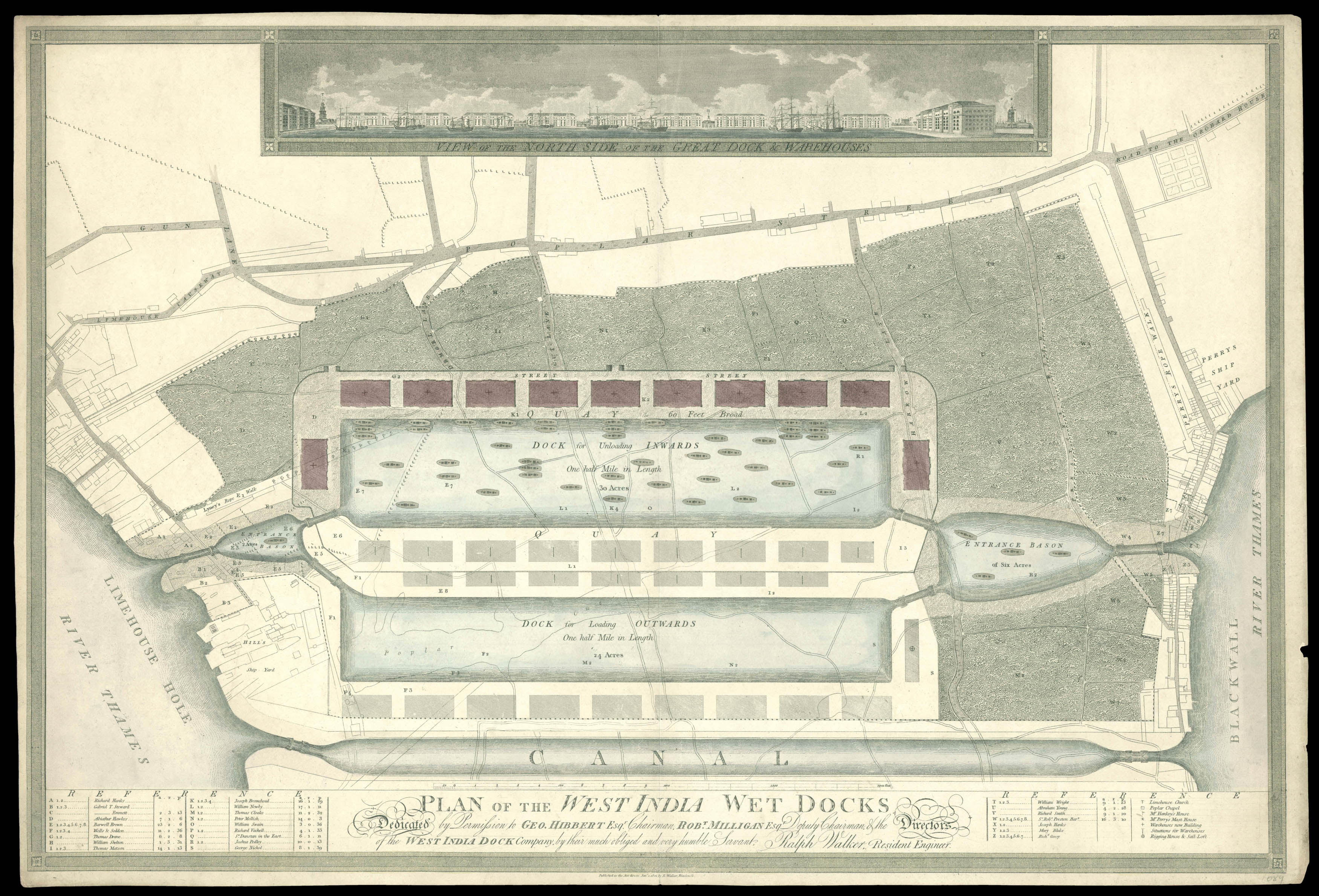 |
Separately issued plan of the proposed West India Docks
1 x
£2,500
|
£2,500 |
|
£2,500 |
|
× |
![PTOLEMAEUS, Claudius [Modern Holy Land].](https://omega.crouchrarebooks.com/wp-content/uploads/2025/03/18404_1H.jpg) |
The modern Holy Land
1 x
£37,500
|
£37,500 |
|
£37,500 |
|
× |
![WALL, Thomas [Lancashire] Map Shewing Proposed Extension of the Parliamentary Borough of Wigan](https://omega.crouchrarebooks.com/wp-content/uploads/2025/03/10776_1H.jpg) |
The borough of Wigan
1 x
£400
|
£400 |
|
£400 |
|
× |
![PTOLEMAEUS, Claudius [translated by ANGELUS, Jacobus, edited by GERMANUS, Nicolaus] [India] Decima Asie tabula.](https://omega.crouchrarebooks.com/wp-content/uploads/2025/03/18409_1H.jpg) |
A striking map of India from the 1482 Ulm Ptolemy
1 x
£37,500
|
£37,500 |
|
£37,500 |
|
× |
![PTOLEMAEUS, Claudius [translated by ANGELUS, Jacobus, edited by GERMANUS, Nicolaus] [Balkans] Nona Europe tabula.](https://omega.crouchrarebooks.com/wp-content/uploads/2025/03/18397_1H.jpg) |
A striking map of Balkans from the 1482 Ulm Ptolemy
1 x
£15,000
|
£15,000 |
|
£15,000 |
|
× |
![Dong Fangli (Youcheng) 董方立(佑誠) (1791-1823), Li Zhaoluo 李兆洛 (1769-1841) Huangchao yitong yudi quantu 皇朝壹统舆地全圖 [Complete Map of the Unified Qing Empire].](https://omega.crouchrarebooks.com/wp-content/uploads/2025/03/14998_1H.jpg) |
Longitude and Latitude on a map of the Qing Empire
1 x
£65,000
|
£65,000 |
|
£65,000 |
|
× |
![[SNOW, W., after Robert DIGHTON] A Caricature of England and Wales.](https://omega.crouchrarebooks.com/wp-content/uploads/2025/03/3205_1H.jpg) |
England and Wales as an old man
1 x
£800
|
£800 |
|
£800 |
|
× |
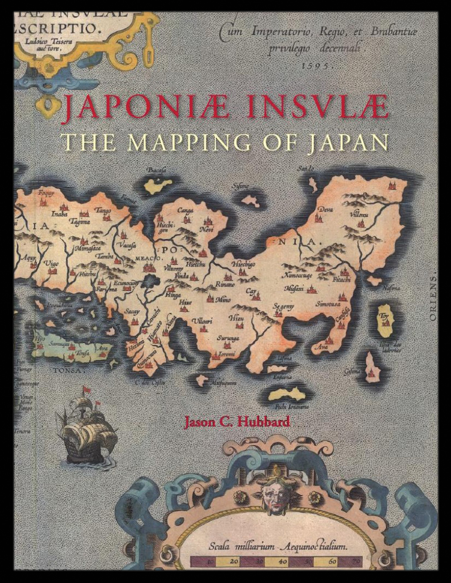 |
Hubbard's cartobibliography of Japan
1 x
£159
|
£159 |
|
£159 |
|
× |
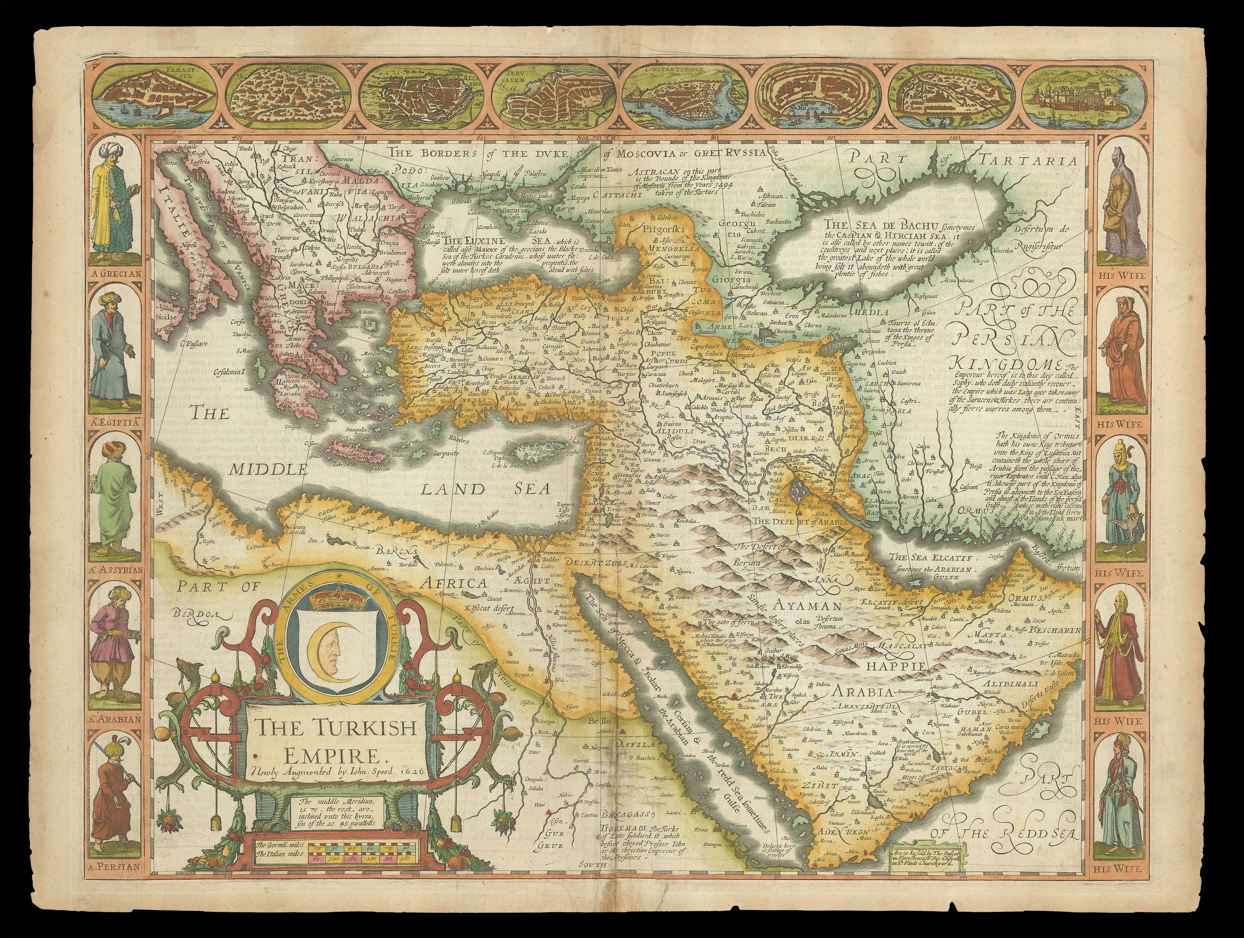 |
Speed's map of the Ottoman Empire
1 x
£2,000
|
£2,000 |
|
£2,000 |
|
× |
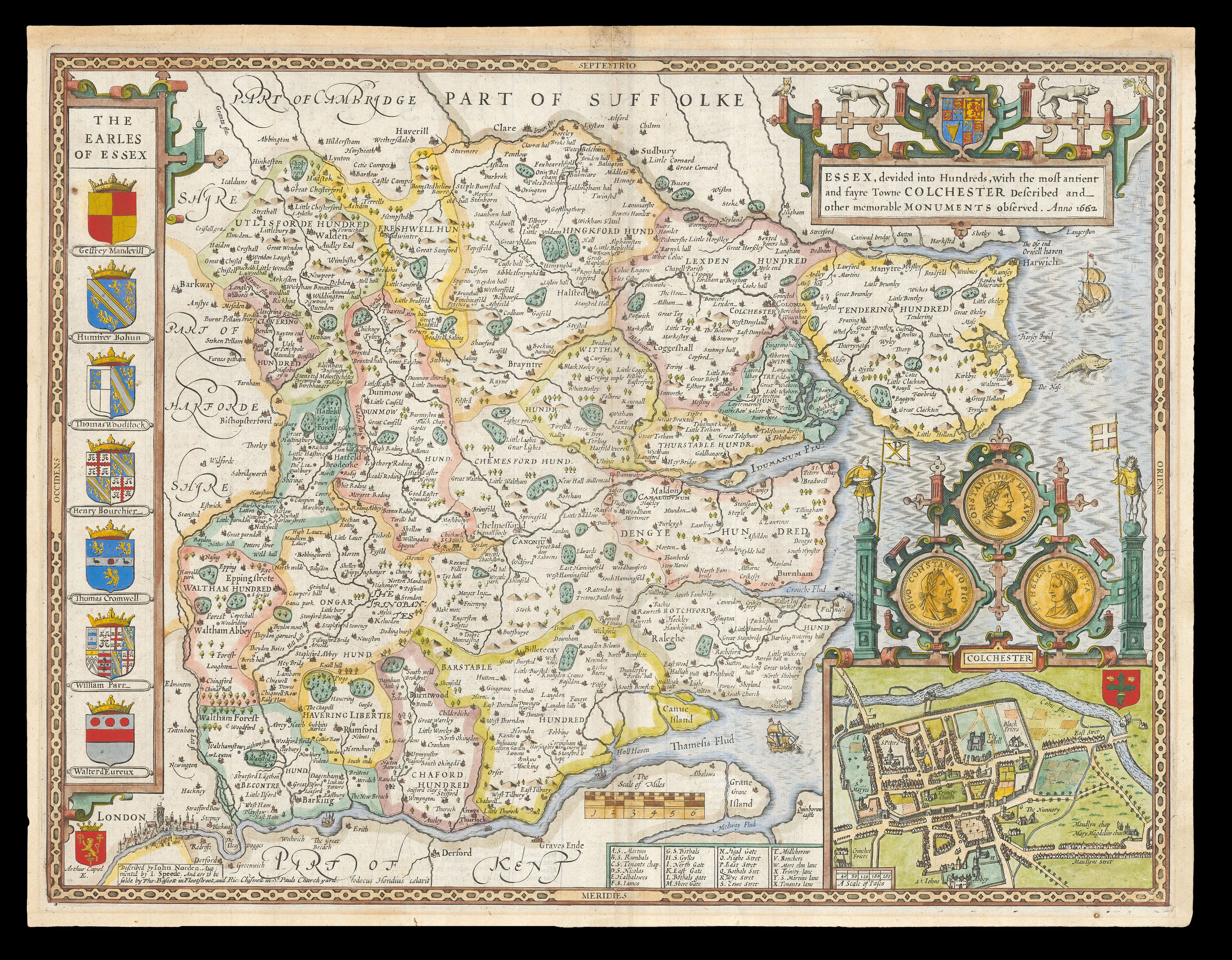 |
Speed's map of Essex
1 x
£900
|
£900 |
|
£900 |
|
× |
![GASTALDI, Giacomo & LAFRERI, Antonio La descrittione della prima parte dell'Asia. [and] Il disegno della seconda parte dell'Asia.](https://omega.crouchrarebooks.com/wp-content/uploads/2025/03/15701_1H.jpg) |
The most important maps of the Middle East and Arabia published in the sixteenth century
1 x
£125,000
|
£125,000 |
|
£125,000 |
|
× |
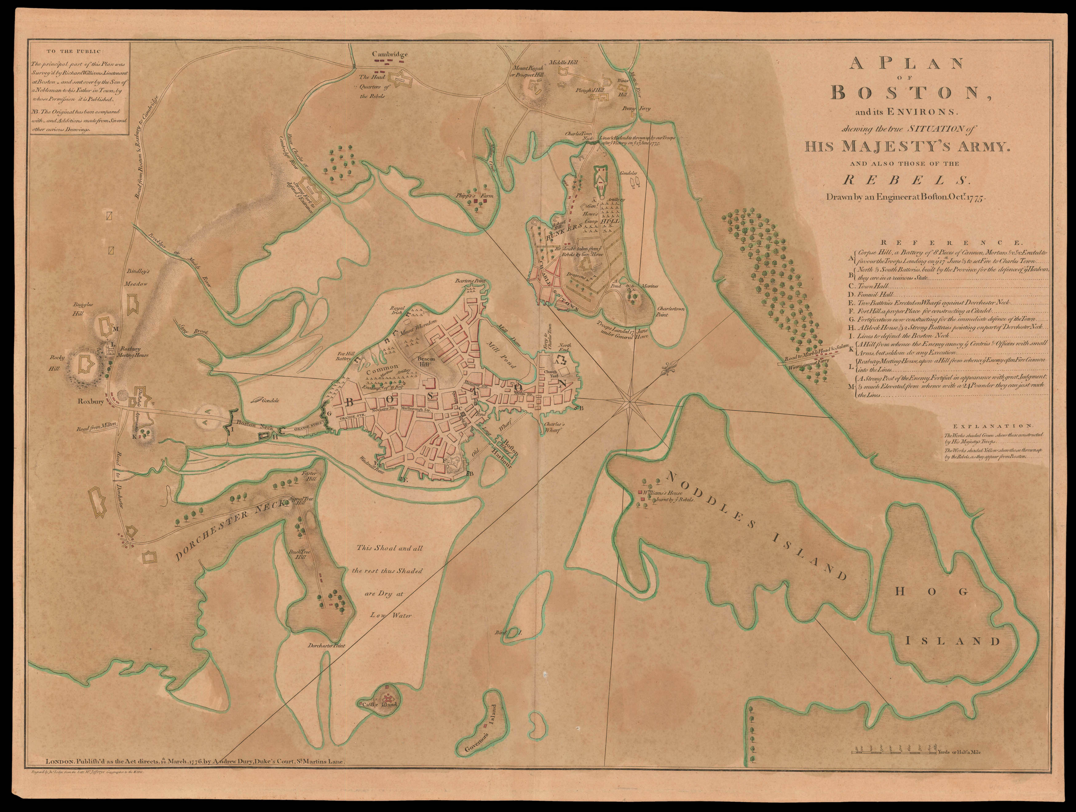 |
"don't one of you fire until you see the white of their eyes"
1 x
£45,000
|
£45,000 |
|
£45,000 |
|
× |
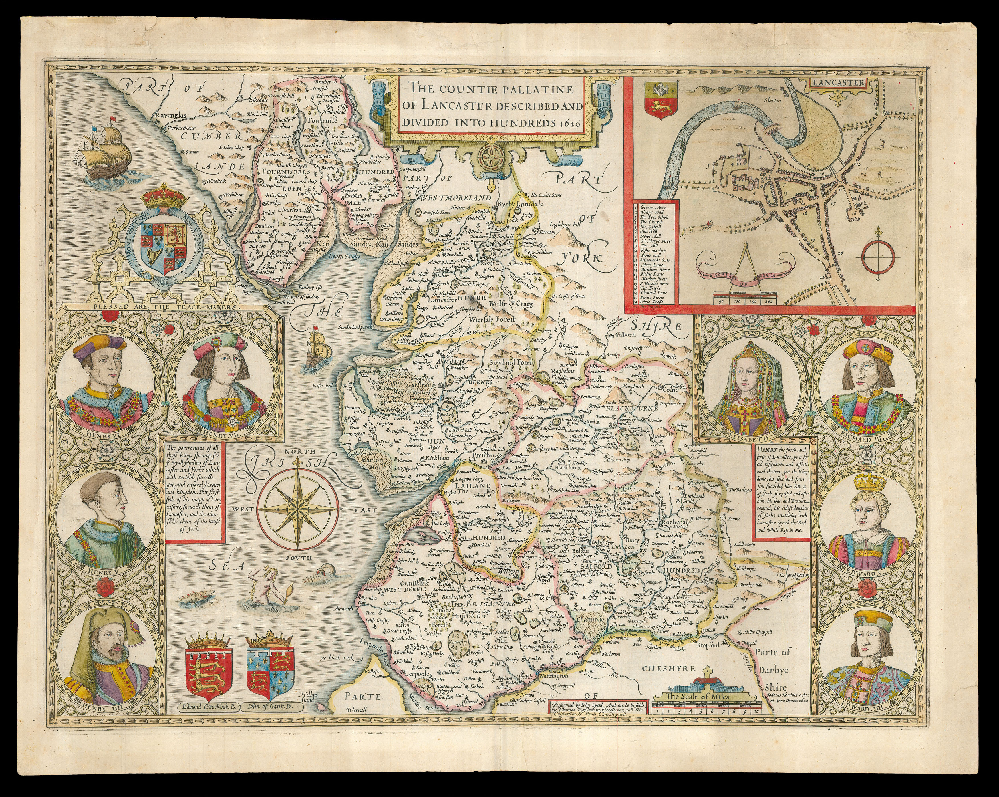 |
Speed's map of Lancashire
1 x
£800
|
£800 |
|
£800 |
|
× |
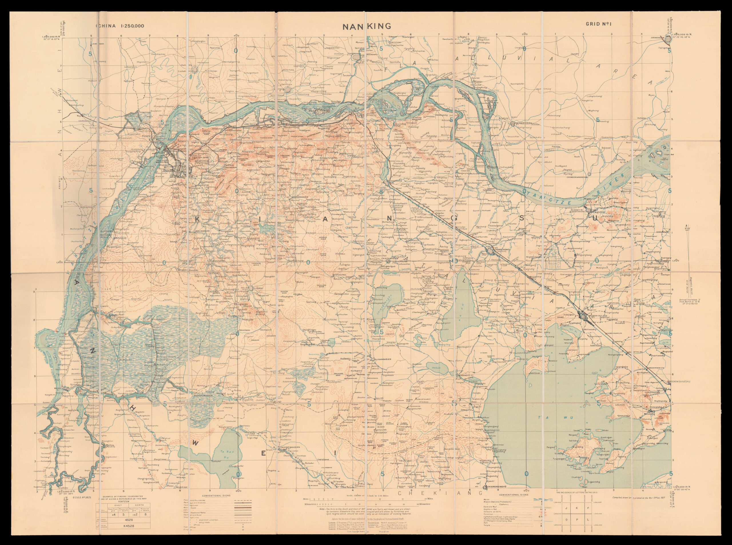 |
General Staff map of Nanking
1 x
£3,500
|
£3,500 |
|
£3,500 |
|
× |
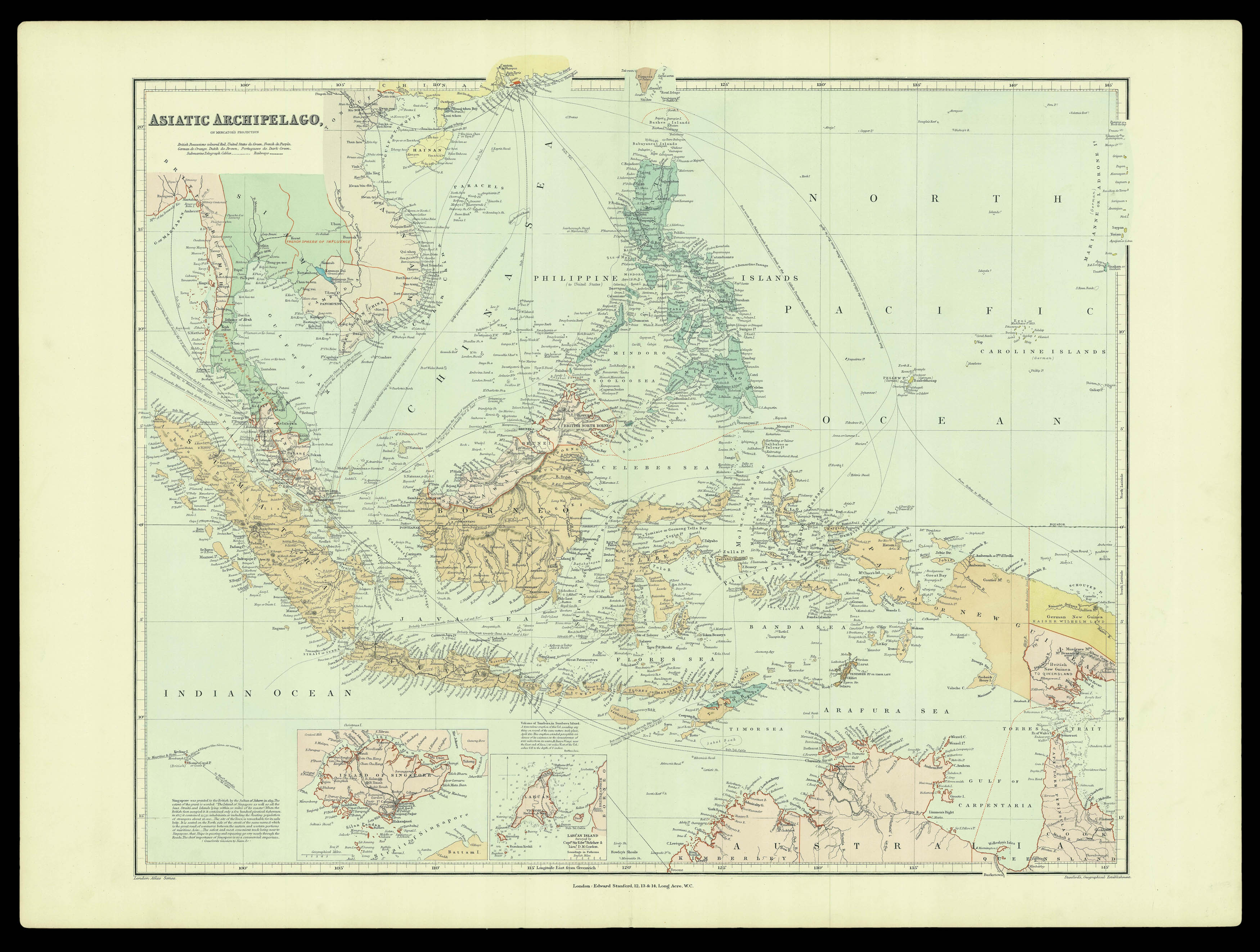 |
Southeast Asia at the end of the nineteenth century
1 x
£950
|
£950 |
|
£950 |
|
|


