|
× |
![CARY, John [World and four continents]](https://omega.crouchrarebooks.com/wp-content/uploads/2025/03/1759_1H.jpg) |
Cary's rare wall maps of the world and four continents
1 x
£15,000
|
£15,000 |
|
£15,000 |
|
× |
![WESTERMAYER, C[onrad]; [after] [Jean Henri] CLESS César-François Cassini de Thury](https://omega.crouchrarebooks.com/wp-content/uploads/2025/03/17729_1H.jpg) |
Cesar-Francois Cassini
1 x
£300
|
£300 |
|
£300 |
|
× |
![WESTERMAYER, C[onrad] [after] CLESS, [Jean Henri] Jean. Domin. Cassini.](https://omega.crouchrarebooks.com/wp-content/uploads/2025/03/17731_1H.jpg) |
Jean Dominique Cassini II
1 x
£300
|
£300 |
|
£300 |
|
× |
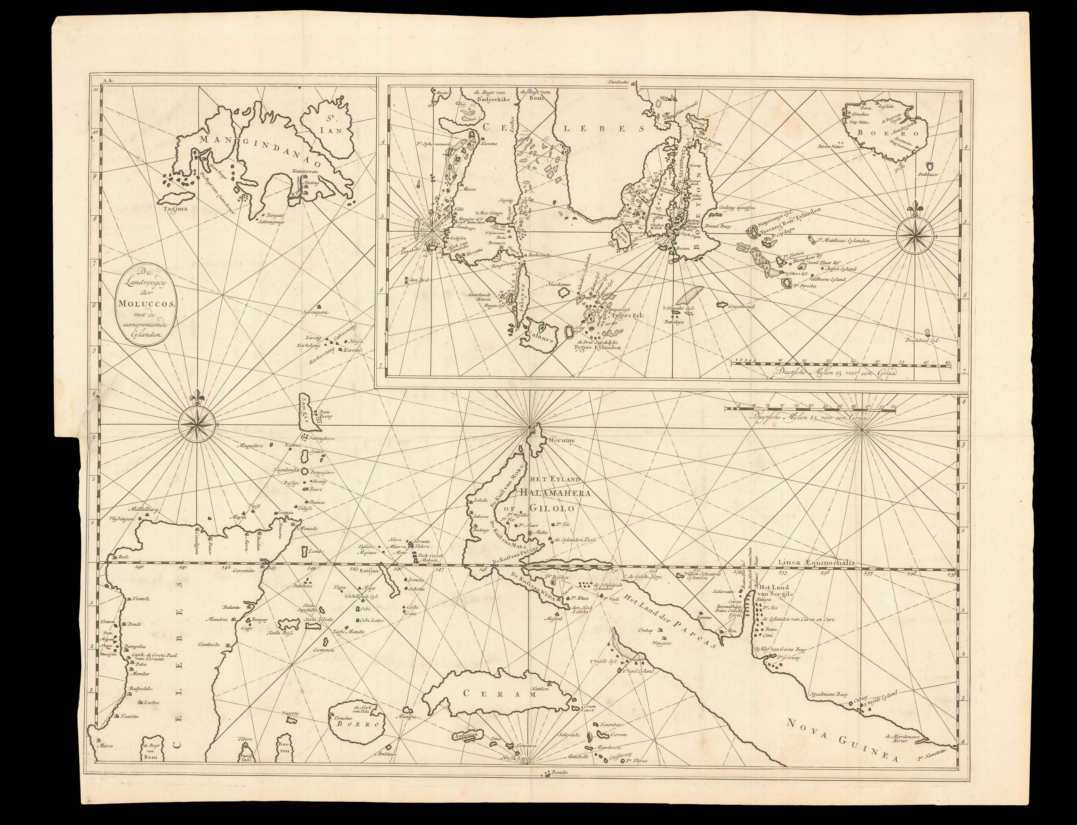 |
The Moluccas
1 x
£370
|
£370 |
|
£370 |
|
× |
 |
John Rocque's rare index to his large wall map of Dublin, including a price list of all Rocque's published works
1 x
£1,200
|
£1,200 |
|
£1,200 |
|
× |
 |
Halley's Zodiacus Stellatus
1 x
£10,000
|
£10,000 |
|
£10,000 |
|
× |
![BLAEU, Johannes [II] [Chart of the West Coast of Saudi Arabia and the Red Sea].](https://omega.crouchrarebooks.com/wp-content/uploads/2025/03/16247_1H.jpg) |
A Dutch East India Company (VOC) manuscript chart fragment of the Arabian Coast and Red Sea signed and dated by Joan Blaeu II
1 x
£90,000
|
£90,000 |
|
£90,000 |
|
× |
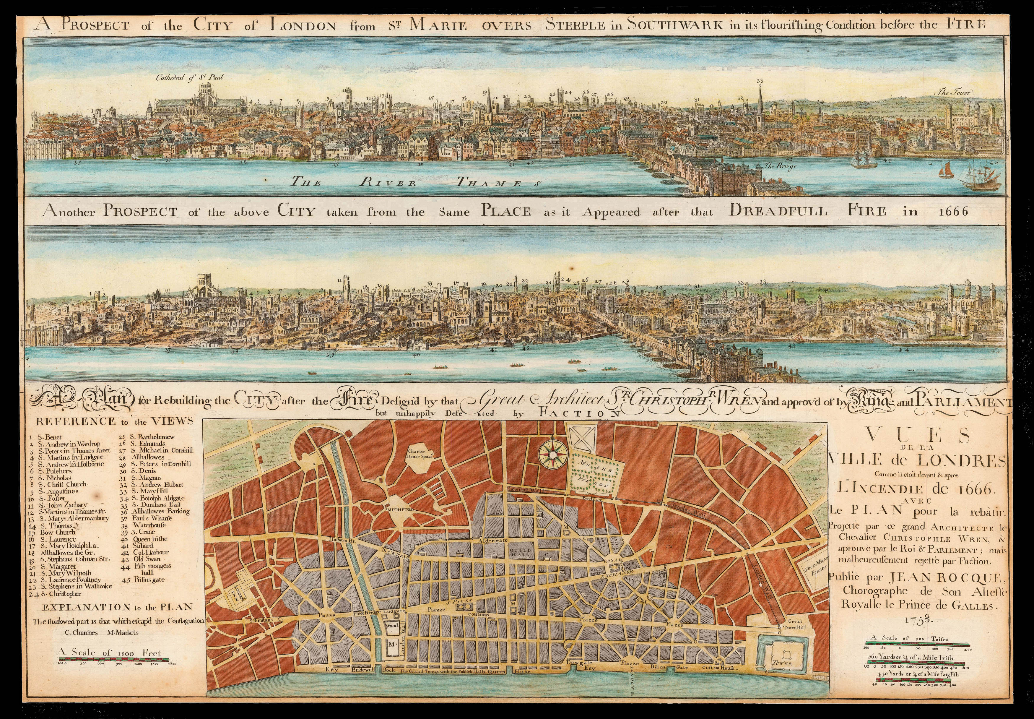 |
Wren's rejected plan for post fire London
1 x
£5,000
|
£5,000 |
|
£5,000 |
|
× |
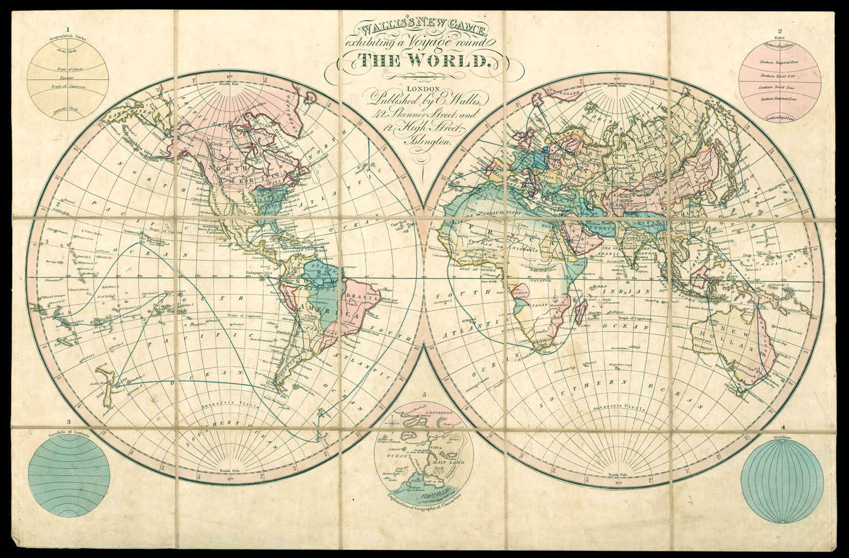 |
A Voyage round the World
1 x
£3,000
|
£3,000 |
|
£3,000 |
|
× |
![[STOOPENDAAL, Bastiaen] Gezicht van de Bosjes Sluis af langs de Kolveniers Burgwal naer de Zuider Kerk toren het Oost-Indisch Huis Dol Huis, Brouwery van t' Amsterdamsche wapen den yoren van de Kolveniers doelen en den binnen Amstel.](https://omega.crouchrarebooks.com/wp-content/uploads/2025/03/14410_1H.jpg) |
A fine eighteenth century view of the Kolveniersburgwal
1 x
£3,530
|
£3,530 |
|
£3,530 |
|
× |
![DOPPELMAYR, Johann Gabriel. Globus Terrestris Novus [and] Globus Coelestis Novus](https://omega.crouchrarebooks.com/wp-content/uploads/2025/03/15669_1H.jpg) |
Popularising the new scientific ideas of the Enlightenment in Germany
1 x
£65,000
|
£65,000 |
|
£65,000 |
|
× |
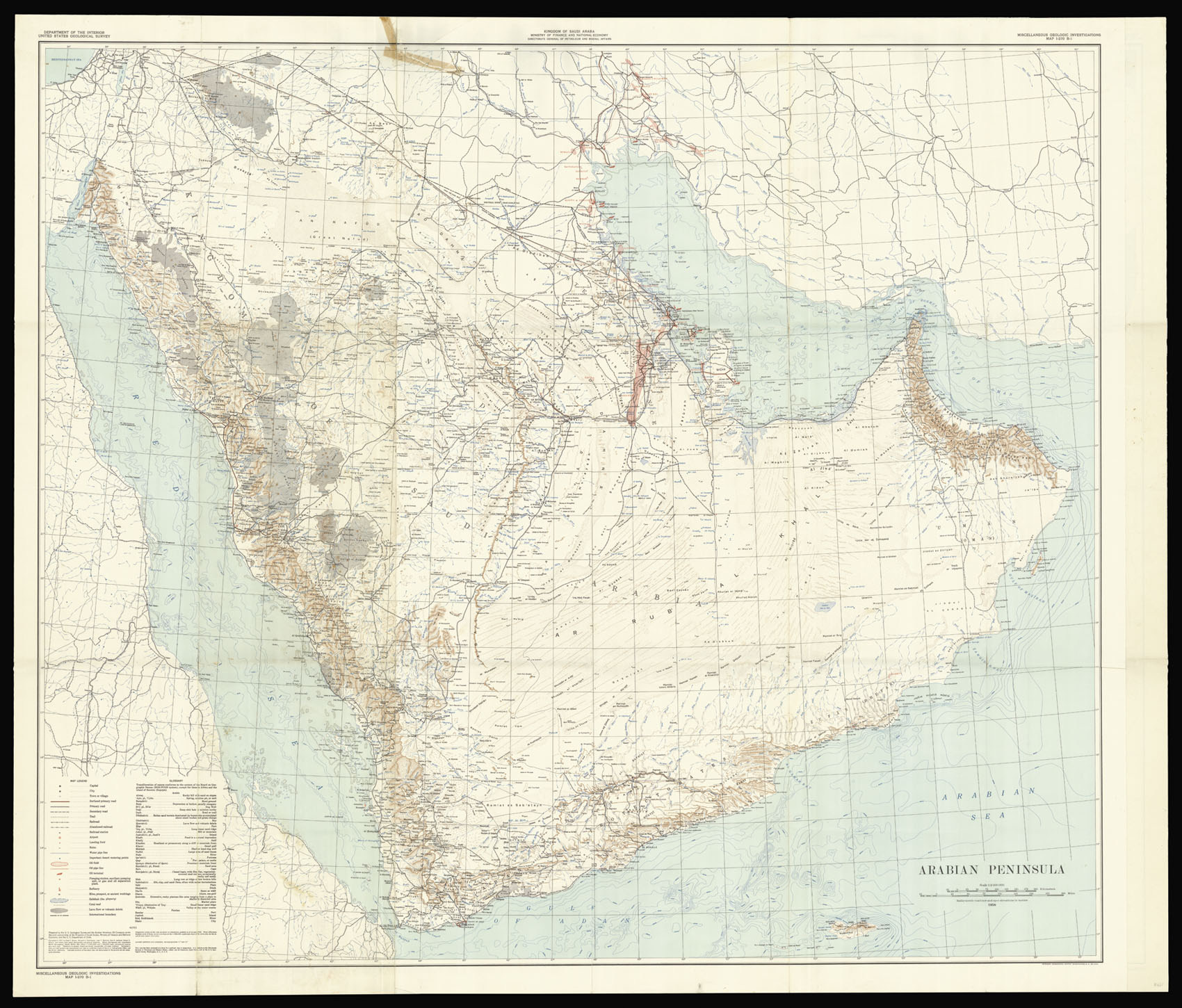 |
The search for black gold continues
1 x
£15,000
|
£15,000 |
|
£15,000 |
|
× |
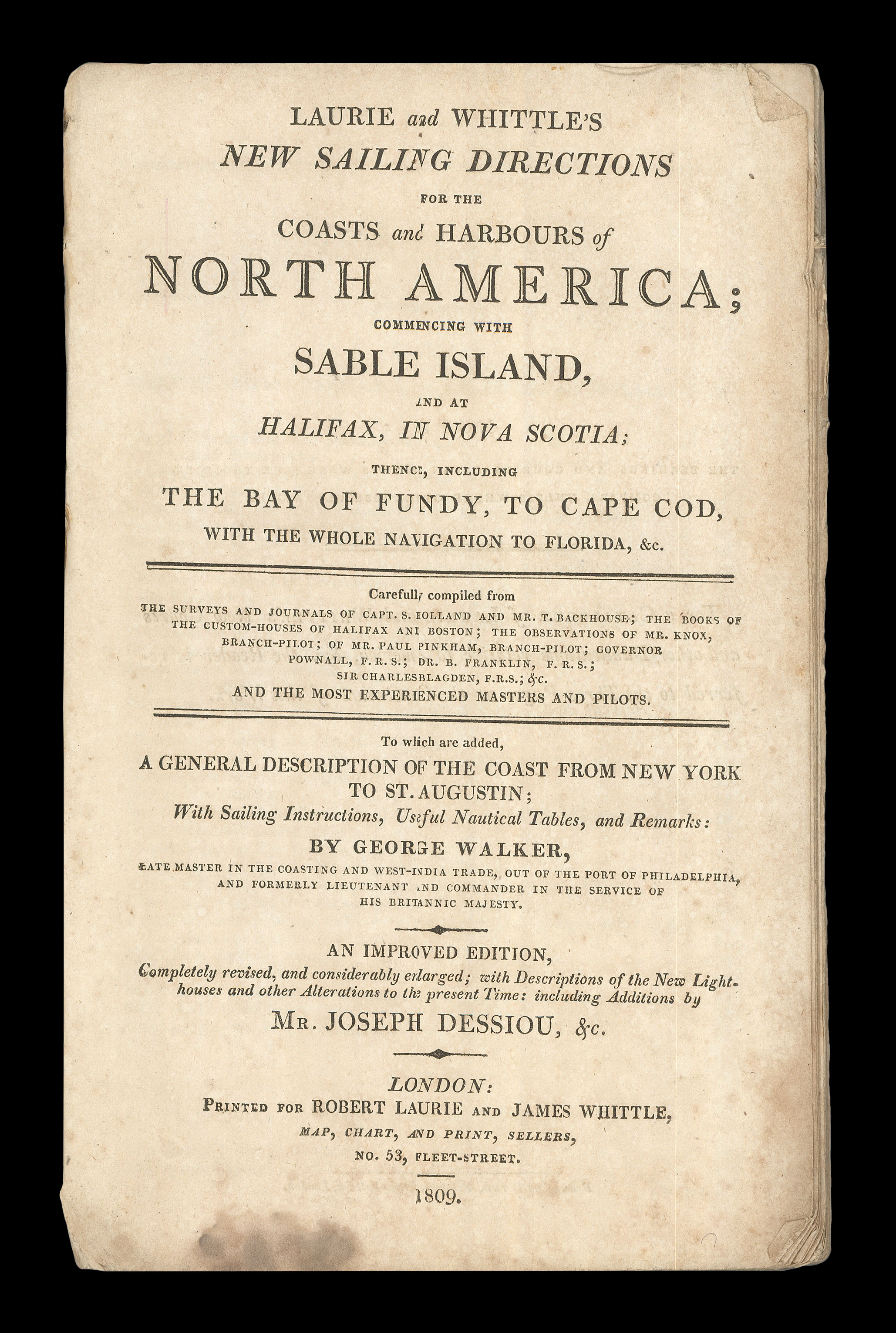 |
Rare sailing directions for the Eastern Seaboard
1 x
£8,000
|
£8,000 |
|
£8,000 |
|
× |
![BRYANT, A[ndrew] Map of the County of Lincolnshire](https://omega.crouchrarebooks.com/wp-content/uploads/2025/03/14515_1H.jpg) |
Lincolnshire - Bryant's large scale map of Lincolnshire
1 x
£3,000
|
£3,000 |
|
£3,000 |
|
× |
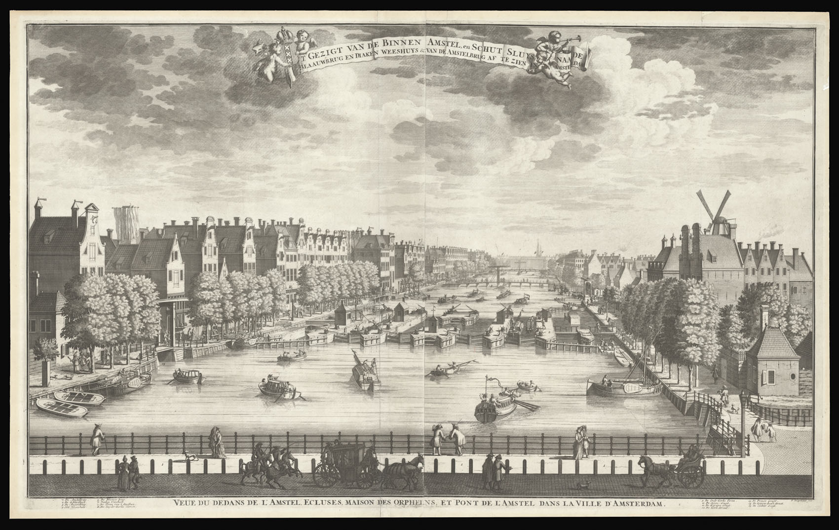 |
View of the Amstel from the Hogesluis towards the Zuiderkerk
1 x
£4,150
|
£4,150 |
|
£4,150 |
|
× |
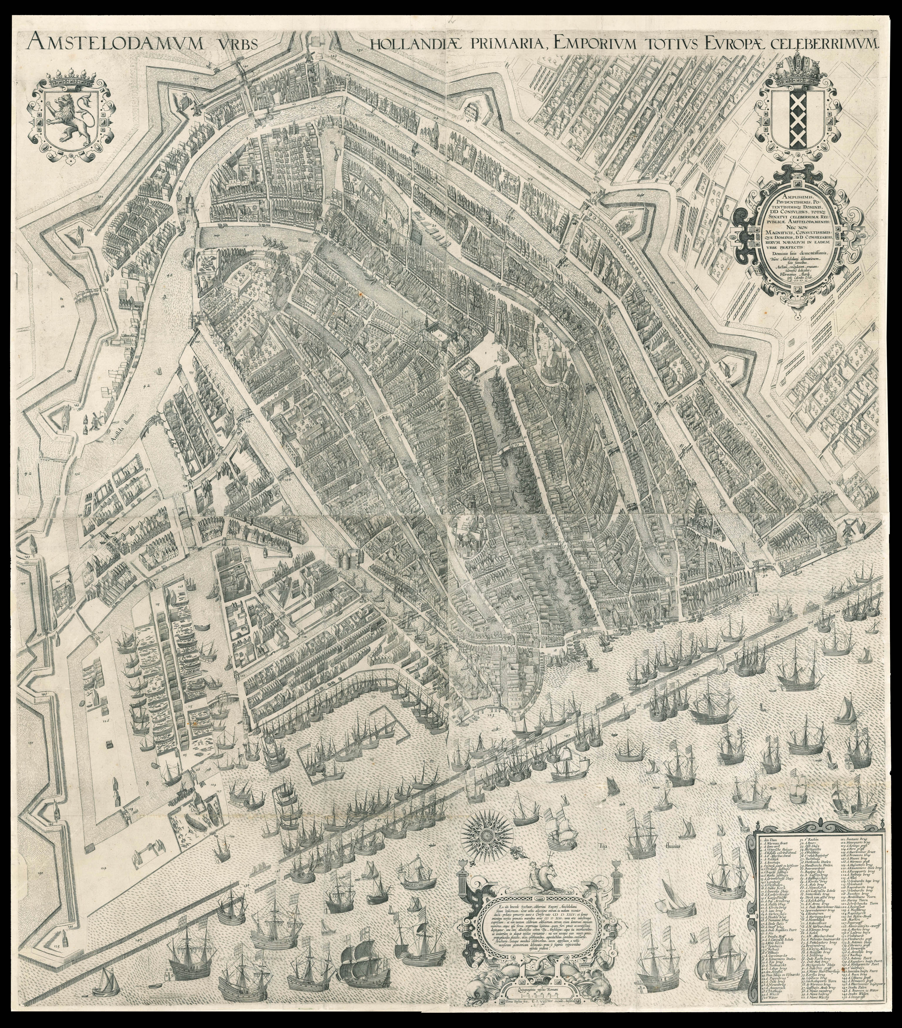 |
One of the most influential maps of Amsterdam
1 x
£60,000
|
£60,000 |
|
£60,000 |
|
× |
![WESTALL, W[illiam] London, View of Regent's Park; London From Greenwich Park.](https://omega.crouchrarebooks.com/wp-content/uploads/2025/03/12322_1H.jpg) |
Regent's Park and Greenwich
1 x
£800
|
£800 |
|
£800 |
|
× |
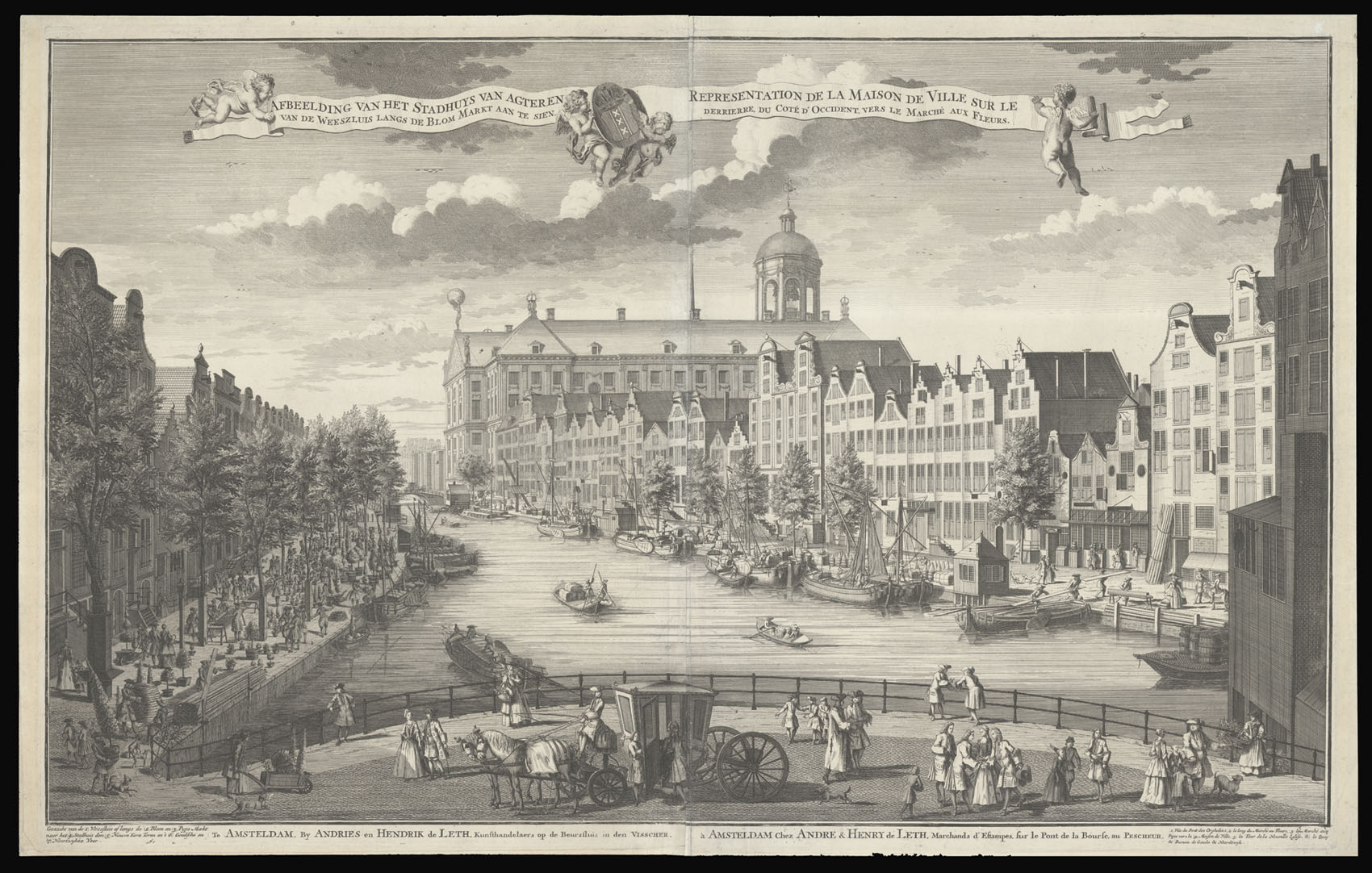 |
View along the Nieuwezijds Voorburgwal, with the rear of the Koninklijk Paleis
1 x
£4,100
|
£4,100 |
|
£4,100 |
|
× |
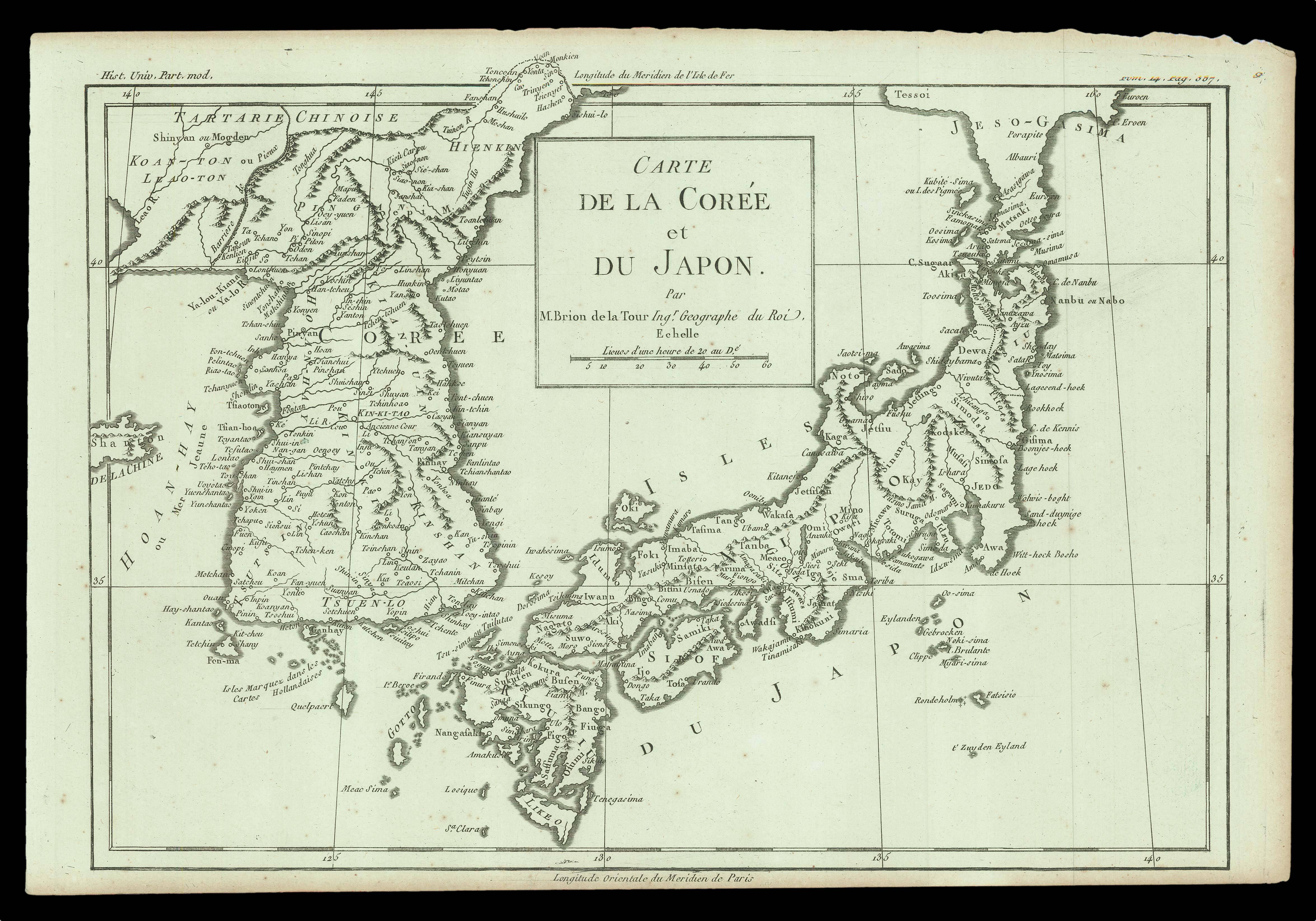 |
A map of Japan and Korea following d'Anville map of 1732
1 x
£135
|
£135 |
|
£135 |
|
× |
![SCHENK, Jan [after] LAAN, Adolphus van der Gezigt Van De Koorn-Beurs, Staande op 't water by de Oude-brug 't Amsterdam: gebouwt in't Iaar 1768.](https://omega.crouchrarebooks.com/wp-content/uploads/2025/03/14422_1H.jpg) |
The Korenbeurs or Corn Exchange, Amsterdam
1 x
£3,900
|
£3,900 |
|
£3,900 |
|
× |
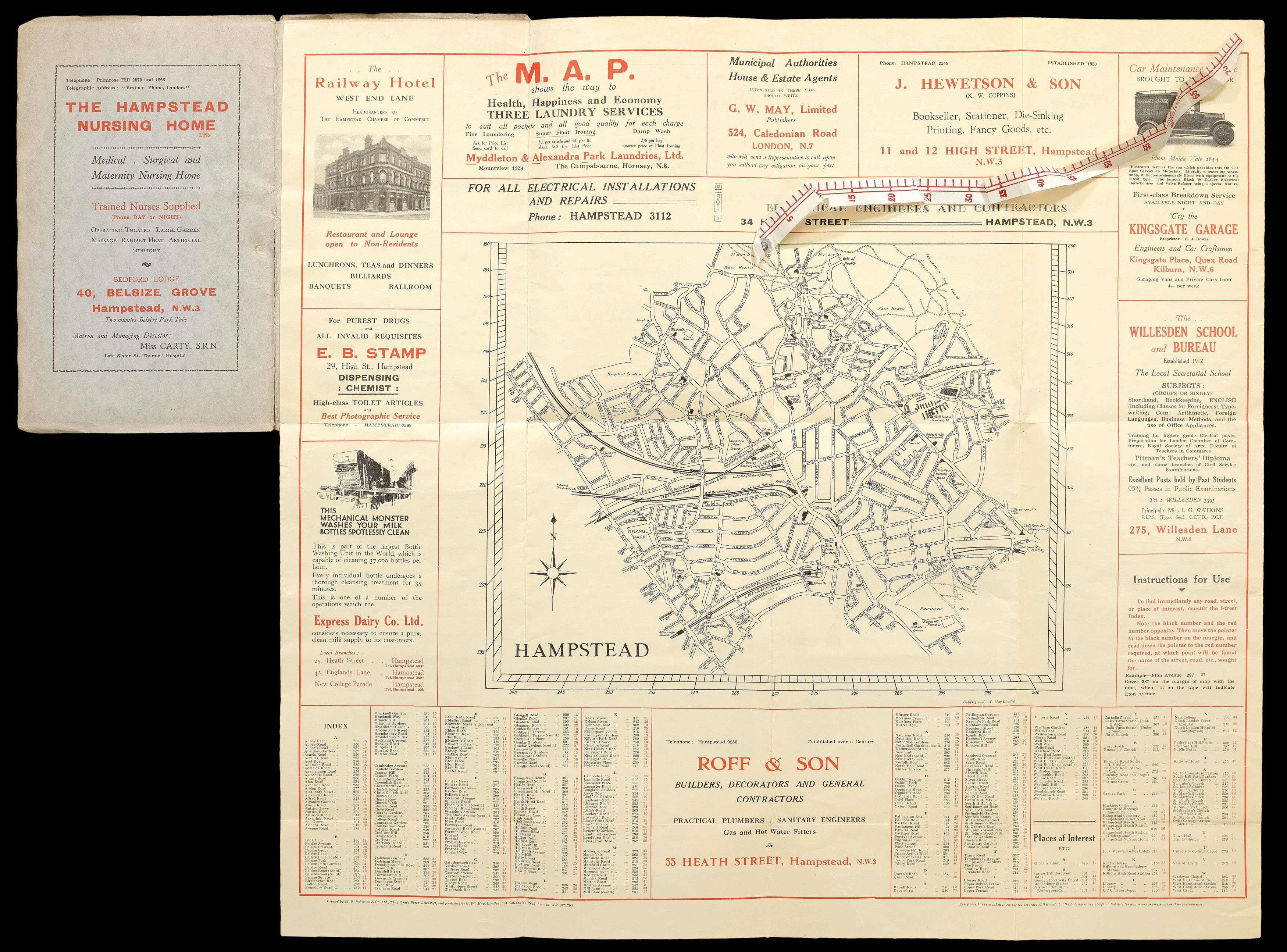 |
Hampstead
1 x
£600
|
£600 |
|
£600 |
|
× |
![ROCQUE, John [Berkshire] A Topographical Survey of the County of Berks,](https://omega.crouchrarebooks.com/wp-content/uploads/2025/03/14994_1H.jpg) |
John Rocque's large-scale map of Berkshire
1 x
£6,000
|
£6,000 |
|
£6,000 |
|
|


