|
× |
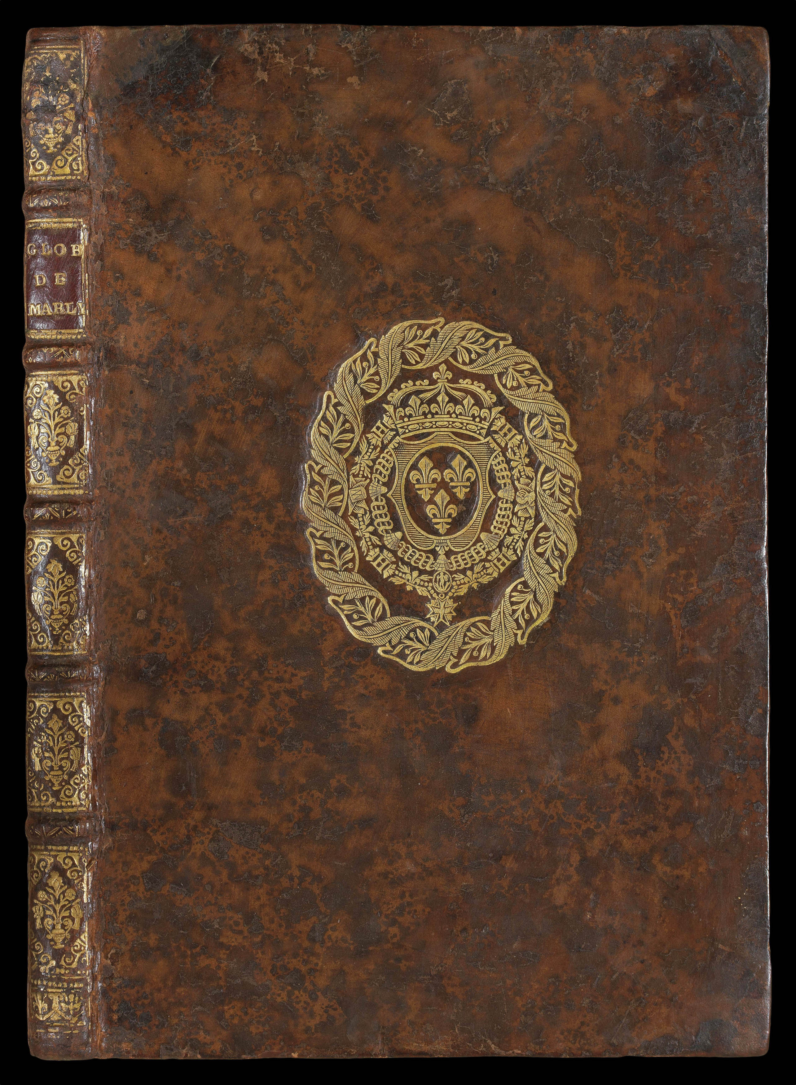 |
With the Arms of the Sun King
1 x
£10,000
|
£10,000 |
|
£10,000 |
|
× |
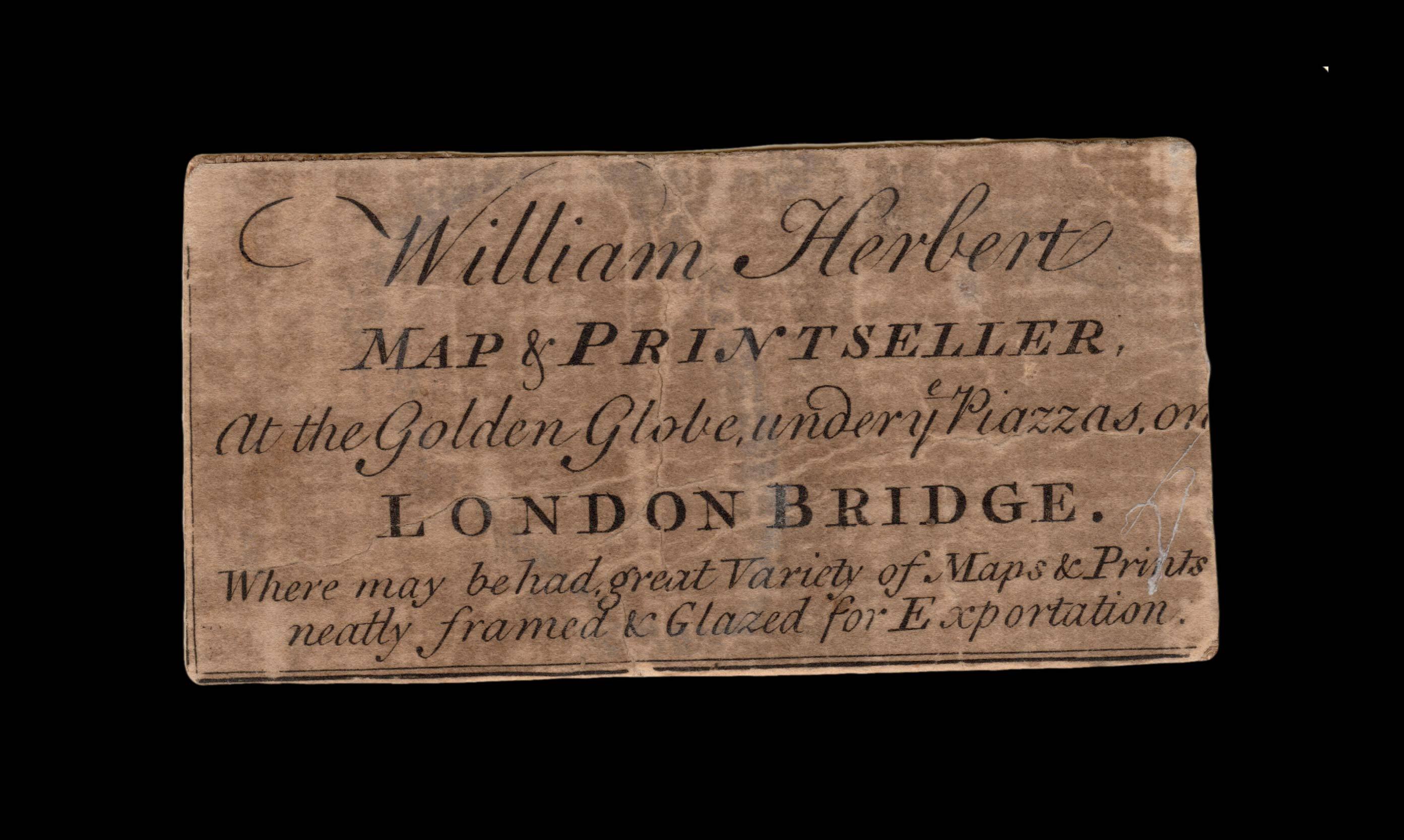 |
Herbert's trade card from his London Bridge address
1 x
£500
|
£500 |
|
£500 |
|
× |
 |
London docks and the Croydon Canal
1 x
£8,000
|
£8,000 |
|
£8,000 |
|
× |
![HOLLAR, W[enceslaus] Ver [and] Aestas [and] Autumnus [and] Hyems](https://omega.crouchrarebooks.com/wp-content/uploads/2025/03/18438_1H.jpg) |
The Strasbourg Views
1 x
£4,000
|
£4,000 |
|
£4,000 |
|
× |
![FORREST, Will[ia]m The County of Lanark from Actual Survey by Will[ia]m Forrest.](https://omega.crouchrarebooks.com/wp-content/uploads/2025/03/10787_1H.jpg) |
Forrest's large-scale survey of West Lothian
1 x
£2,500
|
£2,500 |
|
£2,500 |
|
× |
 |
Jewish East London
1 x
£7,500
|
£7,500 |
|
£7,500 |
|
× |
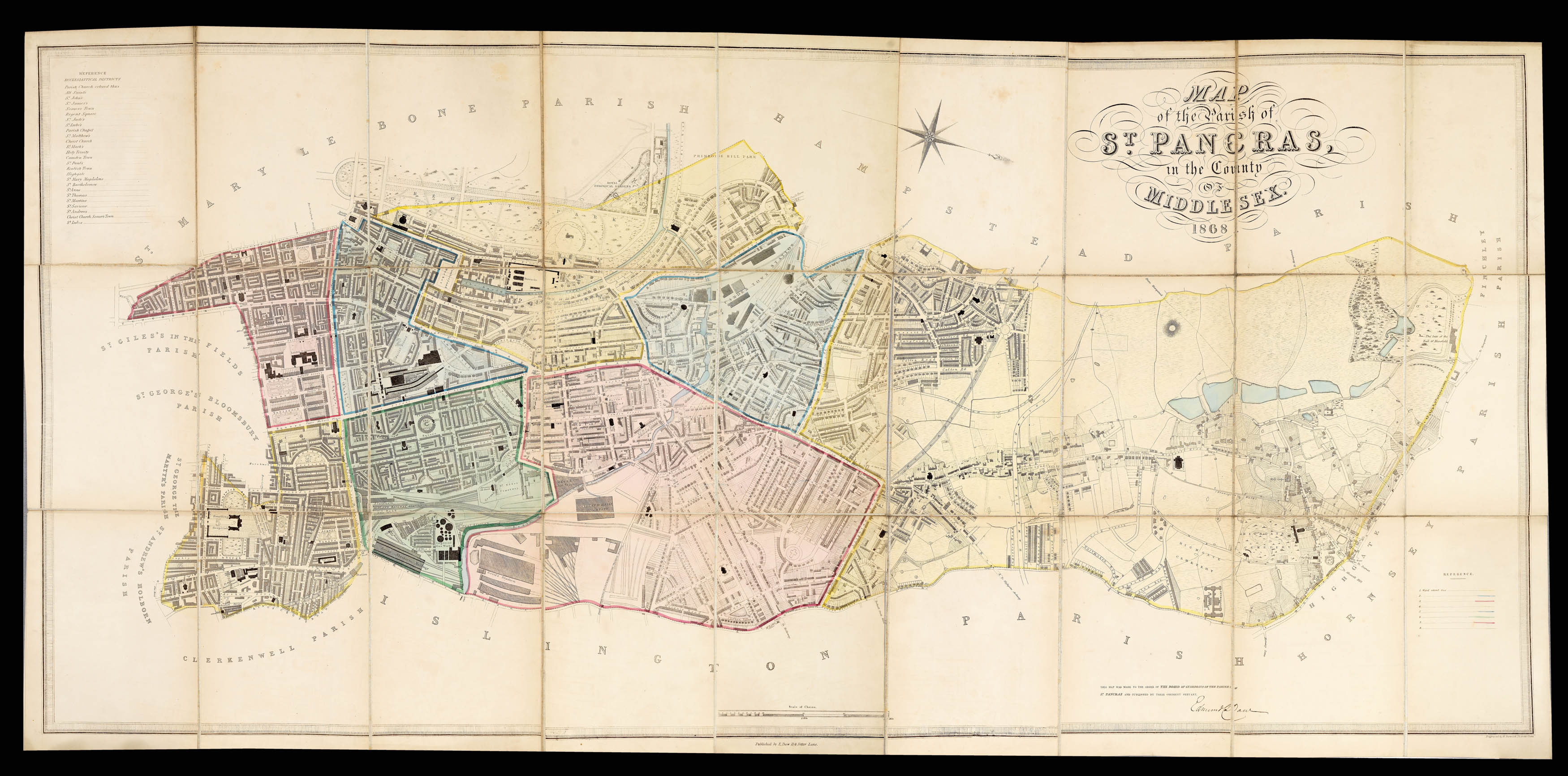 |
Daw's detailed plan of mid-Victorian St Pancras
1 x
£4,500
|
£4,500 |
|
£4,500 |
|
× |
![WHITTLE, [James] and LAURIE, [Robert] View of the Vauxhall Iron Bridge.](https://omega.crouchrarebooks.com/wp-content/uploads/2025/03/12399_1H.jpg) |
Vauxhall Bridge
1 x
£350
|
£350 |
|
£350 |
|
× |
![DODD, R[obert] The Royal Dock Yard at Woolwich.](https://omega.crouchrarebooks.com/wp-content/uploads/2025/03/12379_1H.jpg) |
Woolwich Dockyard
1 x
£950
|
£950 |
|
£950 |
|
× |
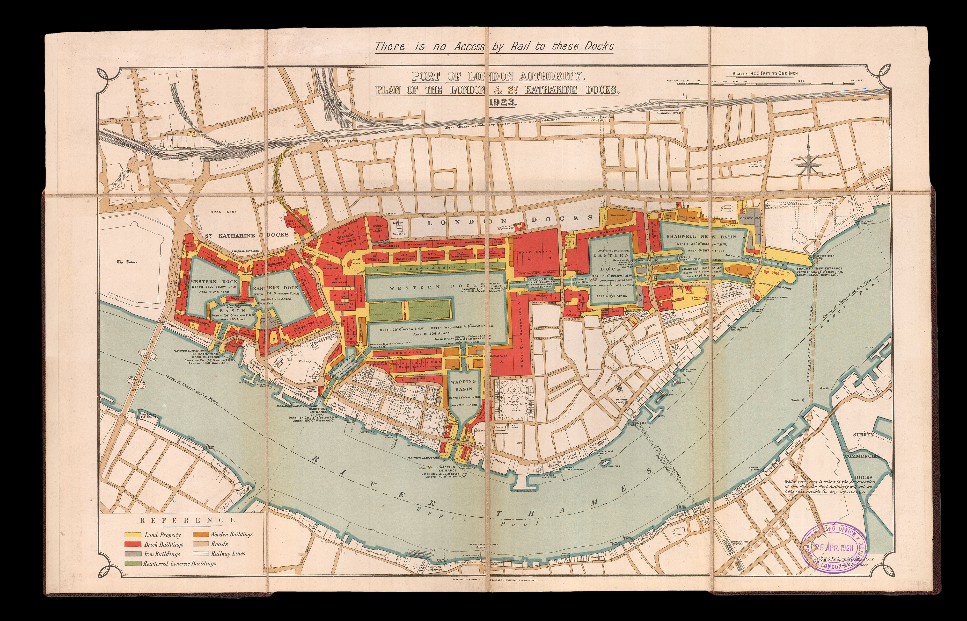 |
The London and St Katharine docks
1 x
£1,200
|
£1,200 |
|
£1,200 |
|
× |
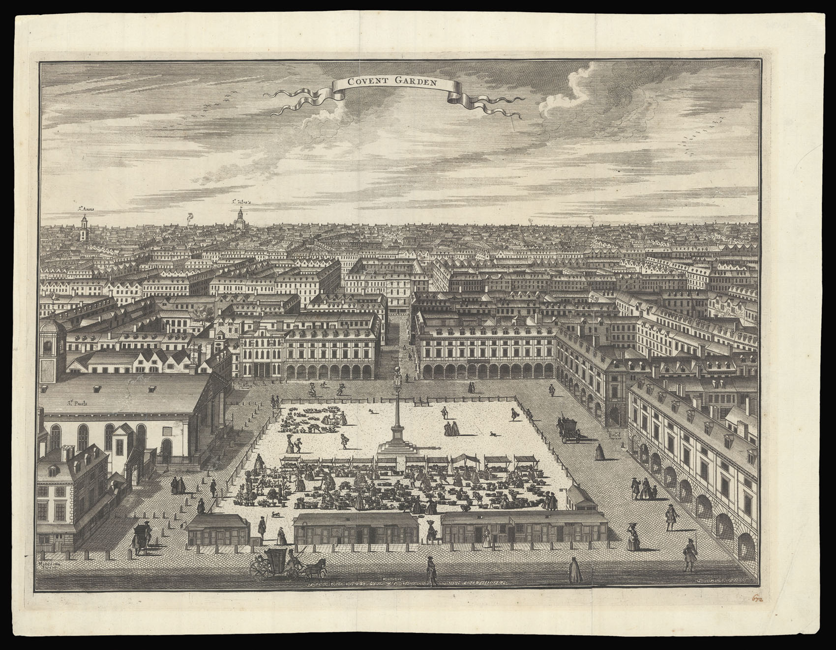 |
Covent Garden
1 x
£450
|
£450 |
|
£450 |
|
× |
![OGILBY, John and MORGAN, William [Title, and upper border vignettes, with the prospect of London to accompany Ogliby's 1682 map of London].](https://omega.crouchrarebooks.com/wp-content/uploads/2025/03/18113_1H.jpg) |
A Variety of Ornaments'
1 x
£16,000
|
£16,000 |
|
£16,000 |
|
× |
![[HOLLAR, Wenceslaus] Whitehall [and] Lambeth](https://omega.crouchrarebooks.com/wp-content/uploads/2025/03/18301_1H.jpg) |
Ferries across the Thames
1 x
£750
|
£750 |
|
£750 |
|
× |
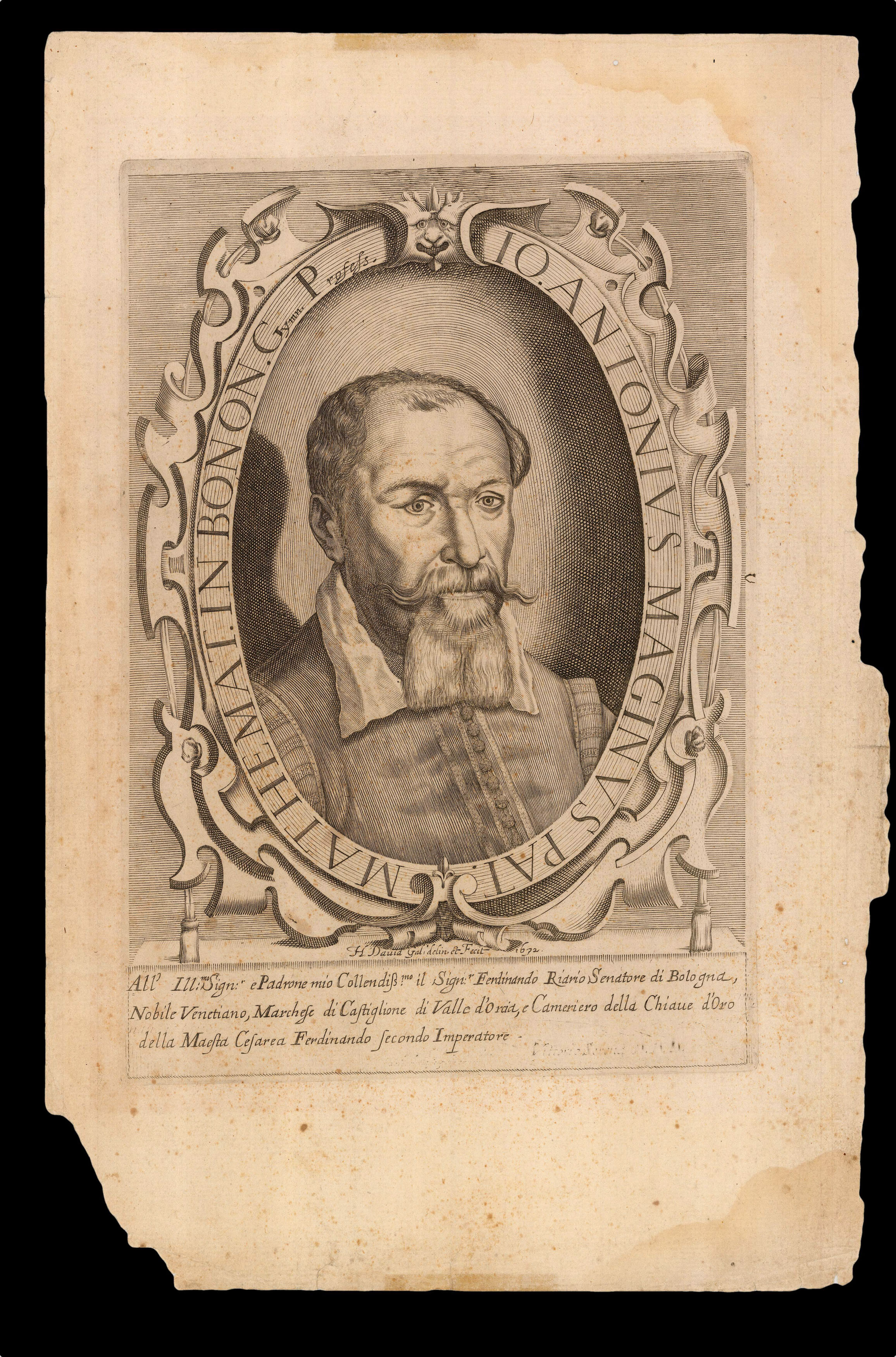 |
Giovanni Antonio Magini
1 x
£600
|
£600 |
|
£600 |
|
× |
![BAUERKELLER, G[eorge] Bauerkeller's New Embossed Plan of London 1841.](https://omega.crouchrarebooks.com/wp-content/uploads/2025/03/13860_1H.jpg) |
George Bauerkeller's rare and strikingly modern embossed plan of London
1 x
£7,000
|
£7,000 |
|
£7,000 |
|
× |
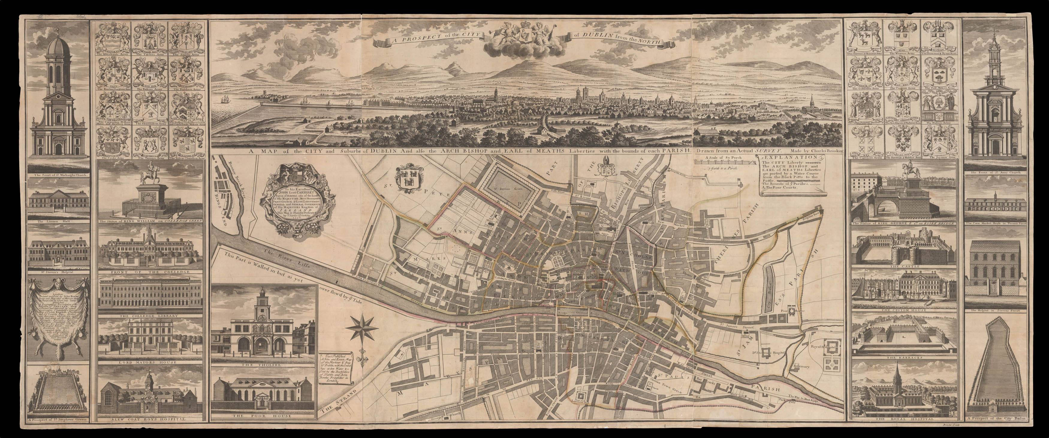 |
The earliest map to portray Dublin on such a large and detailed scale
1 x
£16,000
|
£16,000 |
|
£16,000 |
|
× |
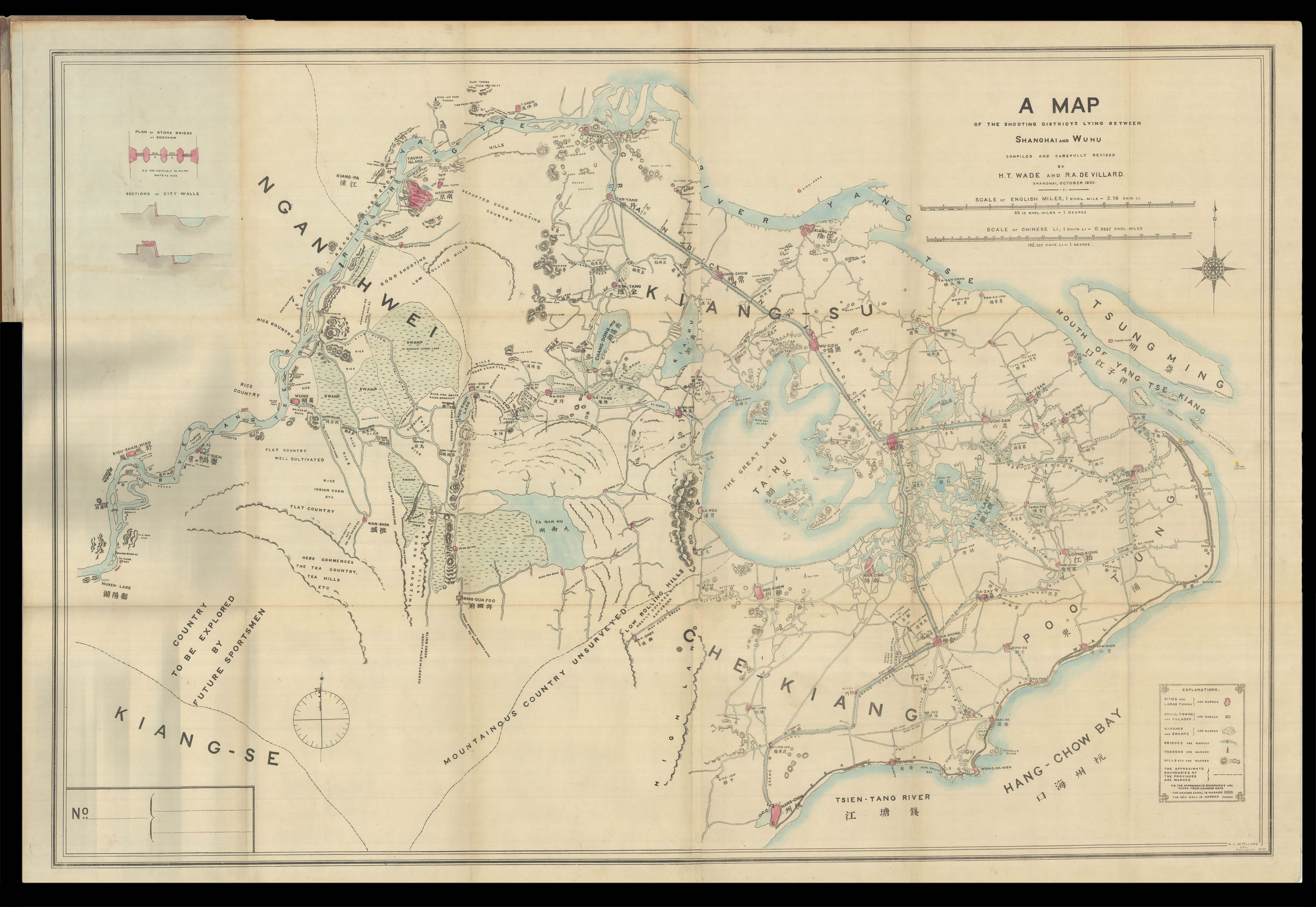 |
The author's copy of the plan of Shanghai
1 x
£5,500
|
£5,500 |
|
£5,500 |
|
× |
![ANONYMOUS 東國輿誌 [동국여지 - Geographical depiction of the Eastern country - Korea]](https://omega.crouchrarebooks.com/wp-content/uploads/2025/03/19466_1H.jpg) |
Manuscript map of Korea showing Dokdo
1 x
£50,000
|
£50,000 |
|
£50,000 |
|
× |
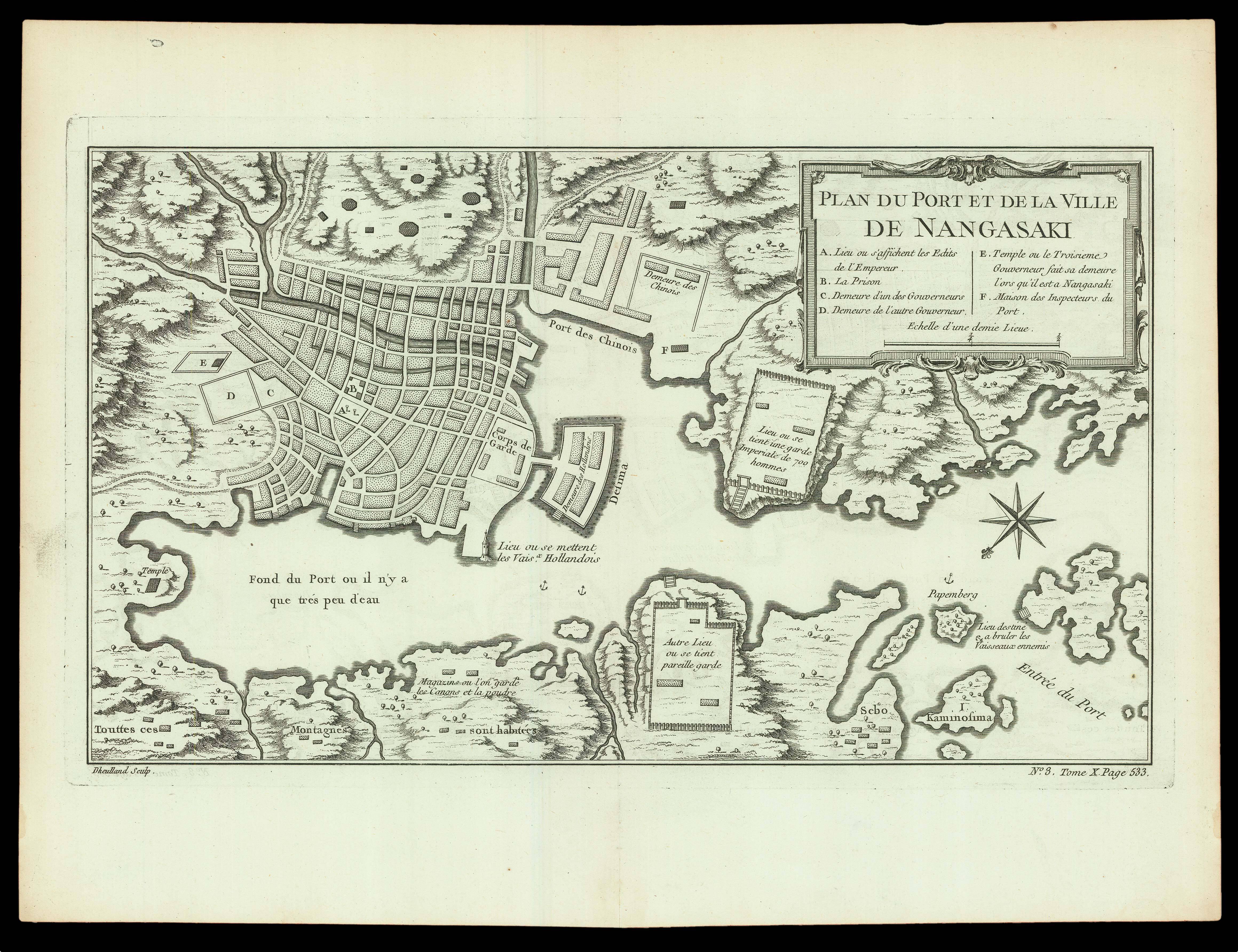 |
Port of Nagasaki
1 x
£200
|
£200 |
|
£200 |
|
× |
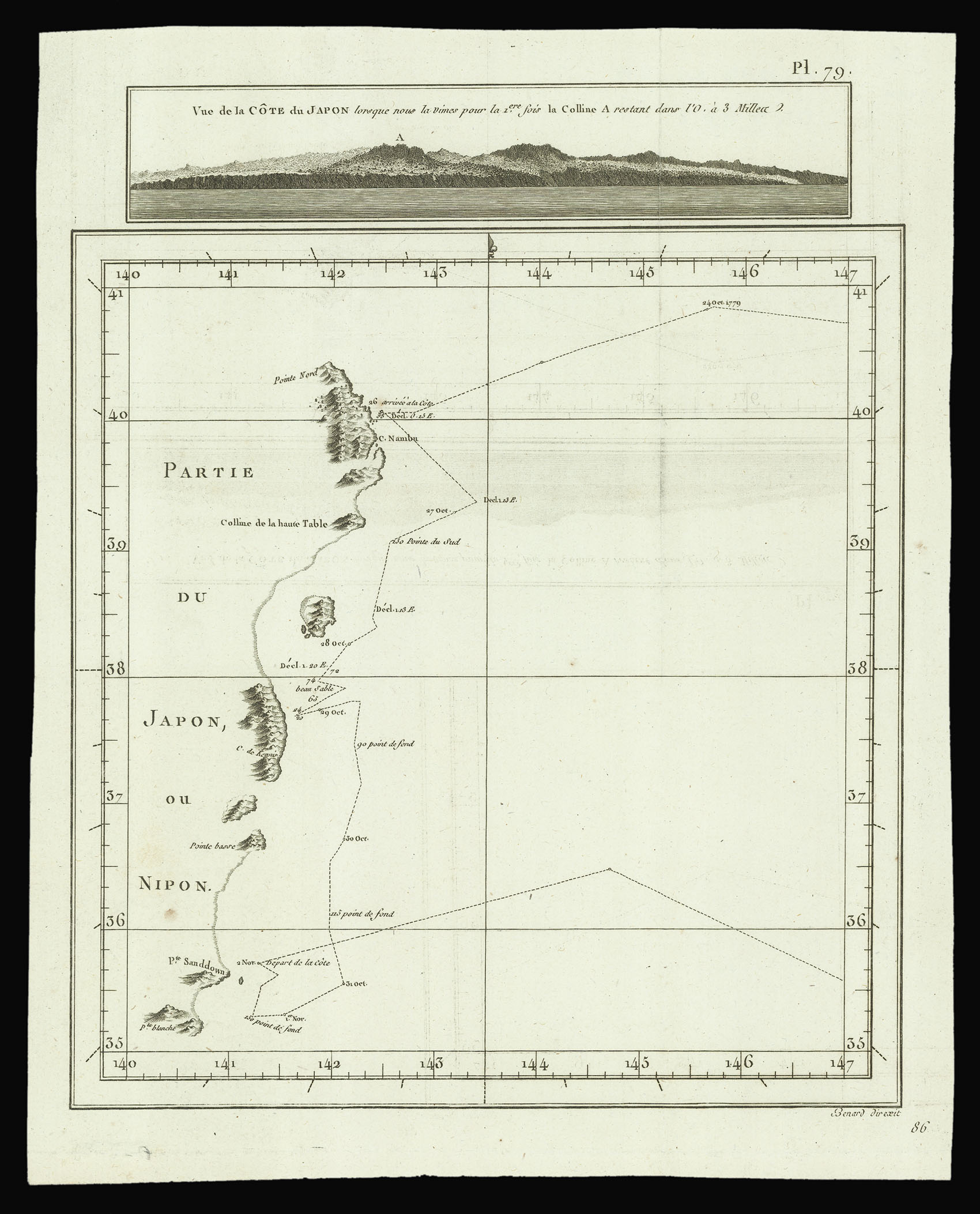 |
From the French edition of Captain Cook's journal
1 x
£75
|
£75 |
|
£75 |
|
× |
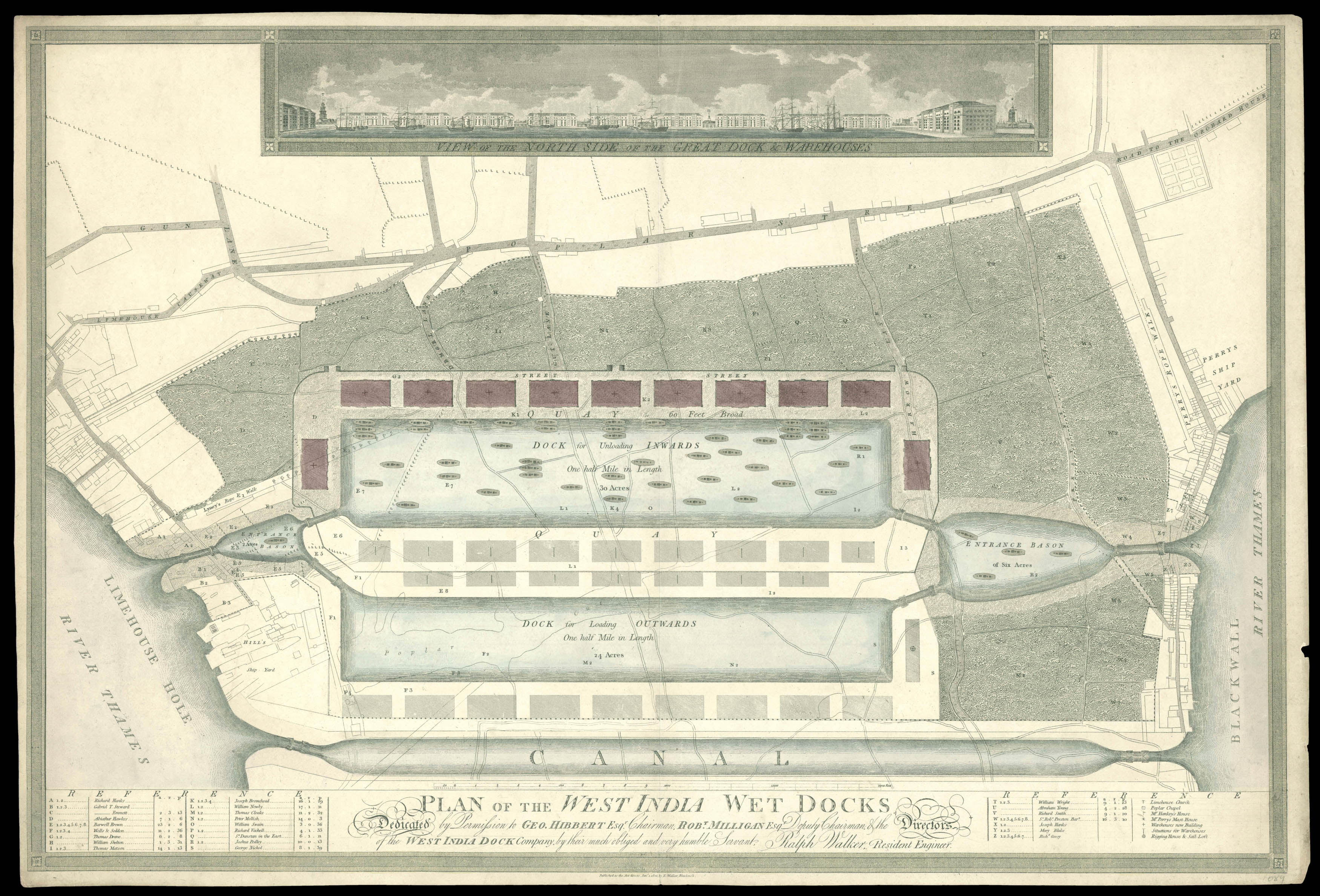 |
Separately issued plan of the proposed West India Docks
1 x
£2,500
|
£2,500 |
|
£2,500 |
|
× |
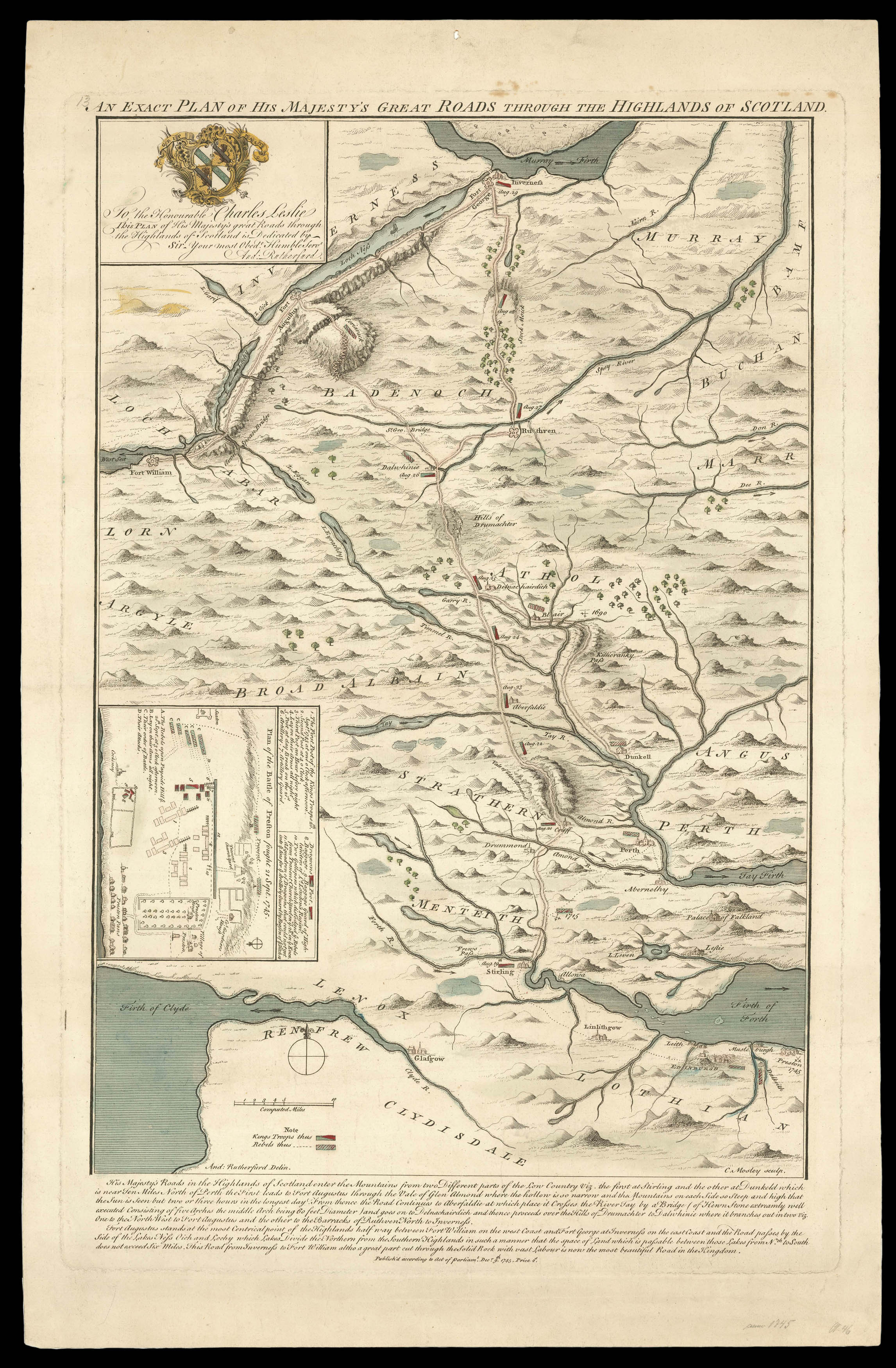 |
Lead up to the Battle of Prestonpans
1 x
£7,500
|
£7,500 |
|
£7,500 |
|
|


