|
× |
![OLIVIER, F[rançois] Nouvelle Carte de la Mer Mediterranee](https://omega.crouchrarebooks.com/wp-content/uploads/2025/03/1303_1H.jpg) |
Rare chart of the Mediterranean
1 x
£6,000
|
£6,000 |
|
£6,000 |
|
× |
![VOOGHT, Claes Jansz. [after] Jan Jansz STAMPIOEN Onderwysing van't Gebruyk des Hemels Pleyn](https://omega.crouchrarebooks.com/wp-content/uploads/2025/03/1991_1H.jpg) |
Vooght's rare star chart and astronomical calculator
1 x
£25,000
|
£25,000 |
|
£25,000 |
|
× |
![Anonymous [kyūseikigaku]](https://omega.crouchrarebooks.com/wp-content/uploads/2025/03/15336_1H.jpg) |
Nine-Star Ki
1 x
£3,800
|
£3,800 |
|
£3,800 |
|
× |
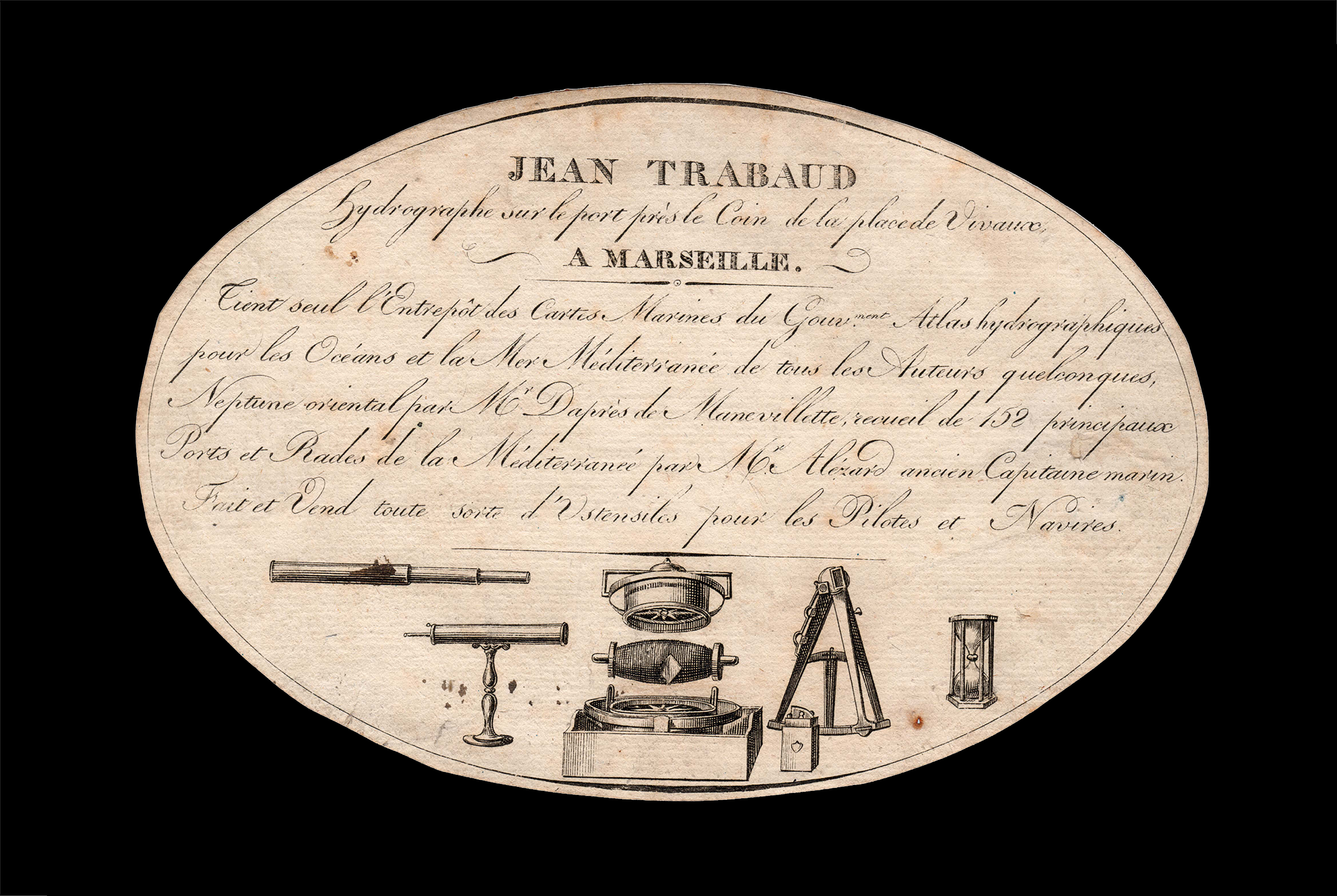 |
Charts of the Mediterranean for sale
1 x
£650
|
£650 |
|
£650 |
|
× |
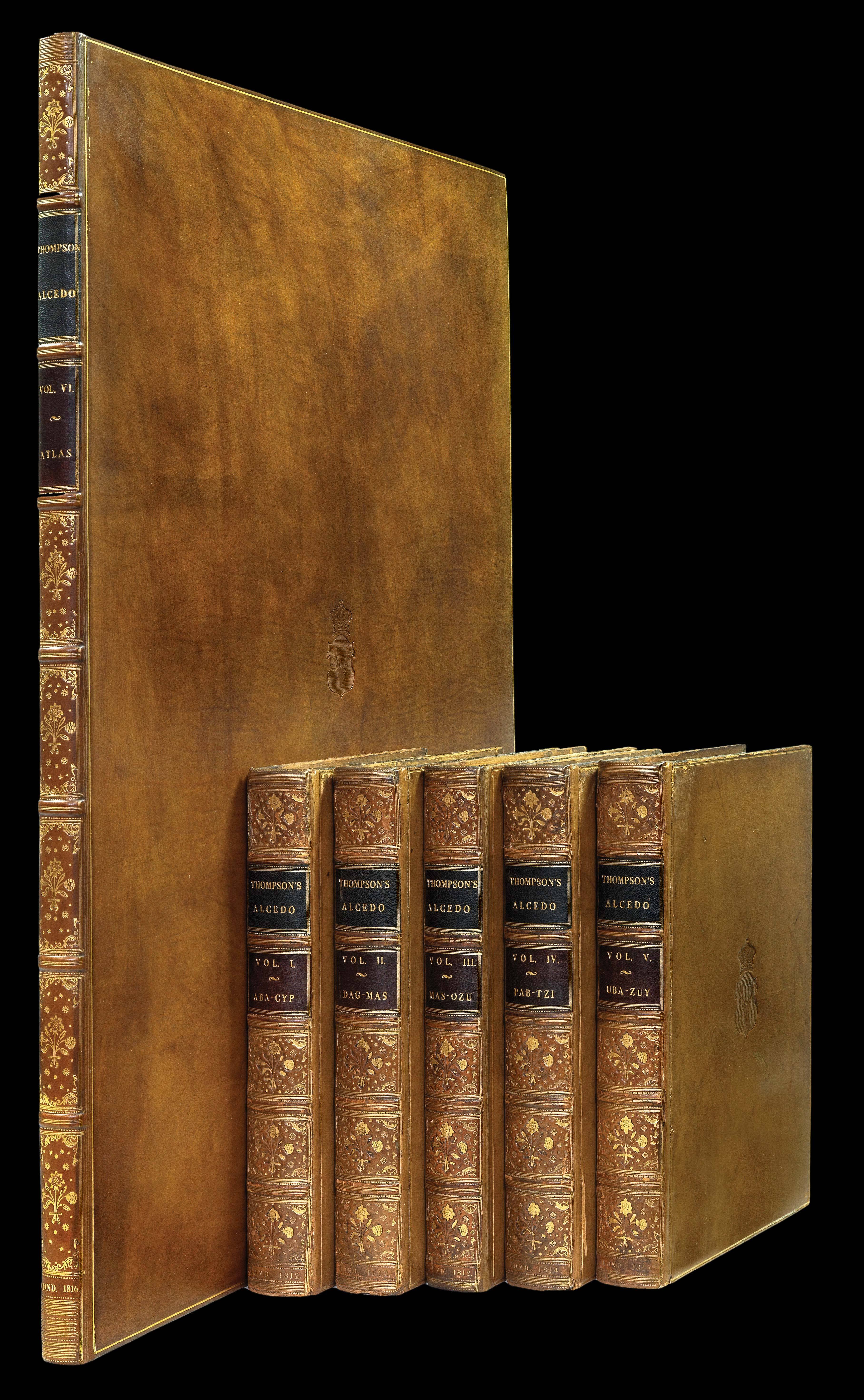 |
The Earl of Lonsdale's copy of Thompson's Alcedo
1 x
£65,000
|
£65,000 |
|
£65,000 |
|
× |
![WOLSTENHOLME, D[ean] A View of Messrs. Barclay & Perkins's Brewery.](https://omega.crouchrarebooks.com/wp-content/uploads/2025/03/12504_1H.jpg) |
London Pride
1 x
£850
|
£850 |
|
£850 |
|
× |
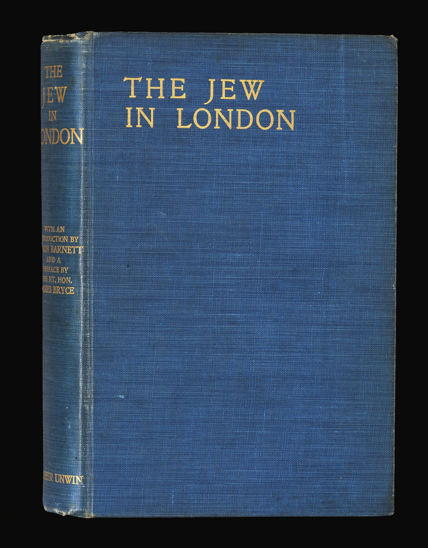 |
Jewish East London
1 x
£7,500
|
£7,500 |
|
£7,500 |
|
× |
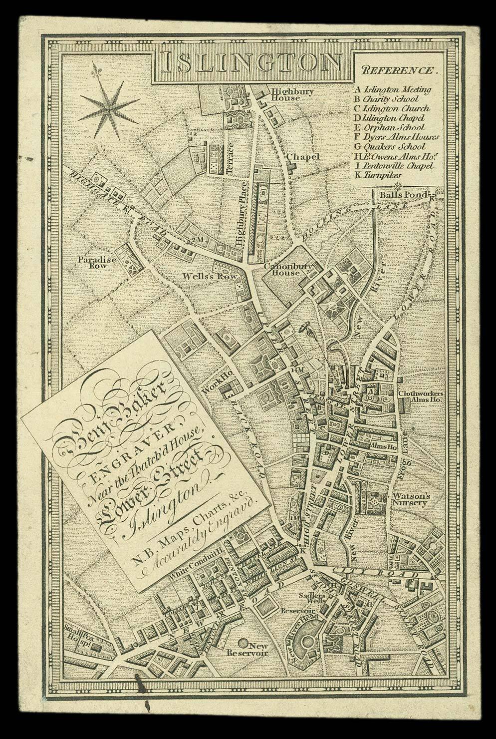 |
Trade card with a miniature map of Georgian Islington
1 x
£2,000
|
£2,000 |
|
£2,000 |
|
× |
 |
The French edition of Waghenaer's pilot
1 x
£110,000
|
£110,000 |
|
£110,000 |
|
× |
 |
The Empire of Japan with part of the Continent of Asia
1 x
£150
|
£150 |
|
£150 |
|
× |
![WESTALL, W[illiam] London, View of Regent's Park; London From Greenwich Park.](https://omega.crouchrarebooks.com/wp-content/uploads/2025/03/12322_1H.jpg) |
Regent's Park and Greenwich
1 x
£800
|
£800 |
|
£800 |
|
× |
 |
Herbert's trade card from his London Bridge address
1 x
£500
|
£500 |
|
£500 |
|
× |
![NASA [Mars taken by Viking 2, 2 Sept 1976]](https://omega.crouchrarebooks.com/wp-content/uploads/2025/03/20455_1H.jpg) |
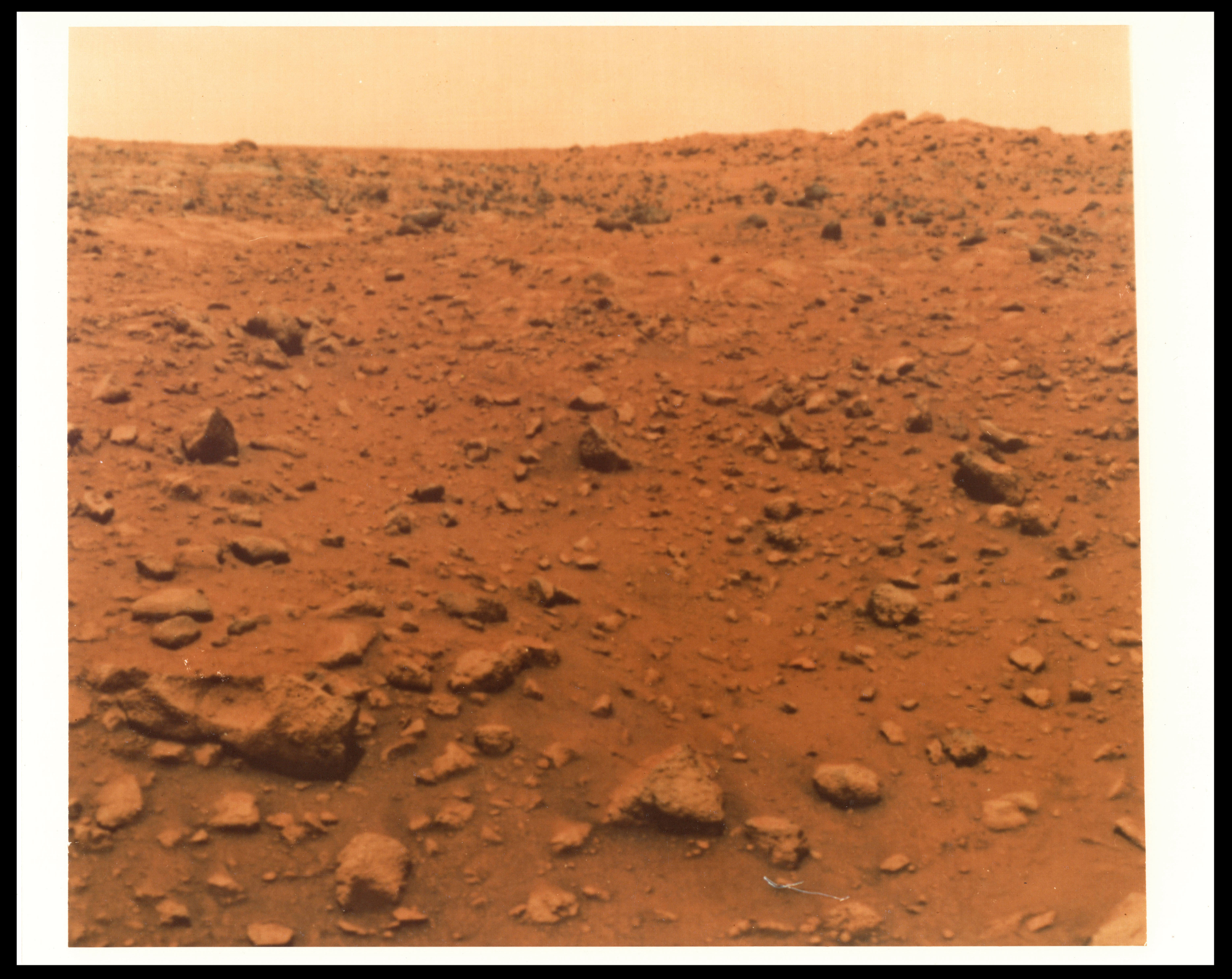
The first colour photograph from the Martian surface taken by Viking 2
1 x
£15,000
|
£15,000 |
|
£15,000 |
|
× |
![BRADLEY, Abraham [Autograph letter to Ezekiel Williams Jr.]](https://omega.crouchrarebooks.com/wp-content/uploads/2025/03/17943_1H.jpg) |
"I have made out a map..." (Bradley) - distributing the first postal map of the United States to local agents
1 x
£2,000
|
£2,000 |
|
£2,000 |
|
× |
 |
Rare English edition of Colom's Mediterranean Sea pilot
1 x
£44,000
|
£44,000 |
|
£44,000 |
|
× |
 |
Panama
1 x
£2,500
|
£2,500 |
|
£2,500 |
|
× |
![LUSVERGH, Domenico and LUSVERG [LUSVERGH], Jacobus [Giacomo]. Notta delli Stromenti Piu Generali.](https://omega.crouchrarebooks.com/wp-content/uploads/2025/03/18420_1H.jpg) |
Lusvergh's sales catalogue of artists' drawing and optical instruments, including Galileo's Sector
1 x
£6,500
|
£6,500 |
|
£6,500 |
|
× |
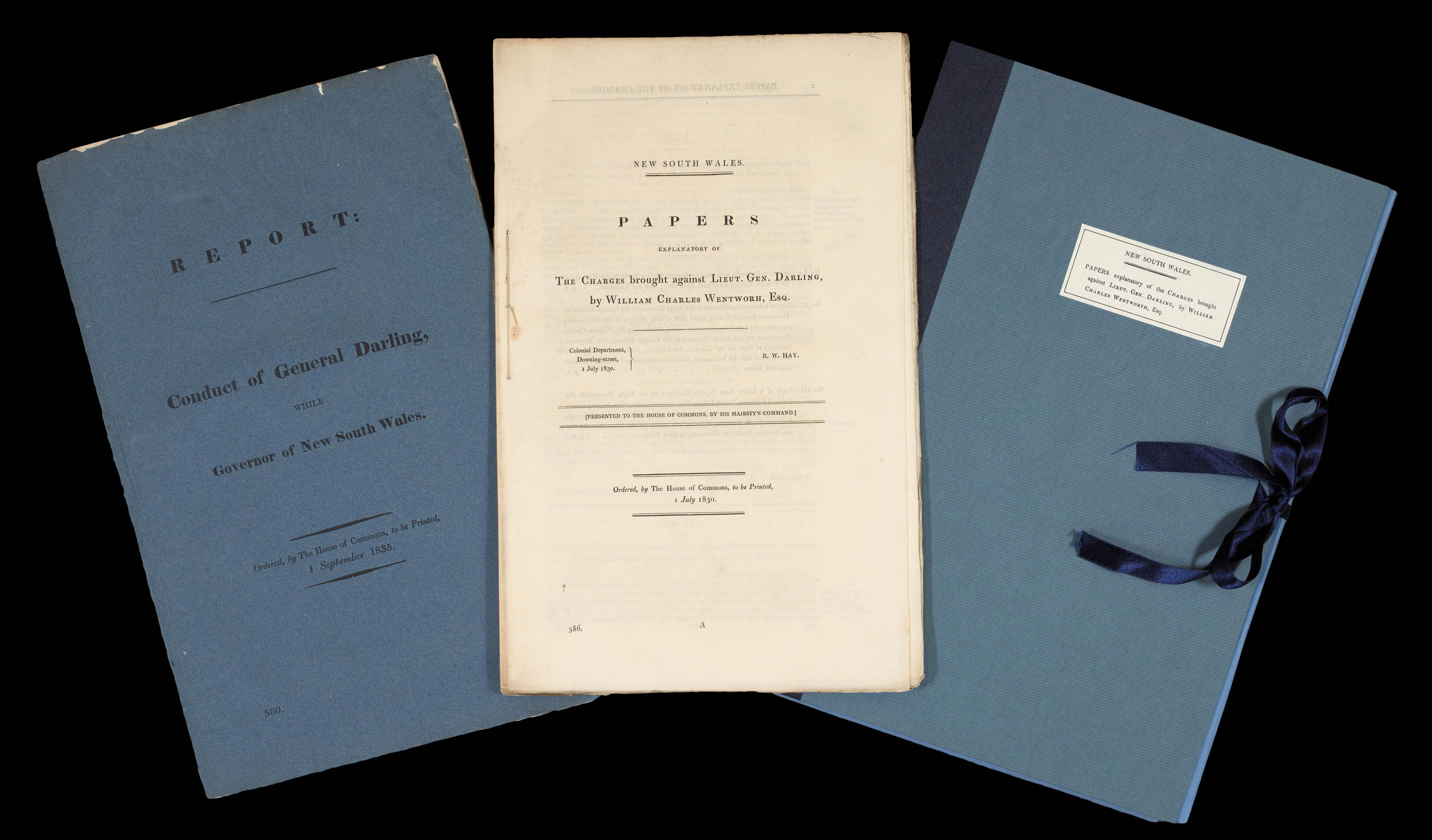 |
First inklings of self-government and nationhood for Australia
1 x
£2,000
|
£2,000 |
|
£2,000 |
|
× |
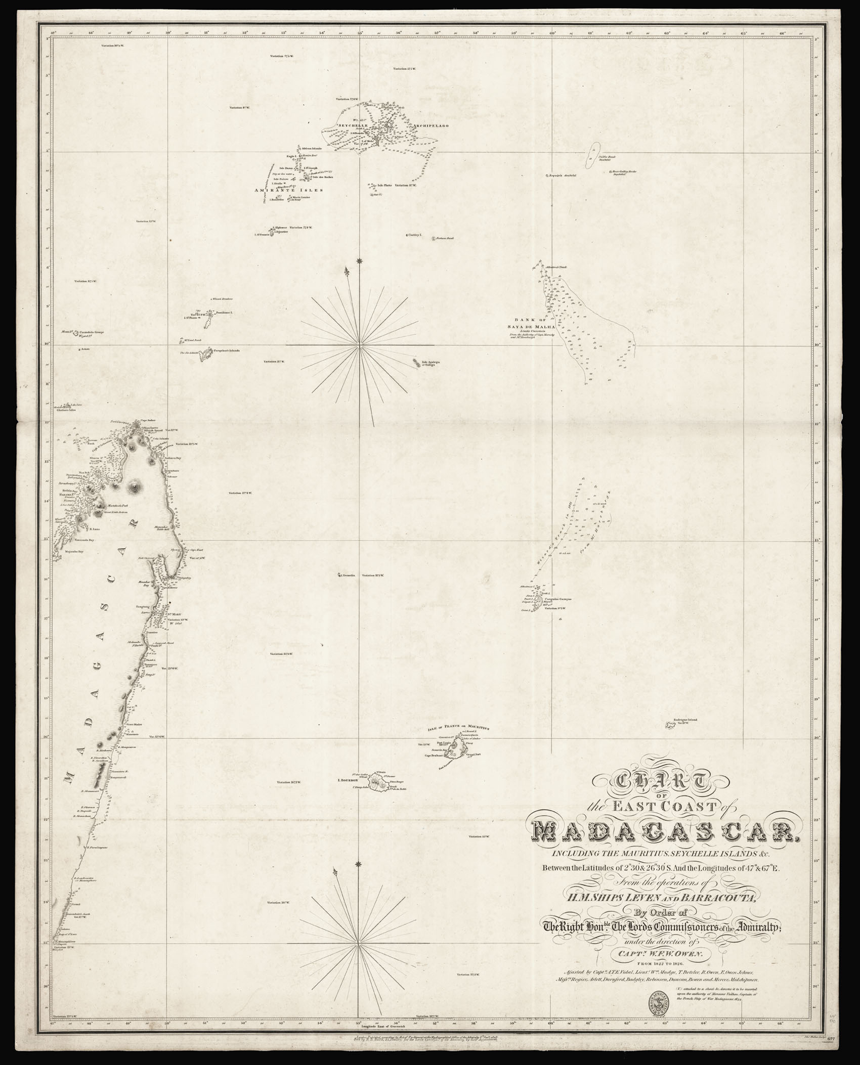 |
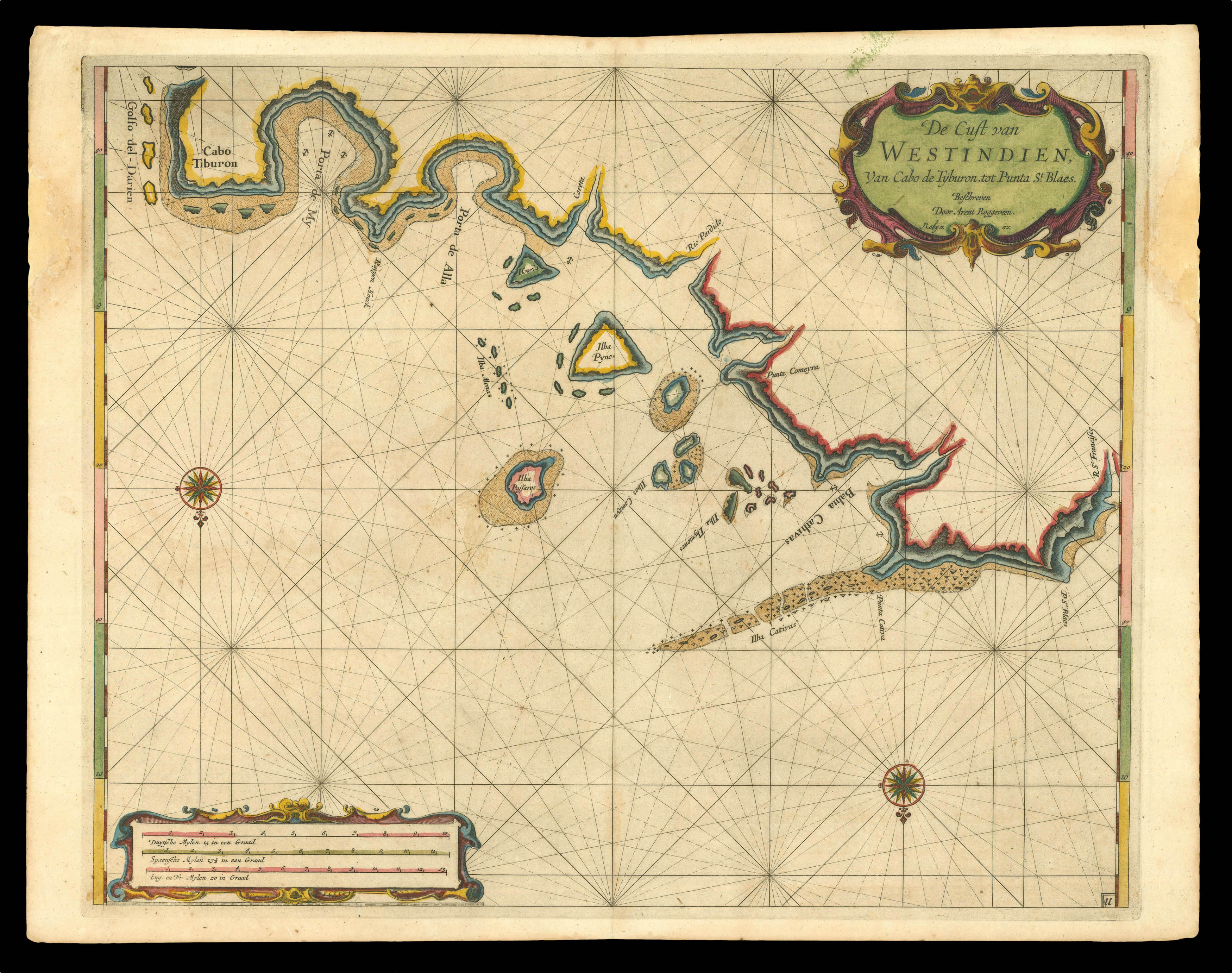
"such parts of the coast of Madagascar as you may conceive not to have been accurately ascertained"
1 x
£2,500
|
£2,500 |
|
£2,500 |
|
× |
![NEWTON, J[ohn] A New Terrestrial Globe J. Newton 1783.](https://omega.crouchrarebooks.com/wp-content/uploads/2025/03/14487_1H.jpg) |
Newton's first pocket globe
1 x
£20,000
|
£20,000 |
|
£20,000 |
|
× |
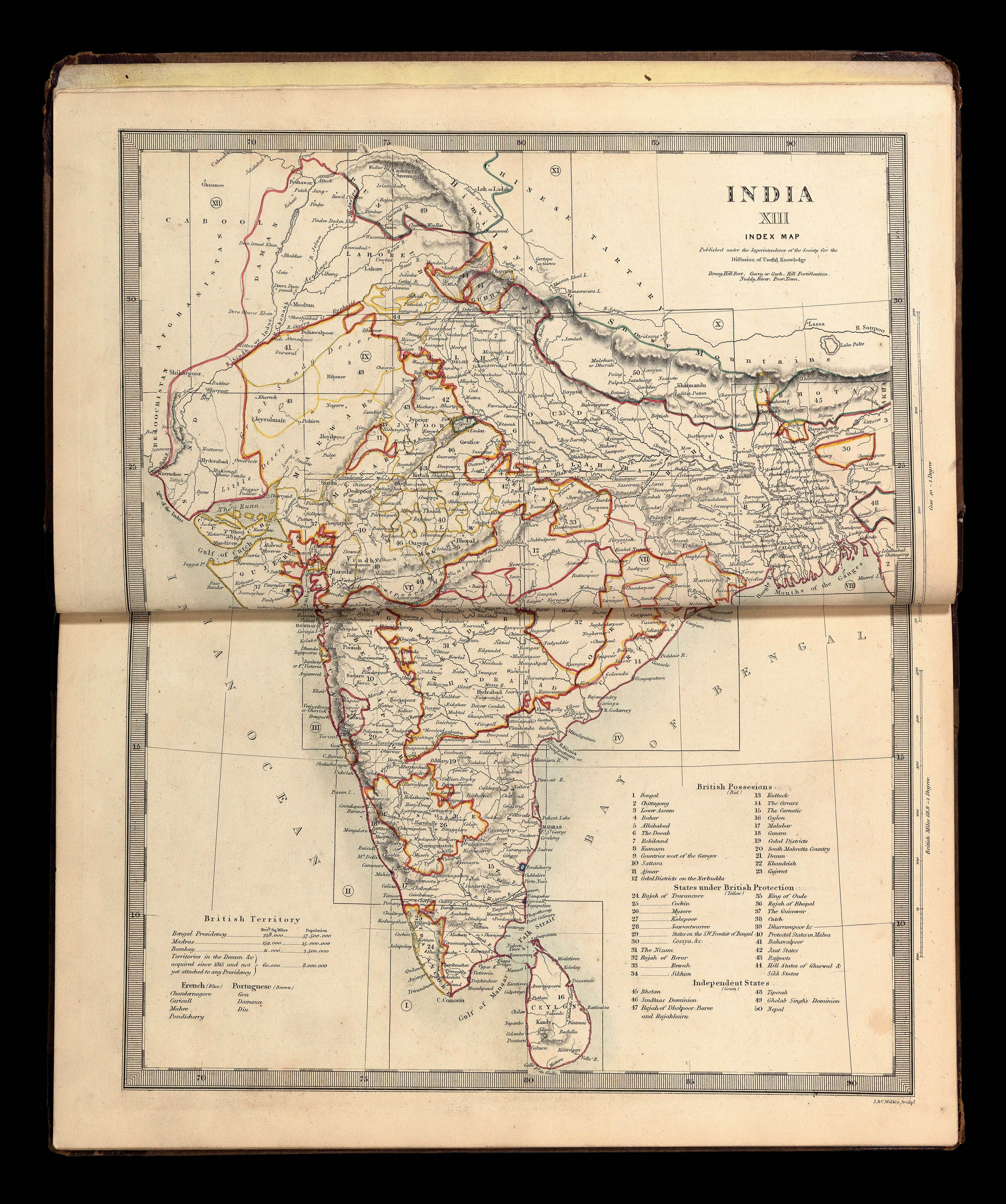 |
Rare atlas of India and the Far East
1 x
£3,000
|
£3,000 |
|
£3,000 |
|
× |
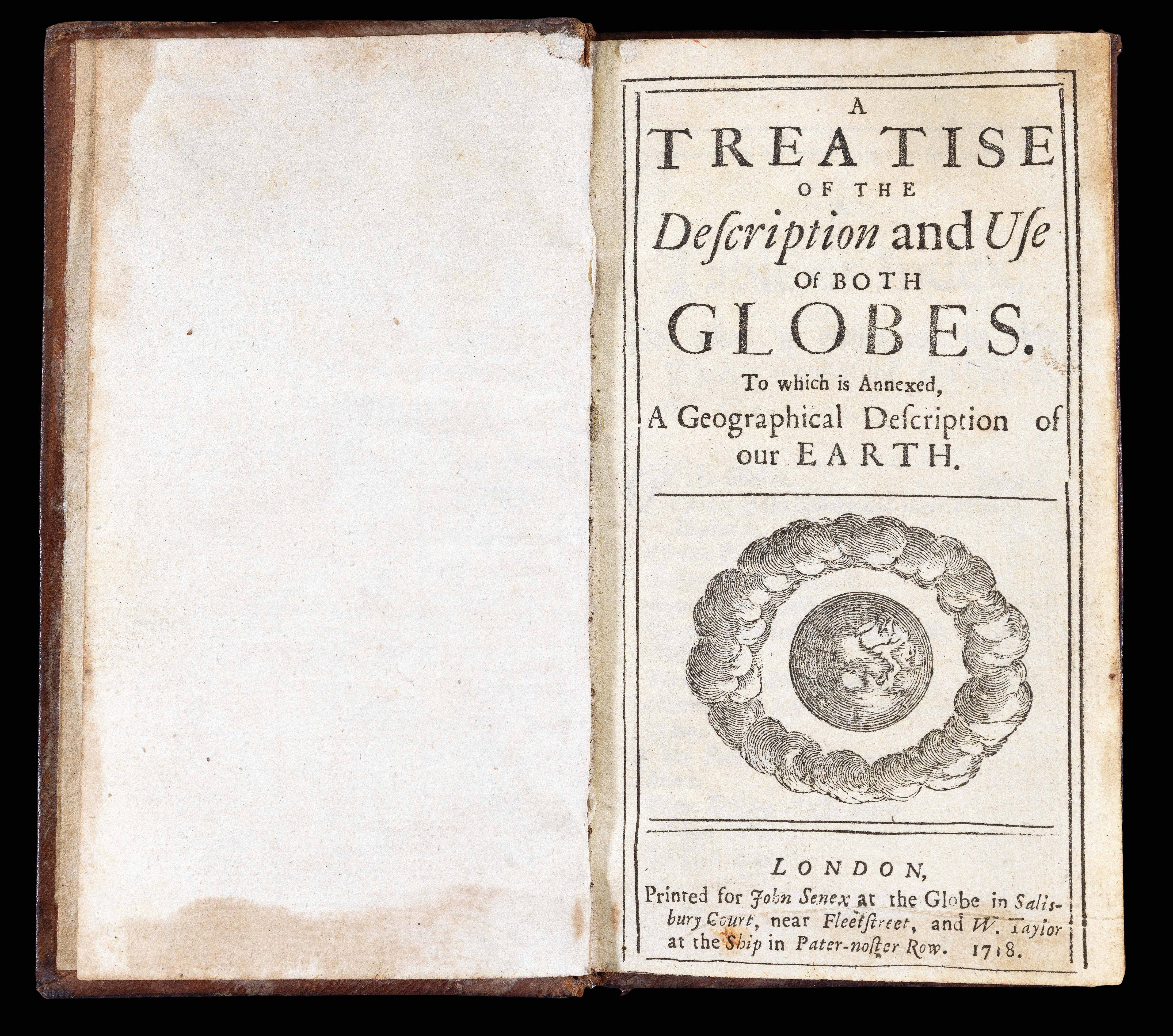 |
"a true and exact representation of the Earth and Heavens"
1 x
£1,200
|
£1,200 |
|
£1,200 |
|
× |
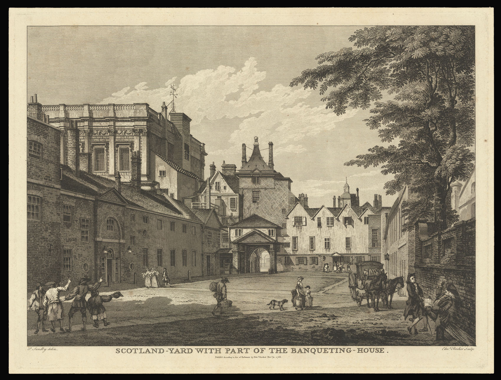 |
Scotland Yard
1 x
£600
|
£600 |
|
£600 |
|
× |
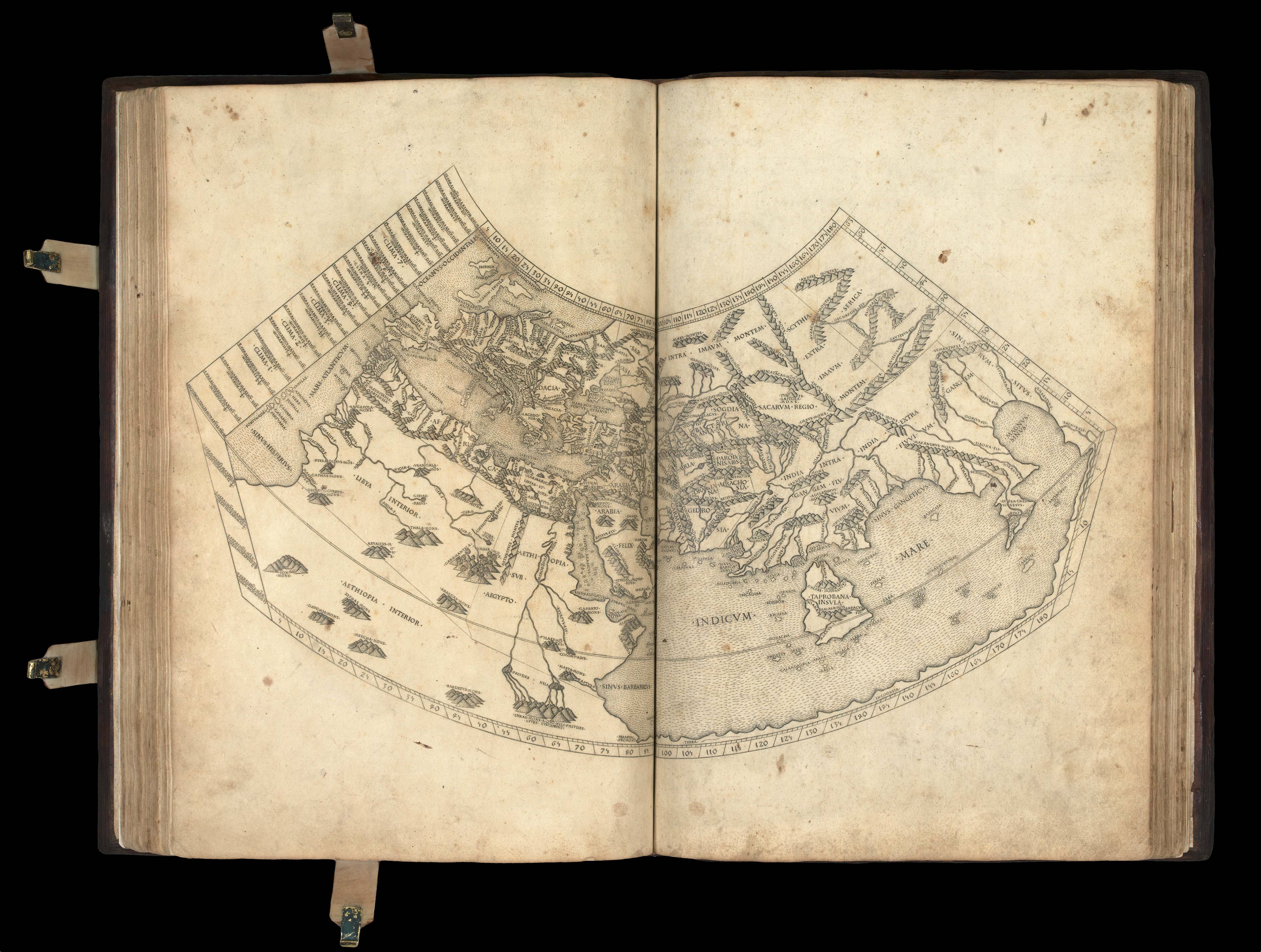 |
Ptolemy's first projection, with the "finest Ptolemaic plates produced until Gerard Mercator"
1 x
£300,000
|
£300,000 |
|
£300,000 |
|
× |
 |
Panama
1 x
£2,500
|
£2,500 |
|
£2,500 |
|
× |
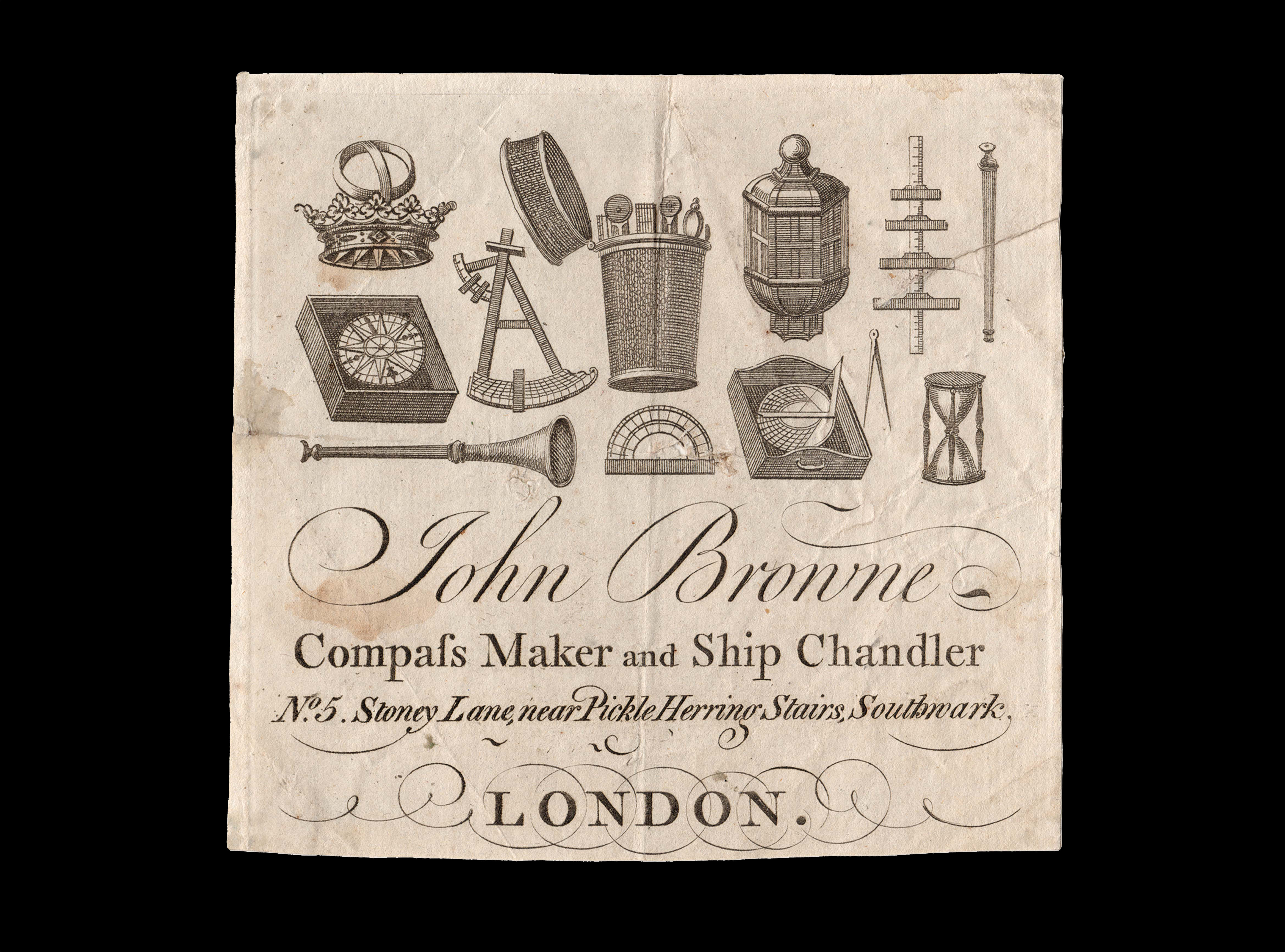 |
Offering "All Sorts of Instruments for Sea and Land"
1 x
£1,500
|
£1,500 |
|
£1,500 |
|
× |
 |
The King's Lock
1 x
£500
|
£500 |
|
£500 |
|
× |
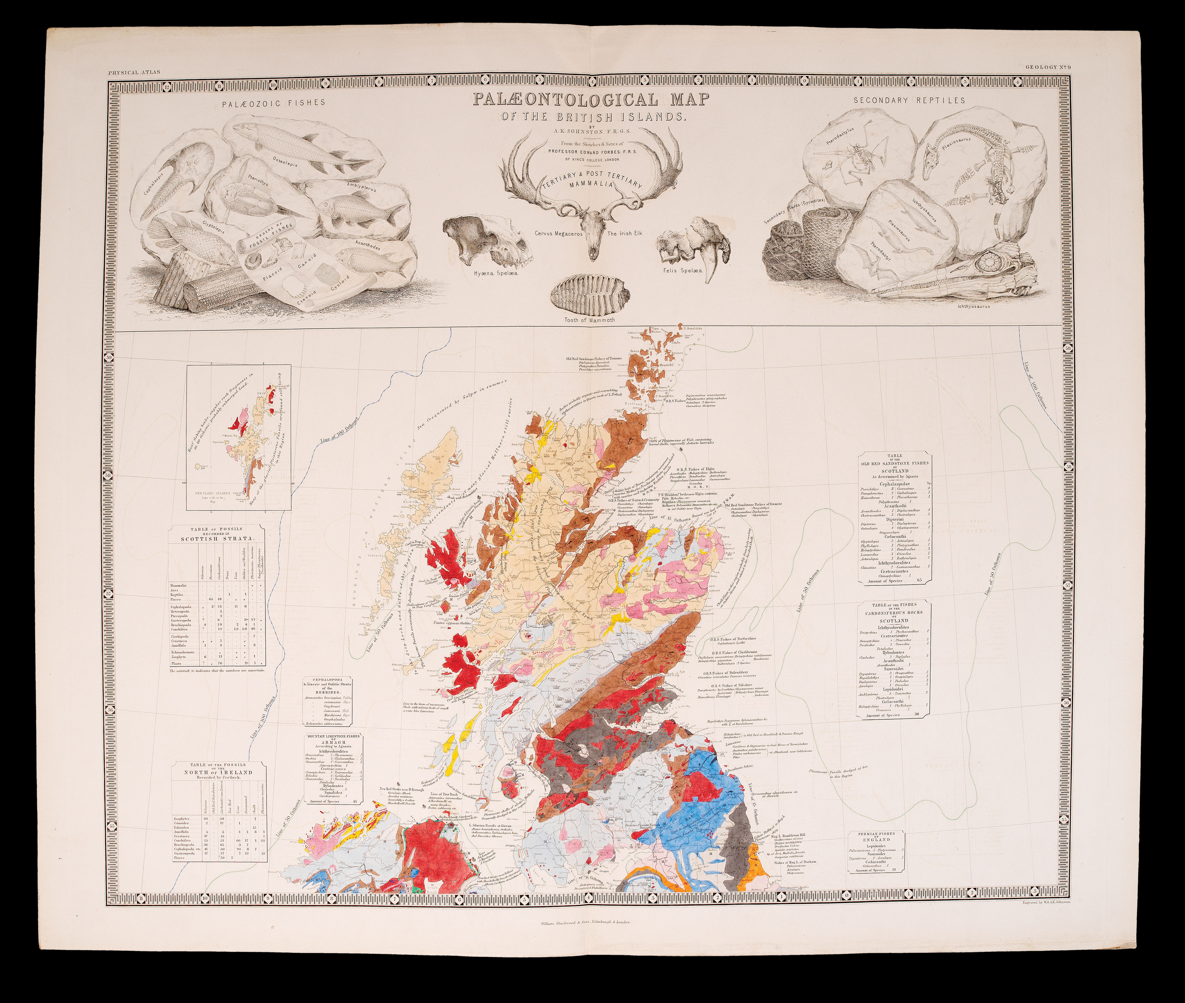 |
Let's get physical
1 x
£12,500
|
£12,500 |
|
£12,500 |
|
× |
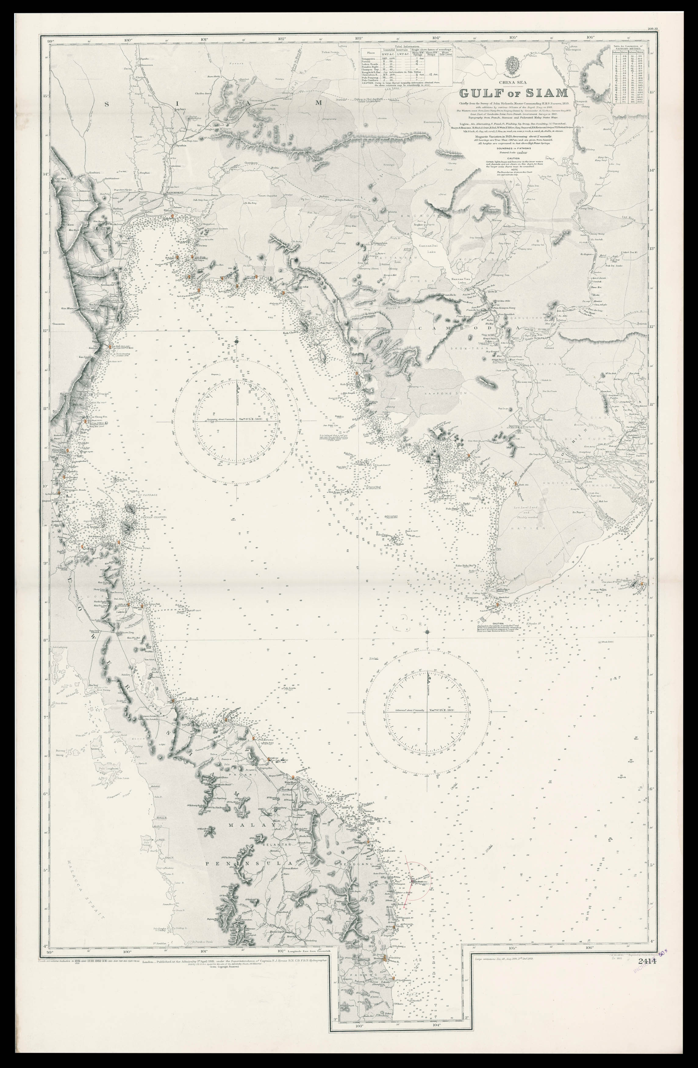 |
Admiralty chart of the Gulf of Thailand
1 x
£1,600
|
£1,600 |
|
£1,600 |
|
× |
![[ANONYMOUS] [Souvenir ticket from the Frost Fair of 1814]](https://omega.crouchrarebooks.com/wp-content/uploads/2025/03/18213_1H.jpg) |
"... you may tell 'twas printed there"
1 x
£750
|
£750 |
|
£750 |
|
× |
 |
Lopez Cuba
1 x
£7,000
|
£7,000 |
|
£7,000 |
|
× |
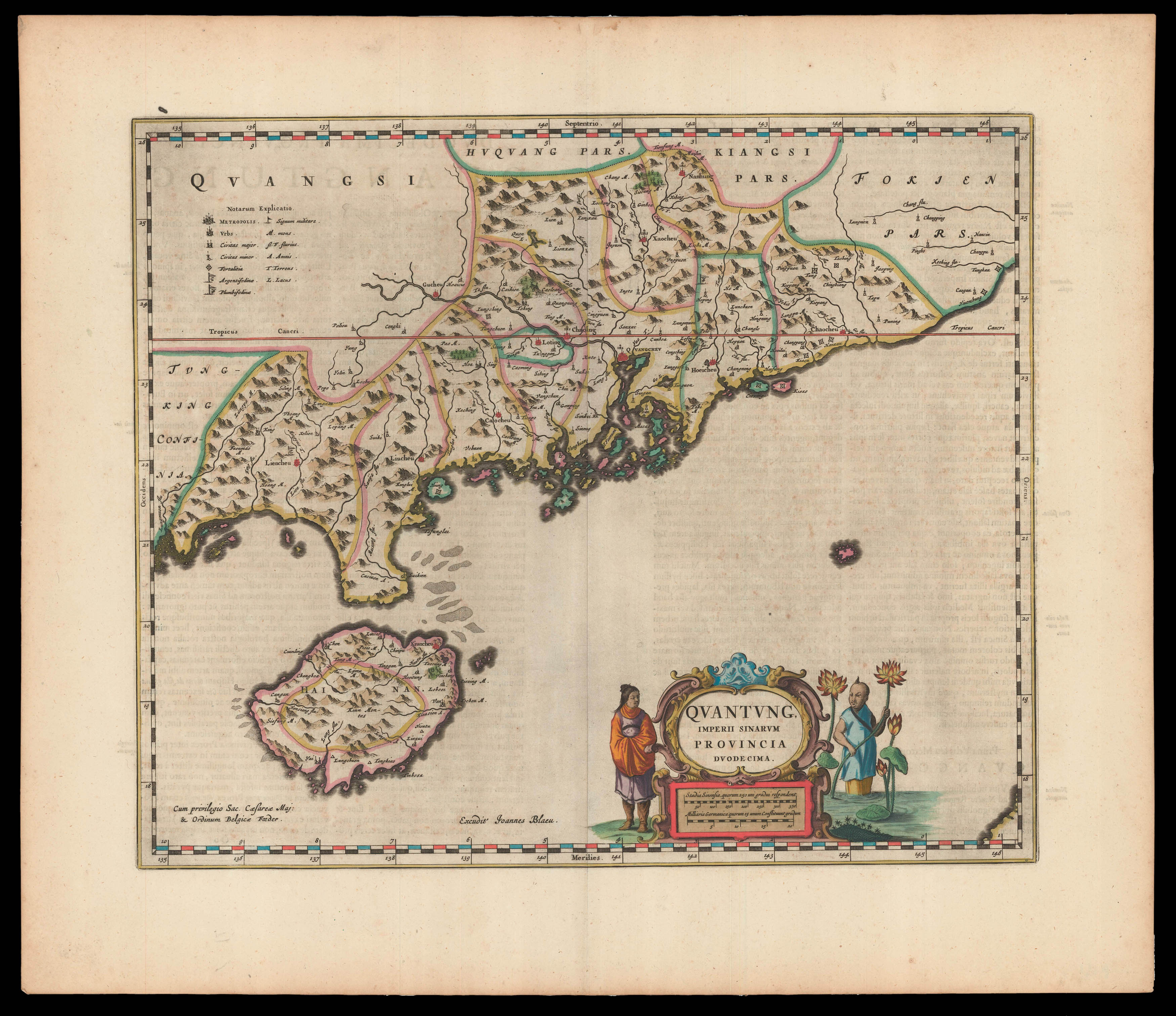 |
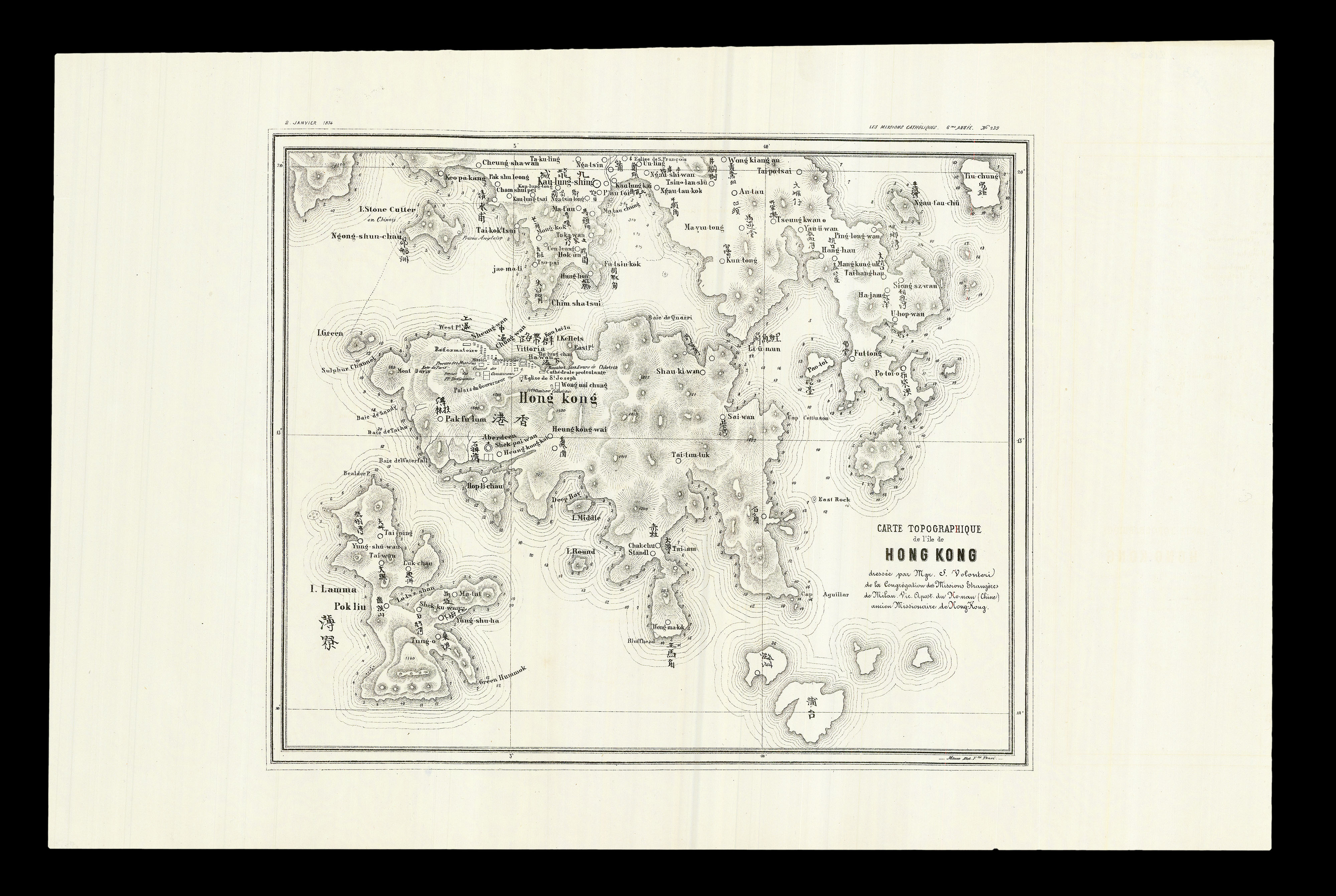
First Western Map of Quantung
1 x
£3,500
|
£3,500 |
|
£3,500 |
|
× |
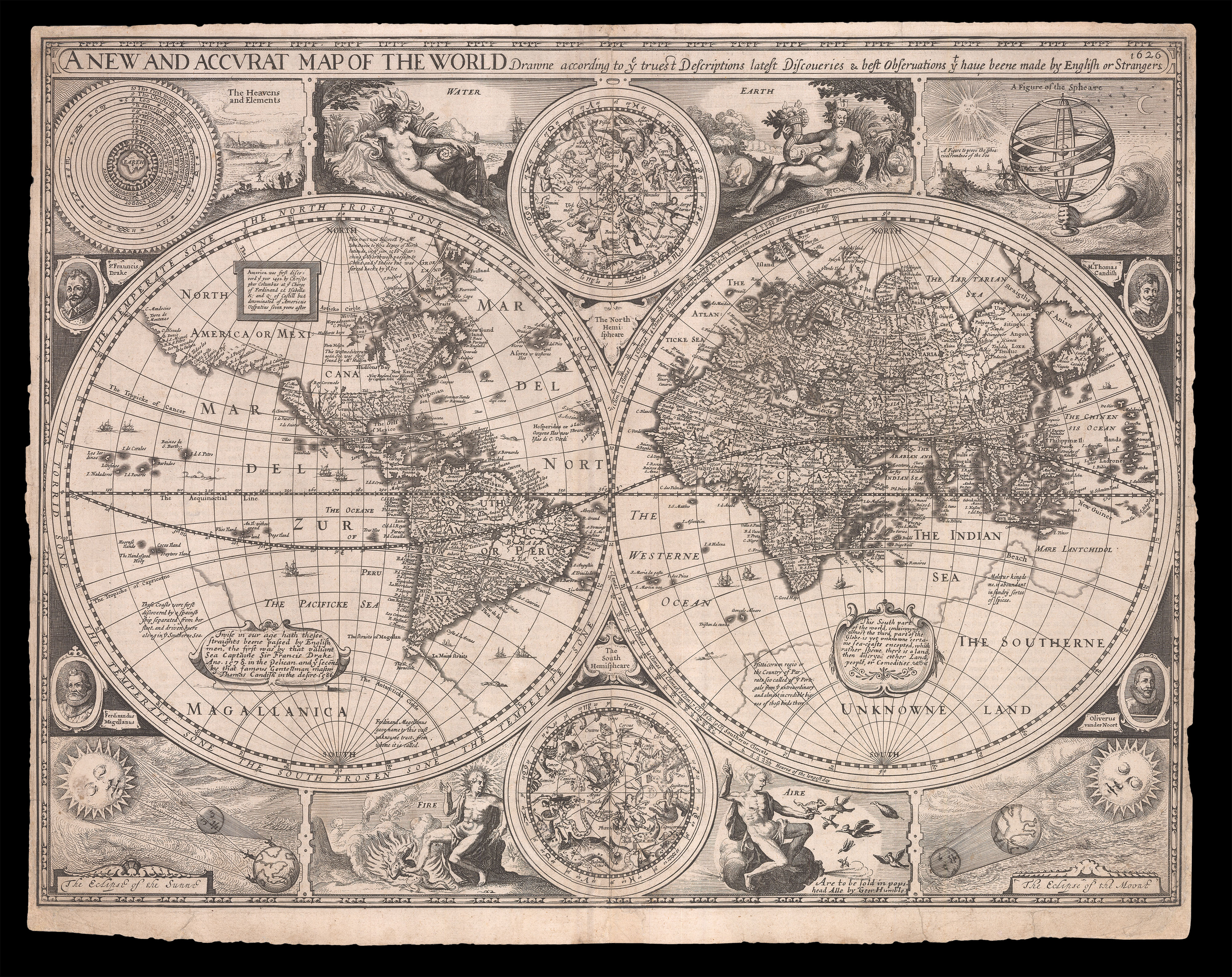 |
The first world map in a world atlas compiled and published by an Englishman
1 x
£10,500
|
£10,500 |
|
£10,500 |
|
× |
![WAGHENAER, Lucas Janszoon Teerste Deel vande Spieghel der Zeevaert... [and] Der ander Theil. Dess Spiegels der Seefart](https://omega.crouchrarebooks.com/wp-content/uploads/2025/03/23910_1H.jpg) |
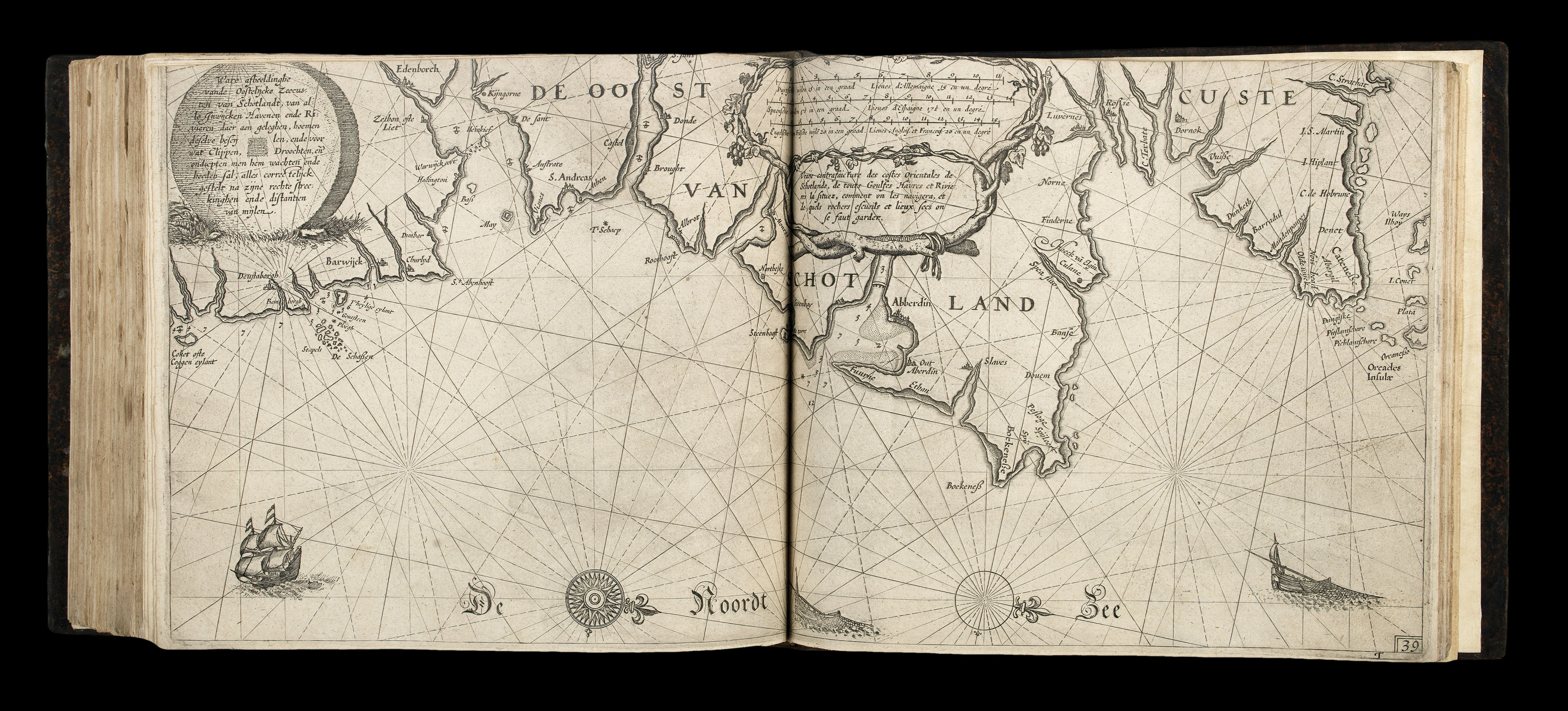
The first printed sea pilot
1 x
£325,000
|
£325,000 |
|
£325,000 |
|
× |
 |
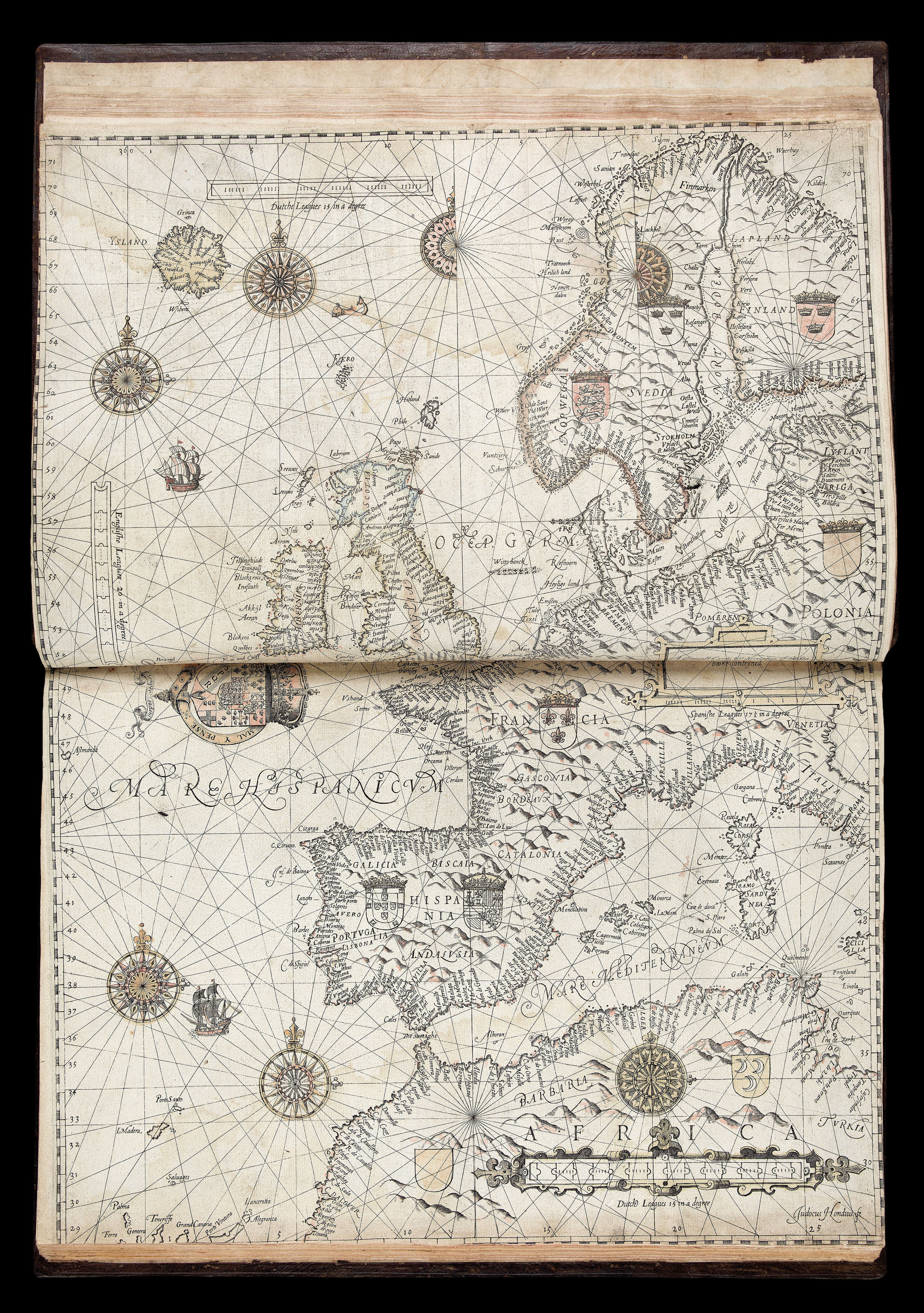
Blaeu's first sea pilot
1 x
£160,000
|
£160,000 |
|
£160,000 |
|
× |
![Աստուածատուր Վ. Աւագեան [AVAKIAN, Astvatsatur V.]. Ատլաս կամ աշխարհացոյց տախտակք Ի պէտս ազգային դպրոցաց [Atlas or World Map for the National Schools].](https://omega.crouchrarebooks.com/wp-content/uploads/2025/03/20717_1H.jpg) |
The most important nineteenth-century Armenian atlas
1 x
£15,000
|
£15,000 |
|
£15,000 |
|
× |
![STAMPIOEN, Jan Jansz the Younger, [and] Marten CALMAM Onderwys in 't Regte Gebruyk van het Hemels-Plyn](https://omega.crouchrarebooks.com/wp-content/uploads/2025/03/1992_1H.jpg) |
Telling the time with stars
1 x
£25,000
|
£25,000 |
|
£25,000 |
|
× |
 |
The first colour photograph from the Martian surface taken by Viking 1
1 x
£15,000
|
£15,000 |
|
£15,000 |
|
× |
![HOLLAR, W[enceslaus] [Twelve Months of the Year with Signs of the Zodiac]](https://omega.crouchrarebooks.com/wp-content/uploads/2025/03/18313_1H.jpg) |
The twelve months
1 x
£12,000
|
£12,000 |
|
£12,000 |
|
× |
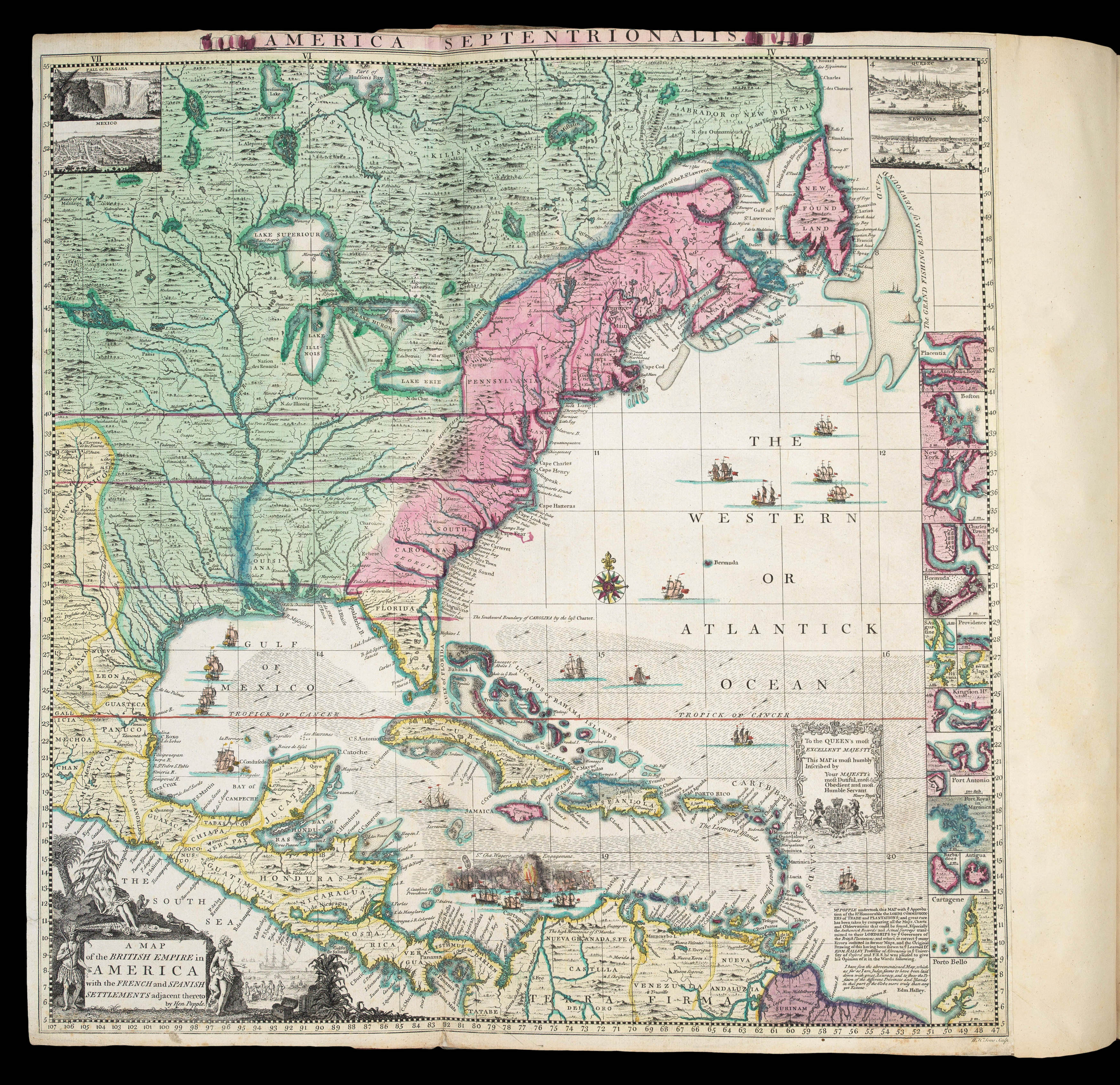 |
A profound statement of England's designs for dominance of the North American continent; at a time when colonial control of North America was by no means certain
1 x
£180,000
|
£180,000 |
|
£180,000 |
|
× |
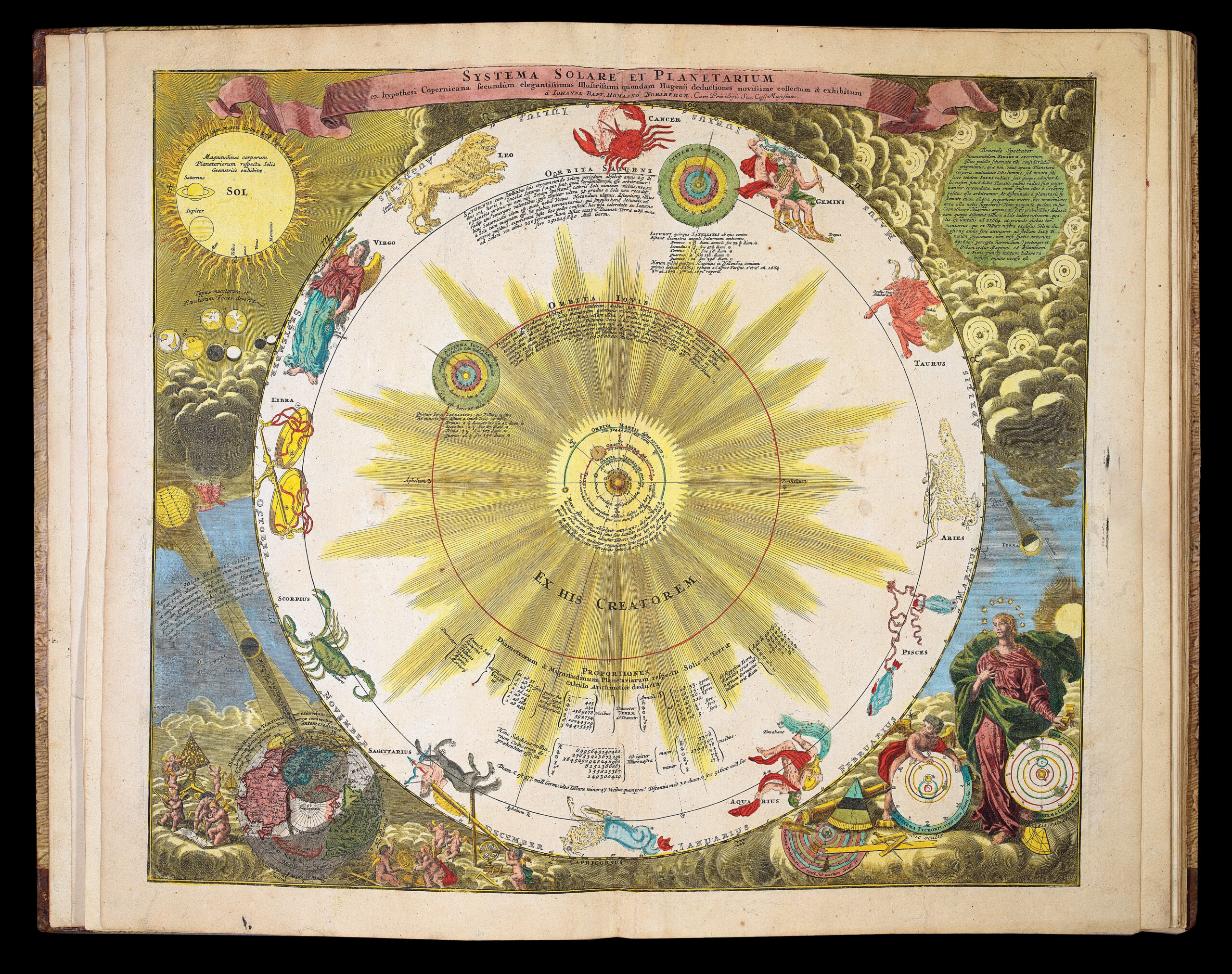 |
An encyclopedic atlas of everything astronomical
1 x
£32,000
|
£32,000 |
|
£32,000 |
|
× |
 |
"A complete bijou of a map, not less useful than elegant"
1 x
£1,250
|
£1,250 |
|
£1,250 |
|
× |
 |
The first sea pilot printed in English
1 x
£195,000
|
£195,000 |
|
£195,000 |
|
× |
![H[ONDIUS, Hendrik] Sebastianus Munsterus Cosmographus nostri felix Germanus](https://omega.crouchrarebooks.com/wp-content/uploads/2025/03/17795_1H.jpg) |
Sebastian Münster
1 x
£300
|
£300 |
|
£300 |
|
× |
 |
Halley's Zodiacus Stellatus
1 x
£10,000
|
£10,000 |
|
£10,000 |
|
× |
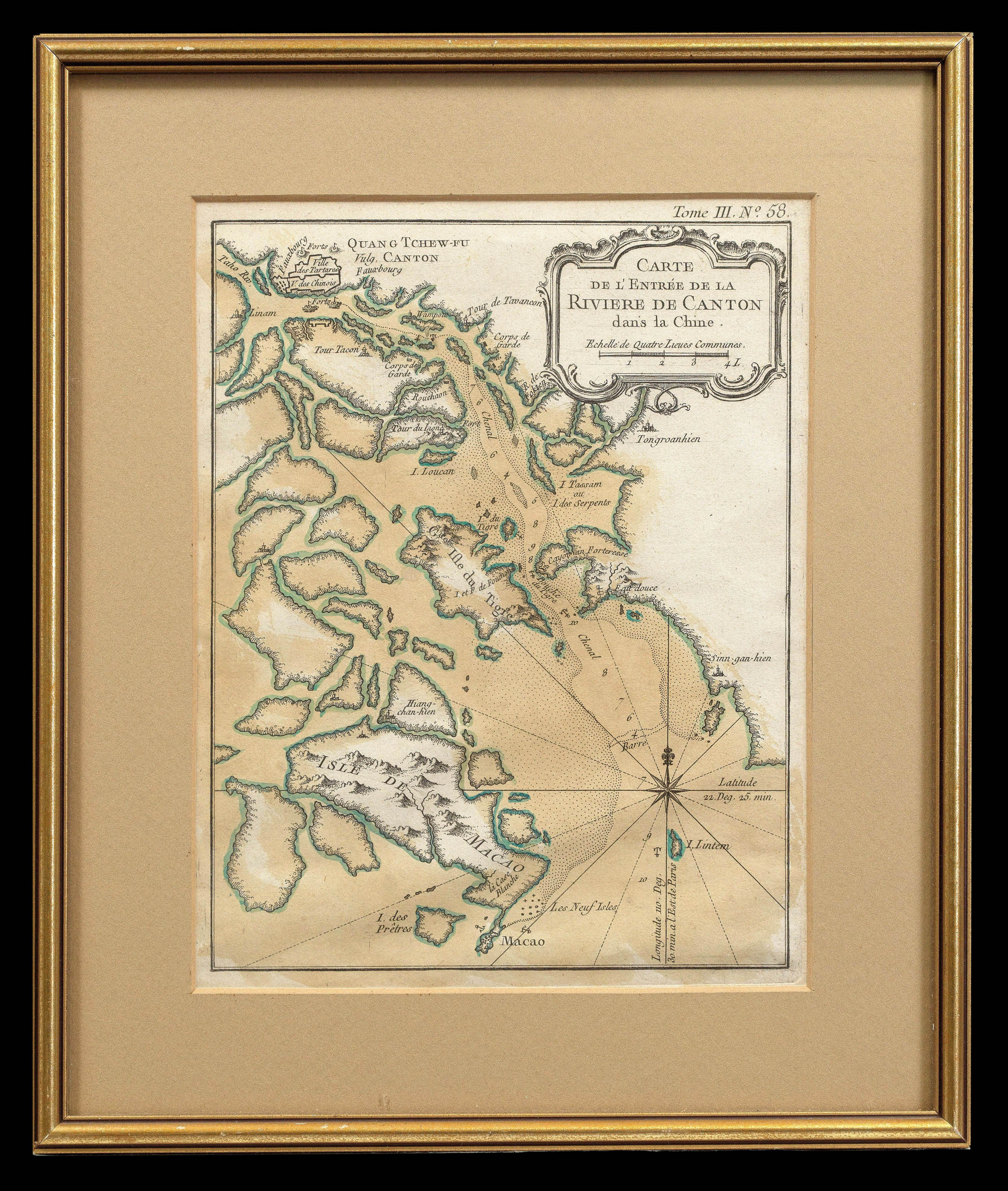 |
Bellin's map of the vicinity of Canton
1 x
£500
|
£500 |
|
£500 |
|
× |
 |
Horse Guards
1 x
£600
|
£600 |
|
£600 |
|
× |
![MANDERSON, Captain [James] An Enquiry into the causes of The Stream which sets through the Gulf of Florida into the Atlantic Ocean: with Directions for Navigating that Passage from Jamaica.](https://omega.crouchrarebooks.com/wp-content/uploads/2025/03/22654_1H.jpg) |
Manderson's pilot of the Gulf of Florida
1 x
£5,000
|
£5,000 |
|
£5,000 |
|
× |
 |
The most influential view of Rome published in the sixteenth century
1 x
£16,000
|
£16,000 |
|
£16,000 |
|
× |
 |
"The First Ever Bilingual Map of its Kind"
1 x
£20,000
|
£20,000 |
|
£20,000 |
|
× |
![KIP, Johannes A Prospect of the City of London [with] A Prospect of Westminster.](https://omega.crouchrarebooks.com/wp-content/uploads/2025/03/12591_1H.jpg) |
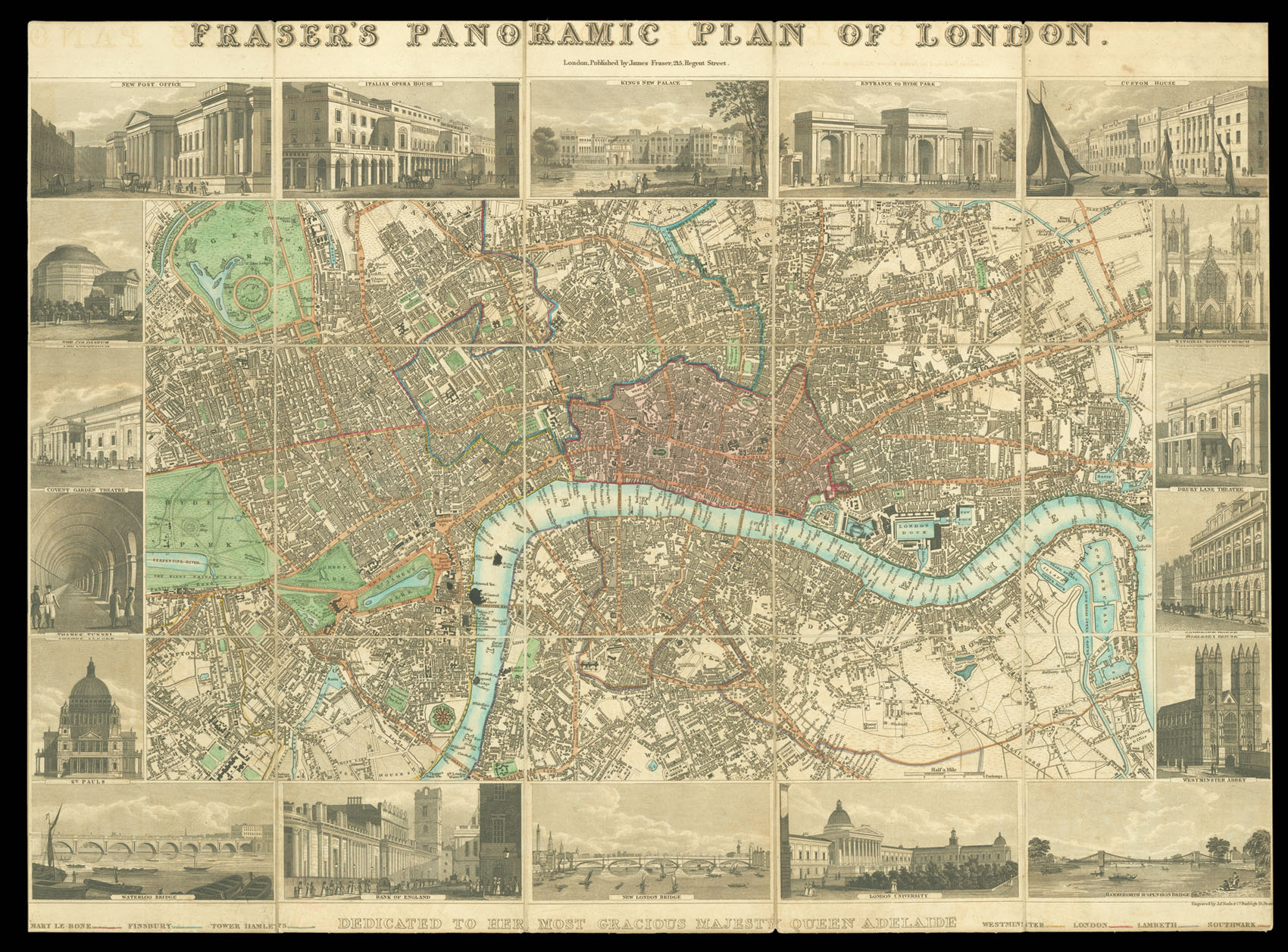
London's calling
1 x
£12,000
|
£12,000 |
|
£12,000 |
|
× |
![NASA [Planet Earth and her Moon]](https://omega.crouchrarebooks.com/wp-content/uploads/2025/03/20452_1H.jpg) |
The first colour photograph of Earth and Moon together in a single frame
1 x
£25,000
|
£25,000 |
|
£25,000 |
|
× |
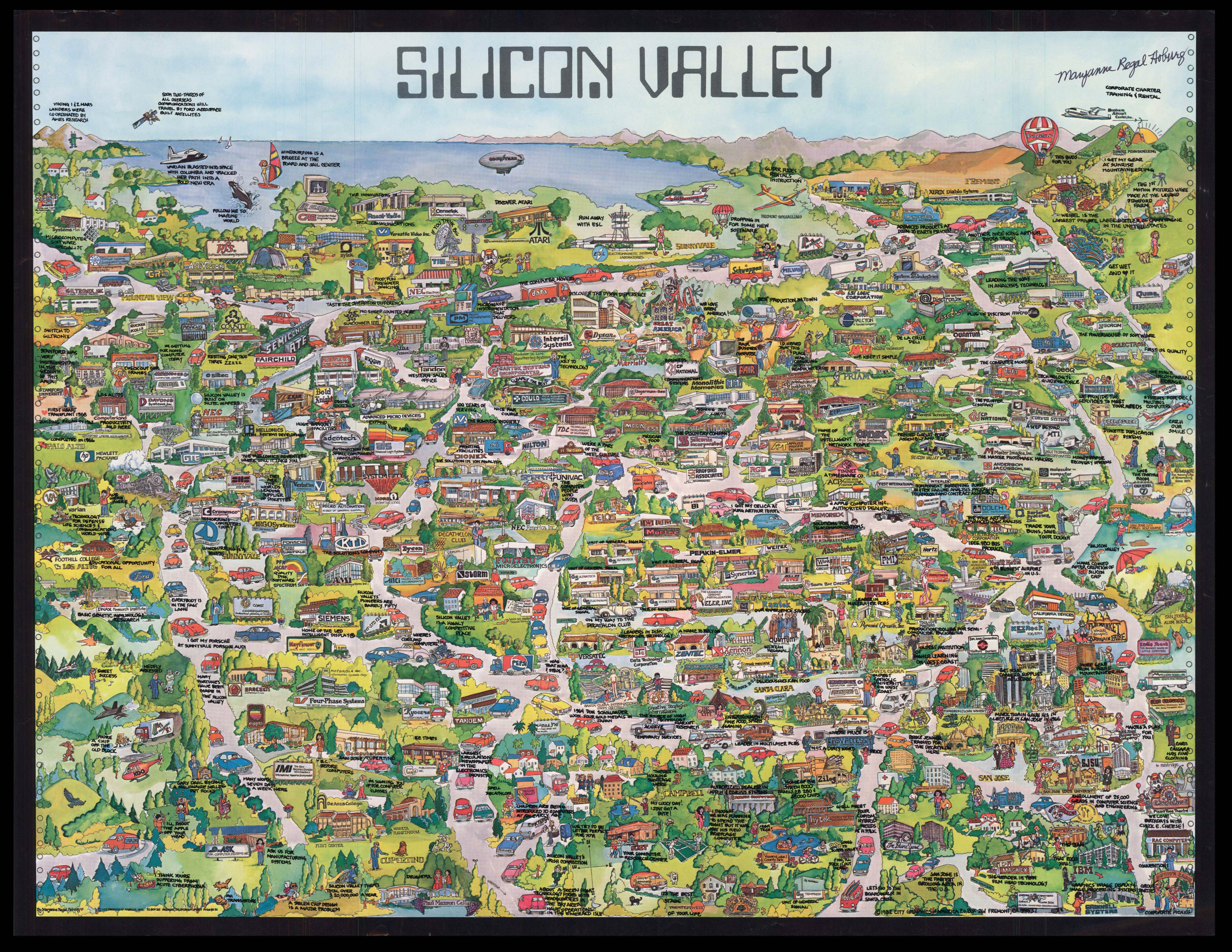 |
Foundation map of Silicon Valley - inscribed by the artist
1 x
£28,000
|
£28,000 |
|
£28,000 |
|
|


