No products in the basket.
Return to shop
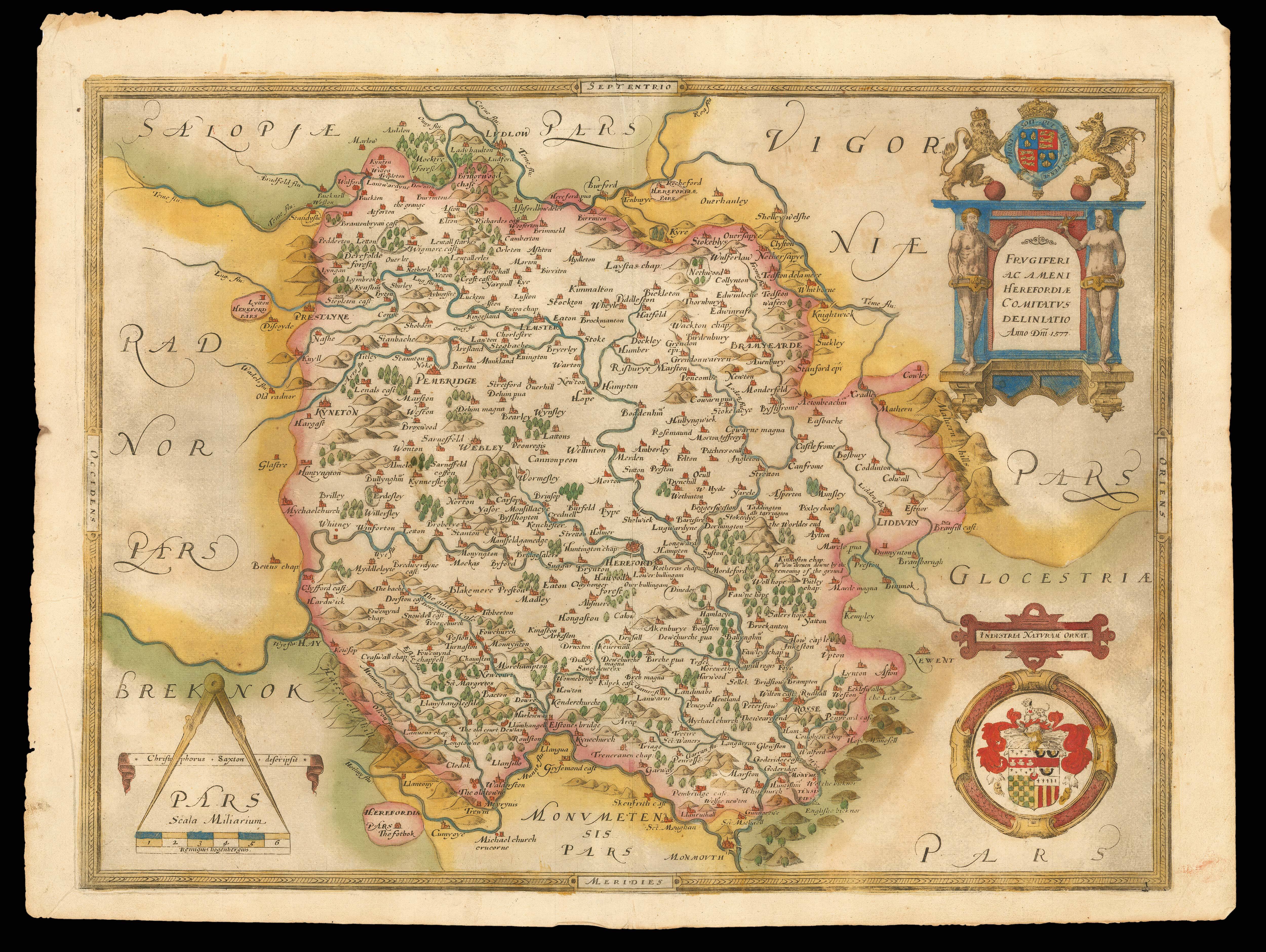
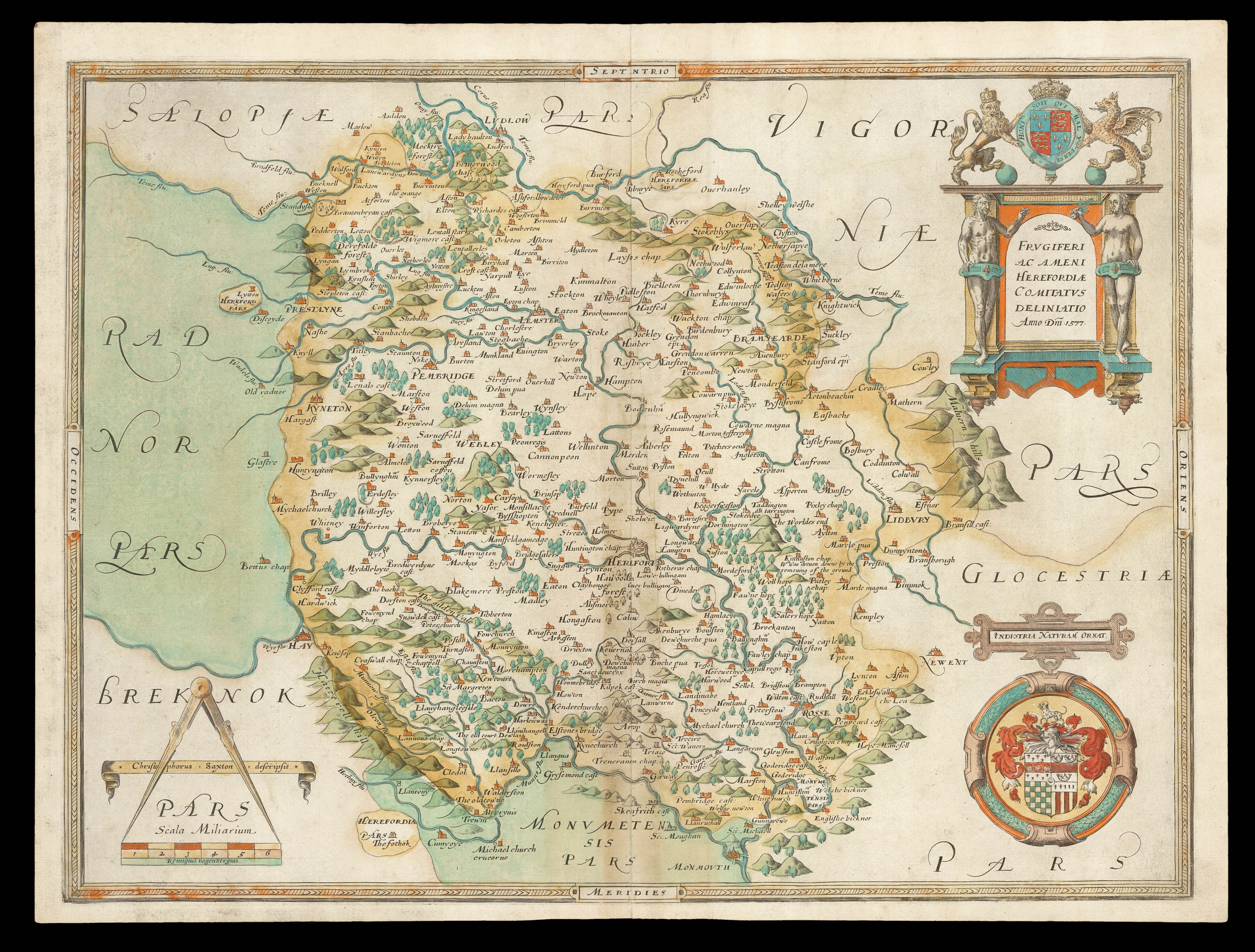
The first printed map of Herefordshire
By SAXTON, Christopher, 1579
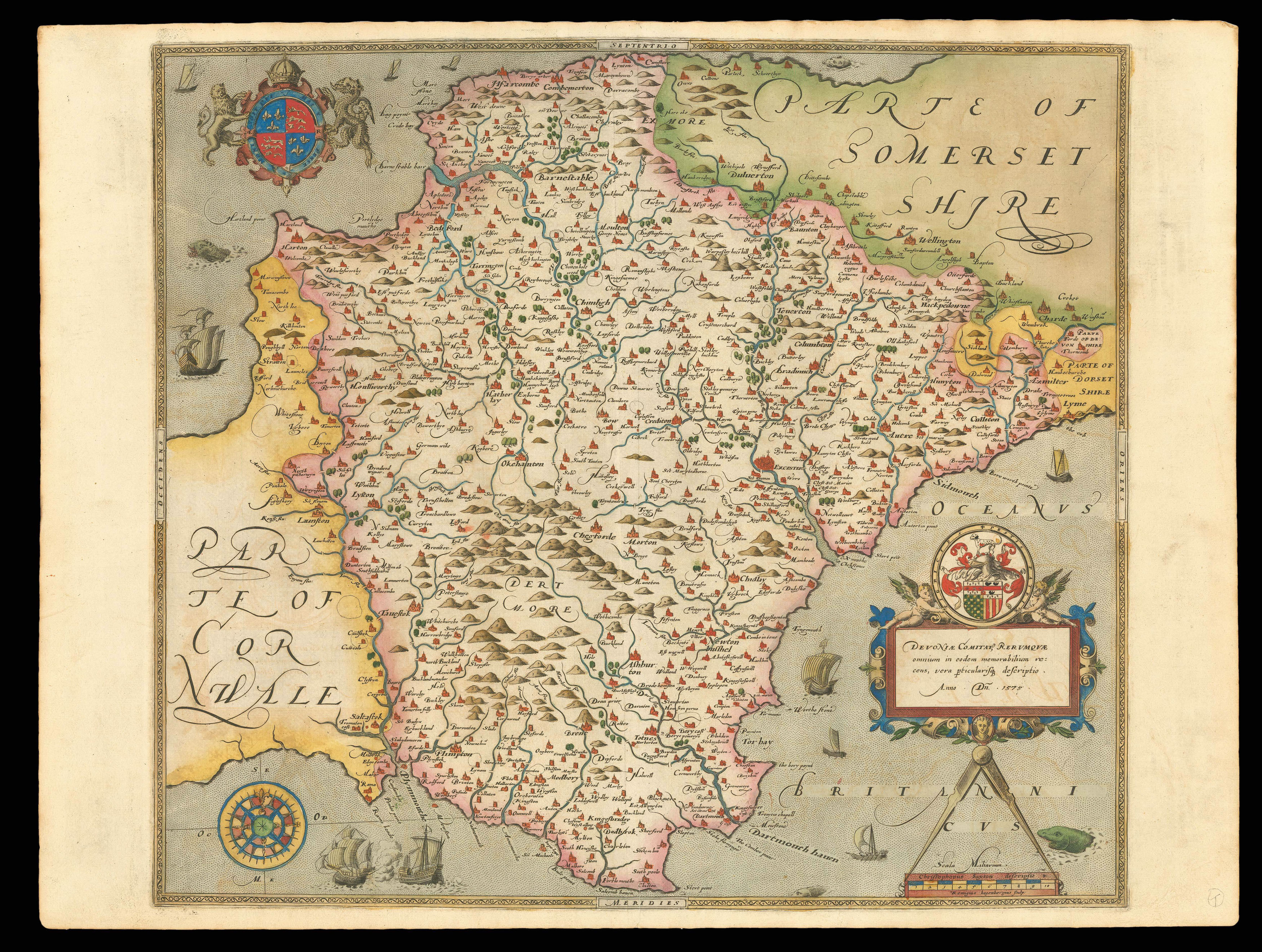
The first printed map of Devon
The first national atlas
By [SAXTON, Christopher], 1579].
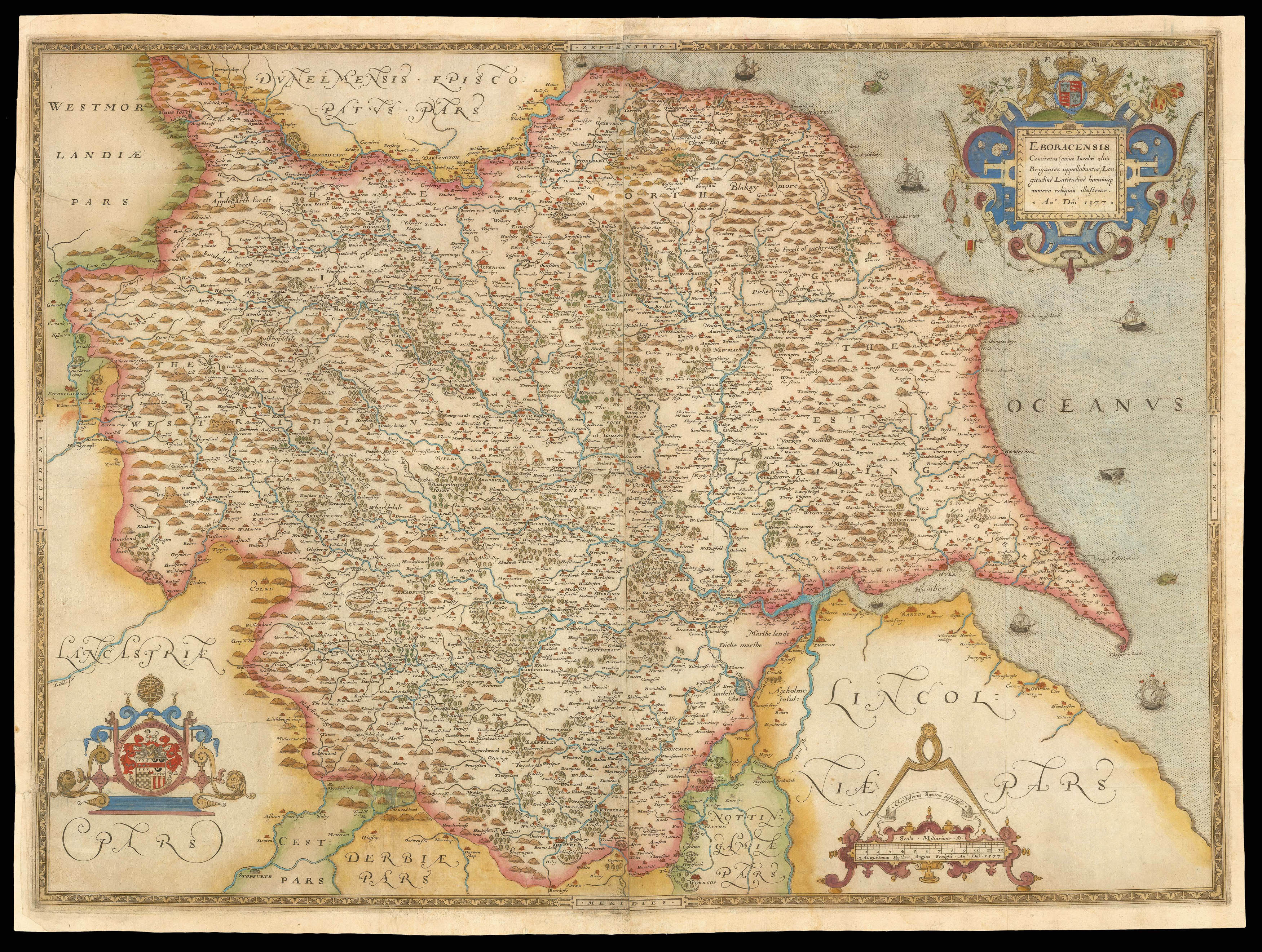
The first printed map of Yorkshire
The first printed map of Lancashire
The first printed map of Radnor, Breconshire, Cardiganshire and Carmarthenshire
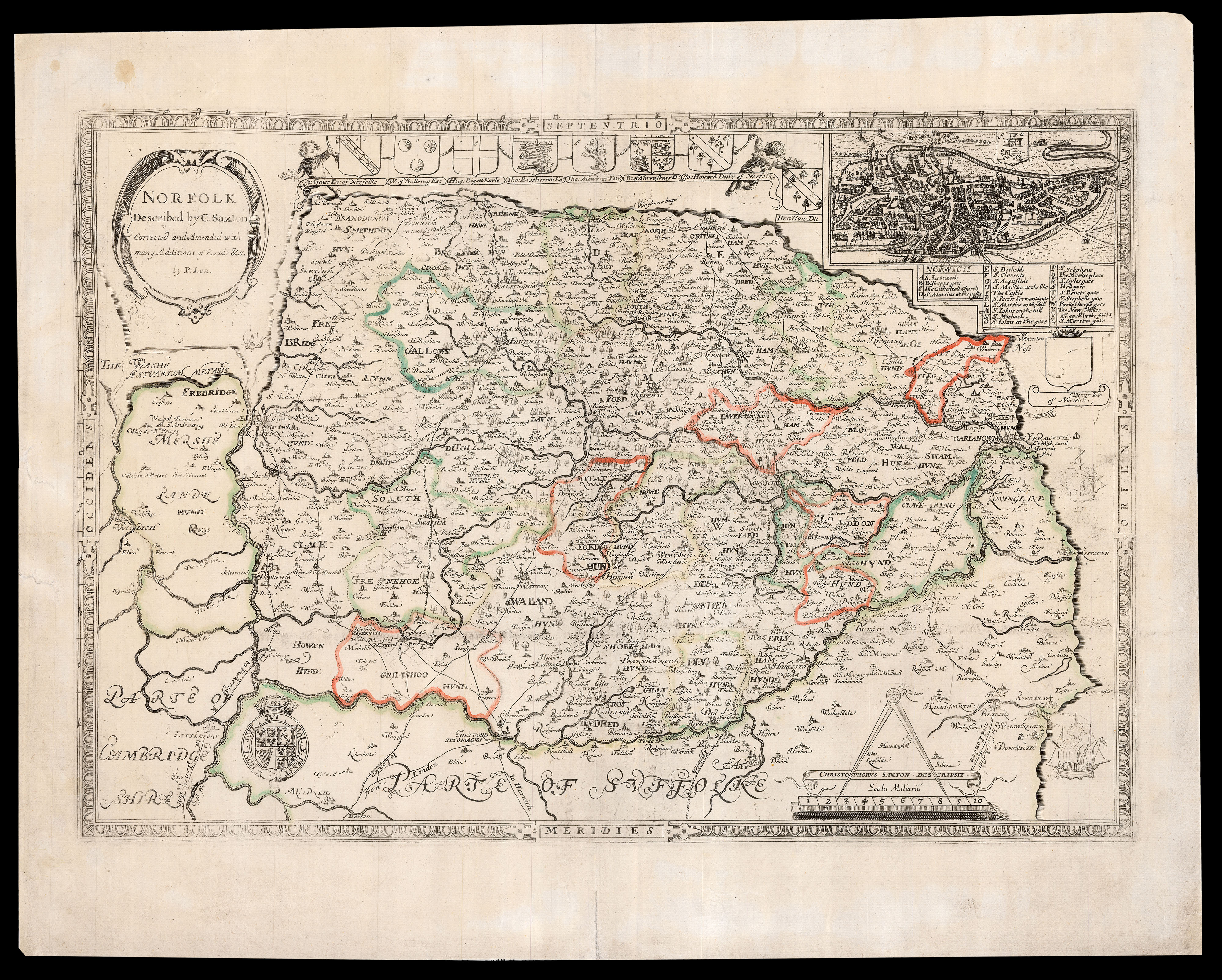
Lea’s edition of Saxton’s map of Norfolk
By SAXTON, Christopher, [c.1693].
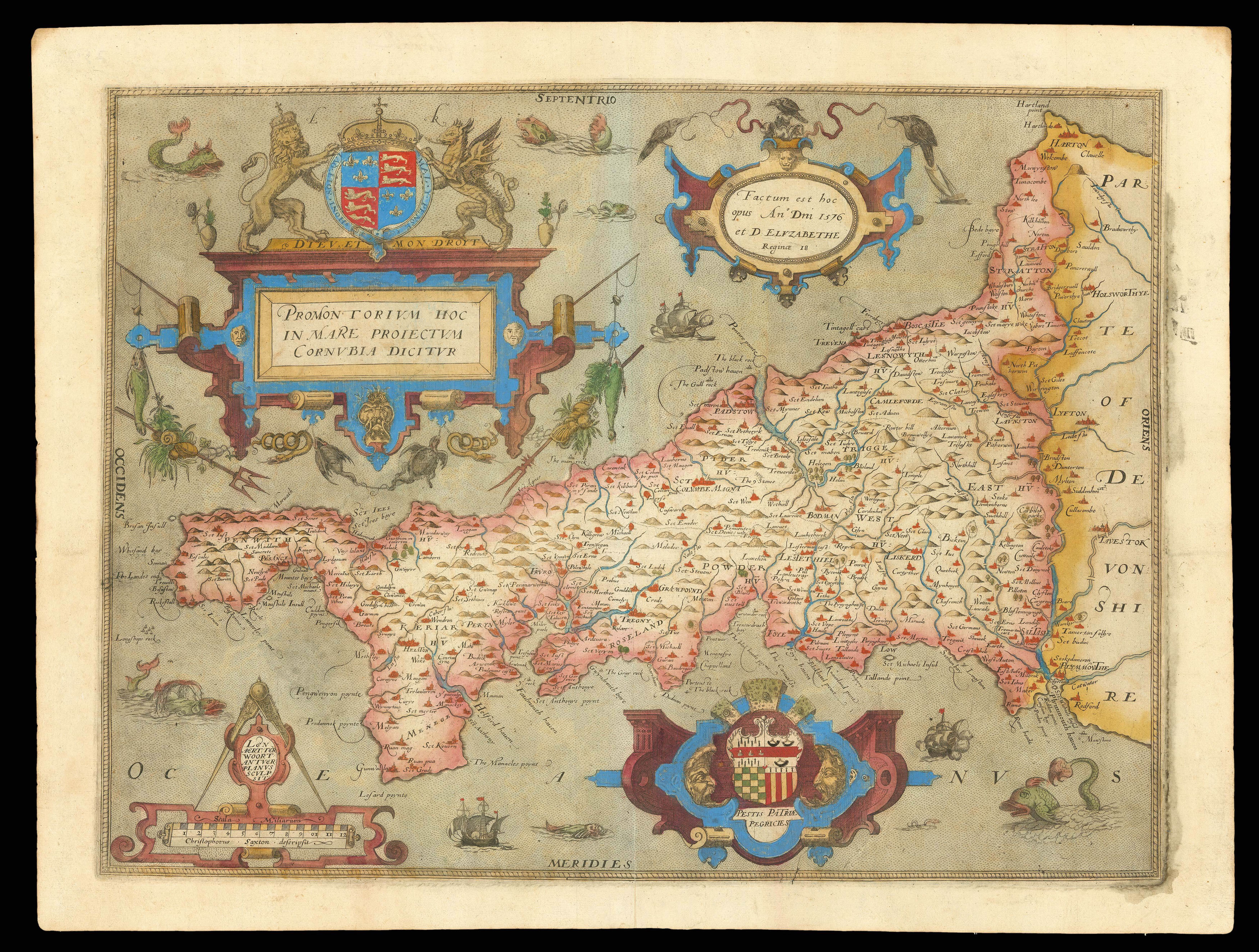
The first printed map of Cornwall
The first printed map of Oxfordshire, Buckinghamshire and Berkshire
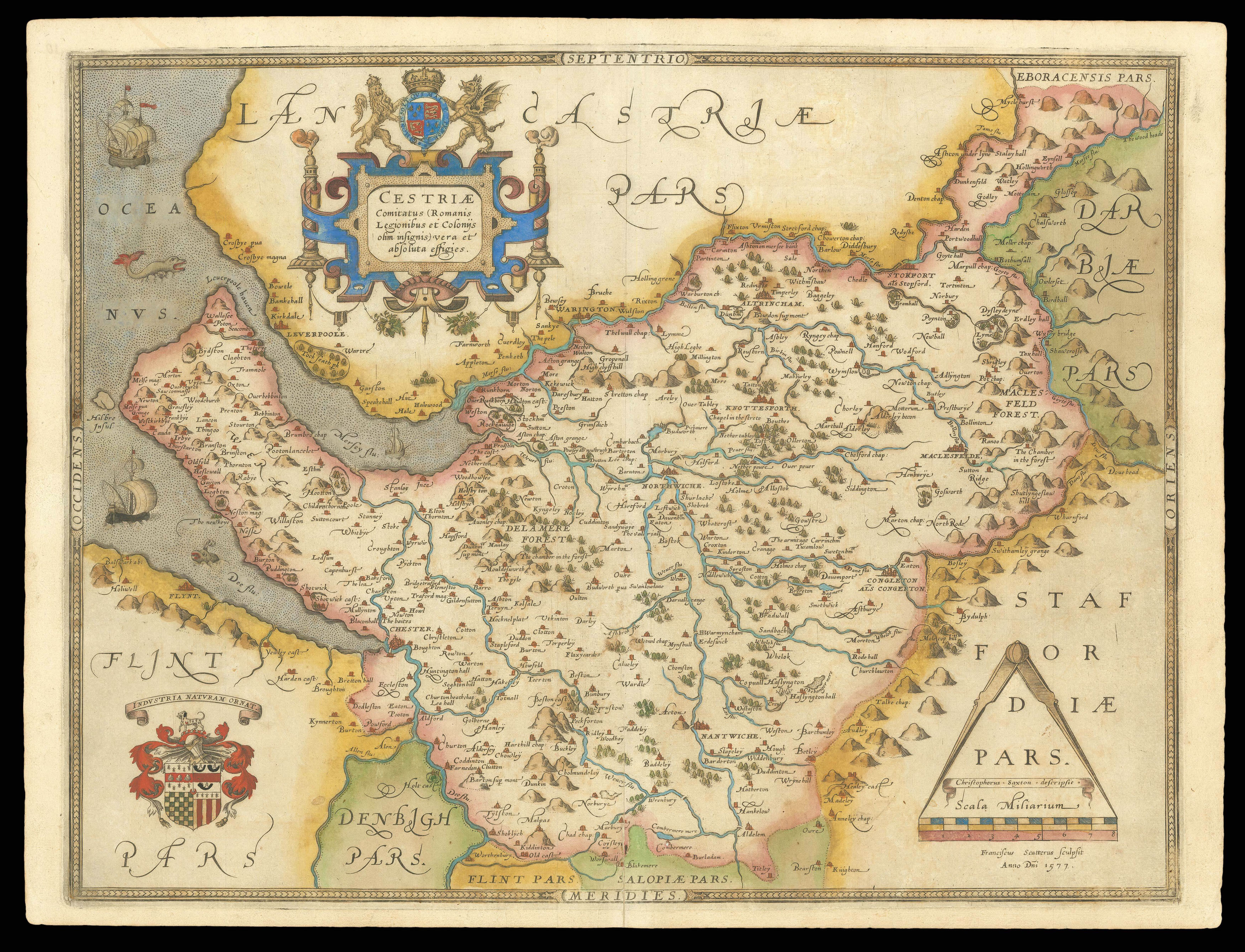
The first printed map of Cheshire
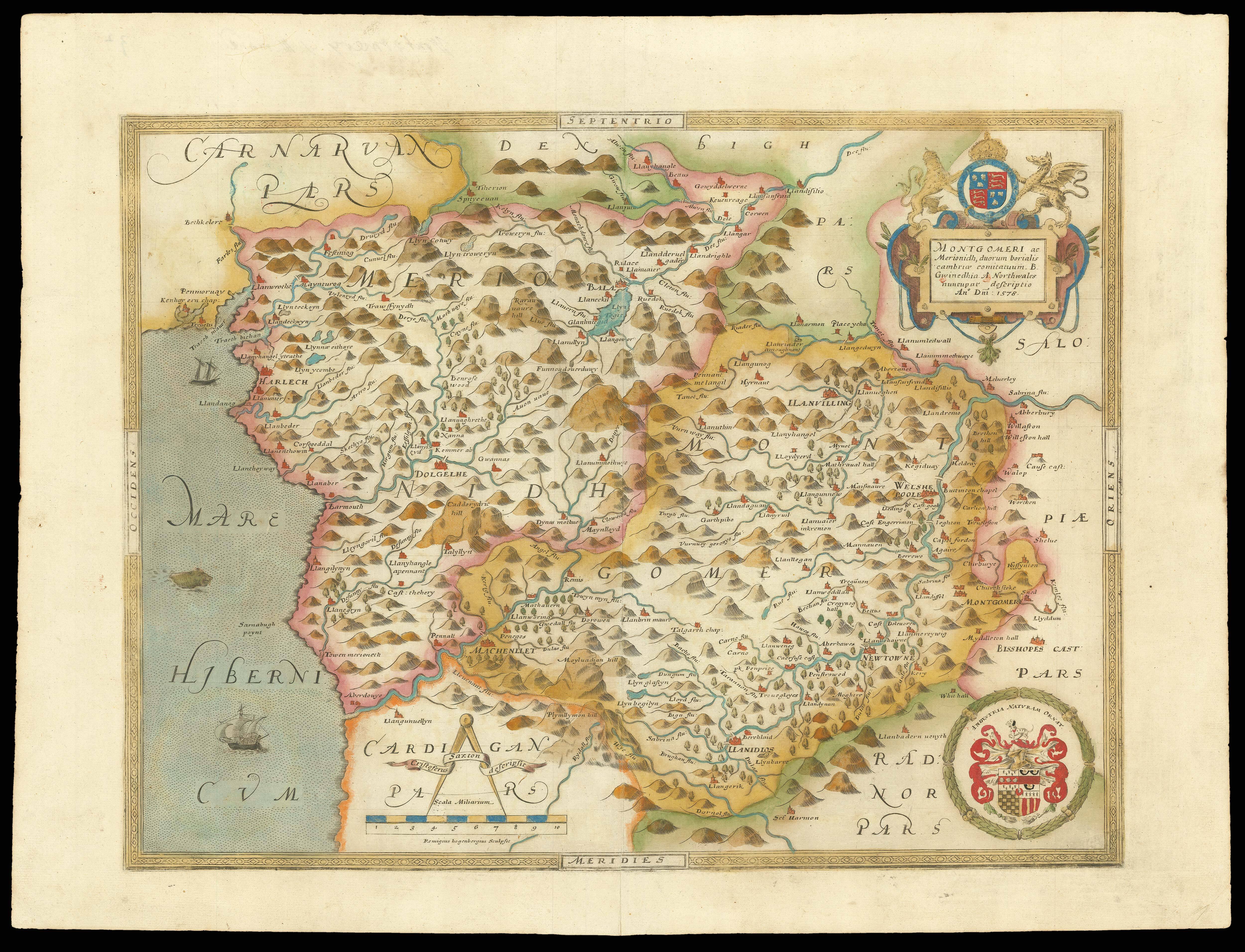
The first printed map of Montgomeryshire and Merionethshire
Username or email address *Required
Password *Required
Remember me Log in
Lost your password?
Email address *Required
A link to set a new password will be sent to your email address.
Your personal data will be used to support your experience throughout this website, to manage access to your account, and for other purposes described in our privacy policy.
Register


![[SAXTON, Christopher] [An Atlas of England and Wales].](https://omega.crouchrarebooks.com/wp-content/uploads/2025/03/11864_1H.jpg)
![SAXTON, Christopher [Lancashire] Lancastriae Comitatus.](https://omega.crouchrarebooks.com/wp-content/uploads/2025/03/15351_1H.jpg)
![SAXTON, Christopher [Radnor, Breconshire, Cardiganshire and Carmarthenshire] Radnor Breknok Cardigan et Caermarden](https://omega.crouchrarebooks.com/wp-content/uploads/2025/03/15371_1H.jpg)
![SAXTON, Christopher [Oxfordshire, Buckinghamshire and Berkshire] Oxonii buckinghamiae et berceriae Comitatum](https://omega.crouchrarebooks.com/wp-content/uploads/2025/03/17625_1H.jpg)