|
× |
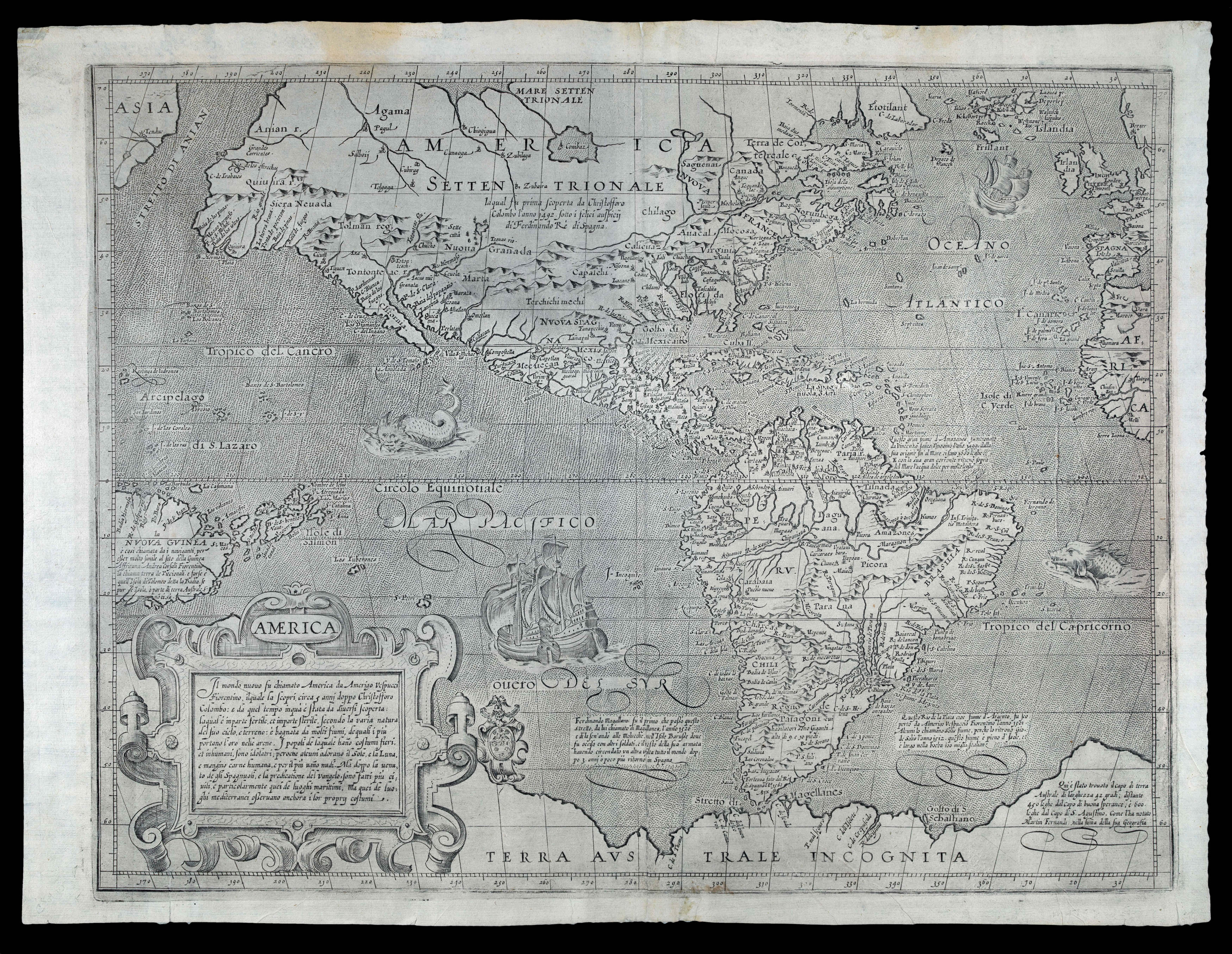 |
Arnoldi's separately-published map of the Americas, with the thumb print of the printer!
1 x
£30,000
|
£30,000 |
|
£30,000 |
|
× |
 |
"A complete bijou of a map, not less useful than elegant"
1 x
£1,250
|
£1,250 |
|
£1,250 |
|
× |
 |
Tooley's influential publication on the history of cartography
1 x
£10
|
£10 |
|
£10 |
|
× |
![FORTIN, [Jean] and BUY DE MORNAS, M. [Claude] [A set of two globes and one armillary sphere]](https://omega.crouchrarebooks.com/wp-content/uploads/2025/03/15693_1H.jpg) |
"Ingenieur-Mechanicien pour les Globes et Spheres"
1 x
£40,000
|
£40,000 |
|
£40,000 |
|
× |
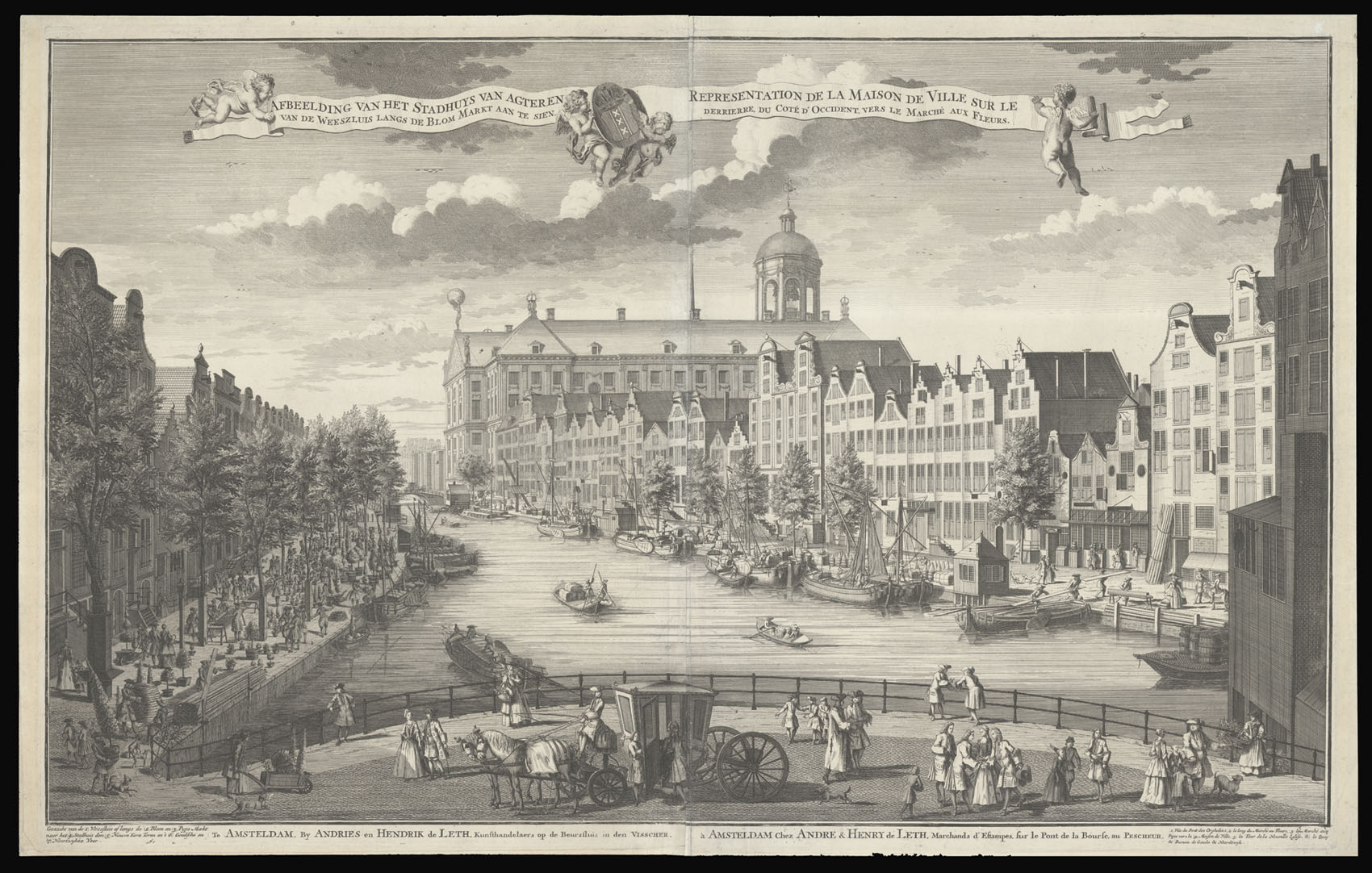 |
View along the Nieuwezijds Voorburgwal, with the rear of the Koninklijk Paleis
1 x
£4,100
|
£4,100 |
|
£4,100 |
|
× |
![ROSE, F[rederick] W[illiam] Angling in Troubled Waters](https://omega.crouchrarebooks.com/wp-content/uploads/2025/03/14585_1H.jpg) |
Tsar Nicholas II puppet master
1 x
£4,500
|
£4,500 |
|
£4,500 |
|
× |
 |
The northern Malacca Strait
1 x
£1,100
|
£1,100 |
|
£1,100 |
|
× |
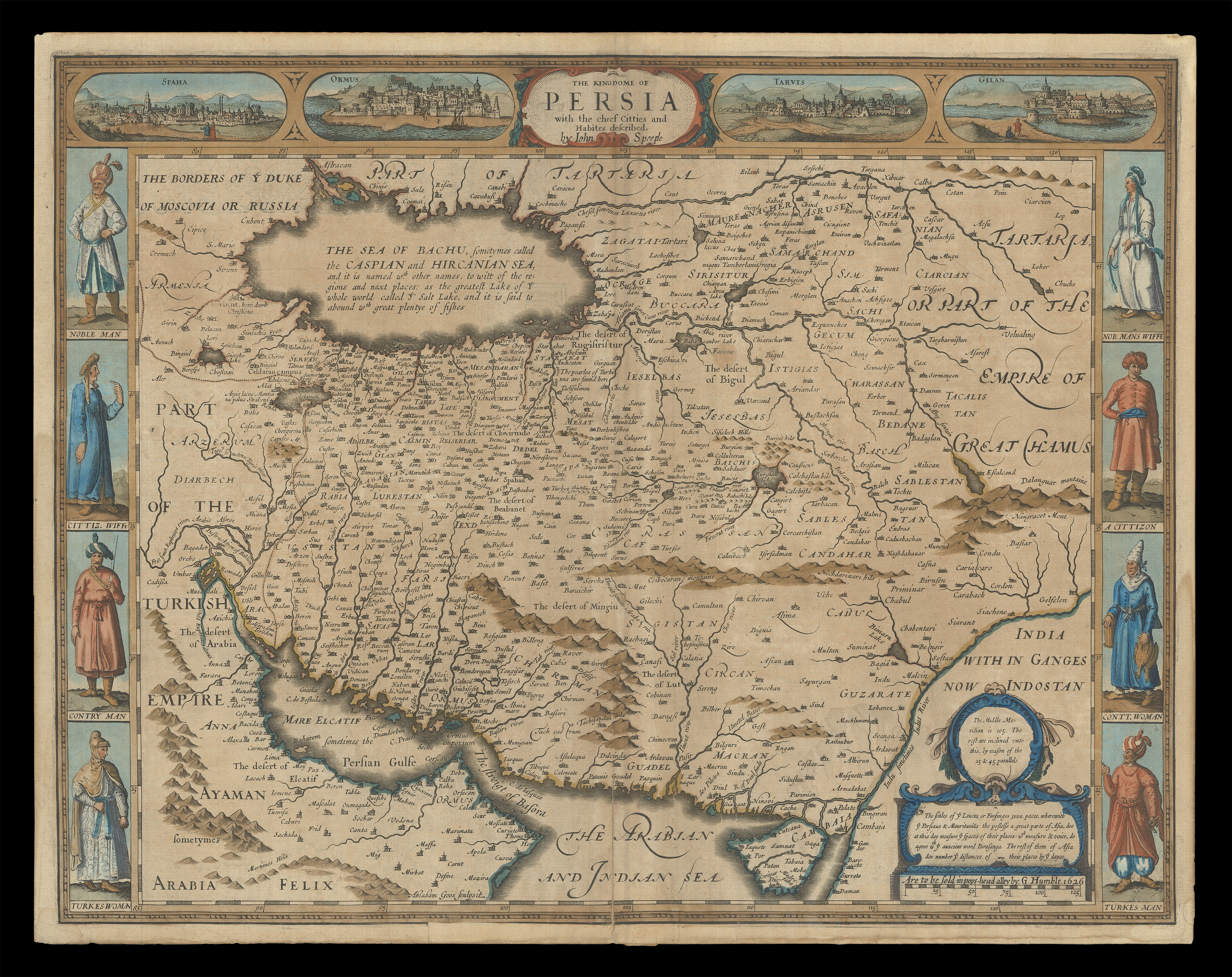 |
Speed's map of Persia
1 x
£1,800
|
£1,800 |
|
£1,800 |
|
× |
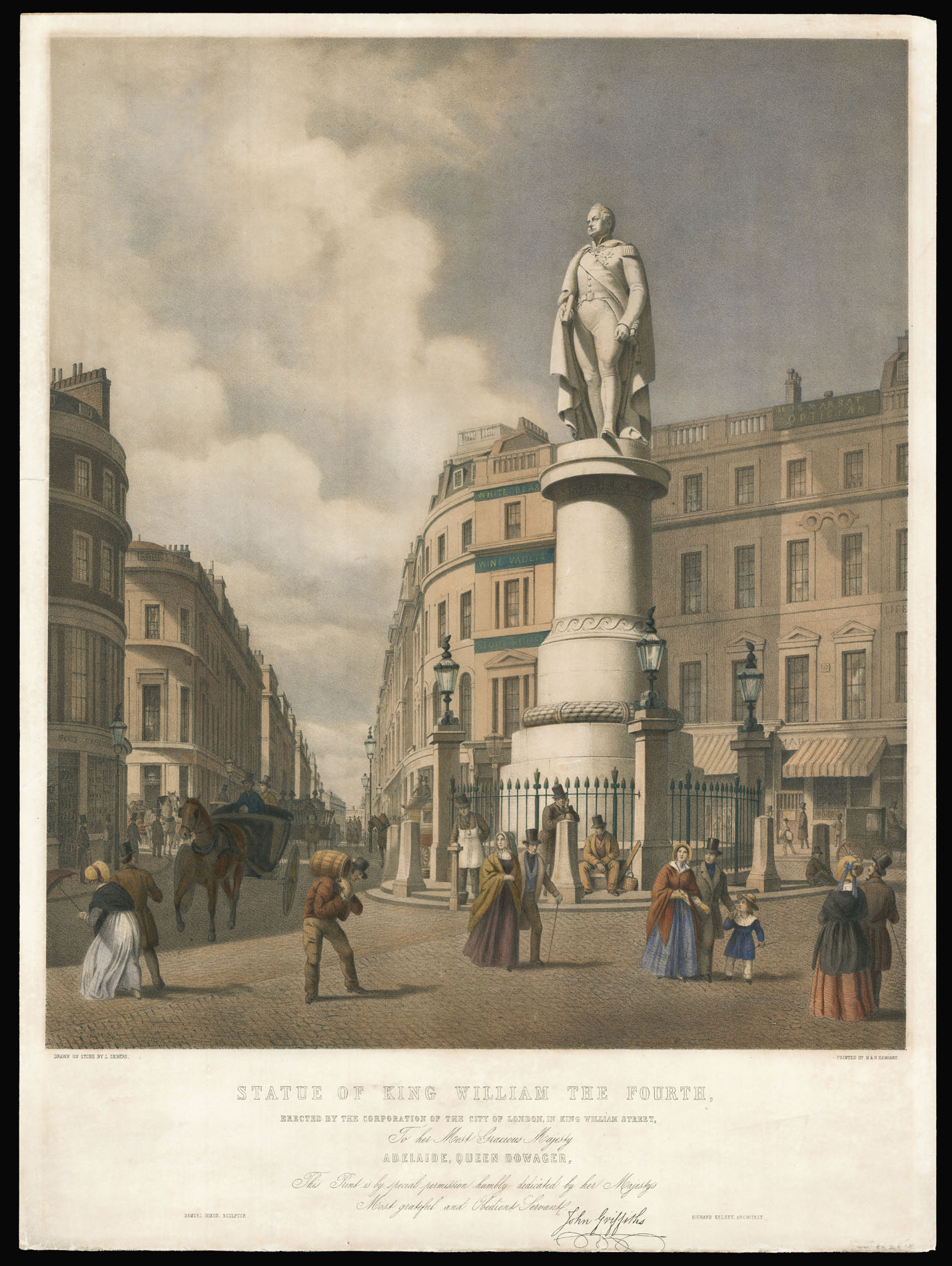 |
The Sailor King
1 x
£2,000
|
£2,000 |
|
£2,000 |
|
× |
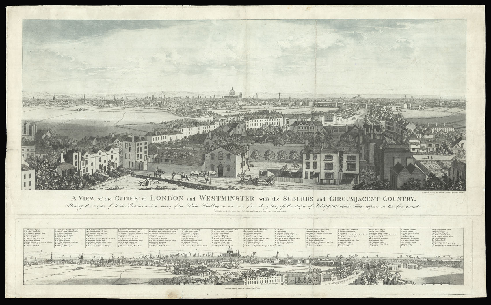 |
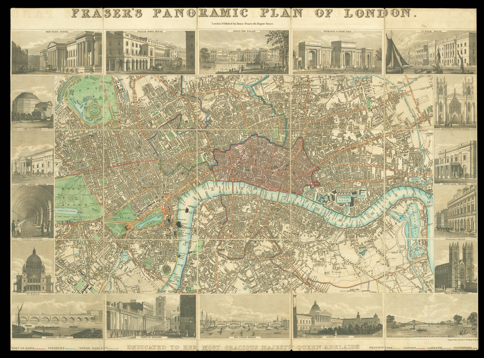
London from Islington
1 x
£4,000
|
£4,000 |
|
£4,000 |
|
× |
![HOLLAR, W[enceslaus] [Views of Tangiers]](https://omega.crouchrarebooks.com/wp-content/uploads/2025/03/18646_1H.jpg) |
Views of Tangiers
1 x
£1,500
|
£1,500 |
|
£1,500 |
|
× |
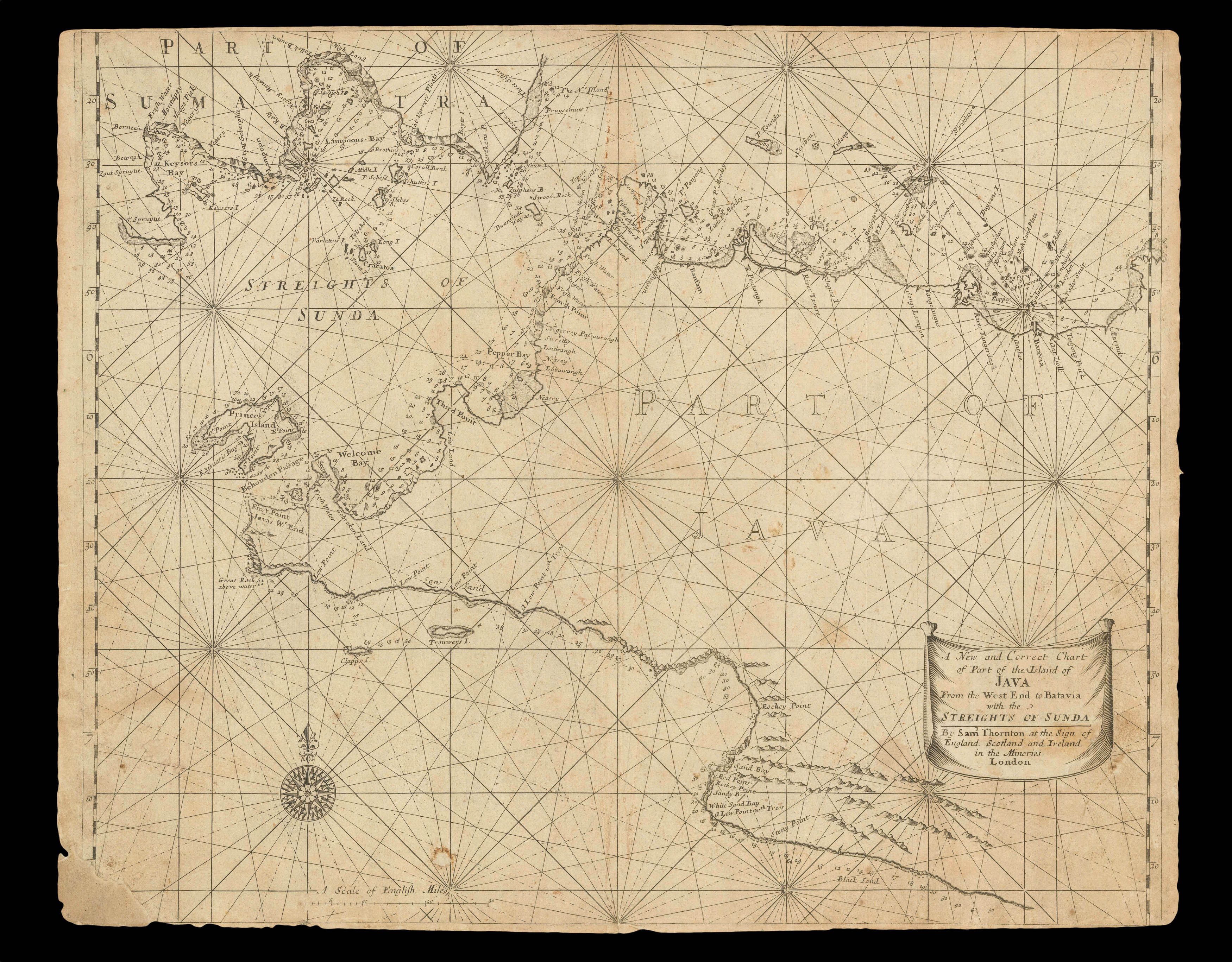 |
The Sunda Strait
1 x
£900
|
£900 |
|
£900 |
|
× |
![MARTIN, Benjamin; R. PAGE [Benjamin Martin]](https://omega.crouchrarebooks.com/wp-content/uploads/2025/03/17792_1H.jpg) |
Benjamin Martin
1 x
£150
|
£150 |
|
£150 |
|
× |
![D'APRES DE MANNEVILLETTE, Jean-Baptiste Le Neptune Oriental, dédié au Roi [with] Supplement](https://omega.crouchrarebooks.com/wp-content/uploads/2025/03/15135_1H.jpg) |
The greatly enlarged second edition of this rare French Sea Atlas with four maps of the Arabian Peninsula
1 x
£35,000
|
£35,000 |
|
£35,000 |
|
× |
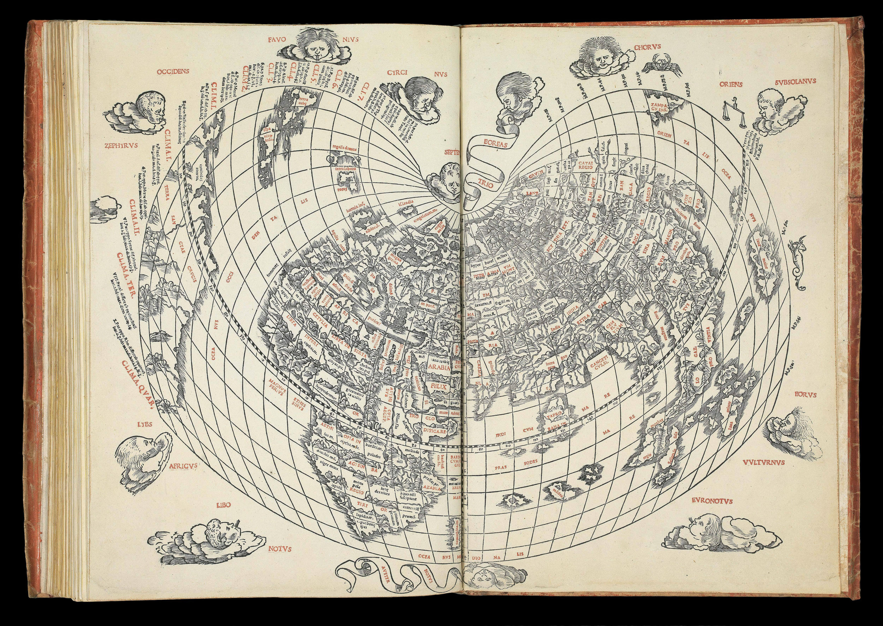 |
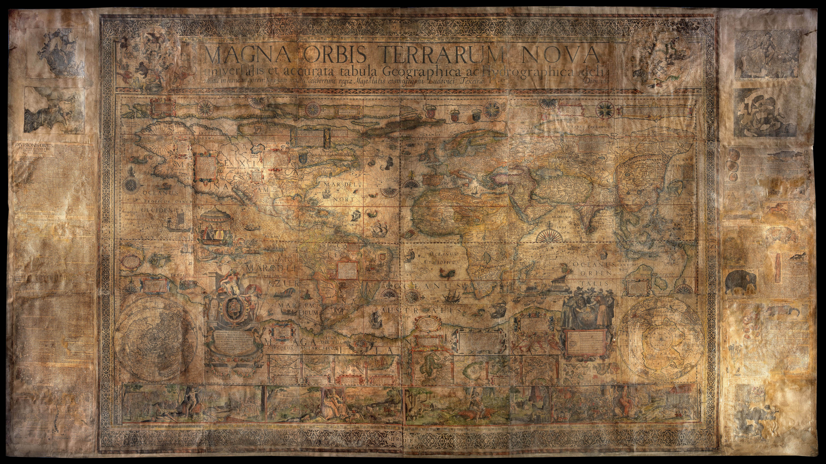
The first atlas printed in Venice, the first wholly printed in colours, incorporating the first map to indicate Japan, the second map in a Ptolemaic atlas to show America.
1 x
£150,000
|
£150,000 |
|
£150,000 |
|
× |
![[BRITISH ADMIRALTY] The North East Provinces of China Including The Coast From Chusan to the Gulf of Liau-Tong](https://omega.crouchrarebooks.com/wp-content/uploads/2025/03/19470_1H.jpg) |
Second Opium War Map
1 x
£8,000
|
£8,000 |
|
£8,000 |
|
× |
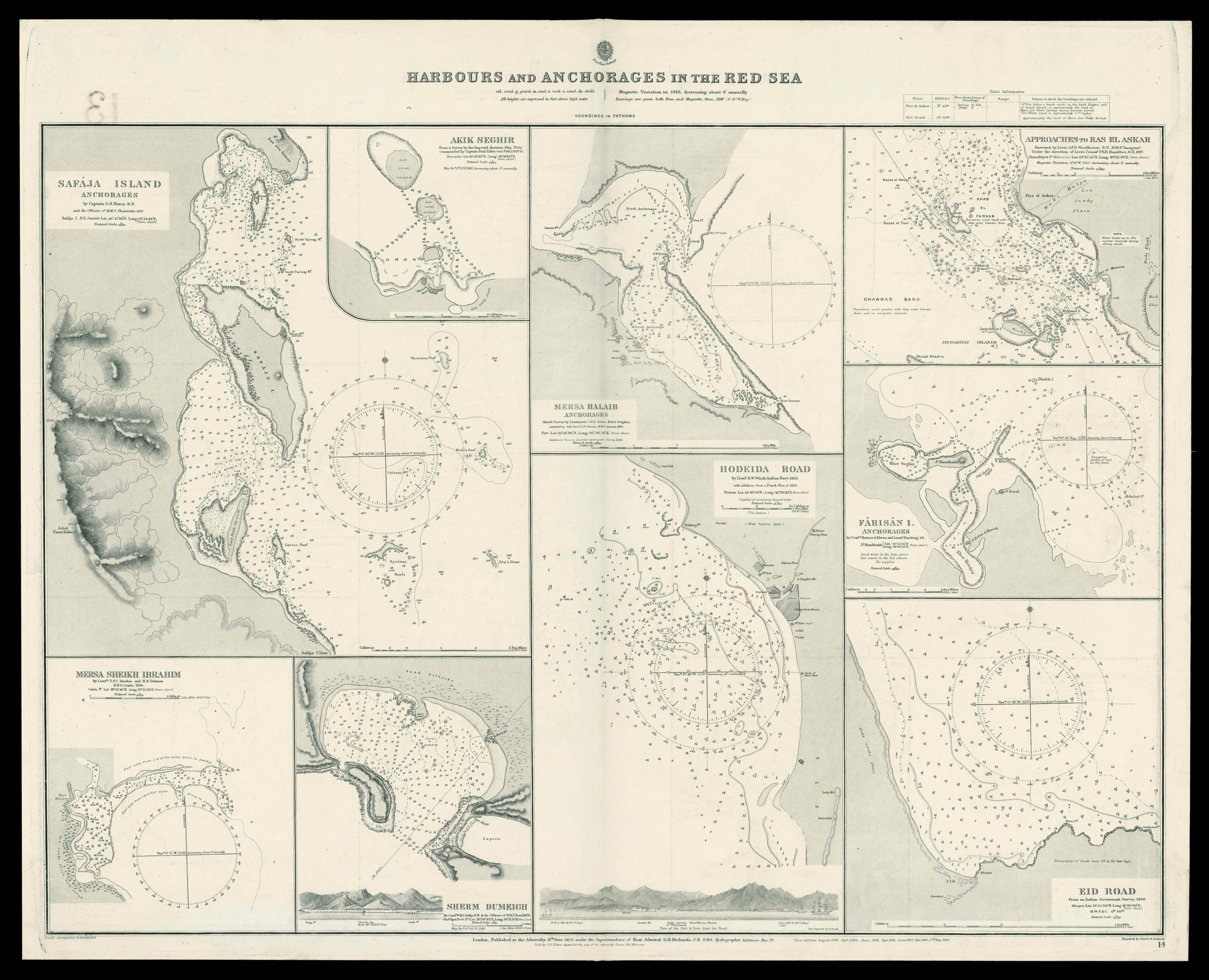 |
Admiralty chart of the harbour's and Anchorages in the Red Sea
1 x
£700
|
£700 |
|
£700 |
|
× |
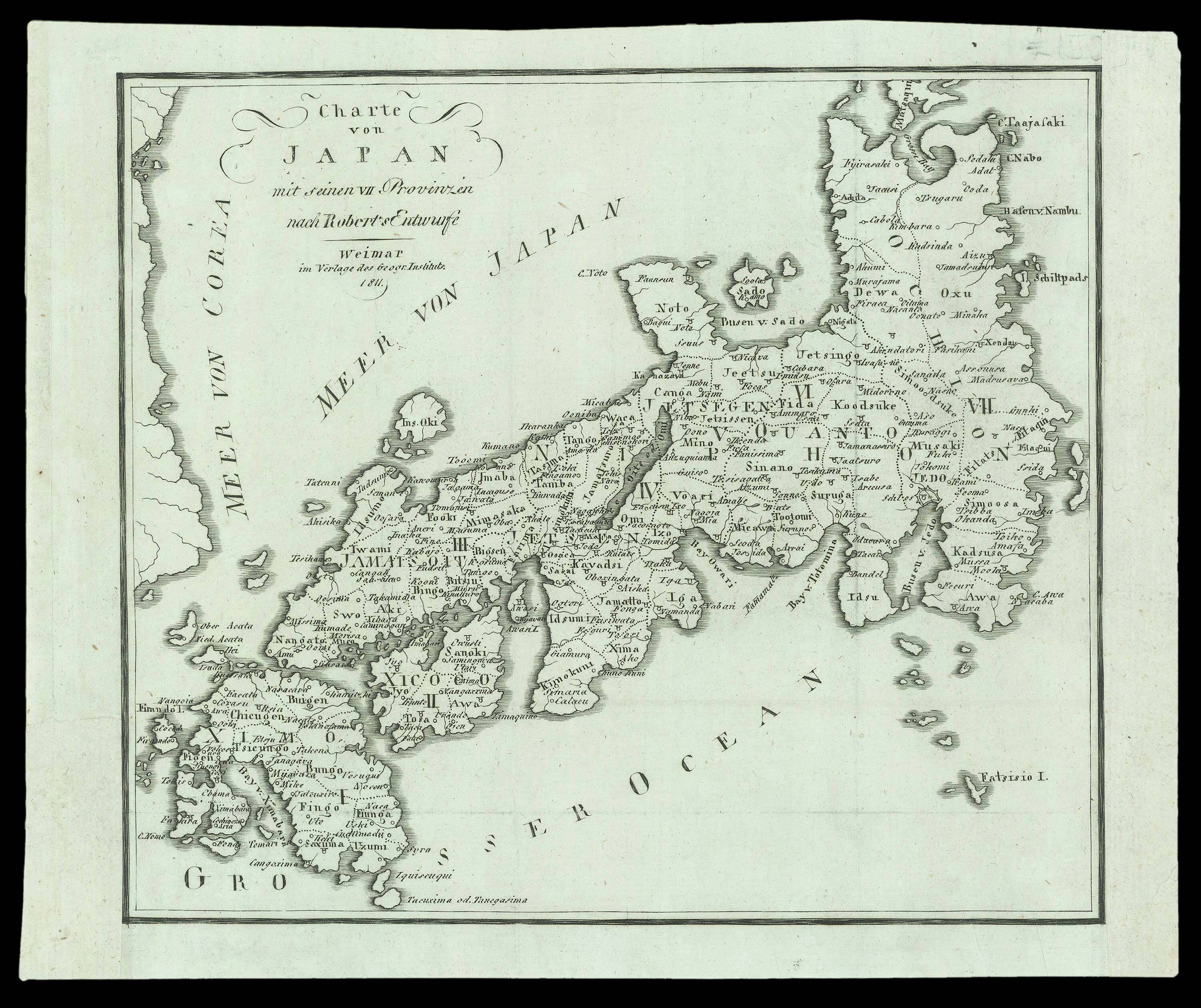 |
A German reprint after Gilles Robert de Vaugondy
1 x
£175
|
£175 |
|
£175 |
|
× |
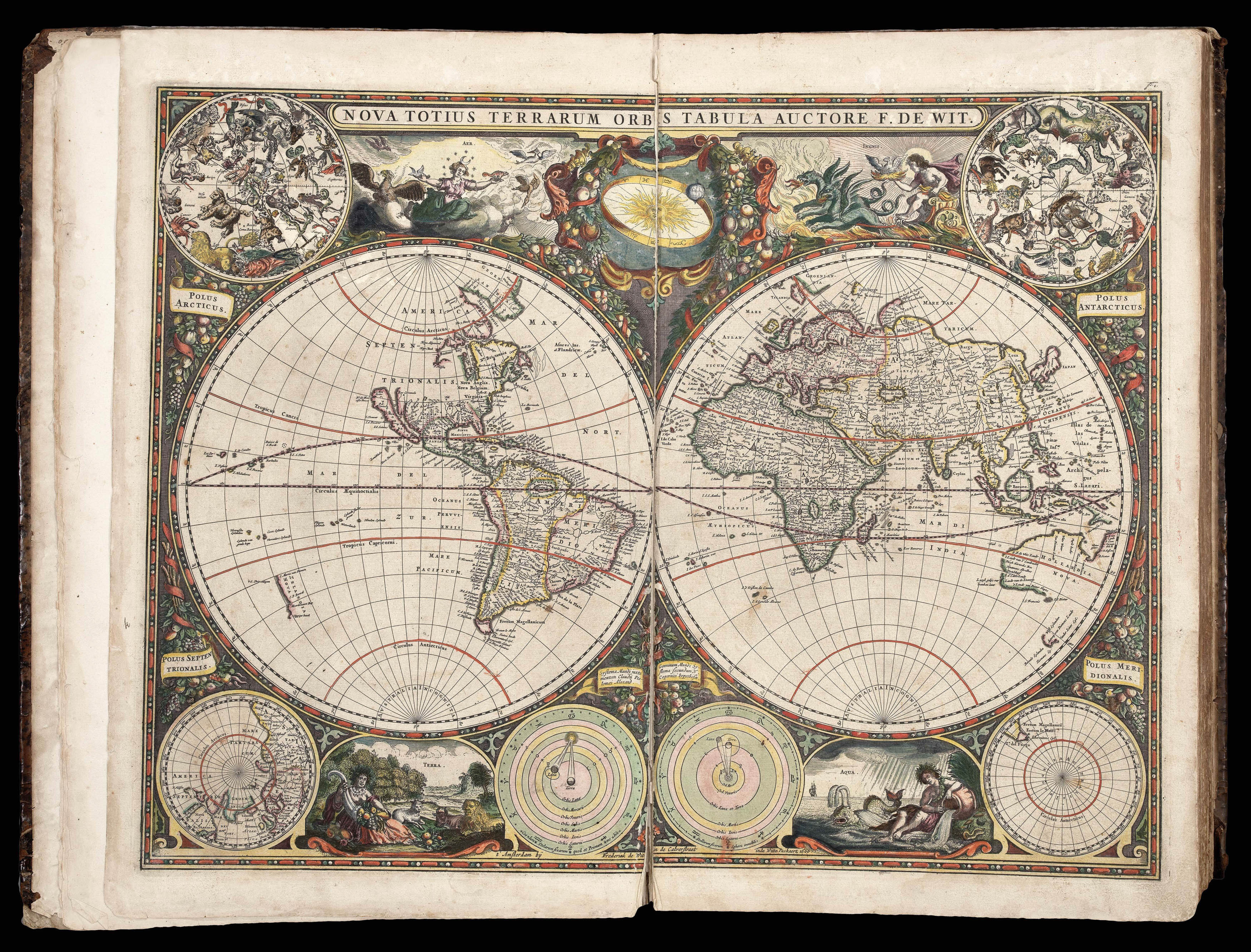 |
The most up-to-date sea atlas of the second half of the seventeenth century
1 x
£80,000
|
£80,000 |
|
£80,000 |
|
× |
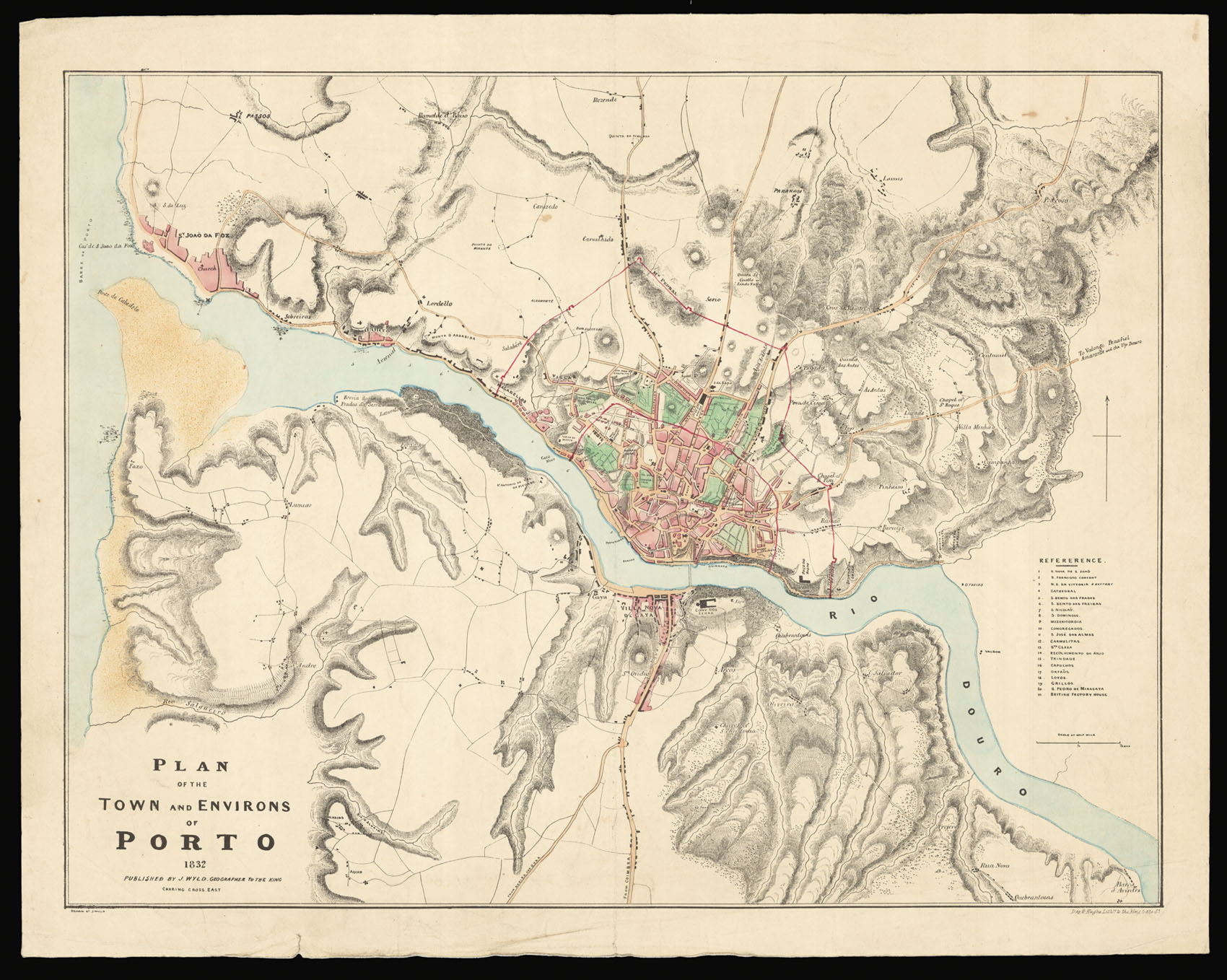 |
Separately issued plan illustrating the siege of Porto during the Portuguese Civil War
1 x
£1,500
|
£1,500 |
|
£1,500 |
|
× |
 |
The Great Southern Continent
1 x
£450,000
|
£450,000 |
|
£450,000 |
|
× |
![RIVET, Claude [Panorama of Leiden] Lugdunum Batavorum Hollandia Celeberrimum et Academia Florentissma.](https://omega.crouchrarebooks.com/wp-content/uploads/2025/03/1914_1H.jpg) |
Leiden - home to Rembrandt, Lievens and, Dou
1 x
£20,000
|
£20,000 |
|
£20,000 |
|
× |
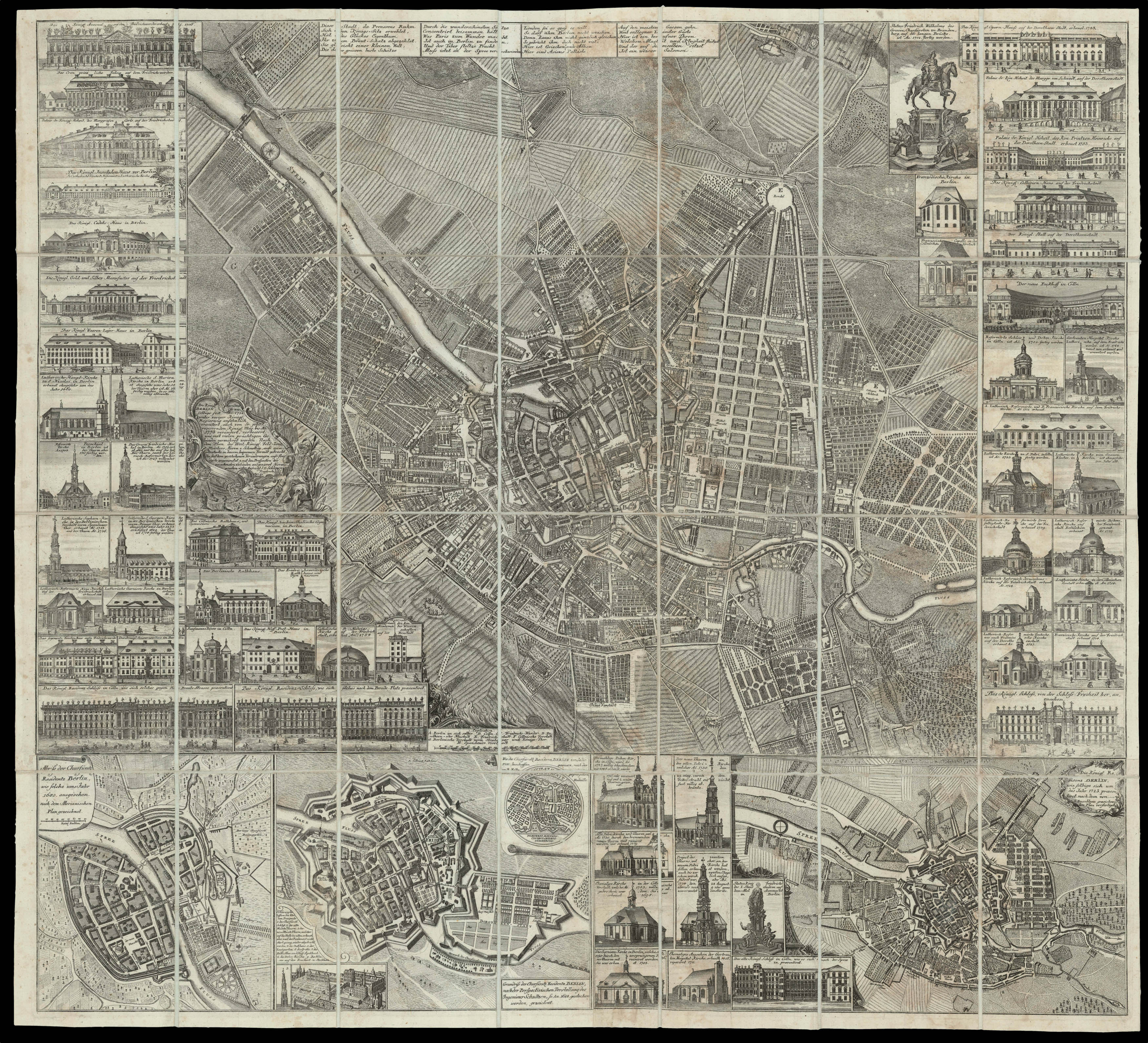 |
The Capital of Prussia
1 x
£15,000
|
£15,000 |
|
£15,000 |
|
|


