|
× |
 |
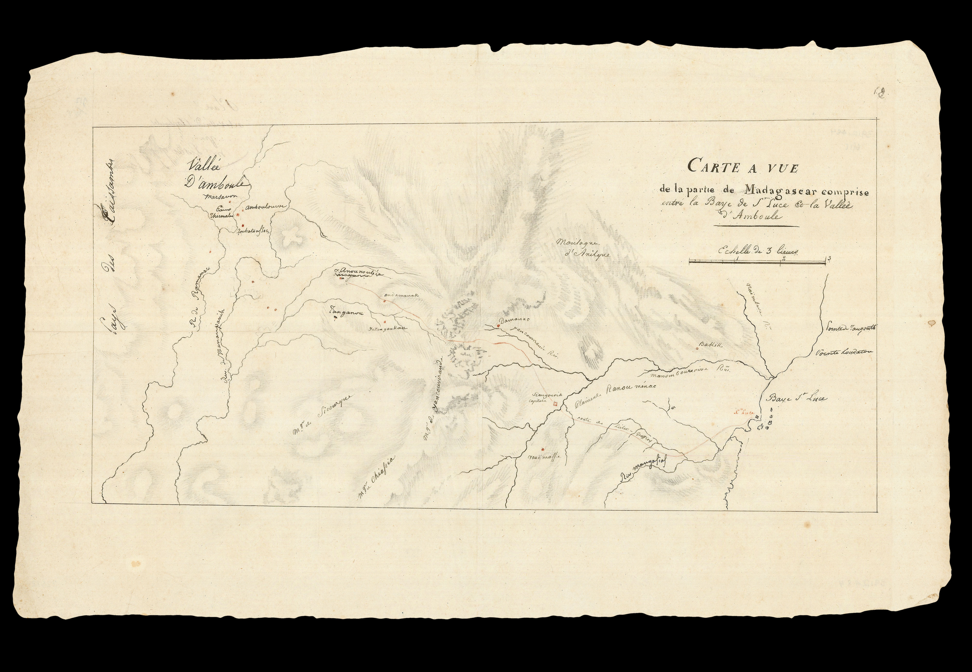
"such parts of the coast of Madagascar as you may conceive not to have been accurately ascertained"
1 x
£2,500
|
£2,500 |
|
£2,500 |
|
× |
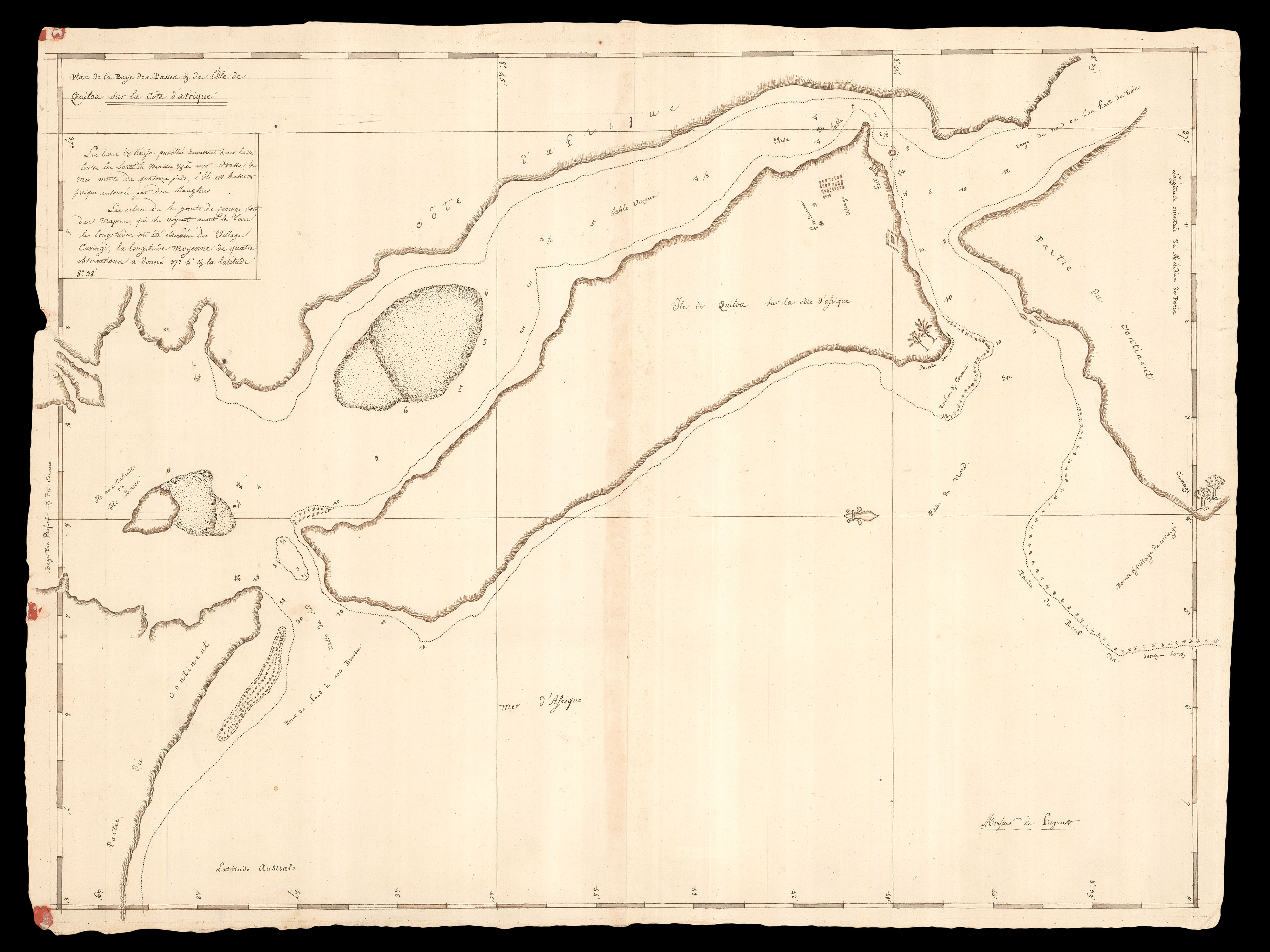 |
"...The island is low and almost surrounded by mangroves"
1 x
£5,000
|
£5,000 |
|
£5,000 |
|
× |
 |
The heart of darkness
1 x
£15,000
|
£15,000 |
|
£15,000 |
|
× |
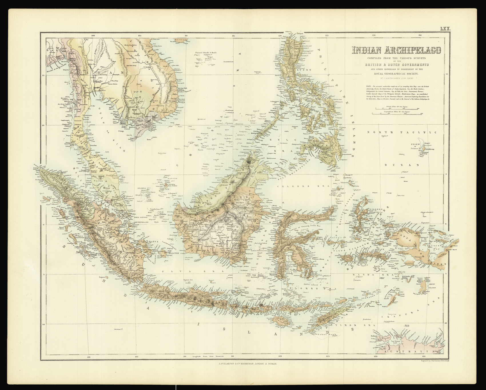 |
Bartholomew's Southeast Asia
1 x
£150
|
£150 |
|
£150 |
|
× |
 |
The only hope for survival for the French islands in the Indian Ocean
1 x
£3,000
|
£3,000 |
|
£3,000 |
|
× |
![HORSBURGH, James; and Captain Daniel ROSS China Sea - Sheet I [and] Sheet II](https://omega.crouchrarebooks.com/wp-content/uploads/2025/03/17533_1H.jpg) |
"The best route towards China for leaky crazy ships during the strength of the S.W. Monsoon"
1 x
£2,900
|
£2,900 |
|
£2,900 |
|
× |
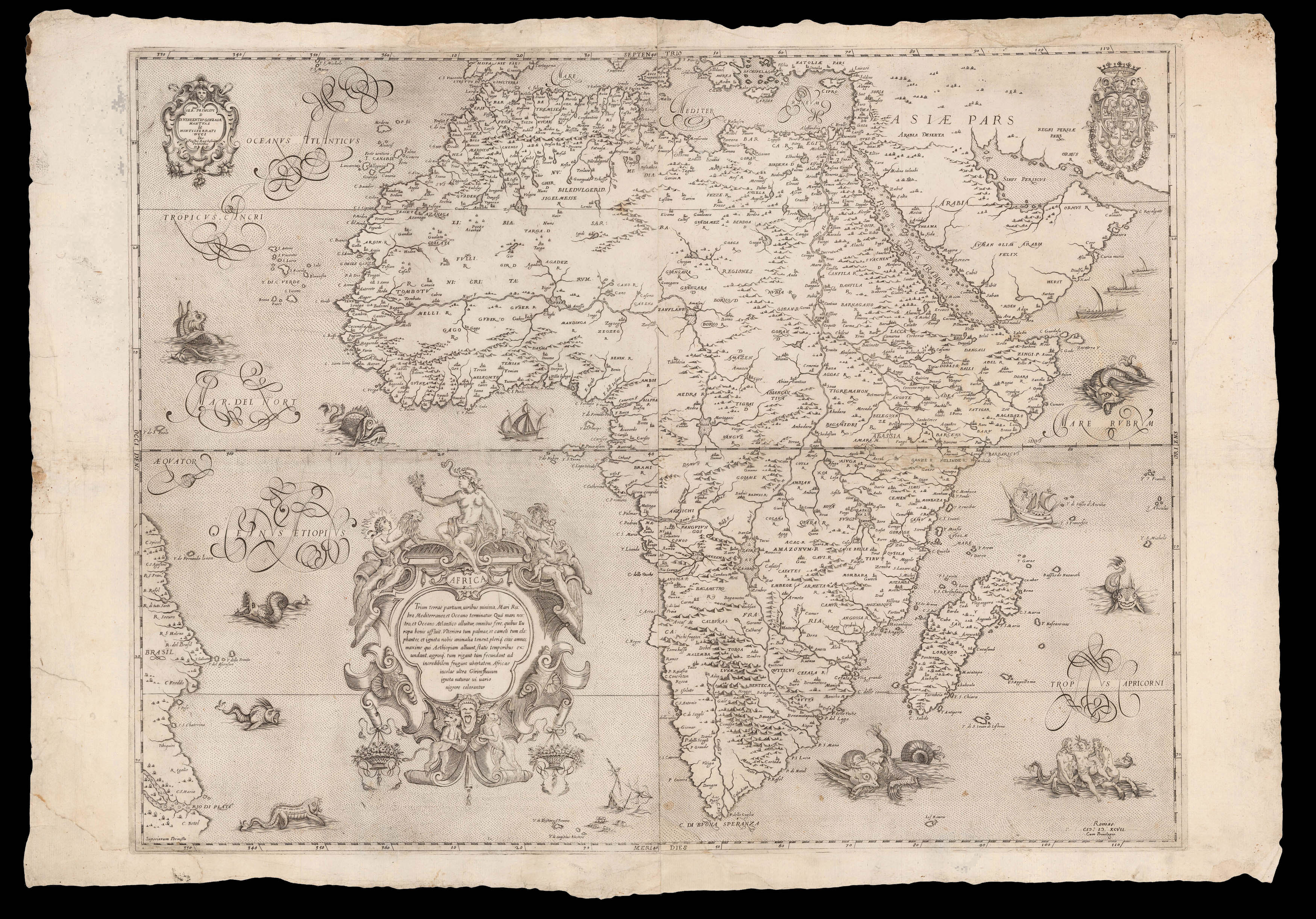 |
Rughesi's incredibly rare map of Africa
1 x
£40,000
|
£40,000 |
|
£40,000 |
|
× |
![LE SAGE, P. Carte depuis la fin du Detroit de la Sonde jusqu'a la fin D'Etroit de Banca faitte en l'anne 1734 – [Singapore Strait] – [South China Sea].](https://omega.crouchrarebooks.com/wp-content/uploads/2025/03/17525_1H.jpg) |
Charting a voyage of nearly two thousand nautical miles from the Sunda Strait to Hong Kong
1 x
£87,000
|
£87,000 |
|
£87,000 |
|
× |
![TAYLOR, Isaac [City of Hereford] To the right Hon[oura]ble ye Earl of Oxford High Steward of the City of Hereford...](https://omega.crouchrarebooks.com/wp-content/uploads/2025/03/21794_1H.jpg) |
Taylor's Plan of Hereford
1 x
£2,500
|
£2,500 |
|
£2,500 |
|
× |
 |
The first folio Sea Atlas
1 x
£60,000
|
£60,000 |
|
£60,000 |
|
× |
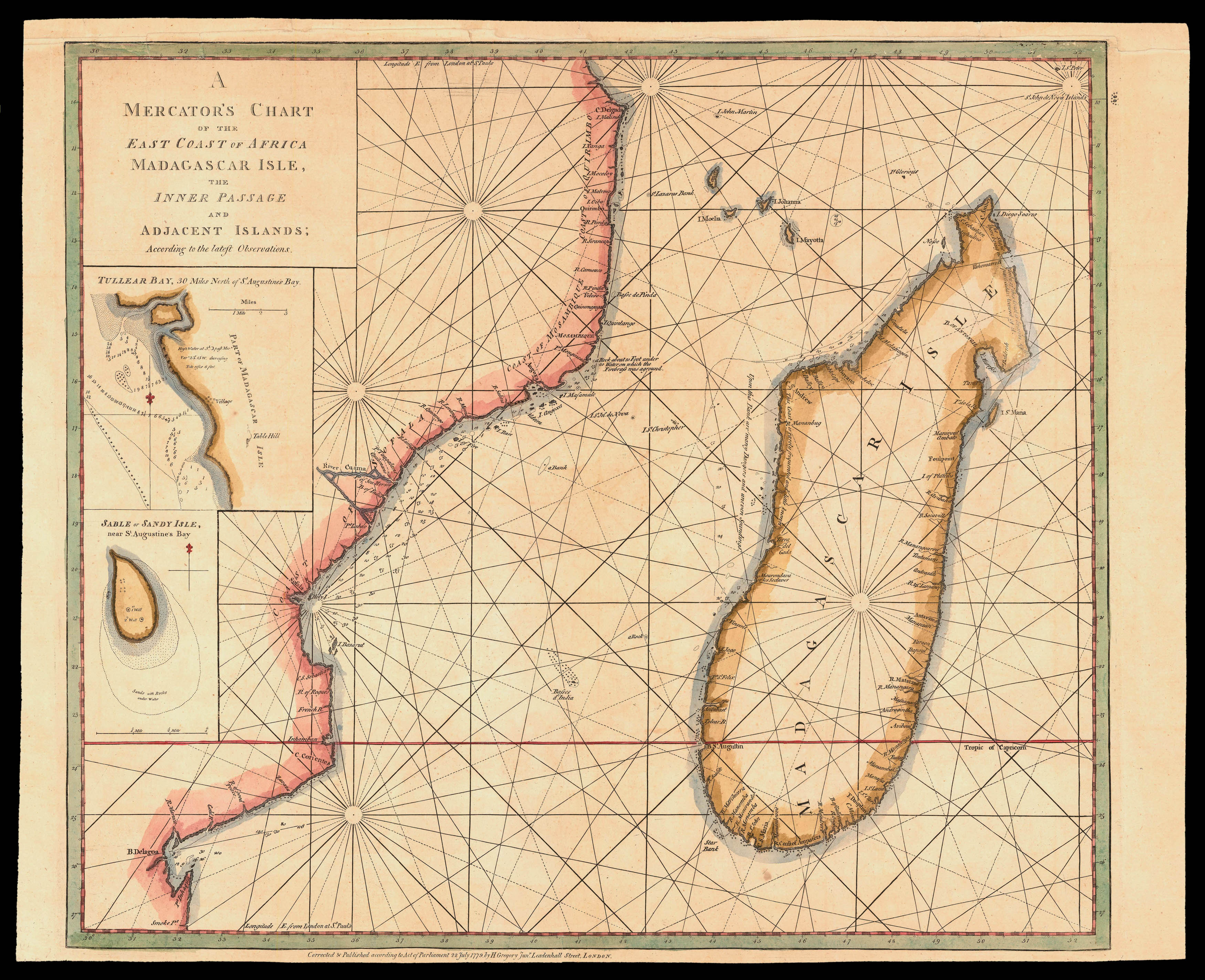 |
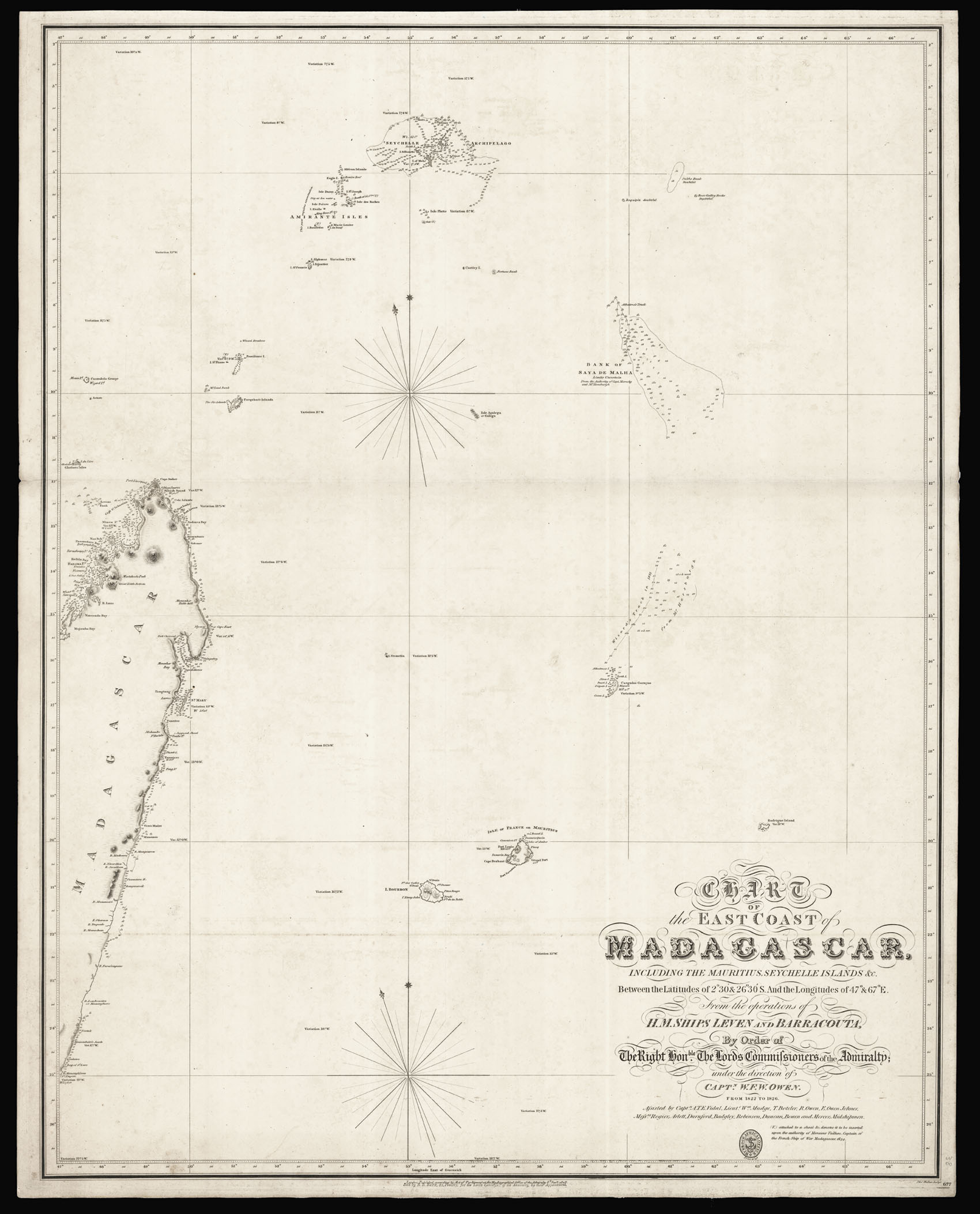
Rare chart of the East coast of Africa
1 x
£1,200
|
£1,200 |
|
£1,200 |
|
× |
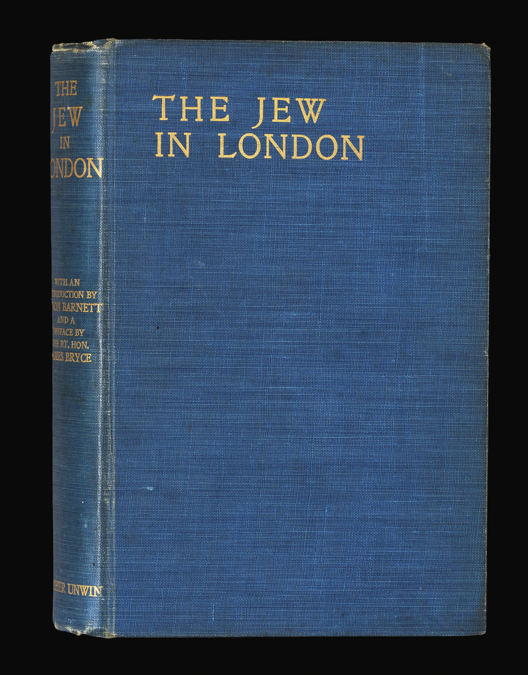 |
Jewish East London
1 x
£7,500
|
£7,500 |
|
£7,500 |
|
× |
![[GASTALDI, Giacomo; after] India tercera nuova tavola.](https://omega.crouchrarebooks.com/wp-content/uploads/2025/03/17576_1H.jpg) |
One of the earliest maps to reference Singapore
1 x
£600
|
£600 |
|
£600 |
|
× |
![HOLLAR, W[enceslaus] [Six Northern European views: Duren, Hemsen, Cologne, Bonn, Brussels]](https://omega.crouchrarebooks.com/wp-content/uploads/2025/03/18605_1H.jpg) |
Views from Northern Europe
1 x
£3,000
|
£3,000 |
|
£3,000 |
|
× |
![WAR OFFICE Singapore [and] Penang](https://omega.crouchrarebooks.com/wp-content/uploads/2025/03/17485_1H.jpg) |
The Malayan Emergency
1 x
£250
|
£250 |
|
£250 |
|
× |
![PTOLEMAEUS, Claudius [translated by ANGELUS, Jacobus, edited by GERMANUS, Nicolaus] [Germany] Quarta Europe Tabula](https://omega.crouchrarebooks.com/wp-content/uploads/2025/03/18390_1H.jpg) |
A striking map of Germany from the 1482 Ulm Ptolemy
1 x
£12,000
|
£12,000 |
|
£12,000 |
|
× |
![[Anonymous] L'Attaque et la Riposte](https://omega.crouchrarebooks.com/wp-content/uploads/2025/03/1735_1H.jpg) |
French Caricature cards of the Outbreak of the First World War
1 x
£1,200
|
£1,200 |
|
£1,200 |
|
× |
![[LOCAL GOVERNMENT BOARD] The Sanitary Acts.](https://omega.crouchrarebooks.com/wp-content/uploads/2025/03/22023_1H.jpg) |
Clean up your act
1 x
£350
|
£350 |
|
£350 |
|
× |
 |
Cook's first cartographer
1 x
£950
|
£950 |
|
£950 |
|
× |
 |
"...being the best for LEAKY VESSELS, during the strength of the S.W. Monsoon"
1 x
£5,750
|
£5,750 |
|
£5,750 |
|
× |
 |
Detailed chart of the Singapore Strait
1 x
£3,700
|
£3,700 |
|
£3,700 |
|
× |
![PTOLEMAEUS, Claudius [translated by ANGELUS, Jacobus, edited by GERMANUS, Nicolaus] [Africa] Quarta et Ultima Affrice Tabula.](https://omega.crouchrarebooks.com/wp-content/uploads/2025/03/18402_1H.jpg) |
A striking map of Africa from the 1482 Ulm Ptolemy
1 x
£30,000
|
£30,000 |
|
£30,000 |
|
× |
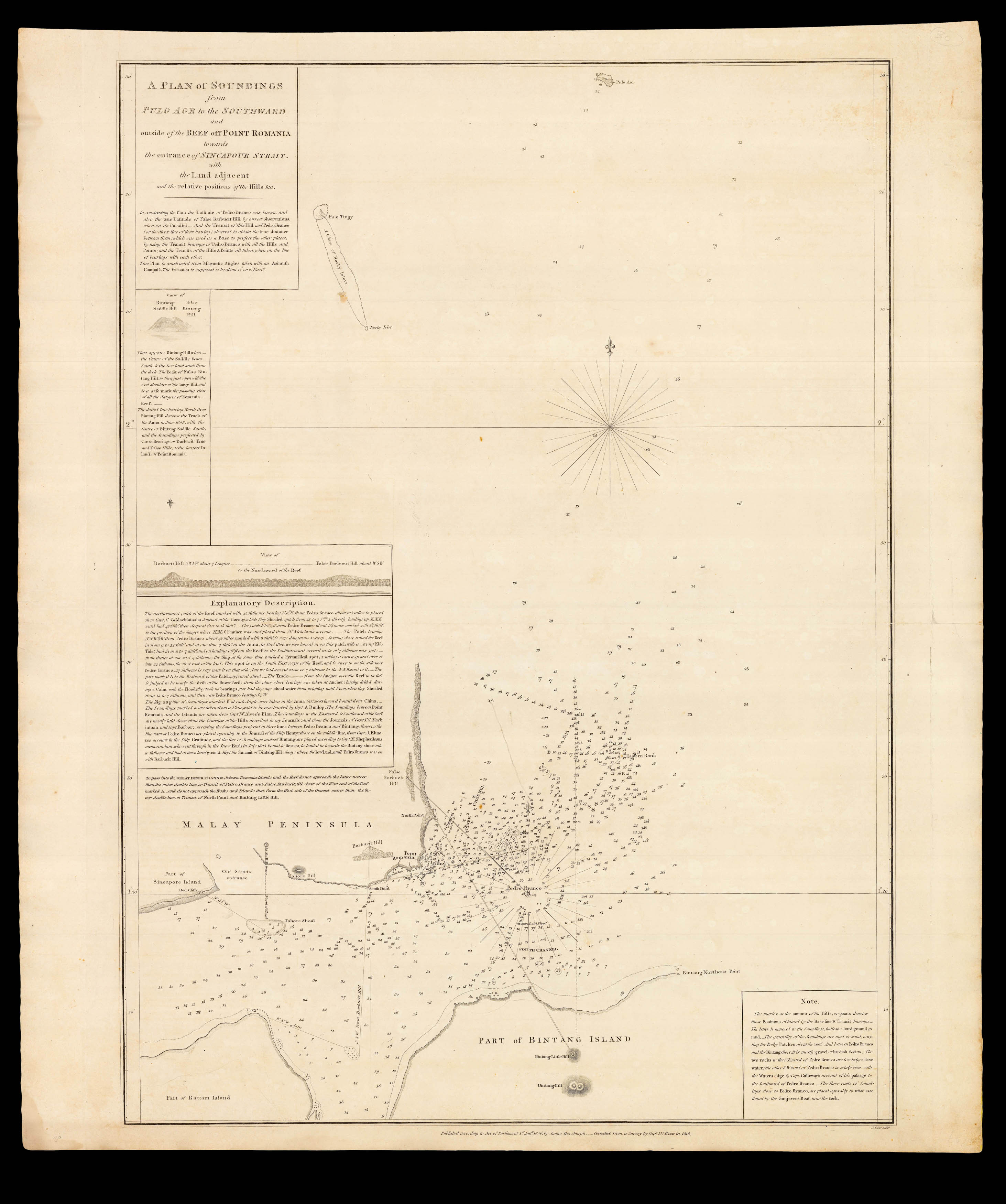 |
The eastern entrance to the Singapore Strait
1 x
£4,000
|
£4,000 |
|
£4,000 |
|
|


