
Rare Maps

Rare Atlases

Rare Books

Rare Prints

![SPEED, John [Set of the world and continents]](https://omega.crouchrarebooks.com/wp-content/uploads/2025/03/11414_1H.jpg)
![PURCHAS, Samuel Purchas his pilgrimes... [WITH] Purchas his pilgrimage. Or relations of the world and the religions observed in all ages and places.](https://omega.crouchrarebooks.com/wp-content/uploads/2025/03/1008_1H.jpg)
By PURCHAS, Samuel, 1625 [but 1626].
![[after VAN SYPE, Nicolas] La heroike interprinse faict par le Signeur Draeck d'avoir cirquit toute la terre.](https://omega.crouchrarebooks.com/wp-content/uploads/2025/03/23148_1H.jpg)
By [after VAN SYPE, Nicolas], c1587].
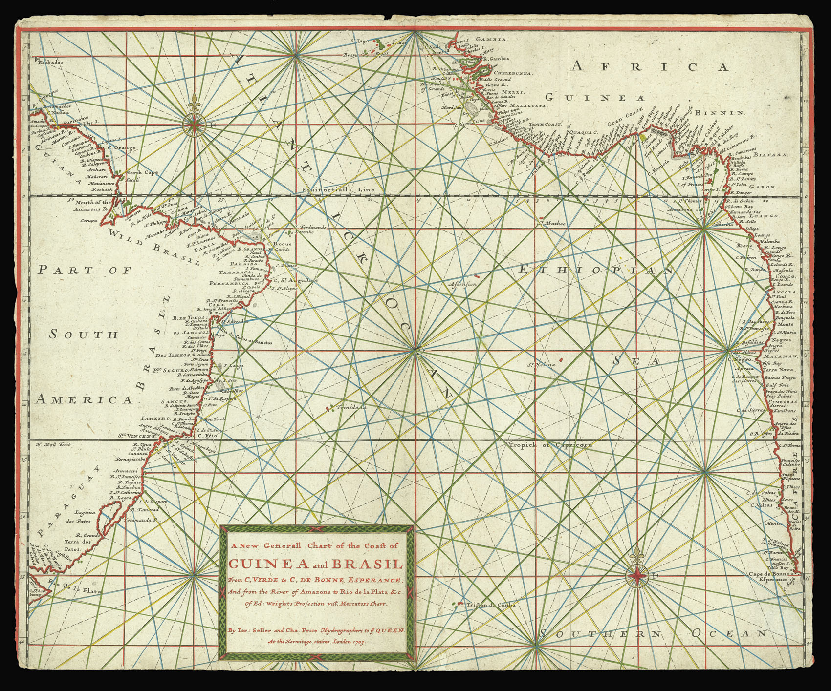
By SELLER, Jeremiah and PRICE, Charles, 1703
![MARGGRAF [or MARGCARF], George Brasilia qua partie paret Belgis.](https://omega.crouchrarebooks.com/wp-content/uploads/2025/03/18481_1H.jpg)
By MARGGRAF [or MARGCARF], George, 1647
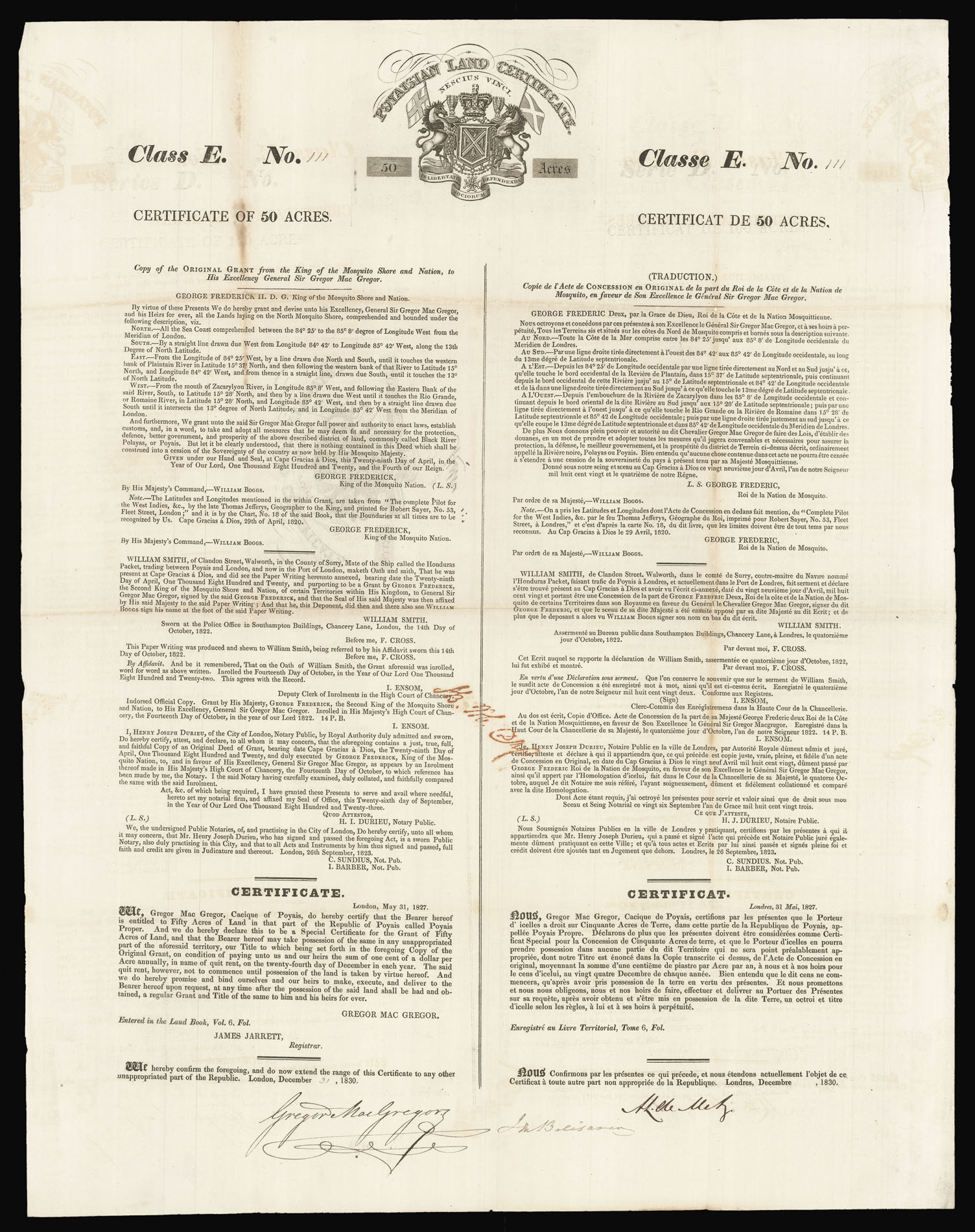
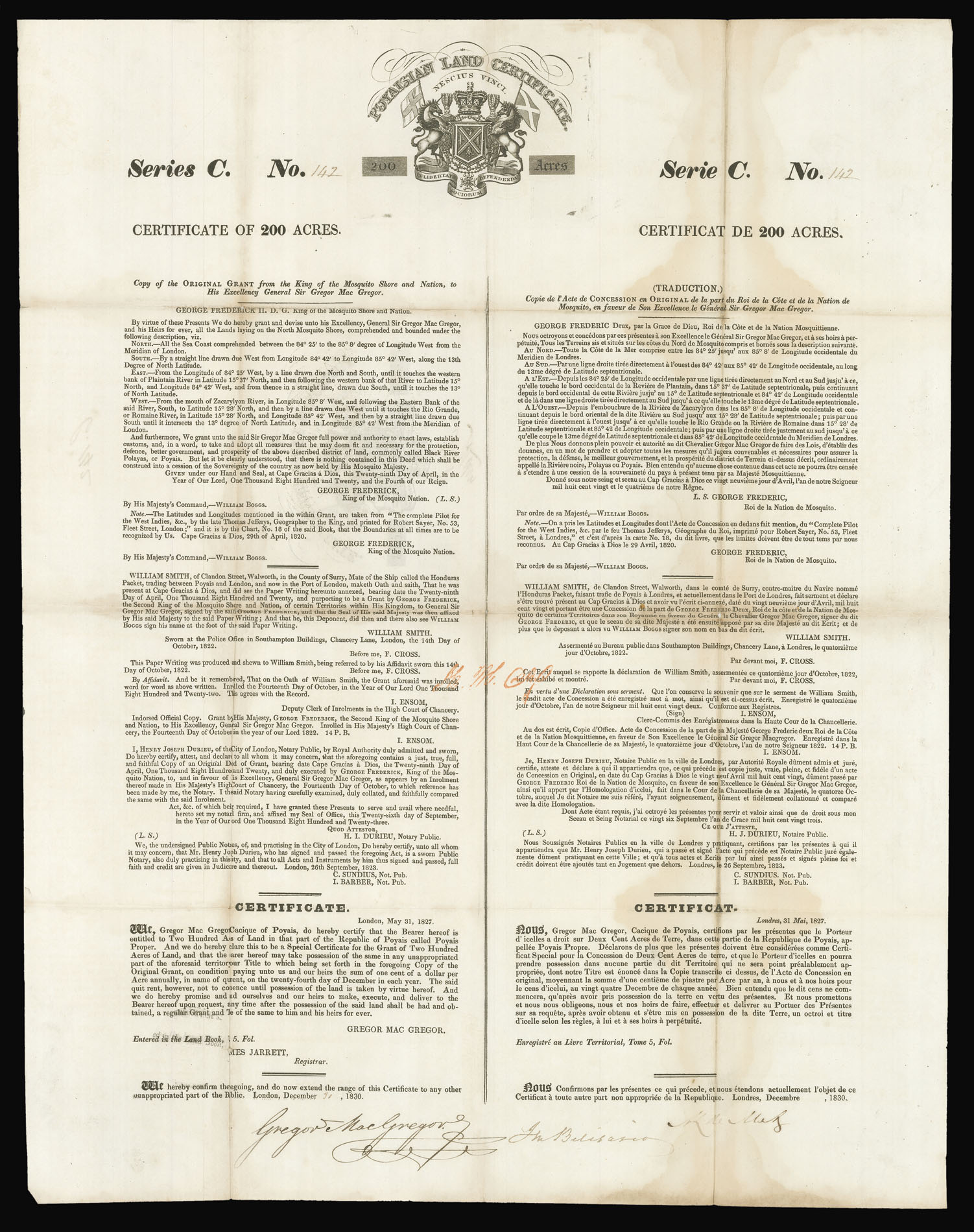
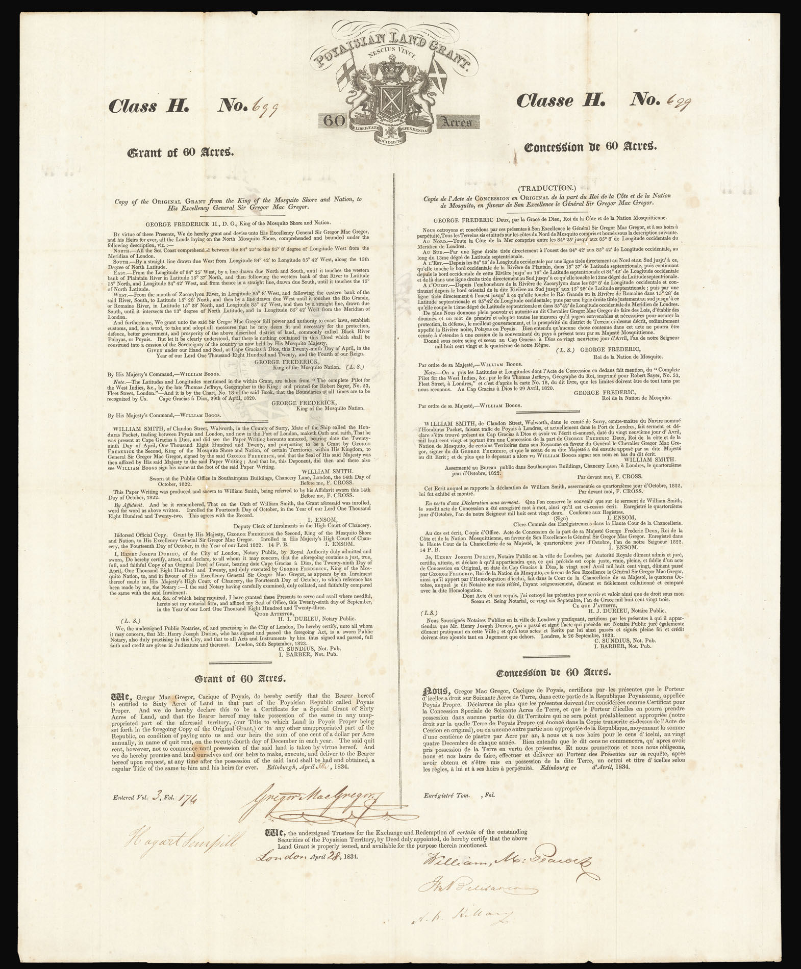
![GREGOR, MacGregor [Poyaisian land grant certificate].](https://omega.crouchrarebooks.com/wp-content/uploads/2025/03/16289_1H.jpg)