No products in the basket.
Return to shop
Westmoreland – Greenwood’s large-scale map of Westmoreland
By GREENWOOD, Christopher, January 1st, 1824.
The first printed map of Westmorland and Cumberland
By SAXTON, Christopher, 1579
Detailed county map of Westmorland
By HODGSON, T[homas], 1828
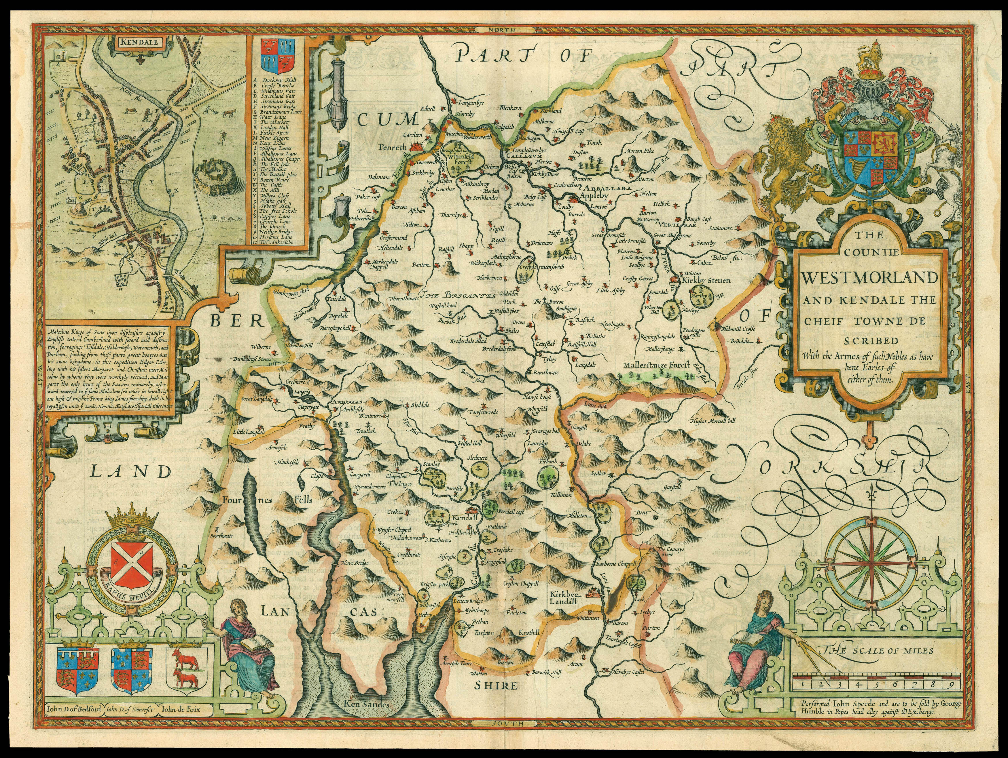
Speed’s map of Westmorland
By SPEED, John, [1627].
Username or email address *Required
Password *Required
Remember me Log in
Lost your password?
Email address *Required
A link to set a new password will be sent to your email address.
Your personal data will be used to support your experience throughout this website, to manage access to your account, and for other purposes described in our privacy policy.
Register


![SAXTON, Christopher [Westmorland and Cumberland] Westmorlandiae et Cumberlandiae Comit](https://omega.crouchrarebooks.com/wp-content/uploads/2025/03/15352_1H.jpg)
![HODGSON, T[homas] Plan of the County of Westmorland](https://omega.crouchrarebooks.com/wp-content/uploads/2025/03/16432_1H.jpg)