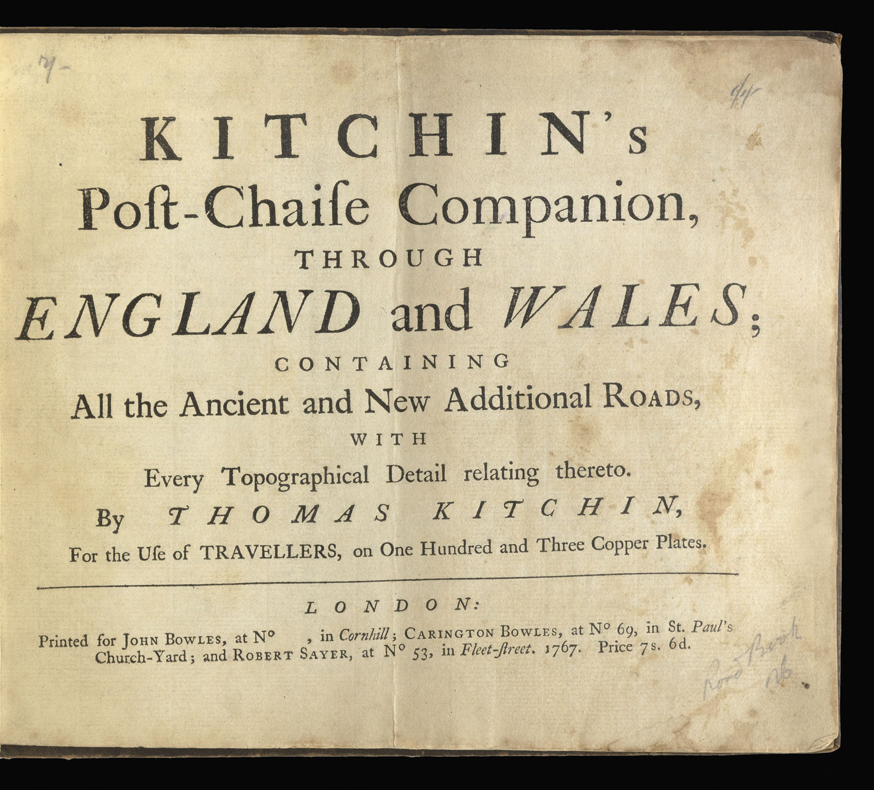
The scroll-form strip maps show the highways and major roads. A great deal of information is included on the maps including mileages, local details, directions, with cross-references to tables. The maps were first published by John Senex in 1719, for the new work Kitchin has reworked the plates adding new information.
...
First edition of this early English road atlas.
The scroll-form strip maps show the highways and major roads. A great deal of information is included on the maps including mileages, local details, directions, with cross-references to tables. The maps were first published by John Senex in 1719, for the new work Kitchin has reworked the plates adding new information.
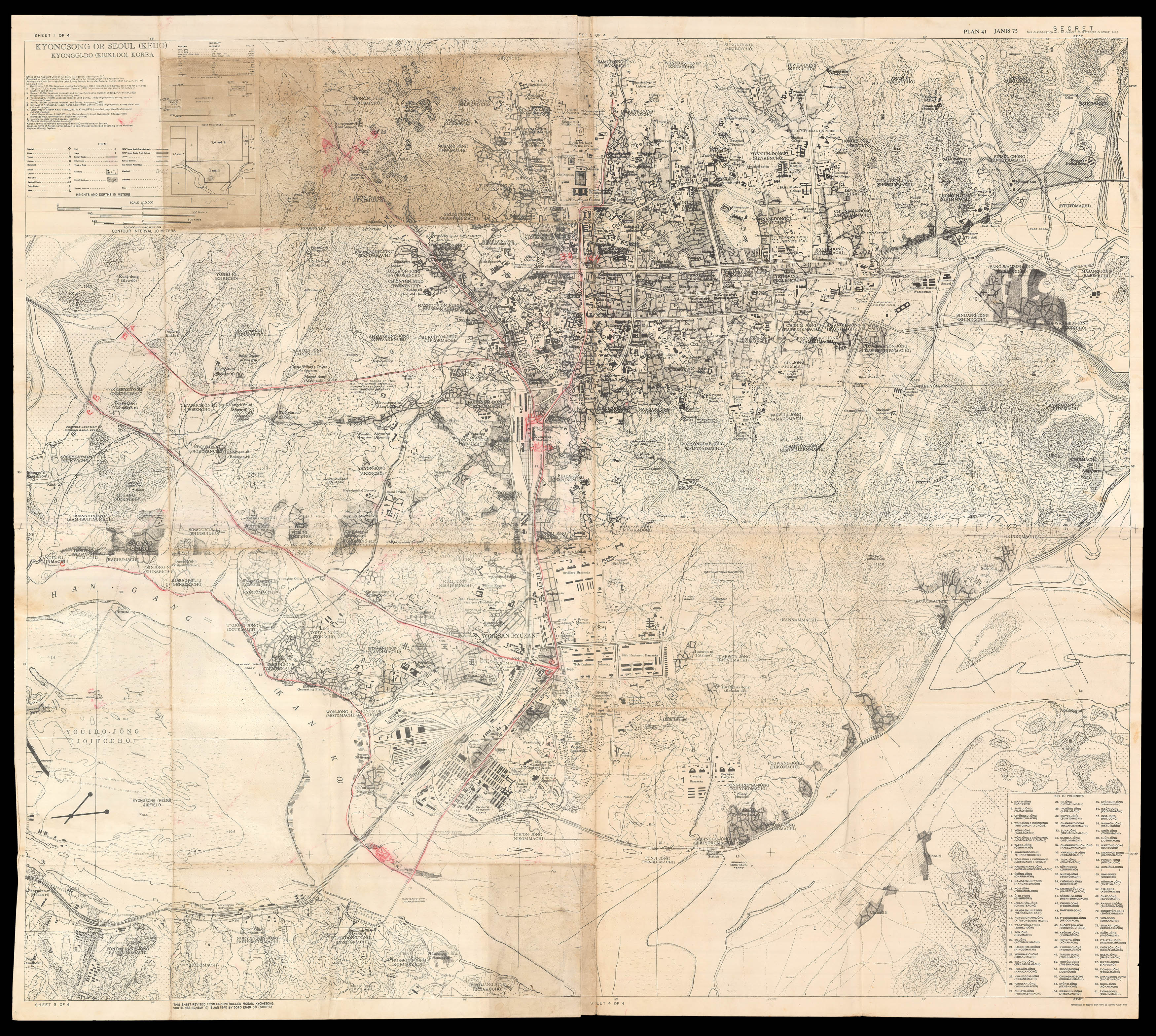 Seoul at the moment of the division of Korea
1 × £5,000
Seoul at the moment of the division of Korea
1 × £5,000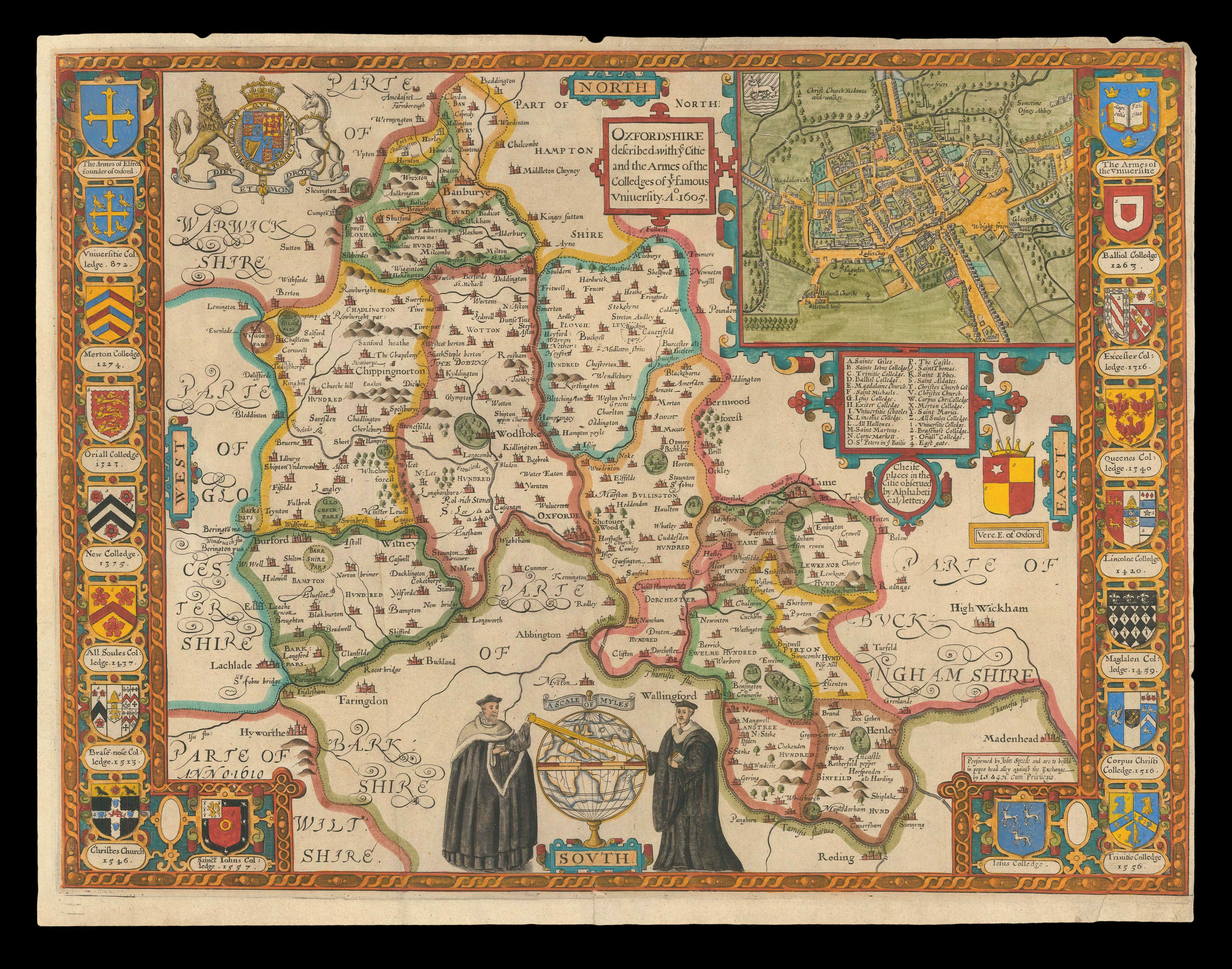 Speed's map of Oxfordshire
1 × £2,000
Speed's map of Oxfordshire
1 × £2,000 Plan of London showing troop dispositions
1 × £1,500
Plan of London showing troop dispositions
1 × £1,500![HOLLAR, W[enceslaus] Ver [and] Aestas [and] Autumnus [and] Hyems](https://omega.crouchrarebooks.com/wp-content/uploads/2025/03/18438_1H.jpg) The Strasbourg Views
1 × £4,000
The Strasbourg Views
1 × £4,000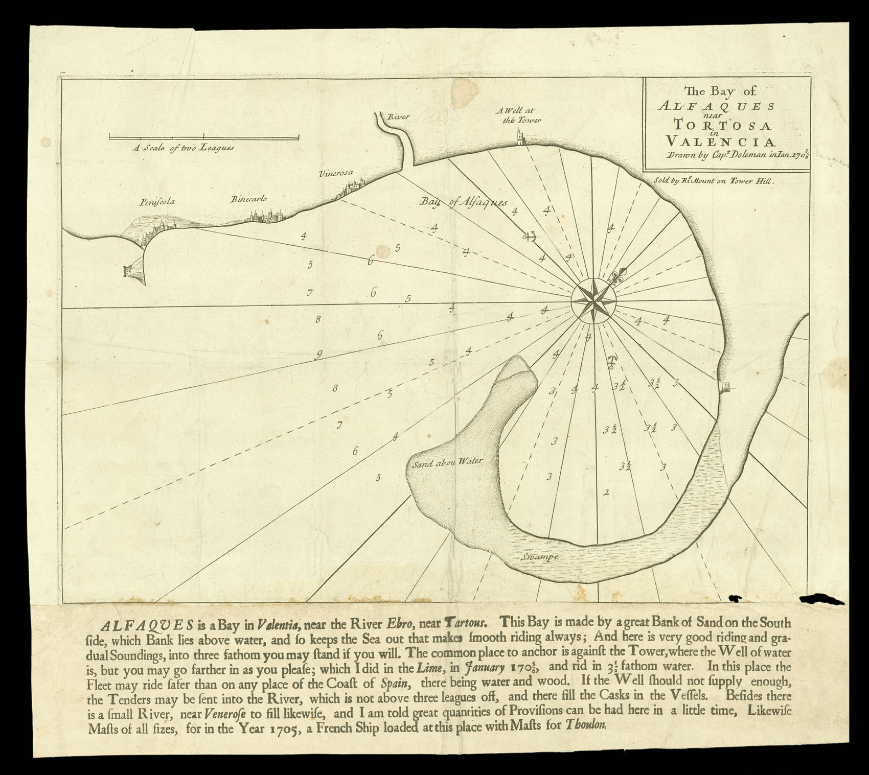 Alfaques Bay
1 × £500
Alfaques Bay
1 × £500